south america - national geographic society...national geographic kids giant traveling maps • page...
TRANSCRIPT
ResouRce Guide
South AmericA
Upon receiving the map, please check the trunk for all contents on this list. If anything is missing or damaged, please call or email Liesl Pimentel immediately at 1-480-243-0753 or [email protected].
When you are done with the map, carefully check the trunk for all the contents on this list. Please report any missing or damaged items before the map is picked up.
PRoPs[ ] Plastic blocks (130)[ ] Whisk brooms (8)[ ] Dustpans (8)[ ] Bingo chips, Blue (500)[ ] Arrows (20)[ ] Bell[ ] Foam die, Yellow[ ] Hourglass timer[ ] Mail barrel[ ] Nylon strap, Red[ ] Nylon strap, Yellow [ ] World Map[ ] Hoops, Green (2)[ ] Menu holders (32)[ ] Cones—Large: Red (8), Yellow (8), Blue (8),
Green (12)[ ] Cones—Small: Green (4)[ ] Poly spots—Large: Red (13)[ ] Poly spots—Small: Purple (6), Blue (5),
Orange (4), Green (9)[ ] Lanyards: 10 each, Red, Yellow, Blue, Green[ ] Plastic chains: Yellow (1), Blue (4), Red (8)[ ] Straps (extra) with buckles for tying map
for transit (2)[ ] Quick Link (extra)
caRds[ ] Animals & Habitats Cards (24)[ ] City Population Cards (30)[ ] Country Population Cards (13)[ ] Cultural Geography Relay Cards (20)[ ] Symbols Are the Key Cards (32) [ ] Countries & Capitals Cards (26)[ ] Go With the Flow Cards (20)[ ] Grid Game Cards (16)[ ] Voyage of the H.M.S. Beagle Cards (17)[ ] Charles Darwin’s Log Cards (10)[ ] Physical Features Scavenger Hunt Cards (32)[ ] Map Keys (4)
trunk contentS
Borrowers will be financially responsible for replacement costs of any missing or damaged items.
Copyright © 2015 National Geographic SocietyAll rights reserved.
Staff for thiS ProjectDan Beaupré, VP, Experiences, Education and Children’s MediaJulie Agnone, VP, Operations, Education and Children’s MediaAmanda Larsen, Managing Art DirectorCallie Broaddus, Design and ProductionChelsea M. Zillmer, Editorial ManagerAlix Inchausti, Production EditorDayne Weber, ResearcherKristen Bednarz, Marketing ManagerSteve Wells and Juan Valdés, Maps
Photo creditSCover: (top left), Dan Beaupré; (bottom left), Peggy Georgi; (top right), Scott Schilling; (bottom right), Dan Beaupré; interior: (pencils), © Grigor Atanasov/Dreamstime; (shoes), © Stanko07 | Dreamstime
The National Geographic Society is one of the world’s largest nonprofit scientific and educational organizations. Founded in 1888 to “increase and diffuse geographic knowledge,” the Society’s mission is to inspire people to care about the planet. It reaches more than 400 million people worldwide each month through its official journal,
National Geographic, and other magazines; National Geographic Channel; television documentaries; music; radio; films; books; DVDs; maps; exhi-bitions; live events; school publishing programs; interactive media; and merchandise. National Geographic has funded more than 10,000 scientific search, conservation, and exploration projects and supports an education program promoting geographic literacy.
For more information, please visit www.nationalgeographic.com or write to the following address:National Geographic Society 1145 17th Street N.W. Washington, D.C. 20036-4688 U.S.A.
More for kids from National Geographic: kids.nationalgeographic.com
national geographic kids giant traveling maps • page 1
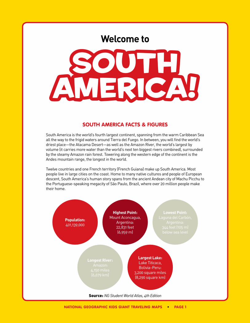
South America!
Welcome to
soUth america Facts & FigUres
South America is the world’s fourth largest continent, spanning from the warm Caribbean Sea all the way to the frigid waters around Tierra del Fuego. In between, you will find the world’s driest place—the Atacama Desert—as well as the Amazon River, the world’s largest by volume (it carries more water than the world’s next ten biggest rivers combined), surrounded by the steamy Amazon rain forest. Towering along the western edge of the continent is the Andes mountain range, the longest in the world.
Twelve countries and one French territory (French Guiana) make up South America. Most people live in large cities on the coast. Home to many native cultures and people of European descent, South America’s human story spans from the ancient Andean city of Machu Picchu to the Portuguese-speaking megacity of São Paulo, Brazil, where over 20 million people make their home.
Source: NG Student World Atlas, 4th Edition
Population: 401,139,000
Highest Point: Mount Aconcagua,
Argentina: 22,831 feet (6,959 m)
Longest River: Amazon:
4,150 miles (6,679 km)
Lowest Point: Laguna del Carbón,
Argentina: 344 feet (105 m) below sea level
Largest Lake: Lake Titicaca, Bolivia–Peru:
3,200 square miles (8,290 square km)
page 2 • national geographic kids giant traveling maps
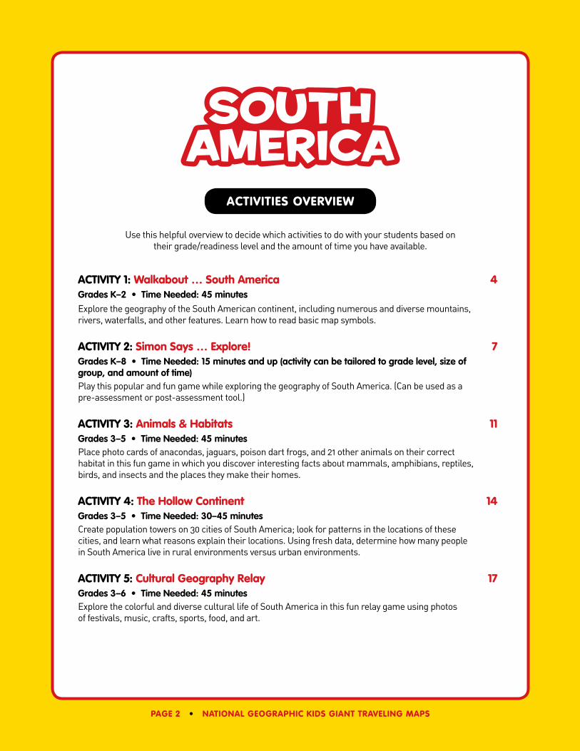
Use this helpful overview to decide which activities to do with your students based on their grade/readiness level and the amount of time you have available.
activitY 1: Walkabout … south america 4Grades K–2 • Time Needed: 45 minutes
Explore the geography of the South American continent, including numerous and diverse mountains, rivers, waterfalls, and other features. Learn how to read basic map symbols.
activitY 2: simon says … explore! 7Grades K–8 • Time Needed: 15 minutes and up (activity can be tailored to grade level, size of group, and amount of time)Play this popular and fun game while exploring the geography of South America. (Can be used as a pre-assessment or post-assessment tool.)
activitY 3: animals & habitats 11Grades 3–5 • Time Needed: 45 minutesPlace photo cards of anacondas, jaguars, poison dart frogs, and 21 other animals on their correct habitat in this fun game in which you discover interesting facts about mammals, amphibians, reptiles, birds, and insects and the places they make their homes.
activitY 4: the hollow continent 14Grades 3–5 • Time Needed: 30–45 minutesCreate population towers on 30 cities of South America; look for patterns in the locations of these cities, and learn what reasons explain their locations. Using fresh data, determine how many people in South America live in rural environments versus urban environments.
activitY 5: cultural geography relay 17Grades 3–6 • Time Needed: 45 minutesExplore the colorful and diverse cultural life of South America in this fun relay game using photos of festivals, music, crafts, sports, food, and art.
South America
activities overvieW
national geographic kids giant traveling maps • page 3
activitY 6: symbols are the key 19Grades 3–6 • Time Needed: 25–45 minutesLearn how to read a map key and play a fun relay game! As a team, compete to see who can find map features accurately and quickly.
activitY 7: countries & capitals concentration 21Grades 4–8 • Time Needed: 25 minutesThe giant map turns into the world’s biggest concentration game board as students learn the locations of all of South America’s countries and their capital cities.
activitY 8: go With the Flow 23Grades 4–8 • Time Needed: 45 minutesUsing props, build raised relief features showing the major mountains and four principal watersheds of the South American continent. Then simulate rain on the map and see where the water flows.
activitY 9: the grid game 26Grades 4–8 • Time Needed: 30–45 minutesUsing latitude and longitude coordinate cards, your team finds locations on the map and marks them. If correct, you get a special bonus question about a place nearby. The team with the most points wins!
activitY 10: the voyage of the h.m.s. Beagle 29Grades 5–8 • Time Needed: 45 minutesExplore the coast of South America and the Galápagos Islands with Charles Darwin! Using latitude and longitude, trace the voyage of the H.M.S Beagle, read excerpts from Darwin’s journals, and deliver postcards with photos of animals he observed on his historic journey.
activitY 11: physical Features scavenger hunt 31Grades 6–8 • Time Needed: 45 minutesThe world’s largest river, tallest waterfall, and driest desert await you! Using colorful and engaging photographs of 32 prominent physical features of the continent, you will compete in teams to place them on the map using clues provided on cards.
additional activities 33Grades K–8There’s so much more you can do. We invite you to try some of these, or use the props and cards provided to create your own!
Activities developed by Katie Kennedy, Herb Thompson, Mary Cahill, and Dan Beaupré
page 4 • national geographic kids giant traveling maps
WALKabout … South America
activitY 1
recommended grades: k–2
introdUction
Give students a few minutes to explore the map before beginning the activity.
Use the following script to introduce them to the continent of South America:
Welcome to South America, the world’s fourth largest continent! In South America you will soon find the world’s largest river by volume, the Amazon, and the world’s longest above-ocean mountain range, the Andes. South America is also home to the world’s largest rain forest, and the world’s highest waterfall, Angel Falls. The world’s driest desert, the Atacama, is here as well. The Pacific Ocean lies to the west of South America and the Atlantic Ocean lies to the east. And many other wonderful places like the Galápagos Islands are waiting for those who visit or study South America. Let’s find out more about this amazing continent!
Objectives• Students will locate basic physical and political features of South America.
Materials(all included in the trunk)• 8 yellow cones for the Andes• 2 red cones for islands• 1 blue chain for the Amazon River• 5 arrows• 2 green hoops for cities• 1 red nylon strap for the Equator• 1 yellow nylon strap for the Tropic
of Capricorn• Lanyards (red, blue, yellow, green)
Preparation15 minutes• Read and familiarize yourself with the
locations of the places used in the introduction and the content of each of the four walkabout activities.
• Remove necessary materials from the trunk before beginning the activity with students.
time needed: 45 minUtes
Rules No writing utensils on the map.
Shoes are not allowed on the map. Please have students remove shoes before walking on the map.
WALKabout … South America
national geographic kids giant traveling maps • page 5
Take a few minutes to show students the highlights of South America. Have individual students join you on the map and stand, sit, or lie on the following locations.
• Amazon River & Rain Forest: Have several students lie down on the river in Brazil. Explain that the rain forest covers an area the size of the 48 contiguous United States.
• Andes Mountains: Have several students lie down in a line along the mountains near the coast in Colombia, Peru, and Chile. Tell them the chain is over 4,000 miles long, which is 1,500 miles farther than the distance from California to New York.
• Angel Falls: Have a student stand on its location near the border of Venezuela and Guyana and tell them the waterfall is over 3,000 feet high. That’s more than a half mile high!
• Atacama Desert: Have a student sit on its location in northern Chile and tell them that parts of this desert can go ten years without rain. That’s dry!
• Lake Titicaca: Have a student stand on the lake shared by Bolivia and Peru and tell them the lake sits at over 12,000 feet (two miles) above sea level.
• Cape Horn: Have a student sit on the very southern tip of South America and face south. Tell them that Cape Horn is only 600 miles north of Antarctica.
Have all the students join you on the map, and continue to introduce the map and its features with the following activities. You can use one of the map keys to help if you wish.
• Show and have students:
Stand on a coast.
Stand on a border between countries.
Stand in a country.
Stand on a capital city.
Stand on a road or highway.
Stand on a river or lake.
Stand on mountains.
• Show students the compass rose in each corner of the map. Then have them turn and face each of the four cardinal directions: east toward the Atlantic Ocean, west toward the Pacific Ocean, south toward Antarctica, and north toward the Caribbean Sea. For fun, have four students make a human compass rose in the middle of the map.
WALKabout … South America
page 6 • national geographic kids giant traveling maps
plaYing the game
Divide the class into four groups—yellow, blue, red, and green—and instruct each group to gather around their “Base Camp” (the colored circles in the corners of the map). Make the groups as even as possible (6–8). Give each student a lanyard corresponding to the color of their team. Tell students that they will all do a short walkabout on the map one group at a time.
Walkabout #1: (Yellow Group) Start on the Isthmus of Panama and follow the Andes Mountains to the southern tip of the continent through the countries of Colombia, Ecuador, Peru, Bolivia, Chile, and Argentina. Make specific stops at the Equator, Lake Titicaca, and Cape Horn. Give each student in the group a yellow cone to place along the world’s longest mountain chain, the Andes. Help students space them out and leave them on the map. Make sure students understand that Colombia is the first country in South America and that Panama is considered part of North America.
Walkabout #2: (Blue Group) Start in the Atlantic Ocean near the mouth of the Amazon River and follow it through the countries of Brazil and Peru to its source high in the Andes Mountains. Make specific stops on the river in Manaus, Brazil (largest port), and Iquitos, Peru (last major port for oceangoing ships). Give your students a length of blue plastic chain and have them place it along the entire course of the Amazon River from source to mouth. To do this, turn south just past Iquitos and follow the Ucayali River to a point past the famous city of Cusco and west of Lake Titicaca. Make sure students understand which way the river flows and that it starts in the mountains and empties into the Atlantic Ocean. Have five students place the five bright orange arrows along the river showing the correct direction of its flow.
Walkabout #3: (Red Group) Start in Uruguay and continue north, recognizing the countries of Paraguay, Suriname, Guyana, and Venezuela. Make specific stops along the way at the Tropic of Capricorn, the cities of São Paulo and Rio de Janeiro (just to the east on the coast of Brazil), and the Equator. Give two students green hoops to identify the largest city in South America (São Paulo) and the 2016 Summer Olympic Games host city (Rio de Janeiro). Then give two different students a yellow band to mark the Tropic of Capricorn. Make sure all students understand that the weather and climate below the Tropic of Capricorn is more temperate (mild) than in the warmer tropics.
Walkabout #4: (Green Group) Start at the Strait of Magellan (Estrecho de Magallanes) and split the students into two groups that will travel up both the east and west coasts of South America to the Caribbean Sea along the Atlantic and Pacific Oceans. Make specific stops in both the Falkland Islands and the Galápagos Islands. Also have both groups stop on the Equator. Give two students one red cone each to mark the location of each island group. Then give two students the red band to mark the location of the Equator. Make sure all students understand that the Equator is located halfway between the North and South Poles. You might use extra students to stand in the Caribbean Sea and the Atlantic and Pacific Oceans.
national geographic kids giant traveling maps • page 7
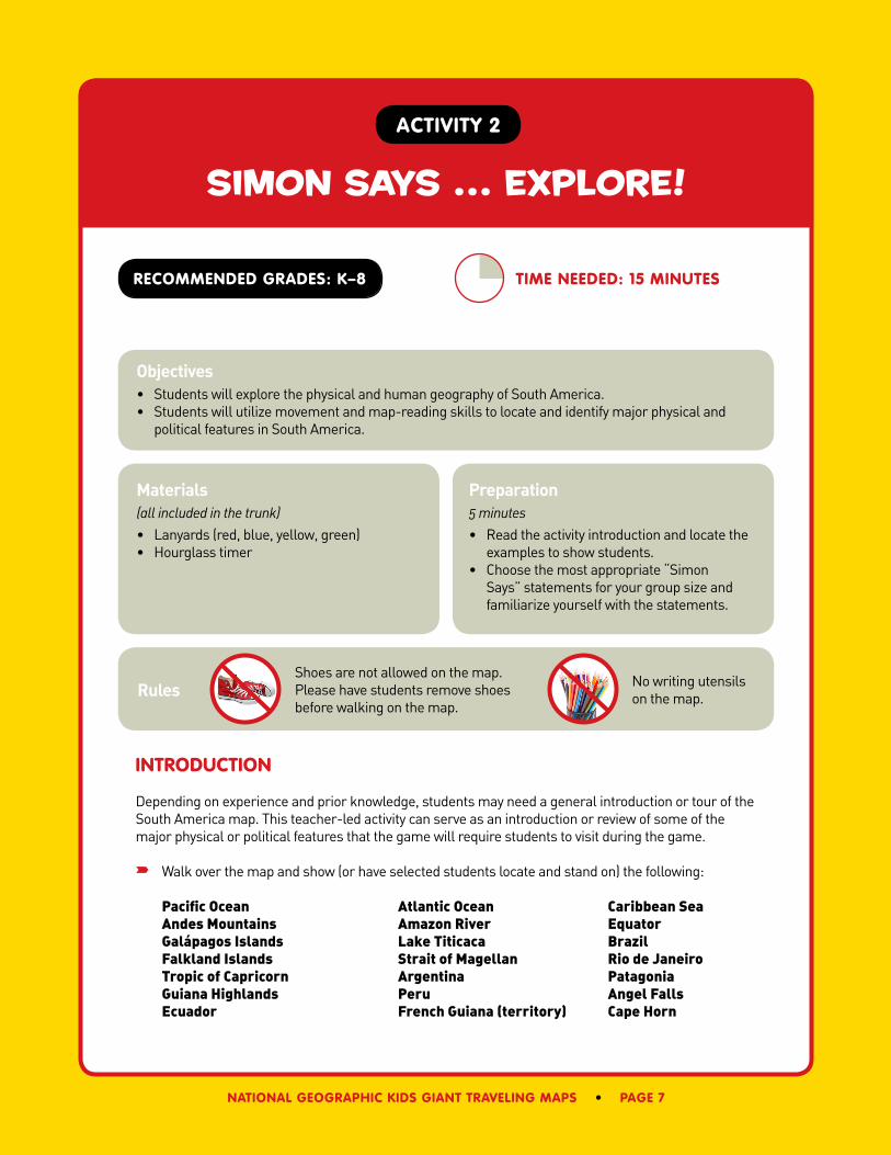
simon says … explore!
activitY 2
recommended grades: k–8
introdUction
Depending on experience and prior knowledge, students may need a general introduction or tour of the South America map. This teacher-led activity can serve as an introduction or review of some of the major physical or political features that the game will require students to visit during the game.
Walk over the map and show (or have selected students locate and stand on) the following:
Pacific Ocean Atlantic Ocean Caribbean SeaAndes Mountains Amazon River EquatorGalápagos Islands Lake Titicaca BrazilFalkland Islands Strait of Magellan Rio de JaneiroTropic of Capricorn Argentina PatagoniaGuiana Highlands Peru Angel FallsEcuador French Guiana (territory) Cape Horn
time needed: 15 minUtes
Objectives• Students will explore the physical and human geography of South America.• Students will utilize movement and map-reading skills to locate and identify major physical and
political features in South America.
Materials(all included in the trunk)• Lanyards (red, blue, yellow, green)• Hourglass timer
Preparation5 minutes• Read the activity introduction and locate the
examples to show students.• Choose the most appropriate “Simon
Says” statements for your group size and familiarize yourself with the statements.
Rules No writing utensils on the map.
Shoes are not allowed on the map. Please have students remove shoes before walking on the map.
simon says … explore!
page 8 • national geographic kids giant traveling maps
Remember to note the colors on the map that represent countries, elevation (or relief), and water. Have students face north on the map and then turn and face each of the other three cardinal directions (south, east, west) before starting the first game.
plaYing the game
Divide the class into four teams—red, yellow, green, and blue—and instruct each team to gather behind their “Base Camp” (the colored circles in the corners of the map). Make the teams as even as possible. Give each student a lanyard to wear corresponding to the color of his/her team.
Using “Simon Says” statements, direct students to visit various locations in South America. If they move toward a location that did not begin with the direction “Simon Says,” or they choose an incorrect place, they will be “out.” When a student is out, they will walk off the map and sit on the border of the map near their team’s corner until the start of a new game.
Mix the game up and control traffic with qualifiers, like these:
• Simon says everybody ...
• Simon says red team ...
• Simon says all girls ...
• Simon says all boys ...
The hourglass timer will signal the end of each game. The team with the most team members still on the map will be declared the winner of that game. Team members who were out of the game can return to the map for the start of a new game.
The “Simon Says” statements on page 9 are best for when the game begins and there are larger groups of students. Statements on page 10 are best for the middle and end of the game when there are fewer students left on the map.
No running is allowed. Students who run, touch, or impede other students will be out.
Allow students a few seconds to get to each location that “Simon Says” for them to visit. Assure students that each game will have a time limit to keep “out time” to a minimum.
Remember to mix in statements without the prefix “Simon Says” to catch students who are not paying close attention.
Feel free to create and use your own “Simon Says” statements. Review the rules, turn the hourglass timer, and begin!
simon says … explore!
national geographic kids giant traveling maps • page 9
“simon saYs” statements For large groUps
“Simon Says” statements for the start of the game or for larger numbers of students:
Simon Says ...
• Sit in the Atlantic Ocean.
• Kneel on one knee in the largest country in square miles.
• Stand south of the Tropic of Capricorn.
• Place one foot on a capital city.
• Stand on the Equator and face east.
• Sit anywhere along the Andes Mountains.
• Put one toe on the Amazon River.
• Sit in a country that borders South America’s only mainland territory.
• Stand in the Pacific Ocean and face west.
• Sit in the country with the largest population in South America.
• Stand in the 2016 Summer Olympics host country.
• Place a finger on any major highway.
• Put one toe on a city that has an airport.
• Stand south of the Equator and face north.
• Line up on 40˚ south latitude and face Antarctica.
• Put one toe on any tributary of the Amazon River.
• Stand in Brazil and face northeast.
• Sit within six feet of the map scale.
• Stand on the Tropic of Capricorn and face south.
• Line up on 70˚ west longitude.
simon says … explore!
page 10 • national geographic kids giant traveling maps
“simon saYs” statements For small groUps
“Simon Says” statements for the end of the game or for smaller numbers of students:
Simon Says ...
• Put one toe in a landlocked country.
• Stand in a country that does not start with A, B, or C.
• Make a circle around the country that includes the Galápagos Islands.
• Stand with one foot in Argentina and the other in the Pacific Ocean.
• Put one toe in a country that borders both the Atlantic and Pacific Oceans.
• Stand in one of the two countries that share Lake Titicaca.
• Place one foot in a country that does not border Brazil.
• Stand in a country that borders the Caribbean Sea.
• Put one toe on the Strait of Magellan.
• Stand in the Amazon Basin, but not in Brazil.
• Form a circle around the Falkland Islands.
• Stand in a country that starts with P.
• Put one toe in the country with the world’s highest waterfall.
• Sit in the country that spans the most degrees of longitude.
• Put one foot in a country that starts with C.
• Stand in Patagonia or the Guiana Highlands.
• Put one toe on a capital that is not also a port city.
• Place one foot in a South American country that is a member of OPEC.
• Place one hand in the country where you will find the ruins of Machu Picchu.
national geographic kids giant traveling maps • page 11
animals & habitats
activitY 3
recommended grades: 3–5
introdUction & stUdent preparation
Students may first need a general introduction to or tour of the South America map. This teacher-led activity can serve as an introduction to or review of some of the major physical features of South America.
Walk over the map and show (or direct selected students to stand on) the following:
Pacific Ocean Atlantic Ocean Caribbean SeaAndes Mountains Amazon River EquatorGalápagos Islands South Georgia Island Falkland IslandsLake Titicaca Cape Horn Atacama Desert
Remember to note the colors on the map that represent countries, elevation (or relief), and water. Direct some students to stand on and name each country. Have students face north on the map by using the compass roses located in each corner and then turn and face each of the other three cardinal directions (south, east, west) before starting.
time needed: 45 minUtes
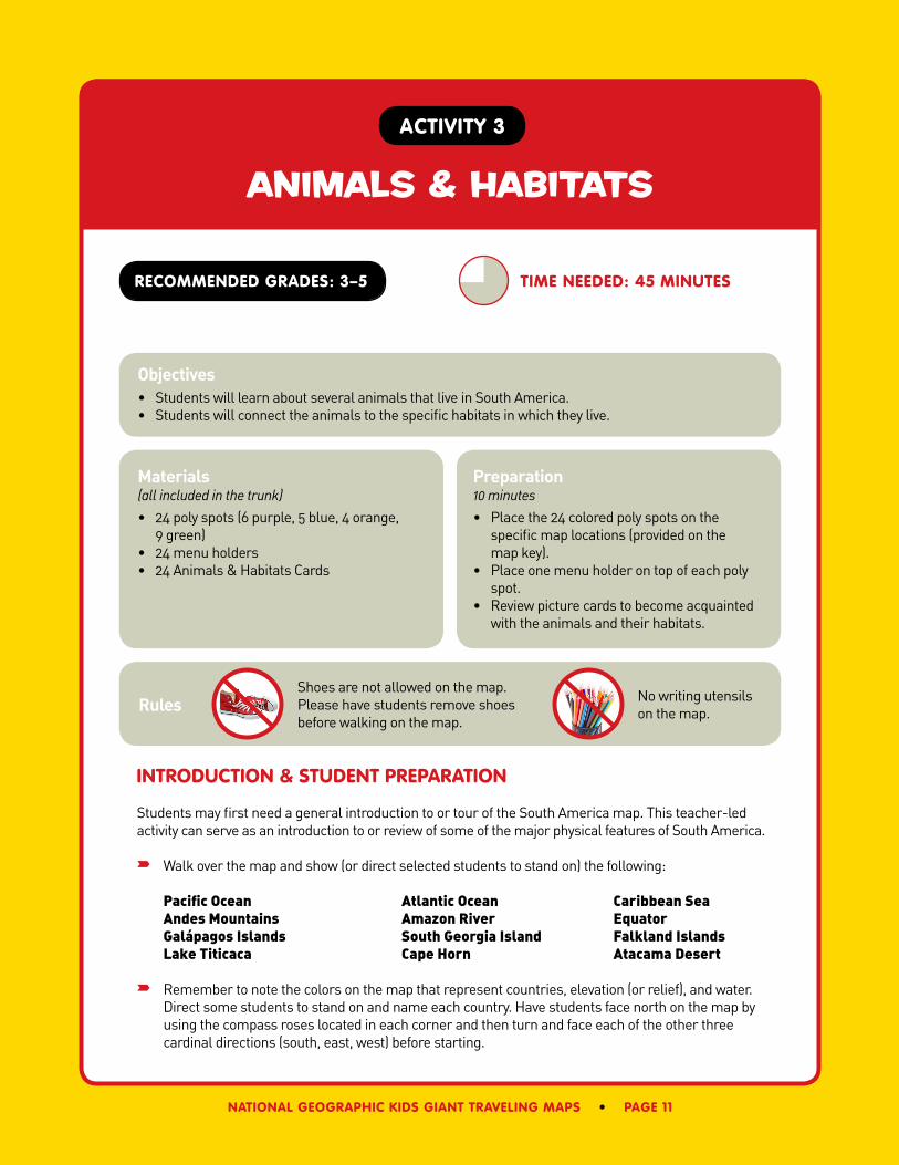
Objectives• Students will learn about several animals that live in South America. • Students will connect the animals to the specific habitats in which they live.
Materials(all included in the trunk)• 24 poly spots (6 purple, 5 blue, 4 orange,
9 green)• 24 menu holders• 24 Animals & Habitats Cards
Preparation10 minutes• Place the 24 colored poly spots on the
specific map locations (provided on the map key).
• Place one menu holder on top of each poly spot.
• Review picture cards to become acquainted with the animals and their habitats.
Rules No writing utensils on the map.
Shoes are not allowed on the map. Please have students remove shoes before walking on the map.
animals & habitats
page 12 • national geographic kids giant traveling maps
plaYing the game
Divide the class into four teams—red, yellow, green, and blue—and instruct each group to line up next to their “Base Camp” (the colored circles in the corners of the map). Make the teams as even as possible with six to eight students in each.
Quickly review the following information about the four habitats they see represented on the map by the colored poly spots. Physically show these areas on the map.
• Mountain Habitats: Purple Poly Spots (6) Includes forests and special high-altitude habitats with short plants and grassy alpine tundra.
• River & Wetland Habitats: Blue Poly Spots (5) Includes lakes, swamps, and flood plains in lowland areas.
• Island Habitats: Orange Poly Spots (4) Vary in climate by latitude, but usually support unique animals well adapted to the environment.
• Rain Forest Habitats: Green Poly Spots (9) May be tropical or temperate with at least 80 inches of rain per year, and support the largest diversity of plants and animals on Earth.
Make sure the colors of the animal picture cards are mixed up and count out six for each group. Place them (picture up) in a stack at each Base Camp.
Tell students they are competing with the other teams to accurately place their cards on the poly spots. Their first clue is the color of each card because that color corresponds to the color of the poly spots (habitats) on the map. When you tell students to begin, one or two students at the front of the line in each group will pick up the first card and go onto the map and try to determine its correct location using the two clues on the back of each card. When they decide on a location they place the card in the menu holder on the poly spot and then return to the line at their Base Camp. At this point, the next student or students proceed with the next card. This will continue until all teams have finished their six cards.
There can be more than one card placed in each menu holder, but only one will be correct (to be revealed later).
Students who run, touch, impede other students, or knock over a menu holder will have to leave the map, return the card to the bottom of their pile, get back in line, and wait for another turn.
When all the groups have finished, ask individual students to sit by each animal and read its descrip-tion out loud to the class. If pressed for time, choose to read the descriptions yourself. If there is more than one card in a menu holder, move the incorrect animal to the correct location and then read its description to the class.
In conclusion, ask the students these questions:
• Is there a pattern to where the animals are and where they are not?
• Why do these patterns exist? This may lead to a discussion about the competition between humans and animals for space and resources (food and water). In general, animals will tend to live and survive in less populated areas and away from cities.
animals & habitats
national geographic kids giant traveling maps • page 13
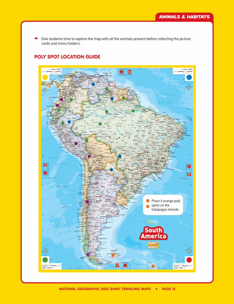
Give students time to explore the map with all the animals present before collecting the picture cards and menu holders.
polY spot location gUide
G
G
GG
GG
G
G
GG
G
G
G
G
G
G
G
G
G
G
G
G
G
G
G
G
G
G
G
GG
G
G
GG
G
G
G
G
G
G
G
G
GG
G
G
G
G
G
G
G
GG
G
G
G
G
G
G
G
G
GG
G
G
GG
G
G
G
G
G
G
G
G
G
G
G
G
G
G
G
G
G
G
G
G
G
G
G
G
G
G
G
TRANS-AMAZON HIGHWAY
Administered by United Kingdom(claimed by Argentina)
Boundary claimedby Suriname
Boundary claimedby Suriname
Colombia
Chile
Brazil
Brazil
U.K.
U.K.
France
Colombia
Chile
Orinoco
Orinoco
Negro
Bra
nco
Ta
pa
jos
Xin
gu
M
adeira
Solim˜oes (Amazonas)
Ucayali
Mara˜non
Paran´a
Uru
gu
ay
Río de la Plata
Negro
Pa
ran
´a
Pa
rag
ua
i
Pa
ran
aíb
a
Sao Fra
nci
sco
Xin
gu
Amazonas
(Amazon)
Teles Pires
(Sa
o Manuel)
Madeira
A
mazonas
Caqueta
Japura
Purus
Tocantins
Ara
guaia
Napo
AngelFalls
Igua¸c´uFalls
PENÍNSULA VALDES
Cabo de Hornos (Cape Horn)
Isla de Margarita
K
K
K
K
K
K
K
K
K
K
K
K
K
K
Laguna del Carb´on
(South America's lowest point)
6959 m22831 ft
Cerro Aconcagua
(South America's highest point)
420 m1378 ft
842 m2762 ft
5007 m16427 ft
2739 m8986 ftMt. Roraima
Pico da Neblina2994 m9823 ft
6768 m22205 ft
Nevado Huascar´an
6542 m21463 ftNevado
Sajama
6880 m22572 ft
1230 m, 4035 ft
Chimborazo
Pico Bolívar
Cerro Ojosdel Salado
Cerro Per´o
514 m1686 ft
6267 m20561 ft
Juliana Top
Pico de Itamb´e 2040 m6693 ft
Cerro Catedral
5775 m18947 ft
Pico Crist´obalCol´on
PA
TA
GO
NI
A
PA
MP
A
S
B R A S I L E I R O
P L A N A L T O
DE
L
OS
AN
DE
S
G UI A
NA
H
IG
HL
AN
DS
A M A Z O N
B A S I N
La
M
on
ta
na
˜
Gr
an
C
ha
co
At
ac
am
a
De
se
rt
L
L
A
N
OS
PANAMA CANAL
CO
RD
I
L
L
E
R
A
Pa
nt
an
al
Represa da Balbina
VanBlommestein
Meer
LagunaMar
Chiquita
Lago Titica
ca
Represa de Sobradinho
Golfo dePanam´a
Golfo de
Guayaquil
Golfo deVenezuela
Bahía
Grande
Golfo
San Jorge
GolfoSan Matías
Estrecho de M
agal
la
nes
Bahía Blanca
Lago deMaracaibo
C A R I B B E A N S E A
P a c i f i c
O c e a n
P a c i f i c
O c e a n
A T L a N T I C
O c e a n
A T L a N T I C
O c e a n
E-105 m-344 ft
ARCHIPIELAGO
DE LOS
CHONOS
ARCHIPIELAGO
REINA ADELAIDA
FALKLAND ISLANDS(ISLAS MALVINAS)
I. de San Andr´es
East Falkland
Isla de los Estados(Staten Island)
West Falkland
ISLA GRANDE DE
TIERRA DEL FUEGO
Atoldas Rocas
Tobago
South Georgia I.
Trinidad
ISLA GRANDE DE CHILOE
Isla de Malpelo
I l h ad e
M a r a j ´o
Islas Juan Fernandez
Isla San Felix Isla San Ambrosio
Arquipelago de
Fernando de Noronha
S e r r a d e T u m u c u m a q u e
C
C
B
B
B
B
BB
B
B
B
B
B
BB
B
B
E
E
E
E
E
E
E E
E
E
E
E
E
E
E
E
EE
E
E
E
E
E
E
E
EE
E
E
E
E
E
E
E
E
E
E
E
E
E
E
E
E
E
E
E
E
E
E
E
E
E
E
E
E
E
E
E
E
E
E
E
E
E
E
E
E
E
E
E
E
E
E
E
E
E
E
E
E
E
E
E
E
E
EE
E
E
E
E
E
E
E
E
E
E E
E
E
E
E
E
EE
E
E
E
E
E
E
E
EE
E
E
E
E
E
E
E
E
E
E
E
E
E
E
E
E
E
E E
E
E
E
E
E
EE
EE
E
E
E
E
E
E
E
E
E
EE
E
E
E
E
E
E
E
E
E
E
E
EE
EE
E
EE
E
E
E
E
E
E
E
E
E
E
E
E
E
EE
E
E
E
E
E
EE
E
E
E
E
E
E
E
E
EE
EE
E
E
E
E
E
E
E
E
E
E
E
E
E
E
E
E
E
E
E
E
E
E
E
E
E
E
E
E
E E
E
E
E
E
E
E
E
E
E
E
E
E
E
E
E
E
E
E
E
E
E
E
E
E
E
E
E
E
E
E
E
E
E
E
E
EE
E
E
EE
E
EE
E
E
E
EE
E
E
E
E
E
E
EE
E
E
EE
E
E
E
E
E
E
E
E
E
E
E
E
E
E
E
E
E
E
E
E
E
E
E
E
E
E
E
EE
E
E
E
E
E
E
E
E
E
E
E
E
E
E
E
E
E
E
E
E
E
E
EE
E
E
E
E
E
E
E
E
E
E
E
E
E
E
E
E
E
E
E
E
E
E
EE
E
E
E
E
E
E
E
E
E
E
E
E
E
E
E
E
E
E
E
E
E
E
E
E
E
E E
E
E
E
E
E
E
E
E
E
E
E
E
E
EE
E
E
E
E
E
E
E
E
E
E
E
E
E
E
EE
E
E
E
E
E
E
E
E
E
E
E
E
E
E
E
E
E
E
E
E
E
E
E
E
E
E
E
E
E
E
EE
EE
E
E
E
EE
E
E
E
E
E
E
E
EE
E
E
E
E
E
E
E
E
E
E
E
E
E
E
E
E
E
E
E
E
E
E
E
E
E
E
E
E
E
E
E
E
E
E
E
E
E
E
E
E
E
E
E
E
E
E
E
E
E
E
E
E
E
E
E
E
E
E
E
E
E
E
E
E
E
E
E
E
E
E
E
E
E
E E
E
E
E
E
E
E
EE
E
E
EE
E
E
E
E
E
E
E
E
E
E
E E
E
E
E
E
E
EE
E
E
E
E E
E
E
E
E
E
E
E
E
E
E
E
E
E
E
E
E
E
E
E
E
E
E
E
E
E
E
E
E
E
E
EE
E
E
E
E
E
E
E
E
E
E
E
E
E
E
E
E
E
E
E
E
E
E
EE
E
E
E
E
E
E
E
E
E
E
E
E
E
E
E
E
E
E
E
E
E
E
EE
E
E
E
E
E
E
E
E
E
E
E
E
EE
E
E
E
E
E
E
E
E
E
E
E
E
E
E
E
E
E
E
E
E
E
E
E
E
E
E
E
E
E
E
E
E
E
E
E
E
E
E
E
E
E
E
E
E
E
E
E
E
E
E
E
E
E
E
E
E
E
E
E
EE
E
E
E
E
E
E
E
EE
E
E
E
E
E
E
E
EE
E
E
E
E
E
E
E
E
E
E
E
E
E
E
E
E
E
EE
E
E
E
E
E
E
E
E
E
E
Stanley
Cayenne
Port of Spain
LIMA
Sucre
CARACAS
BRASÍLIA
BUENOSAIRES
BOGOTA
QUITO
La Paz
Paramaribo
MONTEVIDEO
Georgetown
Asunci´on
SANTIAGO
PanamaCity
FORTALEZA
RECIFE
SALVADOR (Bahia)
PORTO ALEGRE
MANAUS
COCHABAMBA
CORDOBA
CURITIBA
BELEM
CALI
S�AO PAULO
RIO DE JANEIRO
BARRANQUILLA
MEDELLÍN
MARACAIBO
GUAYAQUIL
VALENCIA
BELOHORIZONTE
GOI�ANIA
SANTA CRUZ
ROSARIO
MACEIO
S�AO LUÍS
NOVA IGUA�CU
Natal
Mar del Plata
C´ucuta
Marab´a
Santos
Niteroi
BARQUISIMETO
Sao Bernardo
do Campo
San Miguelde Tucum´an
Santa Fe
Valparaíso Mendoza
La Plata
San Justo
Cartagena
Bucaramanga
Trujillo
Arequipa
CAMPINAS
RíohachaPunto Fijo
Coro
San Felipe
Los TequesBarcelona Cuman´a
Car´upano
Boa Vista
M´erida CiudadBolívarBarinas
GuanareSan Fernandode Apure
CalabozoAcarigua
BuenaventuraTulu´a
Barrancabermeja
Palmira
Florencia
IbarraEsmeraldas
Popay´an
Machala Iquitos
Sullana
MilagroRiobamba
Pucallpa
Cajamarca
Huanuco
Portoviejo
HuarazRio Branco
Ica
Ayacucho
PunoJuliaca
Iquique
TacnaArica
Tarija
Potosí
Corumb´a
Copiap´o
CoquimboLa Serena
Talca
Valdivia
PuntaArenas
San Bernardo
Coronel
Puerto Montt
Osorno
Los Angeles
Curic´o
Chill´anSantaRosa
Rancagua
San Carlos de Bariloche
Comodoro Rivadavia
Río Cuarto
Tandil
Bahía Blanca
San Luis San Nicol´as
Neuqu´en
La Rioja
Catamarca
PelotasRio Grande
Bag´e
Uruguaiana
Santa MariaCanoas
Blumenau
Paranagu´aJoinville
Crici´uma
S˜ao LeopoldoNovo Hamburgo
Florian´opolisPassoFundo
Posadas
Formosa
Cascavel
Maring´a
PresidentePrudente
Ciudaddel Este Foz do Igua¸cu
Sete LagoasUberabaDivin´opolisFranca
Araguari
Ribeir˜ao PretoDourados Marília
Uberlˆandia
Sao Jose
do Rio Preto
Araraquara
Piracicaba
S˜ao Carlos
Guaratinguet´a
Sao Jose dos Campos
LinharesColatina
Governador Valadares
Cachoeiro do ItapemirimJuiz deFora
Conselheiro Lafaiete Barbacena
Te´ofiloOtoni
Porto Seguro
Cabo deSanto Agostinho
Parnaíba
Arapiraca
Barreiras Alagoinhas
Aracaju
Feira de Santana
SobralCaxias
PetrolinaJuazeiro
Crato
TeresinaMossor´o
Imperatriz
Araguaína
Cuiab´a
Rondon´opolis
Ji-Paran´a
Sincelejo
Jequi´e
Garanhuns
ItabunaVit´oria da Conquista
Trindade
Patos deMinas
Lajes
San Juan
Loja
Mercedes
Calama Nova FriburgoDuque de CaxiasCabo Frio
Pamplona
Valera
Oca˜na
El Tigre
Porlamar
Maturín
Ciudad Guayana
Pasto
Ipiales
Babahoyo
Manta
Tumbes
Cuenca
Talara
Santar´em
Bacabal
Arcoverde
Timba´uba Olinda
Petrolˆandia
Jo˜ao Pessoa
Patos
IguatuFloriano
Juazeirodo Norte
Porto Velho
Chiclayo
Piura
Callao
La Oroya
Cusco
Trinidad
An´apolis
Alvorada
Ilh´eus
Curvelo
MontesClaros
FormigaTrˆesLagoas
CampoGrande
Tartagal
Oruro
Salta
San Pedro
Ponta Grossa
Apucarana
Bauru
S˜ao Jo˜aodel Rei
CruzAlta
Caxiasdo Sul
Santo �Angelo IjuíS˜aoBorjaGoya
Santiagodel Estero
Vallenar
Ovalle
San RafaelJunín
Lincoln
Melo
Tres ArroyosLota
SanCarlos
Pereira
GirardotCartago
LinaresConstituci´on
Temuco
Montería
Manizales
Armenia
Duitama
Zipaquir´aSogamoso
Chimbote
Resistencia
Presidente RoqueS´aenz Pe˜na
S˜ao Gabriel
Mercedes
Salto
Crate´us
San Crist´obal
San Felipe Las Heras
Balcarce
Andradina
Paulo Afonso
Corrientes
Caruaru
Valledupar
Magangu´e
Bello
TunjaLa Dorada
VillavicencioBuga
Neiva
Tumaco
Chorrillos
Maracay
Macap´a
Icoraci
Campina Grande
Palmeira dos Índios
Nanuque
CampoMour˜ao
Londrina
Tubar˜ao
Santana do Livramento
Alegrete
San Jos´e de Mayo
Rocha
San Salvadorde JujuyAntofagasta
Rafaela
Concepci´on del Uruguay
Paran´a
San Antonio
NecocheaPunta Alta
Olavarría
San Carlosde Bolívar
Concepci´on
Zapala
Tom´e
Trelew
Río Gallegos
Cer
ro de Pasco
Jaboat˜ao
Vit´oriaVila Velha
Rivera Tacuarembo
Quillota
Cutral C´o
Reconquista
San Fernando
Azul
Itapetinga
Paysand´u
Durazno
Quibd´o
Huancayo
Minas
Brusque
General Roca
Sorocaba
Puerto Cabello
TucuruíTef´e
Coari
Itacoatiara
Breves
SenaMadureira
Cruzeiro do Sul
Guajar´a-Mirim
Ariquemes
Sinop
Boca do Acre
Vilhena
Kourou St.-Laurent
du Maroni
Linden
Concordia
Itaituba
Sta. Marta
Parauapebas
Toconao
Vila Bittencourt
Jurad´o
Turbo
Guasdualito
Arauca
Puerto Ayacucho
Puerto P´aezPuerto Carre˜no
La Paragua
Tucupita
El Dorado
Oiapoque
Cal¸coene
Amap´a
Porto Grande
Vila Velha
Dep´osito
Santa Elena Orinduik
Boia¸cu
Morganito Cacuri
La Esmeralda
Mit´uIauaretˆe
SanFelipe
San Carlosde Río Negro
Miraflores
Calamar
PuertoLeguízamo
Mocoa
Santa Maríade Nanay
NuevoRocafuerte
PuertoAm´erica
Nauta
Santa ClotildePucaUrco
Pebas
La Pedrera
Jutaí
S˜ao Rom˜ao
Carauari
Santa Ritado Weil
S˜ao Paulode Oliven¸ca
Leticia
Fonte Boa
Penha do Tapau´a
CarvoeiroBarcelos
Manicor´e
Mara˜a
Santa Helena
Aveiro
Maloca
Borba
Porteira
Parintins
Nova Olindado Norte
SilvesAltamira
Arere
Iaripo
Jatobal
Araguatins Presidente Dutra
Coroat´a Piripiri
Quixad´a
Cu´o
JeremoaboPiranhas
Salgueiro
Sousa Canguaretama
Tau´a
Picos
Canto do Buriti
S˜ao RaimundoNonato
Paulistana
Colinas
Xique Xique
Tocantin´opolis
Gilbu´esParaíso doTocantins
Ibipetuba
Santana doAraguaia
Concei¸c˜aodo Araguaia
Grada´us
S˜ao F´elix do Xingu
Jacareacanga
Prainha
Panelas
Suma´uma
Aripuan˜a
Constˆanciados Baetas
Canutama
Humait´aL´abreaPauini
Abun˜aJaci-Paran´a
RiberaltaXapuri
CobijaIberia
Santa Rosado Purs
Feij´o
Eirunep´e
Atalaya
MarechalTaumaturgo
Toledo
ContamanaTarapoto
Yurimaguas
Moyobamba
Uchiza
Cajatambo
Paita
Atico
PiscoChincha Alta
Huancavelica
Abancay
Chalhuanca
Puquio
Coracora
Chuquibamba
Man´u
RurrenabaqueReyes
San Borja
Puerto Heath
Santa AnaMagdalena
San Joaquín
Ascenci´on
Pedras Negras
Vila Bela daSantíssima Trindade
Utiariti
PortoEsperidi˜ao
Aren´apolis Diamantino
TesouroPocon´e
Aragar¸casPoxor´eo
Alto Gar¸cas
SantaTerezinha
S˜ao Migueldo Araguaia
Aruan˜aCeres
Goi´as
Goian´esiaFormosa
Niquelˆandia
Mara Rosa
Paran˜a
Taguatinga
Arraias
Natividade
S˜ao Jo˜aoda Alian¸ca
Santana
Manga
MonteAzul
Canavieiras
Bom Jesusda Lapa
Brumado
Rui Barbosa
ParacatuJataí
Camapu˜a
Ba´usCoxim
Jardim
Puerto Su´arez
Amolar
BelaVista
Rio Verdede Mato Grosso
Fortín Su´arez Arana
Iboperenda
Cuevo
Charagua
Villamontes
Fortín Madrej´on
PuertoTres
Palmas
Capit´an PabloLagerenza
SantoCoraz´on
CamargoHuanchaca
GabrielVera
Aiquile
Cuya
Pulacayo
Victoria
MollendoMoquegua
Nasca
La QuiacaVillaz´on
MonteQuemado
Tintina PilarSan JuanBautista
Chapec´o
Laguna
Artigas
Los Amores
Curuz´uCuati´a
La Rubia
Carrizal Bajo
Chepes
Rufino
Realic´o
Treinta y Tres
Choele Choel
General Alvear
Santa IsabelBardas Blancas
San Martínde los Andes
Nueva Imperial
Ancud
Quell´on
Melinka
Coihaique
Tecka
Gan Gan
GeneralSan Martín
Camarones
Rawson
Punta Delgada
Lobería
Viedma
JaramilloPuerto Deseado
PuertoSan Carlos
PeritoMoreno
Laguna GrandeCmte. LuisPiedra Buena
Puerto Natales
San Fernandode Atabapo
San Jos´ede Ocun´e
San Jos´edel Guaviare
Puerto Berrío
Tres Esquinas
Santo Antˆoniodo I¸c´a
Barrado S˜ao Manuel
Santa Inˆes
Príncipeda Beira
PuertoSan Juli´an
El Calafate(Lago Argentino)
Astra
Santa Vit´oria do Palmar
Carinhanha
Chapadinha
AltoParnaíba
Catal˜ao
Caracaraí
Catrimani
Huaral
Otuzco
Uni˜ao da Vit´oria
Porvenir
Monte Dinero
Itaberaba
Nazar´eValen�ca
Chachapoyas
PisoFirme
AltaFloresta
Colídor
Buxton
New Amsterdam
Porto dosGa´uchos
PuertoAcosta
Inírid
a
Guapí
San Lorenzo
Gueppí
Andoas
PuertoPortillo
Ilave
PuertoMaldonado
San Jos´e de Amacuro
LethemConcei�c˜ao do Ma´u
Nieuw Nickerie
Totness
Nieuw Amsterdam
Iracoubo Mana
S˜ao Jos´e de Anau´a
S˜ao Gabrielda Cachoeira
Santa Isabeldo Rio Negro
Nhamund´a
SantaMaria
Itamarati
Caxias
Manoa
Cachimbo
Xinguara
Graja´u
Bragan�ca
Carutapera
Capanema
Salinopolis
Guimar˜aes
Urbano Santos
Humberto de Campos
Itapipoca
Areia Branca
Macau
Propri´a
Remanso
Estˆancia
Tucano
Formosado Rio Preto
Guanambi
Santa Maria da Vit´oria
Riach˜ao
Gurupi
NovaXavantina
Porto Artur
Barra do Bugres
C´aceres
CristalinaAlto Araguaia
Aquidauana
Caravelas
Mategu´a
Santa Rosa
Tipuani
Ollag¨ue(Oyahue)
Achacachi
Viacha
Fortín MayorAlberto Gardel
Misi´on SanJos´e Estero
Pedro JuanCaballero
Villarrica
Embarcaci´on
El Galp´on
Chuquicamata
Aguas Blancas
VillaUni´on
Santa Lucía
Los Vilos
General JuanMadariaga
Chos Malal
Carmen de Patagones
Las HerasBalmaceda
UshuaiaPuertoWilliams
Morawhanna
Charity
Alenquer
Abaetetuba
Pinheiro AnilCamocim
Canind´e
Palmares
Serrinha
Rio Verde
Almenara
S˜ao Mateus
Piresdo Rio
Yp´e Jh´u
Coronel Oviedo
GuaíraCuruguaty
Eldorado
Santo Tom´e
Trenque LauquenGeneral Pico
Toay
Valcheta
Los Plumas
Bahía Laura
TamelAike
Esquel
Patquía
Cruz del Eje
De´an Funes
Taltal
Las Lomitas
Taco Pozo
Tocopilla
FortínPresidenteAyala
Yacuiba
Robor´e
San Ignacio
Limoquije
San Juan
Huacho S˜ao F´elixdo Araguaia
BarrasTodo
Santos
Araracuara
Belmonte
Tinogasta
San Vincentedel Cagu´an
Cunaviche
Brokopondo
Esperanza
San Rafael
Pehuaj´o
Oeiras
Rodeo
Caic´o
Diamantina
Orocu´e
¡¡Norquinc´o
Ibotirama
GeneralAcha
Victorica
PontaPor˜a
PedraAzul
Diego de Almagro
Carolina
Socompa
Serra do Navio
Porto Santana
Oriximin´a
Oficina Dominador
Soure
Caazap´a
Cucuí
TRINIDAD ANDTOBAGO
PA
N AM
A
C O L O M B I A
V E N E Z U E L A
S U R I N A M E FRENCHGUIANA
E C U A D O R
P
E
R
U
B O L I V I A
GU
YA
NA
PA
R
AG
UA
Y
AR
GE
NT
I
N
A
B R A Z I L
UR
UG
UA
Y
CH
IL
E
EQUATOR EQUATOR
TROPIC OF CAPRICORN
Longitude West of Greenwich
TROPIC OF CAPRICORN
25°S
80°W
75°W 60°W 55° 50°W 45°W 40°W
5°N
0°
5°S
45°W50°W55°W60°W65°W70°W
40°S
35°S
30°S
20°S
15°S
10°S
5°S
0°
5°N
40°W55°S
45°S
35°W
10°N
15°S
20°S
30°S
10°N
70°W 65°W
75°W80°W85°W
85°W
90°W
95°W
10°S
25°S
35°S
40°S
45°S
50°S25°W
20°W
30°W35°W 55°S
50°S
KILOMETERS
0 200100 300 400
STATUTE MILES
0 200100 300 400
AZIMUTHAL EQUIDISTANT PROJECTION
KILOMETERS
0 200100 300 400
STATUTE MILES
0 200100 300 400
AZIMUTHAL EQUIDISTANT PROJECTION
KILOMETERS
0200 100300400
STATUTE MILES
0200 100300400
AZIMUTHAL EQUIDISTANT PROJECTION
KILOMETERS
0200 100300400
STATUTE MILES
0200 100300400
AZIMUTHAL EQUIDISTANT PROJECTION
No shoes or writing utensils on map
No
shoe
s or
writ
ing
uten
sils
on m
apN
o shoes or writing utensils on map
No shoes or writing utensils on map
N
SW
NWNE
SE
SW
E
N
S
WNW
NE
SE
SW E
N
S
WNW NE
SESW
E
N
S
WNW NE
SESW
E
Copyright © 2014 National Geographic Society, Washington, D.C. More on National Geographic Maps and its products at natgeomaps.com or call 1-800-962-1643 For more information on National Geographic Giant Traveling Maps go to www.nationalgeographic.com/giantmaps
SouthAmericaSouth
America
Place 2 orange poly spots on the Galápagos Islands.
page 14 • national geographic kids giant traveling maps
the hollow continent
activitY 4
recommended grades: 3–5
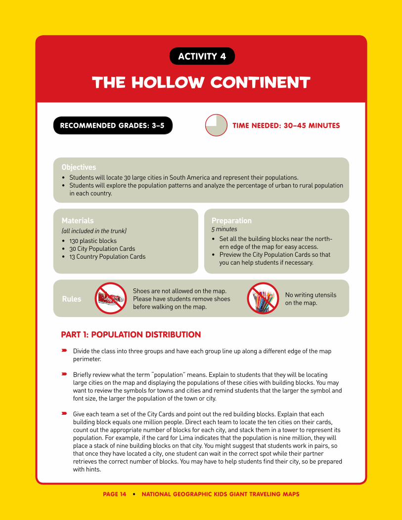
part 1: popUlation distriBUtion
Divide the class into three groups and have each group line up along a different edge of the map perimeter.
Briefly review what the term “population” means. Explain to students that they will be locating large cities on the map and displaying the populations of these cities with building blocks. You may want to review the symbols for towns and cities and remind students that the larger the symbol and font size, the larger the population of the town or city.
Give each team a set of the City Cards and point out the red building blocks. Explain that each building block equals one million people. Direct each team to locate the ten cities on their cards, count out the appropriate number of blocks for each city, and stack them in a tower to represent its population. For example, if the card for Lima indicates that the population is nine million, they will place a stack of nine building blocks on that city. You might suggest that students work in pairs, so that once they have located a city, one student can wait in the correct spot while their partner retrieves the correct number of blocks. You may have to help students find their city, so be prepared with hints.
time needed: 30–45 minUtes
Objectives• Students will locate 30 large cities in South America and represent their populations.• Students will explore the population patterns and analyze the percentage of urban to rural population
in each country.
Materials(all included in the trunk)• 130 plastic blocks• 30 City Population Cards• 13 Country Population Cards
Preparation5 minutes• Set all the building blocks near the north-
ern edge of the map for easy access.• Preview the City Population Cards so that
you can help students if necessary.
Rules No writing utensils on the map.
Shoes are not allowed on the map. Please have students remove shoes before walking on the map.
the hollow continent
national geographic kids giant traveling maps • page 15
After each team has located all their cities and stacked the blocks, direct them to sit in the ocean, on the coastline nearest to their cities. Have each team point out the countries in which their cities are located. Ask which cities are the largest.
As a class, discuss the following:
• These are the largest cities in South America. What do you notice about where they are located?
• Where are there few or no large cities?
• Do you see a pattern? Why might this pattern exist?
• Are there cities that don’t fit the pattern? Why do you think they are located where they are?
Inform the students that this pattern is called the “hollow continent” phenomenon because most of the people live around the edges of the continent. There are many factors contributing to this pattern, including the following:
• Access to Water: Many of the most populated cities are located on the coast or along river systems, which can be used for transportation and trade. When European countries began to explore this area, they developed settlements along the coast, allowing for movement back and forth from Europe.
• Natural Resources: Cities may be located near sources of minerals, timber, or seafood. They may also be located where food can easily be grown.
• Accessibility of the Area: Many portions of the continent have not been settled because of the difficulty in reaching or living in those areas. For example, the densely forested areas in the Amazon Basin present challenges, as do some mountainous regions.
• Historical Events: Before European contact, much of the population in South America was located the Andes, especially in Inca cities. When Europeans began to settle, they tended to do so near the coastal areas. As commerce grew, so did these settlements. At the same time, the population in the center of the continent declined due to disease and the lack of economic opportunities.
part 2: UrBan and rUral popUlation
Introduce or review the terms “urban” and “rural.” Select 13 students and hand each of them a Country Population Card. (Note: French Guiana will be treated as a country for purposes of this activity, but it is actually an overseas territory of France.) Direct the students to look at the total population of their countries and arrange themselves in a line from most populated to least. Once they are lined up in order, starting with the most populated country, have each student tell the class the name and population of their country one at a time and then go sit on that country.
Select 13 new students and have them come onto the map and get a Country Population Card from one of the students sitting on the map. Instruct the first group of students to sit on the yellow border. Direct the students now holding the Country Population Cards to look at the percentage of urban population in their countries and line up facing the class in order from the largest urban
the hollow continent
page 16 • national geographic kids giant traveling maps
population to the smallest. Once they are lined up in order, starting with the country with the largest percentage of urban population, have each student tell the class the name of their country and the percentage of people who live in urban areas. You may also want to have them go and sit on that country.
As a class, discuss the following:
• Why do you think there are so many more people living in cities than in rural areas in South America? [It’s easier to live in a city; more jobs, opportunities for education, health care, etc. in urban areas.]
Source: City population data from the United Nations Population Division (metropolitan areas, 2011). Country and territory population figures and percent urban figures from the U.S. Population
Reference Bureau (mid-2013).
notes
national geographic kids giant traveling maps • page 17
cultural geography relay
activitY 5
recommended grades: 3–6
part 1: plaY the “cUltUral geographY relaY”
Gameplay
Divide the class into four teams—red, yellow, green, and blue—and instruct each team to line up on the yellow border near their “Base Camp” (the colored circles in the corners of the map).
Explain that each team will locate five places on the map using clues found on the photo cards. Working in pairs, students are to take turns following the clues and locating their places. They will need to take a cone with them as they set out. When they identify the correct location, the duo puts the card down on that spot and places the cone on top. Only one pair from each team will be on the map at a time. Teammates can help, but they must do so from the yellow border near their Base Camp.
After the players have placed their cone and card, they return to the Base Camp and tag the next pair of students. These two students draw a card, take a cone, and set off to find their cultural geography location.
time needed: 45 minUtes
Objectives• Students will explore the cultural geography of South America—including cuisine, dress, music,
religion, and work life—by way of photographs and a fun relay activity.
Materials(all included in the trunk)• 20 cones, 5 of each color (red, yellow,
green, blue)• 20 Cultural Geography Relay Cards• 20 menu holders• Hourglass timer (optional)• Bell (optional)
Preparation5 minutes• Distribute the colored cones and Cultural
Geography Relay Cards, with the photo sides down, at each Base Camp.
• Set ten menu holders off to the side near the eastern edge of the map and ten menu holders near the western edge.
• Preview the cards so you can help students locate the places if necessary.
Rules No writing utensils on the map.
Shoes are not allowed on the map. Please have students remove shoes before walking on the map.
cultural geography relay
page 18 • national geographic kids giant traveling maps
Winning
Play continues until all of the cards and cones have been correctly placed. As each team completes its pile of cards, the entire team sits down at Base Camp. This helps identify which teams finish first, second, third, and fourth.
part 2: eXplore the photo gallerY
Direct the teams to take one menu holder to each of their locations, place the photo card in the holder on that spot, and return the cones to Base Camp. After the cards have been placed in the menu holders, have each team review their own team’s cards, reading the facts on the back of each photo. After sufficient time, send the teams back to Base Camp. You may want to use the hourglass to time and the bell to signal that time is up.
Instruct the yellow team to visit the red team’s cards and the red team to visit the yellow team’s cards. Likewise, have the blue and green teams each view each other’s cards. Students will stroll through the other team’s “photo gallery” and learn more about the cultural geography of South America. Allow time for them to look at the photos and read the descriptions on the back. Then, send the students back to their respective Base Camps.
part 3: share the cUltUral eXperience
Each student will have explored half of the Cultural Geography Relay Cards. Lead a discussion about what the students have observed.
Ask students some of the following questions:
• What do people in South America eat?
• How do people make a living? What do they do for work?
• How do they make energy in South America?
• How do people entertain themselves?
• Did you notice anything related to religion?
• What did you learn about how people live?
Since students have not seen all of the photos, you may want to highlight certain photos by holding them up for students or passing them around as the discussion takes place.
optional eXtension
Ask students: “Based on the photos you have seen today, where in South America would you want to go? Why?” This could be done in discussion or via a writing exercise back in the classroom.

national geographic kids giant traveling maps • page 19
symbols are the key
activitY 6
recommended grades: 3–6
introdUction
Ask students to describe what a map key is and why it is important. Explain that colors and shapes are used as symbols on a map to help us understand what is represented on the map. The map key, also called a legend, is the code to interpreting the map. Every map must have a key!
plaY “sYmBols are the keY”
Gameplay
Divide the class into four teams—red, yellow, green, and blue—and instruct each team to line up on the yellow border near their “Base Camp” (the colored circles in the corners of the map). Distribute one map key to each team.
Explain that teams will locate certain features on the map utilizing their map key and the information on their team cards. Each card includes both a map of the continent with one country highlighted and the name of one map feature.
time needed: 25–45 minUtes
Objectives• Students will learn the meaning of map key symbols and apply that knowledge to locate features on
the map.
Materials(all included in the trunk)• 32 Symbols Are the Key Cards• Colored cones (8 of each color: red, yellow,
green, blue)• 4 Map Keys• Hourglass timer (optional)
Preparation5 minutes• Distribute eight colored cones to each Base
Camp, matching the color of the camp.• Distribute Symbols Are the Key Cards
facedown at each Base Camp.
Rules No writing utensils on the map.
Shoes are not allowed on the map. Please have students remove shoes before walking on the map.
symbols are the key
page 20 • national geographic kids giant traveling maps
Instruct the first two players in line from each team to stand on the colored circle at their Base Camp. These players will draw one card. They will use the map key to identify the symbol that matches the feature listed on the card. They set out on the map to find it in the particular country shown on the card. When the duo identifies the correct feature somewhere in the targeted country, they put the card down on that spot and place the cone on top.
After placing the card and cone, the players return to Base Camp and tag the next two players, who then set out to find their feature. Only two players from each team will be on the map at the same time.
Winning
Play continues until all of the cards and cones have been correctly placed. As each team completes its pile of cards, the entire team sits down at Base Camp. This helps identify which teams finish first, second, third, and fourth.
optional eXtension – simon saYs
Now that students are familiar with the map symbols, play a version of Simon Says using state-ments relating to the map key. Direct students to visit various features on the map. If they move toward a location that did not begin with the direction “Simon Says,” or they choose an incorrect place, they will be out. When a student is out, he or she will walk off the map and sit on the border of the map near his or her team’s Base Camp until the start of a new game.
Mix the game up and control traffic with qualifiers, like these:
• Simon Says everybody ...
• Simon Says red team ...
• Simon Says all girls ...
• Simon Says all boys ...
The hourglass timer will signal the end of each game. The team with the most team members still on the map will be declared the winner of that game. Team members who were out of the game can return to the map for the start of a new game.
No running is allowed. Students who run, touch, or impede other students will be out.
Allow students a few seconds to get to each location that Simon Says for them to visit. Assure students that each game will have a time limit of five to ten minutes to keep “out time” to a minimum.
Remember to mix in statements without the prefix “Simon Says” to catch students who are not paying close attention.
national geographic kids giant traveling maps • page 21
countries & capitals concentration
activitY 7
recommended grades: 4–8
plaYing the game
Direct students to walk quietly around the map, focusing their attention on the country names and capital cities. Be sure they know the symbol (encircled star) for capital cities. Tell them they will soon be playing a competitive game testing their knowledge of the names and locations of these capital cites.
Place red poly spots over all 13 capital city names, concealing the whole name.
Select participants for two groups of 13 students and instruct one group to line up along the western (left) yellow border of the map and the other group along the eastern (right) yellow border. Each group should be spread apart and evenly spaced along the whole border.
Give each student on one side a country card and each student on the other side a capital card. Students can look at the cards, but should not show them to the students on the opposite side of the map until instructed to do so.
If you have fewer than 26 students you can have some hold more than one card.
time needed: 25 minUtes
Objectives• Students will learn the countries and capitals of South America.
Materials(all included in the trunk)• 13 Countries & Capitals Cards (red)• 13 Countries & Capitals Cards (yellow)• 13 red poly spots • 1 yellow foam die
Preparation5 minutes• Separate red and yellow cards and shuffle
each group.
Rules No writing utensils on the map.
Shoes are not allowed on the map. Please have students remove shoes before walking on the map.
countries & capitals concentration
page 22 • national geographic kids giant traveling maps
Notes:
• There are two Bolivia country cards and two different capital cards, given that Bolivia has two national capitals (La Paz and Sucre).
• French Guiana has no cards since it has no national capital (it is an overseas territory of France).
Explain to the students that this game is similar to the popular game of concentration. The object is for each student to remember which student across the map has the match for their country or capital.
Have the side with the country cards hold up their cards for one minute, facing the opposite side before turning them back toward themselves. Then have the side with the capital cards hold up their cards for one minute.
Choose a student to roll the die (or do it yourself from the center of the map). If the number is 1, 2, or 3, a student on the country side of the map will go first. If the number is 4, 5, or 6, a student with a capital card will go first.
The first student selects their match (or at least guesses who has it) and asks for that student to reveal their country or capital name. If they do indeed match, those two students will say the name of their country and capital out loud and walk onto the map and sit together in the correct location on or near the capital of their country.
Roll the die again to determine which side goes next. The game is over when all the students are sitting in the right locations on the map.
If time permits, you can reshuffle and distribute both cards and students can play again.
Caution students not to speak out and reveal the location of a match when it is not their turn. These students can sit out if the teacher wants to discourage this behavior.
notes
national geographic kids giant traveling maps • page 23
activitY 8
recommended grades: 4–8
part 1: Finding moUntains and maJor rivers
Divide the class into four teams—red, yellow, green, and blue—and instruct them to line up along the yellow border near their “Base Camp” (the colored circles in the corners of the map).
Explain that each team will locate four mountains and one large river. Working in pairs and using a card, students are to take turns locating a mountain or river. They will need to check their card before setting out to see whether they will be placing a large cone, a small cone, or a blue chain on the map. Note: Some of the mountains are identified on the map and some are not, but all of the mountain cards contain directions as to where to place the cones.
Only one pair from each team will be on the map at a time. Teammates can help, but they must remain on the yellow border near their Base Camp. Direct the students to hold on to their cards after they are done placing their cone or chain.
time needed: 45 minUtes
Objectives• Students will locate major mountains and four large river systems of South America. • Students will learn how topography affects water flow and understand the term “watershed.”
Materials(all included in the trunk)• 4 blue plastic chains• 20 Go With the Flow Cards• 12 large green cones• 4 small green cones• 20 arrows• 8 small whisk brooms• Blue bingo chips• Dustpan (for sweeping up bingo chips when
done)
Preparation10 minutes• At each Base Camp, place the following:
one blue plastic chain, five arrows, one small green cone, three large green cones, and the five color-coordinated Go With the Flow Cards.
• Read over the activity and preview the cards so you can help students locate the mountains and rivers if necessary.
go with the flow
Rules No writing utensils on the map.
Shoes are not allowed on the map. Please have students remove shoes before walking on the map.
Go with the Flow
page 24 • national geographic kids giant traveling maps
Notes:
• The large cones will be placed in the Andes and represent mountains over 10,000 feet in elevation. The small cones will be placed in the Brazilian Highlands or the Guiana Highlands and represent mountains lower than 10,000 feet in elevation. When placing a chain, have students kink it so that it follows the river’s twists and turns. The group with the Amazon River system might need help finding its origin, which is disputed among geographers. A commonly accepted origin is the Ucayali River in Peru.
part 2: demonstrating the terrain
After all the cones and chains have been placed, have each pair of students name the mountain or river on their card. As you discuss the various features, select a student to go to that place on the map. For mountains higher than 10,000 feet in elevation, the student will stand by the cone; for mountains lower than 10,000 feet in elevation, they will kneel next to the cone; and the student will sit or lie down next to a river chain.
Point out the following three areas: the Andes Mountains, the Guiana Highlands, and the Brazilian Highlands.
part 3: going With the FloW in the Watershed
Ask students which way they think the water is flowing in the four major rivers and why. Explain that water always flows downhill. Rainfall and snowmelt seep into the ground and slowly move to a local creek or river, then on to a larger river and on to a bay, sea, or ocean. Point out that the four major rivers denoted by the chains are part of larger systems, with many other rivers and creeks connecting to them that do not appear on the map.
Once that is established, hand out the arrows to the students not currently on the map and ask
them to place the arrows beside the rivers to indicate the direction of the water flow.
Send the students back to their Base Camps and introduce the term “watershed.”
• A watershed is a place where all nearby water flows into a common area. The watershed acts like a funnel, collecting all the water within an area and channeling it into a waterway. Each watershed is separated from neighboring watersheds by a geographical barrier such as a ridge, hill, or mountain. These barriers are called the drainage divide. Watersheds are also sometimes called drainage basins or catchments.
To help students visualize a watershed, ask them to picture rain falling on the pointed roof of a house. The water has to flow down one side or the other. The same is true of rain or snow; water flows down from the mountains, forming streams and rivers.
Ask students:
• Where is the major drainage divide located? [The Andes]
• Where do the major drainage basins empty? [The Atlantic Ocean and the Caribbean Sea]
• Which ocean or sea is closest to the Andes? [The Pacific Ocean]
go with the flow
national geographic kids giant traveling maps • page 25
Because of the relief of the South American continent, rain that falls only 100 miles east of the Pacific Ocean may flow to the Atlantic, 2,500 miles away! The four major drainage systems—the Amazon, Orinoco, Paraná, and São Francisco—cover nearly three-fourths of the continent of South America.
optional eXtension
Demonstrating the Flow of Rainfall
With all the cones, chains, and arrows still on the map, give students a limited amount of time to walk around on the map and make note of the major drainage systems, mountains, and highlands. When time is up, have each group retrieve the cones and chains that their team placed on the map and return them to Base Camp.
Next hand out two whisk brooms to each group. Place blue bingo chips evenly across the continent, explaining that they represent raindrops. Direct the students to use the whisk brooms to move the chips on the map as rainfall would move within the watersheds. Instruct them to keep sweeping until the chips (or rain) have made their way to an ocean or sea.
After all the chips have flowed to their respective places, discuss where the chips have ended up. The largest pile of chips will be at the mouth of the Amazon River, which carries a volume of water larger than any other river in the world. It actually contains one-fifth of the total flowing fresh water in the world!
notes
page 26 • national geographic kids giant traveling maps
the grid game
activitY 9
recommended grades: 4–8
plaYing the game
Divide the class into four teams—red, yellow, green, and blue—and instruct each team to line up behind their “Base Camp” (the colored circles in the corners of the map). Make the teams as even as possible. Optional: Give each student a lanyard corresponding to the color of his/her team.
Explain that four students at a time from each team will work together as a group to locate the coordinates on their card and place their chains on the correct lines of latitude and longitude, forming a plus sign (+) with the two chains along the intersection of the lines of latitude and longitude.
Give students a set time (30 seconds or 1 minute) to locate their coordinates and place their chains. The group waits at that spot for the teacher to check their work.
One point will be given to the team if the group marks the correct location. A second point will be awarded to the team if the group correctly answers a bonus question (opposite) about a place near their coordinates. A group is only asked a bonus question if they first got the location right. The group returns to their Base Camp with their chains and card and the next group from their team goes.
time needed: 30–45 minUtes
Objectives• Learn the concept of absolute location by using latitude and longitude coordinates to find specific
locations on the map.
Materials(all included in the trunk)• 16 Grid Game Coordinate Cards (4 for each
team)• 8 red chains (2 per team)• Lanyards (red, blue, yellow, green) (optional)
Preparation5 minutes• Place two chains per team near the colored
circle in each corner.• Place the Grid Game Coordinate Cards
(numbered one through four) facedown on each team’s circle.
Rules No writing utensils on the map.
Shoes are not allowed on the map. Please have students remove shoes before walking on the map.
the grid game
national geographic kids giant traveling maps • page 27
The game has four rounds. There will be a total of eight points available to each team in the whole game (up to two points per round). The team with the most points at the end of the fourth round is the winner.
No running is allowed. Students who run, touch, or impede other students will be disqualified.
roUnd one BonUs QUestions
• Yellow Group: What large city is located near the confluence of the Amazon and Napo Rivers? [Iquitos, Peru]
• Red Group: Which Brazilian city northeast of your coordinates is the host of the 2016 Summer Olympic Games? [Rio de Janeiro]
• Green Group: Name the capital city nearest to your coordinates. [Santiago, Chile]
• Blue Group: The mouth of what river lies near your coordinates? [Amazon]
roUnd tWo BonUs QUestions
• Yellow Group: Which European nation administers the Falkland Islands? [United Kingdom]
• Red Group: Name the famous island group at the heart of your coordinates. [Galápagos Islands]
• Green Group: Name the capital city southeast of your coordinates. [Brasília, Brazil]
• Blue Group: Which large lake is southeast of your coordinates? [Lake Titicaca]
roUnd three BonUs QUestions
• Yellow Group: Name the capital city just west of your coordinates. [Caracas, Venezuela]
• Red Group: What is the southernmost point of South America called? [Cape Horn]
• Green Group: What wetland region lies northwest of your coordinates? [The Pantanal]
• Blue Group: Name the capital city nearest to your coordinates. [Bogotá, Colombia]
the grid game
page 28 • national geographic kids giant traveling maps
roUnd FoUr BonUs QUestions
• Yellow Group: Name the capital closest to your coordinates. [Montevideo, Uruguay]
• Red Group: Name the large coastal city due north of your coordinates that starts with an R. [Recife, Brazil]
• Green Group: Name the major city on the Rio Negro due north of your coordinates. [Manaus, Brazil]
• Blue Group: What large city lies on the Strait of Magellan? [Punta Arenas, Chile]
notes
national geographic kids giant traveling maps • page 29
activitY 10
recommended grades: 5–8
overvieW
Using Voyage of the H.M.S. Beagle Cards, students will locate some of the places the ship stopped on its voyage mapping the South American coastline and will read descriptions from the log of Charles Darwin. When the students reach the Galápagos Islands, they will pick up a purple postcard from the barrel in Post Office Bay and deliver it to the proper location on the South American continent, checking their understanding of the H.M.S. Beagle’s voyage and the geography of South America.
part 1: Where did the h.m.s. Beagle sail? What Was discovered?
The H.M.S. Beagle was a British navy vessel. It was considered a small, fast sailing ship. It set sail from Plymouth, England, on December 27, 1831, and spent five years (not the two years originally planned) traveling to map and survey the South American coast. Charles Darwin, 22 years old, was the naturalist on board to collect and describe as many organisms as possible. The vast assemblage of specimens he
time needed: 45 minUtes
Objectives• Students will plot the voyage of the H.M.S. Beagle during its trip mapping the coast of South America. • Students will read excerpts from Charles Darwin’s log of his discoveries.• Students will collect postcards from Post Office Bay in the Galápagos and deliver them to the correct
locations on the South American continent.
Materials(all included in the trunk)• 17 Voyage of the H.M.S. Beagle Cards• 10 Charles Darwin’s Log postcards• Colored cones (17 of any color(s)) • Plastic chain (yellow)• Mail barrel
Preparation10 minutes• Place the Galápagos map in the correct
location off the coast of Ecuador. • Place the postcards in the mail barrel and
place the barrel on the north side of Isla Santa María on the Galápagos map.
the voyage of the h.m.s. beagle
Rules No writing utensils on the map.
Shoes are not allowed on the map. Please have students remove shoes before walking on the map.
the voyage of the h.m.s. beagle
page 30 • national geographic kids giant traveling maps
shipped back to London for study included many plants and animals, including 5,436 skins, bones, and carcasses. He was as exhaustive as possible, collecting 27 species of mice on this voyage, including Mus darwinii.
Have a student pick a card and find the coordinates (latitude and longitude) on the giant map. The student needs to place a cone on the location. While standing there, have the student turn the card over and read the description of this location taken from Charles Darwin’s Voyage of the Beagle. As the descriptions are read, students will mark the sailing path of the H.M.S. Beagle by placing the plastic chain between the cones. Remind the class to listen carefully to the descriptions. When the Galápagos Islands are reached, they will need to know where to deliver a set of postcards that awaits them.
part 2: hoW did the post oFFice BaY mail sYstem Work?
The Galápagos Islands were visited by sailors numerous times in history. Many ships came to the Galápagos Islands to hunt whales and collect tortoises, which were used for food on board whaling ships. On Floreana Island (Isla Santa María/Charles) a post office barrel was established where sailors could leave mail to be collected by ships that were traveling home.
In the Post Office Bay barrel, find a number of postcards that need to be delivered back to the South American continent. Observe the organism and description on the front of the postcard. The backside of the postcard has a description of the address where the postcard should be delivered.
Sources:Voyage of the Beagle by Charles DarwinFirst published by Henry Colburn 1839; current copyright 1989
“Darwin’s First Clues”ngm.nationalgeographic.com/2009/02/darwin/darwin-photography
aboutdarwin.com
notes
national geographic kids giant traveling maps • page 31
activitY 11
recommended grades: 6–8
plaYing the game
Divide the class into four teams—red, yellow, green, and blue—and instruct each team to line up behind their “Base Camp” (the colored circles in the corners of the map). Make the teams as even as possible. Give each student a lanyard corresponding to the color of his/her team.
Explain to students that each card has a picture of a prominent South American physical feature. On the back of each picture card they will find three clues to its location and a short description of the physical feature.
When told to start, one student per team will pick up a card and a menu holder and go onto the map. Only one student from each team will be on the map at a time. Students will then read the clues and description and use this information to help them find the location of their physical feature. When they think they have the correct location they will place their card in the menu holder and leave it on the spot they have chosen. When that student returns to the line, the next student can then proceed with the next card and menu holder. Play will continue until all four teams place all their cards on the map.
time needed: 45 minUtes
Objectives• Using pictures and text clues, students will identify and describe important physical features found
on the South American continent.
Materials(all included in the trunk)• 32 Physical Features Scavenger Hunt Cards
(color-coded, 8 for each of 4 groups)• 32 menu holders• Lanyards (red, yellow, green, blue)
Preparation5 minutes• Place eight menu holders on each of the
colored circles representing the four teams.• Place each group’s color-coded picture
cards corresponding to the team’s color at the Base Camps.
PHYSICAL FEATURES SCAVENGER HUNT
Rules No writing utensils on the map.
Shoes are not allowed on the map. Please have students remove shoes before walking on the map.
physical features scavenger hunt
page 32 • national geographic kids giant traveling maps
Students who run on the map or knock over another team’s card will have to leave the map and will not be able to place that card or earn that point for their team.
Teams are awarded four points for finishing first, three points for finishing second, two points for finishing third, and one point for finishing fourth. However, speed is not the only factor for deter-mining a team’s final score. They are also awarded one point for each correct location.
When all teams are finished, instruct students to sit along the yellow border of the map for a scoring and review session. Starting with the fourth-place team, ask eight students from that team to go onto the map and sit next to the physical feature they placed. Ask each student to read the short description for the physical feature out loud to the entire class. If the location is correct, award a point for that team. If the location is incorrect, place the card on the correct location before continuing.
After scoring for both time and correct placement, the final scores will be tallied.
options and eXtensions
Create batches of cards of different colors to best fit the grade/ability level of the student group.
Have students roam and look at the physical features for the other three groups before the scoring session.
Collect and redistribute the cards for another round to assess what the students learned.
notes
national geographic kids giant traveling maps • page 33
additional activities
additional activities
Below are suggestions for additional activities on the National Geographic Giant Traveling Map of South America. Improvise as needed to make the activities appropriate for grade level.
Trunk Resources Use the props and other resources found in the map trunk to supplement your Giant Map experi-ence and classroom studies. Many of the resources in the trunk can enhance the activities and help you adapt them to various grade levels.
Exhibiting Photos This Giant Traveling Map has over 80 photos that support the accompanying activities. The animal photo cards, physical feature photo cards, and cultural photo cards each tell a compelling story of the continent. Use these photos as exhibits by displaying them at open houses or other events.
Geo-Gym! Collaborate with a physical education teacher to create fun games on the map that combine exercise with geography! Use Nerf balls, hoops, cones, and other equipment to invent your own games! Remember: No shoes on the map, and running on the map is not permitted.
Music Invite a music teacher or local musician to lead an activity on the map using the sounds and instruments of South America. Identify geographic regions known for particular musical genres, drawing from indigenous musical traditions, samba, huayno, cumbia, bossa nova, and Afro-Peruvian.
How Big Is South America? For some math and geography fun, challenge students to outline the United States inside South America (using plastic chains) so they can visualize how large the continent is in relation to the United States. This is best in a small group. Alternatively, if you want to quickly demonstrate it, direct four students to stand in these locations, each representing a corner of the U.S.:
• Maine: 5˚ S Latitude, 35˚ W longitude (next to Natal, Brazil)
• Florida: 30˚ S Latitude, 45˚ W longitude (off the coast of Brazil, next to Porto Alegre)
• San Diego: On Tropic of Capricorn at 75˚ W longitude (off the coast of Chile, next to Antofagasta)
• Washington State: 5˚ S latitude, 80˚ W longitude (next to Sullana, Peru)
Rules No writing utensils on the map.
Shoes are not allowed on the map. Please have students remove shoes before walking on the map.
Additional activities
page 34 • national geographic kids giant traveling maps
Team Quiz Quiz students to test geographic knowledge about South America from previous studies in the classroom. Distribute handouts to students one day in advance with readings that cover facts about South America. Create multiple-choice quiz questions based on the readings in which the answers are all countries of South America (or focus on one aspect, e.g. mountains, rivers, languages). Divide the class into four teams, each at a Base Camp, and give each player a cone of his or her color. Have students line up behind their circle. One player per team stands on the colored circle. Play proceeds clockwise so that each team gets a question in turn. Pose quiz questions to players and ask them to place a cone on the country that best answers each question. If the player answers correctly the cone remains in play. If he/she answers incorrectly he/she must return with his/her cone to the end of his/her team’s line. The first team to place all of their cones is the winner.
notes
national geographic kids giant traveling maps • page 35
notes
page 36 • national geographic kids giant traveling maps
notes
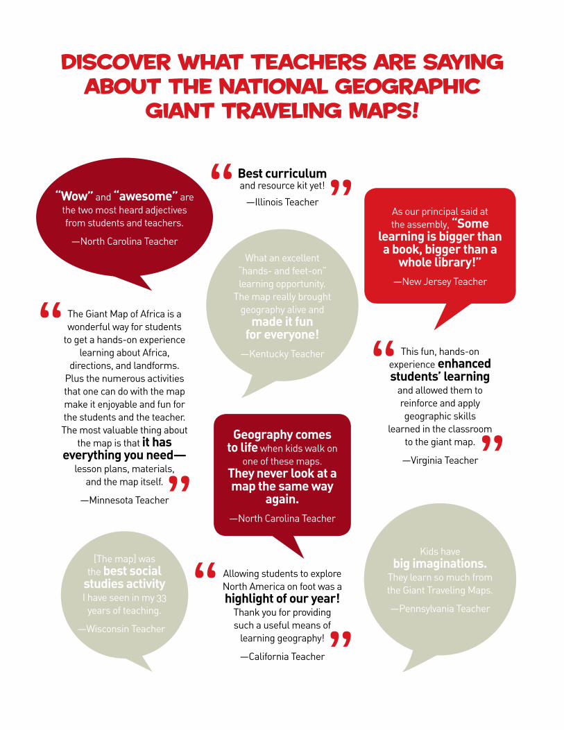
diScover whAt teAcherS Are SAying About the nAtionAl geogrAphic
giAnt trAveling mApS!
“”
Allowing students to explore North America on foot was a highlight of our year!
Thank you for providing such a useful means of
learning geography!
—California Teacher
“
”
The Giant Map of Africa is a wonderful way for students
to get a hands-on experience learning about Africa,
directions, and landforms. Plus the numerous activities that one can do with the map make it enjoyable and fun for the students and the teacher. The most valuable thing about
the map is that it has everything you need—
lesson plans, materials, and the map itself.
—Minnesota Teacher
“
”
This fun, hands-on experience enhanced students’ learning
and allowed them to reinforce and apply geographic skills
learned in the classroom to the giant map.
—Virginia Teacher
“ ”Best curriculum and resource kit yet!
—Illinois Teacher As our principal said at the assembly, “Some
learning is bigger than a book, bigger than a
whole library!”—New Jersey Teacher
Geography comes to life when kids walk on
one of these maps. They never look at a map the same way
again. —North Carolina Teacher
“Wow” and “awesome” are the two most heard adjectives from students and teachers.
—North Carolina Teacher
What an excellent “hands- and feet-on” learning opportunity.
The map really brought geography alive and
made it fun for everyone!
—Kentucky Teacher
Kids have big imaginations.
They learn so much from the Giant Traveling Maps.
—Pennsylvania Teacher
[The map] was the best social
studies activity I have seen in my 33
years of teaching.
—Wisconsin Teacher
• The brightly colored, smooth vinyl surfaces of the maps accurately illustrate and identify geographical features, including countries, cities, bodies of water, mountains, and other prominent physical features.
• Using game props, stunning photos, and data cards, students go on safaris, scavenger hunts, and play other collaborative and competitive games.
• Grades K–8 students gain knowledge of country locations, capital cities, population centers, and physical features, and learn about wildlife, eco-nomics, and human cultures.
• Accompanying each map is a set of laminated, ready-to-use activities, decks of photo and data cards, props, and other educational materials.
• Maps of North America, South America, Africa, Asia, Europe, and the Pacific Ocean are available for rent.
the poSSibilitieS for leArning Are endleSS!
nationalgeographic.com/giantmaps