south atlantic coastal study (sacs)
TRANSCRIPT

Matt Schrader, P.E. and Ashleigh Fountain
U.S. Army Corps of Engineers
Jacksonville District
February 5th, 2020
“The views, opinions and
findings contained in this
report are those of the
authors(s) and should not be
construed as an official
Department of the Army
position, policy or decision,
unless so designated by other
official documentation.”
SOUTH ATLANTIC COASTAL STUDY (SACS) WHAT’S IN IT FOR YOU?

2
PRESENTATION OUTLINE
1
2
3
North Atlantic Coast Comprehensive Study (NACCS) Results
− Planning
− Products
− Advancing Resiliency in the Southeast
What’s in it for you?
South Atlantic Coastal Study (SACS) Overview
“Every dollar spent before an event saves four to five dollars in reconstruction costs after.”
– National Research Council, 2014
− Planning
− Products
− Advancing Resiliency in the Northeast
“Joint planning with stakeholders across sectors, regions, and jurisdictions can help identify critical risks arising from interaction among systems ahead of time.”
– National Climate Assessment, 2018

3
NORTH ATLANTIC COAST COMPREHENSIVE STUDY
Planning– Employed a consistent Coastal Storm Risk Management
Framework
– Common platform for identifying current and future risk and a range of strategies for each reach of coastline
Products (limited list)
– Geospatial Database
– Extreme Water Level Modeling
– Economic Depth-Damage Functions
– Natural and Nature-Based Features development
Advancing Resilience in the Northeast (limited list)
– Nine follow-on feasibility studies
– Products support multiple non-Corps/Corps efforts
– Technical Assistance to states and DoD installations
www.nad.usace.army.mil/CompStudy
"Coastal storm risk management is a shared responsibility, and we believe there should be shared tools used by all decision makers to assess risk and identify solutions. This report provides those tools.”
Commanding Officer (2015)U.S. Army Corps of Engineers North Atlantic Division

4
STUDY AUTHORITYSection 1204, WRDA 2016
• Identify risks and vulnerabilities to increased hurricane and storm damage as a result of sea level rise (SLR).
• Emphasize regional sediment management practices to sustain/enhance current coastal storm risk management measures.
• Recommend measures to address coastal vulnerability of areas affected by sea level rise.
• Develop a long-term strategy to address increased hurricane/storm damages resulting from sea level rise, enhance resiliency and lower risks in –
– populated areas
– areas of concentrated economic development; and
– areas with vulnerable environmental resources
• Submit a report recommending specific and detailed actions.
STUDY GUIDANCE• Follow planning guidance applicable to watershed assessments• Model the study after the North Atlantic Coast Comprehensive Study (NACCS) • Data shall be evaluated consistent with the NACCS to the maximum extent practicable
Study Initiation
AUG 2018 AUG 2019 AUG 2021 OCT 2021 AUG 2022
Final
Watershed
Plan
Draft Watershed
Plan/Report
Recommendations
Milestone
Shared Vision
Milestone
100% Federal funding - $16M
SC
HE
DU
LE

5
STUDY AREA
Over 65,000 miles of tidallyinfluenced coastline in the SouthAtlantic Division (SAD) area ofresponsibility affected by sea levelrise (SLR) where hurricane andstorm damages are occurring, orare forecast to occur.

6
SACS SCOPE
The SACS is:
• a collaborative effort with a diverse group of stakeholders to cooperatively address coastal storm risks
• a comprehensive regional assessment of coastal flood risk for the Tier 1 study area scale(additional datasets are incorporated in Tier 2)
• broadly identifying risk reduction opportunities throughout the study area(detailed action strategies will be developed for Focus Areas, as examples for lowering risks in areas with high population, concentrated economic development, and vulnerable environmental resources)
• incorporating sea level rise as the climate change factor most relevant to increased coastal storm damage

7
SACS STUDY GOALSProvide a Common Operating Picture of Coastal Risk
– Provide decision-makers at all levels with a comprehensive and consistent regional assessment of coastal risk.
Identify High-Risk Locations and Focus Current and Future Resources – Enable resources to be focused on the most vulnerable areas.
Identify and Assess Risk Reduction Actions – Assess actions that would reduce risk to vulnerable coastal populations
Promote and Support Resilient Coastal Communities– Ensure a sustainable coastal landscape system, considering future sea level rise
scenarios and climate change. – Provide information to stakeholders to optimize existing efforts to reduce risk.
Promote Sustainable Projects and Programs– Develop and provide consistent foundational elements to support coastal studies and projects. – Regionally manage projects through Regional Sediment Management and other opportunities.
Leverage Supplemental Actions – Multiple supplemental studies and construction efforts will inform, and be informed by, the SACS.
1
2
3
4
5
6
8U.S. ARMY CORPS OF ENGINEERS | SOUTH ATLANTIC DIVISION
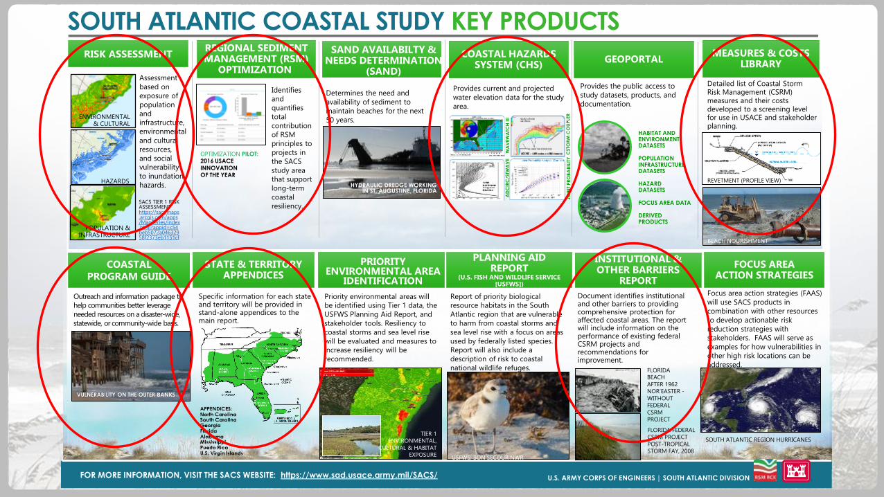
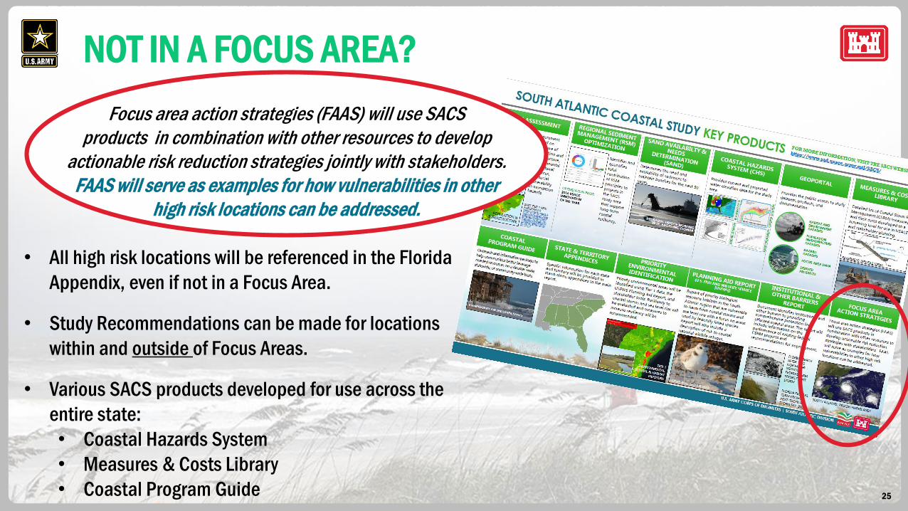
SOUTH ATLANTIC COASTAL STUDY KEY PRODUCTS
FOR MORE INFORMATION, VISIT THE SACS WEBSITE: https://www.sad.usace.army.mil/SACS/
POPULATION & INFRASTRUCTURE
HAZARDS
ENVIRONMENTAL & CULTURAL
HYDRAULIC DREDGE WORKING IN ST. AUGUSTINE, FLORIDA
WA
VEW
ATC
H III
AD
CIR
C/S
TWA
VE
CSTO
RM
CO
UPLE
RJO
INT
PR
OB
AB
ILIT
Y
USFWS; BON SECOUR NWR
RISK ASSESSMENTREGIONAL SEDIMENTMANAGEMENT (RSM)
OPTIMIZATION
COASTAL HAZARDSSYSTEM (CHS)
GEOPORTALMEASURES & COSTS
LIBRARY
Assessment
based on
exposure of
population
and
infrastructure,
environmental
and cultural
resources,
and social
vulnerability
to inundation
hazards.
Identifies
and
quantifies
total
contribution
of RSM
principles to
projects in
the SACS
study area
that support
long-term
coastal
resiliency.
Determines the need and
availability of sediment to
maintain beaches for the next
50 years.
Provides current and projected
water elevation data for the study
area.
Provides the public access to
study datasets, products, and
documentation.
Detailed list of Coastal Storm Risk Management (CSRM) measures and their costs developed to a screening level for use in USACE and stakeholder planning.
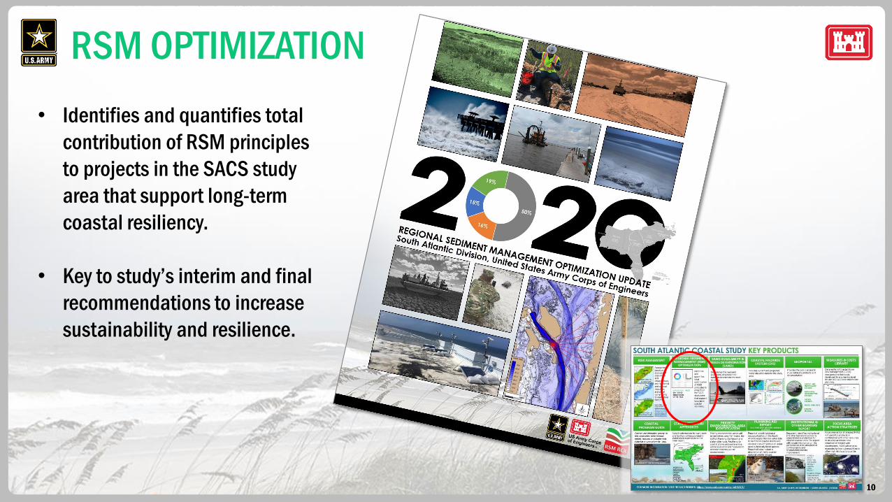
OPTIMIZATION PILOT: 2016 USACE
INNOVATION OF THE YEAR
HABITAT AND ENVIRONMENT DATASETS
POPULATION INFRASTRUCTUREDATASETS
HAZARDDATASETS
FOCUS AREA DATA
DERIVEDPRODUCTS
REVETMENT (PROFILE VIEW)
BEACH NOURISHMENT
COASTAL PROGRAM GUIDE
STATE & TERRITORYAPPENDICES
PLANNING AID REPORT
(U.S. FISH AND WILDLIFE SERVICE [USFWS])
INSTITUTIONAL & OTHER BARRIERS
REPORT
FOCUS AREA ACTION STRATEGIES
Outreach and information package to
help communities better leverage
needed resources on a disaster-wide,
statewide, or community-wide basis.
Specific information for each state and territory will be provided in stand-alone appendices to the main report.
Priority environmental areas will
be identified using Tier 1 data, the
USFWS Planning Aid Report, and
stakeholder tools. Resiliency to
coastal storms and sea level rise
will be evaluated and measures to
increase resiliency will be
recommended.
Report of priority biological
resource habitats in the South
Atlantic region that are vulnerable
to harm from coastal storms and
sea level rise with a focus on areas
used by federally listed species.
Report will also include a
description of risk to coastal
national wildlife refuges.
Document identifies institutional and other barriers to providing comprehensive protection for affected coastal areas. The report will include information on the performance of existing federal CSRM projects and recommendations for improvement.
Focus area action strategies (FAAS)
will use SACS products in
combination with other resources
to develop actionable risk
reduction strategies with
stakeholders. FAAS will serve as
examples for how vulnerabilities in
other high risk locations can be
addressed.
VULNERABILITY ON THE OUTER BANKS
FLORIDA FEDERAL
CSRM PROJECT
POST-TROPICAL
STORM FAY, 2008
TIER 1
ENVIRONMENTAL,
CULTURAL & HABITAT
EXPOSURE
FLORIDA
BEACH
AFTER 1962
NOR’EASTER -
WITHOUT
FEDERAL
CSRM
PROJECT
SACS TIER 1 RISK ASSESSMENT https://sacs.maps.arcgis.com/apps/MapSeries/index.html?appid=c54beb5072a04632958f2373eb1151cf
SOUTH ATLANTIC REGION HURRICANES
PRIORITY ENVIRONMENTAL AREA
IDENTIFICATION
SAND AVAILABILTY & NEEDS DETERMINATION
(SAND)

9
TIER 1 RISK ASSESSMENT
10
RSM OPTIMIZATION
• Identifies and quantifies total
contribution of RSM principles
to projects in the SACS study
area that support long-term
coastal resiliency.
• Key to study’s interim and final
recommendations to increase
sustainability and resilience.
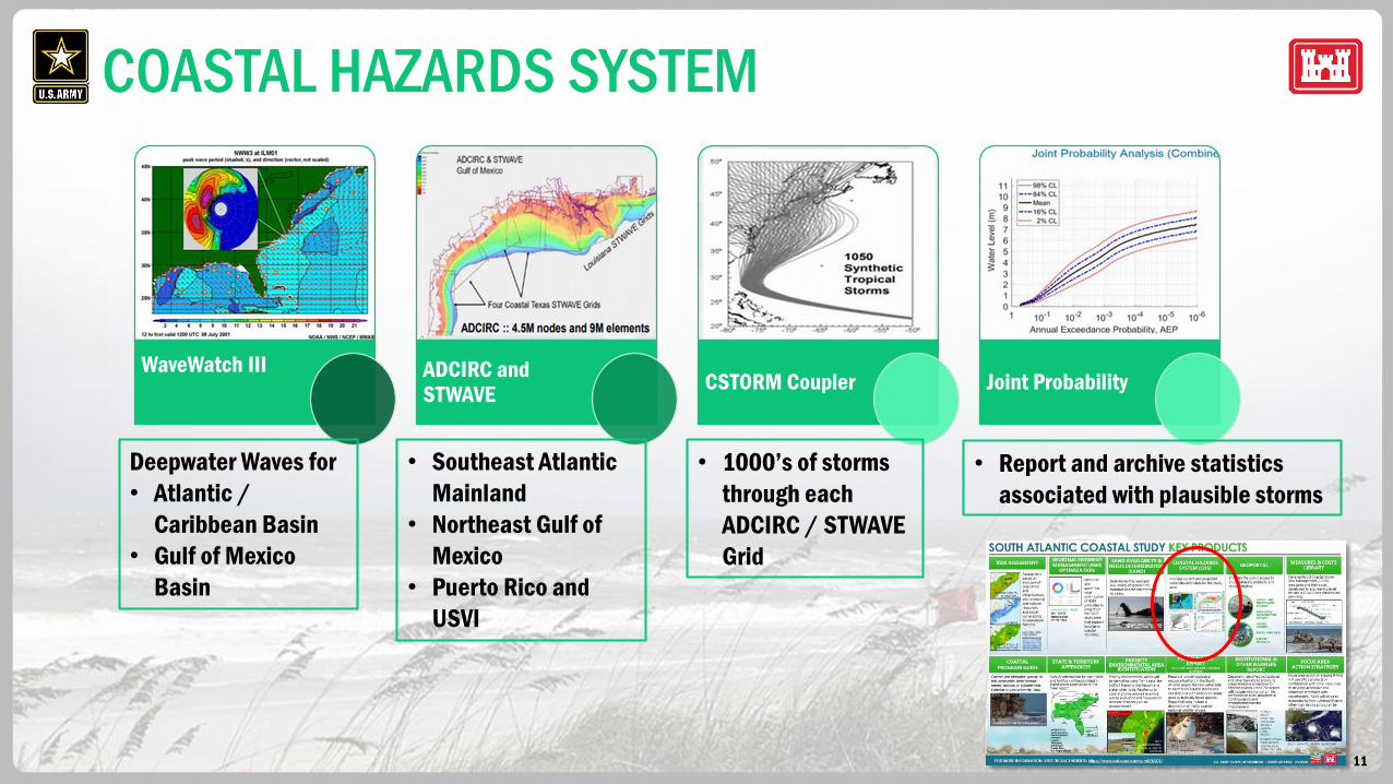
11
WaveWatch III ADCIRC and STWAVE
CSTORM Coupler Joint Probability
Deepwater Waves for
• Atlantic /
Caribbean Basin
• Gulf of Mexico
Basin
• Southeast Atlantic
Mainland
• Northeast Gulf of
Mexico
• Puerto Rico and
USVI
• 1000’s of storms
through each
ADCIRC / STWAVE
Grid
• Report and archive statistics
associated with plausible storms
COASTAL HAZARDS SYSTEM

12
MEASURES & COST LIBRARY
• Detailed list of structural, non-
structural, and natural and nature-
based coastal storm risk management
measures.
• Cost developed to a screening level for
use in stakeholder and USACE planning.
REVETMENT (PROFILE VIEW)
BEACH NOURISHMENT
13
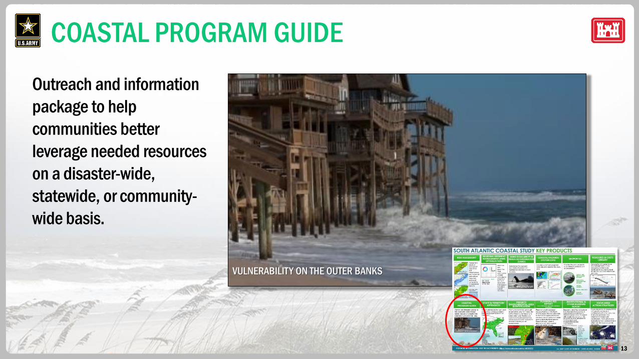
COASTAL PROGRAM GUIDE
Outreach and information
package to help
communities better
leverage needed resources
on a disaster-wide,
statewide, or community-
wide basis.
VULNERABILITY ON THE OUTER BANKS
14
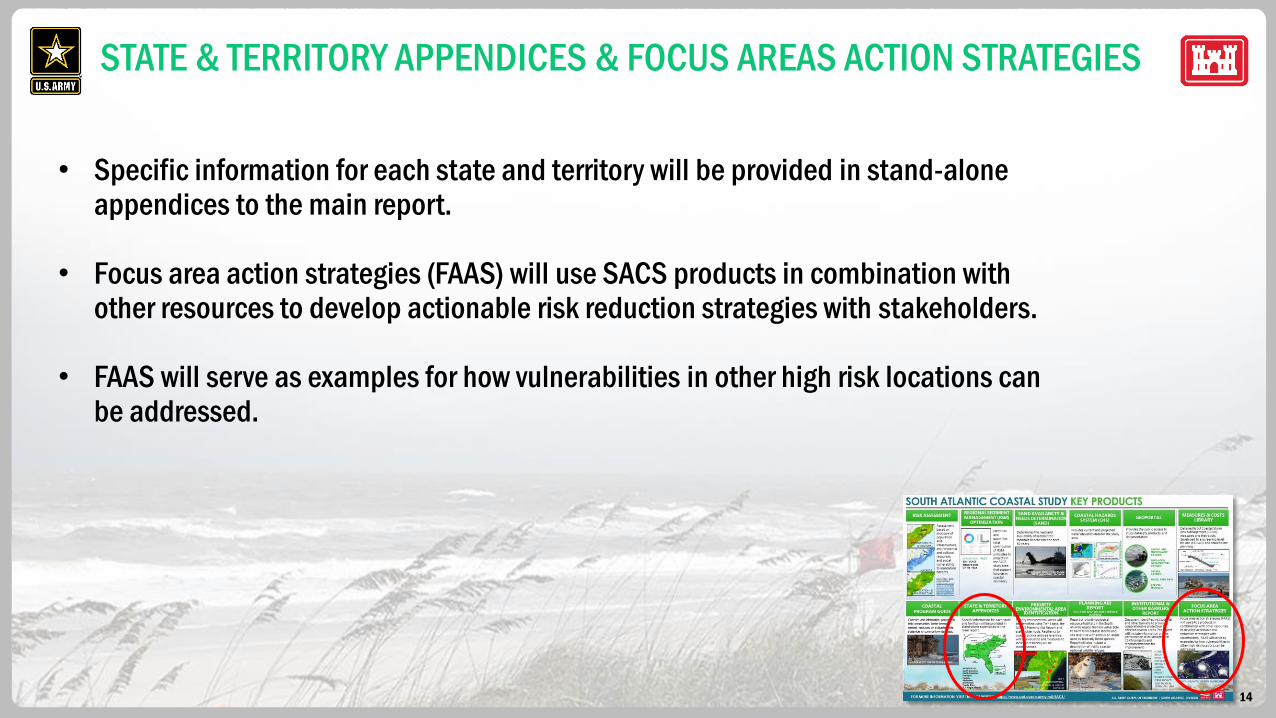
STATE & TERRITORY APPENDICES & FOCUS AREAS ACTION STRATEGIES
• Specific information for each state and territory will be provided in stand-alone appendices to the main report.
• Focus area action strategies (FAAS) will use SACS products in combination with other resources to develop actionable risk reduction strategies with stakeholders.
• FAAS will serve as examples for how vulnerabilities in other high risk locations can be addressed.
15
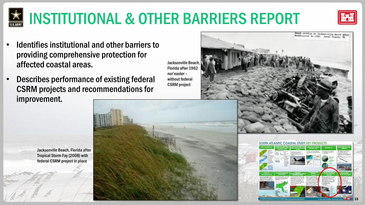
INSTITUTIONAL & OTHER BARRIERS REPORT
• Identifies institutional and other barriers to providing comprehensive protection for affected coastal areas.
• Describes performance of existing federal CSRM projects and recommendations for improvement.
Jacksonville Beach, Florida after
Tropical Storm Fay (2008) with
federal CSRM project in place
Jacksonville Beach,
Florida after 1962
nor’easter –
without federal
CSRM project
16
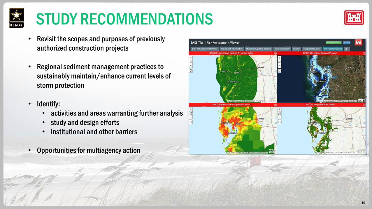
• Revisit the scopes and purposes of previously
authorized construction projects
• Regional sediment management practices to
sustainably maintain/enhance current levels of
storm protection
• Identify:
• activities and areas warranting further analysis
• study and design efforts
• institutional and other barriers
• Opportunities for multiagency action
STUDY RECOMMENDATIONS
17
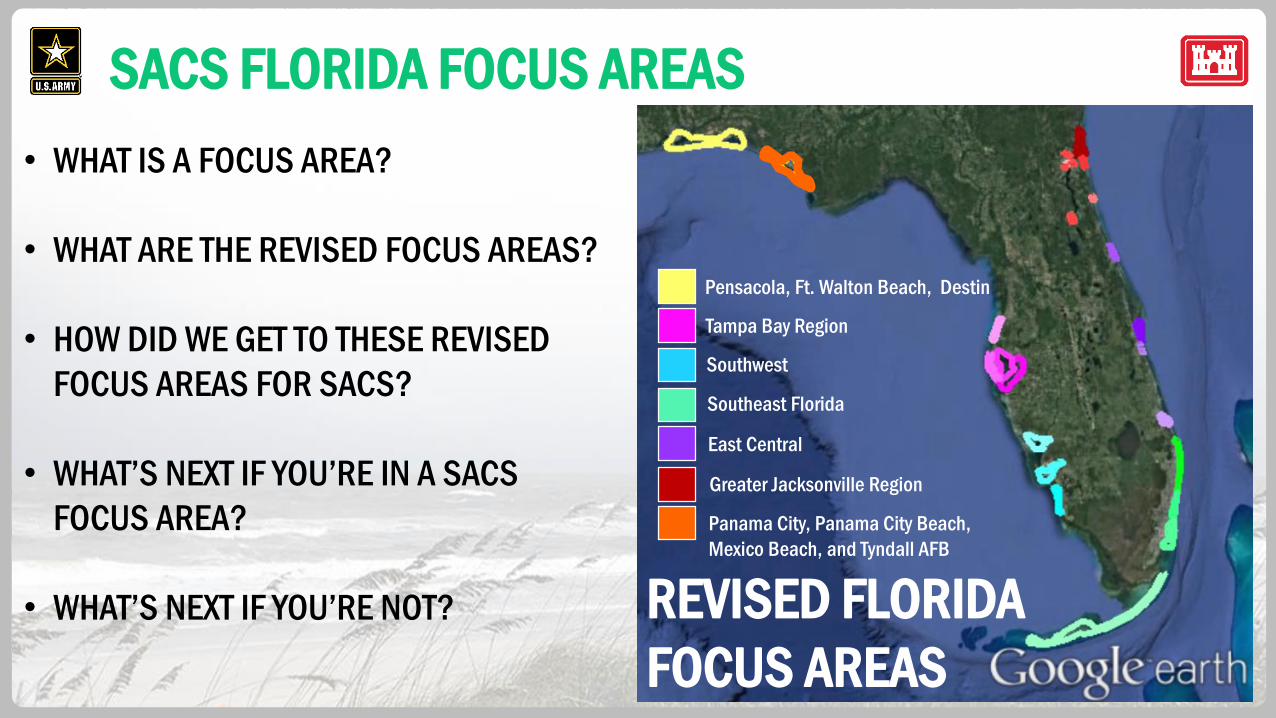
SACS FLORIDA FOCUS AREAS
18
SACS FLORIDA FOCUS AREAS
• WHAT IS A FOCUS AREA?
• WHAT ARE THE REVISED FOCUS AREAS?
• HOW DID WE GET TO THESE REVISED
FOCUS AREAS FOR SACS?
• WHAT’S NEXT IF YOU’RE IN A SACS
FOCUS AREA?
• WHAT’S NEXT IF YOU’RE NOT? REVISED FLORIDA
FOCUS AREAS
Pensacola, Ft. Walton Beach, Destin
Tampa Bay Region
Southwest
Southeast Florida
East Central
Panama City, Panama City Beach,
Mexico Beach, and Tyndall AFB
Greater Jacksonville Region
19
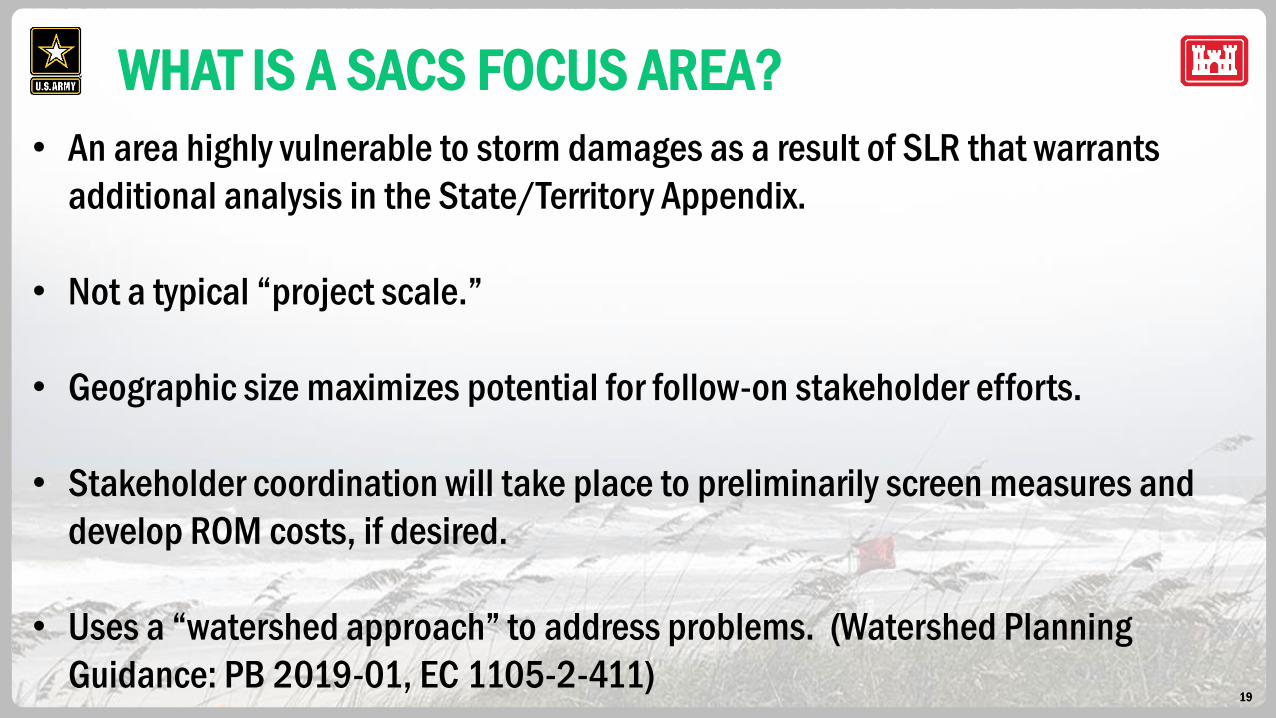
WHAT IS A SACS FOCUS AREA?
• An area highly vulnerable to storm damages as a result of SLR that warrants
additional analysis in the State/Territory Appendix.
• Not a typical “project scale.”
• Geographic size maximizes potential for follow-on stakeholder efforts.
• Stakeholder coordination will take place to preliminarily screen measures and
develop ROM costs, if desired.
• Uses a “watershed approach” to address problems. (Watershed Planning
Guidance: PB 2019-01, EC 1105-2-411)

20
• Provides a shared vision of a desired end state.
• Works collaboratively with a broad range of stakeholders to
address water resources problems in an integrated and sustainable manner.
• Uses systems approach to understand the connection between natural and
man-made systems.
• Seeks long term, holistic solutions rather than piecemeal approaches, regardless of
the entity that might ultimately implement the proposed actions.
• Provides a strategic roadmap to inform future investment decisions by multiple agencies.
WATERSHED APPROACH

21
SACS TIER 1
RISK ASSESSMENT
DRAFT
FOCUS AREAS
SACS FLORIDA FOCUS AREAS
STAKEHOLDER
INPUT TIER 2 DATASETSFDEP CRITICAL EROSION LAYER
PRELIMINARY HAZUS
RESULTS
REVISED FLORIDA
FOCUS AREAS
Pensacola, Ft. Walton Beach, Destin
Tampa Bay Region
Southwest
Southeast Florida
East Central
Panama City, Panama City Beach,
Mexico Beach, and Tyndall AFB
Greater Jacksonville Region
22
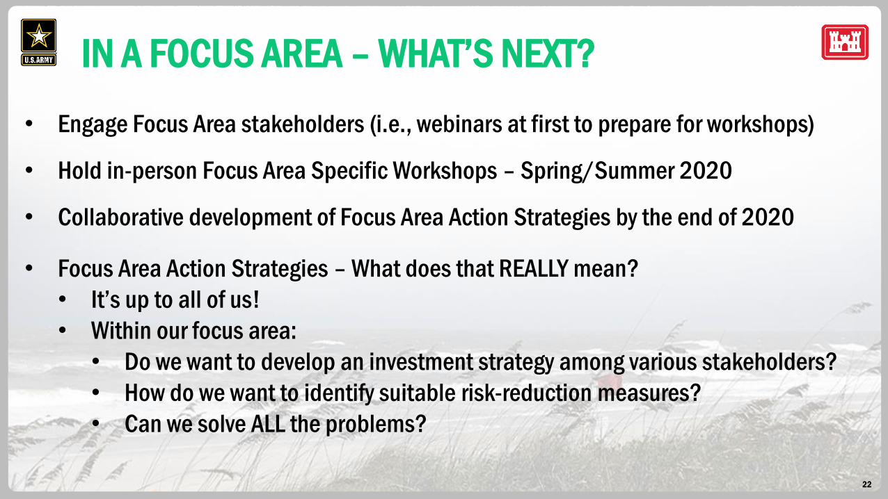
IN A FOCUS AREA – WHAT’S NEXT?
• Engage Focus Area stakeholders (i.e., webinars at first to prepare for workshops)
• Hold in-person Focus Area Specific Workshops – Spring/Summer 2020
• Collaborative development of Focus Area Action Strategies by the end of 2020
• Focus Area Action Strategies – What does that REALLY mean?
• It’s up to all of us!
• Within our focus area:
• Do we want to develop an investment strategy among various stakeholders?
• How do we want to identify suitable risk-reduction measures?
• Can we solve ALL the problems?
23
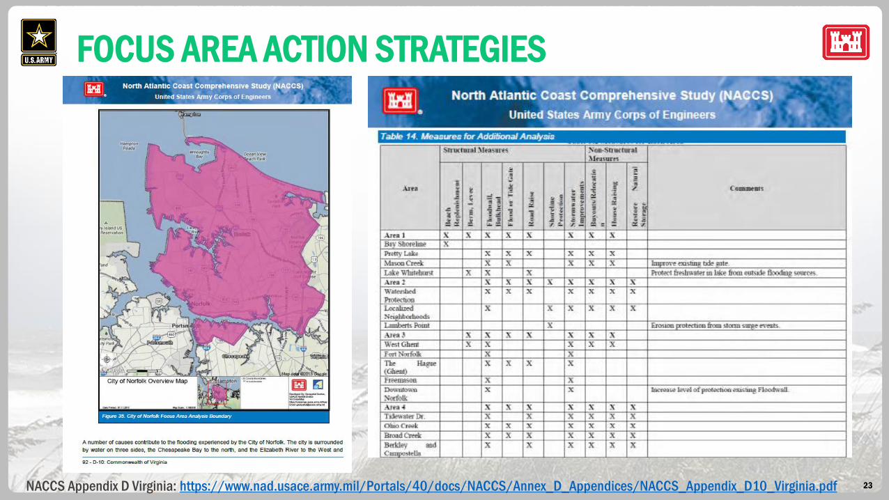
FOCUS AREA ACTION STRATEGIES
NACCS Appendix D Virginia: https://www.nad.usace.army.mil/Portals/40/docs/NACCS/Annex_D_Appendices/NACCS_Appendix_D10_Virginia.pdf

24
FOCUS AREA ACTION STRATEGIES
25
NOT IN A FOCUS AREA?
• All high risk locations will be referenced in the Florida
Appendix, even if not in a Focus Area.
• Study Recommendations can be made for locations
within and outside of Focus Areas.
• Various SACS products developed for use across the
entire state:
• Coastal Hazards System
• Measures & Costs Library
• Coastal Program Guide
Focus area action strategies (FAAS) will use SACS
products in combination with other resources to develop
actionable risk reduction strategies jointly with stakeholders.
FAAS will serve as examples for how vulnerabilities in other
high risk locations can be addressed.
