spacemaster geo - adas iit · rf & wireless specialty embedded specialty spacemaster geo...
TRANSCRIPT
RF & Wireless Specialty Embedded Specialty
SpaceMaster GEO Telemetry Data Management & Visualization Software
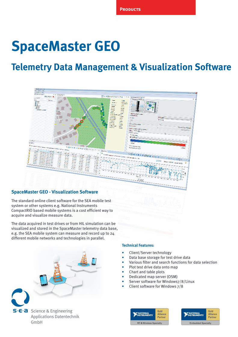
SpaceMaster GEO - Visualization Software
The standard online client software for the SEA mobile test system or other systems e.g. National Instruments CompactRIO based mobile systems is a cost efficient way to acquire and visualize measure data.
The data acquired in test drives or from HIL simulation can be visualized and stored in the SpaceMaster telemetry data base, e.g. the SEA mobile system can measure and record up to 24 different mobile networks and technologies in parallel.
Technical Features:
• Client/Server technology• Data base storage for test drive data• Various filter and search functions for data selection• Plot test drive data onto map• Chart and table plots• Dedicated map server (OSM)• Server software for Windows7/8/Linux • Client software for Windows 7/8
Products
Product and company names listed are trademarks or trade names of their respective companies V 1.2
Mülheimer Str. 7 Tel.: +49 - 22 41 - 127 37 - 0 www.sea-gmbh.com53840 Troisdorf Fax: +49 - 22 41 - 127 37 - 14 [email protected]
The integrated off-line map server avoids the need to disclose sensitive measurement data to public networks and services. Various standard map data formats are supported*.
SpaceMaster GEO can be integrated with the S.E.A. TestMaster test environment for management of geo-localized simulation data for example for to simplify the management of functional test or HIL-test data and related visualization needs. For example the integration of SpaceMaster GEO and TestMaster is applied to test system in the V2X or ADAS application space.
Contact us for detailed and pricing information of the available variants and components of SpaceMaster GEO.
SpaceMaster GEO - Telemetry Management & Visualization Software
Services
S.E.A. Datentechnik GmbH develops soft- and hardwar and creates custom control and measurement systems.We support you from the idea to the finished product.For more information, please visit:
www.sea-gmbh.com
* Map data are based on Open Street Map source data and are free of charge. (Just installation fee per map database applied) Software service and maintenance program is obligatory (required for the first 12 month)
Sience & EngineeringApplications Datentechnik GmbH
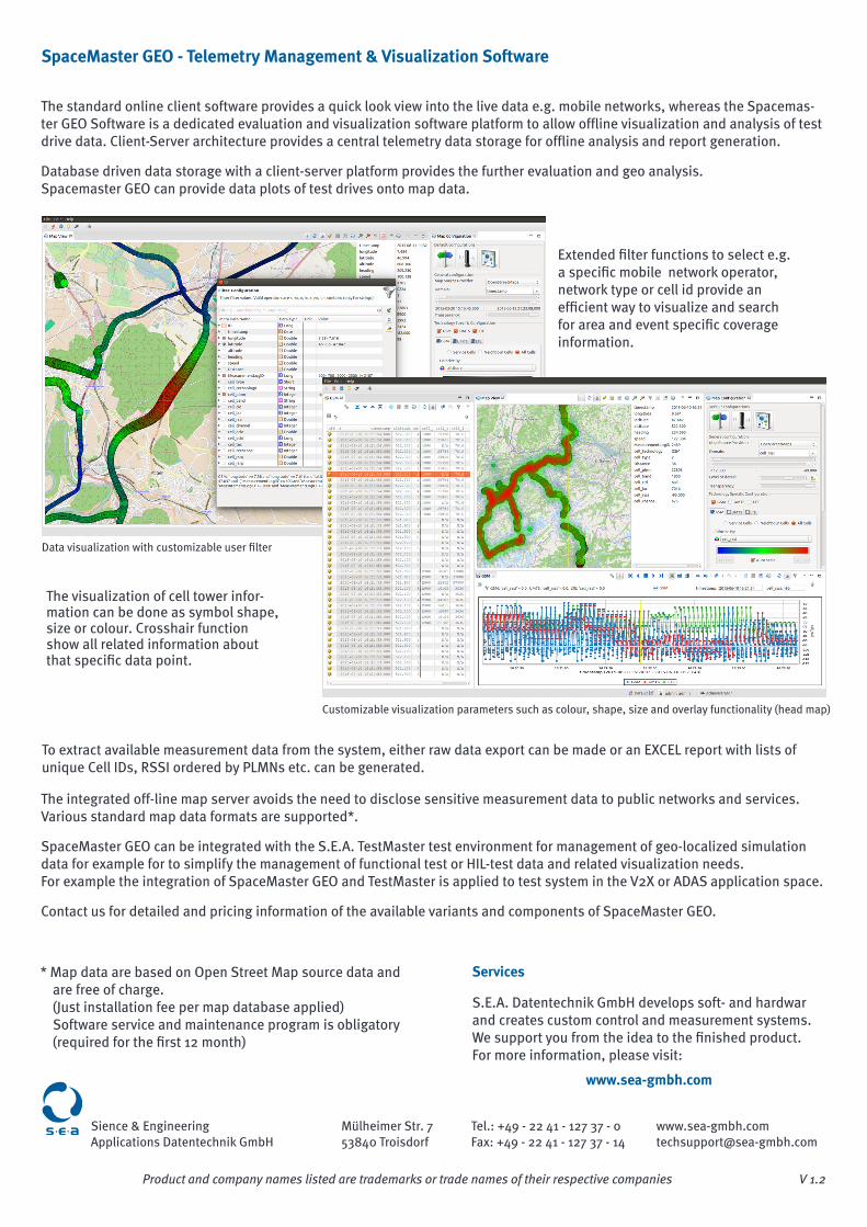
The standard online client software provides a quick look view into the live data e.g. mobile networks, whereas the Spacemas-ter GEO Software is a dedicated evaluation and visualization software platform to allow offline visualization and analysis of test drive data. Client-Server architecture provides a central telemetry data storage for offline analysis and report generation.
Database driven data storage with a client-server platform provides the further evaluation and geo analysis. Spacemaster GEO can provide data plots of test drives onto map data.
Extended filter functions to select e.g. a specific mobile network operator, network type or cell id provide an efficient way to visualize and search for area and event specific coverage information.
The visualization of cell tower infor-mation can be done as symbol shape, size or colour. Crosshair function show all related information about that specific data point.
To extract available measurement data from the system, either raw data export can be made or an EXCEL report with lists of unique Cell IDs, RSSI ordered by PLMNs etc. can be generated.
Customizable visualization parameters such as colour, shape, size and overlay functionality (head map)
Data visualization with customizable user filter