spatially enabled society - fig · a spatially enabled society ... • legal and institutional...
TRANSCRIPT
1
Spatially Enabled Society
A joint publication between FIG and GSDI, edited by
Daniel Steudler and Abbas Rajabifard
Launched atFIG Working Week 2012 in Rome, Italy, 7 May 2012
andGSDI-13 in Québec, Canada, 14 May 2012
Supported by:
Task Force, its Aim, and Activities
• FIG-Task Force mandated at Working Week 2009
• to explore the issue of Spatially Enabled Societies (SES);
• to identify the role of the profession, how it can provide for a spatially enabled society;
• to make recommendations
• May 2011: paper and presentation at FIG-Working Week 2011 in Marrakech
• Oct. 2011 in Melbourne: meeting of Task Force
• Feb. 2012: joint workshop as a platform to discuss the findings and gain further input
• May 2012: launch of publication at FIG-Working Week 2012 in Rome and at GSDI-13 in Québec
2
Steudler and Rajabifard, editors, 72 pages, FIG Publication no. 58
Publication «Spatially Enabled Society»
1. Introduction2. Needs of Societies and Governments3. Role of Land Administration, Land Management and Land
Governance4. Key Elements for a Spatially Enabled Society
Definition of the term «Spatially Enabled Society»4.1 Legal Framework4.2 Common Data Integration Concept4.3 Positioning Infrastructure4.4 Spatial Data Infrastructure4.5 Landownership Information4.6 Data and Information
5. Discussion6. Conclusion and Future Directions
Contents
3
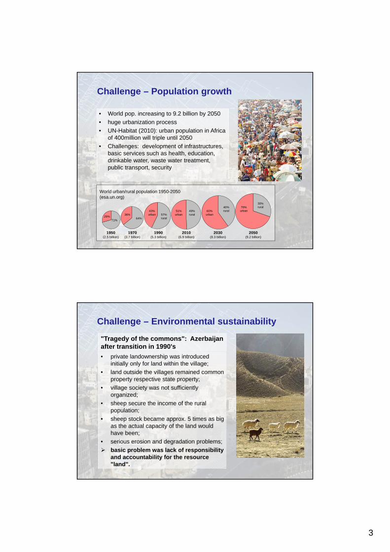
1950(2.5 billion)
1970(3.7 billion)
1990(5.3 billion)
2010(6.9 billion)
2030(8.3 billion)
2050(9.2 billion)
World urban/rural population 1950-2050(esa.un.org)
70%urban
30%rural
60%urban
40%rural51%
urban49%rural
43%urban 57%
rural29%
36%64%
71%
Challenge – Population growth
• World pop. increasing to 9.2 billion by 2050
• huge urbanization process
• UN-Habitat (2010): urban population in Africa of 400million will triple until 2050
• Challenges: development of infrastructures, basic services such as health, education, drinkable water, waste water treatment, public transport, security
Challenge – Environmental sustainability
• private landownership was introduced initially only for land within the village;
• land outside the villages remained common property respective state property;
• village society was not sufficiently organized;
• sheep secure the income of the rural population;
• sheep stock became approx. 5 times as big as the actual capacity of the land would have been;
• serious erosion and degradation problems;
basic problem was lack of responsibility and accountability for the resource "land".
"Tragedy of the commons": Azerbaijan after transition in 1990's
4
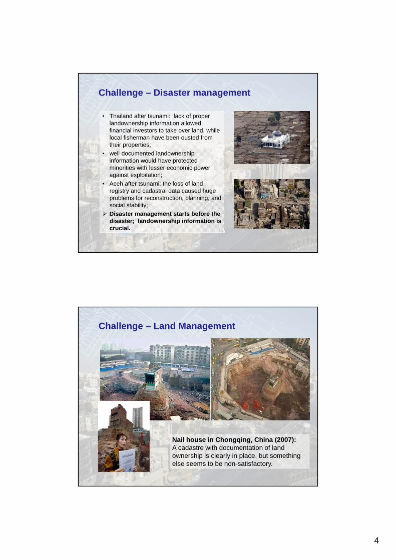
Challenge – Disaster management
• Thailand after tsunami: lack of proper landownership information allowed financial investors to take over land, while local fisherman have been ousted from their properties;
• well documented landownership information would have protected minorities with lesser economic power against exploitation;
• Aceh after tsunami: the loss of land registry and cadastral data caused huge problems for reconstruction, planning, and social stability;
Disaster management starts before the disaster; landownership information is crucial.
Challenge – Land Management
Nail house in Chongqing, China (2007):A cadastre with documentation of land ownership is clearly in place, but something else seems to be non-satisfactory.
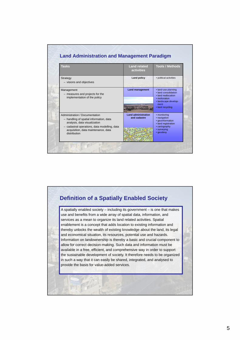
5
Land Administration and Management Paradigm
Tasks Land related activities
Tools / Methods
Strategy
– visions and objectives
Land policy • political activities
Management
– measures and projects for the implementation of the policy
Land management • land-use planning• land consolidation• land reallocation• melioration• landscape develop-
ment• land recycling
Administration / Documentation
– handling of spatial information, data analysis, data visualization
– cadastral operations, data modelling, data acquisition, data maintenance, data distribution
Land administration and cadastre
• monitoring• navigation• geoinformation• land registration• cartography • surveying• geodesy
A spatially enabled society – including its government – is one that makes use and benefits from a wide array of spatial data, information, and services as a mean to organize its land related activities. Spatial enablement is a concept that adds location to existing information and thereby unlocks the wealth of existing knowledge about the land, its legal and economical situation, its resources, potential use and hazards. Information on landownership is thereby a basic and crucial component to allow for correct decision-making. Such data and information must be available in a free, efficient, and comprehensive way in order to support the sustainable development of society. It therefore needs to be organized in such a way that it can easily be shared, integrated, and analysed to provide the basis for value-added services.
Definition of a Spatially Enabled Society
6
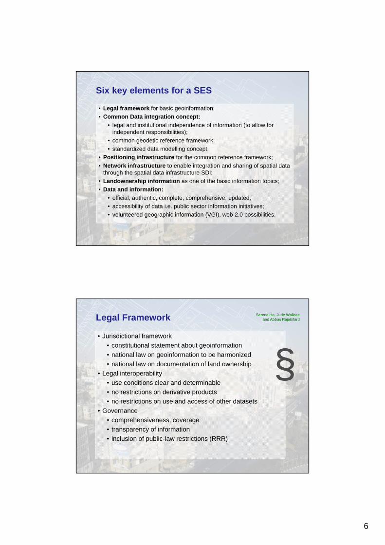
Six key elements for a SES
• Legal framework for basic geoinformation;
• Common Data integration concept:
• legal and institutional independence of information (to allow for independent responsibilities);
• common geodetic reference framework;
• standardized data modelling concept;
• Positioning infrastructure for the common reference framework;
• Network infrastructure to enable integration and sharing of spatial data through the spatial data infrastructure SDI;
• Landownership information as one of the basic information topics;
• Data and information:
• official, authentic, complete, comprehensive, updated;
• accessibility of data i.e. public sector information initiatives;
• volunteered geographic information (VGI), web 2.0 possibilities.
Legal Framework
• Jurisdictional framework
• constitutional statement about geoinformation
• national law on geoinformation to be harmonized
• national law on documentation of land ownership
• Legal interoperability
• use conditions clear and determinable
• no restrictions on derivative products
• no restrictions on use and access of other datasets
• Governance
• comprehensiveness, coverage
• transparency of information
• inclusion of public-law restrictions (RRR)
Serene Ho, Jude Wallace and Abbas Rajabifard
§§
7
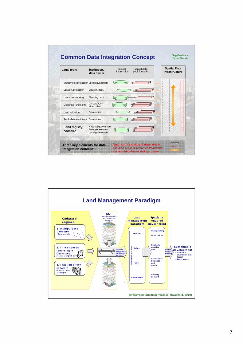
Institution,data owner
Legal topic spatial data,geoinformation
textual information
Spatial DataInfrastructure
Collective land rights Corporations, tribes, clan
Land-use planning Planning dept.
Water/noise protection Local government
Environ. dept.Environ. protection
Land valuation Government
Land registry,cadastre
National governmentState governmentLocal government
Public-law restrictions Government
Three key elements for data integration concept:
- legal resp. institutional independence- common geodetic reference framework- standardized data modelling concept
Common Data Integration Concept Jürg Kaufmann, Daniel Steudler
1. Multipurpose Cadastre(German style)
2. Title or deedstenure styleCadastres(Torrens/English style)
3. Taxation driven cadastre(French/Latin/USA style)
Tenure
Value
Use
Development
Incorporating:
Land policy
SpatiallyenabledLAS
Services tobusinessandpublic
Countrycontext
Sustainabledevelopment
- Economic- Environmental- Social- Governance
Cadastralengines…
Land management
paradigm
Spatially enabled
government
ParcelsPropertiesBuildingsRoads
Inte
gra
ted
fu
nct
ion
s
SDIMapping agencies
and other data providers
Better decision making
(Williamson, Enemark, Wallace, Rajabifard, 2010)
Land Management Paradigm
8
CORS Networkconnected to ITRF
Continuous GNSS directlyon Tide Gauge
CORS Networkconnected to ITRF
Continuous GNSS directlyon Tide Gauge
Continuous GNSS directlyon Tide Gauge
CORS Networkconnected to ITRF
Continuous GNSS directlyon Tide Gauge
CORS Networkconnected to ITRF
Continuous GNSS directlyon Tide Gauge
Continuous GNSS directlyon Tide Gauge
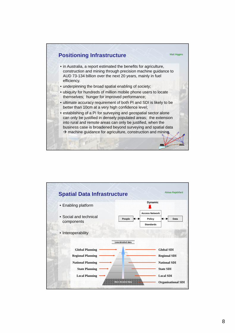
Positioning Infrastructure
• in Australia, a report estimated the benefits for agriculture, construction and mining through precision machine guidance to AUD 73-134 billion over the next 20 years, mainly in fuel efficiency.
• underpinning the broad spatial enabling of society;
• ubiquity for hundreds of million mobile phone users to locate themselves; hunger for improved performance;
• ultimate accuracy requirement of both PI and SDI is likely to be better than 10cm at a very high confidence level;
• establishing of a PI for surveying and geospatial sector alone can only be justified in densely populated areas; the extension into rural and remote areas can only be justified, when the business case is broadened beyond surveying and spatial data machine guidance for agriculture, construction and mining.
Matt Higgins
Spatial Data Infrastructure
• Enabling platform
• Social and technical components
• Interoperability
Abbas Rajabifard
Access Network
Policy
Standards
DataPeople
Dynamic
Global SDI
Regional SDI
National SDI
State SDI
Local SDI
Organisational SDI
Less detailed dataLess detailed data
Global Planning
Regional Planning
National Planning
State Planning
Local Planning
More detailed Data
9
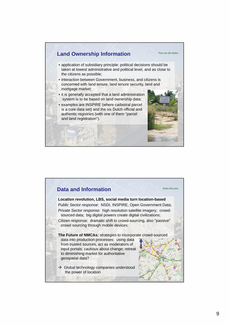
Land Ownership Information
• application of subsidiary principle: political decisions should be taken at lowest administrative and political level, and as close to the citizens as possible;
• interaction between Government, business, and citizens is concerned with land tenure, land tenure security, land and mortgage market;
• it is generally accepted that a land administrationsystem is to be based on land ownership data;
• examples are INSPIRE (where cadastral parcel is a core data set) and the six Dutch official and authentic registries (with one of them "parcel and land registration").
Paul van der Molen
Data and Information
Location revolution, LBS, social media turn location-based
Public Sector response: NSDI, INSPIRE, Open Government Data;
Private Sector response: high resolution satellite imagery; crowd-sourced data; big digital powers create digital civilizations;
Citizen response: dramatic shift to crowd-sourcing, also "passive" crowd sourcing through mobile devices;
The Future of NMCAs: strategies to incorporate crowd-sourced data into production processes: using data from trusted sources, act as moderators of input portals; cautious about change; retreat to diminishing market for authoritative geospatial data?
Global technology companies understood the power of location
Robin McLaren
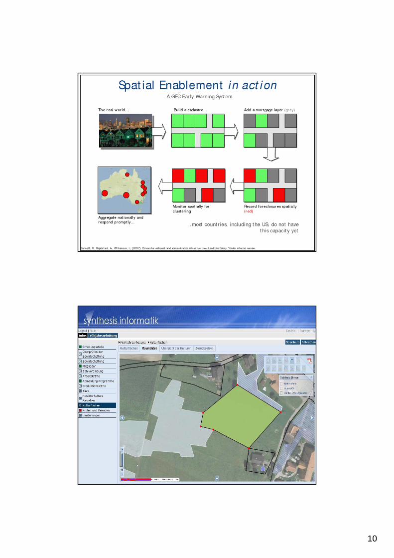
10
Example1
Example2
11
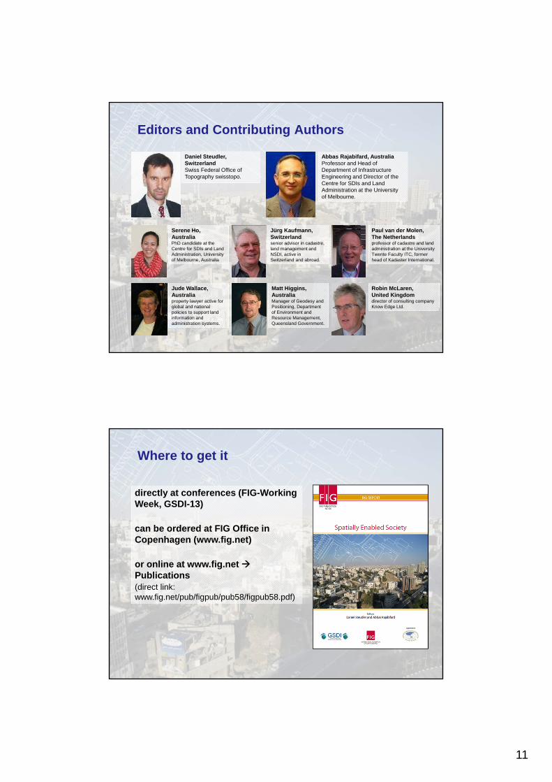
Daniel Steudler, SwitzerlandSwiss Federal Office of Topography swisstopo.
Abbas Rajabifard, Australia Professor and Head of Department of Infrastructure Engineering and Director of the Centre for SDIs and Land Administration at the University of Melbourne.
Serene Ho, AustraliaPhD candidate at the Centre for SDIs and Land Administration, University of Melbourne, Australia
Jude Wallace, Australiaproperty lawyer active for global and national policies to support land information and administration systems.
Jürg Kaufmann, Switzerlandsenior advisor in cadastre, land management and NSDI, active in Switzerland and abroad.
Matt Higgins, AustraliaManager of Geodesy and Positioning, Department of Environment and Resource Management, Queensland Government.
Paul van der Molen, The Netherlandsprofessor of cadastre and land administration at the University Twente Faculty ITC, former head of Kadaster International.
Robin McLaren, United Kingdomdirector of consulting company Know Edge Ltd.
Editors and Contributing Authors
directly at conferences (FIG-Working Week, GSDI-13)
can be ordered at FIG Office in Copenhagen (www.fig.net)
or online at www.fig.net Publications(direct link: www.fig.net/pub/figpub/pub58/figpub58.pdf)
Where to get it
12
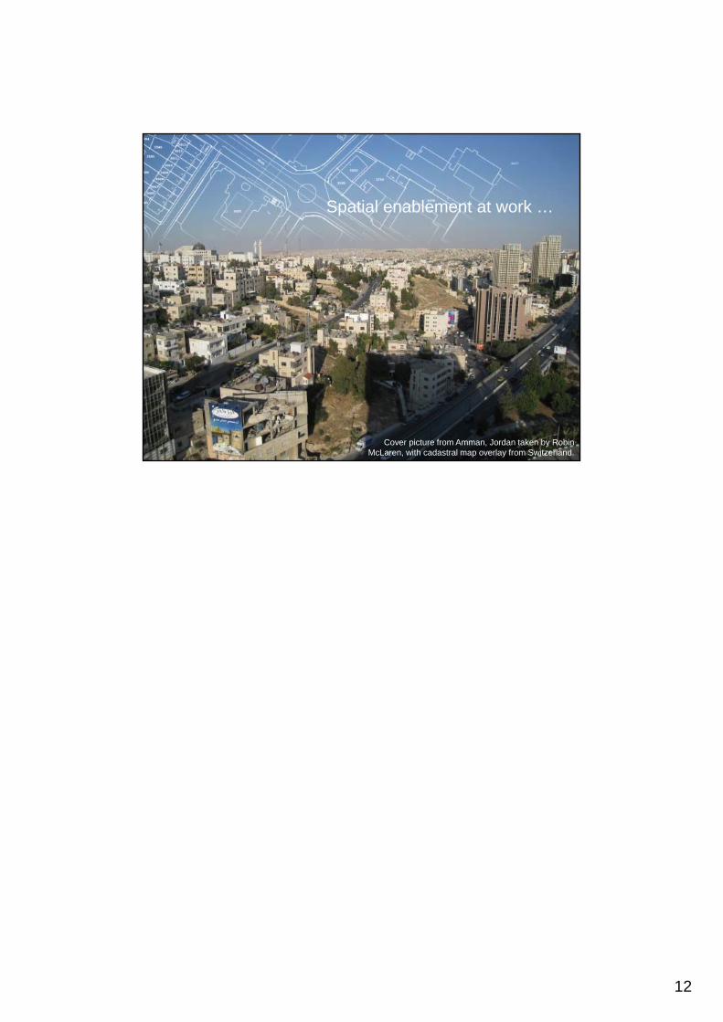
Cover picture from Amman, Jordan taken by Robin McLaren, with cadastral map overlay from Switzerland.
Spatial enablement at work …