status, priorities and needs for sustainable soil management in iran, soil and water research...
TRANSCRIPT
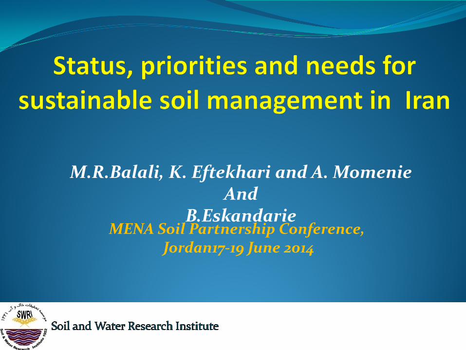
MENA Soil Partnership Conference,
Jordan17-19 June 2014
M.R.Balali, K. Eftekhari and A. Momenie
And B.Eskandarie
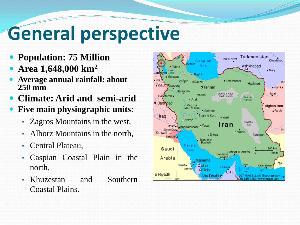
General perspective
Population: 75 Million Area 1,648,000 km2 Average annual rainfall: about
250 mm Climate: Arid and semi-arid Five main physiographic units:
• Zagros Mountains in the west, • Alborz Mountains in the north, • Central Plateau, • Caspian Coastal Plain in the
north, • Khuzestan and Southern
Coastal Plains.
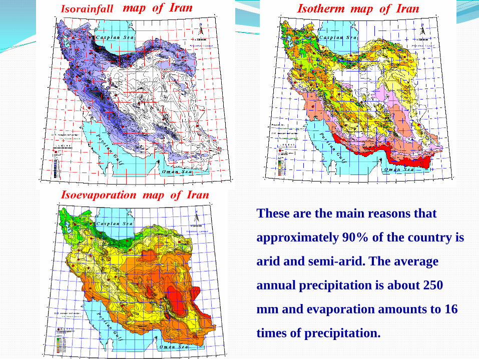
These are the main reasons that
approximately 90% of the country is
arid and semi-arid. The average
annual precipitation is about 250
mm and evaporation amounts to 16
times of precipitation.
Isorainfall
The Islamic Republic of Iran Ministry of Jihad-e Agriculture Deputy for water and soil and industry Water and soil affairs office
Report On Status priorities and needs for sustainable soil
management in Iran Prepared by : M.R.Balali, K. Eftekhari and A. Momenie And presented by B.Eskandarie
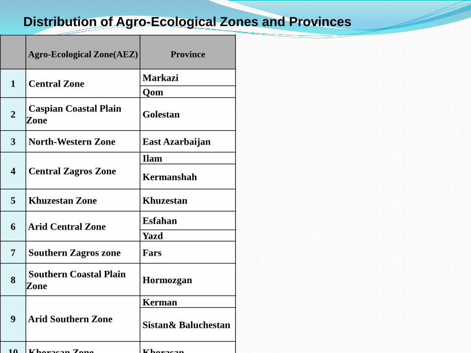
Distribution of Agro-Ecological Zones and Provinces
Agro-Ecological Zone(AEZ)
Province
1 Central Zone Markazi Qom
2 Caspian Coastal Plain Zone Golestan
3 North-Western Zone East Azarbaijan
4 Central Zagros Zone Ilam
Kermanshah
5 Khuzestan Zone Khuzestan
6 Arid Central Zone Esfahan Yazd
7 Southern Zagros zone Fars
8 Southern Coastal Plain Zone Hormozgan
9 Arid Southern Zone Kerman
Sistan& Baluchestan
10 Khorasan Zone Khorasan
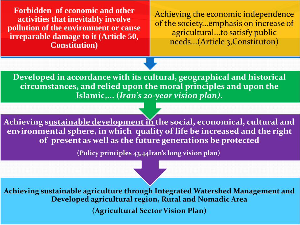
and Integrated Watershed Management through sustainable agriculture Achieving Developed agricultural region, Rural and Nomadic Area
(Agricultural Sector Vision Plan)
the social, economical, cultural and ustainable development in Achieving senvironmental sphere, in which quality of life be increased and the right
of present as well as the future generations be protected (Policy principles 43,44Iran’s long vision plan)
Developed in accordance with its cultural, geographical and historical circumstances, and relied upon the moral principles and upon the
Islamic,... (Iran's 20-year vision plan).
Forbidden of economic and other activities that inevitably involve
pollution of the environment or cause irreparable damage to it (Article 50,
Constitution)
Achieving the economic independence of the society...emphasis on increase of
agricultural...to satisfy public needs...(Article 3,Constituton)

Background information Soil and Water Research Institute (SWRI) is affiliated
to AREEO is engaged in soil and water research activities since early sixties
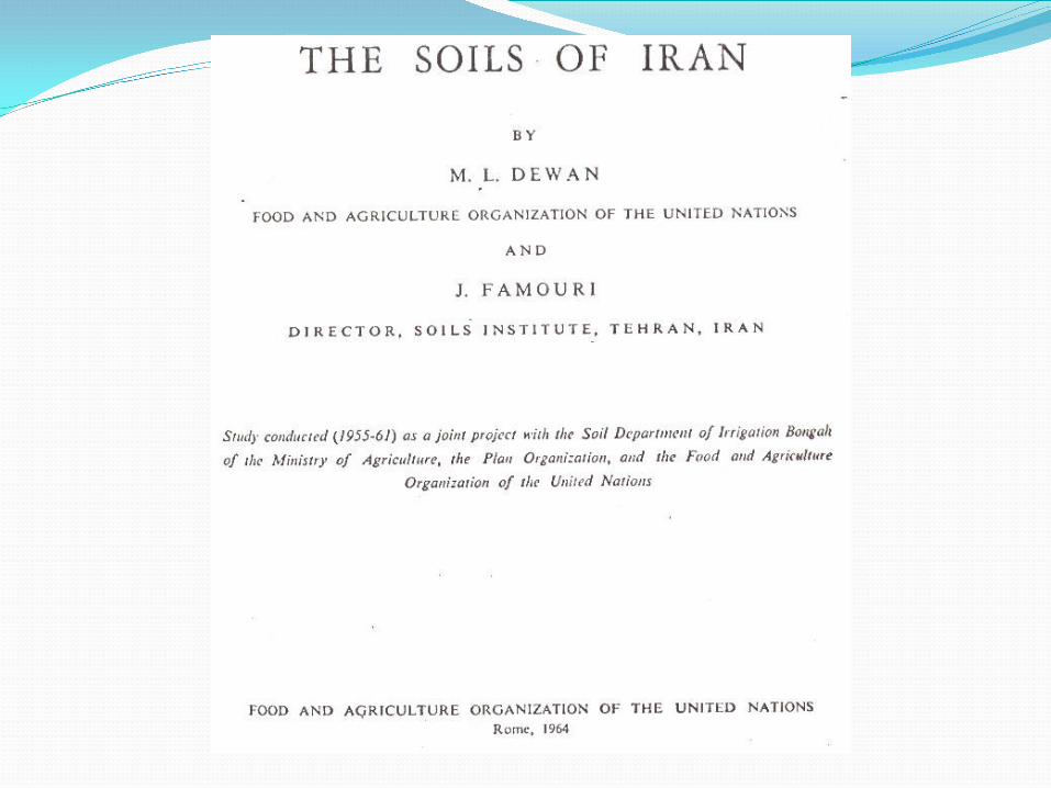
SWRI was established in 1952 in collaboration with FAO
The headquarters is situated in Karaj and 31 regional offices are located in the countries’ provinces
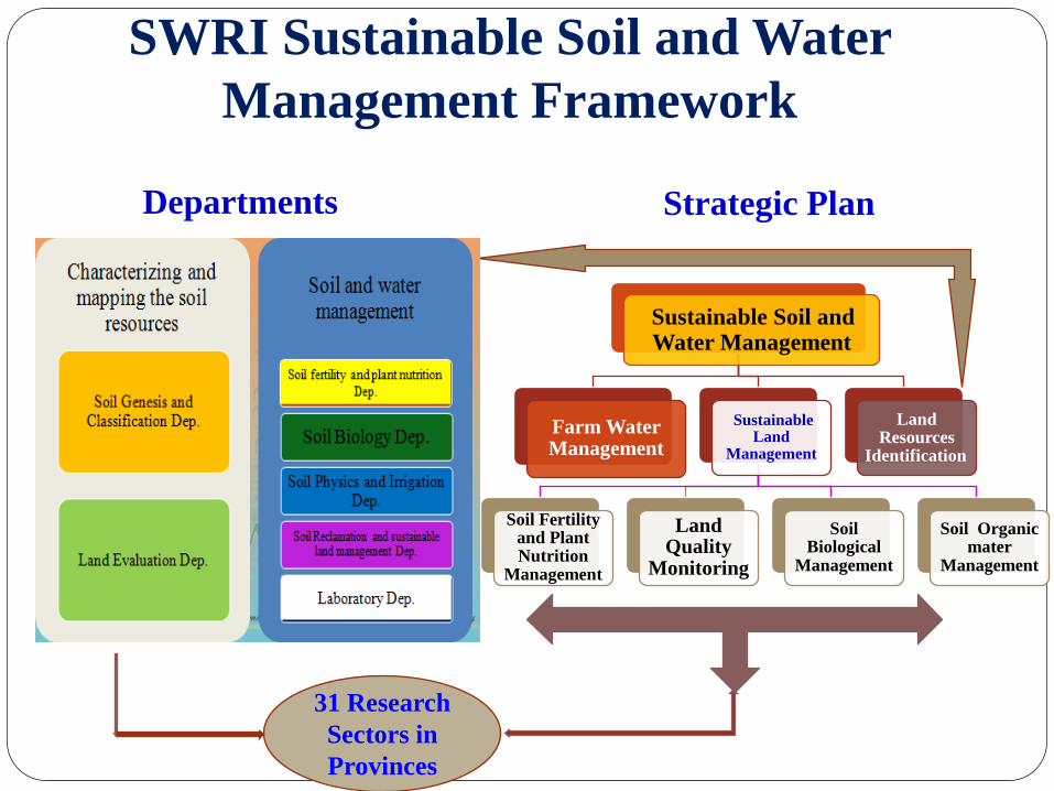
SWRI Sustainable Soil and Water Management Framework
Departments Strategic Plan
Sustainable Soil and Water Management
Farm Water Management
Sustainable Land
Management
Soil Fertility and Plant Nutrition
Management
Land Quality
Monitoring
Soil Biological
Management
Soil Organic mater
Management
Land Resources
Identification
31 Research Sectors in Provinces
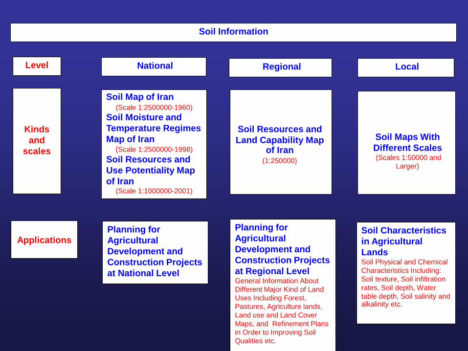
Soil Information
Level National
Regional
Local
Kinds and
scales
Soil Map of Iran (Scale 1:2500000-1960)
Soil Moisture and Temperature Regimes Map of Iran
(Scale 1:2500000-1998) Soil Resources and Use Potentiality Map of Iran
(Scale 1:1000000-2001)
Soil Resources and Land Capability Map
of Iran (1:250000)
Soil Maps With Different Scales (Scales 1:50000 and
Larger)
Applications
Planning for Agricultural Development and Construction Projects at National Level
Planning for Agricultural Development and Construction Projects at Regional Level General Information About Different Major Kind of Land Uses Including Forest, Pastures, Agriculture lands, Land use and Land Cover Maps, and Refinement Plans in Order to Improving Soil Qualities etc.
Soil Characteristics in Agricultural Lands Soil Physical and Chemical Characteristics Including: Soil texture, Soil infiltration rates, Soil depth, Water table depth, Soil salinity and alkalinity etc.
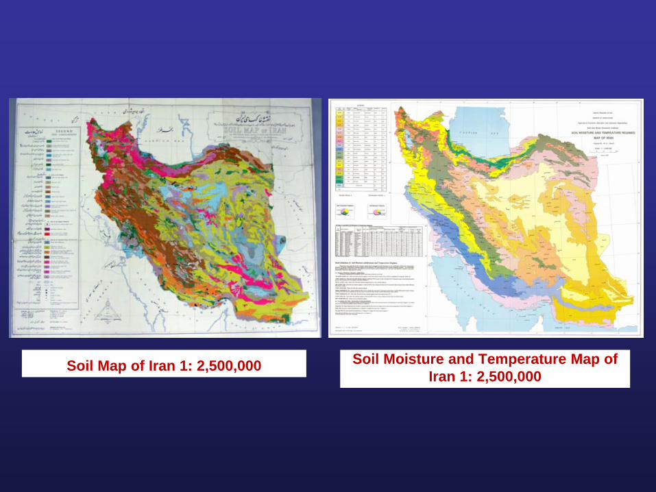
Soil Map of Iran 1: 2,500,000 Soil Moisture and Temperature Map of Iran 1: 2,500,000
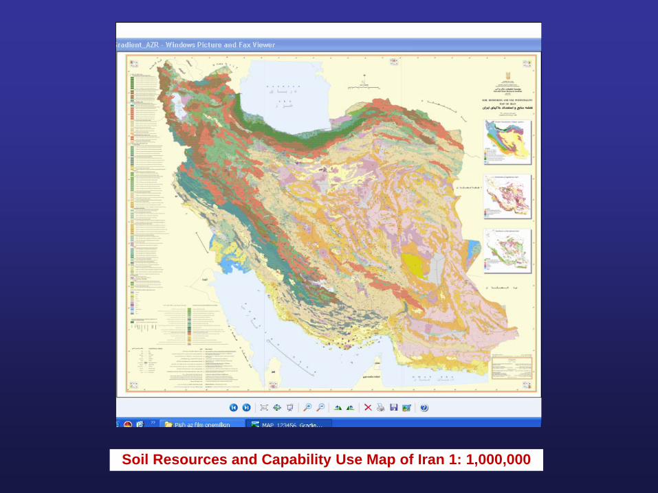
Soil Resources and Capability Use Map of Iran 1: 1,000,000
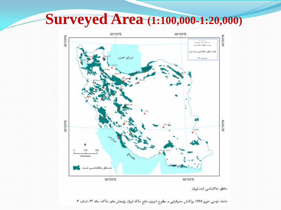
Surveyed Area (1:100,000-1:20,000)
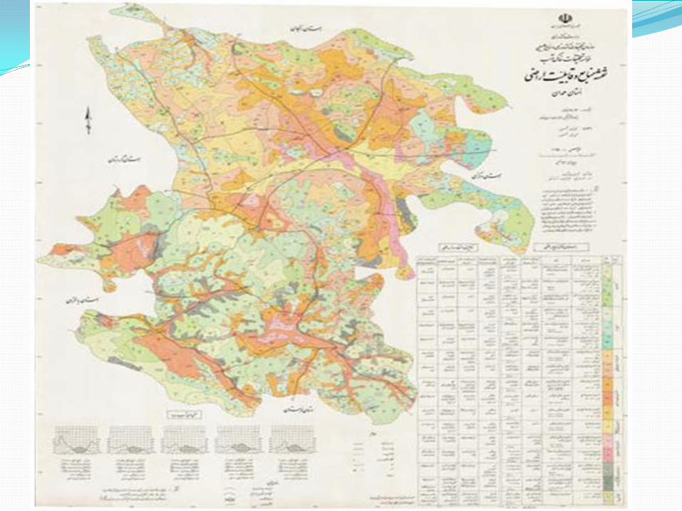
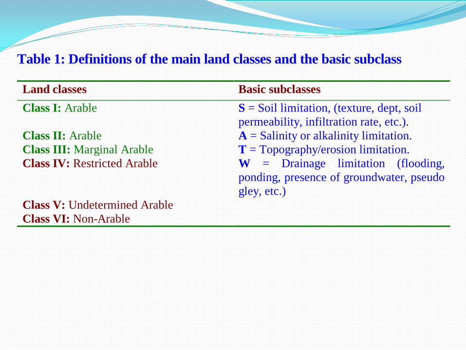
Table 1: Definitions of the main land classes and the basic subclass Land classes Basic subclasses Class I: Arable S = Soil limitation, (texture, dept, soil
permeability, infiltration rate, etc.). Class II: Arable A = Salinity or alkalinity limitation. Class III: Marginal Arable T = Topography/erosion limitation. Class IV: Restricted Arable W = Drainage limitation (flooding,
ponding, presence of groundwater, pseudo gley, etc.)
Class V: Undetermined Arable Class VI: Non-Arable
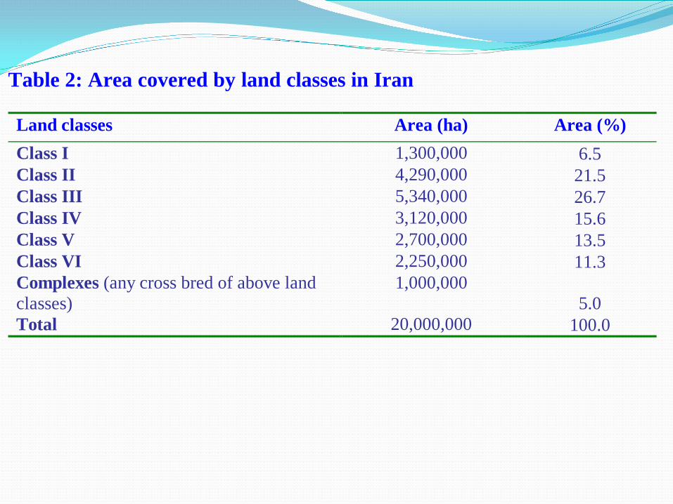
Table 2: Area covered by land classes in Iran Land classes Area (ha) Area (%) Class I 1,300,000 6.5 Class II 4,290,000 21.5 Class III 5,340,000 26.7 Class IV 3,120,000 15.6 Class V 2,700,000 13.5 Class VI 2,250,000 11.3 Complexes (any cross bred of above land classes)
1,000,000 5.0
Total 20,000,000 100.0
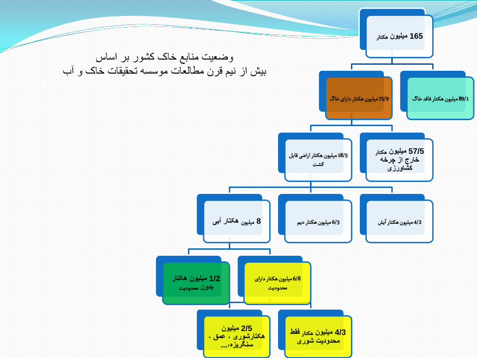
هکـتارمیلیون 165
میلیون هکـتار دارای خاک 75/9
میلیون هکـتار اراضی قابل 18/5 کشت
ھکتار آبی میلیون 8
میلیون ھکتار 1/2محدودیتبدون
میلیون هکـتار دارای 6/8 محدودیت
میلیون 2/5ھکتارشوری ، عمق ،
... سنگریزه،فقط هکـتارمیلیون 4/3
محدودیت شوری
یش 4/2 میلیون هکـتار دیم 6/3 میلیون هکـتار ا
هکـتارمیلیون 57/5خارج از چرخھ
کشاورزی
میلیون هکـتار فاقد خاک 89/1
وضعیت منابع خاک کشور بر اساسبیش از نیم قرن مطالعات موسسھ تحقیقات خاک و آب
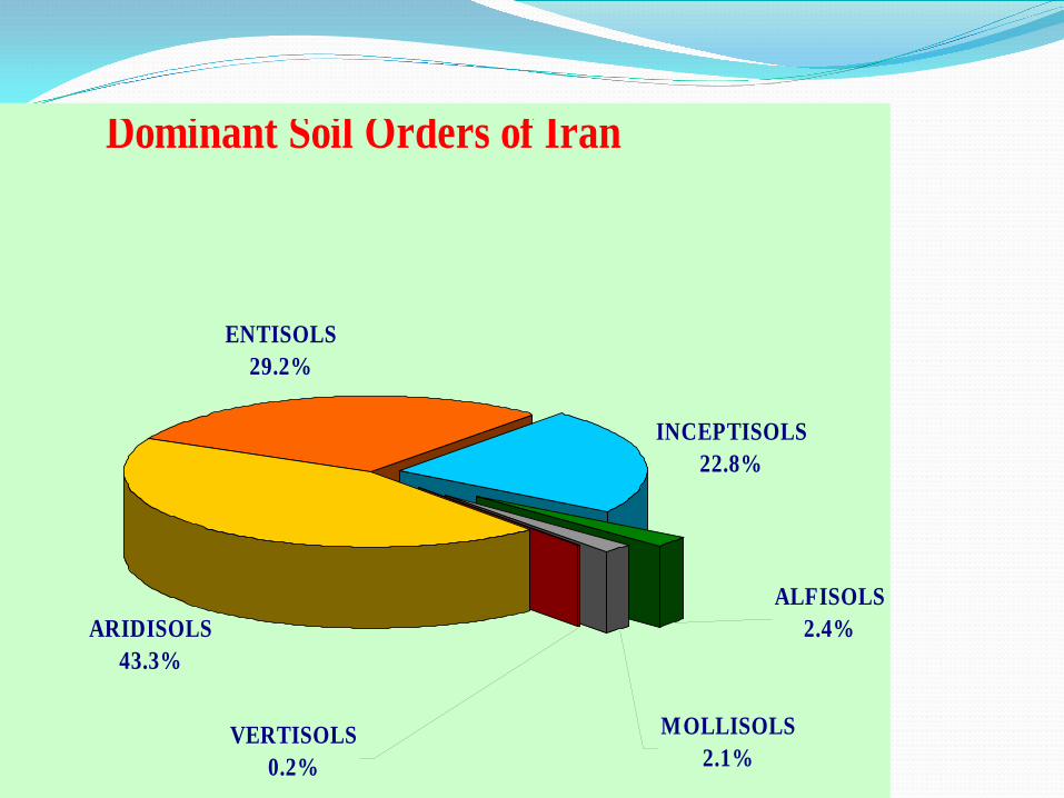
Dominant Soil Orders of Iran
ARIDISOLS43.3%
ENTISOLS29.2%
MOLLISOLS2.1%
ALFISOLS2.4%
VERTISOLS0.2%
INCEPTISOLS22.8%
Justification and analysis of strengths and weakness points The existing of research and educational soil related
centers -The existing of background research related to
executive experiences recognizing in soil resources management
-Incongruity in macro policies and sectorial attitude in soil tenure and management
-Impaired soil position in policy makers outlook, planner, stockholders and citizens as well
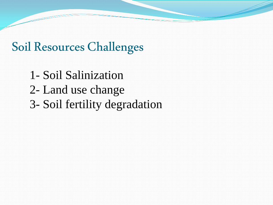
Soil Resources Challenges 1- Soil Salinization 2- Land use change 3- Soil fertility degradation
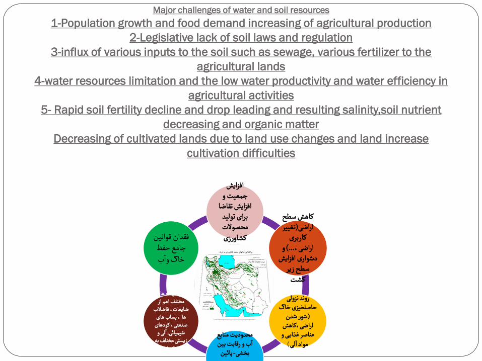
Major challenges of water and soil resources 1-Population growth and food demand increasing of agricultural production
2-Legislative lack of soil laws and regulation 3-influx of various inputs to the soil such as sewage, various fertilizer to the
agricultural lands 4-water resources limitation and the low water productivity and water efficiency in
agricultural activities 5- Rapid soil fertility decline and drop leading and resulting salinity,soil nutrient
decreasing and organic matter Decreasing of cultivated lands due to land use changes and land increase
cultivation difficulties
افزایش جمعیت و
افزایش تقاضا برای تولید محصوالت کشاورزی
کاهش سطح تغییر (اراضی
کاربری و ...) اراضی،
دشواری افزایش سطح زیر
کشت
روند نزولی حاصلخیزی خاک
شور شدن (اراضی،کاهش
عناصر غذایــی و لی
)مواد ا
محدودیت منابع ب و رقابت بین
ا
پائین -بخشی
ورود نهاده های مختلف اعم از
ضایعات، فاضالب ها ، پساب های
صنعتی، کودهای لی و , شیمیائی
ا
زیستی مختلف به مزارع کشاورزی
فقدان قوانین جامع حفظ ب
خاک وا
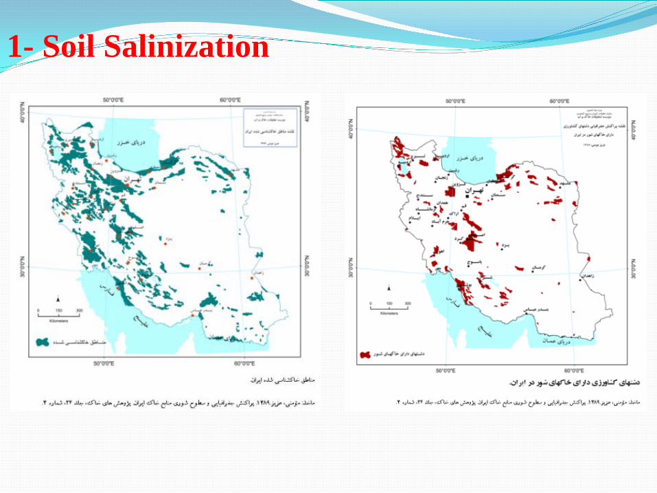
1- Soil Salinization
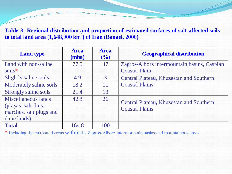
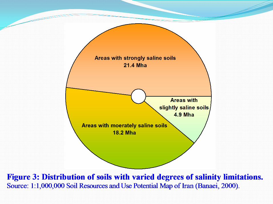
Table 3: Regional distribution and proportion of estimated surfaces of salt-affected soils to total land area (1,648,000 km2) of Iran (Banaei, 2000)
Land type Area (mha)
Area (%) Geographical distribution
Land with non-saline soils*
77.5 47 Zagros-Alborz intermountain basins, Caspian Coastal Plain
Slightly saline soils 4.9 3 Moderately saline soils 18.2 11 Strongly saline soils 21.4 13
Central Plateau, Khuzestan and Southern Coastal Plains
Miscellaneous lands (playas, salt flats, marches, salt plugs and dune lands)
42.8 26 Central Plateau, Khuzestan and Southern Coastal Plains
Total 164.8 100 * Including the cultivated areas within the Zagros-Alborz intermountain basins and mountainous areas
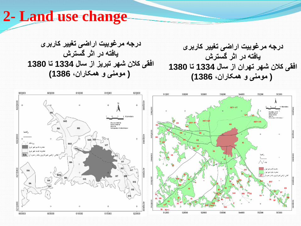
درجھ مرغوبیت اراضی تغییر کاربری یافتھ در اثر گسترش
1380تا 1334افقی کالن شھر تھران از سال )1386مومنی و ھمکاران، (
درجھ مرغوبیت اراضی تغییر کاربری یافتھ در اثر گسترش
1380تا 1334افقی کالن شھر تبریز از سال )1386مومنی و ھمکاران، (
2- Land use change
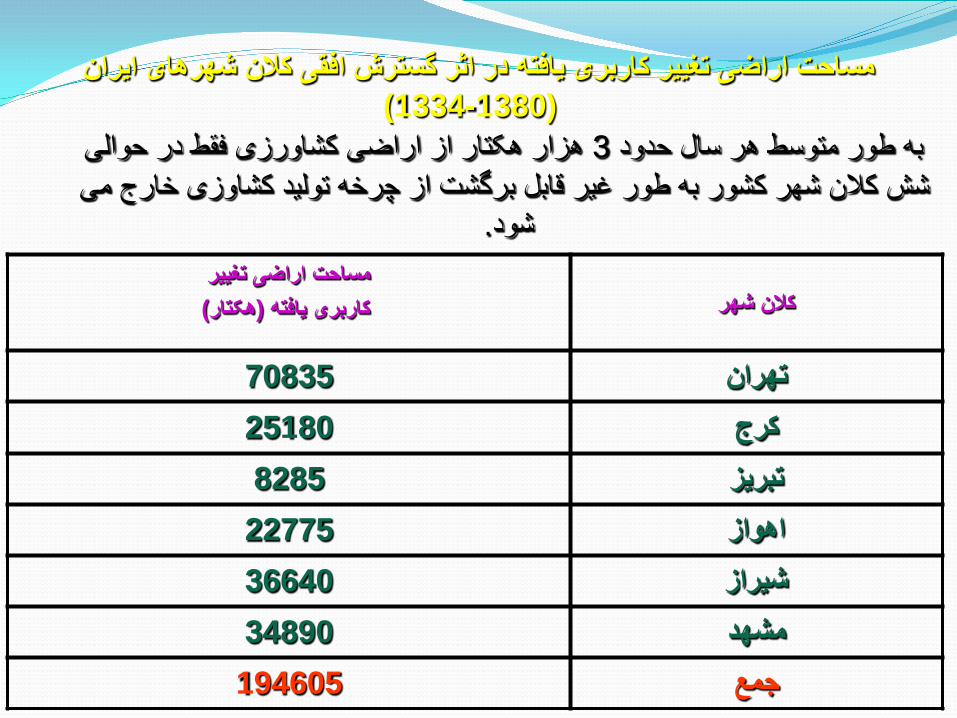
ھزار ھکتار از اراضی کشاورزی فقط در حوالی 3بھ طور متوسط ھر سال حدود شش کالن شھر کشور بھ طور غیر قابل برگشت از چرخھ تولید کشاوزی خارج می
.شود
مساحت اراضی تغییر کاربری یافتھ در اثر گسترش افقی کالن شھرھای ایران )1380-1334 (
کالن شھر مساحت اراضی تغییر
)ھکتار(کاربری یافتھ
70835 تھران 25180 کرج 8285 تبریز 22775 اھواز 36640 شیراز 34890 مشھد 194605 جمع
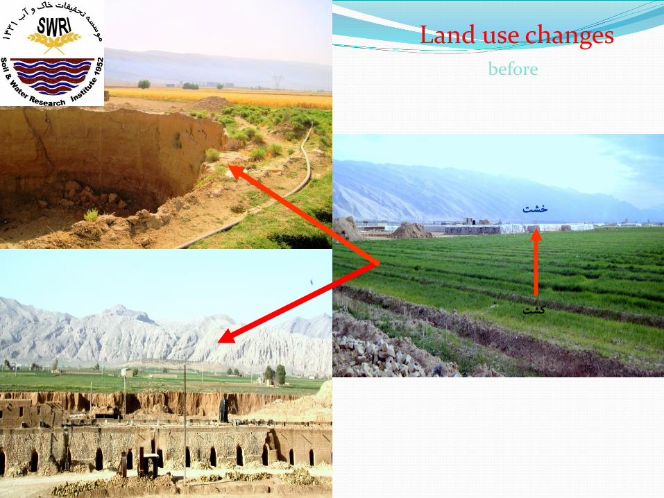
Land use changes before
كشت
خشت
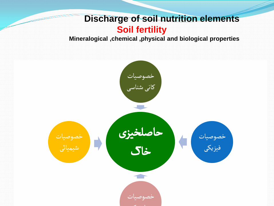
حاصلخیزی خاک
خصوصیات کانی شناسی
خصوصیات فیزیکی
خصوصیات ک ژ ل
خصوصیات شیمیائی
Discharge of soil nutrition elements Soil fertility
Mineralogical ,chemical ,physical and biological properties
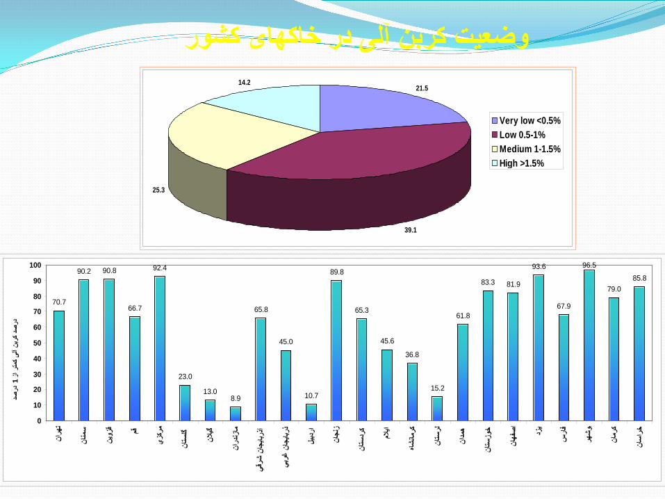
وضعیت کربن آلی در خاکھای کشور21.5
39.1
25.3
14.2
Very low <0.5%Low 0.5-1%Medium 1-1.5%High >1.5%
70.7
90.2 90.8
66.7
92.4
23.0
13.08.9
65.8
45.0
10.7
89.8
65.3
45.6
36.8
15.2
61.8
83.3 81.9
93.6
67.9
96.5
79.085.8
0
10
20
30
40
50
60
70
80
90
100
انھر
ت
انمن
س
ینزو
ق قم
زيرك
م
انست
گل
النگی
اندر
زنما
قيشر
ن جا
بایذر
آ
بيغر
ن جا
بایذر
ا
یلردب
ا
اننج
ز
انست
ردك
المای
شاهمان
كر
انست
لر
انمد
ھ
انست
وزخ
انفھ
صا
زدی
سفار
ھروش
ب
انرم
ك
اناس
خر
صددر
1ز
ر امت
ی ک آل
بنکر
صد در
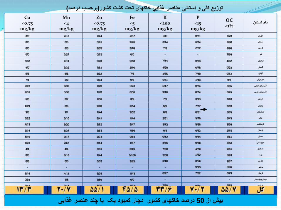
)برحسب درصد(توزیع کلی و استانی عناصر غذایي خاكھاي تحت کشت كشور
نام استانOC <1%
P <15
mg/kg
K <200
mg/kg
Fe <5
mg/kg
Zn <0.75
mg/kg
Mn <4
mg/kg
Cu <0.75
mg/kg 3/5 7/13 7/44 2/57 6/11 0/71 7/70 تھران
0/0 0/0 5/61 9/76 3/14 6/84 2/90 سمنان
0/0 6/5 8/55 3/18 7/6 2/72 8/90 قزوین
0/0 3/27 0/52 0/0 - - 7/66 قم
3/32 2/11 0/28 0/68 7/14 0/63 4/92 مرکزی
4/0 3/32 7/51 2/10 4/29 6/78 0/23 گلستان
5/6 6/6 6/32 7/6 1/75 7/49 0/13 گیالن
7/1 2/9 6/34 0/5 5/41 1/43 9/8 مازندران
2/22 8/30 7/40 6/73 5/17 0/74 8/65 آذربایجان شرقی
9/16 3/36 1/70 8/56 9/10 8/74 0/45 اذربایجان غربی
5/3 3/2 7/56 3/9 7/6 3/93 7/10 اردبیل
4/29 0/0 9/60 2/54 5/5 7/77 8/89 زنجان
9/6 1/1 1/44 9/52 8/8 0/51 3/65 کردستان
6/22 5/10 8/41 1/44 2/31 9/79 6/45 ایالم
4/13 9/20 3/62 9/47 3/12 5/66 8/36 کرمانشاه
3/14 5/34 3/63 7/56 0/3 6/63 2/15 لرستان
5/19 9/17 2/73 9/64 0/12 9/64 8/61 ھمدان
4/23 2/67 5/54 1/47 8/46 0/88 3/83 خوزستان
4/4 4/4 3/31 8/16 7/30 4/78 9/81 اصفھان
0/0 6/13 7/44 0/100 2/50 1/52 6/93 یزد
0/8 0/5 3/52 2/25 8/18 8/56 9/67 فارس
- - - - - 9/93 5/96 بوشھر
7/14 4/11 5/38 1/43 0/27 7/62 0/79 کرمان
0/91 3/8 3/56 0/0 - - - سیستان وبلوچستان
7/41 0/14 8/75 1/73 7/28 9/74 5/85 خراسان
3/13 7/20 1/55 5/45 6/33 2/70 7/55 کل
درصد خاکھای کشور دچار کمبود یک یا چند عنصر غذایی 50بیش از
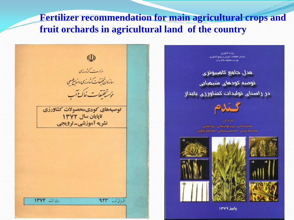
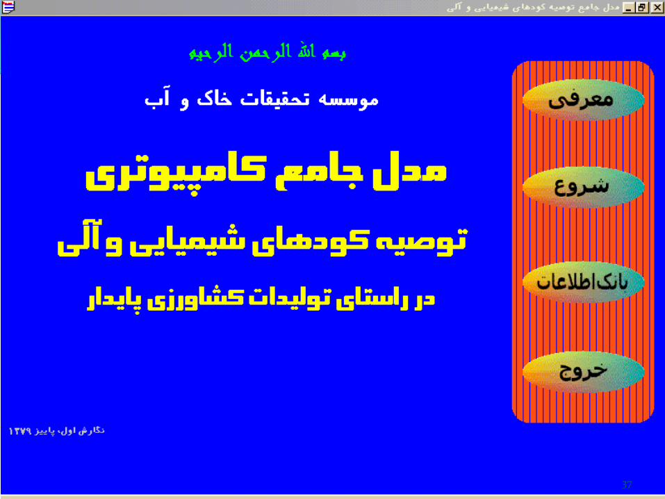
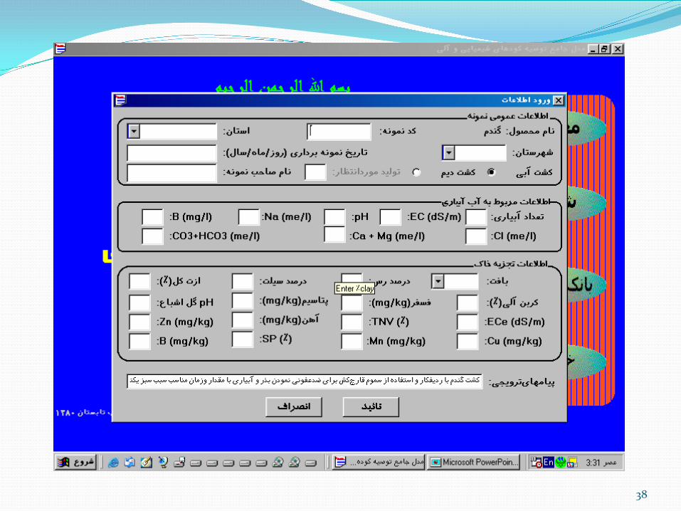
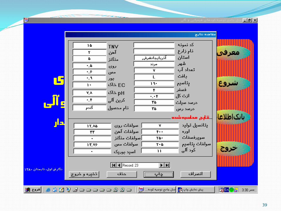
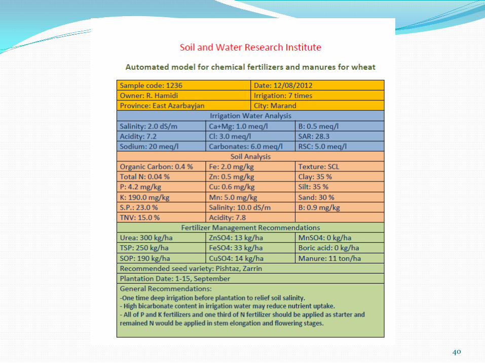
Fertilizer recommendation for main agricultural crops and fruit orchards in agricultural land of the country
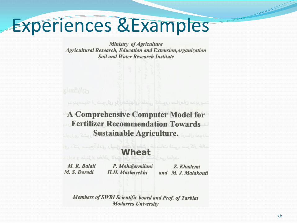
Experiences &Examples
36
37
38
39
40
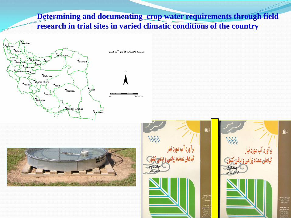
Determining and documenting crop water requirements through field research in trial sites in varied climatic conditions of the country
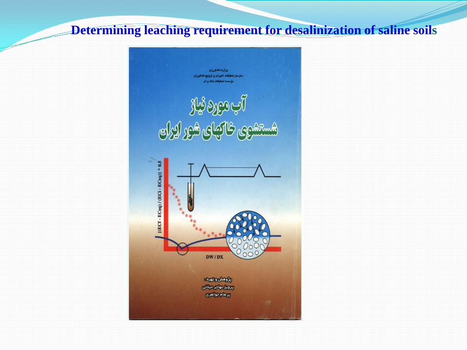
Determining leaching requirement for desalinization of saline soils
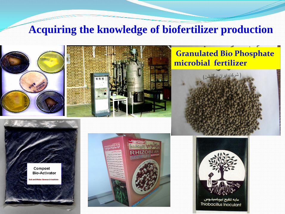
Acquiring the knowledge of biofertilizer production
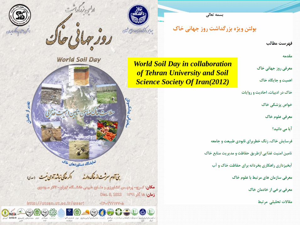
World Soil Day in collaboration of Tehran University and Soil Science Society Of Iran(2012)

•Preparation of manageable soil maps of 1; 250000
•Determination of levels and the grade of agriculture land salinity
•Implementation research in the field of soil conservation and improvement
•Change of cultivation pattern based on land suitability for different uses
•Execution of the existing laws and in case of necessity enacting new laws to
prevention land use changes and uses of agricultural lands
•Enhancing of policy makers and planners

Determination of middle and long time goals
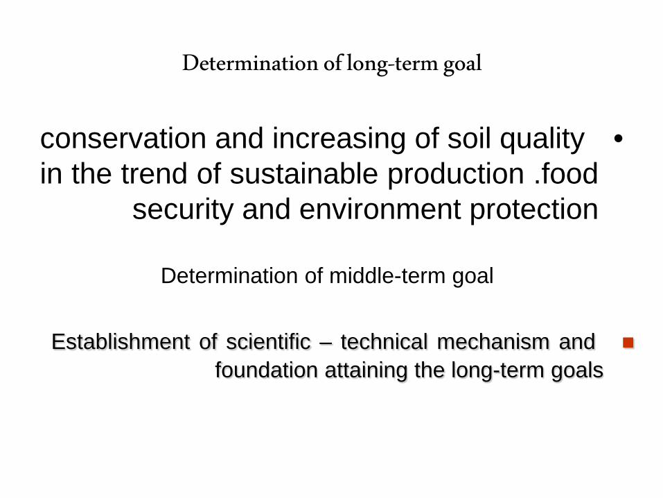
Determination of long-term goal
•conservation and increasing of soil quality in the trend of sustainable production .food
security and environment protection
Determination of middle-term goal
Establishment of scientific – technical mechanism and foundation attaining the long-term goals
Strategies determination
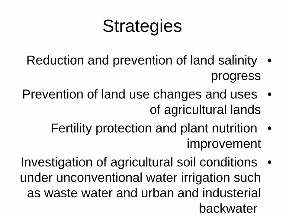
Strategies
•Reduction and prevention of land salinity progress
•Prevention of land use changes and uses of agricultural lands
•Fertility protection and plant nutrition improvement
•Investigation of agricultural soil conditions under unconventional water irrigation such
as waste water and urban and industerial backwater
determination of implementation strategies
Determination of requirements and facilities need
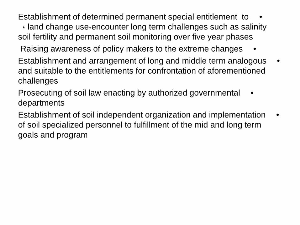
•Establishment of determined permanent special entitlement to encounter long term challenges such as salinity، land change use،
soil fertility and permanent soil monitoring over five year phases • Raising awareness of policy makers to the extreme changes
•Establishment and arrangement of long and middle term analogous and suitable to the entitlements for confrontation of aforementioned challenges
•Prosecuting of soil law enacting by authorized governmental departments
•Establishment of soil independent organization and implementation of soil specialized personnel to fulfillment of the mid and long term goals and program

Thanks for your Attention