strategy 01 - 5 may 01 - northsydney.nsw.gov.au · years council has undertaken a number of studies...
TRANSCRIPT

DRAFT JUNE 2003
st. leonardsdraft public domain strategy

draft june 2003
June 2003
This Document has been prepared by:
Woods Bagot Pty Ltdarchitecture, urban design and planningACN 007 762 174Level 10, Wynyard Green11-31 York StreetSydney, NSW 1220tel: 61 2 9249 2500fax: 61 2 9299 5592www.woodsbagot.com.au
with input from:• The Mayor, Councillors and officers of North Sydney Council• Officers of Lane Cove Council• Officers of Willoughby Council• Page Kirkland Partnership• Hyder Consulting• Transport and Traffic Planning Associates• Urban Bushland Management Pty Ltd• Nada Spasojevic, Social Planner• Lighting Design Partnership• Richard Goodwin, Art Consultant• Garry Emery Design• Residents, businesses and community groups of St Leonards
3
public domain strategyst. leonards
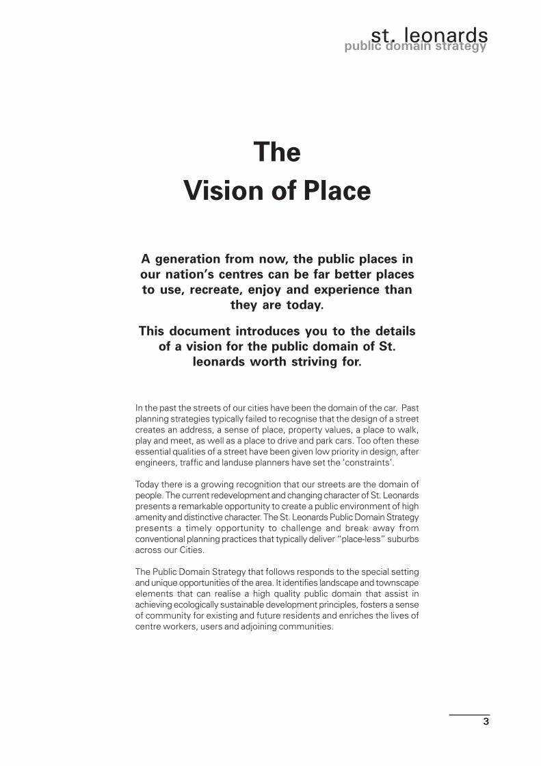
TheVision of Place
A generation from now, the public places inour nation’s centres can be far better placesto use, recreate, enjoy and experience than
they are today.
This document introduces you to the detailsof a vision for the public domain of St.
leonards worth striving for.
In the past the streets of our cities have been the domain of the car. Pastplanning strategies typically failed to recognise that the design of a streetcreates an address, a sense of place, property values, a place to walk,play and meet, as well as a place to drive and park cars. Too often theseessential qualities of a street have been given low priority in design, afterengineers, traffic and landuse planners have set the ‘constraints’.
Today there is a growing recognition that our streets are the domain ofpeople. The current redevelopment and changing character of St. Leonardspresents a remarkable opportunity to create a public environment of highamenity and distinctive character. The St. Leonards Public Domain Strategypresents a timely opportunity to challenge and break away fromconventional planning practices that typically deliver “place-less” suburbsacross our Cities.
The Public Domain Strategy that follows responds to the special settingand unique opportunities of the area. It identifies landscape and townscapeelements that can realise a high quality public domain that assist inachieving ecologically sustainable development principles, fosters a senseof community for existing and future residents and enriches the lives ofcentre workers, users and adjoining communities.
4
draft june 2003
1.0 INTRODUCTION1.1 Background 51.2 Approach 61.3 Vision for St Leonards Public Domain 71.4 Strategy Aims and Objectives 71.5 Study Process 81.6 Strategy Area 81.7 Previous Research 101.8 Structure of this Document 11
2.0 ST. LEONARDS’ LOCATION, PHYSICAL & NATURAL FABRIC2.1 Sub-Regional Context 132.2 Local Context 132.3 Urban Structure 152.4 Landscape and Natural Environment 172.5 Landform and Views 20
3.0 ST. LEONARDS’ SOCIAL, INSTITUTIONAL & BUILT FABRIC3.1 History and Heritage 213.2 Planning Context 223.3 Population 233.4 Land Uses and Activities 253.5 Built Form and Character 283.6 Infrastructure 303.7 Traffic and Access 303.8 Pedestrian Network 32
4.0 STAKEHOLDER VIEWS4.1 St. Leonards’ Community Meeting 354.2 Community Survey 364.3 Adjoining Councils 374.4 Consultant First Impressions 38
5.0 THE STRATEGIC APPROACH5.1 Approach 395.2 Desired Character 395.3 Identified Challenges 41
6.0 STRATEGY/ STAGES6.1 Context 436.2 Stage 1: Minimum Intervention 446.3 Stage 2: Medium Intervention 506.4 Stage 3: Maximum Intervention 556.5 Assessment of Scenarios 60
7.0 ADDITIONAL DETAILED STUDIES RECOMMENDED
TABLE OF CONTENTS

5
public domain strategyst. leonards
1.0 INTRODUCTION
1.1 BACKGROUND
From its earliest beginnings, as a separate village on the edgeof the town of Sydney, St. Leonards has emerged as aprosperous railway station and highway based commercialcentre that today is experiencing a major transition into a highdensity mixed-use urban centre.
This transition has resulted from the intensification of bothresidential and commmercial activity centred around the StLeonards railway station. Redevelopment has been the resultof state government ‘urban consolidation’ policies which haveencouraged new housing and commercial development attransport nodes across the Sydney Region. Specifically, it is aresponse to amended development controls adopted by NorthSydney Council to permit greater mixed-use development withinthe centre to capitalise on the presence of the St. LeonardsRailway Station promoting ecologically sustainable developmentthrough enhanced public transport use.
Consequently, future planned and current redevelopment withinthe centre, has placed St. Leonards at a crossroad in terms ofthe evolution of its character, amenity and the range of servicesand community facilities. It is envisaged that the strategy andpriorities for actions will be reviewed from time to time inconsultation with the community as new development occurswithin the centre.
St. Leonards Centre Study Area

6
draft june 2003
Redevelopment, coupled with the changing numbers andcharacter of the people who live, visit and work in St. Leonardshas the potential to significantly enhance the quality, vitality,comfort and enjoyment of the place. Correspondingly, if notappropriately managed, it has the potential to erode St. Leonardsexisting assets, character and attractiveness, squandering thebenefits that can be achieved with the centre's transformation.
In recognition of this issue, North Sydney Council has madethe timely decision to prepare a strategy to guide futuredevelopment upgrading of, and the activities/facilities within,the public and semi-public areas comprising the streets,pathways and parks (i.e. the “public domain”) of the centre.
1.2 APPROACH
The planned future of St. Leonards as a mixed residential/commercial centre offers many opportunities to enhance theimage and character of the place as an important business andliving centre in the Sydney region. This public domain strategywill provide a level of certainty to the existing and future residents,owners, workers and visitors of Council’s vision andcommitment to provide significantly enhanced public spacesin keeping with the emerging high quality mixed urban centre .
The majority of the actions proposed in this document willinvolve expenditure, in terms of financial commitment, andresources, in terms of physical effort to be implemented. It isanticipated that these actions will be funded by Council usingContributions levied under Section 94 of the EnvironmentalPlanning and Assessment Act 1979 or in partnership with privateenterprise of other government authorities, or by a second partysuch as a government agency, landowner or community group.The area bounded by Hume, Clarke, Oxley Streets and PacificHighway, overlaps with the Crows Nest main street area, andwill be funded by the Crows Nest Main Street Levy.
The strategy in itself is not a “works” document. It makes nocommitment on a timetable, funding or undertaking of theactions Atchison Street
Atchison Street

7
public domain strategyst. leonards
1.3 VISION FOR ST. LEONARDS PUBLICDOMAIN
“To provide a strong, vibrant sense of place and community inthe streets and public spaces of St Leonards”.
1.4 STRATEGY AIMS AND OBJECTIVES
This vision is embodied in six major objectives:
1. Functional: The quality, diversity and capacity of the publicdomain must be enhanced in tandem with the anticipatedgrowth and regeneration of the area. It must contribute tothe role of public transport in the efficient functioning of thecentre.
2. Cultural: The public domain should provide space for peopleto relax, meet friends, congregate and be entertained. Itshould allow for self expression to promote communityidentity and sense of place.
3. Environmental: The public domain should be safe andcomfortable for all users. Impacts of weather, traffic andnoise should be ameliorated and benefits of the naturalenvironment maximised.
4. Quality Built Form: The relationship of built form and publicdomain should create positive images that influence theway people perceive and value the centre.
5. Quality Urban Environment: The design of the publicdomain should facilitate access to all areas by pedestriansfreely, comfortably and safely. It should provide high qualitypublic spaces that contrast with the hard built form wherepeople can relax, gather and be enriched by art, water andgreenery.
6. Efficient Use of Resources: The selection, characteristics,lifecycle and maintenance regime of materials and finishesshould encourage efficient use of resources, recycling ofmaterials and embody low energy use.
Cafe style eating at St Leonards
601 Mitchel Street
Christie Street

8
draft june 2003
1.5 STUDY PROCESS
The study process consisted of three key stages:
Stage 1 - Imagine the Future
At the outset, the study team undertook a detailed analysis ofthe study area to appreciate the existing condition of the publicareas in St. Leonards. In tandem with this work, the studyfocused on existing and future community and cultural needs.The outcome of this initial work was the development of publicdomain opportunities and constraints for the centre.
These opportunities and constraints were then discussed at amulti-disciplinary consultant and council workshop. Thisworkshop defined key issues, generated public domaindevelopment ideas, options and choices for Council, CommunityGroups and other key stakeholders.
Stage 2 - Formulate Draft Strategy Plan
Following another consultant, Council and stakeholder workshopa preferred public domain development concept was agreedand prepared.
Stage 3 - Confirm and Present Final Strategy Plan
Based on the preferred concept this final draft Strategy PlanReport was prepared.
1.6 STRATEGY AREA
The study area for the St. Leonards Public Domain Strategyessentially comprises all of the land zoned “mixed-use” in NorthSydney Local Environmental Plan (LEP) 2001. It includes anarea to the east of Oxley Street zoned “Residential 2 (c)“withinthe LEP.
The area is relatively compact comprising only approximately14 hectares of land. However, it accommodates a large number,and wide range of important and/or distinctive natural andmanmade features and activities. These include:
• Pacific Highway, a busy and important arterial road thatbounds the strategy area to the west.
• An estimated 250,00m² of commercial office space (1996)accommodating a focus of property and business services,advertising, service industries, information technology,technical services, finance and insurance, health andcommunity services. Views of building heights
The corner of Albany Street
Corner of Chandos and Mitchell Streets

9
public domain strategyst. leonards
• An estimated 65,000m² of retail floor space (1996).
• Significant existing residential activity within and surroundingthe centre, plus recent approvals for mixed-use developmentincorporating a total of over 400 residential apartments.
• The presence of the St. Leonards Railway Station to theimmediate west of the study area within comfortablewalking distance of the centre. The station is located withina new landmark mixed-use development called the “Forum”which comprises office, residential and retail usessurrounding a public piazza/square above the station.
• An elevated, hilltop position falling away to the south andwest providing good local and district views and excellentregional views from upper levels of buildings.
• An established streetscape structured around a traditional“grid pattern” road network and a mix of building forms,styles, scale and age.
• Few streetscape works or public places of note, with theexception of Christie Street Reserve in the western part ofthe study area. Council recently declared this Reserve to bean alcohol free zone.
Figure: 1.1 - St LeonardsStudy area study area

10
draft june 2003
Public Seating - Forum at St Leonards
1.7 PREVIOUS RESEARCH
To its credit, the North Sydney Council has demonstrated aprogressive attitude to the development of the centre. In recentyears council has undertaken a number of studies andinvestigations that have provided valuable backgroundinformation for this Public Domain Strategy.
These include:• North Sydney Pedestrian Network and Amenity Study 1999
• North Sydney Recreation Needs Study 1997
• North Sydney Strategic Traffic and Transportation Study 1999• St. Leonards Town Centre Study 1997
• Regional Bike Strategy• North Sydney Area Character Study
• North Sydney Residential Development Strategy• North Sydney Local Environmental Plan 2001• North Sydney Development Control Plan 2002
• Plan of Management for Neighbourhood Parks• Street Tree Strategy 1997
11
public domain strategyst. leonards
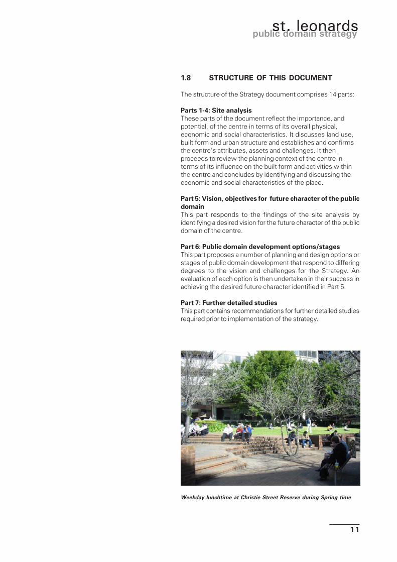
1.8 STRUCTURE OF THIS DOCUMENT
The structure of the Strategy document comprises 14 parts:
Parts 1-4: Site analysisThese parts of the document reflect the importance, andpotential, of the centre in terms of its overall physical,economic and social characteristics. It discusses land use,built form and urban structure and establishes and confirmsthe centre's attributes, assets and challenges. It thenproceeds to review the planning context of the centre interms of its influence on the built form and activities withinthe centre and concludes by identifying and discussing theeconomic and social characteristics of the place.
Part 5: Vision, objectives for future character of the publicdomainThis part responds to the findings of the site analysis byidentifying a desired vision for the future character of the publicdomain of the centre.
Part 6: Public domain development options/stagesThis part proposes a number of planning and design options orstages of public domain development that respond to differingdegrees to the vision and challenges for the Strategy. Anevaluation of each option is then undertaken in their success inachieving the desired future character identified in Part 5.
Part 7: Further detailed studiesThis part contains recommendations for further detailed studiesrequired prior to implementation of the strategy.
Weekday lunchtime at Christie Street Reserve during Spring time

12
draft june 2003

13
public domain strategyst. leonards
2.1 SUB-REGIONAL CONTEXT
St. Leonards is located on the lower north shore and is a localurban centre that forms part of a chain of centres within theSydney Metropolitan Area that stretches from Sydney Airportat Botany Bay in the south to Macquarie Park/North Ryde inthe north.
Collectively these centres form a corridor of activity that isemerging as a global powerhouse in terms of its economic andsocial influence, impact and contribution to not only Sydneybut the nation as a whole.
All parts of the corridor are linked and are convenientlyaccessible by car and rail based public transport. The Sydneyand North Sydney CBD's form the heart, and anchor the corridor.
2.2 LOCAL CONTEXT
At a local level St. Leonards is bordered by a range of institutionsand businesses. These include:
• The Royal North Shore Hospital to the west of the centre.The hospital is the pre-eminent medical facility on Sydney'sLower North Shore and includes teaching and privatefacilities.
• North Sydney TAFE and the Gore Hill ABC Studios to thenorth-west of the centre.
• The Crows Nest Local Centre immediately to the south.The centre is an established low-scale centre with anemphasis in strip local/convenience retailing and hospitality/entertainment activities (bars, restaurants, cafes and thelike). Crows Nest centre is enjoying a very successfulstreetscape upgrading programme which is used as a modelfor other areas.
• The Artarmon industry and business area to the north westof the centre which plays host to a range of service,a lightindustrial and institutional activities.
• The presence of the Gore Hill Freeway to the north and thePacific Highway to the south of the centre providing excellentvehicular access to the Sydney Metropolitan Area by car.
2.0 ST LEONARDS’ LOCATION, PHYSICAL &NATURAL FABRIC
Figure 2.1 - St. Leonards’ Position in theSydney Economic Corridor

14
draft june 2003
• The established residential suburbs of Wollstonecraft to thesouth and Naremburn to the north which accommodate arange of densities and dwelling types.
The emerging character of St Leonards and it’s context offers anumber of opportunities and constraints for the Strategy. Theseinclude:
• The presence of large institutions which adjoins the centre.New residential developments adjacent to St Leonards stationhave brought new workers and residents to the area. Thisexpanded workforce and residential group uses the centre’spublic domain outside business hours (i.e. evenings andweekends). This places an emphasis on a public domainthat exhibits and offers a 24/7 role and function.
• The distinctive character and streetscape works and thefocus of activity in the Crows Nest Centre. It is consideredimportant that the St. Leonards public domain offer acontrasting character and function to differentiate itself fromCrows Nest. Part of the strategy area (Oxley Street) isincluded in the funding area of the Crows Nest Main Streetprogram.
• The globalised orientation of the economic and social corridorin which St. Leonards is located. This requires elements ofthe public domain strategy to exhibit and capturecharacteristics which meet the ‘international’ perspectivesand expectations of many of the centre’s new businessesand residents.
Figure 2.2 - Site Context
St Leonards Streetscape
WOLLSTONECRAFT
PACIFIC HIGHWAY
TAFE & ABC
WARRINGAH FREEWAY
STUDY AREA
ARTARMON
RAILWAY LINE
NARAMBURN
CROWS NEST CENTRE

15
public domain strategyst. leonards
2.3 URBAN STRUCTURE
The structure of the centre is determined by the elements thatcontribute to its understanding, recognition, image and ease ofmovement.
In the centre the following elements are important:
Paths. Paths are the channels of movement, which a personmoves along. They include footpaths, roads and railways.Many people make their observations while moving alongthem and thus they are important components of imagegeneration. Chandos Street, the railway line, Albany Streetand the Pacific Highway are prominent pathways in thecentre.
Gateways. Gateways are entry points. They are the pointwhere people first observe and experience the “sense ofarrival” in an area. There are a number of distinctivegateways to St. Leonards, at the railway station exit andalong the Pacific Highway.
Nodes. Nodes are Focal Points, such as junctions of pathsor concentrations of physical or social activity. These areoften street corners, parks or squares. They can often formthe core or “heart” of an area. St. Leonards offers weaknodes such as the Christie Street Reserve and licensedvenues on Christie Street, but is otherwise dominated bystrong nodes outside the study area at the Forum andWilloughby Road/Crows Nest.
Figure 2.3 - Urban Structure
EDGEPATHWAY
GATEWAY
NODE
PRECINCT
STUDY AREA

16
draft june 2003
Edges. Edges are linear elements, which are either not usedas paths, or which are usually seen from positions wherethe path is obscured. They form the boundaries or barriersbetween distinct areas or precincts. The railway line andPacific Highway form a strong edge to the centre. WilloughbyRoad is also a prominent edge but lies beyond the centre.
Precincts. Precincts are areas that are recognised as havingsome particular identifying character and which a personmentally enters “into”. The centre exhibits three precincts,the commercial precinct in the north-west, the mixedcommercial /residential precinct in the east and the highwayoriented commercial precinct in the south.
Landmarks. Unlike nodes, which can be entered, landmarksare point references. They are usually a simply definedphysical object such as a building, sign, store, monumentor mountain. The centre exhibits few memorable landmarksbeyond tall buildings.
The structure of St. Leonards offers a number of opportunitiesand constraints for the public domain strategy. They include:
• The presence of the Pacific Highway, a busy road, whichessentially dissects the study area into two sectors.
• Prominent gateways into the centre, which presentopportunities for public domain actions to announce theplace, its role and importance.
• The lack of an identifiable node within the centre, whichgenerates dependence by centre users and residents instead,on the activities and role of the “Forum”, (a controlled private/commercial operation with limited role outside businesshours) and Willoughby Road/Crows Nest (which issymbolically separate from the centre).
• Strong precincts, based on land use character and orientation,which may be enhanced in the public domain Strategy.
• Few memorable landmarks, which provides opportunitiesfor the strategy to contribute to the centre's visual interestand memorability.
The hotel on the corner of Chandos/Atchison Streets is a local node
The Pacific Highway is a prominant edgeto the Centre
17
public domain strategyst. leonards
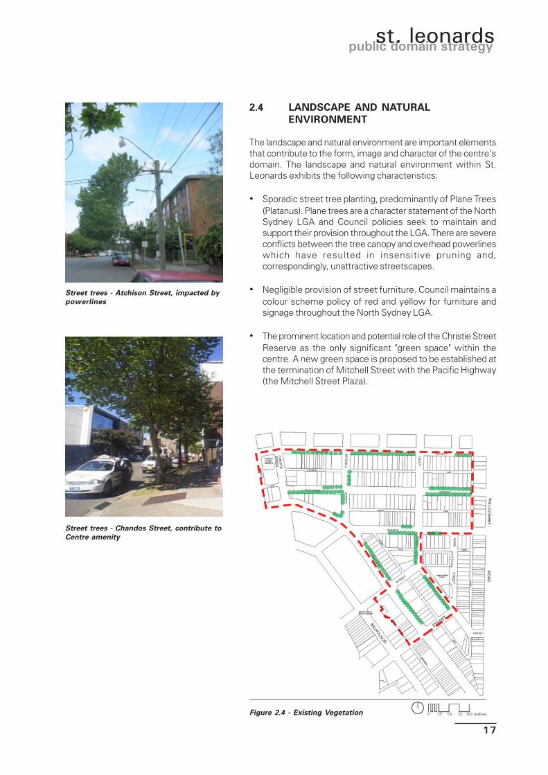
2.4 LANDSCAPE AND NATURALENVIRONMENT
The landscape and natural environment are important elementsthat contribute to the form, image and character of the centre'sdomain. The landscape and natural environment within St.Leonards exhibits the following characteristics:
• Sporadic street tree planting, predominantly of Plane Trees(Platanus). Plane trees are a character statement of the NorthSydney LGA and Council policies seek to maintain andsupport their provision throughout the LGA. There are severeconflicts between the tree canopy and overhead powerlineswhich have resulted in insensitive pruning and,correspondingly, unattractive streetscapes.
• Negligible provision of street furniture. Council maintains acolour scheme policy of red and yellow for furniture andsignage throughout the North Sydney LGA.
• The prominent location and potential role of the Christie StreetReserve as the only significant "green space" within thecentre. A new green space is proposed to be established atthe termination of Mitchell Street with the Pacific Highway(the Mitchell Street Plaza).
Street trees - Atchison Street, impacted bypowerlines
Street trees - Chandos Street, contribute toCentre amenity
Figure 2.4 - Existing Vegetation

18
draft june 2003
• There is also open space adjacent to the council’s basketball/tennis centre in Clarke Street, Crows Nest just outside thestrategy area. Other significant sporting fields are located tothe west along the Highway at the Gore Hill Oval, and to thenorth at the Talus Street Reserve
• Reliance on landscaped environments within the private andsemi-private domain (i.e. setback areas in privately ownedland) to offer visual relief and amenity. Some of these areasare attractive and well maintained offering high amenity, whileother areas are not and detract from the streetscape.
• Landscaped environments and a surrounding urbanenvironment that is generally inhospitable for fauna,minimising opportunities to promote and enhancebiodiversity within the centre.
• No floral communities or fauna species of any significancedue to the harsh urban environment and significantmodification of the natural environment that has taken placesince European settlement and the prevalence of introducedspecies.
• Soils generally derived from Hawkesbury Sandstone, thisbeing the predominant underlying geological structure of mostof the Sydney region.
• Air quality influenced by air quality on a Sydney wide(regional) scale and thus heavily impacted by activities inthe Sydney Basin. Thus air quality can vary from “low” to“high” (based on the Sydney Pollution Index - SPI) dependingon climate, events (eg bushfire) and time of day/year.
• Rainfall enjoyed by the centre is characteristic of Sydney asa whole.
Examples of street furniture within theCentre
19
public domain strategyst. leonards
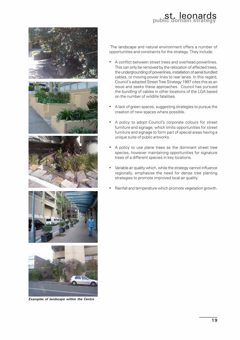
Examples of landscape within the Centre
The landscape and natural environment offers a number ofopportunities and constraints for the strategy. They include:
• A conflict between street trees and overhead powerlines.This can only be removed by the relocation of affected trees,the undergrounding of powerlines, installation of aerial bundledcables, or moving power lines to rear lanes. In this regard,Council's adopted Street Tree Strategy 1997 cites this as anissue and seeks these approaches. Council has pursuedthe bundling of cables in other locations of the LGA basedon the number of wildlife fatalities.
• A lack of green spaces, suggesting strategies to pursue thecreation of new spaces where possible.
• A policy to adopt Council’s corporate colours for streetfurniture and signage, which limits opportunities for streetfurniture and signage to form part of special areas having aunique suite of public artworks.
• A policy to use plane trees as the dominant street treespecies, however maintaining opportunities for signaturetrees of a different species in key locations.
• Variable air quality which, while the strategy cannot influenceregionally, emphasise the need for dense tree plantingstrategies to promote improved local air quality.
• Rainfall and temperature which promote vegetation growth.

20
draft june 2003
Figure 2.5 - Landform Views and vistas within the Centre
2.5 LANDFORM AND VIEWS
St. Leonards straddles a local peak (immediately to the east ofMitchell Street) in an area of high ground that forms part of aridge of elevated land that runs north-south commencing at theHarbour foreshore to the south. The land within the centre fallsaway to the east and west from the peak.
The landform character of the centre thus generates a numberof distinctive views and view corridors within the public domain,predominantly along the straight roads that form the grid-patternwhich characterises the road network in the area. These viewsare framed by buildings and street vegetation.
The landform of the centre presents a number of opportunitiesand constraints for the public domain. They include:
• Landform coupled with the grid-pattern road network whichpresents opportunities for memorable streetscape vistas.
• Tall buildings and prominent street trees to frame local viewsand vistas, contributing to the centre's sense of place andlegibility.
90
80
82
8586
9293
91
8887
8384
89
81
797877
METRES ABOVESEA LEVEL
21
public domain strategyst. leonards
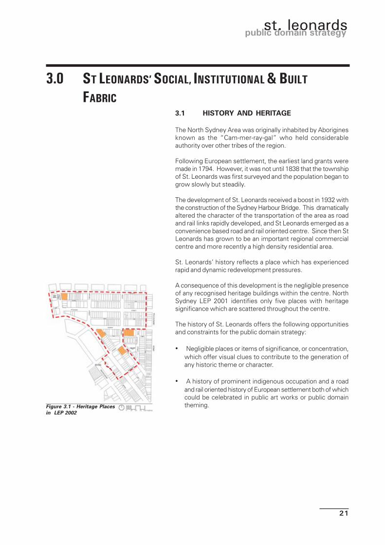
3.1 HISTORY AND HERITAGE
The North Sydney Area was originally inhabited by Aboriginesknown as the “Cam-mer-ray-gal” who held considerableauthority over other tribes of the region.
Following European settlement, the earliest land grants weremade in 1794. However, it was not until 1838 that the townshipof St. Leonards was first surveyed and the population began togrow slowly but steadily.
The development of St. Leonards received a boost in 1932 withthe construction of the Sydney Harbour Bridge. This dramaticallyaltered the character of the transportation of the area as roadand rail links rapidly developed, and St Leonards emerged as aconvenience based road and rail oriented centre. Since then StLeonards has grown to be an important regional commercialcentre and more recently a high density residential area.
St. Leonards’ history reflects a place which has experiencedrapid and dynamic redevelopment pressures.
A consequence of this development is the negligible presenceof any recognised heritage buildings within the centre. NorthSydney LEP 2001 identifies only five places with heritagesignificance which are scattered throughout the centre.
The history of St. Leonards offers the following opportunitiesand constraints for the public domain strategy:
• Negligible places or items of significance, or concentration,which offer visual clues to contribute to the generation ofany historic theme or character.
• A history of prominent indigenous occupation and a roadand rail oriented history of European settlement both of whichcould be celebrated in public art works or public domaintheming.
3.0 ST LEONARDS’ SOCIAL, INSTITUTIONAL & BUILT
FABRIC
Figure 3.1 - Heritage Placesin LEP 2002

22
draft june 2003
3.2 PLANNING CONTEXT
Control of development is subject to two principal documentscomprising:
• North Sydney Local Environmental Plan (LEP) 2001
• North Sydney Development Control Plan (DCP) 2002
The North Sydney LEP zones the majority of the centre “mixed-use” and the area east of Oxley Street “Residential C” andintroduces a range of building heights and floor space ratios.
The LEP is a comparatively recent control which, when gazetted,significantly increased the floor space yield, and hencedevelopment potential of commercial and mixed-commercial/residential sites.
The North Sydney DCP presents detailed controls on buildingform, scale and character to support the land use controls inthe LEP. The DCP identifies the St. Leonards Town Centre in“Planning Area 2 - Crows Nest/St. Leonards”.
It identifies the following desired character for the centre to bepromoted/achieved by new development:
“St. Leonards is a memorable, sustainable and busy urban centre -• with a diverse range of living, employment, recreation
and social opportunities serving both local and regionalpopulations and contributing to the vibrancy of the centre
• where residents, workers and visitors enjoy comfortableconditions and quality of the natural and built environment
• which is accessible to all• which is linked to the city, other suburban centres and
many parts of the Sydney Region by rail and bus as wellas by road and is place of interchange between the variousmodes.”
It proceeds to identify detailed “centre-specific” controls whichare reproduced in Appendix 2.
Figure 3.3 - Floor Space Ratio and Height
Figure 3.2- Zoning
23
public domain strategyst. leonards
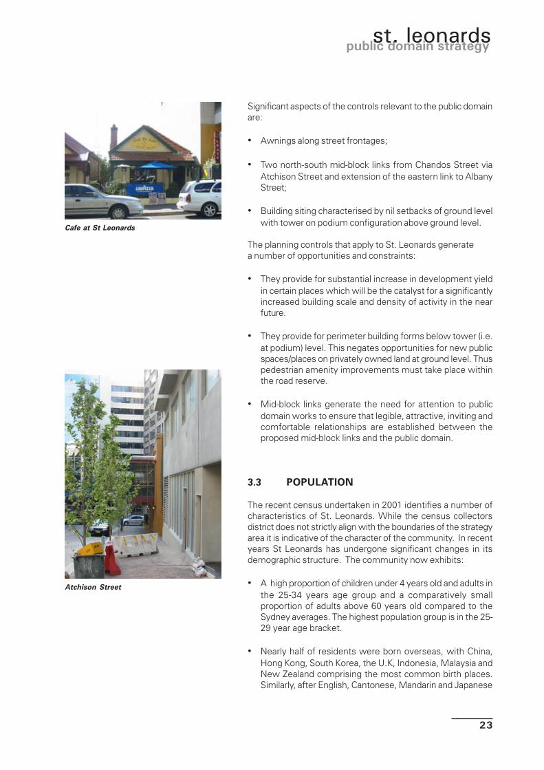
Significant aspects of the controls relevant to the public domainare:
• Awnings along street frontages;
• Two north-south mid-block links from Chandos Street viaAtchison Street and extension of the eastern link to AlbanyStreet;
• Building siting characterised by nil setbacks of ground levelwith tower on podium configuration above ground level.
The planning controls that apply to St. Leonards generatea number of opportunities and constraints:
• They provide for substantial increase in development yieldin certain places which will be the catalyst for a significantlyincreased building scale and density of activity in the nearfuture.
• They provide for perimeter building forms below tower (i.e.at podium) level. This negates opportunities for new publicspaces/places on privately owned land at ground level. Thuspedestrian amenity improvements must take place withinthe road reserve.
• Mid-block links generate the need for attention to publicdomain works to ensure that legible, attractive, inviting andcomfortable relationships are established between theproposed mid-block links and the public domain.
3.3 POPULATION
The recent census undertaken in 2001 identifies a number ofcharacteristics of St. Leonards. While the census collectorsdistrict does not strictly align with the boundaries of the strategyarea it is indicative of the character of the community. In recentyears St Leonards has undergone significant changes in itsdemographic structure. The community now exhibits:
• A high proportion of children under 4 years old and adults inthe 25-34 years age group and a comparatively smallproportion of adults above 60 years old compared to theSydney averages. The highest population group is in the 25-29 year age bracket.
• Nearly half of residents were born overseas, with China,Hong Kong, South Korea, the U.K, Indonesia, Malaysia andNew Zealand comprising the most common birth places.Similarly, after English, Cantonese, Mandarin and Japanese
Cafe at St Leonards
Atchison Street

24
draft june 2003
are the most common languages spoken at home.
• Individual incomes are high with the highest proportion ofpersons earning over $1,500 per week (in the 25-34 yearsage bracket).
• Lone person households comprise the highest proportion ofhousehold structure followed by persons in group households(both in the 25-34 years age bracket).
• The population is very computer literate with a high proportionof computer use and with over two-thirds regularly usingthe internet.
• The predominant dwelling structure is that of a flat, unit orapartment in a four or more storey block. The majority ofdwellings are rented.
In summary, the population exhibits the followingcharacteristics:
• A relatively youthful, well educated, technologically savvypopulation on high incomes in transitory (rental) higher densityaccommodation living either alone or in shared households,of which a significant proportion of the population originatefrom South East Asia countries, exhibiting Asian culturalinfluences.
Furthermore, St. Leonards is currently “in transition” withsignificant redevelopment taking place. It is therefore likely thatthe character of the population will continue to evolve asdevelopment proceeds. It is reasonable and logical to assumethat the characteristics of the population will continue to morestrongly represent the emerging demographic character of thearea. We will see an increase in temporary or permanentresidency by people from South East Asian countries. Theconvenience of St. Leonards to global oriented service/higherorder employment centres and the Sydney CBD/Harbour willcontinue to attract businesses in these fields.
In terms of employment, the most recent survey (1996)estimated that there is approximately 250,000m² of net officefloor space in St. Leonards (which encompasses and exceedsthe study area). There has been a substantial increase incommercial floor space (50,000m²) immediately outside thestudy area within the “Forum” development and 207 PacificHighway. Based on a generous employee/floor space ratio of 1person per 20m² of floor space, this equates to an employeepopulation of approximately 15,000. The dominant businessescomprise property, business services, wholesaling, finance andinsurance, health and community services.
Similarly in 1996, there was an estimated 65,000m² of retail

25
public domain strategyst. leonards
floor space in St. Leonards and Crows Nest providing anadditional 1,482 jobs. While the exact breakdown of retail floorspace and employment in St. Leonards is unknown, both areexpected to increase as density of mixed-use developmentincreases with redevelopment.
The population and employment characteristics of St. Leonardsgenerate a number of opportunities and constraints:
• The predominance of high income transitory and lone/sharedhouseholds places an emphasis on the role of St. Leonards'public domain to offer leisure, recreation and hospitalityfacilities. Similarly, a safe and secure public domain,particularly out-of-hours, and evening access to attractions,facilities and public transport is of paramount importance.
• A high proportion of Asian cultures within the populationmay present opportunities for a South East Asian orientedcharacter or theme in public domain works.
• The high employee population places an emphasis on therole of the public domain in satisfying the lunchtimerecreational needs of employees, and safe and secureaccess to public transport and parking.
3.4 LAND USES AND ACTIVITIES
The St. Leonards Town Centre exhibits a number of distinctiveland use and activity precincts. They comprise:
• A concentration of 6-14 storey contemporary (1980-2000)office towers in the western half of the centre;
• A low height (1-3 storey) mixed density (cottage/townhouses/flats) residential area in the eastern part of thecentre.
• An emerging cluster of mixed-use (commercial on groundand residential tower above) development under constructionaround Albany/Atchison Streets.
• A highway oriented commercial strip comprising showroomon ground floor and office above addressing the PacificHighway in the south-east of the centre.
• A small car maintenance industry in the southern part ofthe strategy area
There are a number of community, recreation, hospitality andleisure facilities within the centre and many others immediatelyoutside the centre. The “North Sydney Recreation Needs Study2000” notes that:
Housing in the western part of theCentre
Laneways at St Leonards

26
draft june 2003
• There is a need to improve lighting, pathways, signage toexisting facilities (the nearest being in Oxley Street).
• Opportunities to provide refreshment facilities in key openspace locations should be pursued.
• Provide low-cost entertainment opportunities and meetingplaces for young people including seating, basketball,skateboarding facility etc.
• Improve provision of outdoor areas and civic places to sitand relax.
• Ensure disability access to all facilities wherever possible.
Similarly, the Community Plans (2000-2003) identify a numberof actions which may be supported by the public domainStrategy. These include:
Figure 3.4 - Landuse
HIGHWAY SHOWROOM
MIXED RESIDENTIAL
LOW RISE OFFICES
CAR REPAIR
HIGH RISE OFFICES
HIGH RISE OFFICES
EMERGING MIXED USE

27
public domain strategyst. leonards
• Older people; revitalisation of public areas and promotion ofroad safety.
• Families and children in the community; the provisions of arange of play facilities.
• People with disabilities, accessible facilities and signage .
• Aboriginal people; continue to promote the importance ofaboriginal heritage and culture.
• Ethnic and cultural diversity opportunities for creative culturalexpression and festival space.
Of all land uses, the most prominent in a physical sense arethe large scale of commercial office buildings. However thegrowing concentration of residential floor space is also emergingas a prominent characteristic of the centre. In the last 10 years,over 1,000 units have been constructed in Herbert Street andthe “Forum” adjoining the study area alone. Currently, there isdevelopment consent for an additional 400 units in mixed-usedevelopments within the study area. Some of these are underconstruction and the landuse zones within the study area providepotential to at least triple that number of units.
Land uses and activities offer a number of opportunities andconstraints for St. Leonards’ public domain. They include:
• Differing land uses, which generate different demands fordifferent uses of the public domain and at different times ofthe day.
• Cultural development through interaction and culturalexpression by various parts of the community is enhanced.
• Growing concentration of residential developments, whichwill place an emphasis on the public domain contributing toboth amenity and lifestyle.
• A broader range of recreation facilities to provideopportunities for the design of the public domain to moreclearly reflect and cater to the emerging role and characterof St Leonards.
• Building on Council’s goals for community development andequity, as embodied in the Community Plans in the publicdomain.
New mixed use development inAtchison St.

28
draft june 2003
3.5 BUILT FORM AND CHARACTER
Building form and character within the centre are significantlyinfluenced by the land use and activities within the centre asdiscussed previously.
St. Leonards’ built form is characterised by:
• Tall (up to 11 stories) large-scale buildings with high sitecoverage (built to boundaries) in the western part of the centre.The buildings predominantly comprise office floor space withsome ground floor retail. The buildings are comparativelycontemporary in age and exhibit an international style ofdesign. Beyond the visual impact of height, no buildingexhibits particularly distinctive and memorable style, designelements or features.
• Lower-scale buildings with high site coverage in the centralpart of the centre. Whilst commercial office floor space isthe predominant use, buildings also accommodate a widerange of other uses. The buildings exhibit a mix of ages withsome 30 or so years old and therefore many may be reachingthe end of their life without significant refurbishment. Again,buildings do not exhibit particularly distinctive or memorablestyles, design elements or features.
• Low, small-scale buildings within the residential area in theeastern half of the study area containing predominantlyresidential uses. This area exhibits a well-establisheddomestic character containing a mix of 1-2 storey dwellingforms, styles and ages of construction. There is no unity indevelopment form with buildings set well back from thestreet. Landscaped gardens dominate the streetscape.
• Highway oriented, comparatively low scale showroomdevelopments along the Pacific Highway in the southernpart of the centre. Buildings address the street with negligiblesetbacks and facades are dominated by shopfront windowsand bright advertising signage.
Figure 3.5 - BuildingFootprints
Mixed building heights: AtchisonStreet

29
public domain strategyst. leonards
The form and character of buildings within St. Leonards presenta number of opportunities for the public domain Strategy. Theyinclude:
• The negligible setbacks of commercial buildings from thestreet frontage defines the edge of the public domain.Landscape works should reinforce this positive relationship.
• Tall buildings have significant implications on ground levelmicroclimatic conditions (overshadowing, solar access,wind) which must be considered in species selection.Similarly, public domain elements must shelter centre usersfrom inhospitable microclimate conditions generated by tallbuildings.
• As buildings styles, forms and design elements contributelittle to the visual character of the area, this places animportant emphasis on the role of the public domain. Itshould help to generate positive perceptions by incorporatingdistinctive, memorable and visual elements to promote thecharacter of the centre.
• Showroom advertising signage on the Pacific Highway is asymptom of the need for exposure by retail activities to fastmoving vehicular traffic. Future public domain works alongthe Highway must balance the need to upgrade the characterand appearance of the Highway and the maintenance ofappropriate sightlines to commercial tenancies.
3.6 INFRASTRUCTURE
Tall buildings generate poor microclimaticconditions
The Forum - an attractive plaza but part of the private domain and outside the study area
30
draft june 2003
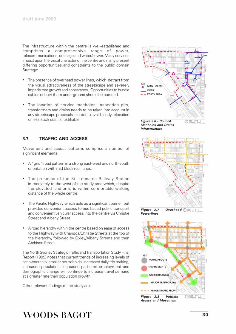
The infrastructure within the centre is well-established andcomprises a comprehensive range of power,telecommunications, drainage and water/sewer. Many servicesimpact upon the visual character of the centre and many presentdiffering opportunities and constraints to the public domainStrategy:
• The presence of overhead power lines, which detract fromthe visual attractiveness of the streetscape and severelyimpede tree growth and appearance. Opportunities to bundlecables or bury them underground should be pursued.
• The location of service manholes, inspection pits,transformers and drains needs to be taken into account inany streetscape proposals in order to avoid costly relocationunless such cost is justifiable.
3.7 TRAFFIC AND ACCESS
Movement and access patterns comprise a number ofsignificant elements:
• A “grid” road pattern in a strong east-west and north-southorientation with mid-block rear lanes.
• The presence of the St. Leonards Railway Stationimmediately to the west of the study area which, despitethe elevated landform, is within comfortable walkingdistance of the whole centre.
• The Pacific Highway which acts as a significant barrier, butprovides convenient access to bus based public transportand convenient vehicular access into the centre via ChristieStreet and Albany Street.
• A road hierarchy within the centre based on ease of accessto the Highway with Chandos/Christie Streets at the top ofthe hierarchy, followed by Oxley/Albany Streets and thenAtchison Street.
The North Sydney Strategic Traffic and Transportation Study FinalReport (1999) notes that current trends of increasing levels ofcar ownership, smaller households, increased daily trip making,increased population, increased part-time employment anddemographic change will continue to increase travel demandat a greater rate than population growth.
Other relevant findings of the study are:
Figure 3.6 - CouncilManholes and DrainsInfrastructure
Figure 3.7 - OverheadPowerlines
Figure 3.8 - VehicleAccess and Movement
MAN HOLES
PIPES
STUDY AREA
ROUNDABOUTS
TRAFFIC LIGHTS
PACIFIC HIGHWAY
MAJOR TRAFFIC FLOW
MINOR TRAFFIC FLOW
31
public domain strategyst. leonards
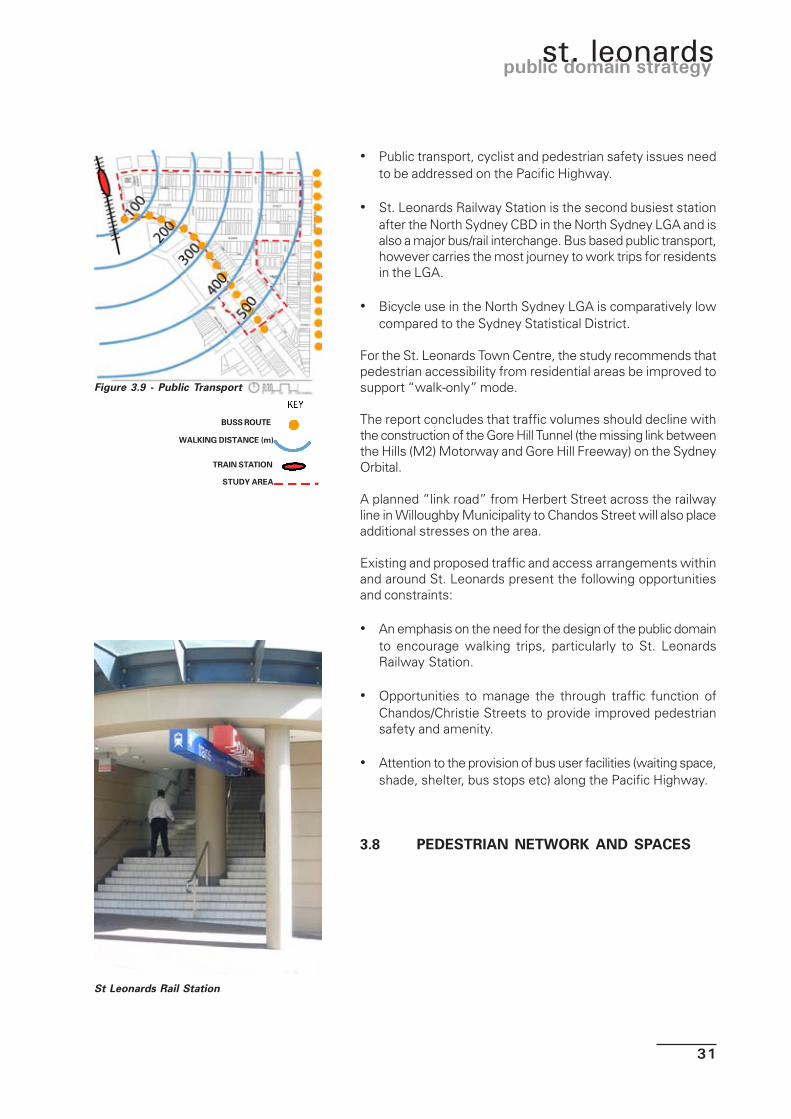
• Public transport, cyclist and pedestrian safety issues needto be addressed on the Pacific Highway.
• St. Leonards Railway Station is the second busiest stationafter the North Sydney CBD in the North Sydney LGA and isalso a major bus/rail interchange. Bus based public transport,however carries the most journey to work trips for residentsin the LGA.
• Bicycle use in the North Sydney LGA is comparatively lowcompared to the Sydney Statistical District.
For the St. Leonards Town Centre, the study recommends thatpedestrian accessibility from residential areas be improved tosupport “walk-only” mode.
The report concludes that traffic volumes should decline withthe construction of the Gore Hill Tunnel (the missing link betweenthe Hills (M2) Motorway and Gore Hill Freeway) on the SydneyOrbital.
A planned “link road” from Herbert Street across the railwayline in Willoughby Municipality to Chandos Street will also placeadditional stresses on the area.
Existing and proposed traffic and access arrangements withinand around St. Leonards present the following opportunitiesand constraints:
• An emphasis on the need for the design of the public domainto encourage walking trips, particularly to St. LeonardsRailway Station.
• Opportunities to manage the through traffic function ofChandos/Christie Streets to provide improved pedestriansafety and amenity.
• Attention to the provision of bus user facilities (waiting space,shade, shelter, bus stops etc) along the Pacific Highway.
3.8 PEDESTRIAN NETWORK AND SPACES
Figure 3.9 - Public Transport
BUSS ROUTE
WALKING DISTANCE (m)
TRAIN STATION
STUDY AREA
St Leonards Rail Station
32
draft june 2003
Given the potential levels of development within St. Leonardsthe intensity of pedestrian activity is expected to significantlyincrease. The centre is inherently attractive to walking due tothe proximity of major activity generators (Willoughby Road,hospital, station etc) and the presence of a grid-pattern roadnetwork which assists movement.
However the character, comfort and safety of the pedestrianenvironment within St. Leonards is currently mixed in terms ofits quality and standard of amenity. For example:
• Chandos Street is a recognised vehicle/pedestrian accidentspot.
• Christie Street is intensively used by both pedestrians andvehicles with a significant conflict between crossingpedestrians and waiting/moving cars.
• The proliferation of roundabouts throughout the centre ispedestrian unfriendly as it removes the need for vehicles tostop or pause.
• Mid-block (rear) laneways are not lit at night and offer poorsafety and security due to negligible casual surveillance,yet provide good rear access to development.
• Provision of building awnings and street trees isuncoordinated and ad-hoc offering negligible pedestrianshelter and visual amenity.
• The provision of active frontages at ground level to providestreetscape interest for pedestrians is negligible.
• With the exception of the Christie Street reserve pedestrianspaces are negligible.
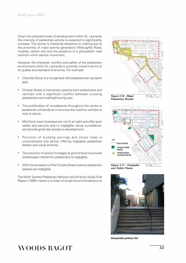
The North Sydney Pedestrian Network and Amenity Study FinalReport (1999) makes a number of broad recommendations to
Figure 3.10 - MajorPedestrian Routes
Inhospitable pathway link
Figure 3.11 - Footpathsand Public Places
FOOT PATHS
PUBLIC OPENSPACE
PEDESTRIANACCESS ROUTE

33
public domain strategyst. leonards
enhance the ‘walkability’ of the North Sydney LGA includingSt. Leonards. These include:
• More audible traffic signals and signal controlled crossings.
• Introduce tactile surface markings.
• Introduce refuge islands and associated medians.
• Encourage provision of weather protection for all non-discretionary pedestrian routes.
• Explore opportunities to reduce road widths for trafficcalming and safety.
More specific comments with regard to St. Leonards andimmediate area comprise:
• Investigate opportunities to develop an east-west pedestrianoverbridge over the railway line immediately to the north ofSt. Leonards Station linking Chandos Street with HerbertStreet.
• Investigate opportunities to provide a pedestrian bridge acrossthe Pacific Highway to provide comfortable pedestrianaccess to the station from the south.
• Reduce the pedestrian barrier effect of the Pacific Highwaythrough the area.
The intensity of pedestrian activity and the existingcharacteristics of the pedestrian environment introduce a
Figure 3.12 Awnings andActive Frontages
Un-cordinated provision of awningsand few active frotnages
AWNINGS
ACTIVE FRONTAGE

34
draft june 2003
number of opportunities and constraints for the public domainStrategy. They include:
• The need to improve pedestrian safety at roundabouts withinthe area.
• The existing road reserves, which are generous in widthand provide opportunities to increase footpath width andreduce road pavement (calming traffic).
• The upgrading of lighting throughout the centre, particularlylaneways.
• A co ordinated approach to enhanced street tree provision.
• Upgrading and provision of new pedestrian crossings(including tactile surface markings) in key pedestrian conflictareas (i.e. Chandos Street and Christie Street).
• Opportunities to explore new pedestrian bridges, particularlyacross the Pacific Highway.

35
public domain strategyst. leonards
4.1 ST. LEONARDS' COMMUNITY MEETING
On 8 August 2002, Council held a community meeting todiscuss and obtain the comments and issues regarding St.Leonards Public Domain as a precursor to this draft Strategy.Despite widespread notification of the meeting, communityattendance was very poor.
However attendees made the following comments:
• Sergeants Lane - Willoughby end - is spacious and welldesigned. The other end - where main pedestrian traffic is -hasn't been made to cope with the traffic. Is now sharedzone but needs widening as it is the main pedestrian accessfrom St. Leonards Station to the Centre. There is conflictbetween service vehicles and pedestrians. The lane ismarked no standing but delivery trucks are parked thereconstantly.
• Getting across Christie Street at Sergeants Lane is difficult -no pedestrian crossing - a left only turn out of SergeantsLane may help.
• People congregate in Forum plaza - has better connectionsto the centre and is a lively spot.
• Conflict with outdoor eating and pedestrians.
• Wind off Highway past Motorola building a problem - needto cut down wind to plaza, without walls.
• Need to improve tunnel - very difficult to cross PacificHighway.
4.0 STAKEHOLDER VIEWS

36
draft june 2003
4.2 COMMUNITY SURVEY
In July 2002, Council distributed a survey to businesses anddwellings in St. Leonards and undertook one-to-one spot surveysat random locations within the centre.
A total of 237 surveys were returned, which represents a goodresponse rate of 43%.
Relevant findings of the survey are summarised as below:
• The majority of respondents were in St. Leonards foremployment of which the majority arrived by car, the nextlargest group were travellers.
• Over two-thirds of respondents stated that they spend timein public areas with the Forum/Courtyard the most popular“public” area mentioned, followed by Christie Street Reserve.The sunny, peaceful and relaxing setting was noted aspositive characteristics of both spaces.
• The majority of respondents felt safe in St. Leonards (a higherresponse than the North Sydney CBD in comparison).However concerns were raised regarding the impacts ofjunkies attracted to the area by medical facilities.
• Where respondents noted that there were areas within thecentre that they did not like, the reasons given includedmicroclimate (cold and windy), rubbish and physicalappearance.
• When asked what facilities respondents would like to seein St. Leonards, the most popular were places to meet people,exhibitions/displays, markets and an outdoor cinema.
• Two thirds of respondents felt that St. Leonards has noidentity, those who said it did referred to its compactcommercial, new and sophisticated nature.
• Just over half of respondents felt that St. Leonards was notpedestrian friendly with insufficient shelter cited as the mainreasons.
When asked to rate the most important issues to the PublicDomain Strategy, the following were noted in order of importance:• pedestrian walkways to/from St. Leonards Station;• additional street crossings for pedestrians;
• even footpaths;• grassed areas in public spaces;
• reduced wind impact; and

37
public domain strategyst. leonards
• places to sit and eat lunch, either sheltered or in the sun.
4.3 ADJOINING COUNCILS
St. Leonards is bordered to the north by Willoughby Counciland to the south by Lane Cove Council.
Officers of both Councils were consulted during the preparationof this Strategy.
Lane Cove council made the following comments:• As Lane Cove Council facilities are used by the workers
and residents of St Leonards Council requested thatdiscussions be held with the view to seeking a benefit toLane cove municipality in return. They suggest this mighttake the form of streetscape improvements along thesouthern side of the Pacific Highway between the railwaystation and Oxley Street to contribute to the ‘gateway effect’sought by the Strategy.
• Improved links between the two areas across the highwayis needed, particularly the tunnel.
• Suggest include consideration of children’s play equipmentin the strategy area.
• Support the ‘greening’ of St Leonards public domain andsuggest details of tree species be developed by consultationbetween the three councils represented in the Strategy area.
Willoughby Council made the following comments:• The Strategy must take into account the proposed Link road
between Christie Street and the Meriton developments onthe railway lands to the north west.
• The State government are preparing a master plan for theRoyal North Shore Hospital which is likely to involveincreased commercial and/or residential development.
• Would like to see the strengthening of pedestrian and greenlinks into their local government area generally from StLeonards public domain.
• Would like a stronger pedestrian connection between thestation and the Royal north shore Hospital site, particularlyto the new commercial development fronting the highway.
• Council would consider upgrading street lighting in ChandosStreet to complement works proposed in the Strategy.
• Council opposes any down grading of the traffic function ofAtchison Street without alternative traffic routes beingidentified.
• Provision should be made for a westbound ‘contra flow’cycle land in Atchison Street.
• Reconfiguration of Atchison Street should ensure safepassage of bikes.

38
draft june 2003
• Council is considering a pedestrian/cycle link between thehospital, the North Sydney TAFE and the ABC site.
• Would like to see the strengthening of pedestrian and greenlinks into their local government area generally from StLeonards public domain.
4.4 CONSULTANT FIRST IMPRESSIONS
As part of the consultant Design Workshop on 15 October 2002,the consultant and Council team, on immediate return from thesite visit, were asked for their first impressions. Commentsmade were:
• Clean slate to invent something new• Nowhere to stop, nowhere you want to stop
• Consistency of plane trees - problems emerging• Need to create spaces• Utilities in reserves• Pedestrian/vehicles conflict - parking• No distinct night time identity
• Road and street lighting inadequate• No outdoor/street amenity/safety at ground level• No attention to public places in new development• Sightlines - trees obstruct views• Loading and parking everywhere
• Laneway conflict - loading and pedestrian unfriendly• Plane trees valued - create avenues in certain streets• Lack of identity• Age of infrastructure - paths, roundabouts, buildings -
discordant streetscapes• Views - vistas obstructed
• Lack of landmarks• Gateways poor
• Lack of heart
• Green streets good• Lack of open space - link new open spaces with greenways
• Lack of active frontages• New development opportunities to borrow space from
forecourts

39
public domain strategyst. leonards
5.1 APPROACH
The Public Domain Strategy represents a concept for theenhancement of the public places of St. Leonards that will deliverlasting benefits to not only the residents and users of the centre,but also property owners and investors.
In this regard, the Strategy is a planning tool that provides afocussed approach to the design and development of the publicplaces and spaces in the centre in a manner that responds to anumber of identified challenges to achieve a stated desiredcharacter.
Thus the Strategy is comprised of a number of components:• A desired character
• Identified challenges• Supporting strategies
5.2 DESIRED CHARACTER
The Strategy is based on the achievement of an agreed futurecharacter for the centre.
The desired character has been derived from the issues andassets within the centre and the inherent opportunities andconstraints that these create for the future of the centre asdetailed in the preceding sections of this report.
In a physical sense, essentially the character of St. Leonardsis the synergy and personal experiences created out of thesum of its distinguishing components that differentiate St.Leonards from other centres within Sydney.
This encompasses the kind of people who live and work in thearea, the mix and proximity of users and activities, built form,vegetation, access and movement, natural environment andtopography.
In identifying St. Leonards character, additional complexityarises from the need to envisage the large scale redevelopmentthat is, and will, take place in the centre, imparting its owninfluence on a new character for the place.
5.0 THE STRATEGIC APPROACH

40
draft june 2003
In this context, the desired future character for St. Leonards isproposed as follows:
St. Leonards will be a vibrant and prosperouslandmark public transport oriented urbanvillage where the north shore railway andPacific Highway meet as the gateway to theNorth Sydney CBD in the south, and theimportant regional institutions/activities to thenorth. Its dense built form coupled with publicdomain works will establish a sheltered,comfortable, interesting and attractivestreetscape at ground level.
Footpaths will accommodate intensepedestrian activity where residents andworkers will mix and mingle, experiencingcasual, friendly encounters. They will accesstransport and/or be entertained, eat andrecreate in inviting intimate commercialestablishments that address and spill out intothe street.
The St. Leonards Public Domain will exhibit thecharacteristics of a cosmopolitan village centre,where its spaces are safe, comfortable andinviting. The centre will be a place to stroll,see and be seen, or retreat in the urbanenvironment.

41
public domain strategyst. leonards
5.3 IDENTIFIED CHALLENGES
Conventional planning strategies typically contain manyobjectives, which they seek to achieve. However, the usualclassification of objectives into categories (such as traffic,pedestrian, movement, land use, etc.) is problematical. It tendsto foster a segregated, rather than integrated, approach todevelopment. This can lead to failure to recognise that planningand design decisions in any one discipline will usually impacton many other matters. For example, the design of the streetenvironment creates an address and exposure, and hencepromotes economic vibrancy with regard to commercialdevelopment. It also creates a sense of place, can enhanceproperty values and is a place to walk and play as well as parkand drive, etc.
Sergeants Lane, a busy pedestrian pathway to St.Leonards Station

42
draft june 2003
The desired character advocated for St. Leonards thereforeextends to a range of challenges which the strategy must aimto address.
These challenges are set out below in no particular order ofimportance:
Challenge No. 1To promote a special character of the centre.Development must promote the Centre's desiredcharacter,achieving a unique “sense of place” through thecreation of a range of attractive, high quality public spaces,streetscapes and public realm and a vibrant, exciting andcompact City “Heart”.
Challenge No. 2To make the Centre as welcoming and inviting as possible forresidents and visitors.The range of services, facilities, activities and spaces in thepublic domain must be diverse meeting the wide ranging needsof residents and visitors alike. The Centre must be perceivedas comfortable and inviting, with no fear of crime or hazard tohealth or well being.
Challenge No. 3To be easily accessible from, and integrated with, the Centre'ssub-region.The public domain must ensure the Centre is easy to understand,navigate and explore. Its form, structure, layout and location ofuses must assist access and movement and not createconfusion, particularly for the visitor.
Challenge No. 4To be cost effective.Development within the public domain must represent anefficient use of land and infrastructure, maximising the costeffective provision of works funded through publicly sourcedfinances.
Challenge No. 5To be equitable.The public domain must serve all the different socio-economicgroups (residents, day visitors, etc) within the area. The designof the Centre's spaces must not discriminate against anyonewho needs to use its facilities and services.

43
public domain strategyst. leonards
6.0 STRATEGY STAGES
6.1 CONTEXT
The confirmation of the broad strategy for the development ofSt. Leonards’ public domain is the most important and vitalfirst step. An agreed approach for St. Leonards forms both thefoundation and framework of the characteristics of theStrategies that follow.
In order to identify an appropriate approach that effectivelyrealises the desired future character, and meets the challengesconfronting St. Leonards, the consultant team has formulatedthree possible stages in improvements to the public domain.
These are not mutually exclusive and can, depending on timeand availability of funds be structured so that they represent aprogressive works programme that may ultimately achieve thedesired outcome.
Similarly, the stages presented are not detailed designs andthe specific elements within each stage present opportunitiesfor a number of detailed design possibilities, guided by choice,based on preferences and priorities.
The stages are based on the following criteria:• Timeframe;• Cost; and• The degree to which they serve to achieve the desired future
character for St Leonards.
They comprise:
• Stage 1: Minimum Intervention (a low-scale public domain strategy that suggests minor works that can be
implemented in the short-term).
• Stage 2: Medium Intervention (a strategy that suggestssome significant works that can be implemented over themedium term).
• Stage 3: Maximum Intervention (a significant strategy thatsuggests major works, some of significant cost, over theshort to long-term).

44
draft june 2003
6.2 STAGE 1: MINIMUM INTERVENTION
6.2.1 Description
Stage 1 essentially represents an approach that proposesminor improvements that can be achieved at minimum costand with minimal pre-planning in terms of design anddocumentation of work. Thus it also presents the scenario thatcan be achieved in the shortest period of time.
DIRECTIONAL SIGNAGE
EXISTING VEGETATION
INFILL TREE PLANTING
INFILL TREE PLANTING
ART & FURNITURE
UPGRADE CHRISTIE RES.
UPGRADE LIGHTING
Figure 6.1 Stage 1: Key Elements

45
public domain strategyst. leonards
Stage 1 responds to the following observations:
• There are immediate opportunities to introduceimprovements to St. Leonards’ public domain.
• There are some immediate deficiencies with St. Leonards’public domain which can be addressed in the short-termwith minimal cost.
• There are opportunities to undertake low key actions whichcan provide immediate noticeable benefits to the publicdomain and which can lay the foundations for moresignificant works over the longer term when finance permits.
This stage is considered to address the immediate priorities interms of improving the centre’s public domain.
6.2.2 Key Elements
The key elements of Stage 1 are:
• Development of a street tree master plan: rationalisation ofexisting street trees, in terms of species, condition, canopyspread, streetscape character and orientation to determinespecies which are appropriate for retention and those whichrequire replacement with an alternative.
• Introduction of some more compact tree species in“constricted spaces”. Plane Trees have been plantedthroughout most of St Leonards’ streetscapes. In somestreets, where space allows, they have been able to growto full potential to form a significant avenue and should beretained and supplemented with infill planting as required.However, in other streets where space is limited and / oroverhead wires are present, root zones have been severelyrestricted and canopies butchered. These species shouldbe replaced with a more compact tree species, such as theornamental Chanticleer Pear (Pyrus calleryana“Chanticleer”).
• Adoption and implementation of a proprietary suite of streetfurniture where existing opportunities exist i.e. the ChristieStreet Reserve, Sergeants Lane and the Mitchell Street Plaza.
• Erection of better way-finding signage at key decision points.
Figure 6.2 vegetation
Figure 6.3 Way FindingSignage Elements
Figure 6.4 LightingElements
Existing vegetation
Proposed vegetation
Proposed vegetation
46
draft june 2003
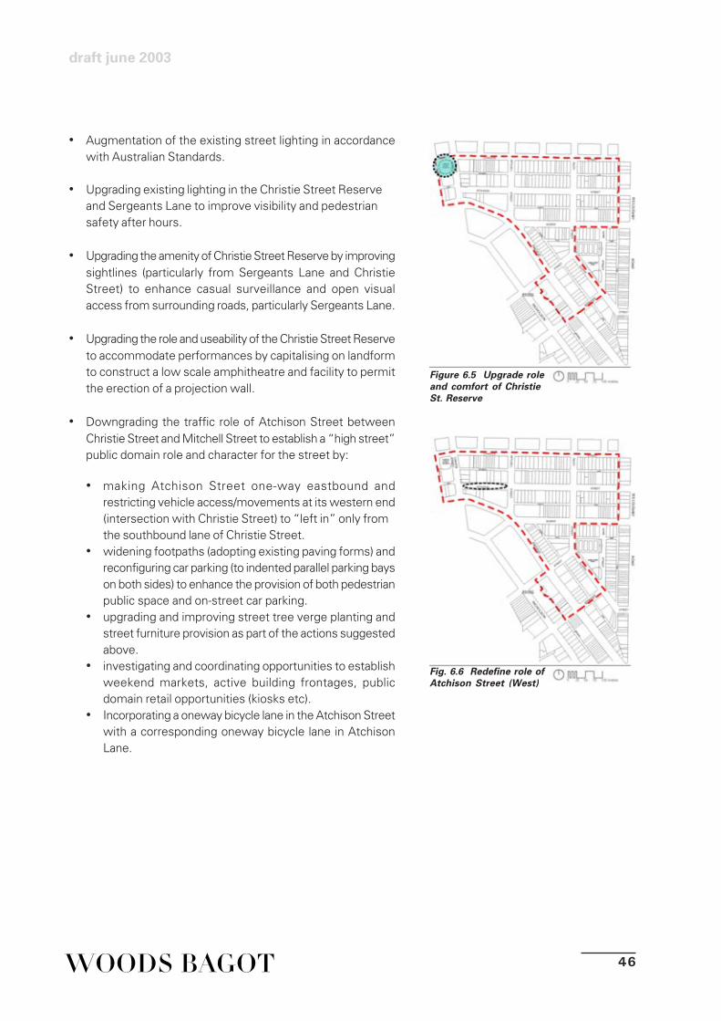
• Augmentation of the existing street lighting in accordancewith Australian Standards.
• Upgrading existing lighting in the Christie Street Reserveand Sergeants Lane to improve visibility and pedestriansafety after hours.
• Upgrading the amenity of Christie Street Reserve by improvingsightlines (particularly from Sergeants Lane and ChristieStreet) to enhance casual surveillance and open visualaccess from surrounding roads, particularly Sergeants Lane.
• Upgrading the role and useability of the Christie Street Reserveto accommodate performances by capitalising on landformto construct a low scale amphitheatre and facility to permitthe erection of a projection wall.
• Downgrading the traffic role of Atchison Street betweenChristie Street and Mitchell Street to establish a “high street”public domain role and character for the street by:
• making Atchison Street one-way eastbound andrestricting vehicle access/movements at its western end(intersection with Christie Street) to “left in” only fromthe southbound lane of Christie Street.
• widening footpaths (adopting existing paving forms) andreconfiguring car parking (to indented parallel parking bayson both sides) to enhance the provision of both pedestrianpublic space and on-street car parking.
• upgrading and improving street tree verge planting andstreet furniture provision as part of the actions suggestedabove.
• investigating and coordinating opportunities to establishweekend markets, active building frontages, publicdomain retail opportunities (kiosks etc).
• Incorporating a oneway bicycle lane in the Atchison Streetwith a corresponding oneway bicycle lane in AtchisonLane.
Fig. 6.6 Redefine role ofAtchison Street (West)
Figure 6.5 Upgrade roleand comfort of ChristieSt. Reserve
47
public domain strategyst. leonards
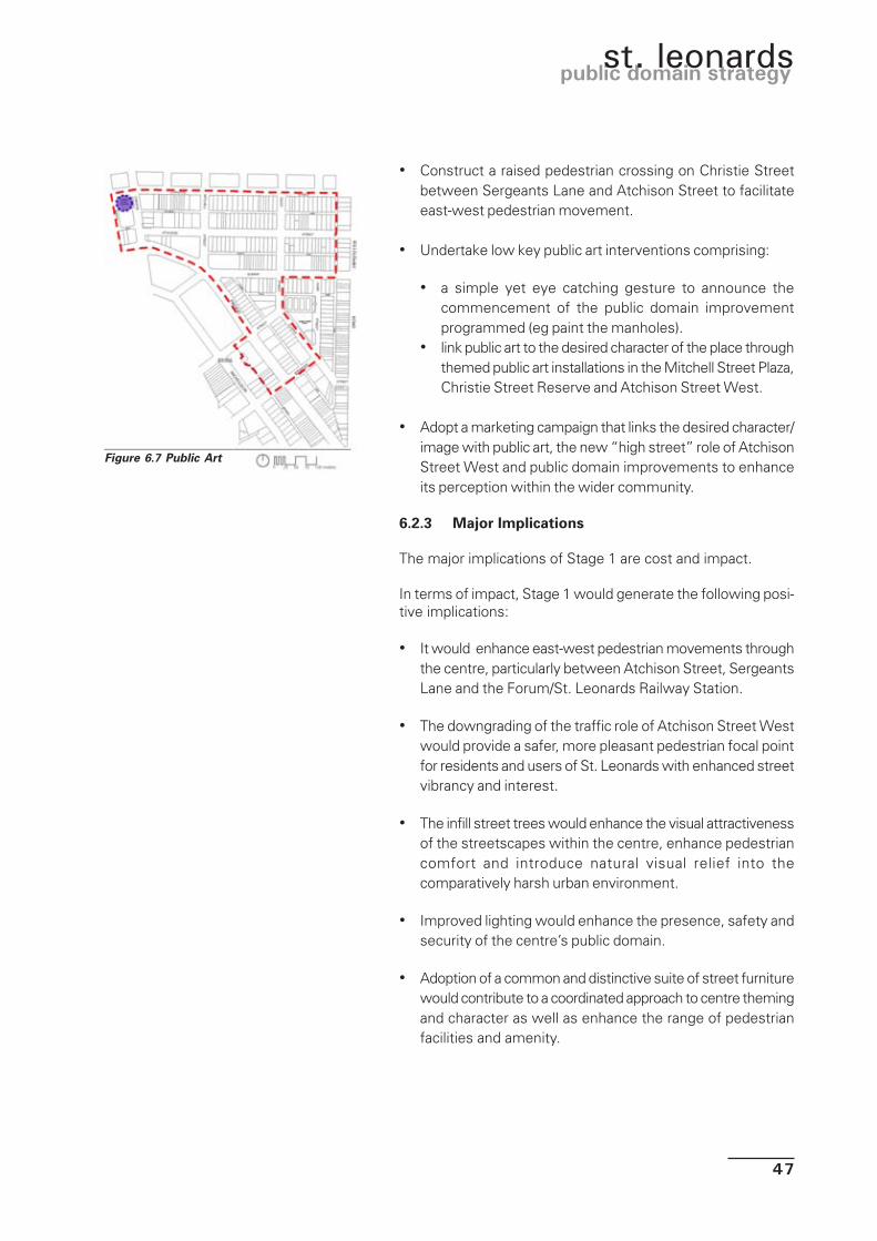
• Construct a raised pedestrian crossing on Christie Streetbetween Sergeants Lane and Atchison Street to facilitateeast-west pedestrian movement.
• Undertake low key public art interventions comprising:
• a simple yet eye catching gesture to announce thecommencement of the public domain improvementprogrammed (eg paint the manholes).
• link public art to the desired character of the place throughthemed public art installations in the Mitchell Street Plaza,Christie Street Reserve and Atchison Street West.
• Adopt a marketing campaign that links the desired character/image with public art, the new “high street” role of AtchisonStreet West and public domain improvements to enhanceits perception within the wider community.
6.2.3 Major Implications
The major implications of Stage 1 are cost and impact.
In terms of impact, Stage 1 would generate the following posi-tive implications:
• It would enhance east-west pedestrian movements throughthe centre, particularly between Atchison Street, SergeantsLane and the Forum/St. Leonards Railway Station.
• The downgrading of the traffic role of Atchison Street Westwould provide a safer, more pleasant pedestrian focal pointfor residents and users of St. Leonards with enhanced streetvibrancy and interest.
• The infill street trees would enhance the visual attractivenessof the streetscapes within the centre, enhance pedestriancomfort and introduce natural visual relief into thecomparatively harsh urban environment.
• Improved lighting would enhance the presence, safety andsecurity of the centre’s public domain.
• Adoption of a common and distinctive suite of street furniturewould contribute to a coordinated approach to centre themingand character as well as enhance the range of pedestrianfacilities and amenity.
Figure 6.7 Public Art

48
draft june 2003
• The implementation of public artworks would enhance therichness of residents and users experiences of St. Leonards,generate visual interest and contribute to the centre’scharacter and theme.
• The promotion of the role, function and streetscape ofAtchison Street West as a vibrant attractive public placewould contribute to its identification by residents and usersof St. Leonards as the symbolic “heart” of the area andengender a sense of community ownership.
• The enhancement of the role and function of the ChristieStreet Reserve would widen its period of useability to includeevenings and weekends as well as enhance safety andsecurity through enhanced sightlines and access.
• Pedestrian way-finding and legibility would be improved bythe placement of directional signage at key decision points.
Figure 6.8 Atchison Street (West) Concept

49
public domain strategyst. leonards
Broad approximations of cost are as follows:
STAGE 1 – COSTS OF DEVELOPMENT
ITEM $ RANGE
• Infill street tree planting $58,760.00
• New (catalogue) street furniture $57,000.00
• New way-finding signage $25,000
• Augment street lighting to Australian Standards $397,000
• Refurbish Christie Street Reserve: -
new lighting $29,375.00
performance amphitheatre $17,000.00
new landscaping, boundary treatments $23,900.00
• New pedestrian crossing on Christie Street (at grade) $21,000.00
• Redefine Atchison Street West: -
partial road closure $77,000.00
widen footpaths (localised) $129,800.00
reconfigure car parking $70,000.000
new verge planting $12,640.00
street furniture $33,440.00
• Public art installations (1 major, 2 minor) $100,000.00
TOTAL $1,039,775.00 *Costs are indicative only
Exclusions include but are not limited to : site decontamination and remediation; Council fees, charges and S94 contributions; consultants,agents and legal fees; design and construction contingency; tactile signage if required; new street name signage; disconnection or diversionof existing services; escalation beyond June 2003; marketing, promotion and display unit costs; + GST

50
draft june 2003
6.3 STAGE 2: MEDIUM INTERVENTION
6.3.1 Description
Stage 2 proceeds from Stage 1 by extending the physical areaand scope of works within the St. Leonards Public Domain.
Figure 6.9 Stage 2: Key Elements
COMPLETE SIGNAGE
STREET TREE THEMES
STREET TREE THEMES
GATEWAY ARTWORK
LANEWAY LIGHTING
SMART POLES
UPGRADE PAVING
SIGNALISE INTERSECTION

51
public domain strategyst. leonards
Stage 2 responds to the following observation:
• There may be financial scope to increase the level ofimprovements to the public domain to enhance theachievement of the project objectives.
• The increased financial scope may be achieved either bythe scale of available funding in the short-term or by theaccumulation of funds through developer contributions in thelonger term.
• The works proposed in Stage 1 provide an effectiveframework on which to base the actions contained withinStage 2 as well as expand the area of influence of the works.
6.3.2 Key Elements
The key elements of Stage 2, in addition to Stage1, are:
• Upgrade all paving in the area bounded by Sergeants Laneto the west and Oxley Street to the east, encompassing thearea of the centre with the greatest redevelopment potentialand propensity for change.
• Extend the erection of directional signage throughout thecentre to facilitate pedestrian movement to the St. LeonardsRailway Station to the west and the Willoughby Roadcommercial strip to the east.
• Extend the redefined role and streetscape works identifiedin Stage 1 for Atchison Street West to encompass AtchisonStreet Central including the completion of burying thepowerlines in West and Central Atchison Street whererequired.
• Provide lighting to all laneways west and north west of OxleyStreet.
Figure 6.10 PavingElements
Figure 6.11 SignageElements
Figure 6.12 RedefineRole of Atchison St.(Central) & Bury Power

52
draft june 2003
• Conversion of the existing roundabout at the Christie Street/Chandos Street intersection into traffic signals, phased withlights at chandos/Pacific Highway intersection, to enhancepedestrian comfort, safety and movement.
Figure 6.14 SignaliseIntersection
Figure 6.13 LightingElement
Figure 6.15 Atchison St (Central) Concept

53
public domain strategyst. leonards
• Adopt street tree themes for key streets (Chandos, Albany,Oxley, Atchison and Mitchell) that link with the Christie StreetReserve and Mitchell Street Plaza to emphasise the roleand importance of these places in the centre. Tree speciesshould be densely planted, but clear trunked, to encouragebirds and other native wildlife.
• Introduce “smart poles” throughout all major streets in theCentre including opportunities for banners.
• Implement an Arts Programme that facilitates the rotatingplacement of installations at the Christie Street Reserve andMitchell Street Plaza. The Mitchell Street Plaza in particularshould accommodate constantly changing, dramatic/dynamic, eye catching and memorable art works thatemphasise the plaza’s gateway role and local landmark statuswithin the Pacific Highway Streetscape.
Figure 6.17 Smart PoleElements
Figure 6.16 Street TreeTheme Elements

54
draft june 2003
6.3.3 Major Implications
The major implications of Stage 2 works are cost and impact.
In terms of impact, Stage 2 would generate the following implications in addition tothose identified in Stage 1:
• It would provide a greater level of enhancement of east-west pedestrianmovements across the centre between Willoughby Road and the railway station.
• It would establish an attractive, inviting and comfortable pedestrian orientedpublic domain in that part of the centre likely to experience the greatest amountof change in the short to medium term.
• The works in Atchison Street central would expand the influence and significanceof Atchison Street as the physical and symbolic heart of the centre.
• It would “signpost” St. Leonards through the erection of memorable artworks,at the major vehicular gateway, the Pacific Highway.
• The provision of distinctly different street tree species in key streets wouldfacilitate the establishment of a local character and legibility.
Broad approximations of cost are as follows:
ITEM $ RANGE
• New paving to west of Oxley $1,175,000.00
• Redefine Atchison Street Central: -
partial road closure $57,000.00
widen footpaths $149,800.00
reconfigure car parking $80,000.00
new verge planting $10,440.00
new street furniture $22,000.00
• New directional and way finding signage $37,500.00
• Bury powerlines in Central and West Atchison St. $214,000.00
• New lighting in laneways to west of Oxley St. $308,000.00
• New smart poles in Key Streets $683,000.00
• New traffic signals at Christie /Chandos Street $250,000.00
• New street tree theme in key streets $74,840.00
• Arts programme $750,000.00
TOTAL $3,811,580.00 *Costs are indicative onlyExclusions include but are not limited to : site decontamination and remediation; Council fees, charges and S94 contributions; consultants,agents and legal fees; design and construction contingency; tactile signage if required; new street name signage; disconnection or diversionof existing services; escalation beyond June 2003; marketing, promotion and display unit costs; + GST

55
public domain strategyst. leonards
6.4 STAGE 3: MAXIMUM INTERVENTION
6.4.1 Description
Stage 3 proceeds from both Stages 1 and 2 and proposes awide scale upgrading and enhancement of all public domainplaces throughout St. Leonards.
This Stage responds to the following observations:
• It is appropriate, and equitable, to prepare a strategy thataddresses the whole of the centre in a comprehensive way,despite funding and timing issues, to ensure a centre-wideupgrading of the public domain.
Figure 6.16 Stage 3: Key Elements
ON STREET PARKING
NEW FOOTBRIDGE
PROPOSED VEGETATION
SIGNALISATION
PUBLIC ART
UPGRADE CLARK LANE
CANOPY LIGHTING
OXLEY STREET
PROPOSED VEGETATION
PAVEMENT
DIRECTIONAL SINAGE

56
draft june 2003
Figure 6.19 NewFootbridge Element
• The extent of redevelopment, increase in density ofpedestrian, vehicle and land use activity, and the scale ofchange that will take place in St. Leonards over the long-term warrants a comprehensive public domain strategy.
6.4.2 Key Elements
The key elements of Stage 3, in addition to those elementsidentified in Stages 1 and 2, are:
• Burying powerlines throughout the centre.
• Extending the new paving to the public domain throughoutthe centre.
• Instigating an optimum lighting upgrade resulting in totalcompliance with Australia Standards.
• Designing and installation of custom light poles and a suiteof custom designed street furniture.
• Provision of under canopy lighting along Atchison Street andSergeants Lane to emphasise the role and function of thepathway.
• Erection of a pedestrian bridge across the Pacific Highwayat the Mitchell Street Plaza to enhance pedestrianmovements .
• Conversion of the existing roundabouts at the Chandos Street/Oxley Street and Albany Street/Oxley Street intersectionsinto traffic signals to enhance pedestrian comfort, safetyand movement.
Figure 6.17 Lighting,Powerlines, Paving, CustomFurniture Elements
Figure 6.18 CanopyLighting Element

57
public domain strategyst. leonards
Figure 6.23 On Street ParkingElement
Figure 6.22 SignalisationElements
Figure 6.23 Clarke LaneUpgrade
• Investigate opportunities to increase provision of on-streetcar parking on Pacific Highway between Christie Street andMitchell Street after completion of the Gore Hill Tunnel.
• Enhance role and visual attractiveness of Clarke Lane withlandscaping and pedestrian crossing at Albany Street.

58
draft june 2003
Figure 6. 26 Oxley Street Concept
Figure 6.25 Oxley StreetNarrowing (refer Fig. 26)
• Widen the western verge of Oxley Street and establish alinear forest along western edge of the road reserve.
St Leonards Station, excellent access to theSydney Metropolitan Area
EXISTING ROUNDABOUTS

59
public domain strategyst. leonards
6.4.3 Major Implications
The major implications of Stage 3 are cost and impact.
In terms of impact, Stage 3 would generate the followingimplications in addition to those identified in Stages 1 and 2:
• The provision of a pedestrian bridge across the Highwaywould provide superior pedestrian linkages, safety andaccess to and within that part of the strategy area acrossthe Highway. However, in terms of visual impact, the designof the bridge must exhibit a high quality/standard and beresponsive and sensitive to its surroundings.
• Burying of powerlines would significantly enhance the visualappearance of the public domain but would come at a highcost.
• The Oxley Street Linear Park would offer a significant publicspace in the eastern half of the centre, contributing to greeningof the streetscape and strengthened sense of place.
• The conversion of all remaining roundabouts to traffic signalswould both calm traffic, reduce environmental impacts andenhance pedestrian movement and safety.
Broad approximations of cost are as follows:
*Costs are indicative onlyExclusions include but are not limited to : site decontamination and remediation; Council fees, charges and S94 contributions; consultants,agents and legal fees; design and construction contingency; tactile signage if required; new street name signage; disconnection or diversionof existing services; escalation beyond June 2003; marketing, promotion and display unit costs; + GST
ITEM $ RANGE
• Bury powerlines through centre $1,401,250.00
• New paving throughout centre $1,039,000.00
• Optimum light upgrade $667,500.00
• Under canopy lighting to Atchison St./Sergeant Lane -
• Custom light poles and furniture $300,000.00
• New pedestrian bridge $800,000.00
• New traffic signals x 2 $700,000.00
• New Oxley Street Linear Park: -
landscaping $61,680.00
widen verge $175,000.00
• Clarke Lane landscaping and crossing $38,400.00
• New On-street Parking Pacific Highway $46,000.00
TOTAL $5,428,830.00

60
draft june 2003
6.5 ASSESSMENT OF STAGES
Each stage can be compared against the degree by which theirkey elements achieve the desired character and address thechallenges for the centre presented in Section 5.0 above.
The most effective manner by which the stages can becompared is through the use of a matrix or table, whereby aquick comparison of the attributes of each stage is assessedagainst the challenges.
The table below uses symbols to illustrate potential success ofeach Stage to address the challenges and meet the Strategyobjectives.
The assessment of possible benefits/disbenefits in the tableabove has required the consultants to make subjective/qualita-tive judgements.
Nevertheless, the assessments illustrated are considered rea-sonable given the brief for this study and enable readers toquickly identify critical benefits and disbenefits to assist in de-cision making.
KEYLow benefit
High benefit

61
public domain strategyst. leonards
7.0 ADDITIONAL DETAILED STUDIESRECOMMENDED
1. It is recommended that a comprehensive traffic strategy beprepared to ensure minimal impact on surrounding streetnetwork and Pacific Highway.
2. A detailed lighting strategy should be prepared, particularlylooking at lighting theme, safety and security, main roadsand laneway lighting designs.
3. If the detailed design of Atchison Street results in any lossof on-street parking, an analysis of any revenue lost toCouncil should be prepared.
4. A detailed street tree planting plan should be prepared.

62
draft june 2003