subdivision (preliminary plat) application · pdf filecontact name (print): phone: address:...
TRANSCRIPT

G:\Applications\Original Application Documents\Subdivision Application (Preliminary Plat).doc
CITY OF MAPLE GROVE 12800 ARBOR LAKES PARKWAY
P. O. BOX 1180 MAPLE GROVE MN 55311-6180
763-494-6040 SUBDIVISION (PRELIMINARY PLAT) APPLICATION Name of Subdivision (Project Name:
For Residential Projects: Number of Lots ______, Attached/Detached (circle), Number of Affordable Units______, PID#’s: Legal Description: OWNER:
CONTACT NAME (PRINT): PHONE:
ADDRESS: FAX:
CITY/ZIP: E-MAIL:
APPLICANT:
CONTACT NAME (PRINT): PHONE:
ADDRESS: FAX:
CITY/ZIP: E-MAIL:
The following information is submitted in support of the application:
_____1) Completed Application for Subdivision (Submission Deadline Date FIRM) _____2) Application fee: Residential: $400 plus $10 lot/unit or plus $50 per acre for multiple dwellings.
Nonresidential: $400 plus $75 per acre _____3) Legal description of the property to be divided _____4) Narrative of Project _____5) Completed Acknowledgement of Responsibility form _____6) Completed Affirmation of Sufficient Interest form _____7) Completed Application to appropriate Watershed District _____8) Names and addresses of property owners within 500' of subdivision requested, certified
by the Auditor of Hennepin County (Mail attached letter to John Smith-Hennepin Cty) _____9) Blue line copies of the following:
____a) 15 folded copies of a Preliminary Plat ____b) 15 folded copies of the preliminary grading, drainage and utility plans
____10) One set (8½" 11") paper copy of all documents listed in #9 above. ____11) One computer file in .jpg and .dxf or .dwg of all maps listed in #9 above. ____12) Fourteen (14) sets (11” 17”) stapled paper copies of all document listed in #9 above. ____13) Information required on attached Hennepin County Preliminary Plat/Development Review
Process pamphlet dated January 2010. * PLEASE NOTE: Prior to release of the final plat by the City, a registered property abstract (for Torrens property) or an updated certified abstract of title (for abstract property) must be submitted per State Statute, Title Commitments cannot be accepted to fulfill title submittal requirements.
Office Use Only: CASE #____________ PLANNER: __________________

G:\Applications\Original Application Documents\Subdivision Application (Preliminary Plat).doc
In an effort to promote housing affordability, applicants for residential proposals are strongly encouraged to explore all possible means by which affordability may be realized in their projects. To that end and, as a means to promote knowledge on the issues and factors involved in affordable housing, any and all narrative, graphic, statistical and/or financial information relative to those efforts in the proposal should be submitted with the application.
City of Maple Grove Subdivision Application (Preliminary Plat) Page 2
I fully understand that all of the above required information must be submitted at least 28 days prior to a Planning Commission meeting to ensure review by the Planning Commission on that date.
Applicant's Signature Printed Name Date

ACKNOWLEDGEMENT OF RESPONSIBILITY This is to certify that I am making application for the described action by the City and that I am responsible for complying with all City requirements with regard to this request. This application should be processed in my name and I am the party whom the City should contact regarding any matter pertaining to this application. I have read and understand the instructions supplied for processing this application. The documents and/or information I have submitted are true and correct to the best of my knowledge. I will keep myself informed of the deadlines for submission of material and of the progress of this application. I understand that this application may be reviewed by City staff and consultants. I further understand that additional information, including, but not limited to, traffic analysis and expert testimony may be required for review of this application. I agree to pay to the City upon demand, expenses, determined by the City, that the City incurs in reviewing this application and shall provide an escrow deposit to the City in an amount to be determined by the City. Said expenses shall include, but are not limited to, staff time, engineering, legal expenses and other consultant expenses. I agree to allow access by City personnel to the property for purposed of review of my application and to erect a temporary sign indicating the application proposed. Signature of applicant Date Name of applicant Phone (Please Print) Name and address of Contact (if other than applicant) Phone Number Date
G:\Applications\Original Documents\Acknowledgement of Responsiblity.doc

AFFIRMATION OF SUFFICIENT INTEREST I hereby affirm that I am the fee title owner of the below described property or that I have written authorization from the owner to pursue the described action. Name of applicant (Please Print) Street address/legal description of subject property Signature Date If you are not the fee owner, attach another copy of this form which has been completed by the fee owner or a copy of your authorization to pursue this action. If a corporation is fee title holder, attach a copy of the resolution of the Board of Directors authorizing this action. If a joint venture or partnership is the fee owner, attach a copy of agreement authorizing this action on behalf of the joint venture or partnership.
G:\Applications\Original Documents\Affirmation of Sufficient Interest.doc
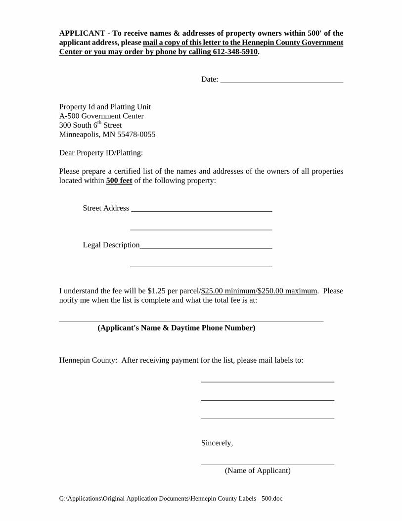
G:\Applications\Original Application Documents\Hennepin County Labels - 500.doc
APPLICANT - To receive names & addresses of property owners within 500' of the applicant address, please mail a copy of this letter to the Hennepin County Government Center or you may order by phone by calling 612-348-5910.
Date: Property Id and Platting Unit A-500 Government Center 300 South 6th Street Minneapolis, MN 55478-0055 Dear Property ID/Platting: Please prepare a certified list of the names and addresses of the owners of all properties located within 500 feet of the following property:
Street Address
Legal Description
I understand the fee will be $1.25 per parcel/$25.00 minimum/$250.00 maximum. Please notify me when the list is complete and what the total fee is at: ___________________________________________________________________
(Applicant's Name & Daytime Phone Number) Hennepin County: After receiving payment for the list, please mail labels to:
Sincerely,
(Name of Applicant)
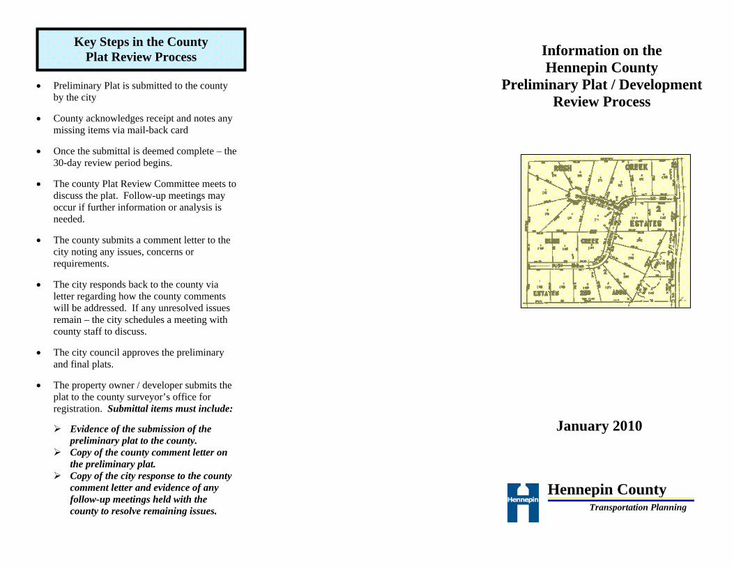
• Preliminary Plat is submitted to the county
by the city • County acknowledges receipt and notes any
missing items via mail-back card
• Once the submittal is deemed complete – the 30-day review period begins.
• The county Plat Review Committee meets to
discuss the plat. Follow-up meetings may occur if further information or analysis is needed.
• The county submits a comment letter to the
city noting any issues, concerns or requirements.
• The city responds back to the county via
letter regarding how the county comments will be addressed. If any unresolved issues remain – the city schedules a meeting with county staff to discuss.
• The city council approves the preliminary
and final plats.
• The property owner / developer submits the plat to the county surveyor’s office for registration. Submittal items must include:
Evidence of the submission of the
preliminary plat to the county. Copy of the county comment letter on
the preliminary plat. Copy of the city response to the county
comment letter and evidence of any follow-up meetings held with the county to resolve remaining issues.
Information on the Hennepin County
Preliminary Plat / Development Review Process
January 2010
Key Steps in the County Plat Review Process
Hennepin County
Transportation Planning

This brochure was developed to clarify how the county plat review process works, who is responsible for submittals to the county, and what type of response schedule can be anticipated. Minnesota State Statutes MS 505.02, 505.03 and 462.358 stipulate that cities need to submit plats to the county for review and comments. These statutes also specify what items of information must be submitted and what time schedules apply.
For formal plat reviews, the county does not accept plat submissions from third parties – the submissions must come from the city directly. City submission is important to ensure completeness of the submission, provide consistency in the process, and to assure good communication. Prior to a formal submittal, county staff is very willing to examine concept layouts, preliminary site plans, or sketch plans. Cities, developers, project consultants, or property owners can submit this type of draft information. The benefit of an early review is that many issues can be identified and possibly resolved prior to the formal plat review process (often speeding up all subsequent reviews).
Preliminary Plats should be submitted to:
Hennepin County Transportation Planning Division
1600 Prairie Drive Medina, MN 55340-5421
Questions or comments can be directed to:
Bob Byers, P.E., Senior Professional Engineer (612) 596-0354
Plat submittals to the county should include a transmittal letter and a set of legible plans that include the following information:
The transmittal letter should include the city contact person, the dates of upcoming city actions such as Planning Commission or City Council meetings, and when a response is needed from the county.
A location map of the site relative to area roadways and local streets.
A site plan map with scaled dimensions authenticated by a registered engineer or land surveyor showing: • Date, title, scale, and north arrow • All existing and proposed property lines • Lot dimensions, right-of-ways, & easements • Existing centerline and paved area of the
county roadway (which is not always centered in the right-of-way)
• Proposed development building footprints • Parking lot layouts, aisle configuration • Locations of ingress and egress to the
proposed platted area including existing and proposed driveway locations.
• Locations of other nearby driveways, street intersections and access points on the county roadway in the vicinity of the proposed plat. This would include driveways immediately adjacent to or across from the proposed plat.
• The outlet for and means of disposal of surface waters from the proposed platted area
A written description of the current and proposed use of the property including land use type (commercial, industrial, residential, etc.) and specific uses (discount store, convenience center, etc.) if known.
If the plat is for non-residential uses, include an estimate of the amount of daily traffic the development is expected to generate.
County staff evaluates proposed plats for a number of items that affect county roadways. Some examples of review items include;
Safety Issues • Conformance with entering sight distance guidelines • Unusual weaving & merging maneuver conflicts • Turn lane / auxiliary lane needs
Access Management • Proposed driveway and street entrance compliance
with county access spacing guidelines • Opportunities for access reorientation and / or
consolidation • Driveway design, throat lengths
Right-of-Way Needs • Anticipated future roadway section • Right-of-way needs for turn lanes / auxiliary lanes • Other needs (pedestrian / bike accommodations)
Operational Elements • Intersection capacity analysis • Turn lane / auxiliary lane design configurations • Traffic control needs • Potential on-site circulation impacts ?
Pedestrian and Bicycle Accommodations • Is roadway designated as part of a city bike plan or
the County Bicycle System Plan ?
Miscellaneous Items • Drainage needs (road and / or site ?). Any
encroachments within roadway right-of-way ? • Proposed grading impacts
State Statutes provide the county up to 30 calendar days for review after receipt of the plat. This review period only starts when the county receives a complete plat submittal. As part of the plat review process, the county will confirm the receipt of the plat with the city and provide notification of any missing information. The back page of this brochure illustrates the key time points for the county review process.
Purpose of this Brochure
Who Should Submit Plats ?
Plat Submittal Checklist
Where to Submit Plats
How are Plats Evaluated ?
Review Schedule

Sec. 30-14. Short plat procedure.
The short plat review process shall require submission of the same information and shall follow the same procedures as are required for preliminary and final plats, except that the preliminary plat and final plat may be reviewed together in one meeting by the planning commission and then by the city council, thereby shortening the review process. The fee for the short plat review process shall be as established by the city council as set forth in chapter 16, article XI. Wherever any conflict between requirements for preliminary plats and final plats is created by such combined considerations, those provisions which require greater public notice and disclosure shall govern. (Code 1984, § 350:15) Sec. 30-15. Review and approval of preliminary plat. (a) Required submittals. (1) An application for preliminary plat review, application fee and preliminary plat with required content and submittals as
specified in section 30-16 shall be delivered to the zoning administrator. The required filing fees, sureties, escrows and deposits are as established by the city council as set forth in chapter 16, article XI, and any necessary applications for variances from or amendment of the provisions of this Code shall be submitted with the required fees, sureties, escrows and deposits.
(2) The application and required submittals shall be delivered at least 28 days prior to the regular planning commission
meeting at which it will be scheduled. (3) The application shall be considered as being officially delivered when all the information requirements are complied
with. (b) Hearing. (1) Upon delivery of the application, the zoning administrator shall set a public hearing date before the planning commission
in accordance with subsection (a)(2) of this section, and distribute the preliminary plat and submittals to appropriate staff and referral agencies. The planning commission shall conduct the hearing, and report its findings and make recommendations to the city council.
(2) Notice of the hearing shall consist of a property identification number and street address or common description, a
description of the request, and a map detailing the property location, and shall be published in the official newspaper at least ten days prior to the hearing.
(3) Written notification of the hearing shall be mailed at least ten days prior to the hearing date to all owners of land within
500 feet of the boundary of the property in question. (c) Technical assistance reports. After the public hearing has been set, staff shall prepare technical reports where appropriate, and provide general assistance in preparing a recommendation on the action to the city council. (d) Review by other agencies or jurisdictions. The zoning administrator shall refer copies of the preliminary plat to the park board and county, state or other public jurisdictions for their review and comment, where appropriate. (e) Planning commission action. The planning commission shall make a recommendation to the city council within 30 days following the close of the public hearing unless an extension of the review period has been agreed to by the applicant. If the recommendation of the planning commission has not been received in time to meet the requirement, the council may act on the preliminary plat without such recommendation. (f) City council action. (1) If all requirements of this chapter and as additionally imposed by the planning commission are complied with, the council
shall act upon the preliminary plat and may impose conditions and restrictions which are deemed necessary within 120 days following delivery of an application and written acknowledgment by the city that the application is in compliance with this Code, unless an extension of the review period has been agreed to by the applicant. If the council fails to approve or disapprove the preliminary plat within such period, the preliminary plat shall be deemed approved and upon demand the city shall execute a certificate to that effect.
(2) If the preliminary plat is approved by the city council or by act of law, the subdivider must submit the final plat within
one year after such approval or, subject to the provisions of Minn. Stats. § 462.358, subd. 3c, and subject to the following, approval of the preliminary plat shall be void:
a. At any time within 30 days before such deadline, the subdivider may file with the zoning administrator a
written request that the deadline be extended one year beyond the deadline date of the preliminary plat approval.
b. The zoning administrator shall place the subdivider's request on the agenda of a regularly scheduled council

meeting to be held within 30 days of such filing if in his opinion no change has occurred in any land use restriction or the comprehensive plan, or any other official control affecting the use, development density, lot size, lot layout, or dedication or platting required or permitted by the approved preliminary plat. If good cause is shown, the council may grant the extension. The request may be approved by the council as an item on its consent agenda.
c. Only one such extension request may be made. d. Failure to file an extension request in a timely fashion, or the change of any restriction or control referred to in
(f)(2)b of this section will require the submission of a new application for subdivision approval. (3) If the preliminary plat is denied by the city council, the reasons for such action shall be recorded in the proceedings of the
council and transmitted to the applicant. a. Revisions to an approved preliminary plat may be necessary as a result of public improvement feasibility
studies or other new information that renders any aspect of the approved plan questionable. b. Any revision which, in the determination of the zoning administrator or planning commission, results in a
significant change to the approved preliminary plat shall be subject to a public hearing as prescribed in subsection (b) of this section.
c. The city council may also require such revisions in the preliminary plat as it deems necessary for the health,
safety, general welfare or convenience of the city. d. A preliminary plat shall be denied if the applicant has failed to determine if a mound management plan is
necessary. (4) Written notification of the city council action shall be sent to the applicant within one week of such action. (Code 1984, § 350:18; Ord. No. 04-09, § 1, 4-19-2004) Sec. 30-16. Data required for preliminary plat. (a) Required submittals. Fifteen sets of all preliminary plat drawings with any necessary supplementary information, one set of 8 1/2-inch by 11-inch paper copy of all maps thereof, and a list of property owners located within 500 feet of the land proposed to be subdivided shall be submitted. The list shall be obtained from and certified by the county. The preliminary plat shall contain the following information: (1) General requirements. The plan shall contain the following: a. Proposed name of the subdivision. Names shall not duplicate or too closely resemble names of existing
subdivisions within the county. b. Location of boundary lines in relation to a known section, quarter section or quarter-quarter section line
comprising a legal description of the property. c. Names and addresses of all persons having an interest in the property, and the developer, designer and
surveyor, together with their registration number. d. Graphic scale of plat, not less than one inch to 100 feet. e. Date and north arrow. (2) Existing conditions. The plan shall contain the following: a. Boundary line of the proposed subdivision, clearly indicated. b. Existing zoning classifications for land within and abutting the subdivision. c. A dimensional summary including area of the proposed subdivision, street rights-of-way, parks and trailways,
wetlands, lots and outlots, and average lot area and width. d. Location, dimensions, names and types of any and all existing or previously platted streets or other public
ways, railroad and utility rights-of-way, parks and other public open spaces, permanent buildings and structures, easements, sections and district boundaries of taxing, fire, watershed, school, governmental and other such authorities having jurisdiction within the tract and to a distance of 200 feet beyond the tract.
e. Location and size of existing sewers, water mains, culverts or other underground facilities within the tract and
to a distance of 200 feet beyond the tract. Such data as grades, invert elevations, and locations of catchbasins,

manholes and hydrants shall also be shown. f. Boundary lines of adjoining unsubdivided land, within 200 feet, identified by name and ownership, including
all contiguous land owned or controlled by the applicant. Where the applicant owns property adjacent to that which is being proposed for the subdivision, the applicant shall submit a sketch plan of the remainder of the property as to show the possible relationships between the proposed subdivision and future adjacent subdivision.
g. Topographic data, including contours at vertical intervals of not more than two feet. Watercourses, marshes,
rock outcrops, power transmission poles and lines, and other significant features shall also be shown. USGS datum shall be used for all topographic mapping where feasible.
h. Location, dimensions, and other identifying characteristics of any and all historical, archeological, cultural and
human burial sites located within and to a distance of 200 feet beyond the applicant's tract, including, but not limited to, Native American burial sites that may be identified.
i. The information required pursuant to section 36-697. (3) Proposed design features. a. Layout of proposed streets showing right-of-way widths, centerline gradients, typical cross sections, and
proposed names of streets in conformance with all applicable city ordinances and policies shall be shown. Street names shall be assigned in accordance with chapter 28, article III.
b. Locations and widths of proposed alleys and pedestrian ways shall be shown. c. Locations of proposed sanitary and storm sewer lines and water mains shall be shown. d. Provision for surface water disposal, drainage, and flood control that complies with applicable ordinances,
statutes and governmental regulations shall be included. e. A plan for soil erosion and sediment control both during construction and after development has been
completed shall be included. The plan shall include gradients of waterways, design of velocity and erosion control measures, landscaping of the erosion and sediment control system and stabilization of disturbed areas, and the plan shall be in conformance with chapter 14, article IV.
f. Layout, numbers, lot areas, and preliminary dimensions of lots and blocks shall be shown. g. Minimum building setback lines as required in chapter 36 shall be shown. h. When lots are located on a curve, the width of the lot at the building setback line shall be shown. i. Any area, other than streets, alleys, pedestrian ways and utility easements, intended to be dedicated or reserved
for public use, including the acreage of each such area, shall be shown. j. Water mains shall be provided to serve the subdivision by extension of an existing community system wherever
feasible. Service connections shall be stubbed into the property line and all necessary fire hydrants shall also be provided. Extensions of the public water supply system shall be designed so as to provide public water in accordance with the standards of the city as contained in the Maple Grove Water Supply and Distribution Report, as amended.
k. Sanitary sewer mains and service connections shall be installed in accordance with the city's comprehensive
sewer plan, as amended. l. Where structures are to be placed on large or deep lots which are subject to potential replat, the applicant
should consider the placement of structures so that lots could be further subdivided. A sketch plan that illustrates a way in which the lots could possibly be resubdivided may be submitted for review and non-binding comment by the city.
m. A vegetation preservation and protection plan that shows those trees proposed to be removed, those to remain,
the types and locations of trees, and other vegetation that is to be planted shall be included. (b) Supplementary information. When deemed necessary by the zoning administrator, any or all of the following supplementary information requirements shall be submitted: (1) Proposed covenants. (2) An accurate soil survey of the subdivision prepared by a qualified person.

(3) A survey prepared by a qualified person identifying tree coverage in the proposed subdivision in terms of type, weakness,
maturity, potential hazard, infestation, vigor, density, and spacing. (4) Such other information as may be requested by the zoning administrator, city engineer, planning commission, or city
council. (Code 1984, § 350:21; Ord. No. 04-04, § 1, 2-2-2004) Sec. 30-17. Design standards for preliminary and final plats.
Design standards for preliminary and final plats are as follows:
(1) Blocks. a. Block length. 1. In general, intersecting streets determining block lengths shall be provided at such intervals as to
serve cross-traffic adequately and to meet existing streets. 2. Where no existing plats control, blocks shall not exceed 1,320 feet in length, except where
topography or other conditions justify a departure from this maximum. 3. In blocks longer than 800 feet, pedestrian ways and/or easements through the block may be required
near the center of the block. b. Block width. The width of the block shall normally be sufficient to allow two tiers of lots having a depth
appropriate to the applicable zoning district as suggested by the minimum lot requirements for that zoning district. Blocks intended for business or industrial use shall be of such width as to be considered most suitable for their anticipated use, including adequate space for off-street parking and deliveries.
(2) Lots. a. Minimum area and width. The minimum lot area and width shall not be less than that established by the zoning
regulations of chapter 36 in effect at the time of the most current completed application for preliminary plat of the affected property. This requirement shall not apply to property used or to be used for a public purpose such as, but not limited to, a well site or park.
b. Ratio of depth to width. No lot shall be more than four times as deep as it is wide. Those portions of a lot within
any abutting wetland, public water, or steep slopes of the type described in subsection (7)c of this section shall be ignored when determining whether the lot complies with this ratio.
c. Corner lots. Corner lots for residential use shall have such dimensions as to permit building setback from both
streets as required in chapter 36. d. Side lot lines. Side lines of lots shall be approximately at right angles to street lines or radial to curved street
lines. e. Frontage. Every lot must have frontage on a public street. f. Watercourses. Lots abutting a watercourse, drainageway, channel or stream shall have additional depth and
width, as required under the provisions of chapter 36 for the floodplain, shoreland and wetland systems districts.
g. Preservation of special features. In the subdividing of any land, due regard shall be shown for all natural
features, such as trees, wetlands, watercourses, historic sites or similar conditions which if preserved will add attractiveness and stability to the proposed development.
h. Lot remnants. All remnants of lots below minimum size left over after subdividing of a larger tract must be
added to adjacent lots, rather than allowed to remain as separate parcels or platted as outlots. i. Tax district boundaries. No lot shall extend over a tax district boundary without approval of the affected district
tax authorities. j. Through lots. Through lots shall not be permitted except where lots back on major streets, or where topographic
or other conditions render subdividing otherwise unreasonable. To allow space for screen planting along the back lot line, such lots, where allowed, shall have an additional depth of at least 20 feet beyond the lot depth appropriate to the applicable zoning district as suggested by the minimum lot requirements for that zoning district.

k. Access restrictions. No residential lots shall receive direct access from a high volume collector or greater
volume street, nor shall any commercial or industrial lot receive direct access from a minor arterial street or a street of greater volume.
(3) Streets, alleys and sidewalks. a. Continuity and arrangement of streets. Except for culs-de-sac, streets shall connect with dedicated or existing
streets on adjoining or adjacent lands, or provide for future connections to adjoining lands, or shall be a reasonable projection of streets on the nearest properties. The arrangement of streets shall be considered in their relation to the reasonable circulation of traffic, to topographic conditions, to runoff of stormwater, and to public convenience and safety, and in their appropriate relation to the proposed uses of the area to be served.
b. Local streets and dead-end streets. 1. Local streets should be so planned so as to discourage their use by non-local traffic. Permanent dead-
end streets are prohibited, but culs-de-sac may be permitted if not contrary to public health, safety, welfare or convenience.
2. Culs-de-sac shall not be longer than 500 feet. The length shall be measured from the centerline of the
adjoining street to the center of the turnaround. 3. The cul-de-sac shall have a minimum right-of-way radius of 60 feet. Where the street right-of-way
intersects the cul-de-sac right-of-way, a 30-foot radius is required. c. Width of right-of-way. Right-of-way shall be dedicated in the following minimum widths. The city engineer
may require such additional right-of-way as he determines will be necessary as a result of approval of the subdivision either standing alone or as a part of a group of subdivisions over time.
1. Local street: 60 feet. 2. Minor collector street: 80 feet. 3. Major collector street: 100 feet. 4. Minor arterial street: 120 feet. d. Railroad crossings. Dedication of sufficient land, as determined by the city council, to ensure a safe view will
be required before the city will accept any street dedication requiring a crossing of a railroad. An indication in writing from the public utilities commission that a crossing permit may be granted shall also be submitted before the preliminary plat can be approved.
e. Street intersections. Under normal conditions, streets shall be laid out so as to intersect as nearly as possible at
right angles, except where topography or other conditions justify variations. Under normal conditions, the minimum angle of intersection of streets shall be 80 degrees. Street intersections less than 125 feet apart, as measured from right-of-way to right-of-way, shall be avoided.
f. Subdivisions abutting major rights-of-way. Wherever the proposed subdivision contains or is adjacent to the
right-of-way of a U.S. or state highway, or railroad, provision shall be made for a frontage road approximately parallel and adjacent to the boundary of such right-of-way, provided that due consideration is given to proper traffic circulation. Such frontage roads shall be located at a distance from the rights-of-way suitable for the appropriate use of the intervening land. Such distance shall be determined with due consideration of the minimum distance required for approach connections to future grade separations, or for lot depths.
g. Sidewalks. A paved sidewalk or pedestrian pathway not less than five feet in width is required on each side of
the paved surface of any street to be constructed in a proposed plat. See section 14-128 and the city's approved standard specifications adopted by the city council pursuant thereto. When a sidewalk parallels a street ending in a cul-de-sac, the sidewalk need not encircle the cul-de-sac but may continue upon its parallel course until it intersects with the pavement of the cul-de-sac and may there terminate.
h. Alleys. 1. Except where justified by special conditions related to the health, safety, welfare or convenience of
the public, alleys will not be approved. 2. Alleys, where provided, shall not be less than 30 feet wide. 3. Dead-end alleys shall be avoided wherever possible, but, if unavoidable, such dead-end alleys may be

approved if adequate turnaround facilities are provided at the closed end. i. Half streets. Dedication of half streets shall not be approved, except where it is essential to the reasonable
development of the subdivision and in conformity with the other requirements of this chapter, where it is found that it will be practical to require the dedication of the other half when the adjoining property is subdivided, or where it becomes necessary to acquire the remaining half by condemnation so that it may be improved in the public interest.
j. Compliance with city transportation plan. For all public ways hereafter dedicated and/or accepted, the
minimum right-of-way, curve radius, curb radius, surfaced width and design standards for streets, alleys and pedestrian ways included in any subdivision shall be in accordance with the city's transportation plan, as amended, and subject to the approval of the city engineer.
k. Street grades. Except upon the recommendation of the city engineer that the topography warrants a greater
maximum, the maximum grade for boulevards perpendicular to the right-of-way shall be four percent, the maximum grade for culs-de-sac shall be six percent, and the maximum grade for all other grades in all streets and alleys in any subdivision shall be eight percent. In addition, there shall be a minimum longitudinal grade on all streets, including culs-de-sac, of not less than 0.5 percent.
l. Reverse curves. Tangents of at least 100 feet in length shall be introduced between reverse curves on collector
streets. m. Reserve strips. Reserve strips controlling access to streets shall be prohibited. n. Horizontal curves. Local street horizontal curves shall be at least 125 feet in centerline radius, for curves
having internal angles of not more than 90 degrees. Where the internal angle exceeds 90 degrees, the minimum curve radius shall be 75 feet. The horizontal curves for collector or greater volume streets shall meet the minimum design criteria for the design speed of the street in accordance with municipal state aid standards.
(4) Easements. a. Width and location. An easement for utilities and drainage at least ten feet wide along the front lot line and five
feet wide along side and rear lot lines shall be provided. If necessary for the extension of main water or sewer lines or similar utilities, easements of greater width may be required along lot lines or across lots.
b. Continuity. Utility and drainage easements shall connect with easements established in adjoining properties.
These easements, when approved, shall not thereafter be changed without the approval of the city council after a public hearing.
c. Easements along watercourses and drainage channels. Easements shall be provided along each side of the
centerline of any watercourse or drainage channel, whether or not shown in the comprehensive plan, to a width sufficient in the judgment of the city council to provide proper maintenance and protection and to provide for stormwater runoff and installation and maintenance of storm sewers, and they shall be dedicated to the city by appropriate language in the owner's certificate.
(5) Erosion and sediment control. The development shall conform to the natural limitations presented by topography and soil
so as to create the least potential for soil erosion. Also see section 30-22(a)(6). (6) Drainage. a. Where municipal storm sewer systems do not exist, or the introduction of such public system is deemed
inappropriate by the city council, provisions for stormwater drainage shall be consistent with the city's storm drainage plan, as amended, and be subject to the review of the city engineer, who shall report to the city council on the feasibility of the plan presented.
b. No plat shall be approved before an adequate stormwater disposal plan is approved by the city engineer and
council, and approval of grade and drainage requirements shall be at the applicant's expense. The use of dry wells for the purpose of stormwater disposal is prohibited.
c. No buildable portion of a subdivision shall be approved on land subject to flooding or containing poor drainage
facilities, and on land which would make adequate drainage of the streets and lots impossible. However, if the applicant agrees to make improvements which will, in the opinion of the city engineer, make the area completely safe for residential occupancy or provide adequate street and lot drainage and conform to applicable regulations of other agencies such as the U.S. Corps of Engineers, or the state department of natural resources, the final plat of the subdivision may be approved. In addition, such plats may not be approved if the cost of providing municipal services to protect the floodplain area would impose an unreasonable economic burden upon the city.

(7) Protected areas. a. Where land proposed for subdivision contains drainageways, watercourses, floodable areas, wetlands or steep
slopes, and thus may be unsuitable for development, the platting and development of those areas shall be consistent with limitations presented by such conditions.
b. Subdivisions shall be designed so that at least 75 percent of the minimum lot area is free of wetland soil types,
water bodies, watercourses, drainageways or floodway areas, or steep slopes (over 18 percent). c. No construction or grading shall be allowed on slopes steeper than 18 percent in grade over a horizontal
distance of 50 feet. d. For land in the S shoreland district, steep slopes shall be defined as set forth in 36-3. (Code 1984, § 350:24) Sec. 30-18. Provision of land for public use. (a) Required. Pursuant to Minn. Stats. § 462.358, subd. 2b, except as otherwise provided in this section, the city requires all owners or developers, as a prerequisite to approval of a plat, subdivision or development of any land, to convey to the city, or dedicate to the public use, a reasonable portion of any such proposal for public use as streets, roads, sewers, electric, gas and water facilities, stormwater drainage and holding areas or ponds, similar utilities and improvements, or parks, playgrounds, trails or open space, such portions to be approved and acceptable to the city. (b) Suitability of dedicated land. Any land to be dedicated as a requirement of this section shall be reasonably adaptable for its proposed use and shall be at a location convenient to the people to be served. Factors used in evaluating the adequacy of proposed park and recreation areas shall include size, shape, topography, geology, tree cover, access and location. (c) Park dedication requirements. Except as otherwise provided in this subsection, subdividers and developers of land within the city shall be required to dedicate to the city for park, playground, trail and public open space purposes the following minimum amounts of land or cash, or both, whichever the city, at its option, shall require. The required dedication shall be made prior to the city's release of the final plat for filing. Subdividers and developers may, however, pay the park dedication fee at any time after the final plat has been approved by the city council. The amount of any required cash contribution shall be calculated based upon rates established by the city and in effect as of the date of the release of the final plat for filing. For purposes of this subsection (c), words such as, but not limited to, "total acreage," "subdivision area," "the property in the plat, subdivision or development," and "the property being platted," whenever such words appear in this subsection or any resolution or policy adopted pursuant thereto, shall mean the gross area of the plat, subdivision or development except any undeveloped outlot that will, by current standards, be required to make the dedication required in this subsection at such time as the outlot is developed, subdivided or platted in the future. (1) Residential dedications. a. Land shall be dedicated pursuant to the following schedule, wherein density is calculated by considering the total acreage of the entire plat, subdivision or development being considered:
Dwelling Units per Gross Acre
Dedication Requirement
Less than 9 10 percent of subdivision area
9 and more 11 percent of subdivision area plus an additional 1 percent for each additional dwelling unit per acre over 9
The following schedules shall apply in the specific situations listed below:
1. Developments that include affordable units (affordable as determined by the city) shall receive a 25 percent reduction from the single unit rate for each affordable unit.
2. Developments with multiple dwelling structures that have a density of 14 units per acre, a minimum
of eight units per structure and has a common internal access corridor for all units shall receive a 20 percent reduction from the single unit rate for each unit that satisfies the above.
3. Developments that include memory care and assisted living units shall apply the commercial rate to
the percentage of memory care and/or assisted living units that are in the project multiplied by the project net acres.

The above schedules shall not be utilized cumulatively.
b. A cash contribution in lieu of land dedication may be required at the discretion of the city. The cash contribution shall be calculated by the city estimating the fair market value per acre of residential property in the city, and such value shall then be multiplied by ten percent and the resulting figure divided by the average density of residential development existing in the city. The city shall establish the cash contribution by resolution, which shall not exceed the above calculation.
c. The city may require the subdivider or developer to make a combination cash and land dedication pursuant to
the following formula: 1. The amount of land which could be required in accordance with this chapter shall be calculated. 2. From the total calculated under subsection c.1 of this subsection, the actual amount of land the city
determines to be needed to fulfill the purposes of this subsection c shall be subtracted. 3. The balance arrived at under subsection c.2 of this subsection shall be converted into a cash
contribution in lieu of land dedication pursuant to a standard formula established by the city, which formula takes into consideration such things as, but not necessarily limited to, the fair market value of the property in the plat, subdivision or development and the percentage of the total park dedication obligation represented by such balance.
(2) Commercial and industrial dedication requirements. a. Land dedication, if required, shall be 7 1/2 percent of the subdivision or development. b. If the city requires payment of fees in lieu of land dedication, that fee shall be based upon the same percentage
set forth in subsection a of this subsection, multiplied by the acreage of the proposed plat, development or subdivision, and by the council's estimate, as established at least annually by resolution, of the fair market value per acre of undeveloped commercial/industrial land in the community.
c. Where a combination land and cash dedication is made, the lands dedicated will be deducted from the total park
dedication land requirement, and the balance of required dedication acreage will be multiplied by the current council estimate established pursuant to subsection b of this subsection to determine the amount of cash dedication.
(3) Miscellaneous requirements. The following requirements apply to all dedications or conveyances for park, playground,
trail or public open space purposes: a. Suitability of land. Land conveyed or dedicated pursuant to the provisions of this subsection (c) must be located
outside of drainageways, floodplains and ponding areas after the site has been developed. b. Installation of improvements. As part of their development contract or site plan approval responsibilities,
owners and developers shall be responsible for making certain improvements to the developments for park, playground, trail and public open space purposes, including, but not limited to, finished grading and ground cover for all park, playground, trail and public open spaces within their developments.
c. Standards for location. 1. The park board shall develop and recommend to the city council for adoption standards and
guidelines for determining what geographic location of each such development should reasonably be required to be so conveyed or dedicated.
2. Such standards and guidelines may take into consideration the zoning classification to be assigned to
the land to be developed, the particular use proposed for such land, amenities to be provided and factors of density and site development as proposed by the owners or developers.
3. The park board shall further recommend changes and amendments from time to time to such
standards and guidelines to reflect changes in the usage of land which may occur, changes in zoning classifications and concepts, and changes in planning and development concepts that relate to the development and usages to which land may be put.
d. Park board recommendations. The park board shall, in each case, recommend to the city council the total area
and location of such land that the park board feels should be so conveyed or dedicated within the development for park or playground purposes.
e. Acquisition of sites proposed on official map or comprehensive plan. Where a proposed park, playground, trail,
open space or other recreational area that has been indicated on the official map and/or comprehensive plan is

located in whole or in part within a proposed subdivision, such proposed site shall be designated as such and be dedicated to the city. If the subdivider chooses not to dedicate an area in excess of the land required under this section for such proposed site, the council shall not be required to act to approve or disapprove the plat of the subdivision for a period of 90 days after the subdivider meets all the provisions of this chapter, in order to permit the council to consider the proposed plat and to take the necessary steps to acquire, through purchase or condemnation, all or part of the public site proposed on the official map or comprehensive plan.
f. Density and open space requirements under zoning regulations. Land area so conveyed or dedicated for park,
playground, trail and open space purposes may not be used by an owner or developer as an allowance for purposes of calculating the density requirements of the development as set out in chapter 36 and shall be in addition to and not in lieu of open space requirements for planned unit developments pursuant to chapter 36.
g. Private open space. Where private open space for park, playground, trail, open space or other recreation
purposes is provided in a proposed subdivision and such space is to be privately owned and maintained by the future residents of the subdivision, such areas may be used for credit at the discretion of the city council against the requirement of dedication for purposes described in this subsection (c), provided the city council finds it is in the public interest to do so and that the following standards are met:
1. Yards, court areas, setbacks and other open space required to be maintained by the zoning and
building regulations shall not be included in the computation of such private open space; 2. The private ownership and maintenance of the open space shall be adequately provided for by written
agreement; 3. The private open space shall be restricted for park, playground, trail, open space or recreational
purposes by recorded covenants which run with the land in favor of the future owners of property within the tract and which cannot be eliminated without the consent of the city council;
4. The proposed private open space must be reasonably adaptable for use for such purposes, taking into
consideration such factors as size, shape, topography, geology, access and location of the private open space land;
5. Facilities proposed for such purposes must be in substantial accordance with the provisions of the
recreational element of the comprehensive plan, and be approved by the city council; and 6. Where such credit is granted, the amount of credit shall not exceed 25 percent of the amount
calculated in subsection (c)(1) or (2) of this section, whichever is applicable. h. Disposition of cash contributions. The park board shall establish a separate fund into which all cash
contributions received from owners and developers in lieu of conveyance or dedication of land for park, playground, trail and open space purposes shall be deposited. The park board shall establish separate budgeting and accounting procedures for such fund and shall make from time to time appropriations from such fund for acquisition of land for such purposes, for developing existing park, playground, trail and open space sites or for debt retirement in connection with land previously acquired for such purposes.
i. Administrative procedures. The park board shall establish such administrative procedures as it may deem
necessary and required to implement the provisions of this subsection (c). (4) Determination of land type. The determination of whether land is residential, commercial, or industrial shall be based upon the zoning of the particular land for which dedication is required. Zoning classifications shall be categorized as follows:
Zoning Land Type R-A, R-1, R-2, R-2b, R-3, R-4, R-5
Residential
B, FF Commercial I Industrial Planned unit development (PUD), FP, S, and W
See underlying zoning classification
PUD district See major use approved when zoned PUD
(5) Waivers. The park dedication requirement may be waived by the city council in connection with lands described in
subsections a and b of this subsection, subject to the requirements of subsections c and d of this subsection. Such lands include:
a. Land owned by a government or governmental subdivision, which land is or will be devoted to a public

purpose; and b. Privately owned land that is intended to be maintained or developed so as to contain on at least 90 percent of
the gross subdivision area large park-like areas open to use by the public such as a golf course. c. Prior to subdivision approval and any such waiver, the property owner (public or private) must present to the
city in recordable form a covenant running with the land and satisfactory to the city wherein the owner agrees for himself, his heirs, successors, and assigns to make park dedication for the land according to prevailing requirements at the time dedication is required in any of the following circumstances:
1. Whenever public lands or uses or portions thereof which are otherwise exempt become privately
owned and do not or will not meet the 90 percent requirement set forth in this subsection, as measured at the time of the covenant;
2. Whenever more than ten percent of the gross subdivision area of any privately owned property, as
measured at the time of the covenant, becomes developed so as to prevent the public by design or implication from unrestricted access to the land; or
3. If the actual or intended use of the land changes so as to be inconsistent with the types of public
activities and uses set forth in this subsection. d. The covenant referred to in subsection c of this subsection shall be filed in the office of the county recorder at
the owner's expense at or before the recording of the plat by which the subdivision is accomplished. (Code 1984, § 350:27; Ord. No. 04-25, § 1, 12-6-2004; Ord. No. 08-14, § 1, 11-3-2008) Sec. 30-19. Review, approval and recording of final plat. (a) Application for review. (1) Within one year after preliminary plat approval, an application for final plat review, application fee as established in
chapter 16, article XI, and final plat with required content and submittals as specified in section 30-20 shall be delivered to the zoning administrator or else preliminary plat approval will expire.
(2) The application and required submittals shall be delivered at least 14 days prior to the regular planning commission
meeting at which it will be scheduled. (3) The application shall be considered as being officially delivered when all the information requirements are complied
with. (b) Planning commission action. Upon receipt of a completed application for final plat, the zoning administrator shall schedule it for consideration in accordance with subsection (a)(2) of this section, distribute the final plat to appropriate staff and review agencies and arrange for the preparation of a report to assist in arriving at a recommendation to the city council. The planning commission shall make a recommendation to the city council within 30 days after receipt of a completed application for final plat review unless an extension of the review period has been agreed to by the applicant. If the recommendation of the planning commission has not been received in time to meet this requirement, the council may act on the final plat without such recommendation. (c) Approval by city council. (1) After review of the final plat by the planning commission such final plat, together with the recommendations of the
planning commission, shall be submitted to the city council for consideration. (2) The final plat shall conform to the approved preliminary plat except for any adjustments deemed to be minor by the
zoning administrator and approved by the planning commission. The city council may also require revisions in the final plat as it deems necessary for the health, safety and general welfare or convenience of the city. If any revision results in a significant change to the approved preliminary plat, the revisions shall be subject to a public hearing as prescribed in section 30-15(b).
(3) If accepted, the final plat shall be approved by resolution, which resolution shall provide for the acceptance of all
agreements for basic improvements, public dedication and other requirements as indicated by the city council. (4) If disapproved, the grounds for any refusal to approve a plat shall be set forth in the proceedings of the council and
reported to the applicant. A final plat shall be disapproved if a mound management plan has not been approved by the city.
(5) If the council fails to approve the final plat within 60 days of the date the applicant has complied with all conditions and
requirements of applicable regulations and all conditions and requirements upon which preliminary approval was expressly conditioned, either through performance or the execution of appropriate agreements assuring performance, the final plat shall be deemed approved, and upon demand the city shall execute a certificate to that effect.

(6) Written notification of the city council action shall be sent to the applicant within one week of such action. (d) Recording. If the final plat is approved by the city council, or by act of law, the applicant shall record it with the county recorder within two years after such approval or, subject to the provisions of Minn. Stats. § 462.358, subd. 3c, and subject to the following, approval of the plat shall be void. A final plat will not be released by the city for recording purposes until the applicant has satisfied the ministerial requirements of section 30-21. (1) At any time within 30 days before such deadline, the subdivider may file with the zoning administrator a written request
that the deadline be extended one year beyond the date the extension is granted. (2) The zoning administrator shall place the subdivider's request on the agenda of a regularly scheduled council meeting to
be held within 30 days of such filing if in his opinion no change has occurred in any land use restriction or the comprehensive plan, or any other official control affecting the use, development density, lot size, lot layout, or dedication or platting required or permitted by the approved preliminary plat. If good cause is shown, the council may grant the extension. The request may be approved by the council as an item on its consent agenda.
(3) Only one such extension request may be made. (4) The change of any restriction or control referred to in subsection (d)(2) of this section will require the submission of a
new application for subdivision approval. (Code 1984, § 350:30; Ord. No. 04-09, § 2, 4-19-2004)

12951 Weaver Lake Rd Maple Grove MN 55369-9409 Phone: (763) 494-6500 Fax: (763) 494-6454 Dear Owners and/or Developers: Pursuant to Minnesota laws and City Comprehensive Park Plan, the City of Maple Grove requires all owners or developers to convey to the City, or dedicate to the public for park or playground purposes, a reasonable portion of the area being platted, subdivided or developed as specified in Section 30:18 of the Maple Grove Subdivision Ordinance as a prerequisite to approval of a plat, subdivision or development of any land. In lieu of the aforementioned requirements, and with proper consideration of the City's Comprehensive Park Plan, the owners or developers are required to pay to the City an equivalent amount in cash based upon the undeveloped land value of that portion of said land that would have otherwise been required to be dedicated for use in the acquisition of public parks and playgrounds, development of existing public park and playground sites and for debt retirement in connection with land previously required for public parks and playgrounds. The form of contribution (cash or land or any combination) shall be decided by the City based upon the requirements of this ordinance, need and conformance with approved City plans. Correspondingly, as part of the City's plat, subdivision and development process, you are required to contact the Parks and Recreation Director to fully review your proposal and discuss in detail the requirements of the Subdivision Ordinance Section 30:18 pertaining to Parks and Recreation. To meet this requirement, contact Chuck Stifter, Park Planner at 763-494-6503 to schedule a meeting. This requirement must be fulfilled at least 28 days prior to the Planning Commission meeting and before the preparation of plans for submission of the application for preliminary plat approval. Thank you for your cooperation on this matter.
G:\Applications\Original Documents\Park Dedication Requirement.doc

"T", Tree Preservation Plan Submittal To aid in the assessment of development-related impacts to trees located within the "T" District, the City requires the applicant to provide plans in the format below. Staff finds that the format is useful not only for City review but also for planning purposes. Please familiarize yourself with the provisions of the Tree Preservation District Standards, Section 36-721 through 36-733 of the Zoning Ordinance. 1. A separate proposed development plan should be overlaid with the legal boundary lines
of the applicable tree districts(s). 2. The locations of all trees 8 inches in diameter or greater, within the "T" District
boundary, shall be surveyed and accurately positioned on a development plan. Each tree should be assigned an identifying number or letter on the plan. This plan should also illustrate the grading limits within the tree district(s).
3. A table corresponding to each (if more than one within the development area) affected
"T" District shall be provided clearly illustrating:
a. The tree number corresponding to that as shown on the plan, b. the tree type, c. the tree size, and d. a notation indicating whether the tree is to be saved or removed during the
subdivision process. 4. A second table should then be created that shows:
a. The Tree Preservation District number(s), b. the total existing tree inches within the district, c. the total tree inches removed, d. the percentage of trees preserved, and e. the amount, in total inches, of trees to be replaced (if necessary).
Data in similar form must be provided when individual certificates of survey are submitted to the City when building permits are being requested for each affected lot.
G:\Applications\Original Documents\Tree Preservation Plan.doc


Watershed Districts
Shingle Creek
ElmCreek
ElmCreek
West Mississippi
City of Maple Grove

Elm Creek Watershed Management Commission Plan Review Requirements
The Commission requires submittal of plans for activities that may impact the natural resources of the watershed. The information below lists the requirements of the Commission for review and approval of plans. Complete applications must be submitted ten (10) working days prior to the meeting date for consideration at the Commission meeting. Applicants must present all of the items below prior to consideration by the Commission. The Commission meets on the second Wednesday of each month at 3:00 p.m. at the Plymouth City Hall. One full-size and one reduced copy (11" x 17") of the plan must be submitted to the City along with the application form and appropriate fee. The City will forward the plans to the Hennepin Conservation District to be reviewed on behalf of the Commission. Erosion and Sediment Control An erosion and sediment control plan is required for the following type of developments: 1. Any development that is fully or partially within a site classified as a Critical Construction Site Erosion
Area in the Elm Creek Watershed Plan (Chapter VI, pp. 1-16), **This covers pretty much everything.
2. All commercial/industrial subdivisions or site plan developments,
3. All residential subdivisions greater than 20 acres in size with more than two dwelling units per acre,
4. All residential subdivisions, regardless of size, with more than three dwelling units per acre.
The plan must be forwarded with the following information for review, comment and approval: • An erosion and sediment control plan prepared by a qualified individual, shall show proposed
practices, time of implementation of those practices relative to other construction activities (sequencing plan), and maintenance of those practices for retaining waterborne sediments on-site during the period of construction. The plan shall show how the site will be restored, covered, or revegetated after construction. Details for each practice must be shown on the plans. The plan must include identification of all temporary and permanent erosion control measures that will remain in place until permanent vegetation is established. Examples include, but are not limited to seeding, mulching, sodding, silt fence, erosion control blankets, temporary diversions, rock check dams (hay bale check dams may not be used), and riprap protection. The plan must comply with the provisions set forth in the MPCA or HCD manuals.
• Property lines and delineation of lands under ownership of the applicant and the work areas, • Delineation of wetlands, existing drain tiles and ditches, waterways, shoreland and floodplain areas, • Delineation of forested areas, • Existing and proposed site contour elevations at two-foot intervals, related to the NGVD 1929 datum,
within 100 feet of the site, • Proposed and existing stormwater facilities location, alignment and elevation, • Identification of all temporary and permanent erosion controls, • Identification of waterway or waterbody where stormwater runoff will be discharged, • A plan showing that the lowest floor elevation of all new residential, commercial or industrial
structures are a minimum of two (2) feet above the established 100-year high water elevation (if the site is within mapped flood plain or upland storage area),
• Computation of change in flood storage capacity resulting from proposed grading elevation (if the site is within mapped flood plain or upland storage area),
Following are not required by the Commission but may be required by the Cities or due to State regulations: • Copy of the MPCA NPDES stormwater permit application if greater than 5 acres disturbed (threshold
will change to 1 acre), • Documentation that stormwater facilities will be maintained by the City or another party, • Geotechnical soil boring results if available, G:\Applications\Original Documents\Elm Creek Watershed Requirements.doc

• Identification of Ordinary High Water (OHW) and shoreland zone for streams and lakes (300' from stream and 1000' from lake),
• Location of all on-site septic treatment systems, • Identification of all private wells. Stormwater Management
Quantity
Plans must include drainage areas, direction of runoff, and computations for runoff before and after development, and with peak control. Development in the Elm Creek watershed shall not alter the peak discharge and timing of runoff resulting from a 2-, 10-, and 100-year rainfall event of the critical duration for that subwatershed. This requirement applies to developments that propose to change the 1990 Land Use Plan, as approved in the Management Plan.
Identify the waterway or lake that the site will discharge to.
Quality • For all new residential development, platting or replatting, of 5 acres or more and having a density
equal to or greater than 1 unit per acre and all new commercial and industrial development larger than 1 acre, within a critical lake drainage basin (Elm Creek Watershed Management Plan, Chapter VIII, pp. 1-35) shall treat stormwater runoff to at least the Nationwide Urban Runoff Program (NURP) design criteria for wet detention ponds.
• A water quality protection plan, prepared by a qualified individual, shall delineate and identify drainage areas based on the elevations proposed in the grading plan and the proposed stormwater conveyance system for each area. The plan shall include details for all best management practices proposed for treatment of runoff from the site. The plan shall also include a schedule of implementation for the proposed treatment practices.
• For sites where NURP or other ponds are required or are used for water quality treatment, a detailed plan and sizing computations for the pond must be submitted along with outlet details, normal water and high water elevations, bench slopes and average depth.
o All residential development ponds will be sized to hold 0.5 inches of runoff from the entire watershed,
o All commercial/industrial development ponds will be sized to hold 2.5 inches of runoff from the impervious portion of the development.
In addition to the exhibits listed above and required under Erosion and Sediment Control, the following must be included with the plans:
• Delineation of the subwatershed contributing runoff from off-site and proposed and existing subwatersheds on-site.
• Proposed and existing stormwater conveyance systems including location, alignment and elevation.
• Existing and proposed 100-year water elevations on site. • Identification, description, permeability and approximate delineation of site soils in both existing
and proposed as-developed conditions, for applications proposing infiltration as a stormwater management practice.
• Construction plans and specifications of all proposed stormwater management facilities • Stormwater runoff volume and rate analyses for the 2-, 10- and 100-year critical events, existing
and proposed conditions, with peak control. • All hydrologic, water quality and hydraulic computations completed to design the proposed
stormwater management facilities. • For stormwater treatment ponds, contour and primary and emergency outlet details, normal and
high water levels (NWL and HWL). • Delineation of any flowage easements or other property interests dedicated to stormwater
management purposes, including, but not limited to, county or judicial ditches.
G:\Applications\Original Documents\Elm Creek Watershed Requirements.doc

G:\Applications\Original Application Documents\Elm Creek Watershed Requirements.doc
Wetlands The Commission is the Local Governmental Unit for administering the Wetland Conservation Act (WCA) for the municipalities of Corcoran and Champlin, and Hassan Township. If wetland alteration is proposed, request a copy of the Commission's WCA requirements and fees. A wetland delineation report must be submitted for projects in the above municipalities before the final
plat stage. Wetland delineations must be completed May 1 to October 31. Exemption and no-loss certificates are required for all exempt activities. A wetland replacement plan is required for any non-exempt filling or draining. Floodplain Alteration Any fill within the mapped 100-year flood plains and upland storage areas must be mitigated on a 1:1 volume basis. If any fill is proposed, a mitigation plan must be submitted which shows location, proposed and existing elevations and earthwork cut-and-fill volumes for the filled and mitigation areas. An as-built survey must be submitted showing that the project has fulfilled the mitigation requirements. Any fill or floodplain alteration must not change the flood stage or the timing of the flood. Drainage Alteration For any proposed culvert or bridge installation or replacement in waterways, submit plans showing the following (the Commission has to comment on activities proposed in or near DNR protected waters through DNR permit review process): Location of installation Diameter, length and type of culvert, proposed invert elevations, bridge details, etc. For replacements also include existing bridge details, culvert diameter, length, type and invert
elevations Hydrologic computations Pond Excavation (wildlife pond) Submit Combined Project Notification Form and include drawing of proposed pond, depth, and location on site and location where dredge spoils will be disposed. Water Appropriation A permit is required for appropriation of waters for non-essential uses. (Request separate permit form)
Technical Advisor Administrative Office Elm Creek Watershed Management Commission c/o Hennepin Conservation District 6900 Wedgwood Road, Suite 140 Maple Grove, MN 55311-3176
Judie A. Anderson 3235 Fernbrook Lane Plymouth, MN 55447
Phone: 763-420-2157 Fax: 763-494-3176 Email: [email protected]
Phone: 763-553-1144 Fax: 763-553-9326 Email: [email protected]

Elm Creek Watershed Management CommissionProject Review Fee Schedule and Worksheet
I. No applications will be reviewed until the Commission receives a completed application form, all appropriate materials, and fees. Amount DueII. Application Fee 50.00$ III. Project Reviews1
A. Grading and Erosion Control1 Residential development or redevelopment >1.0 acre
a >1.0 - 5.0 acres 250b >5.0 - 10.0 acres 500c PLUS each additional five acres or fraction thereof 100 5,000 maximum
2 Commercial/industrial/institutional/governmental agency development projecta ≤ 1.0 acres 250b >1.0 - 5.0 acres 500c PLUS each additional five acres or fraction thereof 250 5,000 maximum
3 Commercial/industrial/institutional/governmental agency redevelopment project resulting in disturbance of >1.0 acre or increase in impervious area 2 of >0.5 acre)a ≤ 1.0 acres of disturbance 250b >1.0 - 5.0 acres of disturbance 500c PLUS each additional five acres or fraction thereof of disturbance 250 2,500 maximum
B. Water Quantity and Quality1 Residential development or redevelopment on site ≥8 acres with density3 of <2 units per acre
a 8.0-10.0 acres 250b. PLUS each additional five acres or fraction thereof 150 2,500 maximum
2 Residential development or redevelopment on site >5 acres with density of >2 units per acrea 5.0-10.0 acres 500b PLUS each additional five acres or fraction thereof 250 5,000 maximum
3 Commercial/industrial/institutional/governmental agency development on site ≥ 1.0 acre a 1.0-5.0 acres 500b PLUS each additional one acre or fraction thereof 300 10,000 maximum
4 Commercial/industrial/institutional/governmental agency redevelopment on site ≥ 1.0 acre, resulting in net increase in new impervious area >0.5 acrea 0.5 - 1.0 acre increase in new impervious area 250b 1.0 - 5.0 acre increase in new impervious area 500c PLUS each additional one acre of new impervious area or fraction thereof 300 10,000 maximum
5 Trail, road, street or highway project resulting in a net increase in new impervious surface area >1.0 acrea 1.0 - 1.99 acres new impervious surface 500b PLUS each additional one acre or fraction thereof 250 5,000 maximum
C. Developments with mapped floodplains on site1 No impact or impacts ≤ 100 cubic yards 1002 Impacts > 100 cubic yards 500
D. Drainage alterations - Any culvert installation or replacement, bridge construction, stream cross-section alteration, or activity requiring a DNR Waters Permit
1 on Elm, Rush, North Fork Rush, or Diamond Creeks 5002 on all other tributaries within the watershed 100
E. Water appropriation permits (two years) 50IV Wetland Project Fees
F. Wetland fees apply in the communities (Champlin, Corcoran and Hassan Township) where the Commission is the LGU for the Wetland Conservation Act (WCA) and are in addition to the project fees.1 Exemption certificates 1002 Determinations 1003 Delineation review 2504 Pond Excavations 1005 Wetland replacement plans <10,000 SF impact on single basins or <1/4 acre impact for private driveways 4006 All other replacement plans 2,5007 Replacement plan in conjunction with wetland banking 3,500
a All other wetland banking applications 3,500Additional wetland replacement plan and banking application escrows and sureties are determinedon a site-specific basis. (See page 3.)
V. Failure to make application and receive approval prior to beginning work results in doubling of fees
Total fees 1
Double fees if V. applies 2
1 The following projects require review: Any residential project >1.0 acre; any commercial/industrial/institutional project; any project where there are floodplains
or drainage alterations; any project with wetlands in a community where the Commission Statutory reviews are exempt from review fees.2 Impervious area includes any compacted gravel surface such as road shoulders, parking lots and storage areas.3 Density = number of units per buildable area prior to development. Building area = area excluding wetlands and floodplains. Rights-of-way are included
in buildable area. Acreage is based on total lot size unless noted.
Total due (Line 1 or 2 )
Z:\Elm Creek\Projects\Project Admin\FeeSchedule_August 2011Fees

Elm Creek Watershed Management Commission Request for Plan Review and Approval
Administrative Office 3235 Fernbrook Lane Plymouth, MN 55447 Ph: 763-553-1144 Fax: 763-553-9326 Email: [email protected] Date: Fee Submitted: $ Applicant: Address: City: Zip Code: Phone: ( ) Fax: ( ) Email: Agent: Address: City: Zip Code: Phone: ( ) Fax: ( ) Email:
Application for Approval of: (check all the applicable items) Residential Development Road Construction WCA Exemption Certificate
Commercial/Industrial Development Wetland Determination Wetland Replacement Plan
Floodplain Alteration Wetland Delineation Wetland Banking Application
Drainage Alteration Wetland Alteration Pond Excavation
Other (explain): Issuance of General Permit Project Name: Project Location - City or Town: PID#: Total Acres: Acres Disturbed: Acres Impervious Before Development: Acres Impervious After Development (incl. gravel roads and parking areas): For Residential Developments: Number of Lots: Lot Density: Anticipated Project Start Date: Remarks:
Applicant’s Signature:
Print Name: x_________________________________
In order for a project to be considered by the Commission, a complete application packet must be received in the Commission’s administrative office at least TEN BUSINESS DAYS prior to the Commission’s next regular meeting. Action by the Commission will be predicated on factors such as completeness of the application documents and complexity of the project, etc. The Commission normally meets on the second Wednesday of the month.
Submit this form to the City along with three copies of the required plans and the appropriate fee (check made payable to “Elm Creek Watershed Management Commission”). The City will forward two copies and the fee payment to the Commission. The Commission will transmit a letter to the applicant following approval. For submittal requirements, see the Commission Plan Review Requirements packet. A copy of this form and the fee schedule can be downloaded from: http://www.elmcreekwatershed.org/projrb.shtml Z:\Elm Creek\Projects\Project Admin\ApplicationForm_2010.doc
Please Print Clearly


Power and Phone Company BoundariesCity of Maple Grove
Elm Creek Park Reserve
Kerber Park
Maple Lakes Park
Fish Lake Tra ils Park
Fernbrook Elem
Maple Grove Sr High
Fish Lake
Regional
Park
Boundary Creek Park
Oakview Elem
Maple Grove Jr High
Basswood Elem
Weaver Lake Elem
Elm CreekSpecial Use P ark
Arboretum
Timber Crest Forest
Donahue North Park
Rice Lake Elem
Engels Park
Elm Creek Elem.
Maple Meadow
Park
Gleason Fields
Lakeview Knol ls Park
Eagle Lake
Woods Park
Goldenrod Marsh Park
Timber Crest Forest
Jonquil Meadows
Park
Fish Lake Woods
Park
Grove West Park
Forestview Pond Park
Worden Special
Use Park
Crosswinds Park
Teal Lake Park
Rice Lake
School Park
Nottingham Park
Maple Grove Jr High Park
Timber Crest Forest
Bayless
Donahue South Park
Hemlock Ponds Park
Wedgewood Park
Maple Tree Park
Polaris Park
Weaver Lake Park
Weaver Lake Publ ic Access
Rush Creek Elem
Hidden Meadows Park
Rush Creek Golf Course
Cedar Island E lem
South ElmRoad Park
Rice
Lake
Eagle
Lake
Fish
Lake
Weaver
Lake
Mud
Lake
Pike Lake
Cedar Island Lake
Edward Lake
Golden Pond
Arbor Lake
North Arbor Lake
West Arbor Lake
93R D AVE N
COUNTY RO AD 8 1
BASS L AKE RD
ZAC
HA
RY
LN
N
89TH AVE N
EL M RD N
WEAVER L AKE RD N
FISH
LAK
E R
D E
73R D AVE N
HE
ML
OC
K L
N N
101 ST AVE N
ELM
CR
EE
K B
LVD
N
FER
NB
RO
OK
LN
N
77TH AVE N
TERRI TO RIAL R D N
VIC
KS
BU
RG
LN
N
90TH PL N
90TH AVE N
ZA NZIBA
R
LN N
CO
MS
TO
CK LN N
NA R C IS S US L N N
LAW
ND
AL
E LN
N
MA
IN S
T N
85TH AVE NPI
NE
VIE
W L
N N
68TH AVE N
82N D AVE N
109 TH AVE N
105 TH AVE N
RIC
E L
AKE
RD
N
MAGDA DR N
NAT
HA
N L
N N
97TH AVE N
63R D AVE N
N OTTINGHAM
PK
WY
N
FIS
H L
AK
E R
D W
SYC
AMO
RE
LN
N
92N D PL N
G L ADS
TONE B LVD N
WO
OD
LA
RK
WA
Y
N
VA
ND
EG
RIFF
WAY
N
YAR B
ORO UG H TR AC E N
97TH PL N
JUN
EA
U L
N N
9 6T H AVE N
DUNKIRK L N N
VAG
AB
ON
D L
N N
99TH AVE N
88TH PL N
98TH AVE N
100 TH PL N
TRO
Y L
N N
GROVE DR N
80T H PL N
94TH AVE N
WEAVER L AKE DR N
82ND PL N
XEN
IUM
LN
N
TIM
BER C RE ST DR N
IVE
S L
N N
BR OC
KTO
N C
T N
TEW
SB
U
RY GAT E N
RA N
IER
LN
N
LAN
CA
ST
ER
LN
N
78TH AVE N
WE
DG
EW
OO
D R
D N
62N D PL N
PEO
NY
LN
N
FOR
ES
TVIE
W L
N N
99TH PL N
86T H AVE N
RA
NC
HV
IEW
LN
N
GL A DST ONE BLVD N
81ST AVE N
BO U
N D A RY CREEK T ER N
89TH PL N
KILM
ER
DR
N
79TH PL N
85 TH PL N
62N D AVE N
ARBOR L AKES PKW Y N
I NL AN
D L
N N
MERRIM A C LN
N
101 ST PL N
GA
RLA
ND
LN
N
69TH PL N
6 4 TH AV E N
66TH PL N
65TH PL N
C A REY LN N
88TH AVE N
FIEL DSTO NE BLVD N
MARINER DR N
GROVE CIR N
90TH PL N
M APLE KNO L L W AY N
72N D AVE N
RO
SE
WO
OD
LN
N
ITHAC
A LN N
PHE
ASA
NT L N N
7 4TH AVE N
86TH PL N
X E N
E LN
N
75TH AVE N
SUN
NY
SLO
PE
DR
N
81ST PL N
EAGLE LA K E BL VD N
107 TH PL N
YEL L
OW
STO
NE LN
N
MO
NTI
CE
LLO
LN
N
84TH AVE N
ROBIN RD N
QU
AK
ER
LN
N
B ERKSHIR E WAY N
GL A
CIER LN N
PIL GRIM WAY N
91 ST PL N
NAR
C ISS U
S L
N N
OLIVE L N N
SH
AD
YV
IEW CT N
SH
AD
YV
IEW
LN
N
QU
INW
OO
D L
N N
MI N
NE
SOTA
L N N
LAKEVIE W DR N
96TH PL N
GO
LD
EN
RO
D L
N N
VALL
EY
FO
RG
E L
N N
F ISH LAKE P ARK RD N
ZINN
IA L N N
BAL SAM LN
N
MA
PLE V
AL L E
Y DR N
NORW
O OD LN
N
DA
LLA
S LN
N
RE
VER
E L
N N
91ST AVE N
72N
D PL N
UP
LAND
LN
N
9 5TH AVE N
78TH PL N
ZA
CH
AR
Y L
N N
EAGL E L AK E DR W
TR
EN
TO
N L
N N
PRIV
AT
E R
D
OLI
VE
LN N
ZAN
ZI B
AR
LN
N
SAR
ATO
GA
LN
N
WE
STON
LN
N
93R D PL N
Z IR CO N LN
N
87 T H AV E N 87 TH WAY N
76T H PL N
10 3RD AVE N
OR
CH
ID LN
N
SH
AD
YV
IEW LN N
WE
DG
EW
OO
D L
N N
T ARLE
TON CRES N
87TH PL N
KIM
BE
RLY
LN
N
89TH PL N
BL ACKOAKS CT N
AR
CH
ER
L N N
SCIM
ED
PL N
F OU
NTA
INS
DR
N
7 0T H PL N
XIMIN
ES LN
N
67TH PL N
CO
MS
TOC
K LN
N
68T H P L N
Y
U CCA LN
N
W
INSLOW
CHA
S N
COUNTY RO AD 1 01
98TH PL N
MA
PLE
WO
OD
DR
N
NA
RCISS US LN N
NI A
GAR A L N N
ALV
AR
AD
O L
N N
RED F
OX
DR
N
BL
ACKO
AKS
LN
N
VAG
AB
ON D CT N
UR
BAN
DAL
E L N N
ALV
AR
AD
O L
N N
PILG
RIM
LN
N
SHAD Y VI E
W L
N N
70TH AVE N
MEAD OW
LAR K LN N
BL UEBIRD DR N
100 TH AVE N
GENTILLY RD N
TEW
SBU
RY
GATE
N
SH ADO W
CRE EK R D N
73 RD
P
L N
SH EFF IELD LN N
103 RD PL N
108 TH PL N
83R
D W
AY
N
9 5T H P L N
UN D
ER W
OOD L N
N
QU
ARL E S R D N
7 6T H AVE N
QU
EENS
LAN D
LN
N
LA
KE R
IDG E DR N
82ND WAY N
102ND PL N
TE
AKW
OO
D LN
N
74TH PL N
BERKSH
IRE L N N
92 ND AVE N
KI N
GSV
IEW
LN N
LAR
CH
LN
N
CH
ES
SHIR
E L
N N
6 9T H AVE N
102
N
D A VE N
6 4T H P L N
EA
GL
E LAK
E D
R N
Z INNIA W AY N
80T H A VE N
MA
GN
OL
IA L
N N
EM
PIR
E LN N
CRES T DR N
JON QUIL WAY N
MAP
LE L N
N
79TH AVE N
WA
LN
U
T GR
OV
E LN
N
SH
EN
AN
DO
AH
LN
N
106T H PL N
F O UNTAI NS WAY N
90TH AVE N
WE
LLIN
GT
ON
LN
N
AN
NAP
OL I S
L N N
HOS
PI
TA
L D
R
SHAD
O W CR
EEK D
R N
JON
QU
IL L
N N
MAG NOL IA
WA
Y N
107 TH AVE N
ZAN
ZIB
AR
LN
N
CO
MS
T OC
K L
N N
84 TH A V E N
YUM A CT N
SH E
NAN
DO
AH
LN
N
R E V EL
WO
OD
PL
N
104 TH AVE N
TI M
BE
R L
N W
WIL L
OW
RD N
ME
RR
IMAC
LN
N
JEW
EL L
N N
BIR
CH
VIE
W R
D N
71 ST PL N
OAK
VI E
W L
N N
71ST AVE N
108T
H A V
E N
7 7TH CIR N
66T H AV E N
PO
LA R
IS L
N N
BL
ACK
O
AKS LN N
FA
IR W
AY
N
HE
ML
OC K WA Y N
P AS
SF
IELD
TU
RN
N
QU
AIL HIL
L RD N
QU
AN TIC
O LN
N
QU
AN
TI CO
L N N
106 TH AVE N
6 7T H AV E N
YU
MA
LN N
7 7 TH PL N
E VERG R EEN LN N
IVES WAY N
6 5 TH AVE N
OAKVIE
W W
AY
N
MA RI NER P T
N
RA
N IER
LN
N
75TH PL N
OR
LEA
NS
LN N
EMP
IRE
CT
N
DE
ER
WO
OD
LN
N
MA
RIN
ER DR N
72ND P
L N
FO
UN
TAIN
LN
N
K IMB
ERLY CT
N
SHADY
VIEW
LN N
70TH PL N
ME
RR
IMAC
LN N
LANEW
OOD L
N N
KIR
KW
OO
D L
N N
84TH PL N
YU
M
A WA Y N
UR
BA N
DA
LE L
N N
ZOP
FI WA
Y W
9 4 TH PL N
CY
PR
ES
S LN N
QU
ANTI
CO
LN
N
XE
NA L
N N
8 0T H CIR N
6 3RD PL N
FO UN T AIN
LN
N
SA
RA
TO
GA WAY N
OLIV
E LN
N
ME
RR
IMA
C LN
N
ME
RR
IMA
C L
N N
SHAD
YVIEW
CT N
VAG
AB
ON
D L N
N
WA
LNU
T G
RO
VE
LN
N
7 3RD C
I R N
EVERE S T LN N
L AKE RI DG E DR N
104 TH PL N
VIN
EWO
OD
LN
N
YORKTOWN LN N
W EDGEW
OO
D WAY
N
CO
TTO
NW
OO
D L
N N
TIM
BE
R L
N N
IVE
S C
T N
9 0 T H C
T N
CA
RD
I NA
L CIR N
KIM
BE
RLY
LN
N
YE
LLO
WS
TON
E L N NA
LVAR
ADO
LN
N
EVE R
ST
CT
N
PA
RK
N R
IDE
TE WS B UR
Y B
ND N
K ILM ER W
AY
N
R ICE L AKE CIR N
LAK E
LA ND D R N
QU EEN SLAND L N N
WE
DG
EW
OO
D C
T N
DA L L A
S C
T N
CH
ES
SHI RE C T N
2ND
AV
E N
W
LA
RK
SP
UR
GL AD
E N
1ST
AV
E N
W
UN
ION
TE
RR
AC
E L
N N
83R D PL N
CH
ES
HIR
E L
N N
QU
E E
NS LA ND
LN
N
ME
RR
IMA
C L
N N
KIM
BE
RL
Y LN
N
FO U N TAIN
LN
N
E V
ERE
ST
LN
N
NO
TT
ING
HA
M P
KW
Y N
HA
RBO
R LN N
W ILLO WB Y
XIN
G N
V INE WOOD WAY N
LAN
EW
OO
D L
N N
KIR
KW
OO
D C
I R N
LA
NE
WO
OD CT N
105 TH PL N
NAGELL CIR N
CO
MS
TO
C
K C T N
ZIRCON CT N
CE
NTR
AL
AVE
OLIVE
CT N
92ND C IR N
EVENSTAD DR N
MA
RIL
YN
DR
N
KIRKWOOD CT N
8 3RD HIG H R D N
7 8T H AVE N
BER KSHIR E CT N
F OUN
TA IN CT N
YU MA CT N
MERIDIA
N CI R
N
79TH C T N
REIMER DR N
SAWGR AS S GL N N
XAN
THU
S LN
N
89T
H C
IR N
64TH C IR N
NIA GA R A CT N
JEWEL CT N
78TH
CT N
THURY HL N
VAG
AB
ON
D C
T N
3RD
AV
E N
W
VILL
ARD
CV
N
FER
NB
RO
OK
LN
N
TIM
BE
R C
RE
ST
DR
N
FE
RN
BR
OO
K C
T N
BASS LAKE RD
JUNEAU CT NMEADO WLARK C IR N
CO
MM
UN
ITY
CE
NTE
R D
R N
BAYLI SS CIR N
UM
BR
I A P
L N
LAREDO CT
PEONY CT N
MEADO WLARK C T N
UPPER WESTMO NT N
NORWO
OD CT N
BL UEBIRD CIR N
8 4TH PL N
PEO
NY LN N
87 TH AVE N
INLAND LN N
YUC
CA
LN
N
YOR
KT
OW
N L
N N
BER
KSH
IRE
LN
N
7 8T H AV E N
DA LLA S CT N
82N D PL N
80TH PL N
95T
H A
VE
N
7 8T H P
L N
89TH PL N
WE
LLIN
GT
ON
LN
N
84TH PL N
1 02 ND P L N
106 TH AV E N
95TH AVE N
96TH AVE N
7 3RD PL N
QU
AN
TIC
O LN
N
DE
ER
WO
OD
LN N
QU
AK
ER
LN
N
UN
ION
TER
RAC
E L
N N
Q UEE NSLA ND L
N N
6 4TH AV E N
99TH PL N
SHE F
FIEL
D L
N N
77TH PL N
FER
NB
RO
OK
LN
N
95TH PL N
91ST AVE N
T ER RACE
VIE
W
LN N
6 2N D
PL
N91ST PL N
65TH AVE N
ZAC
HA
RY
LN
N
92N D PL N
95T H AVE N
7 8T H AVE N
68TH AVE N
68 TH PL N
87T H AVE N
CHESSHIRE LN N
WA
LN
UT
GR
OV
E L
N N
92N D AVE N
T RO
Y L
N N
ZAN
ZIB
AR
LN
N
8 3RD AVE N
9 6T H A
VE N
ZIN
NIA
LN
N
GO
LDE
NR
OD L
N N
LAR
CH
LN
N
ANNAP
OL IS L N N
9 6T H AV E N
WE
STO
N L
N N
V A GABO ND LN
N
73R D AVE N
76TH AVE N
81ST PL N
NO
RW
OO
D L
N N
W E
ST O
N L
N N
CO
T TO
NWO
OD L
N N
92N D AVE N
CHE
SS
HIR E LN N
8 1 ST A VE N
FIEL DSTO NE BLVD N
A NNA P OLI S L N
N
80TH AVE N
8 7TH P L N
P
E ONY LN N
SHE NAN DOA H
LN N
GA
RLA
ND
LN N
66 TH AV
E N
75TH AVE N
PE O
NY L N
N
70TH AVE N
JUN
EA
U L
N N
JUN
EA
U L
N N
BALS AM L
N N
DE
ER
WO
OD
LN
N
88TH AVE N
MA
GN
OL
IA L
N N
BLA
CK
OA
KS
LN
N
90TH PL N
83R D AVE N
104 TH PL N
PEO
NY
LN
N
K I NG
SV
IEW
LN
N
ZIN
NIA
LN
N
96 TH P L N
SYC
AMO
RE
LN
N
8 7T H AV E N
GA RLAND LN N
DE
E
R WO
O
D LN N
XE
NIU
M L
N N
VINEW
OO
D L
N N
HA
RB
OR
LN
N
GA
RL A
ND
LN N
90 T
H A
V
E N
96TH AVE N
67TH PL N
8 6 TH PL N
WEL
L IN
GTO
N L
N N
70TH PL N
95T H AVE
N
EMPI R
E LN
N
62ND PL N
NA
RC
I SS
US
LN
N
ANN
AP
OLI
S L
N N
SAR
ATO
GA
LN
N
LAN
EW
OO
D L
N N
91ST PL N
PILG
RIM
LN
N
QU
AK
ER
LN
N
104 TH AVE N
Q UE ENS LAN
D LN N
73 RD P L N
84 TH P L N
67T H AVE N
NAT
HA
N L
N N
65TH AVE N
XEN
IUM
LN N
KIMB
ER
LY LN
N
68TH PL N
89TH PL N
KIMB
ER
LY LN
N
90TH PL N
67TH PL N
E VER
EST
L N N
BLA
CKO
AKS L
N N
96TH AVE N
QU
AKE
R L
N N
82N D AVE N
IVE
S L
N N
94TH AVE N
108 T H PL N
WE
DG
EW
OO
D L N
N
63R D AVE N
XEN
IUM
LN N
86TH PL N
76TH AVE N
JUNEAU L
N N
TRE
NT
ON
LN
N
OR
LEA
NS
LN N
PILG
RIM
LN
N
NO
RW
OO D LN N
9 4TH AVE N
108 TH AVE N
70 TH A VE N
70T H PL N
KIN
GS
VIE
W L
N N
PEO
NY
LN
N
85TH PL N
72N D AVE N
P EO
NY
LN
N
VALL
EY
FO
RG
E L
N N
74TH AVE N
10 4T H AVE N
85TH PL N
6 8TH A V E N
6 9 T H PL N
YU
CC
A LN
N
KIMB
ER
LY
LN
N
100 TH PL N
86TH AVE N
95 TH A V E N
85TH PL N
87TH AVE N
96TH PL N
65TH AVE N
CO
MS
T OC
K L
N N
82 ND P L N
78TH PL N
MA
PLE
WO
OD
DR
N
XE
NIU
M L
N N
62 ND AV E N
91ST AVE N
RE
VER
E L
N N
89TH AVE N
95TH PL N
95TH AVE N
FIS
H L
AKE CIR E
VI NE W
OO
D C
T N
96T H AVE N
66T H AVE N
93R D PL N
BER
KSH
IRE L
N N
GLA
CIE
R L
N N
MO
NTI C
ELL
O L
N N
9 0TH AV E N
VIN
EW
OO
D LN
N
88TH AVE N
90T
H AVE N
71ST AVE N
HO
LLY
LN
N
83R D AVE N
LAW
ND
AL
E LN
N
NIA
GA
RA
LN
N
EVE
RG
RE
EN
LN
N
ARCH
E R LN
N
OR
C HID
LN N
OR
LEA
NS
LN N
VIN E
WO
OD
CT N
81S T PL N
PEO
NY
LN N
KIN
GS
VIE
W L
N N
99T H A VE N
H OLL Y LN N
71ST PL N
65TH P L N
87TH PL N
72N D PL N
85TH PL N
84T H P L N
91ST AVE N
XEN
E LN
N
99TH PL N
97TH PL N
8 4T H AV E N
74TH PL N
100 TH AVE N
ME
RR
I MA
C LN
N
96TH AVE N
RA
NC
HV
IEW
LN
N
NAT
HA
N L
N N
XIM
I NE
S L
N N
VA
LLEY F
OR
GE L
N N
QU
AN
TIC
O L
N N
CO
TTO
NW
OO
D L
N N
9 2N D PL N
1 02 ND PL N
ZINN
IA LN
N
9 9T H PL N
80TH AVE N
6 3RD PL N
BA
LSAM
LN N
WEL
LING
TON
LN N
UR B
A NDALE LN N
63R D AVE N
69 TH PL N
GA
RLA
ND
LN
N
69 T H P L N
LA NCAS TER LN N
91ST PL N
98TH AVE N
96TH AVE N
85TH AVE N
10 7T H PL N
63R D AVE N
95TH AVE N
CH
ESSH
I RE L N N
66TH AVE N
76TH AVE N
7 2N D PL N
106 TH PL N
OL
IVE
LN
N
PIN
EV
IEW
LN
N
KI
R
K WO O D LN N
WEL
LI
NGT ON LN N
MA PLE GR O
VE PK W
Y N
QU
INW
OO
D L
N N
64TH PL N
8 4 TH P L N
7 4 TH PL N
9 1S T PL N
99TH PL N
CO
TTO
NW
OO D
LN
N
ZIN
NIA
LN
N
71ST AVE N
98TH PL N
HE
ML
OC
K L
N N
FO UN
TA
IN L
N N
HE M
LOC
K L
N N
90TH PL N
QU
EEN
SLA
ND
LN
N
74TH PL N
TER
RA
C EV IE
W L N
N
EVE
REST LN N
8 0TH AVE N
83R D AVE N
79 TH AVE N
91ST AVE N
63 RD PL N
OR
LEA
NS LN
N
79TH PL N
1 05 TH AVE N
9 6TH AV E N
TRO
Y L
N N
WE
STO
N LN
N
DALLAS CT N
95 TH PL N
82 ND AVE N
OR
CH
ID L
N N
88TH AVE N
LAN
EW
OO
D L
N N
TRE
NT
ON
LN
N
7 4TH AV E N
93R D PL N
LAN
EW
OO
D L
N N
SY
CA M
OR
E L
N N
8 7TH A V E N
74TH AVE N
NIA
GA
RA
LN
N9 6T H P L N
73R D AVE N
XIM
INES
LN
N
LAR
CH
LN N
65TH PL N
85TH PL N
POLA
RI S
LN N
87T H AVE N
69TH AVE N
101 ST AVE N
BRO
CK
TO
N L
N N
78 TH AVE
N
72N D AVE N
63R D AVE N
93 RD
PL N
10 7T H AVE N
JEW
EL LN N
VA
GA
BO
ND
LN
NTRO
Y LN N
94TH PL N
VALL
EY
FO
RG
E L
N N
85T H PL N
72ND A VE N
T EWS B URY GAT E N
QU
AN
TIC
O L
N N
NAT
HA
N L
N N
98TH P
L N
NO
RW
OO
D L
N N
POLA
RI S
LN
N
GA
RLA
ND
LN
N
92N D PL N
80 TH AVE N
92 ND AVE N
98TH PL N
SHADYV IE W LN N
EV
ER
ES T L
N N
NIA
GA
RA
LN
N
89 TH PL N
VAG AB
ON
D LN
N
ZAC
HA
RY
LN N
1 03R D AVE N
RE
VE
RE
LN
N
99TH AVE N
HOLLY L N N
63R D PL N
QU
INW
OO
D L
N N
95T H AVE N
107 TH PL N
9 4T H AV E N
YUC
CA
LN
N
7 1ST PL N
95TH AVE N
NIAGA
RA
LN
N
8 9
T H PL N
65TH AVE N
97TH PL N
DA
LLA
S L
N N
88TH AVE N
OA
KV
IEW
LN
N
URB
ANDAL E LN N
TRE
NT
ON
LN
N
RO
SE
WO
OD
LN N
TR OY L N
N
NO
RW
OO
D L
N N
FOR
ES
TVIE
W LN
N
96TH PL N
VA
LLEY F
OR
GE LN
N
62N D AVE N
67TH PL N
QU
ANT
ICO L
N N
87TH AVE N
64TH AVE N
102 ND AVE N
8 0T H P
L N
67T H P L N
OR
CH
ID L
N N
KIM
BE
RLY
LN
N
POLA
RI S
LN
N
7 0 TH AVE N
9 1ST AVE N
BAL
SA
M L
N N
OR
CH
ID L N
N
6 8T H P L N
1 03RD AVE N
EVE
RE
ST
LN
N
95TH PL N
97TH AVE N
87TH PL N
65TH PL N
77T
H PL N
95TH AVE NA
NN
AP
OLI
S L N
N
OA
KV
IEW
LN
N
9 7TH PL N
JEW
EL
LN
N
DU
NK
IRK
LN
N
ORCHI D LN
N
85TH PL N
VI N
EW
OO
D L
N N
74TH PL N
9 0TH AVE N
FOR
ES
TVIE
W L
N N
91ST PL N
GL
ACIE
R L
N N
RO
SE
WO
OD
LN N
77TH AVE N
82ND AVE N
ZAN
ZIB
AR
LN
N
KILM
ER
LN
N
ORCHI D LN N
PINEVIEW
L N N
PO
L AR
IS L
N N
94TH PL N
DU
NK
IRK
LN
N
RAN IER L N N
102 ND AVE N
MIN
NE
SO
TA L
N N
CH
ES
SH
IRE
LN
N
TER
RA
CE
VIE
W LN
N
NAT
HA
N L
N N
ANN
AP
OLI
S L
N N
77TH AVE N
91ST AVE N
VA
G AB
OND
LN N
INLA
ND
LN
N
WALN UT G
RO
VE
LN N
UN
DE
RW
OO
D L
N N
7 8T H P L N
OR
LEA
NS
LN N
8 8T H AV E N
76
TH P L N
UN
ION
TERR ACE L N N
96TH PL N
88TH PL N
POLA
RI S
LN N
INLA
ND
LN N
81ST AVE N
64TH AVE N
97TH PL N
94TH PL N
DA
LLA S
LN
N
92 ND AVE N
BAL
SA
M L
N N
76TH PL N
63R D AVE N
ZIN
NIA
LN
N
91 ST AVE N
107 TH AVE N
7 0T H AV E N
RA
NC
HV
IEW
LN
N
72ND
AVE N
E VER E S
T LN N
S UN
NY
SLO
PE
DR
N
A RC
HER
LN
N
9 4TH AVE N
108 TH AVE N
IVE
S L
N N
82N D PL N
62 ND PL N
1 08 TH AVE N
99TH AVE N
YUC
CA
LN
N
8 2ND AVE N
TE A
K WO
OD
LN
N
DEE
RW
OO
D L
N N
NO
RW
OO
D L
N N
93R D PL N
73R D PL N
XEN
IUM
LN
N
91ST PL N
68TH PL N
UPL
AND
LN N
106 TH PL N
6 6 T H P
L N
UP
LAN
D L
N N
LANEWO
OD L N N
67TH AVE N
6 5TH P L N
MO
NT IC
EL
LO
LN
N
8 5T H AVE N
YUC
CA L
N N
70TH PL N
UN
ION T
E RR
AC
E L N
N
QU
AK
ER
LN
N
7 5TH PL N
64TH AVE N
88TH PL N
8 2ND P L N
XIM
INE
S L
N N
KIN
GS
VIE
W L
N N
106 TH PL N
90TH AVE N
8 6TH A VE N
7 4T H AVE N
FOR
ES
TVIE
W L
N N
INL
A ND
LN
N
HO
LLY
LN
N
DA
LL
AS
L N N
8 8T H A
V E N
105 TH AVE N
7 0T H PL N
88TH PL N
79TH AVE N
84TH PL N
KIR
KW
OO
D L
N N
81 ST AV E N
94TH AVE N
CO
MS
TO
CK
LN
N
MIN
NE
SO
TA L
N N
62N D AVE N
92N D AVE N
63
RD PL N
7 3RD PL N
OR
CH
ID L
N N
7 3RD AVE N
85TH AVE N
YOR
KTO
WN L
N N
QU
EE
NS
LAN
D L
N N
70TH PL N
FER
N BR
OO
K L
N N
CH
ES
SH
I RE
L N N
93R D PL N
84 TH AVE N
EA
GL
E LAK
E D
R N
75TH PL N
88TH AVE N
70TH AVE N
MAGNOL IA
LN N
YUC
CA
LN
N
J ONQ
UI L L N N
95TH AVE N
87TH AVE N
89TH PL N
76TH AVE N
63R D AVE N
JEFF
ER
SO
N H
WY
N
NA
RC
ISS
US
LN
N
ZI R
CO
N L
N N
HE
ML
OC
K L
N N
9 0 TH PL N
ZAC
HA
RY
LN
N
MON TIC ELLO LN N
GO
LD
EN
RO
D L
N N
67TH AVE N
TR
OY
LN
N
67T H PL N
EA GLE LAKE D
R N
JEW
EL
LN
N
73R D AVE N
92N D PL N
77TH AVE N
71 ST PL N
OA
KV
IEW
LN
N
WE
DG
EW
OO
D L
N N
84TH PL N
67TH AVE N
OLIVE CT
N
UPLA ND LN N
81ST P L N
66TH PL N
81ST P L N
INLA
N D LN N
101 ST PL N
10 3RD PL N
7 5T H AV E N
81ST AVE N
85 TH AV E N
RO
SEW
OO
D LN N
95TH AVE N
LAN
CASTER
L N N
J EW
EL
L N N
DAL
LAS
LN
N
1 0 0TH AVE
N
96TH AVE N
ZA
NZ
IBA
R L
N N
9 4T H PL N
95TH PL N
Z INN IA LN
N
UN
ION
TE
RR
AC
E L
N N
91ST AVE N
73RD PL N
PEO
NY
LN
N
98TH PL N
NIA
GAR
A L
N N
86TH AV E N
8 0TH PL N
98TH AVE N
RA
NIER
LN
N
IVE
S L
N N
100 TH AVE N
HO
LLY
LN
N
101 ST AVE N
69T H AVE N
74T
H A
V E N
LAW
ND
AL
E LN
N
63R D AVE N
86TH AVE N
7 6
T H PL N
OLI
VE
LN N
ANN
AP
OLI
S LN N
PE
ON
Y L
N N
79TH PL N
I TH
AC
A L
N N
DA
LLAS
LN N
Z INN IA WAY N
8 8T H PL N
94T H P L N
HE
MLO
CK
LN
N
K IRKWO OD
LN
N
KIR KW
OOD
LN N
71ST AVE N
69T H AVE N
LAR
CH
LN
N
KIR
KW
OO
D L
N N
OA
KV
IEW
LN
N
NO
RWO
OD
LN
N
TEAKW
O OD C
IR N
73R D AVE N
ROBIN RD N
SYCAM ORE CT N
LARC
H LN
N
63 RD
P L N
6 4T H AVE N FOR
ES
TV
IEW
LN
N
GO
LD
EN
RO
D L
N N
EV
ER
GR
EE
N L
N N
FO
RE
ST
VIE
W L
N N
EV
ERG
REE
N L
N N
EA
GLE
LAK
E D
R W
BA
LSA
M L
N N
ARR
OW
WO
OD L
N N
YO
RKT
OW
N L
N N
UNIO
N T
ERR
AC
E L
N N
7 1ST AVE N
KI LM
ER LN N
MO NTICE LL O LN
NM
ON
TIC
ELL
O L
N N
MA
GD
A D
R N
L ANC
A ST ER
L N N
MA
GD
A D
R N
77TH PL N
75TH PL N
83R D AVE N
CO
TTO
NW
OO
D L
N N
85 TH PL N
MA
GN
OL
IA LN
N
86TH AVE N
M AG NOLIA CT N
R OS EWO
OD
CT
NO
AK
VIEW
CT
NQ
UIN
WO
OD
LN
N
87 TH AVE N
AN
NA
PO
LIS
LN
N
CH
ESS
HIR
E LN
N
DA
LLA
S LN N
91ST AVE N
YU
CC
A L
N N
YUC
C A L
N N
AN
NAP
OLI
S L
N N
94TH AVE N
SY CA MO
RE C
T N
RO
SE
WO
OD
LN
N
PIN
E VIE
W L
N N
KIR
KW
OO
D LN
N
93RD PL
N
KI RKWOOD WAY NPI N
EV
IEW
LN N
9 4T
H
AV E N
RO
SEW
OO
D L
N N
ELM
CR
EE
K B
L VD
N
OAK
VIE
W L
N N
UN
DE
RW
OOD
CT N
UND
ER
WO
OD
LN
N
JO
NQ
UIL L
N N
GO
LD
EN
RO
D LN
N
FO
RE
ST
VIE
W L N
N
93R D AVE N
LAN
CA
STE
R L
N N
94TH PL N
WE
LLIN
GTO
N L
N N
TRE
NTO
N L
N N
UN
ION
TE
RR
AC
E L
N N
NAT
HA
N L
N N
HE
MLO
CK
LN
N
ARROW
WOO
D LN N
VA
LLE
Y F
OR
GE
LN N
YO
RK
TO
WN
LN
N
Y OR
KT OW
N L N N
103RD P L N
10 8T H P L N
10 7 T H P L N TR
EN
TO
N L
N N
ZO
PF
I WA
Y E
K ILMER
LN N
LAN
CA
ST
ER
LN
N
SH
EN
AN
DO
AH
LN
N
R AN
C HV
I EW LN
NR
AN
CH
VIE
W LN
N
RA
NC
HV
IEW
LN
N
KIN
GS
VIE
W C
T N
93R D AVE N
101 ST AVE N
COUNTY ROA D 30
CH
ES
SHI R
E LN N
FE
RN
BR
OO
K L
N N
COUNTY ROAD 81
6TH ST
5TH ST
4TH ST
3RD ST
JEF
FER
SO
N H
WY
N
UP
LA
ND
LN N
RA
NC
HVIEW
LN
N
EL M RD N
POLA
RIS
LN N
JUN
EA
U L
N N
OR
CH
ID LN
N
QU
AN
TIC
O L
N N
66T H PL N
POLA
RIS
LN
N
PO
L AR
IS LN N
INLA
ND
LN
N
TE
RR
AC
EV
IE W LN N
6
5TH
PL
N
G LAC IER L N N
62N D PL N
PILG
RIM LN
N
RA
NIE
R L
N N
SHA
DYV
IEW
LN N
QU
EE
NS
LAN
D L
N N
SHA
DY
VIE
W L
N N
75TH AVE N
MERR
I MA
C L
N N
FIS
H L
AK
E R
D W
68TH PL N
GA
RL
AN
D LN
N
68TH PL N
UR
BAN
DA
LE
L N N
U RB AND ALE LN N
62N D PL N
RAN
I ER
LN
N
KIMB
ER
LY LN
N
JEW
EL L
N N
JEW
EL
LN N
GARLAND L
N N
FOU
N T AIN
LN N
63R D PL N
64TH AVE N
64TH PL N
GAR
L AN
D LN
N
JEW
EL L
N N
GAR LA N
D LN
N
EV ER EST L N
N
72 ND AVE N
7 2ND PL N
ZA
NZ
I BAR
L N N 74TH PL N
76T H AVE N
EVE
RE
ST
LN
N
89TH AVE N
TROY LA N
BRO
CK
TO
N L
A N
KI RK
WO
OD
LN
N
PEO NY LN N
75 TH A VE N
OLI
VE
LN N
NA
RC
ISS
US
LN
NN
AR
CIS
SU
S LN
N
CONNEXUS ENERGY
12-07 -062007_ Power _Phone_ Co mpan y_Bo undar ies_8.5 x11 .mxd
EMBARQ
ISD 279
ISD 284
QWEST
WRIGHT - HENNEPIN
XCEL ENERGY
WRIGHT - HENNEPIN
XCEL ENERGY
QWEST
XCEL ENERGY
ELECTRICAL SERVICECOMMUNICATION SERVICESCHOOL DISTRICTS 0 0.2 0.4 0.6 0.80.1
Miles
Z
EMBARQ

CITY OF MAPLE GROVE UTILITY COMPANY CONTACTS
You are requested to contact, as soon as possible, the appropriate utility company serving your development area to initiate the process to provide the necessary utilities to serve your proposed development.
GAS CenterPoint Energy 612-372-4727 800 LaSalle Ave, P O Box 59038 Minnegasco 612-372-5050(after hours) Minneapolis MN 55402 www.centerpointenergy.com
ELECTRIC Xcel Energy 1-800-895-4999 3115 Centre Point Dr 1-800-895-1999(after hours) Roseville MN 55113 www.xcelenergy.com Wright-Hennepin 763-477-3000 P O Box 330 Electric 763-477-3100(after hours) Rockford MN 55373-0330 www.whe.org Connexus Energy 763-323-2600 14601 Ramsey Blvd
1-800-642-1672 P O Box 279, Anoka MN 55303 www.connexusenergy.com
TELEPHONE
Embarq & High Speed Internet 1-800-788-3500 343-82nd St., Chaska MN 55318 www.embarq.com Qwest & High Speed Internet -1-800-244-1111-Res. 1-800-603-6000-Bus www.qwest.com
CABLE Comcast 651-222-3333 10 Riverpark Plaza St. Paul MN 55107 www.comcast.com GOPHER STATE ONE CALL Maple Grove Caller ID#2549 651-454-0002 or 1-800-252-1166 www.gopherstateonecall.org
G:\Applications\Original Application Documents\Utilities.doc

NEIGHBORHOOD MEETINGS The City of Maple Grove, in certain cases, strongly encourages developers to hold neighborhood meetings prior to bringing a development through the formal approval process. It is hoped that through these informational meetings, citizens will be better informed about the development in their neighborhoods, and be given the opportunity to voice concerns and/or provide input to the developer prior to a formal public hearing. It is suggested that residents within a 500 ft. radius of the proposed development site be notified of the neighborhood meeting in writing. For assistance with the notification area, production of address labels, or list of possible meeting facilities and contacts located near the neighborhood, please contact the Community Development Department at 763-494-6040. If any of the following items apply to the development being proposed, the City strongly encourages holding two or more neighborhood meetings:
• Comprehensive Land Use Plan Amendment • Rezoning • Proposed land use that is inconsistent with neighboring land uses. • City financing or other City involvement
HOW TO ORGANIZE COMMUNITY MEETINGS Holding an open invitation community meeting is only one way of communicating with prospective neighbors. Other options include direct mail, door to door canvassing (with handouts), holding one smaller pre-meeting prior to a large meeting, holding a series of smaller house meetings, or hold an all day “open house” in the neighborhood in which developer staff are available to provide information and answer questions. The main benefit of open invitation community meetings is that they can require less staff time. The benefit of smaller meetings and open houses is the opportunity for better conversation, more civility, better understanding of your organization and the proposal.
G:\Applications\Original Documents\Neighborhood Meetings.doc

CITY OF MAPLE GROVE 2015 PLANNING COMMISSION SUBMISSION DATES Submission Deadline
(DATE is FIRM)
Planning Commission
Meeting Dates
City Council
Meeting Dates
Osseo-MG Press
PH Notice Deadline
Residential Mailing
Deadline
December 15, 2014
December 29, 2014
January 12, 2015
January 26, 2015
*Tues., January 20, 2015
February 2, 2015
December 23, 2014
January 8, 2015
January 2, 2015
January 16, 2015 January 12, 2015
January 26, 2015
February 9, 2015
February 23, 2015
*Tues., February 17, 2015
March 2, 2015
January 22, 2015
February 5, 2015
January 30, 2015
February 13, 2015 February 9, 2015
March 2, 2015
March 9, 2015
March 30, 2015
March 16, 2015
April 6, 2015
February 19, 2015
March 12, 2015
February 27, 2015
March 20, 2015 March 16, 2015
March 30, 2015
April 13, 2015
April 27, 2015
April 20, 2015
May 4, 2015
March 26, 2015
April 9, 2015
April 3, 2015
April 17, 2015 April 13, 2015
April 27, 2015
May 11, 2015
*Tues., May 26, 2015
May 18, 2015
June 1, 2015
April 23, 2015
May 7, 2015
May 1, 2015
May 15, 2015 May 11, 2015
June 1, 2015
June 8, 2015
June 29, 2015
June 15, 2015
July 6, 2015
May 21, 2015
June 11, 2015
May 29, 2015
June 19, 2015 June 15, 2015
June 29, 2015
July 13, 2015
July 27, 2015
July 20, 2015
August 3, 2015
June 25, 2015
July 9, 2015
July 3, 2015
July 17, 2015 July 13, 2015
August 3, 2015
August 10, 2015
August 31, 2015
August 17, 2015
*Tues., Sept. 8, 2015
July 23, 2015
August 13, 2015
July 31, 2015
August 21, 2015 August 17, 2015
August 31, 2015
September 14, 2015
September 28, 2015
September 21, 2015
October 5, 2015
August 27, 2015
September 10, 2015
September 4, 2015
September 18, 2015 September 14, 2015
September 28, 2015
October 12, 2015
October 26, 2015
October 19, 2015
November 2, 2015
September 24, 2015
October 8, 2015
October 2, 2015
October 16, 2015 October 12, 2015
November 2, 2015
November 9, 2015
November 30, 2015
November 16, 2015
December 7, 2015
October 22, 2015
November 12, 2015
October 30, 2015
November 20, 2015 November 16, 2015
December 14, 2015
December 21, 2015
November 24, 2015
December 4, 2015
Planning Commission meetings are held on the 2nd and last Mondays of the month at 7:00 p.m. unless a holiday falls on a Monday, then it would be held on the following
Tuesday. After the Planning Commission makes its recommendation, (unless it is tabled) the item will be scheduled on the next available City Council meeting for their action.