submersibles factsheet: exploring the deep · supports ocean research vessels, deep sea...
TRANSCRIPT
National Science Foundation | FACT SHEET
FAST FACTS 60 Number of years NSF has been supporting scientific discoveries in the ocean
18 Number of ships NSF supports in the US Academic Research Fleet
8000 Approximate number of scientists the US Academic Research Fleet supports annually
15000 ft Depth at which the submersible Alvin can descend below the oceanrsquos surface
6 miles The depth at which the JOIDES Resolution can drill from the ocean surface into the seafloor
830 Number of instruments aboard 83 ocean platforms comprising the NSF-funded Ocean Observatories Initiative
CONNECT WITH US ONLINE
NSF
USNSF
nsfgov
nsfgovtransformpdf
EXPLORING THE DEEP
The ocean covers the majority of the Earthrsquos surface yet more than 80 of it remains unexplored The National Science Foundation is committed to enhancing our understanding of the ocean which plays a role in everything from regulating the global climate and supporting life on Earth to global trade and sustaining a prosperous ocean economy NSF-supported researchers investigate the ocean system from beneath the sea floor and from the deepest waters to the ocean surface NSF also supports ocean research vessels deep sea submersibles autonomous gliders and other ocean-faring vessels that allow researchers to probe the oceanrsquos mysteries in different ways
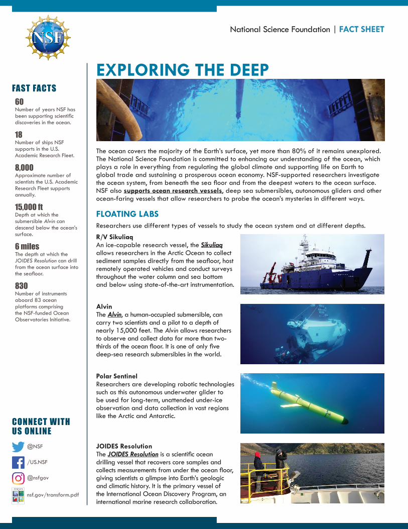
FLOATING LABS Researchers use different types of vessels to study the ocean system and at different depths
RV Sikuliaq An ice-capable research vessel the Sikuliaq allows researchers in the Arctic Ocean to collect sediment samples directly from the seafloor host remotely operated vehicles and conduct surveys throughout the water column and sea bottom and below using state-of-the-art instrumentation
Alvin The Alvin a human-occupied submersible can carry two scientists and a pilot to a depth of nearly 15000 feet The Alvin allows researchers to observe and collect data for more than two-thirds of the ocean floor It is one of only five deep-sea research submersibles in the world
Polar Sentinel Researchers are developing robotic technologies such as this autonomous underwater glider to be used for long-term unattended under-ice observation and data collection in vast regions like the Arctic and Antarctic
JOIDES Resolution The JOIDES Resolution is a scientific ocean drilling vessel that recovers core samples and collects measurements from under the ocean floor giving scientists a glimpse into Earthrsquos geologic and climatic history It is the primary vessel of the International Ocean Discovery Program an international marine research collaboration
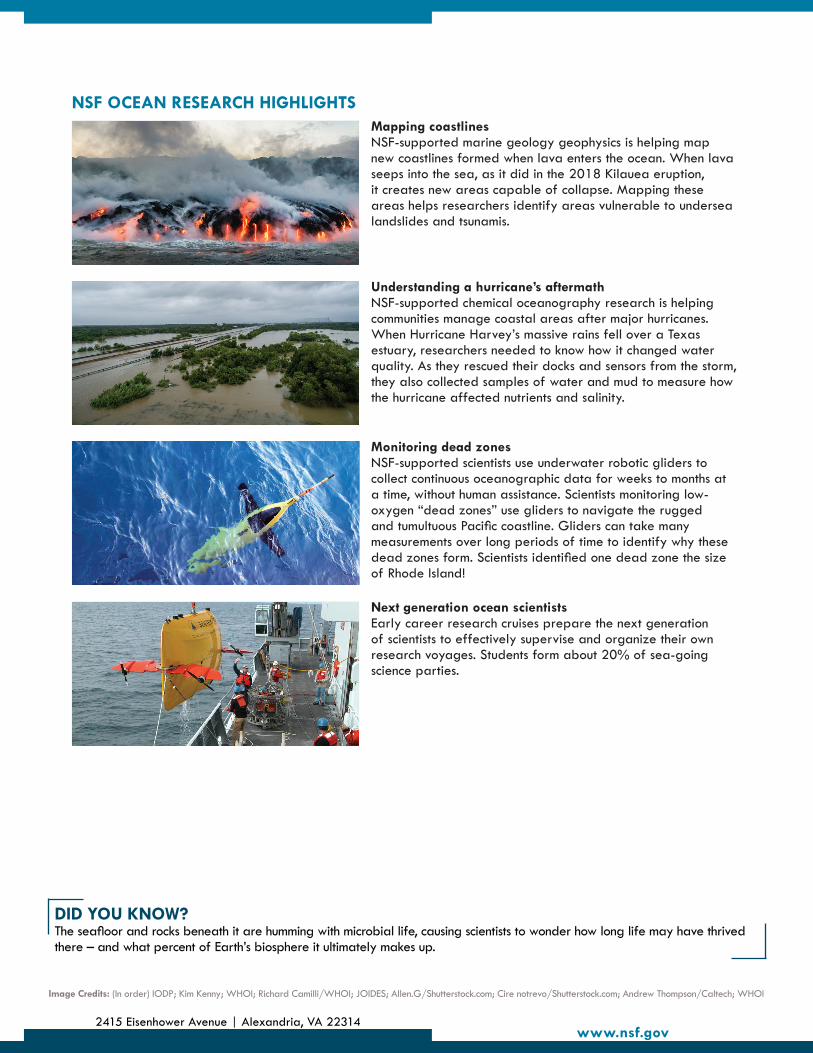
NSF OCEAN RESEARCH HIGHLIGHTS Mapping coastlines NSF-supported marine geology geophysics is helping map new coastlines formed when lava enters the ocean When lava seeps into the sea as it did in the 2018 Kilauea eruption it creates new areas capable of collapse Mapping these areas helps researchers identify areas vulnerable to undersea landslides and tsunamis
Understanding a hurricanersquos aftermath NSF-supported chemical oceanography research is helping communities manage coastal areas after major hurricanes When Hurricane Harveyrsquos massive rains fell over a Texas estuary researchers needed to know how it changed water quality As they rescued their docks and sensors from the storm they also collected samples of water and mud to measure how the hurricane affected nutrients and salinity
Monitoring dead zones NSF-supported scientists use underwater robotic gliders to collect continuous oceanographic data for weeks to months at a time without human assistance Scientists monitoring low-oxygen ldquodead zonesrdquo use gliders to navigate the rugged and tumultuous Pacific coastline Gliders can take many measurements over long periods of time to identify why these dead zones form Scientists identified one dead zone the size of Rhode Island
Next generation ocean scientists Early career research cruises prepare the next generation of scientists to effectively supervise and organize their own research voyages Students form about 20 of sea-going science parties
DID YOU KNOW The seafloor and rocks beneath it are humming with microbial life causing scientists to wonder how long life may have thrived there ndash and what percent of Earthrsquos biosphere it ultimately makes up
Image Credits (In order) IODP Kim Kenny WHOI Richard CamilliWHOI JOIDES AllenGShutterstockcom Cire notrevoShutterstockcom Andrew ThompsonCaltech WHOI
2415 Eisenhower Avenue | Alexandria VA 22314 wwwnsfgov