surface and airborne monitoring technology for detecting ... library/events/2016/fy16 cs...
TRANSCRIPT
Surface and Airborne Monitoring Technology for Detecting Geologic Leakage in a CO2-Enhanced Oil
Recovery Pilot, Anadarko Basin, Texas
Project Number DE-FE0012173
Jack C. Pashin, Peter E. Clark, Tyler Ley, Nick Materer, Jamey Jacob, and Girish Chowdhary
Oklahoma State University
U.S. Department of EnergyNational Energy Technology Laboratory
Mastering the Subsurface Through Technology, Innovation and Collaboration:Carbon Storage and Oil and Natural Gas Technologies Review Meeting
August 16-18, 2016
2
Presentation Outline
• Benefit to Program• Goals and Objectives• Project Team• Technical Status• Accomplishments to Date• Synergy Opportunities• Summary
3
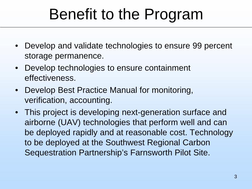
Benefit to the Program
• Develop and validate technologies to ensure 99 percent storage permanence.
• Develop technologies to ensure containment effectiveness.
• Develop Best Practice Manual for monitoring, verification, accounting.
• This project is developing next-generation surface and airborne (UAV) technologies that perform well and can be deployed rapidly and at reasonable cost. Technology to be deployed at the Southwest Regional Carbon Sequestration Partnership’s Farnsworth Pilot Site.
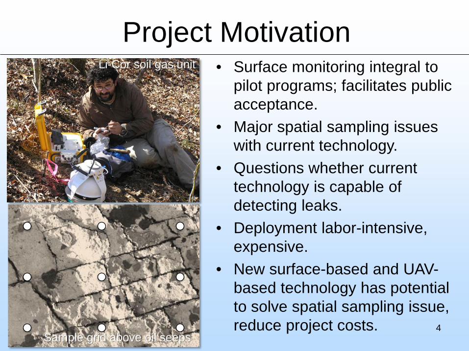
Project Motivation
4
• Surface monitoring integral to pilot programs; facilitates public acceptance.
• Major spatial sampling issues with current technology.
• Questions whether current technology is capable of detecting leaks.
• Deployment labor-intensive, expensive.
• New surface-based and UAV-based technology has potential to solve spatial sampling issue, reduce project costs.
Li-Cor soil gas unit
Sample grid above oil seeps
5
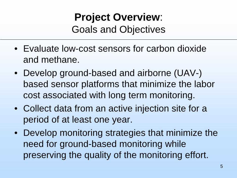
Project Overview: Goals and Objectives
• Evaluate low-cost sensors for carbon dioxide and methane.
• Develop ground-based and airborne (UAV-) based sensor platforms that minimize the labor cost associated with long term monitoring.
• Collect data from an active injection site for a period of at least one year.
• Develop monitoring strategies that minimize the need for ground-based monitoring while preserving the quality of the monitoring effort.
6
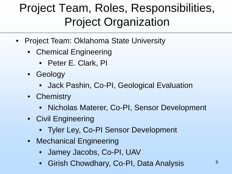
Project Team, Roles, Responsibilities, Project Organization
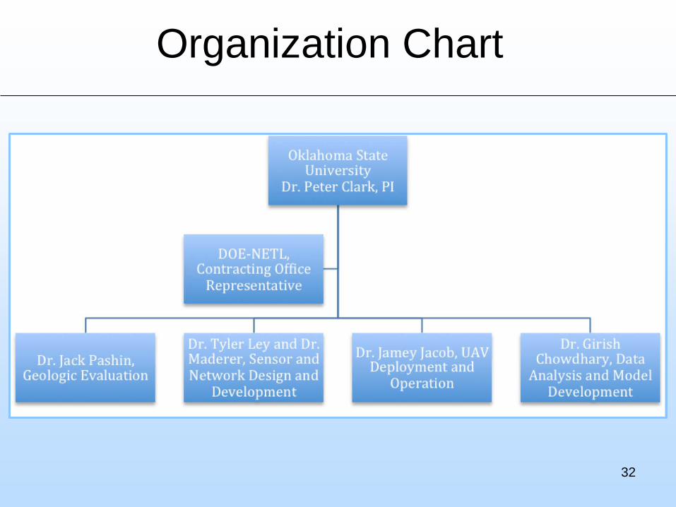
• Project Team: Oklahoma State University• Chemical Engineering
• Peter E. Clark, PI• Geology
• Jack Pashin, Co-PI, Geological Evaluation• Chemistry
• Nicholas Materer, Co-PI, Sensor Development• Civil Engineering
• Tyler Ley, Co-PI Sensor Development• Mechanical Engineering
• Jamey Jacobs, Co-PI, UAV• Girish Chowdhary, Co-PI, Data Analysis
Technical Status
7
• Geological characterization and assessment of leakage risks.
• Sensor evaluation and deployment using surface and airborne platforms.
• UAV evaluation and testing; and deployment at Farnsworth Oil Unit.
• Application of advanced data analysis techniques.
• Technology Transfer, Best Practices Manual.
8
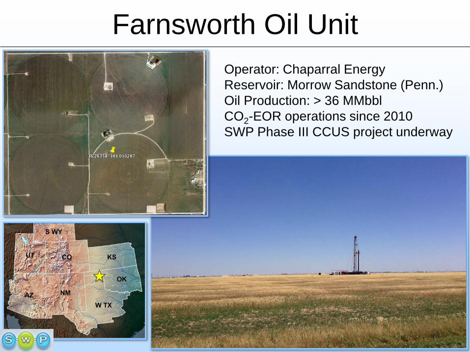
Farnsworth Oil UnitOperator: Chaparral EnergyReservoir: Morrow Sandstone (Penn.)Oil Production: > 36 MMbblCO2-EOR operations since 2010SWP Phase III CCUS project underway
9
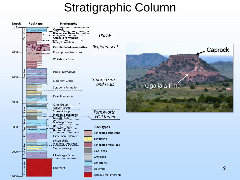
Stratigraphic Column
Caprock
Ogallala Fm.
10
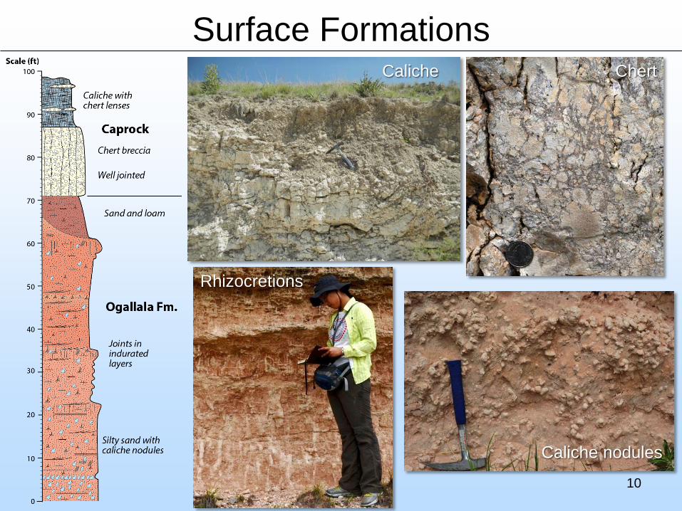
Surface FormationsCaliche Chert
Rhizocretions
Caliche nodules
11
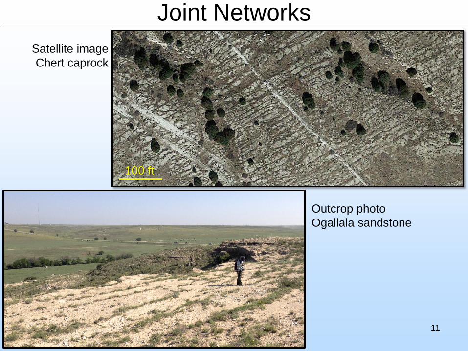
Joint Networks
100 ft
Satellite imageChert caprock
Outcrop photoOgallala sandstone
12
Joint Orientation
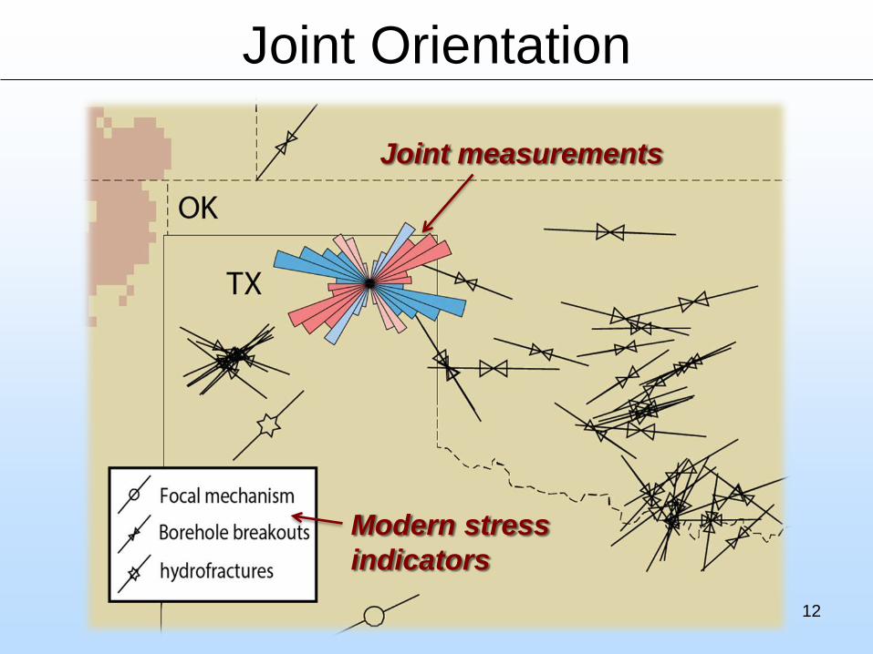
Joint measurements
Modern stress indicators
13
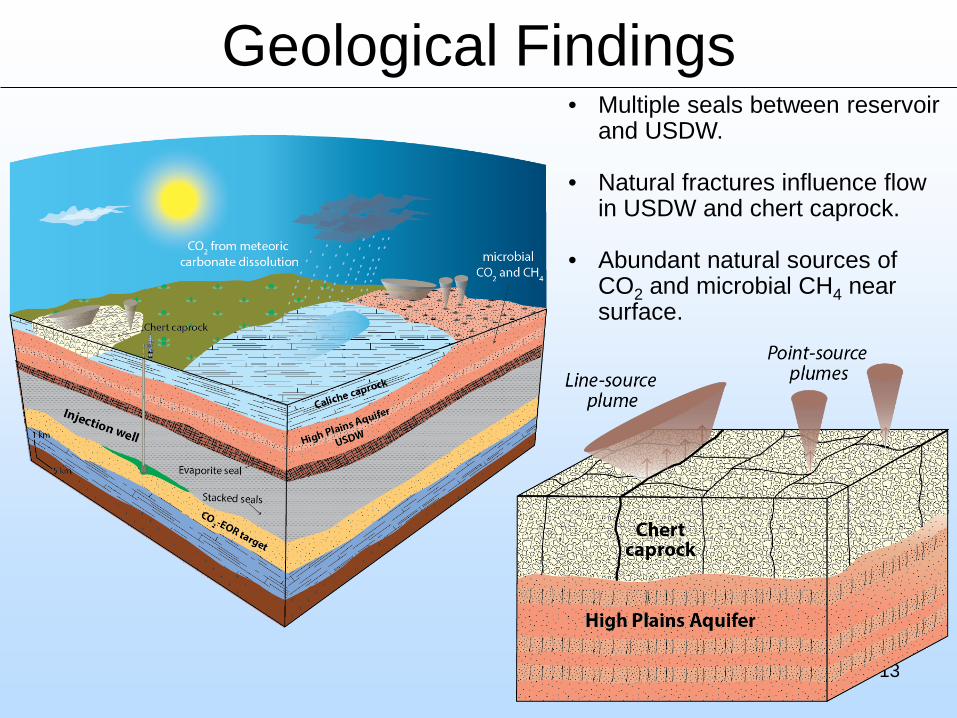
Geological Findings• Multiple seals between reservoir
and USDW.
• Natural fractures influence flow in USDW and chert caprock.
• Abundant natural sources of CO2 and microbial CH4 near surface.
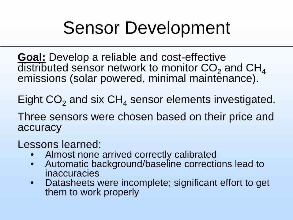
Sensor DevelopmentGoal: Develop a reliable and cost-effective distributed sensor network to monitor CO2 and CH4emissions (solar powered, minimal maintenance).
Eight CO2 and six CH4 sensor elements investigated.Three sensors were chosen based on their price and accuracyLessons learned:
• Almost none arrived correctly calibrated• Automatic background/baseline corrections lead to
inaccuracies• Datasheets were incomplete; significant effort to get
them to work properly
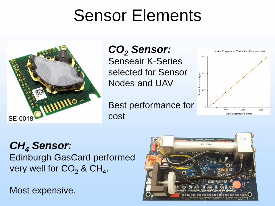
Sensor Elements
CH4 Sensor:Edinburgh GasCard performed very well for CO2 & CH4.
Most expensive.
CO2 Sensor: Senseair K-Series selected for Sensor Nodes and UAV
Best performance for cost
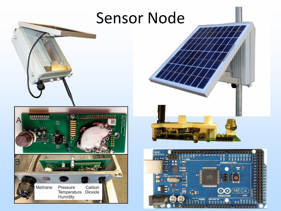
Sensor Node
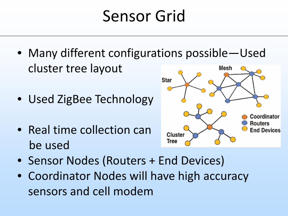
Sensor Grid
• Many different configurations possible—Used cluster tree layout
• Used ZigBee Technology
• Real time collection canbe used
• Sensor Nodes (Routers + End Devices)• Coordinator Nodes will have high accuracy
sensors and cell modem
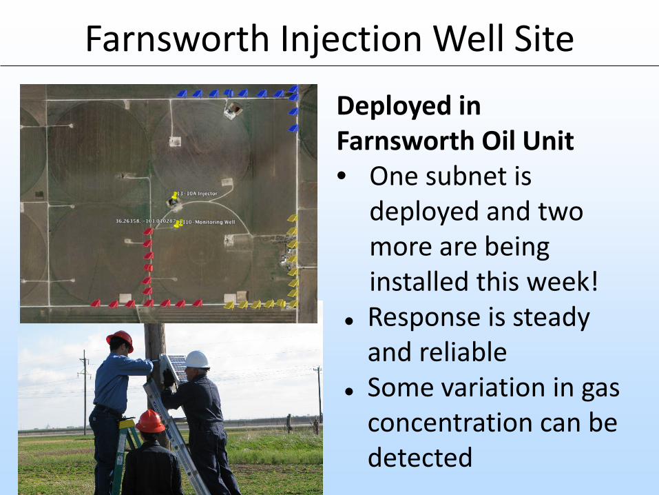
Farnsworth Injection Well SiteDeployed in Farnsworth Oil Unit• One subnet is
deployed and two more are being installed this week!
Response is steady and reliable
Some variation in gas concentration can be detected
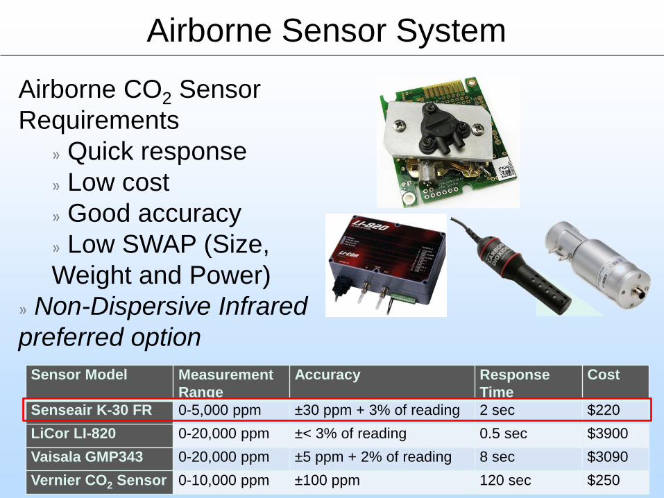
Airborne CO2 Sensor Requirements
» Quick response» Low cost» Good accuracy» Low SWAP (Size, Weight and Power)
» Non-Dispersive Infrared preferred option
Sensor Model MeasurementRange
Accuracy Response Time
Cost
Senseair K-30 FR 0-5,000 ppm ±30 ppm + 3% of reading 2 sec $220LiCor LI-820 0-20,000 ppm ±< 3% of reading 0.5 sec $3900Vaisala GMP343 0-20,000 ppm ±5 ppm + 2% of reading 8 sec $3090Vernier CO2 Sensor 0-10,000 ppm ±100 ppm 120 sec $250
Airborne Sensor System
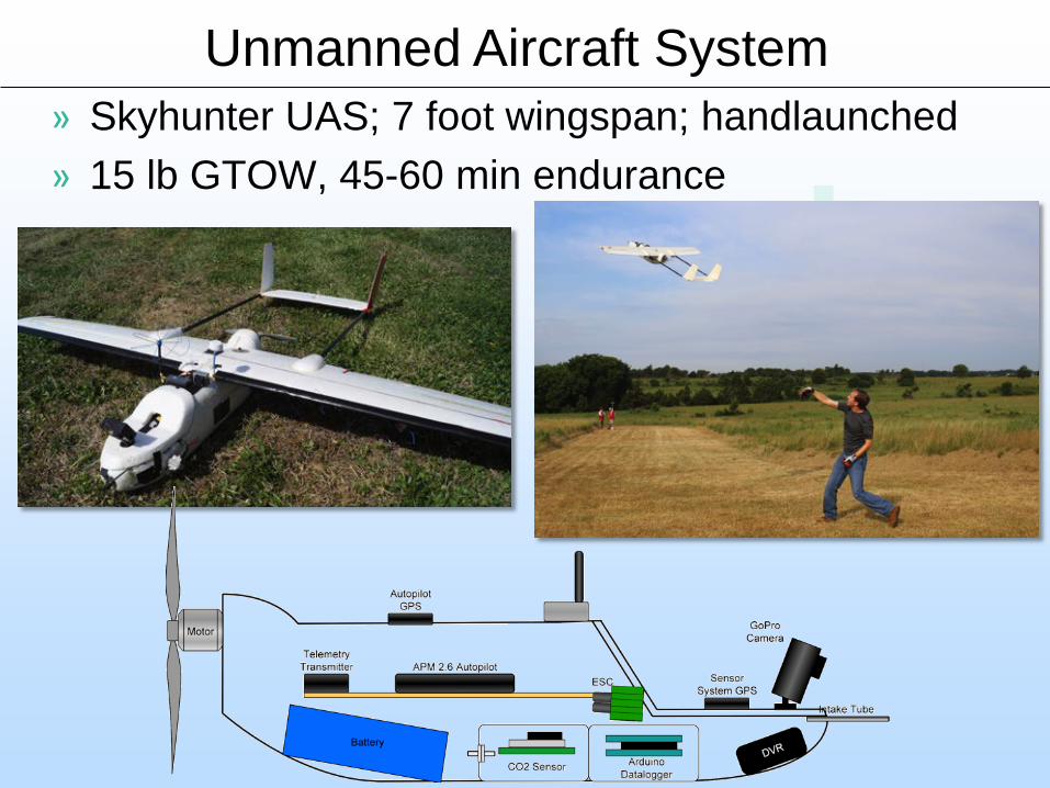
» Skyhunter UAS; 7 foot wingspan; handlaunched» 15 lb GTOW, 45-60 min endurance
Unmanned Aircraft System
21
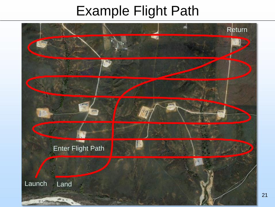
Example Flight Path
Launch
Return
Land
Enter Flight Path
22
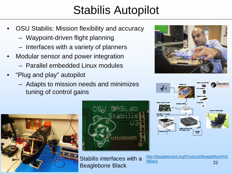
Stabilis Autopilot• OSU Stabilis: Mission flexibility and accuracy
– Waypoint-driven flight planning– Interfaces with a variety of planners
• Modular sensor and power integration– Parallel embedded Linux modules
• “Plug and play” autopilot – Adapts to mission needs and minimizes
tuning of control gains
http://beagleboard.org/Products/BeagleBone%20BlackStabilis interfaces with a
Beaglebone Black
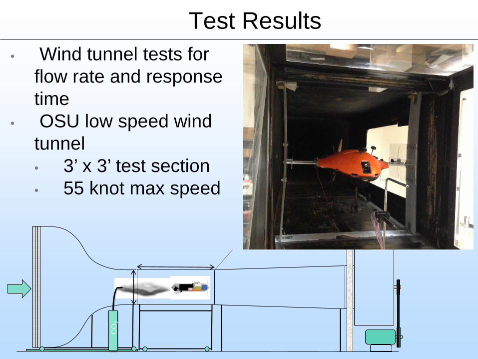
Test Results• Wind tunnel tests for
flow rate and response time
• OSU low speed wind tunnel• 3’ x 3’ test section• 55 knot max speed
CO
2
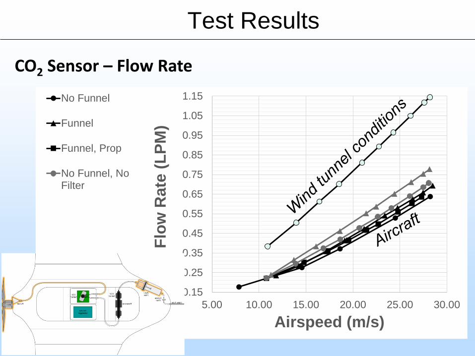
Test Results
CO2 Sensor – Flow Rate
0.15
0.25
0.35
0.45
0.55
0.65
0.75
0.85
0.95
1.05
1.15
5.00 10.00 15.00 20.00 25.00 30.00
Flow
Rat
e (L
PM)
Airspeed (m/s)
No Funnel
Funnel
Funnel, Prop
No Funnel, NoFilter
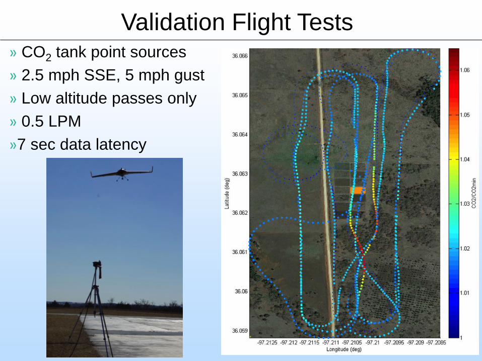
» CO2 tank point sources» 2.5 mph SSE, 5 mph gust» Low altitude passes only» 0.5 LPM»7 sec data latency
Validation Flight Tests
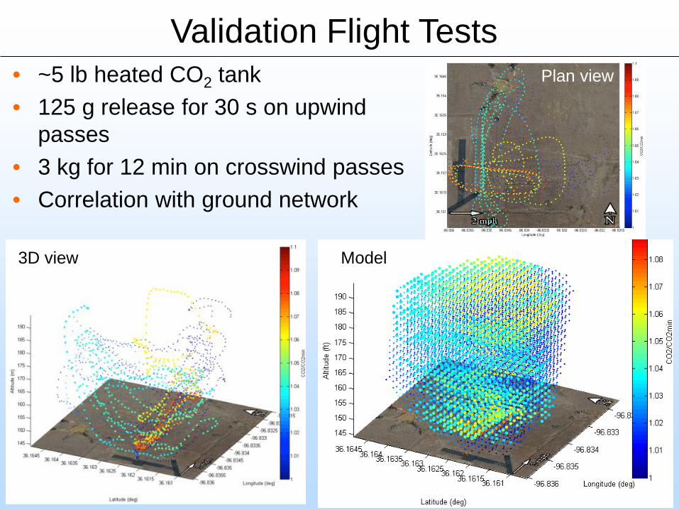
• ~5 lb heated CO2 tank• 125 g release for 30 s on upwind
passes• 3 kg for 12 min on crosswind passes• Correlation with ground network
Validation Flight TestsPlan view
3D view Model
27
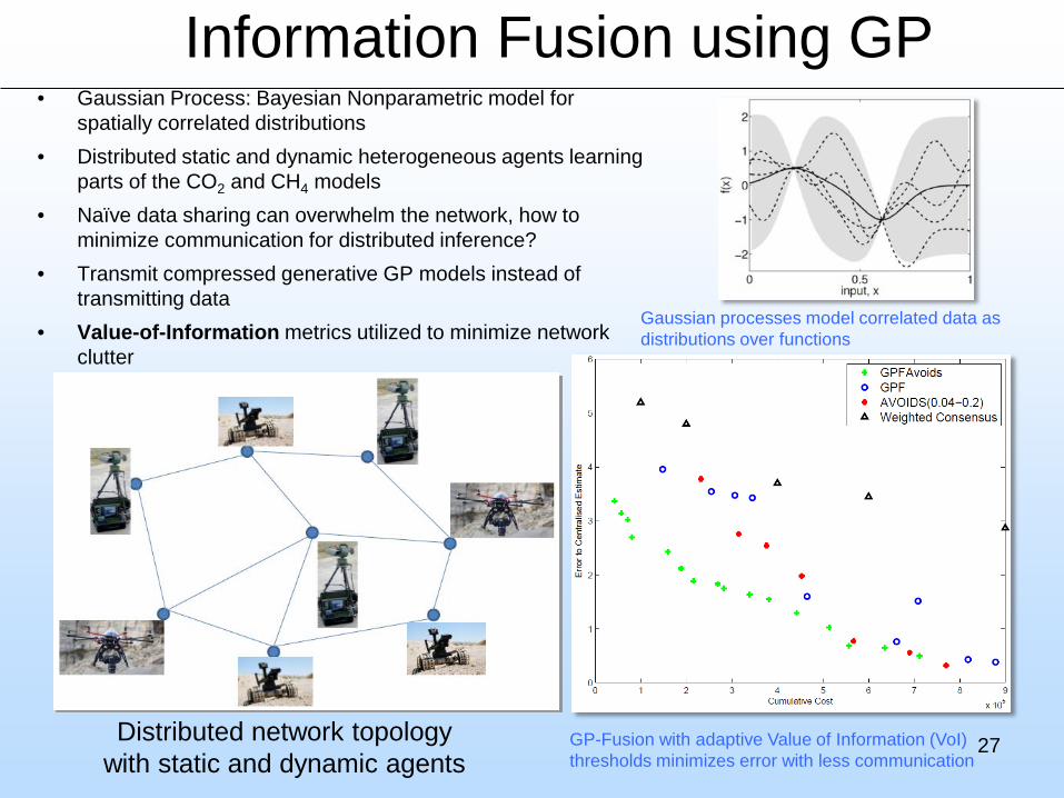
Information Fusion using GP• Gaussian Process: Bayesian Nonparametric model for
spatially correlated distributions• Distributed static and dynamic heterogeneous agents learning
parts of the CO2 and CH4 models• Naïve data sharing can overwhelm the network, how to
minimize communication for distributed inference?• Transmit compressed generative GP models instead of
transmitting data• Value-of-Information metrics utilized to minimize network
clutter
Distributed network topology with static and dynamic agents
GP-Fusion with adaptive Value of Information (VoI) thresholds minimizes error with less communication
Gaussian processes model correlated data as distributions over functions
Accomplishments to Date
• Field site at Farnsworth Oil Unit.• Geologic framework characterized; hypotheses
formulated to help guide field operations.• Robust and cost-effective near-surface and airborne
sensors identified.• UAV platform selected, instrumented, field-tested.• Data management and processing techniques
evaluated and tested.• Deployment at Farnsworth underway.
28
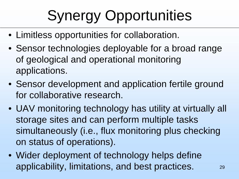
Synergy Opportunities• Limitless opportunities for collaboration.• Sensor technologies deployable for a broad range
of geological and operational monitoring applications.
• Sensor development and application fertile ground for collaborative research.
• UAV monitoring technology has utility at virtually all storage sites and can perform multiple tasks simultaneously (i.e., flux monitoring plus checking on status of operations).
• Wider deployment of technology helps define applicability, limitations, and best practices. 29
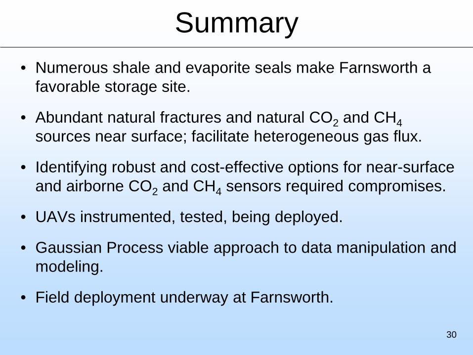
Summary• Numerous shale and evaporite seals make Farnsworth a
favorable storage site.
• Abundant natural fractures and natural CO2 and CH4sources near surface; facilitate heterogeneous gas flux.
• Identifying robust and cost-effective options for near-surface and airborne CO2 and CH4 sensors required compromises.
• UAVs instrumented, tested, being deployed.
• Gaussian Process viable approach to data manipulation and modeling.
• Field deployment underway at Farnsworth.
30
Appendix– These slides will not be discussed during the
presentation, but are mandatory
31
32
Organization Chart
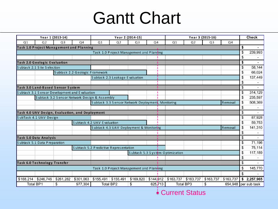
Gantt Chart
Current Status
BibliographyAxelrod A., Chowdhary G. Adaptive Algorithms for Data-Ferrying in Nonstationary Environments, AIAAInfotech@Aerospace, Orlando,
FL, USA 2014, finalist for best student paper award.Axelrod, Chowdary, Karaman. Exploitation by Informed Exploration between Isolated Operatives for Data Harvesting, CDC, Osaka,
Japan.Axelrod, Learning to Exploit Time-varying Heterogeneity in Distributed Sensing using the Information Exposure Rate, MS Thesis, OSU,
Stillwater, USA.Brown, C. "Evaluation Of Low-Cost Commercial-Off- The-Shelf Autopilot Systems For Suas Operations,” OSU MS Thesis, May 2015.
Brown, C. and Jacob, J. D. "Evaluation of Low-Cost Autopilots for SUAS Operations,” AIAA-2015-3348, AIAA Aviation, Dallas, TX, June, 2015.
Hassan A. Kingravi, Harshal Maske, and Girish Chowdhary. "Kernel Controllers: Systems-Theoretic Modeling and Control of Spatiotemporal Processes" CDC, Osaka, Japan.
Jacob, J. D., Axelrod A., Allamraju, R., Brown, C., Chowdhary, G. V., and Mitchell, C. T., 2014, "Airborne Detection and Tracking of Geologic Leakage Sites," American Physical Society Division of Fluid Dynamics 67th Annual Meeting Proceedings,” San Francisco, CA, Nov. 2014.
Meng Jingyao and Pashin, J. C., 2014, Fracture architecture in the Miocene-Pliocene Ogallala Formation and Quaternary strata, northeastern Texas Panhandle: Implications for geologic storage of carbon dioxide: Geological Society of America Abstracts with Programs, v. 46, no. 6, p. 537.
Meng Jingyao, 2015, Fracture architecture of the High Plains Aquifer, northeastern Texas Panhandle: Implications for geologic storage of carbon dioxide: OSU MS Thesis, August 2015.
Meng Jingyao and Pashin, J. C., 2015, Fracture architecture of the High Plains Aquifer, northeastern Texas Panhandle: Implications for geologic storage of carbon dioxide: Geological Society of America Abstracts with Programs, v. 47, no. 1, p. 13.
Meng Jingyao and Pashin, J. C., 2016, Geologic architecture of the High Plains Aquifer, northeastern Texas Panhandle: Implications for implementing surface and airborne monitoring techniques: American Association of Petroleum Geologists Annual Convention and Exhibition Program, unpaginated CD-ROM.
Meng, Jingyao and Pashin, J. C., in review, Fracture architecture of the High Plains Aquifer, northeastern Texas Panhandle: Implications for geologic CO2 storage: Environmental Geosciences.
Mitchell, T. A., Brown, C. T., and Jacob, J. D., 2015, “System Development for CO2 Plume Detection Using UAS,” AIAA-2015-1459, 53rd AIAA Aerospace Sciences Meeting, Orlando, FL, Jan., 2015.
Mitchell, T. "Development Of A Low Cost Unmanned Aircraft System For Atmospheric Carbon Dioxide Leak Detection,” OSU MS Thesis, May 2015.
Rakshit Allamraju & Girish Chowdhary, Multiagent Game Emulator(MAGE) for collaborative Autonomy Research, R4Sim workshop at the Robotics Science & Systems 2015, Rome Italy. 34