survey and construction product … precision...rot, ggk, gga, gsa, zda, vtg,gst, pjt, and pjk • 5...
TRANSCRIPT

Spectra preciSion10355 Westmoor DriveSuite #100Westminster, co 80021USa+1-720-587-4700 phone888-477-7516 (toll Free in USa)www.spectraprecision.com
For more information and sales contacts:www.spectraprecision.com
© 2009, Spectra Precision. All rights reserved. Spectra Precision and the Spectra Precision logo, FOCUS and EPOCH are trademarks of Spectra Precision, registered in the United States and in other countries. StepDrive and LockNGo are unregistered trademarks of Trimble Navigation Limited. Windows Mobile is a trademark of Microsoft Corporation, registered in the United States and/or other countries. All other trademarks are the property of their respective owners. PN 022487-189 (09/09)
contact your local dealer:
Specifications subject to changes without notice.
SURVEY AND CONSTRUCTIONPRODUCT CATALOG
WWW.SPECTRAPRECISION.COM
Simply Powerful.


Contents
Spectra Precision® ProductsFOCUS® Robotic Total Stations 1–4EPOCH® GNSS Systems 5–8FOCUS Mechanical Total Stations 9–12Spectra Precision Data Collectors 13–18Spectra Precision Software 19–22Spectra Precision Lasers 23–32Spectra Precision Theodolites 33–34Spectra Precision Auto Levels 35–36
AccessoriesSpectra Precision Accessories 37General Accessories 38
Pacific Crest PDL Radio ProductsPacific Crest Radios 39–40
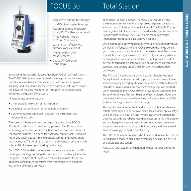
Introducing the powerful Spectra Precision® FOCUS® 30 Total Station The FOCUS 30 fully robotic motorized solution provides the same usability as a mechanical total station, but with improved speed, accuracy, and precision in measurement A robotic instrument moves the power of the observer from the instrument to the range pole, improving the quality of your work
All robotic instruments require:
� a motorized drive system at the instrument
� a tracking sensor to track the range pole and prism
� a communication connection between the instrument and range pole and prism
The speed of observation and precise positioning of the FOCUS 30 robotic total station is provided by patented StepDrive motion technology StepDrive controls the horizontal and vertical motion of the motors, so there is no need for traditional motion locks Using the motorized drives it is possible to precisely turn to, and repeat, angle measurements This results in quick and reliable measurements which substantially increases your staking productivity
Each FOCUS 30 model includes a tracking sensor that uses LockNGo tracking technology enabling the instrument to constantly lock onto the prism The benefi t of LockNGo is the ability to follow the prism at all times and reduce downtime from not having to re-point the instrument on every observation
FOCUS 30 Total Station
� StepDrive™ motion technology� LockNGo tracking technology � Featuring Spectra Precision®
Survey Pro™ software on-board� Three Robotic models
2", 3" and 5" accuracies � Long-range, refl ectorless
distance measurement� High-precision prism
measurements� GeoLock™ GPS-assist
technology
1 2
spec
tra
pr
ecisio
n p
ro
du
cts
To maintain contact between the FOCUS 30 instrument and the remote observer with the range pole and prism, the robotic solution must include a communication link The FOCUS 30 uses an integrated 2 4 GHz radio modem, as does the Spectra Precision Ranger™ data collector The 2 4 GHz radio modem provides interference-free robotic data communications
Once your robotic communications have been established you can control all the functions of the FOCUS 30 from the range pole as you move through the jobsite making measurements This makes it possible for a single surveyor to perform high accuracy stakeout or topographic surveys by themselves From high-order control surveys to topographic data collection or fast-paced construction stakeout, you can rely on a FOCUS 30, even in harsh outdoor conditions
The FOCUS 30 total station is combined with Spectra Precision Survey Pro fi eld software, providing you with world class software solutions for any surveying situation An example of these features includes a unique robotic software technology that can be used when associating the FOCUS 30 with a low-cost GPS receiver and Survey Pro software This combination of technologies allows the user to take full advantage of the Spectra Precision GeoLock GPS-assist technology to keep locked on target
The Spectra Precision GeoLock fi eld software technique allows a robotic total station to perform an aided search for an optical target using an initial GPS position The remote instrument can then be directed towards the robotic roving operator using the GPS position and a subsequent search is quickly performed to re-acquire the target at the robotic rover This technique greatly reduces wasted time, improving your fi eld work effi ciency
The FOCUS 30 robotic solution is best described as Simply Powerful Packaged in a modern, sleek, and streamlined design, it is easy-to-use, aff ordable and tough
FOCUS 30 Total Stations are designed to meet all your surveying needs
�
FOCUS 30 Total Station
� StepDrive™ motion technology� LockNGo tracking technology � Featuring Spectra Precision®
� Three Robotic models
� Long-range, refl ectorless
� High-precision prism
FOCUS 30 Total Station
�
�
�
�
�
�

Performance
angle measurementAccuracy (Standard deviation based on ISO 17123-3)2" (0.6 mgon), 3" (1.0 mgon), or 5" (1.5 mgon)Angle reading (least count)Standard1" (0.1 mgon)Tracking2" (0.5 mgon)
Distance measurement1
Accuracy to Prisms (Standard deviation based on ISO 17123-4)Standard2 mm + 2 ppm (0.007 ft + 2 ppm)Tracking5 mm + 2 ppm (0.016 ft + 2 ppm)Accuracy Reflectorless ModeStandard < 300 m (984 ft)3 mm + 2 ppm (0.01 ft + 2 ppm)Standard > 300 m (984 ft)5 mm + 2 ppm (0.016 ft + 2 ppm)Tracking10 mm + 2 ppm (0.033 ft + 2 ppm)Measuring timePrism Standard2.4 sec.Prism Tracking0.5 sec.
Reflectorless Standard3–15 sec.Reflectorless Tracking0.7 sec.Range Prism Mode1 prism4,000 m (13,123 ft)3 prisms7,000 m (22,966 ft)Foil Reflector 60 mm300 m (984 ft)Range Reflectorless ModeDifficult4, Normal5, Good6
KGC (18%)300 m, 350 m, 400 m(980 ft, 1,150 ft, 1,310 ft)KGC (90%)400 m, 600 m, 800 m(1,310 ft, 1,970 ft, 2,620 ft)Shortest possible range 1.5 m (4.9 ft)
automatic level compensatorTypeDual-axisAccuracy0.5" (0.15 mgon)Working Range±6' (±111 mgon)
3 4
spec
tra
pr
ecisio
n p
ro
du
cts
FOCUS 30 Total Station
1 Standard clear: No haze, overcast or moderate sunlight with very light heat shimmer. Range and accuracy are dependent on atmospheric conditions, size of prism and background radiation.
2 Kodak Gray Card, Catalog number E1527795.3 Spectra Precision GeoLock is available on data collectors after station setup.4 Difficult conditions (haze, object in direct sunlight, high ambient light).5 Normal conditions (normal visibility, object in the shadow, moderate ambient light).6 Good conditions (good visibility, overcast, twilight, underground, low ambient light).
eDm SPecIfIcaTIonS
eDm Laser and PrincipleLight sourceLaser Diode 660 nmPrinciplePhase Shift
eDm Beam divergenceHorizontal4 cm/100 m (0.13 ft/328 ft)Vertical3 cm/100 m (0.10 ft/328 ft)Atmospheric Correction–150 ppm to 160 ppm continuously
cerTIfIcaTIon
Class B Part 15 FCC certification, CE Mark approval. C-Tick.Laser safety IEC 60825-1 am2:2007Prism Mode: Class 1Reflectorless/Laser Pointer: Class 3R laserBluetooth type approvals are country specific.
roBoTIc SUrVeYInG
robotic operation1
Maximum Robotic Range300 m to 800 m (984 ft to 2,625 ft)Point precision at 200 m (656 ft)<2 mm (0.007 ft)Maximum Search Distance300 m to 800 m (984 ft to 2,625 ft)Search Time (typical)2–10 sec.
communicationsinternal/external2.4 GHz, frequency hopping, spread spectrum
GPS Search GeoLock3
GPS Search GeoLock360° (400 gon)RangeFull robotic operation range
GeneraL SPecIfIcaTIonS
coarse LevelingElectronic coarse leveling range±3° (±3,3 gon)Circular level in tribrach8'/2 mm (8'/0.007 ft)
DrivesDrive systemSpectra Precision StepDrive systemRotation speed maximum90°/sec (100 gon/sec)Rotation time Face 1 to Face 23.7 sec.Positioning speed180° (200 gon)3.5 sec.Clamps and slow motionsStepDrive driven, endless fine adjustment
centeringCentering system3-pinPlummetBuilt-in optical plummetMagnification2.4 xFocusing distance0.5 m to ∞ (1.6 ft to ∞)
TelescopeMagnification31xAperture50 mm (1.96 in)Field of view1º30'Focusing distance1.5 m to ∞ (4.9 ft to ∞)Illuminated crosshairStandardTracklight built-inStandardTrunnion axis height196 mm (7.71 in)
environmentalOperating temperature–20 ºC to +50 ºC (–4 ºF to +122 ºF)Dust and water proofingIP55
Power supplyInternal batteryLi-Ion, 11.1 V/4.4 AhOperating time with one internal batteryApprox. 6 hours
communicationsExternal foot connectorUSB cable connection and external power supplyWireless communicationBluetooth®
WeightInstrument5.0 kg (12.1 lb)Tribrach0.7 kg (1.54 lb)Internal battery0.3 kg (0.66 lb)
DaTa coLLecTIon
control Units fixed on alidadeFace 1Display3.5" TFT color touch-screen, 320x240 Pixel, backlightKeyboardAlphanumeric keypadMemory (data storage)128 MB RAM, 128 MB FlashField Application SoftwareSpectra Precision Survey ProFace 2Display6 lines, monochrome, 96x49 Pixel, backlightKeyboard4 keysInstrument Software FunctionsChange Face, Radio and Instrument Settings, Measurement Value Display, Leveling
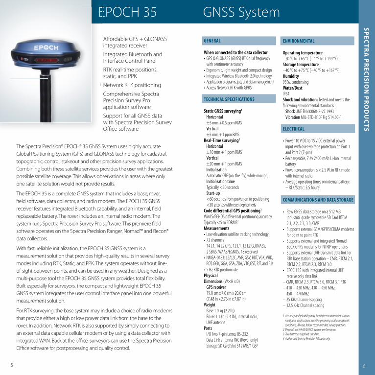
The Spectra Precision® EPOCH® 35 GNSS System uses highly accurate Global Positioning System (GPS) and GLONASS technology for cadastral, topographic, control, stakeout and other precision survey applications Combining both these satellite services provides the user with the greatest possible satellite coverage This allows observations in areas where only one satellite solution would not provide results
The EPOCH 35 is a complete GNSS system that includes a base, rover, fi eld software, data collector, and radio modem The EPOCH 35 GNSS receiver features integrated Bluetooth capability, and an internal, fi eld replaceable battery The rover includes an internal radio modem The system runs Spectra Precision Survey Pro software This premiere fi eld software operates on the Spectra Precision Ranger, Nomad™ and Recon® data collectors
With fast, reliable initialization, the EPOCH 35 GNSS system is a measurement solution that provides high-quality results in several survey modes including RTK, Static, and PPK The system operates without line-of-sight between points, and can be used in any weather Designed as a multi-purpose tool the EPOCH 35 GNSS system provides total fl exibility Built especially for surveyors, the compact and lightweight EPOCH 35 GNSS system integrates the user control interface panel into one powerful measurement solution
For RTK surveying, the base system may include a choice of radio modems that provide either a high or low power data link from the base to the rover In addition, Network RTK is also supported by simply connecting to an external data capable cellular modem or by using a data collector with integrated WAN Back at the offi ce, surveyors can use the Spectra Precision Offi ce software for postprocessing and quality control
� Aff ordable GPS + GLONASS integrated receiver
� Integrated Bluetooth and Interface Control Panel
� RTK real-time positions, static, and PPK
� Network RTK positioning� Comprehensive Spectra
Precision Survey Pro application software
� Support for all GNSS data with Spectra Precision Survey Offi ce software
5 6
GeneraL
When connected to the data collector• GPS & GLONASS (GNSS) RTK dual frequency with centimeter accuracy• Ergonomic, light weight and compact design• Integrated Wireless Bluetooth 2.0 technology• Application programs, job, and data management• Access Network RTK with GPRS
TecHnIcaL SPecIfIcaTIonS
Static GNSS surveying1
Horizontal ±5 mm +0.5 ppm RMS Vertical ±5 mm +1 ppm RMSReal-Time surveying1
Horizontal ±10 mm + 1 ppm RMS Vertical ±20 mm + 1 ppm RMS Initialization Automatic OTF (on-the-fl y) while moving Initialization time Typically <30 seconds Start-up <60 seconds from power on to positioning <30 seconds with recent ephemerisCode differential GPS positioning1
WAAS/EGNOS diff erential positioning accuracy Typically <5 m 3DRMS2
Measurements• Low elevation satellite tracking technology• 72 channels 14 L1, 14 L2 GPS, 12 L1, 12 L2 GLONASS, 2 SBAS, WAAS/EGNOS, 18 reserved• NMEA-0183: L2/L2C, AVR, GSV, HDT, VGK, VHD, ROT, GGK, GGA, GSA, ZDA, VTG,GST, PJT, and PJK• 5 Hz RTK position ratePhysicalDimensions (W×H x D) GPS receiver 19.0 cm x 7.0 cm x 20.0 cm (7.48 in x 2.76 in x 7.87 in)Weight Base 1.0 kg (2.2 lb) Rover 1.1 kg (2.4 lb), internal radio, UHF antennaPorts I/O Two 7-pin Lemo, RS-232 Data Link antenna TNC (Rover only) Storage SD Card Slot 512 MB/1 GB4
enVIronmenTaL
Operating temperature –20 °C to +65 °C (–4 °F to +149 °F)Storage temperature –40 °C to +75 °C (–40 °F to +167 °F)Humidity 95%, condensingWater/DustIP64Shock and vibration: Tested and meets the following environmental standards: Shock UNE EN 60068-2-27:1993 Vibration MIL-STD-810F Fig 514.5C-1
eLecTrIcaL
• Power 10 V DC to 15 V DC external power input with over-voltage protection on Port 1 and Port 2 (7-pin)• Rechargeable, 7.4v 2400 mAh Li-Ion internal battery • Power consumption is <2.5 W, in RTK mode with internal radio• Average operating times on internal battery: – RTK/Static: 5.5 hours3
commUnIcaTIonS anD DaTa SToraGe
• Raw GNSS data storage on a 512 MB industrial grade removable SD Card RTCM 2.1, 2.2, 2.3, 3.0, CMR• Supports external GSM/GPRS/CDMA modems for point to point RTK• Supports external and integrated Nomad 800X GPRS modems for NTRIP operations• Supports external UHF transmit data link for RTK base station operation – CMR, RTCM 2.1, RTCM 2.2, RTCM 2.3, RTCM 3.0• EPOCH 35 with integrated internal UHF receive only data link– CMR, RTCM 2.3, RTCM 3.0, RTCM 3.1 RTK– 410 – 430 MHz, 430 – 450 MHz, 450 – 470MHZ– 25 KHz Channel spacing– 12.5 KHz Channel spacing
1 Accuracy and reliability may be subject to anomalies such as multipath, obstructions, satellite geometry, and atmospheric conditions. Always follow recommended survey practices.
2 Depends on WAAS/EGNOS system performance.3 Two batteries supplied standard.4 Authorized Spectra Precision SD cards only.
spec
tra
pr
ecisio
n p
ro
du
cts
EPOCH 35 GNSS SystemEPOCH 35 GNSS System
� Aff ordable GPS + GLONASS
� Integrated Bluetooth and
� RTK real-time positions,
� Network RTK positioning� Comprehensive Spectra
� Support for all GNSS data
EPOCH 35 GNSS System
�
�
�
�
�
�
EPOCH 35 GNSS System

The Spectra Precision® EPOCH® 10 GPS System is a completely integrated L1 GPS postprocessed solution It combines an L1 GPS receiver, an antenna, and a rugged handheld Spectra Precision Recon data collector The EPOCH 10 operates without line-of-sight between points, and it can operate day or night in just about any weather
Additionally, the EPOCH 10 system includes fully integrated software for fi eld and offi ce Spectra Precision Field Surveyor* software runs on the Recon data collector, working in the fi eld to collect and manage the data When you return to the offi ce, download the data to Survey Offi ce software for postprocessing
Spectra Precision Field Surveyor* GPS technology for L1 GPS delivers superior satellite tracking, faster measuring, optimal precision, and lower power usage Plus, the GPS antenna resists unwanted signal interference that may give inaccurate measurements
The GPS receiver simply fi ts into the CompactFlash (CF) slot of the Recon data collector and is protected by a customized CF cap that fi ts securely over the receiver The compact, lightweight Recon data collector comes with a 15-hour battery, and you can operate the Recon data collector with the EPOCH 10 system for up to eight hours without recharging the battery
* Interlock software in North America
� Aff ordable GPS solution� Survey-grade L1 GPS receiver� L1 GPS antenna� Recon data collector� Spectra Precision Field
Surveyor* software for EPOCH 10
� Spectra Precision Survey Offi ce software
� Field-proven technology
7
DaTa coLLecTIon
When connected to the Spectra Precision Recon data collector:• Application fi le and data management• Color touch-screen indicators for satellite
tracking, data logging, and power
GeneraL
PowerInput 5 V DCPower consumption0.6 W receiver and antennaBatteryUp to 8 hours data collectionBattery weight0.20 kg (0.44 lb)Battery chargeInternal with external AC power adapter TemperatureOperating temperature –30 °C to +60 °C (–22 °F to 140 °F) Long-term storage–40 °C to +70 °C (–40 °F to +158 °F) Humidity100%, condensing
Performance SPecIfIcaTIonS
Measurements• Unfi ltered, unsmoothed pseudorange
measurement data for low noise, lowmultipath error, and high dynamic response
• Very low noise L1 measurements with 1 mm precision at 1 Hz
• 12 Channels L1 C/A Code, L1 Full Cycle Carrier, WAAS/EGNOS1
• WAAS/EGNOS diff erential positioning accuracy typically <3 m 3DRMS2
Static GPS surveyingHorizontal±5 mm + 0.5 ppm × (baseline length) RMSVertical±5 mm + 1 ppm × (baseline length) RMSKinematic surveyingHorizontal±(10 mm + 1 ppm) × (baseline length) RMSVertical±(20 mm + 1 ppm) × (baseline length) RMS
See complete Recon specifi cations in the Spectra Precision Data Collectors section of this catalog
1 WAAS/EGNOS capable GPS Receiver dependant on fi eld software application.
2 Depends on WAAS/EGNOS system performance.
TecHnIcaL SPecIfIcaTIonS
Physical Dimensions (W×H×L)9.5 cm × 4.4 cm × 24.2 cm (3.7 in × 1.7 in × 9.5 in)Weight (with internal batteries) 0.62 kg (1.3 lb)
8
spec
tra
pr
ecisio
n p
ro
du
cts
EPOCH 10 L1 GPS System
� Aff ordable GPS solution� Survey-grade L1 GPS receiver� L1 GPS antenna� Recon data collector� Spectra Precision Field
� Spectra Precision Survey
� Field-proven technology
EPOCH 10 L1 GPS System
�
�
�
�
�
�
�
EPOCH 10 L1 GPS System

109
The Spectra Precision® FOCUS® 8 Total Station off ers the power of a Windows CE operating system and world class Spectra Precision Survey Pro fi eld software combined with clear-to-view quality optics, smart design, and superior components that your surveying jobs demand
The Spectra Precision FOCUS 8 has intuitive Survey Pro on-board software that is easy to use and it has a large display that makes data management simple
Touch-screen technology also improves data workfl ow speed to access menus and software modes for fast every day data management The Windows CE operating system supports a full alphanumeric ‘pop-up’ keyboard helping users to enter data quickly and accurately
Built tough for use on your every day work site in all degrees of dust, dirt, and weather conditions The large graphic display uses features such as diff erent font sizes, icons, and pop-up menus to make the on-board software system intuitive and easy to learn for maximum effi ciency
Use the FOCUS 8 to reliably measure and save all your topographic and staking needs This solution includes key features such as:
� Quick Coding: for lightning fast feature coding� CoGo: for your in-fi eld calculations� Fast Measure: confi gure keys for one touch measurement
All FOCUS 8 models support Bluetooth communications to external data collectors In addition, all models come standard with a traditional optical plummet which can be upgraded to a laser plummet
� 2" and 5" angle accuracy� Aff ordable Total Station� Windows CE� Accurate distances and
stable angles� 300 m (984 ft) refl ectorless
measurement� Tough and reliable� Spectra Precision Survey Pro
on-board� All-weather construction� Long battery life
TeLeScoPe
Magnifi cation30× (18x/36x with optional eyepieces)Eff ective diameter of objective2" 40 mm (1.6 in) 2" EDM diameter. 45 mm (1.8 in)5" 45 mm (1.8 in) 5" EDM diameter. 50 mm (2.0 in)Minimum focusing distance1.5 m (4.9 ft)
DISTance meaSUremenT
Refl ectorless mode (white target)1
1.5 m to 300 m (4.9 ft to 984 ft)Range with specifi ed prismsGood conditions (No haze, visibility over 40 km (25 miles))With refl ector sheet 5 cm x 5 cm (2 in x 2 in)2" 1.5 m to 270 m (4.9 ft to 886 ft)5" 1.5 m to 300 m (4.9 ft to 984 ft)
With single prism 6.25 cm (2.5 in)2" 1.5m to 3,000 m (4.9 ft to 9,843 ft)5" 1.5 m to 5,000 m (4.9 ft to 16,404 ft)Accuracy2 (Precise mode)2" Prism ±(2+2 ppm × D) mm2" Refl ectorless ±(3+2 ppm x D) mm5" Prism ±(3+2 ppm × D) mm5" Refl ectorless ±(3+2 ppm × D) mmMeasuring interval3
Prism mode2" Precise mode 1.6 sec.5" Precise mode 1.5 sec.Normal mode 0.8 sec.Refl ectorless mode2" Precise mode 2.1 sec.5" Precise mode 1.8 sec.2" Normal mode 1.2 sec.5" Normal mode 1.0 sec.Least countPrecise mode 1 mm (0.002 ft)Normal mode 10 mm (0.02 ft)
spec
tra
pr
ecisio
n p
ro
du
cts
FOCUS 8 Total Station
�
�
�
�
�
�
�
�
�
FOCUS 8 Total Station
�
�
�
�
�
�
�
FOCUS 8 Total Station
1 White objects with high refl ectivity (KGC 90%). Measuring distance may vary depending on targets and measuring conditions.2 ±(3+3 ppm × D) mm –20 °C to –10 °C, +40 °C to +50 °C (–4 °F to +14 °F, +104 °F to +122 °F)3 Measuring time may vary depending on measuring distance and conditions. For the initial measurement, it may take a few more seconds.4 Battery life specifi cation at 25 °C (77 °F). Operation times may vary depending on the condition and deterioration of the battery.
GeneraL SPecIfIcaTIonS
Operating temperature range–20 °C to +50 °C (–4 °F to +122 °F)Atmospheric correction–40 °C to +60 °C (–40 °F to +140 °F)Barometric pressure400 mmhg to 999 mmhg533 hPa to1,332 hPa15.8 inhg to 39.3 inhgMinimum increment (Degree, Gon, MIL6400)Degree: 1/5/10"Gon: 0.2/1/2 mgonMIL6400: 0.005/0.02/0.05 milDIN 18723 accuracy (horizontal and vertical)2" 0.5 mgon5" 1.5 mgonDust & water protectionIP66Tilt SensorTypeDual axisLevel vialsSensitivity of Circular level vial10'/2 mmOptical plummetMagnifi cation3×Display face 1VGA,16 bit color, TFT LCD, backlit (320x240 pixel)Display face 2Backlit, graphic LCD (128x64 pixel)
Point memory128 MB RAM, 128 MB Flash memoryDimensions (W x D x H)149 mm x 145 mm x 306 mm(5.8 in x 5.7 in x 12.0 in)Weight (approx.)Main unit (without battery)2" 3.9 kg (8.6 lb)5" Main unit (without battery) 3.8 kg (8.4 lb)Battery0.1 kg (0.2 lb)Carrying case2.3 kg (5.1 lb)Internal Li–ion battery (x2)Operating time4
2"approx. 12 hours (continuous distance/angle measurement)approx. 26 hours (distance/angle measurement every 30 seconds)approx. 28 hours (continuous angle measurement)5"approx. 7.5 hours (continuous distance/angle measurement)approx. 16 hours (distance/angle measurement every 30 seconds)approx. 20 hours (continuous angle measurement)Charging time (Full charge)4 hours

11 12
The Spectra Precision® FOCUS® 6 Total Station off ers clear-to-view quality optics, smart design, and superior components your surveying jobs demand The FOCUS 6 is a fast measuring device in both Prism (0 8 sec) and Refl ectorless (1 0 sec) modes for improving your day-to-day fi eld operations
For most construction and surveying applications the FOCUS 6 Total Station 2" and/or 5" accuracy is ideal Coupled with its quality, you can be confi dent that you are achieving this level of accuracy with every measurement
On a single battery, the FOCUS 6 provides full measurement every 30 seconds for 15+ hours It’s tough, water resistant, and will continue working no matter what the weather brings The smart small design of the FOCUS 6 is convenient and portable for all occasions
The Spectra Precision FOCUS 6 total station has intuitive on-board software that is easy-to-use Want to make your FOCUS 6 even more powerful? Instead of on-board data collection you can choose to use a Spectra Precision Ranger, Nomad, or Recon data collector powered by Survey Pro to maximize performance in the fi eld
� 2" and 5" angle accuracy � Aff ordable Total Station � Accurate distances and
stable angles� 300 m (984 ft) refl ectorless
measurement� Tough and reliable� On-board data collection� All-weather construction� Long battery life
TeLeScoPe
Magnifi cation30× (18x/36x with optional eyepieces)Eff ective diameter of objective2" 40 mm (1.6 in) 2" EDM diameter. 45 mm (1.8 in)5" 45 mm (1.8 in) 5" EDM diameter. 50 mm (2.0 in)Minimum focusing distance 1.5 m (4.9 ft)
DISTance meaSUremenT
Refl ectorless mode (white target)1
1.5 m to 300 m (4.9 ft to 984 ft)Range with specifi ed prismsGood conditions (no haze, visibility over40 km (25 miles))With refl ector sheet 5 cm × 5 cm(2 in x 2 in)2" 1.5 m to 270 m (4.9 ft to 886 ft)5" 1.5 m to 300 m (4.9 ft to 984 ft)
With single prism 6.25 cm (2.5 in)2" 1.5m to 3,000 m (4.9 ft to 9,843 ft)5" 1.5 m to 5,000 m (4.9 ft to 16,404 ft)Accuracy2 (Precise mode)2" Prism ±(2+2 ppm × D) mm5" Prism ±(3+2 ppm × D) mm2" Refl ectorless ±(3+2 ppm x D) mm5" Refl ectorless ±(3+2 ppm × D) mmMeasuring interval3
Prism mode2" Precise mode 1.6 sec.5" Precise mode 1.5 sec.Normal mode 0.8 sec.Refl ectorless mode2" Precise mode 2.1 sec.5" Precise mode 1.8 sec.2" Normal mode 1.2 sec.5" Normal mode 1.0 sec.Least countPrecise mode 1 mm (0.002 ft)Normal mode 10 mm (0.02 ft)
GeneraL SPecIfIcaTIonS
Operating temperature range–20 °C to +50 °C (–4 °F to +122 °F)Atmospheric correction–40 °C to +60 °C (–40 °F to +140 °F)Barometric pressure400 mmHg to 999 mmHg533 hPa to 1,332 hPa15.8 inHg to 39.3 inHgMinimum increment (Degree, Gon, MIL6400)Degree: 1/5/10"Gon: 0.2/1/2 mgonMIL6400: 0.005/0.02/0.05 milDIN 18723 accuracy(horizontal and vertical)2" 0.5 mgon5" 1.5 mgonDust & Water protectionIP66Tilt sensorType Dual axisLevel vialSensitivity of Circular level vial10'/2 mm Optical plummet Magnifi cation3xDisplayGraphic LCD (128 × 64 dot); Single sidePoint memory10,000 records
Dimensions (W × D × H)149 mm x 145 mm x 306 mm(5.8 in x 5.7 in x 12.0 in)Weight (approx.)Main unit (without battery)2" 3.8 kg (8.4 lb)5" 3.6 kg (8.0 lb)Battery0.1 kg (0.2 lb)Carrying case2.3 kg (5.1 lb)Internal Li-ion battery (x2)Operation time4
2"approx. 19 hours (continuous distance/angle measurement)approx. 57 hours (distance/angle measurement every 30 seconds)approx. 62 hours (continuous angle measurement)5"approx. 10 hours (continuous distance/angle measurement)approx. 26 hours (distance/angle measurement every 30 seconds)approx. 31 hours (continuous angle measurement)Charging time (Full charge)4 hours
spec
tra
pr
ecisio
n p
ro
du
cts
FOCUS 6 Total Station
�
�
�
�
�
�
�
�
FOCUS 6 Total Station
�
�
�
�
�
�
�
FOCUS 6 Total Station
1 White objects with high refl ectivity (KGC 90%). Measuring distance may vary depending on targets and measuring conditions.2 ±(3+3 ppm × D) mm –20 °C to –10 °C, +40 °C to +50 °C (–4 °F to +14 °F, +104 °F to +122 °F)3 Measuring time may vary depending on measuring distance and conditions. For the initial measurement, it may take a few more seconds.4 Battery life specifi cation at 25 °C (77 °F). Operation times may vary depending on the condition and deterioration of the battery.

1413
The fi eld-proven Spectra Precision® Ranger™ Data Collectore delivers military-grade durability with the features surveyors depend on It meets rigorous MIL-STD-810F military standard for drops, vibration, humidity and extreme temperatures, and with an IP67 rating, it’s impervious to water and dust, keeping your data safe The Ranger features Survey Pro and Windows Mobile 5 0, with the capability to run the mobile version of all your favorite programs including Excel and Outlook Integrated wireless capabilities let you connect to fi eld equipment without bulky cables Plus, with CF and SD slots, you can add multiple accessories and increase data storage The Ranger comes in three models; the powerful 500X, the economical 300X, and the simple NX The powerful 500X and the economical 300X provide you options without limiting any features The 500X also includes the 2 4 GHz robotic radio The Ranger NX is a 300X without the expansion slots and is our most aff ordable model
� Ergonomic, alpha and numeric keys
� Meets MIL-STD-810F standards� IP67 rating� Featuring Spectra Precision
Survey Pro software� Two CompactFlash (CF) slots� One Secure Digital (SDIO) slot� 30-hour rechargeable battery� Windows Mobile 5 0� Integrated Bluetooth and
802 11g wireless
enVIronmenT
Operating Temperature–30 °C to 60 °C (–22 °F to 140 °F )Storage Temperature–40 °C to 70 °C (–40 °F to 158 °F)Humidity100% condensing, MIL-STD-810F, Method 507.4WaterIP67, sealed against accidental immersion (1 m for 30 min.)MIL-STD-810F, Method 512.4, Procedure ISand & DustIP67, MIL-STD-810F, Method 510.3, Procedures I & II
DropMIL-STD-810F, Method 516.5, Procedure IV 48” onto concrete, 26 drops at room temperature (all faces, edges, corners, one drop each)6 additional drops at –30 °C (–22 °F) 6 additional drops at 60 °C (140 °F)VibrationMIL-STD-810F, Method 514.5, Procedure I, Figs. 5 & 17Altitude4,572 m (15,000 ft) at 23 °C (73 °F) MIL-STD-810F, Method 500.4, Procedures I, II & III
STanDarD feaTUreS
• Microsoft Windows Mobile 5.0 • 53 tactile key alphanumeric keypad, 8 position
spider key• Touch-screen• Battery life of 30 hours under normal
operating conditions• Complete recharge in 4.5 hrs (80% in 2 hrs)• Battery charge status LED indicator• Notifi cation LED• Rugged polycarbonate shell• Integrated speaker and microphone
PHYSIcaL
Size266 mm × 131 mm × 48 mm(10.5 in x 5.2 in x 1.9 in)Weight0.95 kg (2.1 lb) including battery1.09 kg (2.4 lb) including battery and optional internal radio
eLecTrIcaL
ProcessorIntel PXA 270 XScale CPUExpansion1x Type I and 1x Type II CompactFlash slots2
1x Secure Digital (SDIO) slot2
DisplayColor, illuminated TFT, daylight-readable touch-screen displayed at 320 × 240 pixelsPowerLi-Ion rechargeable pack, 6600 mAh
2 Not applicable to Ranger NX model.
I/o
Ports9-pin serial port RS-232 (115 Kbps)USB client and hostDC power port
STanDarD SofTWare
Internet ExplorerFile ExplorerWord MobilePower Point MobileExcel MobileOutlook MobileWindows Media® Player MobileMicrosoft ActiveSync® technologyMicrosoft Transcriber (handwriting recognition)Pictures, Picture&Videos, Calendar, Contacts, Tasks and NotesOnline help
STanDarD acceSSorIeS
Rechargeable Lithium-Ion battery moduleInternation AC re-charger (100 V–240 V)Standard CF-CapUSB data cableHand strapStylus penStylus pen lanyard2 screen protectorsNylon carry case
moDeLS oVerVIeW 500X 300X nX
ProceSSor/SPeeDIntel XScale 520 MHz 312 MHz 312 MHzmemorYSDRAM 128 MB 64 MB 64 MBData storage (On-board Flash) 512 MB 256 MB 128 MBWIreLeSSIntegrated Bluetooth Standard Standard N/AIntegrated 802.11g Optional N/A N/AfeaTUreS2.4 GHz robotic radio Module Optional N/A N/A
Ranger Data Collectorsp
ectr
a p
rec
ision
pr
od
uc
ts
�
�
� Ergonomic, alpha and
� Meets MIL-STD-810F standards� IP67 rating� Featuring Spectra Precision
� Two CompactFlash (CF) slots� One Secure Digital (SDIO) slot� 30-hour rechargeable battery� Windows Mobile 5 0
Ranger Data Collector
�
�
�
�
�
�
�
�
Ranger Data Collector

moDeL oVerVIeW 800X 800Lc 800LD 800B
ProceSSor/SPeeD
Marvell PXA320 XScale 806 MHz 806 MHz 806 MHz 806 MHzmemorY
DDR SDRAM 128 MB 128 MB 128 MB 128 MBData storage (On-board Flash) 2 GB 1 GB 1 GB 512 MB
feaTUreS
Integrated Card Slots SD/CF D SD/USB SD/CFIntegrated Bluetooth x x x xIntegrated GPS, Navigational Grade x x x Integrated WiFi 802.11g x x x Integrated WWAN x Integrated Camera x
The Spectra Precision® Nomad® Data Collector, packed with functionality, is an extremely powerful and full-featured rugged data collector Start with an 806 MHz processor, a long-life 5200 mAh lithium-ion battery and integrated wireless capabilities like GPS, WiFi 802 11g, and Bluetooth Then, the Spectra Precision Nomad adds 128 MB RAM and 1 full GB non-volatile Flash storage to manage all the data you can collect
The Nomad features a high-resolution, sunlight-visible full VGAdisplay that shows graphics and maps in crisp detail plus a backlit numeric keypad
The Nomad is available in a range of solutions from the powerful 800X, the camera-based 800LC, the traditional 800LD and the economical 800B, each packed with features and benefi ts to suit your specifi c needs
� Full VGA display � Meets MIL-STD-810F
standards, IP67 rating� Backlit Numeric keypad� Featuring Spectra Precision
Survey Pro software� 806 MHz processor� Optional integrated GPS� Optional integrated
Bluetooth, WiFi 802 11g� 15-hour rechargeable battery� Windows Mobile 6� Optional integrated WAN
enVIronmenT
Operating Temperature–30 °C to 60 °C (–22 °F to 140 °F)Storage Temperature–40 °C to 70 °C (–40 °F to 158 °F)HumidityMIL-STD-810F, Method 507.4WaterIPX7, sealed against accidental immersion (1 m for 30 minutes)MIL-STD-810F, Method 512.4, Procedure I
DropMIL-STD-810F, Method 516.5, Procedure IV;26 drops from 1.22 m (4 ft) onto plywood over concrete6 additional drops at –30 °C (–22 °F)6 additional drops at +60 °C (+140 °F)Sand and dustIP6X, MIL-STD-810F, Method 510.3, Procedures I & IIVibrationMIL-STD-810F, Method 514.5, Procedure IAltitudeMIL-STD-810F, Method 500.4, Procedures I, II and III;4572 m (15,000 ft) at +23 °C (+73 °F)
STanDarD feaTUreS
• Windows Mobile 6 (Classic edition)• Numeric keypad with backlight• Marvell 806 MHz XScale processor• 128 MB DDR SDRAM• 1 GB nonvolatile Flash storage (800LD) 2 GB nonvolatile Flash storage (800X)• Full VGA display, sunlight-readable color TFT• Touch-screen • Rugged submersible design• Integrated speaker and microphone• Integrated Bluetooth 2.0• Secure Digital (SDIO) slot• Notifi cation LEDs• 15-hour battery life with active use (default settings)
PHYSIcaL
Size17.6 cm x 10.0 cm x 5.0 cm(6.92 in x 3.92 in x 1.96 in ) Weight0.596 kg (21 oz) with rechargeable Lithium-Ion battery module
eLecTrIcaL
Processor806 MHz Marvell PXA320 XScale CPUDisplay480x640 pixel (full VGA) 16 bit color TFT with LED backlight, Sunlight readable color TFT displayBatteriesInternal 5200 mAh Lithium-Ion, rechargeable battery module, 15 hours battery life with active use (default settings)
I/o
Standard 9-pin male D-shell RS-232 serial port (115 kbps)Mini USB-Guest portDC power port
STanDarD SofTWare
Microsoft® Windows Mobile® 6 software programs including:• Internet Explorer Mobile• File Explorer• Word Mobile• Excel Mobile• PowerPoint Mobile• Outlook Mobile• Microsoft Windows Media Player• Microsoft ActiveSync• Microsoft Pictures & Videos• Calendar, Contacts, Notes, Tasks, Calculator• Online Help
STanDarD acceSSorIeS
Rechargeable Lithium-Ion battery moduleInternational AC re-charger (100 V–240 V)Standard CF-CapUSB data cableHand strapStylus penStylus pen lanyard2 screen protectorsNylon carry case
1615
Nomad Data Collectorsp
ectr
a p
rec
ision
pr
od
uc
ts
�
� Full VGA display � Meets MIL-STD-810F
standards, IP67 rating� Backlit Numeric keypad� Featuring Spectra Precision
Survey Pro software� 806 MHz processor� Optional integrated GPS� Optional integrated
Bluetooth, WiFi 802 11g
Nomad Data Collector�
�
�
�
�
�
�
Nomad Data Collector

17 18
enVIronmenT
Operating temperature–30 °C to 60 °C (–22 °F to 140 °F )Storage Temperature–40 °C to 70 °C (–40 °F to 158 °F)HumidityMIL-STD-810F, Method 507.4WaterIP67, sealed against accidental immersion(1 m for 30 min.)MIL-STD-810F, Method 512.4, Procedure ISand and dustIP67, MIL-STD-810F, Method 510.4, Procedures I
DropMIL-STD-810F, Method 516.5, Procedure IV26 drops from 1.22 m (4 ft)onto plywood over concrete6 additional drops at –30 °C (–22 °F)6 additional drops at 60 °C (140 °F)VibrationMIL-STD-810F, Method 514.5, Procedure I (Fig. 17) & IIAltitude15,000 ft at 23 °C (73 °F) MIL-STD-810F, Method 500.4,Procedures I, II & III
STanDarD feaTUreS
• Windows Mobile 6• 400 MHz Intel PXA255 XScale processor• 64 MB high-speed SDRAM• 256 MB nonvolatile Flash storage (NX: 128 MB)• Sunlight-readable color TFT display• Touch-screen• Rugged waterproof design• Integrated speaker and microphone• 15 hours of continuous room-temperature
operation with default settings• Integrated Bluetooth
PHYSIcaL
Size16.5 cm x 9.5 cm x 4.5 cm (6.50 in x 3.75 in 1.75 in)Weight490 g (17 oz) w/PowerBoot Module
eLecTrIcaL
ProcessorIntel PXA255 XScale CPUExpansion1x Type I and 1x Type II CompactFlash slotsDisplay240 x 320 pixel (1/4 VGA) color TFTwith LED front lightPowerNiMH rechargeable pack 4000 mAh
I/o
Ports Standard 9-pin male D-shell RS-232 serial port(115 kbps) USB clientDC power port
STanDarD SofTWare
Word Mobile Excel Mobile Outlook Mobile Contacts PowerPoint Mobile Calculator Internet Explorer Mobile CalendarWindows Media Player Online helpMicrosoft ActiveSync NotesTerminal services clientTasksMicrosoft Pictures and Videos
STanDarD acceSSorIeS
AC chargerUSB cableStandard CF-CapStylus LanyardScreen protectorsHand strapStylusPowerBoot ModuleNylon carry casee
moDeLS oVerVIeW 400X nX
ProceSSor/SPeeD
Intel XScale 400 MHz 400 MHz
memorY
SDRAM 64 MB 64 MBData storage (On-board Flash) 256 MB 128 MB
WIreLeSS
Integrated Bluetooth Standard Standard
The Spectra Precision® Recon® Data Collector delivers maximum performance and reliability in a lightweight, extremely rugged design that’s easy to carry The waterproof Recon weighs just 490 gm (17 oz), meets military specifi cations for drops, vibration, and both high and low temperature operation, and runs Windows Mobile 6 The Recon off ers industry-standard COM ports and a sunlight-readable color TFT display, so it works wherever and whenever you need it If portability, data security, and maximum operating time are crucial to your work, you can count on the Recon
Its innovative design provides customization options to suit your diff erent applications Two CompactFlash (CF) slots and embedded Bluetooth wireless capabilities add to the versatility of the Recon data collector
� Featuring Spectra Precision Survey Pro software
� Weighs just 490 grams (17 oz)� Meets MIL-STD-810F standards� IP67 rating � Two CompactFlash (CF) slots� 400 MHz processor� Integrated Bluetooth� 15 hour rechargeable battery� Windows Mobile 6
Recon Data Collectorsp
ectr
a p
rec
ision
pr
od
uc
ts
�
� Featuring Spectra Precision Survey Pro software
� Weighs just 490 grams (17 oz)� Meets MIL-STD-810F standards� IP67 rating � Two CompactFlash (CF) slots� 400 MHz processor� Integrated Bluetooth� 15 hour rechargeable battery� Windows Mobile 6
Recon Data Collector
�
�
�
�
�
�
�
�
�
Recon Data Collector
19 20
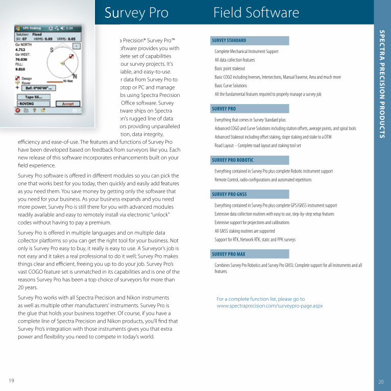
Spectra Precision® Survey Pro™ Field Software provides you with a complete set of capabilities for all your survey projects It's fast, reliable, and easy-to-use Transfer data from Survey Pro to your laptop or PC and manage your jobs using Spectra Precision Survey Offi ce software Survey Pro software ships on Spectra Precision's rugged line of data collectors providing unparalleled integration, data integrity,
effi ciency and ease-of-use The features and functions of Survey Pro have been developed based on feedback from surveyors like you Each new release of this software incorporates enhancements built on your fi eld experience
Survey Pro software is off ered in diff erent modules so you can pick the one that works best for you today, then quickly and easily add features as you need them You save money by getting only the software that you need for your business As your business expands and you need more power, Survey Pro is still there for you with advanced modules readily available and easy to remotely install via electronic “unlock” codes without having to pay a premium
Survey Pro is off ered in multiple languages and on multiple data collector platforms so you can get the right tool for your business Not only is Survey Pro easy to buy, it really is easy to use A Surveyor’s job is not easy and it takes a real professional to do it well; Survey Pro makes things clear and effi cient, freeing you up to do your job Survey Pro’s vast COGO feature set is unmatched in its capabilities and is one of the reasons Survey Pro has been a top choice of surveyors for more than 20 years
Survey Pro works with all Spectra Precision and Nikon instruments as well as multiple other manufacturers' instruments Survey Pro is the glue that holds your business together Of course, if you have a complete line of Spectra Precision and Nikon products, you’ll fi nd that Survey Pro’s integration with those instruments gives you that extra power and fl exibility you need to compete in today’s world
Survey Pro Field Softwaresp
ectr
a p
rec
ision
pr
od
uc
ts
SUrVeY STanDarD
Complete Mechanical Instrument Support
All data collection features
Basic point stakeout
Basic COGO including Inverses, Intersections, Manual Traverse, Area and much more
Basic Curve Solutions
All the fundamental features required to properly manage a survey job
SUrVeY Pro
Everything that comes in Survey Standard plus:
Advanced COGO and Curve Solutions including station off sets, average points, and spiral tools
Advanced Stakeout including off set staking, slope staking and stake to a DTM
Road Layout – Complete road layout and staking tool set
SUrVeY Pro roBoTIc
Everything contained in Survey Pro plus complete Robotic instrument support
Remote Control, radio confi gurations and automated repetitions
SUrVeY Pro GnSS
Everything contained in Survey Pro plus complete GPS/GNSS instrument support
Extensive data collection routines with easy to use, step-by-step setup features
Extensive support for projections and calibrations
All GNSS staking routines are supported
Support for RTK, Network RTK, static and PPK surveys
SUrVeY Pro maX
Combines Survey Pro Robotics and Survey Pro GNSS: Complete support for all instruments and all features.
For a complete function list, please go towww spectraprecision com/surveypro-page aspx
Spectra Precision® Survey Pro™ Field Software provides you with a complete set of capabilities for all your survey projects It's fast, reliable, and easy-to-use Transfer data from Survey Pro to your laptop or PC and manage your jobs using Spectra Precision Survey Offi ce software Survey Pro software ships on Spectra Precision's rugged line of data collectors providing unparalleled integration, data integrity,
Survey Pro Field Software
for all your survey projects It's fast, reliable, and easy-to-use Transfer data from Survey Pro to your laptop or PC and manage your jobs using Spectra Precision

22
Spectra Precision® Survey Offi ce software is ideal for processing and analyzing GPS and GNSS, and terrestrial (total station and level) survey data recorded in the fi eld, and exporting it to a design package The software provides numerous innovative and unique features, and it is easy to learn and use
With Spectra Precision Survey Offi ce software on your PC you have the ability to work
with RTK and Static/PPK data to generate reports as well as identify and correct fi eld errors Import data from existing surveys or directly from the Internet and export data as points, or in CAD or XML format Rest assured that your data is secure and reliable with built-in quality assurance and quality control features The intuitive, integrated Spectra Precision Survey Offi ce software saves time with its short learning curve and powerful features
Survey data acquired in the fi eld using a total station and contained in a data fi le can be imported into the software and integrated as necessary with other data collected as part of a survey project (for example, GNSS or level data)
The Spectra Precision Survey Offi ce software is powerful and confi gurable, yet easy-to-use The user interface features options that are familiar to Microsoft Offi ce users Drag-and-drop compatible fi les from your computer directly into an open project and the Spectra Precision Survey Offi ce software analyzes the fi le to determine its type and how it needs to be processed Visualization tools such as Plan views, 3D views, time-based data views and session editors help you "see" the data in the context of the entire project
The Spectra Precision Survey Offi ce software provides surveyors and engineers with advanced technology, integrating common tasks into a single system Process and review RTK, Static, FastStatic, and stop-and-go Kinematic data Spectra Precision Survey Offi ce also performs data reduction, computation, QA/QC and network adjustment Control data can be exported to the fi eld software for use in the fi eld
SamPLe feaTUreS/fUncTIonS
21
oVerVIeW
Core FeaturesImport/ExportProject explorer view of data hierarchyGraphic views (Plan View, 3D View)Lists of data allowing sorting and selection Points spreadsheet Occupation spreadsheetReports and quality assurance plotsInternet download – for base stations and precise ephemeris
Basic moduleGNSS L1 postprocessingLoop closure reportNetwork adjustment (L1 vectors)Complete moduleGNSS postprocessingFull network adjustment
SofTWare feaTUreS
FileProject New/Open/Close/Save/ArchivePage SetupPrint Preview/PrintImport/Export Survey DC (Survey Data Collector) Trajectory (CSV) CAD DXF DWG Construction LandXML Custom Points (user-defi ned ASCII export format)Import/Export Format EditorInternet DownloadEditUndo/Redo/Delete/Add PointExplode BlocksPropertiesViewNew Plan View/New 3D ViewNew Spreadsheet Points/Vector/OccupationNew Time-based ViewToggle Gridlines/Line marking3D View settingsProject Explorer/Selection ExplorerDevice PaneCommand PaneFlags paneView Filter ManagerZoomPan/Pan PreciseFloat/Unfl oat ViewProjectProject SettingsChange Coordinate SystemLocal Site SettingsDatum GriddingGeoid Sub-GriddingCompute ProjectSnap ModeLayer Options
SelectSelect AllInvert SelectionSelect/Duplicate PointsSelect ObservationsSelect Unprocessed SessionsSelect by Elevation Range/LayerAdvanced SelectSelection Set (save, manage, retrieveselection sets)PointCreate/Merge/Merge Duplicate/RenameSurveyFeature coding Process BaselinesClear Processing ResultsSessions EditorAdjust NetworkClear Adjustment ResultsSite Calibration/Clear Site CalibrationInverseMean Angle/Mean Angle residualsLevel editorReportsBaseline Processing ReportImport reportMean Angle ReportNetwork Adjustment ReportPoint Derivation ReportPoint ListProject Computation ReportSite Calibration ReportVector ListJob Report GeneratorReport OptionsToolsCoordinate System ManagerFeature Defi nition ManagerPlanningExternal Tools ManagerMeasure Angle Explore ObjectConfi guration / Data transfer Web pageCustomize /OptionsWindowNew Horizontal Tab GroupNew Vertical Tab GroupMove to Previous Tab GroupMove to Next Tab GroupClose All Windows
Survey Offi ce Offi ce Softwaresp
ectr
a p
rec
ision
pr
od
uc
tsyou have the ability to work with RTK and Static/PPK data to generate reports as well as identify
Spectra Precision® Survey Offi ce software is ideal for processing and analyzing GPS and GNSS, and terrestrial (total station and level) survey data recorded in the fi eld, and exporting it to a design package The software provides numerous innovative and unique features, and it is easy to learn and use
With Spectra Precision Survey Offi ce software on your PC
Survey Offi ce Offi ce Software
fi eld, and exporting it to a design
features, and it is easy to learn
With Spectra Precision Survey

up to corrosion from acids, chemicals, salts, and other destructive underground elements as well as to the physical abuse typical in the construction industry
23
� Widest automatic self-leveling range available
� Patented Target Lens transfers the beam up at an angle for easy viewing by the pipe layer
� Industry's largest display� Armor-plated housing� Rubberized front bumper� Line Alert*� Line Set-Check*
The Spectra Precision® Laser DG711 and DG511 pipe lasers feature the largest automatic leveling range in the industry, providing quick, easy setups, regardless of the grade Unlike traditional pipe lasers, there is no need for rough leveling, thus minimizing crew training Simply set up the laser in the pipe, manhole or open cut, set the proper grade and start working
The DG711 and DG511 Pipe Lasers are built tough for long lasting performance and reliability The DG711 and DG511 pipe lasers are completely waterproof and designed to ensure easy cleanup Setup is fast with a full range of mounting accessories available, and easy to use with straightforward, "no-instructions-required" controls In addition, through the Service Alert feature, they keep track of their own maintenance needs, indicating at pre-set intervals when it's time for a check-up
The DG711 has two additional features: Line Alert and Line Set-Check Line Alert is a unique feature that is ideal for working in high-vibration or wet conditions where the pipe lasers may be disturbed The beam fl ashes to notify you that the setup line has been disturbed, eliminating the necessity of rework The Line Set-Check capability of the pipe laser allows you to raise the beam outside of the trench for fast line setup or checking Raising the laser beam out of the trench to an above-ground stake saves you time, instead of having to move the excavator off -line during setup of the pipe laser; you can just get on with your job In addition, the Line Set-Check feature is ideal for rechecking the line in pipe jacking pits after each push
Spectra Precision pipe lasers feature a very rugged design and a variety of unique technological capabilities These pipe lasers stand
24
Performance SPecIfIcaTIonS
Grade Range –15% to +40% –15% to +40%Self-Leveling Range Complete grade range Complete grade range (no rough leveling required) (no rough leveling required)Line Range 20° 20°Line Center Yes YesGrade Zero and Quick Grade Yes YesLine Set/Check YesLine Alert YesTemperature Compensation YesGrade Compensation Yes YesMaintenance Interval Notifi cation Selectable Intervals: Selectable Intervals: 3, 6, 12, 18 or 24 Months 3, 6, 12, 18 or 24 MonthsWarranty Period 2 Years 1 Year
LaSer cLaSSIfIcaTIon
Laser output 4.5 to 5 mW 4.5 to 5 mW (maximum allowable) (maximum allowable)Laser classifi cation 3A/3R 3A/3R
GeneraL cLaSSIfIcaTIonS
Weight 3.6 kg (8.0 lb) 3.6 kg (8.0 lb)Length 37.5 cm (14.75 in) 37.5 cm (14.75 in) Diameter 14 cm (5.5 in) 14 cm (5.5 in)Housing material Armored Die Casting H Hard Anodized AluminumBattery type and life NiMH / 60 Hours with Daily NiMH / 60 Hours with Daily Setup at 20 °C (68 °F) Setup at 20 °C (68 °F)Battery pack Sealed (NiMH), Sealed (NiMH), 0-Ring Sealed Removable 0-Ring Sealed Removable (Alkaline) (Alkaline)Operating voltage 6 V DC to 16 V DC 6 V DC to 16 V DCOperating temperature –20 °C to 60 °C –20°C to 60 °C (–4°F to 140 °F) (-4 °F to 140 °F)Waterproof Continuous Submersion Continuous Submersion at 3 m (10 ft) at 3 m (10 ft)
WIreLeSS remoTe cLaSSIfIcaTIonS
Functionality 7 ButtonPower, 3 ButtonPower, Line and Grade Line Adjustment Adjustment, Line SetThrough the Pipe Range 225 m (750 ft) 37.5 cm 225 m (750 ft)Front / Over the Top Range 150 m (500 ft) 150 m (500 ft) Rear Range 10 m (30 ft) 10 m (30 ft)Battery life (normal operation) 2 Years / 24 Months 3 Years / 36 Months
DG711 DG511
* DG711 Model only
Available at authorized Spectra Precision dealers
DG711/DG511 Pipe Laserssp
ectr
a p
rec
ision
pr
od
uc
ts
� Widest automatic self-leveling
� Patented Target Lens transfers
� Industry's largest display� Armor-plated housing� Rubberized front bumper� Line Alert*� Line Set-Check*
DG711/DG511 Pipe Lasers�
�
�
�
�
�
�
DG711/DG511 Pipe Lasers

The GL522 off ers an additional advanced feature that stops the rotation and points the laser along one axis for “Over the Top” pipe laying applications
The GL512 and GL522 packages include the laser, RC402 remote, choice of either a HL750 or a CR600 receiver with clamps, NiMH rechargeable batteries & charger, and hard shelled carrying case
2625
The Spectra Precision® Laser GL512 single grade and GL522 dual grade transmitters are rugged, cost-eff ective, automatic self-leveling lasers that do three jobs—level, grade, and vertical alignment
Both the GL512 and GL522 include a 2-way, full-function radio remote control with a built-in back-lit grade display You can do everything with the remote control that you can do at the laser keypad, up to 100 m (330 ft) away from the laser—even from the cab of a machine! The ability to make grade changes from anywhere on the job greatly reduces setup time and speeds operation Verbal and visual communication errors are eliminated
New wireless communication between the HL750 Laserometer and the transmitters provide automatic Grade Matching Grade Matching allows measurement of unknown grade values between two points PlaneLok is also available in both the horizontal and vertical planes PlaneLok automatically locks the beam on the receiver and keeps it on grade This eliminates all environmental factors that may induce an error
The GL512 and GL522 Grade Lasers self-plumb in the vertical position to allow an even wider range of applications such as anchor bolt installation, tilt up, and curtain wall plumbing
Both units incorporate automatic temperature and grade compensation for high accuracy in any weather or geographical location Also, the laser beam can be turned off electronically on up to 3 sides of your choice This capability eliminates interference with other crews on the jobsite by keeping the beam from straying into other areas
� Automatic electronic self-leveling� Large compensated grade range
from –10% to +15%� Single and Dual grade application� Electronic leveling vibration fi lter� Automatic temperature and grade
compensation� Automatic Grade Matching� PlaneLok� Mask mode� High capacity NiMH battery pack
GeneraL SPecIfIcaTIonS
Laser type/class<5 mW 635 nm, Class 3A/3R (GL522)3 mW 650 nm, Class 2 (GL512)Drop height on concrete1 m (3 ft)Operating diameter(w/ HL750) 800 m, 2,600 ft (GL522)600 m, 2,000 ft (GL512)Compensation methodH/V Electronic Self LevelingTemperature compensationYes, every 5 °CLevel / vertical accuracy10 arc seconds1.5 mm @ 30 m (1/16" @ 100 ft)Grade range–10 to +15% Dual Axes (GL522)–10 to +15% Single Axis (GL512)Grade accuracy0.015% 3 mm@30 m (1/8" @ 100 ft)Grade resolution0.001% up to 9.999%,0.01 % at higher gradesGrade compensationYesTransmitter battery life (4 x D NiMHs)55 hoursMask modeUser selectable to any window, 3 max.
Remote control typeFull 2-way communication,operation and security lock with transmitterRemote control range100 m (330 ft) radiusRotation speed0 (GL522), 300, 600 RPM selectableRC402 battery Life (2 x AA Alkaline)130 hrs continuous1 year under normal useStandby modeYesDisplay backlightYes, auto shutoff after 8 secondsMounting threads5/8" x 11 Horizontal and VerticalOperating temperature–20° to +50°C (–4° to 122°F)Dust and waterproofYes - IP66Dimensions 21L x 18W x 20H cm (8.3L x 7.1W x 7.9H in)Weight3.1 kg (6.8 lb)Warranty2 Years
Available at authorized Spectra Precision dealers
GL522/GL512 Grade Laserssp
ectr
a p
rec
ision
pr
od
uc
ts
� High capacity NiMH battery pack
Automatic electronic self-leveling
Large compensated grade range from –10% to +15%
Single and Dual grade application
Electronic leveling vibration fi lter
Automatic temperature and grade compensation
Automatic Grade Matching
PlaneLok
Mask mode
GL522/GL512 Grade Lasers
� Automatic electronic self-leveling� Large compensated grade range
� Single and Dual grade application� Electronic leveling vibration fi lter� Automatic temperature and grade
� Automatic Grade Matching� PlaneLok� Mask mode
GL522/GL512 Grade Lasers

2827
More contractors around the world use Spectra Precision lasers to increase construction jobsite productivity and profi tability than any other brand Each laser comes with the solid dependability that has made the Spectra Precision Laser name the standard in the industry
The automatic, self-leveling Spectra Precision Lasers are the most rugged lasers available, tough enough to handle a wide variety of general and concrete construction applications Even in harsh jobsite conditions, these lasers will deliver consistent, reliable and accurate performance, enabling you to work faster and smarter
LL300**� Delivers consistent reliable performance even in the harshest jobsite conditions
� Customizable to your needs with choice of two receivers
The rugged Spectra Precision® Laser LL300 laser can withstand drops of up to 1 m (3 ft) onto concrete and tripod tip-overs up to 1 5 meters (5 ft) This strength, combined with full weatherproofi ng and dust proofi ng, reduces downtime and lowers repair costs over the life of the product The LL300 laser’s self-leveling capability and optional RC601 remote control result in outstanding accuracy and ease of use Since the LL300 laser levels itself when turned on, setup is easy with fewer controlsto deal with The RC601 remote control gives you the option of matching slopes or having slopes-on-grade It also off ers single-axis slope including HI warning control with the other axis continuing to level itself
� Automatic self-leveling� Durable construction� One touch operator controls
for quick start up� Long battery life� Exclusive ins tant “Over
the Counter” replacement warranty, for 3 years*
LL100� Complete leveling crew in a case
� Simple one-button operation for quick start up
The fully automatic, self-leveling Spectra Precision® Laser LL100 sets a new standard in rugged reliability, handling a wide variety of general construction applications Even in the toughest jobsite conditions, the LL100 consistently delivers reliable, accurate performance to increase your overall productivity and cost-savings The LL100 laser mounts on a tripod and sends a 360° plane of laser light over the entire work area, allowing one person to take accurate, self-leveled elevation measurements up to 150 m (500 ft) away with the HR320 laser receiver The LL100 is designed to be durable and reliable, day in and day out, and features superior drop and weather protection The tough LL100 laser can withstand drops of up to 1 m (3 ft) onto concrete and tripod tip-overs up to 1 5 m (5 ft) This ruggedness results in reduced downtime and lower repair costs A tripod and grade rod is included with the laser, HR320 receiver, in one hard-shelled, portable, system carrying case It’s easy to transport, easy to carry, easy to store, and especially easy to use
HV101� Remote control off ers scanning, speed control, slope setting, and alignment control for fast one person setups
� Beam is easily visible even in brightly lit interior conditions
The Spectra Precision® Laser HV101 is a professional tool with an economical price tag Exceptional versatility allows it to handle a wide variety of horizontal, vertical and plumb applications The HV101 laser transmitter is automatically self-leveled in the horizontal and vertical planes and sends a continuous 360-degree laser reference over the entire work area The HV101 laser is easy to set up and use and is rugged enough for the toughest jobsite Simple controls allow operators to carry out many functions with “one-touch” commands A remote control off ers scanning, speed control, slope settings, and alignment control for fast one person setups Highly durable construction enables the HV101 laser to survive a drop of up to 1 m (3 ft) onto concrete IP54 environmental sealing means the HV101 is unaff ected by dust or moisture
* Only for LL100 and HV101
** Available at authorized Spectra Precision dealers
LL300/LL100/HV101 Positioning & Alignment Laserssp
ectr
a p
rec
ision
pr
od
uc
ts
Automatic self-leveling
Durable construction
One touch operator controls
Long battery life
Exclusive ins tant “Over
LL300/LL100/HV101 Positioning & Alignment Lasers
� Automatic self-leveling� Durable construction� One touch operator controls
� Long battery life� Exclusive ins tant “Over
LL300/LL100/HV101 Positioning & Alignment Lasers

3029
LL300 Laser HV101 LaserLL100 LaserSPecIfIcaTIonS
Laser Source635 – 670 nm visible, Class 3A/3RLaser Accuracy ±20 arc seconds±2.2 mm per 30 m (±3/32 in per 100 ft)Operating Receiver Range (Diameter)400 m (1,300 ft)w/HR350 ReceiverSelf-Leveling Range±5ºCompensation MethodElectronic Self LevelingPower Source4 x D Rechargeable NiCad or Alkaline BatteriesBattery Life (20 ºC / 68 ºF)Rechargeable NiCad: 45 hours, Alkaline: 90 hoursBattery Status LEDFlashing Red LEDBattery Recharging TimeLess than 10 hoursRotation Speed 600 RPMOut of Level (HI)-WarningRotor stops, red out-of-level LED blinksOut of Level Warning at ReceiverProgrammable at dealer(with CR600 receiver only)Machine Control CompatibleYesProtective Rotor CageYesDrop Height on Concrete1 m (3 ft)Single Axis Manual Slope ModeYes (w/self-leveling mode on the second axis), with optional RC601 remote controlExternal Remote Control (Operating Range)Up to 50 m(164 ft)Tripod Mount (Horizontal and Vertical)5/8"–11Operating Temperature–20 ºC to +50 ºC (–4 ºF to 122 ºF)Storage Temperature–20 ºC to +70 ºC (–4 ºF to 158 ºF)Warranty2 yearsWaterproofYes, IP54Size24.5L cm x 16.5W cm x 18.5H cm (9.6L in x 6.5W in x 7.3H in)Weight2.7 kg (6 lb)
SPecIfIcaTIonS
Laser Source<5 mW @ 635 nm, Class 3ALaser Accuracy ±20 arc seconds±2.2 mm per 30 m (±3/32 in per 100 ft)Operating Range 100 ft (30 m) minimum visual1,000 ft (300 m) diameter with receiverSelf-Leveling Range±5ºCompensation MethodElectronic Self LevelingPower Source2 x "D" Alkaline BatteriesBattery Life 50 hours Alkaline45/25 hours user provided Ni-MH/Ni-CDBattery Status LEDFlashing red LEDRotation Speed Four preset speeds 0, 50, 200, 600 RPMScan anglesFive preset angles 3°, 8°, 45°, 90°, 180°Out of Level (HI)-WarningRotor stops, laser shuts off,red out-of-level LED flashesOperating Temperature 23 °F to 113 °F (–5 °C to 45 °C)Storage Temperature–4 °F to 158 °F (–20 °C to 70 °C)Warranty3 Year Limited with Instant ExchangeWaterproof Yes, and IP54 sealingSize21.6L cm x 17.1W cm x 15.2H cm (0.5L in x 6.7W in x 6.0H in)Weight1.5 kg (3.3 lb)
SPecIfIcaTIonS
Laser Source650 nm visible, Class 2Laser Accuracy ±20 arc seconds±2.2 mm per 30 m (±3/32 in per 100 ft)Operating Range (Diameter)w/HR320 receiver1,000 ft (300 m)Self-Leveling Range±5ºCompensation MethodElectronic Self LevelingPower Source 2 "D" alkalineBattery Life 80 hoursRotation Speed 600 rpmOut of Level (HI)-WarningYesDrop Height on Concrete1 m (3 ft)Single Axis Manual Slope ModeYes Tripod Mount (Horizontal and Vertical)5/8"–11Operating Temperature23 °F to 113 °F (–5 °C to 45 °C)Storage Temperature–4 °F to 158 °F (–20 °C to +70 °C)Warranty3-Year limited with instant exchangeWaterproofYes, IP54 sealingSize22L cm x 17W cm x 15 Hcm (8.5L in x 6.7W in x 6.0H in)Weight1.5 kg (3.3 lb)
LL300/LL100/HV101 Positioning & Alignment Laserssp
ectr
a p
rec
ision
pr
od
uc
ts
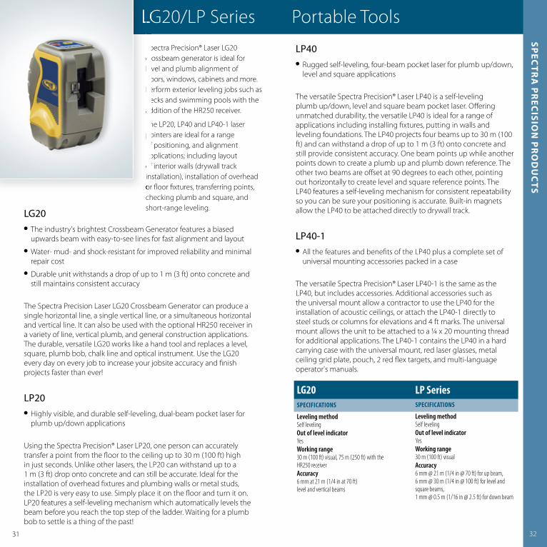
LG20� The industry's brightest Crossbeam Generator features a biased
upwards beam with easy-to-see lines for fast alignment and layout � Water- mud- and shock-resistant for improved reliability and minimal
repair cost � Durable unit withstands a drop of up to 1 m (3 ft) onto concrete and
still maintains consistent accuracy
The Spectra Precision Laser LG20 Crossbeam Generator can produce a single horizontal line, a single vertical line, or a simultaneous horizontal and vertical line It can also be used with the optional HR250 receiver in a variety of line, vertical plumb, and general construction applications The durable, versatile LG20 works like a hand tool and replaces a level, square, plumb bob, chalk line and optical instrument Use the LG20 every day on every job to increase your jobsite accuracy and fi nish projects faster than ever!
LP20� Highly visible, and durable self-leveling, dual-beam pocket laser for
plumb up/down applications
Using the Spectra Precision® Laser LP20, one person can accurately transfer a point from the fl oor to the ceiling up to 30 m (100 ft) high in just seconds Unlike other lasers, the LP20 can withstand up to a 1 m (3 ft) drop onto concrete and can still be accurate Ideal for the installation of overhead fi xtures and plumbing walls or metal studs, the LP20 is very easy to use Simply place it on the fl oor and turn it on LP20 features a self-leveling mechanism which automatically levels the beam before you reach the top step of the ladder Waiting for a plumb bob to settle is a thing of the past!
LP40� Rugged self-leveling, four-beam pocket laser for plumb up/down,
level and square applications
The versatile Spectra Precision® Laser LP40 is a self-leveling plumb up/down, level and square beam pocket laser Off ering unmatched durability, the versatile LP40 is ideal for a range of applications including installing fi xtures, putting in walls and leveling foundations The LP40 projects four beams up to 30 m (100 ft) and can withstand a drop of up to 1 m (3 ft) onto concrete and still provide consistent accuracy One beam points up while another points down to create a plumb up and plumb down reference The other two beams are off set at 90 degrees to each other, pointing out horizontally to create level and square reference points The LP40 features a self-leveling mechanism for consistent repeatability so you can be sure your positioning is accurate Built-in magnets allow the LP40 to be attached directly to drywall track
LP40-1� All the features and benefi ts of the LP40 plus a complete set of
universal mounting accessories packed in a case
The versatile Spectra Precision® Laser LP40-1 is the same as the LP40, but includes accessories Additional accessories such as the universal mount allow a contractor to use the LP40 for the installation of acoustic ceilings, or attach the LP40-1 directly to steel studs or columns for elevations and 4 ft marks The universal mount allows the unit to be attached to a ¼ x 20 mounting thread for additional applications The LP40-1 contains the LP40 in a hard carrying case with the universal mount, red laser glasses, metal ceiling grid plate, pouch, 2 red fl ex targets, and multi-language operator's manuals
3231
Spectra Precision® Laser LG20 crossbeam generator is ideal for level and plumb alignment of doors, windows, cabinets and more Perform exterior leveling jobs such as decks and swimming pools with the addition of the HR250 receiver
The LP20, LP40 and LP40-1 laser pointers are ideal for a range of positioning, and alignment applications; including layout of interior walls (drywall track installation), installation of overhead or fl oor fi xtures, transferring points, checking plumb and square, and short-range leveling
LG20 LP SeriesSPecIfIcaTIonS
Leveling methodSelf levelingOut of level indicator YesWorking range30 m (100 ft) visual, 75 m (250 ft) with the HR250 receiverAccuracy6 mm at 21 m (1/4 in at 70 ft)level and vertical beams
SPecIfIcaTIonS
Leveling methodSelf levelingOut of level indicator YesWorking range30 m (100 ft) visualAccuracy6 mm @ 21 m (1/4 in @ 70 ft) for up beam,6 mm @ 30 m (1/4 in @ 100 ft) for level and square beams,1 mm @ 0.5 m (1/16 in @ 2.5 ft) for down beam
LG20/LP Series Portable Toolssp
ectr
a p
rec
ision
pr
od
uc
ts
of interior walls (drywall track
or fl oor fi xtures, transferring points,
Spectra Precision® Laser LG20 crossbeam generator is ideal for level and plumb alignment of doors, windows, cabinets and more Perform exterior leveling jobs such as decks and swimming pools with the addition of the HR250 receiver
The LP20, LP40 and LP40-1 laser pointers are ideal for a range of positioning, and alignment applications; including layout of interior walls (drywall track
LG20/LP Series Portable ToolsSpectra Precision® Laser LG20 crossbeam generator is ideal for
doors, windows, cabinets and more
decks and swimming pools with the addition of the HR250 receiver
The LP20, LP40 and LP40-1 laser
of positioning, and alignment applications; including layout of interior walls (drywall track
LG20/LP Series Portable Tools
3433
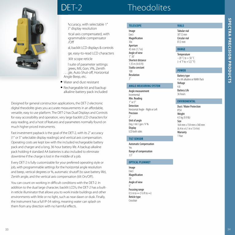
Designed for general construction applications, the DET-2 electronic digital theodolite gives you accurate measurements in an aff ordable, versatile, easy to use platform The DET-2 has Dual Displays and Controls for easy accessibility and operation, very large backlit LCD characters for easy reading, and a host of features and parameters normally found on much higher priced instruments
Fast investment payback is the goal of the DET-2, with its 2" accuracy (1" or 5" selectable display readings) and vertical axis compensation Operating costs are kept low with the included rechargeable battery pack and charger and a long, 36 hour battery life A backup alkaline pack holding 4 standard AA batteries is also included to eliminate downtime if the charge is lost in the middle of a job
Every DET-2 is fully customizable for your preferred operating style or job, with programmable settings for the horizontal angle resolution and beep, vertical degrees or %, automatic shutoff (to save battery life), Zenith angle, and the vertical axis compensation (tilt On/Off )
You can count on working in diffi cult conditions with the DET-2 In addition to the dual large character, backlit LCD’s, the DET-2 has a built-in reticle illuminator that allows you to work inside buildings and other environments with little or no light, such as near dawn or dusk Finally, the instrument has a full IP-54 rating, meaning water can splash on them from any direction with no harmful eff ects
� 2" Accuracy, with selectable 1" or 5" display resolution
� Vertical axis compensated, with programmable compensator On/Off
� Dual, backlit LCD displays & controls� Large, easy-to-read LCD characters� Backlit scope reticle � Full suite of parameter settings:
Degrees, Mil, Gon, V%, Zenith Angle, Auto Shut-off , Horizontal Angle Beep, etc
� Water and dust resistant� Rechargeable kit and backup
alkaline battery pack included
TeLeScoPe
ImageErectMagnifi cation30xAperture45 mm (1.7 in)Angle of view1˚ 30'Shortest distance1.35 m (4.43 ft)Stadia constant100Resolution3"
anGLe meaSUrInG SYSTem
Angle measurementIncrementalMin. Reading1" or 5"DetectionHorizontal Angle - Right or Left Precision2"Unit of angleDeg / mil / gon / V %DisplayLCD both sides
TILT SenSor
Automatic CompensationYesRange of compensation±3'
oPTIcaL PLUmmeT
ImageErectMagnifi cation3XAngle of view5˚Focusing range0.5 m to ∞ (1.6 ft to ∞)Reticle typeCrosshair
VIaLS
Tubular vial30"/2 mm Circular vial8'/2 mm
ranGe
Temperature–20 ˚C to + 50 ˚C (–4 ˚F to +122 ˚F)
PoWer
Battery type4 x AA alkaline or NiMH PackVoltage4.8Battery Life36 hours
enVIromenTaL
Dust / Water ProtectionIP54Weight4.5 kg (9.9 lb)Size164 mm x 154 mm x 340 mm (6.4 in x 6.1 in x 13.4 in)Warranty1 Year
DET-2 Theodolitessp
ectr
a p
rec
ision
pr
od
uc
ts
� Water and dust resistant
2" Accuracy, with selectable 1" or 5" display resolution
Vertical axis compensated, with programmable compensator On/Off
Dual, backlit LCD displays & controls
Large, easy-to-read LCD characters
Backlit scope reticle
Full suite of parameter settings: Degrees, Mil, Gon, V%, Zenith Angle, Auto Shut-off , Horizontal
DET-2 Theodolites
� 2" Accuracy, with selectable 1"
� Vertical axis compensated, with
� Dual, backlit LCD displays & controls� Large, easy-to-read LCD characters� Backlit scope reticle � Full suite of parameter settings:
DET-2 Theodolites

3635
The AL2X-X series automatic levels are designed for a variety of elevation control and alignment tasks including general building construction, cut and fi ll measurements, area leveling, and landscaping
The levels are easy to set up and attach quickly to fl at or domed head tripods An adjustable built-in bubble mirror can be tilted for easy viewing of the circular bubble in any position A built-in optical peep sight and double-sided endless tangent drives allow for easy targeting and operation with either hand
Reliable automatic compensators ensure stability and accuracy in the line of sight Telescope optics are bright and clear providing sharp images for ease of viewing A short focusing distance provides for better performance in tight spots or on steep slopes Stadia lines on the reticle make distance calculations easy Angle measurements are quick and convenient with the horizontal scale located directly below the eyepiece
Rugged metal housings provide increased durability Weather resistant housing design and rubber and plastic controls ensure the instruments can continue working even in adverse environmental conditions All models include a hard-shell carrying case, plumb bob, rain hood, allen wrench, adjusting pin, and manual
� Choice of magnifi cation: 24x or 28x
� Choice of magnetic or air-dampened automatic compensators
� Double-sided, continuous horizontal tangent drives
� Stadia lines for simple distance measurement
� Convenient horizontal angle measurement
� Built-in bubble mirror and optical sighting alignment
� Metal housing increases durability� Water resistant construction
SPecIfIcaTIonS aL24a / m aL28a / m aL28m-GTELESCOPEImage Erect Erect Erect
Magnifi cation 24x 28x 28x
Objective aperture 30 mm (1.2 in) 30 mm (1.2 in) 30 mm (1.2 in)
Field of view 1° 20" 1° 20" 1° 20"
Minimum focusing distance 0.60 m (1.97 ft)
0.60 m (1.97 ft)
0.60 m (1.97 ft)
Stadia ratio 100 100 100
Additive constant 0 0 0
LEVEL VIAL SENSITIVITYCircular level 8'/ 2 mm 8'/ 2 mm 8'/ 2 mm
STANDARD DEVIATION(1 km double-run leveling)
±2.0 mm ±1.5 mm ±1.5 mm
AUTOMATIC COMPENSATOR Wire hung Wire hung Wire hung
Type A =Air Damper M=Magnetic Damper
A =Air Damper M=Magnetic Damper
Magnetic Damper
Working Range ± 15' ± 15' ± 15'
Setting Accuracy 0.5" 0.5" 0.5"
Horizontal Circle 360° 360° 400 gon
Minimum increment 1° 1° 1 gon
DIMENSIONS (L X W X H)Instrument – mm (inch) 130 x 190 x 135
(5.1 x 7.5 x 5.3)130 x 190 x 135(5.1 x 7.5 x 5.3)
130 x 190 x 135(5.1 x 7.5 x 5.3)
Carrying Case – mm (inch) 170 x 280 x 190(6.7 x 11 x 7.5)
170 x 280 x 190(6.7 x 11 x 7.5)
170 x 280 x 190(6.7 x 11 x 7.5)
WEIGHT – KG (LB)Instrument 1.6 (3.5) 1.6 (3.5) 1.6 (3.5)
Carrying Case 1.25 (2.75) 1.25 (2.75) 1.25 (2.75)
AL24/AL28 Auto Levelssp
ectr
a p
rec
ision
pr
od
uc
ts
Built-in bubble mirror and optical
Choice of magnifi cation: 24x or 28x
Choice of magnetic or air-dampened automatic compensators
Double-sided, continuous horizontal tangent drives
Stadia lines for simple distance measurement
Convenient horizontal angle measurement
Built-in bubble mirror and optical
AL24/AL28 Auto Levels
� Choice of magnifi cation: 24x or
� Choice of magnetic or
� Double-sided, continuous
� Stadia lines for simple distance
� Convenient horizontal angle
� Built-in bubble mirror and optical
AL24/AL28 Auto Levels
ac
cesso
ries
3837
Spectra Precision
ePocH 35 acceSSorIeSPoWer SUPPLY
Receiver charging bundle Battery SofTWare
Spectra Precision Survey Office Complete (L1/L2)Spectra Precision Survey Office Upgrade to complete module Spectra Precision Survey Office no dongle
caBLeS
Cable 1.5 m data Cable for LPB radio Cable for HPB radio mISceLLaneoUS
Transport CaseExtension pole
Accessories PrISm SYSTemS
Mini Prism SystemComplete tilting mini prism assemblyPremier Prism SystemWaterproof canister type prism Prism SystemWaterproof canister type prismStakeout Prism Assembly (25 mm)On-board level vials top and bottom
PoLeS anD acceSSorIeS
PRISM POLESPrism Pole, 2.6 m (8.5 ft) Compression LockPrism Pole, 2.6 m (8.5 ft) TLV LockPrism Pole, 3.7 m (12 ft) Compression LockPrism Pole, 4 m (13 ft) TLV LockACCESSORIES FOR PRISM POLESBipod, Thumb ReleaseRANGE POLES2.0 m Aluminum Range Pole2.0 m Carbon Fiber Range Pole2.0 m Carbon Fiber Snap-Lock Range Pole
refLecTor SHeeT TarGeTS
Reflector Sheet Target0 mm offset, built-in level bubbleAdapter for Reflector Sheet TargetFor mounting Reflector Sheet Target on prism pole
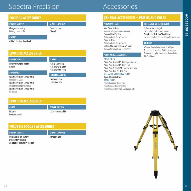
TrIPoDS
Wooden, Heavy Duty, Round Head TripodAluminum, Heavy Duty, Quick Clamp TripodAdvanced Fiberglass Composite, Heavy Duty Tri-Max Tripod
GeneraL acceSSorIeS – PrISmS anD PoLeS
ePocH 10 acceSSorIeScaSeS
Kit caseReceiver pouch
PoWer SUPPLY
1.2 m antenna cable
focUS 30 acceSSorIeSPoWer SUPPLY
Charger dual batteryBattery Li-Ion 11.1V
caBLeS
Cable 1.5m data download
mISceLLaneoUS
Transport caseTribrach
focUS 8 & focUS 6 acceSSorIeSPoWer SUPPLY
On-board Li-Ion batteryDual battery chargerAC adaptor for battery charger
mISceLLaneoUS
Transport case

4039
pac
iFic c
rest r
ad
io p
ro
du
cts
� Field-proven, fam iliar technology
� High Power Base Kits� Low Power Base Kits� PDL R epeaters� PDL R overs� Accessories� Replacement P arts
Pacifi c Crest
Positioning Data Link (PDL) radio kits and communication products from Pacifi c Crest provide the critical connection between the GNSS reference station and other GNSS user equipment Pacifi c Crest PDL units are compact, lightweight and power-effi cient The unique design of these units allows them to be mounted easily on all standard tripods and range poles
Pacifi c Crest PDL radios are turnkey solutions for RTK data linksthat easily integrate with most major GNSS OEM equipment The data link features a 19,200 bps data rate and fl exible transparent or packet-based protocol Waterproof and all-weather operational, PDL modems, kits and accessories help you increase productivity in the fi eld no matter where you are since they are compatible with GNSS RTK equipment
moDeLS oVerVIeW PDLLPB PDLHPB
GENERAL SPECIFICATIONS
DTE-DCE Interface 3 Wire, RS-232, 38.4 k Baud Max 3 Wire, RS-232, 38.4 k Baud MaxUser Interface On/Off Button On/Off Button Auto Power On feature included Auto Power On feature included Channel Button with AutoBase™ Channel Button with AutoBase and AutoRover and AutoRover™ Digital Display Digital Display Modem/Power Status Indicators Modem/Power Status Indicators RF Power Select Toggle Switch
PoWer
External 9–16 V DC 9–16 V DCInternal Battery N/A N/ADuring TX (nominal) 11 W 110 WDuring RX (nominal) 0.9 W 1.9 W
anTenna
External/Connector External 50 Ohm, NMO External 50 Ohm, BNC
moDem SPecIfIcaTIonS
Link Rate/Modulation 19,200 bps/4 Level FSK (25 kHz) 19,200 bps/4 Level FSK (25 kHz) 9600 bps/4 Level FSK (12.5 kHz) 9600 bps/4 Level FSK (12.5 kHz) 9600 bps/GMSK (25 kHz) 9600 bps/GMSK (25kHz) 4800 bps/GMSK (12.5 kHz) 4800 bps/GMSK (12.5kHz)Link Protocols Transparent, Packet Switched, transparent, Packet Switched Digipeater, TrimTalk Digipeater, TrimTalkForward Error Correction Yes Yes
raDIo SPecIfIcaTIonS
Frequency Bands 430–450 MHz, 450–470 MHz 430–450 MHz, 450–470 MHzFrequency Control Synthesized 12.5 kHz Resolution Synthesized 12.5 kHz Resolution ±2.5 ppm Stability ±2.5 ppm StabilityRF Power Select Factory Set Low/High RF Transmitter Output 0.5/2 Watts 2/35 Watts MaximumSensitivity –110 dBm BER 10-5 –110 dBm BER 10-5
Adjacent Channel Selectivity >65 dB (25 kHz), >65 dB (25 kHz), >55 dB (12.5 kHz) >55 dB (12.5 kHz)Type Certifi cation All models are type accepted and certifi ed for operation in the U.S. and Canada
enVIronmenTaL SPecIfIcaTIonS
Operating Temperature –22 to +140 °F (–30 to +60 °C) –22 to +140 °F (–30 to +60 °C)Storage Temperature –67 to +185 °F (–55 to +85 °C) –67 to +185 °F (–55 to +85 °C)Vibration/Shock ANSI/ASAE EP455 ANSI/ASAE EP455Enclosure IEC 144/855420 IP 66 IEC 144/855420 IP 66 Watertight and Dustproof Watertight and Dustproof
mecHanIcaLSPecIfIcaTIonS
Dimensions 8.25"L x 2.40" Diameter 6.23" W x 2.77" H x 6.58"L (21.0 cm L x 6.1 cm Diameter) (15.8 cm W x 7.0 cm H x 16.7 cm L)Weight 0.65 lb (0.30 Kg) 2.96 lb (1.34 Kg)Data Power Connector 5-pin LEMO #0 Shell 5-pin LEMO #1 ShellMounting Options 5/8"–11 Range Pole Tripod Bracket
� Field-proven, fam iliar technology
� High Power Base Kits� Low Power Base Kits� PDL R epeaters� PDL R overs� Accessories� Replacement P arts
Pacifi c Crest


Spectra preciSion10355 Westmoor DriveSuite #100Westminster, co 80021USa+1-720-587-4700 phone888-477-7516 (toll Free in USa)www.spectraprecision.com
For more information and sales contacts:www.spectraprecision.com
© 2009, Spectra Precision. All rights reserved. Spectra Precision and the Spectra Precision logo, FOCUS and EPOCH are trademarks of Spectra Precision, registered in the United States and in other countries. StepDrive and LockNGo are unregistered trademarks of Trimble Navigation Limited. Windows Mobile is a trademark of Microsoft Corporation, registered in the United States and/or other countries. All other trademarks are the property of their respective owners. PN 022487-189 (09/09)
contact your local dealer:
Specifications subject to changes without notice.
SURVEY AND CONSTRUCTIONPRODUCT CATALOG
WWW.SPECTRAPRECISON.COM
Simply Powerful.