surveying, charting and mapping problems in papua · pdf filesurveying, charting and mapping...
TRANSCRIPT
The Geographical Journal, Vol. 151, No. 3, November 1985, pp. 371-378
SURVEYING, CHARTING AND MAPPING PROBLEMS IN PAPUA NEW GUINEA
P. DONE
Aspects of the rather confused state of survey control, mapping and hydrographic work in Papua New Guinea are considered, and recommendations are made. Relevant further reading material is listed in a bibliography.
T IS A TRUISM that geodetic and subsequent control surveys provide the essential basis for all mapping and charting operations. Ideally there should be an integrated
national network which is specified, coordinated and administered by central authority. However, historical, political, economic and other ad hoc factors may often combine to produce a complex, composite and apparently irrational result. In the case of Papua New Guinea, pre-Second World War control was virtually non-existent. Control surveys that were carried out during the war were largely confined to areas of immediate military relevance, and these tended to be on independent and often unconnected datums. One result of this deficiency was that serious errors in positions and elevations of mountain peaks were made, which are known to have contributed to losses of aircraft. In the years immediately following the war, some further independent control surveys were carried out on the mainland and in the islands by both military and civil authorities. With the advent of electronic distance measurement in the early 1960s, such operations became easier, with the emphasis shifting from triangulation to traversing, and a 'tellurometer' control survey was carried out in the period 1963-65. The well known disadvantage of such microwave work is its critical dependence on a knowledge of meteorological parameters-over long distances the provenance of measurements merely made at each end of the line is always doubtful.
Geodetic surfaces of reference The earth is curved, a fact which any system of primary geodetic control over a large
area, such as a country or a continent, must take into account. Since the geoid, or mean sea level (m.s.l.) surface is irregular, a theoretical surface, an ellipsoid, or oblate spheroid, is postulated, to which the coordinates of points are referred, so that instead of rectangular coordinates, ellipsoidal coordinates (t(, X, h) are defined with q being geodetic latitude, X being geodetic longitude and h being height above the hypothetical surface. Computations involve observed quantities being first 'reduced' to this ellipsoid, and then fairly complex formulae bound up with the doubly curved geodesic, the shortest distance between two points on the surface, are invoked.
The theoretical surfaces known as ellipsoids (the term often, somewhat confusingly, being regarded as interchangeable with 'spheroids') may be grouped in two principal classes. In the first are the so-called local ellipsoids. These are positioned and defined to approximate closely to the geoid surface in the area of interest (a country or a continent, for example). They are therefore said, and indeed designed, to 'fit' the geoidal surface well over an area which is usually comparatively limited, at least in the global sense.
'Goodness of fit' may be quantified as the geoid/ellipsoid separation (N). If this is small, distances reduced to the geoid may be used in ellipsoidal calculations without the introduction of serious errors; in fact, ignoring an N value of 6 m, for instance, results in a scale error of 1 part per million (ppm). A further aspect of 'fit' concerns the difference between the local vertical at a point (which is the direction of local gravity, of significance since surveying instruments are set up with their principal axes 'level', that is perpendicular, to this) and the normal to the ellipsoid, which is known as the deflection, or deviation, of the vertical. Directions observed with respect to the former
->* Peter Done is Associate Professor in the Department of Surveying and Land Studies, University of Technology, Lae, Papua New Guinea. This paper was accepted for publication in January 1985.
0016-7398/85/0003-0371/$00.20/0 () 1985 The Royal Geographical Society
0o t<m 290
YQ NEW IRELAND
o
Arawa Bay /KIETA
E A
, PHILIPPINES
INDONESIA
(AUSTRALIA
, /
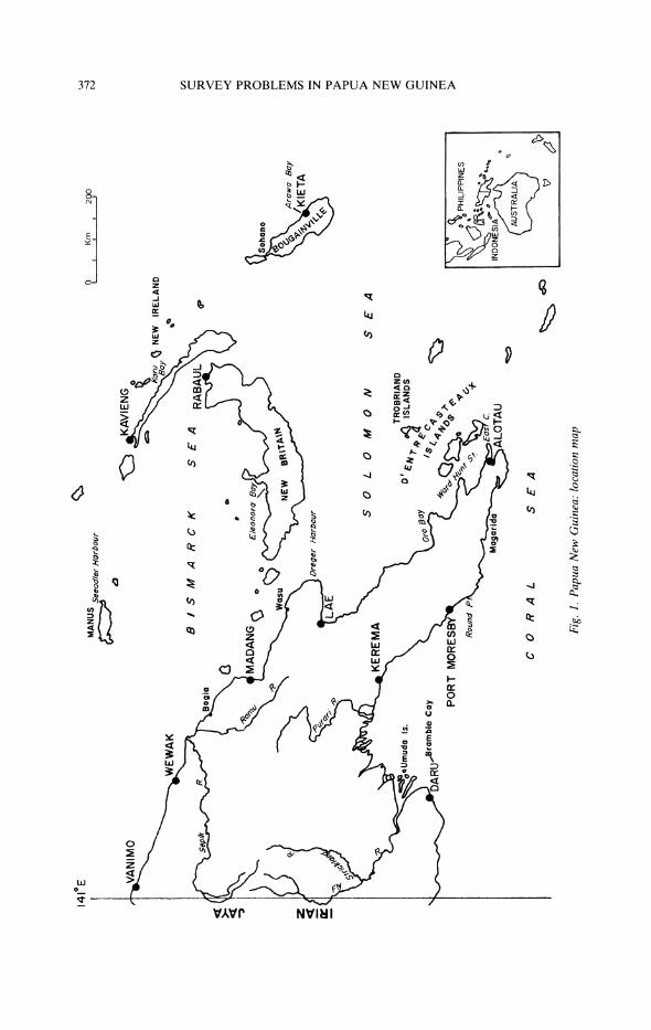
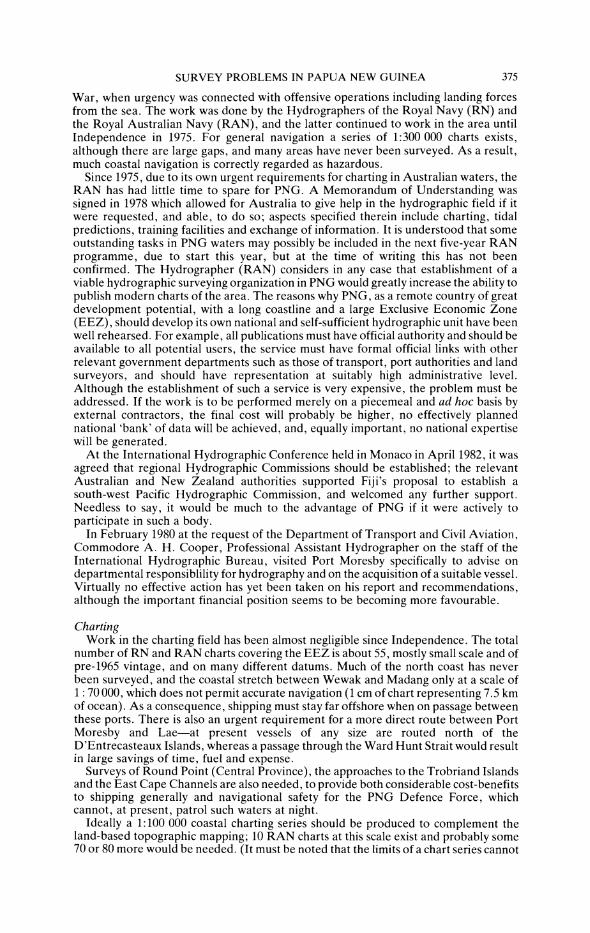
Fig. 1. Papua New Guinea: location map
141?E k hi
z
Zc
V:
CC "o
rTi
0 CTI
r-I
,It
rTi
C) Clf
rZr mr
^;;z?
SURVEY PROBLEMS IN PAPUA NEW GUINEA
should be 'reduced' to ellipsoidal directions taking this into account. If this is not done, inconsistencies and local distortions occur in the computed control network; ignoring a deflection of the vertical of, say, 10 seconds of arc can result in a one second error in a direction, in turn producing a 5 ppm positional error.
Local ellipsoids have been widely used in the past, and most national mapping systems are based on such surfaces as appropriately defined for individual countries. A second class of ellipsoid, however, is now attaining more significance: here the principal characteristic is geocentricity-i.e. the centre of the ellipsoidal figure coincides with the geocentre and one principal axis is aligned with the earth's axis of spin. The relevance of such ellipsoids is a consequence of the increasing part played in geodetic and control surveys by satellite techniques; satellite orbits and ephemerides are predicted using models of geopotential conveniently referred to a geocentric origin.
The Australian national spheroid and geodetic datum Much of PNG has been mapped using geodetic control based on a piecemeal network
computation referred to the Australian National Spheroid (ANS). This is a local ellipsoid, introduced to meet the need for a unified control system in Australia (known as the Australian Geodetic Datum 1966 or AGD 66), and its 'fit' to PNG obviously was not a consideration. In fact, in the south west of the country the fit is reasonably good, but in New Ireland the geoid is some 30 m below the ANS; in other words, the ANS is inclined to, and intersects, the m.s.l. surface in PNG. Measured distances merely reduced to m.s.l. can therefore be regarded as ellipsoidal distances for control computation purposes only within an accuracy of about 6 ppm. The second aspect of fit, that of deflection of the vertical, is also significant; in PNG the maximum deflection of the vertical is thought to be approximately 64 seconds of arc, much greater than in Australia. Clearly, this is a potentially serious source of directional and computational error (6 to 7 seconds may be involved). Ideally, its exact value should be known at each control point and it should be rigorously employed in the computation process. There is little or no evidence that this has ever been done.
Satellite work and the two datums In the period 1974-79, 202 satellite point positioning fixes were achieved in PNG by
the Royal Australian Survey Corps (RASC). These provide coordinates based on an earth-centred datum. Using observations by AN/PPR-14 Geoceiver to the US NAVSAT satellite system, the derived coordinates are based on the Naval Weapons Laboratory 9D (NWL-9Z-2) ellipsoid. These values are then transformed to the geodetic datum in use. Selection of the World Geodetic System 1972 (WGS-72) ellipsoid was agreed on by Australia and Papua New Guinea. This 'surface' is very roughly parallel to the geoid in PNG but is, on average, about 74 m below it, the range of N values being from 4 60 to +85 m. Due to the fact that many offshore areas (e.g. Manus, New Ireland and the North Solomons) of Papua New Guinea are not adequately connected to the AGD-66, use of WGS-72 was agreed on their behalf. Since 151 of the Doppler stations are in the AGD-66 area, and 51 in the WGS-72 area, coordinate transformations were required. Using the differences between NAVSAT-derived WGS-72 coordinates and known AGD-66 coordinates at 22 stations, WGS-72 coordinates for 129 stations in the AGD-66 were graphically transformed to AGD-66; changes varied from 4".43 to 5".45 southwards and 2".93 to 3".73 eastwards. Likewise, using the differences between NAVSAT-derived heights above the WGS-72 spheroid and known heights above m.s.l. at 109 stations throughout PNG, WGS-72 heights were graphically transformed to m.s.l. heights by interpolation at the satellite stations where no m.s.l. heights were available. It should be noted that these satellite results have not been used to recompute the networks, but have been employed for comparison and for the determination of local transformation parameters. No single set of the latter is valid for PNG as a whole, partly because of the piecemeal adjustment of the original surveys; this is not in fact unusual on a national scale. WGS-72, in contrast to AGD-66, is a geocentric (earth-centred) system, and transformation to other such systems whether existing or projected as replacements for the future can be carried out. Since it is envisaged that future survey work such as mapping and charting, border surveys, offshore navigation, oil-rig
373
SURVEY PROBLEMS IN PAPUA NEW GUINEA
positioning and isolated terrestrial surveys will increasingly employ satellite techniques, a fully integrated system of control based on WGS-72 is now to be aimed at, despite the large geoid/spheroid separations involved. Before this can be properly achieved, reliable data on m.s.l. and geoid heights are required.
When the RASC left PNG in 1981, they did in fact recommend that, should a unified national system of control be adopted, the one based on WGS-72 should be chosen. It may be noted that their estimate was that current AGD coordinates would then change by an average figure of 187 m on a bearing of 035?. Such major coordinate alterations could without doubt be expected to have considerable repercussions, a wide range of users obviously being affected.
Aerial photography In any developed or developing country, aerial photography and topographic
mapping should of course be as comprehensive as possible. As a result of Defence Aid agreement with Australia, Papua New Guinea has a complete cloud-free coverage of small scale (1:80 000-1:20 000) photography ('SKAI PIKSA') and, since 1980, a complete mainland and island coverage of 1:100 000 basic topographic mapping based on it. This is in stark contrast to the position in many other, less fortunate, developing countries. Approximately 150 major towns and villages have also been 'flown' at a scale of 1:100 000 and much of this photography has been assembled into uncontrolled mosaics. Some additional special project work covering potential road routes, mineral development and hydroelectric sites and forest areas has also been carried out. The basic 1:100 000 series covers the whole country in 280 sheets; these maps are finely detailed and none is more than ten years old, but, as will be appreciated from the above comments, the series is on two different datums, the mainland and some islands being mostly on the AGD/ANS, whilst the majority of the offshore islands is on WGS-72. The difference between the two systems is of the order of 3" and 5" in latitude and longtitude respectively, and of approximately 70 m in geoid-spheroid separation.
Some larger scale maps do exist, covering limited areas such as Port Moresby, Bougainville, New Ireland and Lae at scales of 1:50 000 and a few special areas at 1:10 000. Future demands will require more of these, clearly in those areas which are of an important urban nature or have development potential.
Hydrography The hydrographic requirements of any developing nation are of great importance;
economic expansion results in increased trade, and the necessary entry into its coastal waters and harbours of modern specialized vessels which are often very large. These require up-to-date and accurate charts, so that safe and economic passages can be made regularly and with total confidence. Almost invariably such a developing country has no hydrographic capability, and possesses limited chart coverage, probably based on work carried out in a previous century by a major naval charting service. Traditional inshore position-fixing methods then necessarily involved close visual fixing by horizontal sextant angles during daylight hours, and the quality of the surveys was often high; however, the relatively inaccurate lead-line was not superseded until the 1930s. Offshore work was obviously of much lower reliability and remained so until electronic position-fixing was introduced during the 1950s and 1960s. Many charts of the waters of even developed countries like Australia still depend to an uncomfortably large extent on arbitrary or indiscriminate nineteenth-century lines of soundings of questionable accuracy both in depth and position. These lines naturally often tend to follow transportation corridors between ports but reliance thereon is unwise; the initial work may have failed either to detect or to position correctly potential hazards, while interim changes, for example, due to siltation, coral head growth, or submarine volcanic activity may often have occurred. (In theory, of course, a chart, unlike a map, is continually updated; the user should inform the publishing authority of any significant information which can then be published in weekly Notices to Mariners.) In all cases the increased draught of current shipping emphasizes the potential dangers involved.
In the case of PNG waters, modern charting operations were initiated extra-nationally as a result of military and naval requirements during the Second World
374
SURVEY PROBLEMS IN PAPUA NEW GUINEA
War, when urgency was connected with offensive operations including landing forces from the sea. The work was done by the Hydrographers of the Royal Navy (RN) and the Royal Australian Navy (RAN), and the latter continued to work in the area until Independence in 1975. For general navigation a series of 1:300 000 charts exists, although there are large gaps, and many areas have never been surveyed. As a result, much coastal navigation is correctly regarded as hazardous.
Since 1975, due to its own urgent requirements for charting in Australian waters, the RAN has had little time to spare for PNG. A Memorandum of Understanding was signed in 1978 which allowed for Australia to give help in the hydrographic field if it were requested, and able, to do so; aspects specified therein include charting, tidal predictions, training facilities and exchange of information. It is understood that some outstanding tasks in PNG waters may possibly be included in the next five-year RAN programme, due to start this year, but at the time of writing this has not been confirmed. The Hydrographer (RAN) considers in any case that establishment of a viable hydrographic surveying organization in PNG would greatly increase the ability to publish modern charts of the area. The reasons why PNG, as a remote country of great development potential, with a long coastline and a large Exclusive Economic Zone (EEZ), should develop its own national and self-sufficient hydrographic unit have been well rehearsed. For example, all publications must have official authority and should be available to all potential users, the service must have formal official links with other relevant government departments such as those of transport, port authorities and land surveyors, and should have representation at suitably high administrative level. Although the establishment of such a service is very expensive, the problem must be addressed. If the work is to be performed merely on a piecemeal and ad hoc basis by external contractors, the final cost will probably be higher, no effectively planned national 'bank' of data will be achieved, and, equally important, no national expertise will be generated.
At the International Hydrographic Conference held in Monaco in April 1982, it was agreed that regional Hydrographic Commissions should be established; the relevant Australian and New Zealand authorities supported Fiji's proposal to establish a south-west Pacific Hydrographic Commission, and welcomed any further support. Needless to say, it would be much to the advantage of PNG if it were actively to participate in such a body.
In February 1980 at the request of the Department of Transport and Civil Aviation, Commodore A. H. Cooper, Professional Assistant Hydrographer on the staff of the International Hydrographic Bureau, visited Port Moresby specifically to advise on departmental responsiblility for hydrography and on the acquisition of a suitable vessel. Virtually no effective action has yet been taken on his report and recommendations, although the important financial position seems to be becoming more favourable.
Charting Work in the charting field has been almost negligible since Independence. The total
number of RN and RAN charts covering the EEZ is about 55, mostly small scale and of pre-1965 vintage, and on many different datums. Much of the north coast has never been surveyed, and the coastal stretch between Wewak and Madang only at a scale of 1: 70 000, which does not permit accurate navigation (1 cm of chart representing 7.5 km of ocean). As a consequence, shipping must stay far offshore when on passage between these ports. There is also an urgent requirement for a more direct route between Port Moresby and Lae-at present vessels of any size are routed north of the D'Entrecasteaux Islands, whereas a passage through the Ward Hunt Strait would result in large savings of time, fuel and expense.
Surveys of Round Point (Central Province), the approaches to the Trobriand Islands and the East Cape Channels are also needed, to provide both considerable cost-benefits to shipping generally and navigational safety for the PNG Defence Force, which cannot, at present, patrol such waters at night.
Ideally a 1:100 000 coastal charting series should be produced to complement the land-based topographic mapping; 10 RAN charts at this scale exist and probably some 70 or 80 more would be needed. (It must be noted that the limits of a chart series cannot
375
SURVEY PROBLEMS IN PAPUA NEW GUINEA
really be set by geographical coordinate division; large overlaps are very frequently required for navigational safety purposes-for example, a lighthouse must be shown on a chart to the limits of its visual range.) Such a work programme alone would fully occupy the lifetime of any survey vessel.
The Harbours Board urgently requires a series of regular surveys of the major and developing ports. Of these, only Lae has been surveyed since 1973, yet it is acknowledged that due to movement of sandbanks, siltation, coral head growth or potential coastal instability, surveys of ports such as Wewak, Madang, Kieta, Kavieng, Rabaul and Port Moresby require updating every ten years whilst Daru and Lae should be resurveyed at three-year intervals.
Amongst other outstanding needs are regular surveys of at the very least the lower reaches of the major rivers, the Fly and the Sepik, the former being of major topical interest in connection with the Ok Tedi Scheme (the mining of enormously rich gold and copper deposits in the remote Star Mountains at the headwaters of the Fly River, near the PNG/Indonesian border). The Fly has been charted at 1:50 000 by the Snowy Mountains Engineering Corporation for Ok Tedi Mining Ltd. The shifting, unstable nature of this waterway demands continuous attention, particularly in its tidal zone. The Sepik too is expected to develop in significance in the very near future, again in connection with mineral extraction work and probable forestry development.
Remote sensing Recent developments in remote sensing techniques could be of great use to PNG in
its present parlous hydrographic position; their advantages lie in reduction of the expensive ship-time factor and/or the lack of requirements for shore control and installation of electronic position-fixing facilities for offshore operations. Such relatively cheap, non-traditional methods have their own limitations and disadvantages and should be used with discretion: they should not be regarded, for example, as having replaced modern and rigorous hydrographic charting operations; professionally it is accepted that before a particular route is shown to be safe for surface navigation, the area must be surveyed by conventional means.
Photobathymetry is suitable for detailed mapping in clear shallow waters-it obviously requires ground control for aerotriangulation, but its use may release ships for operations in deeper waters. A cost advantage over ship-borne methods of about 5:1 is claimed, together with accuracies of around 1 m and water penetrations of up to 20 m. However, PNG might not be able to support such high technology, which, in any case, is still undergoing evaluation in Australian waters.
LANDSAT imagery is again suitable for reconnaissance mapping and reef location (but not coral-head detection) in shallow waters, at present with a positional accuracy adequate for 1:250 000 mapping. In Australian waters depth measurements up to 25 m with 10 per cent RMS accuracy have been achieved. It must be noted that depth derivation must be generally based on known depths in the area of LANDSAT scene, and that features found by LANDSAT must be related in position to other navigational dangers or features which a vessel uses to determine its position, even if the absolute positions of these features are not known.
The greater turbidity which characterizes many PNG riverine, estuarine and coastal areas may reduce the effectiveness of the above techniques, but both methods afford a means of rapid data gathering, at the very least for reconnaissance purposes.
In several areas of PNG, unlike the experience of much of the rest of the world, transport by air became established without an immediate phase dominated by the wheel. Such a technological 'leap-frog' may well be occurring in many aspects of surveying. Conventional methods are in a number of cases totally unsuitable for PNG, whereas recent developments in satellite-based operations offer attractive (i.e. cost-effective) alternatives covering a wide range of development-related activities.
The LANDSAT series of 'civilian' satellites was put into orbit by the United States National Aeronautics and Space Administration (NASA). Multispectral scanners in the first three satellites in the LANDSAT series scan the earth in four discrete spectra (in contradistinction to the lack of spectral resolution of the aerial photograph) at a ground resolution which is relatively coarse, 80 m2 approximately. The imagery is near vertical
376
SURVEY PROBLEMS IN PAPUA NEW GUINEA
(orthographic) and repetitive-almost exactly the same scene is imaged every 18 days. Overlaps are small, and all analysis is either by examination of monoscopic images using conventional photointerpretation techniques, or by computer-assisted digital tape interpretation where the spectral properties of objects are dominant.
Characteristic patterns on the earth's surface, caused, for example, by different spectral responses of objects, their spatial arrangement in any image, and the variation of either of these with time, as seen in a succession of images, may be identified and analysed. PNG coverage by LANDSAT imagery is complete although not as yet totally cloud-free; this latter aspect is of significance since there is no cloud penetration and even a small amount of randomly distributed cloud can render a single image useless for meaningful interpretation.
The format of the available imagery is digital (computer-compatible tapes), and photographic, in scales which vary from 1:3 million to 1:50 000. A fourth LANDSAT satellite was put into orbit in mid-1982. It presents considerable advances in the field of thematic mapping. Spatial resolution is down to some 30 m2; seven spectral scanners are used and the increased data flow is handled by a shift to the X-band of radio communication frequencies and a more powerful computer facility back-up.
Many projects in PNG will require environmental surveys at exploratory, planning, developmental and operational stages. Often other, and more traditional, methods of assessment and monitoring are available, but remain comparatively expensive; satellite-based techniques have great potential, for example, in the fields of mineral exploration, land use and forestry, site planning and map revision. In the hydrographic and oceanographic fields, in particular, much expensive ship time can be saved. The bathymetric and charting aspects have been mentioned, but other very important areas of relevance include siltation studies, coastline stability (often dependent on mangroves) as related to harbour development, and pollution studies.
Application of LANDSAT methods relies on an adequate base of expertise in the technique of data handling and a sound appreciation of the limitations involved. Essentially, it is still a new technology.
Conclusions and recommendations PNG is still in modern terms a remote, underdeveloped and under-surveyed country.
Its true potential is as yet unknown and many areas remain incredibly isolated. The surveying profession should play a pivotal role in the immediate future, as the country emerges into the twentieth century.
The following immediate priorities may be identified, but it is acknowledged that in the current economic and political climate their rapid realization is unlikely:
- development of a fully integrated national geodetic network, including first-order height control;
- use of modern satellite techniques both for the national geodetic network and for its subsequent densification;
- a major hydrographic effort, either through a combined south-west Pacific body and/or under Defence Force auspices;
- research into development and use of LANDSAT techniques; - systematic mapping programming, including updating of existing coverage and
the production of maps of larger scales; - the introduction of legislation regarding modern systems of land tenure, to
replace the predominant but archaic customary type.
Bibliography Done, P. The present status of hydrography in PNG. Int. hydrogr. Rev. Monaco. 60 (2), July
1983. Genia, J. Registration of customary land. Proc. of the Casle Pacific Regional Meeting. Port
Moresby, 1980. Greene, B. A. Space techniques for geodesy in Australia in the 1980's. Proc. of the 1st Australian
Congress of Surveying and Cartography. Canberra, 1982. Hawkey, W. N. Surveys for development. Proc. of the Casle Pacific Regional Meeting. Port
Moresby, 1980.
377
SURVEY PROBLEMS IN PAPUA NEW GUINEA
Jackson, R. Ok Tedi: the pot of gold. Port Moresby: University of Papua New Guinea, 1982. Kershaw, P. J. Taxation of customary land. Proc of the A.S. P.N. G. 17th Survey Congress. Port
Moresby, 1982. King, D. and Ranck, S. PNG Atlas-a nation in transition. Port Moresby: Department of
Geography, University of Papua New Guinea, 1982. Lloyd, D. C. Hydrographic surveying in PNG. Proc. of the Casle Pacific Regional Meeting. Port
Moresby, 1980. Lyons, K. J. One geodetic system for PNG-but which one? Proc. of the 16th Survey Congress.
Lae, 1981. McCulloch, T. D. W. The exploitation, management and development of oceanic resources. Proc.
of the Pacific Regional Meeting. Port Moresby, 1980. Mennis, B. J. Survey integration 1981. Proc. of the A.S.P.N.G. 16th Survey Congress. Lae, 1981. Milliken, B. E. Surveying by satellite. Proc. of the 3rd Int. Symp. on Satellite-Doppler positioning.
Las Cruces, 1982. Morgan, P. Simulation studies for crustal motion monitoring in PNG. Australian Journal of
Geodesy, Photogrammetry and Surveying, 35 (December), 1981. Nacino, T. M. Development of geodetic survey in Australia and PNG. Department of Surveying,
PNG University of Technology, Research series 4, 1982. Norokobi, B. M. Masta Mak. Proc. of the A.S.P.N.G. 13th Survey Congress, Lae, 1978. National Planning Office (PNG) National manpower assessment 1979-1980. National Planning
Office, Waigani, 1982. Pratt, F. Surveying in mineral exploration-Ok Tedi Copper Project. Proc. of the A.S.P.N.G.
12th Survey Congress. Port Moresby, 1977. Snowy Mountains Engineering Corporation. Ok Tedi Project: hydrographic survey of the Fly River
for Ok Tedi Mining Limited. Chart folio and report (Volumes 1 and 2). 1981 and 1983. Trebilock, M. J. Customary land reforms in PNG: law economics and property rights in a
traditional culture. Proc. of the 17th Survey Congress. Port Moresby, 1982. Wright, G. L. and Young, F. R. Development and use of remote sensing in PNG. Proc. of the
A.S.P.N.G. 16th Annual Congress. Lae, 1981. Young, F. R. Charting PNG's waters-the hydrographer's challenge. Hydrogr. J. 34, April 1982. Young, F. R. Satisfying a need-the hyregraphic. Cartography 13 (2), September 1983. Young, F. R. and Lyons, K. J. Hydrographic charting in PNG. Proc. of the XVI Congress (Fig).
Montreux, 1981.
378