synops a pesticide risk indicator model to assess ... · synops a pesticide risk indicator model to...
TRANSCRIPT

www.julius-kuehn.deLinked Open Data in Agriculture, MACS-G20 Workshop – 27-28 Sep. 2017, Berlin
SYNOPS a pesticide risk indicator model to assess
environmental risk
– contribution to and benefits of LOD
Strassemeyer J.1, Dominic A.R.1, Tecklenburg J.1 Daehmlow D.1, Horney P. 1, Claus A.2,
Böhmer J.2, Golla B.1
1 Institute for Strategies and Technology Assessment, Julius Kühn-Institute (JKI), Kleinmachnow, Germany2 Chamber of Agriculture in North-Rhine Westphalia, Plant Protection Service, Germany
(Schriftgröße mindestens 16, besser 1
Linked Open Data in Agriculture, MACS-G20 Workshop – 27-28 Sep. 2017, Berlin www.julius-kuehn.de
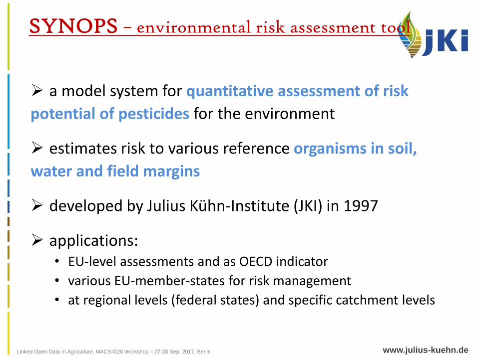
a model system for quantitative assessment of risk
potential of pesticides for the environment
estimates risk to various reference organisms in soil,
water and field margins
developed by Julius Kühn-Institute (JKI) in 1997
applications: • EU-level assessments and as OECD indicator
• various EU-member-states for risk management
• at regional levels (federal states) and specific catchment levels
SYNOPS – environmental risk assessment tool
Linked Open Data in Agriculture, MACS-G20 Workshop – 27-28 Sep. 2017, Berlin www.julius-kuehn.de
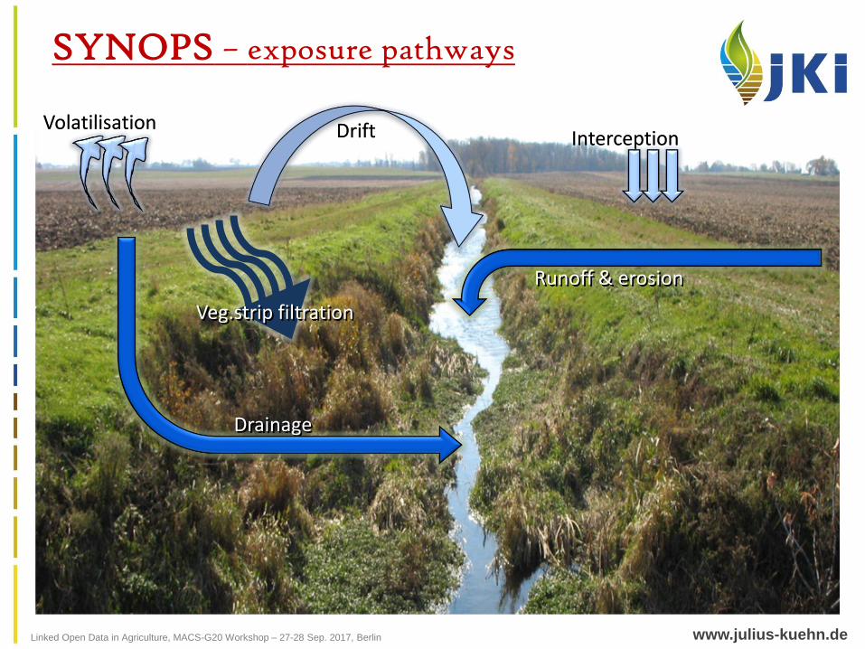
SYNOPS – exposure pathways
Runoff & erosion
Drainage
DriftVolatilisationInterception
Veg.strip filtration
Linked Open Data in Agriculture, MACS-G20 Workshop – 27-28 Sep. 2017, Berlin www.julius-kuehn.de
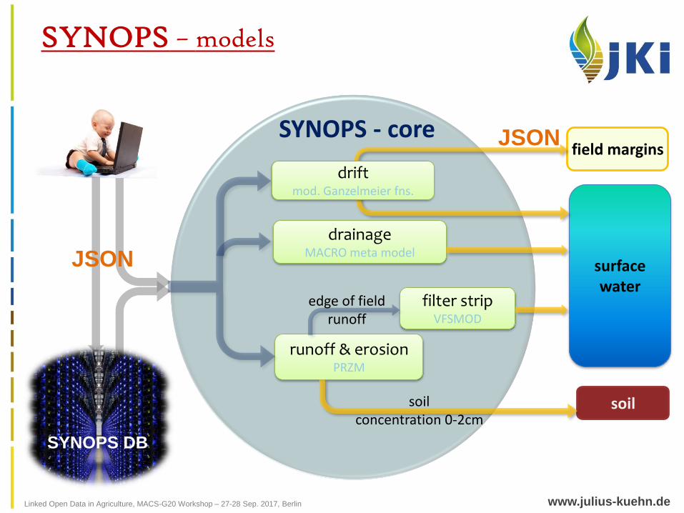
SYNOPS - core
runoff & erosionPRZM
drainageMACRO meta model
surface water
field margins
soil
edge of field runoff
filter stripVFSMOD
SYNOPS DB
soilconcentration 0-2cm
driftmod. Ganzelmeier fns.
SYNOPS – models
SYNOPS DB
JSON
JSON
Linked Open Data in Agriculture, MACS-G20 Workshop – 27-28 Sep. 2017, Berlin www.julius-kuehn.de
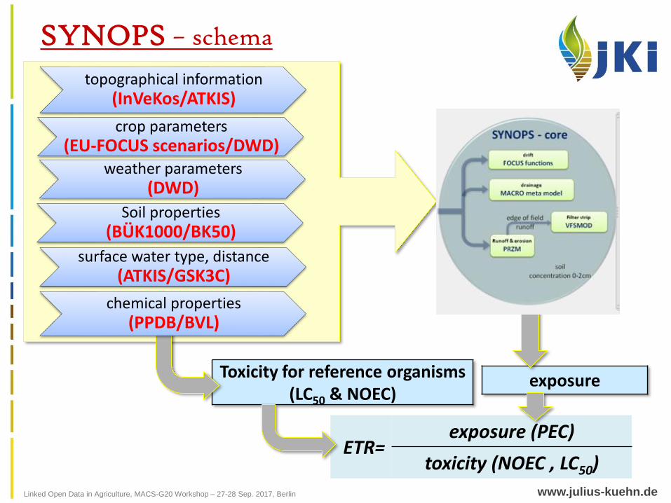
ETR=exposure (PEC)
toxicity (NOEC , LC50)
SYNOPS – schema
Toxicity for reference organisms (LC50 & NOEC)
exposure
chemical properties (PPDB/BVL)
topographical information(InVeKos/ATKIS)
crop parameters (EU-FOCUS scenarios/DWD)
weather parameters(DWD)
surface water type, distance(ATKIS/GSK3C)
Soil properties(BÜK1000/BK50)
Linked Open Data in Agriculture, MACS-G20 Workshop – 27-28 Sep. 2017, Berlin www.julius-kuehn.de
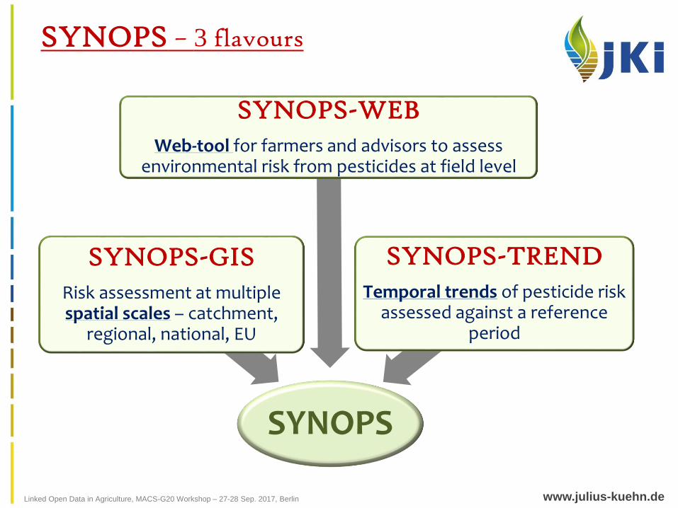
SYNOPS – 3 flavours
SYNOPS
SYNOPS-GIS
Risk assessment at multiple spatial scales – catchment,
regional, national, EU
SYNOPS-WEB
Web-tool for farmers and advisors to assess environmental risk from pesticides at field level
SYNOPS-TREND
Temporal trends of pesticide risk assessed against a reference
period
Linked Open Data in Agriculture, MACS-G20 Workshop – 27-28 Sep. 2017, Berlin www.julius-kuehn.de
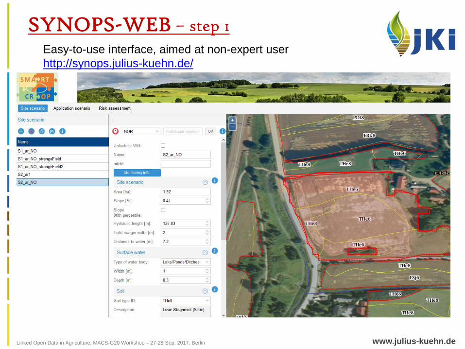
SYNOPS-WEB – step 1Easy-to-use interface, aimed at non-expert user
http://synops.julius-kuehn.de/
Linked Open Data in Agriculture, MACS-G20 Workshop – 27-28 Sep. 2017, Berlin www.julius-kuehn.de
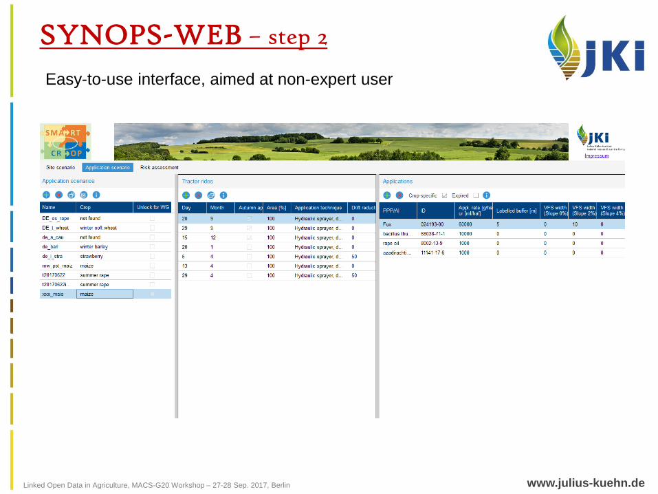
SYNOPS-WEB – step 2
Easy-to-use interface, aimed at non-expert user
Linked Open Data in Agriculture, MACS-G20 Workshop – 27-28 Sep. 2017, Berlin www.julius-kuehn.de
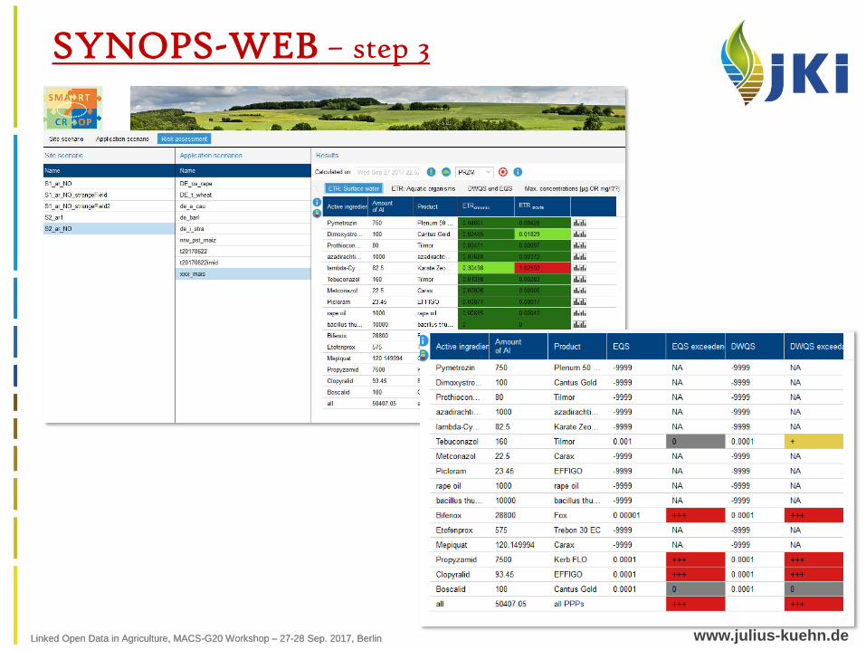
SYNOPS-WEB – step 3
Linked Open Data in Agriculture, MACS-G20 Workshop – 27-28 Sep. 2017, Berlin
Linked Open Data in Agriculture, MACS-G20 Workshop – 27-28 Sep. 2017, Berlin www.julius-kuehn.de
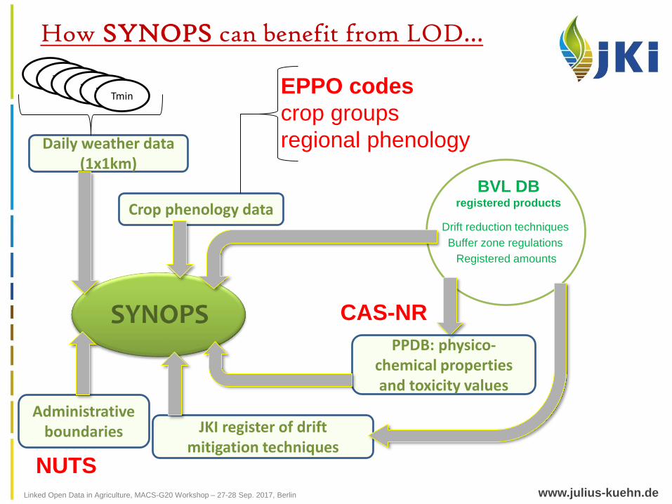
How SYNOPS can benefit from LOD…
BVL DBregistered products
Drift reduction techniques
Buffer zone regulations
Registered amounts
SYNOPSPPDB: physico-
chemical propertiesand toxicity values
JKI register of drift mitigation techniques
Daily weather data(1x1km)
Crop phenology data
TminTminTminTminTminTmin
CAS-NR
EPPO codes
crop groups
regional phenology
Administrative boundaries
NUTS
Linked Open Data in Agriculture, MACS-G20 Workshop – 27-28 Sep. 2017, Berlin www.julius-kuehn.de
SYNOPS-WEB – outputs as LOD?
Too field/farmer specific, the farmer would not want to
make it open
Many fictional simulations are possible and hence not
reliable or useful for further analysis
Not much potential for providing it as open data
Linked Open Data in Agriculture, MACS-G20 Workshop – 27-28 Sep. 2017, Berlin www.julius-kuehn.de
SYNOPS-GIS
aimed at non-expert user
calculations at field-level, results aggregated at various spatial scales
spatial scales – catchment, growing regions, district, federal states, national(?)
1.5 million fields for Germany
Different possible crop combinations – exact crop location is not known
Many randomised application scenarios
Linked Open Data in Agriculture, MACS-G20 Workshop – 27-28 Sep. 2017, Berlin www.julius-kuehn.de
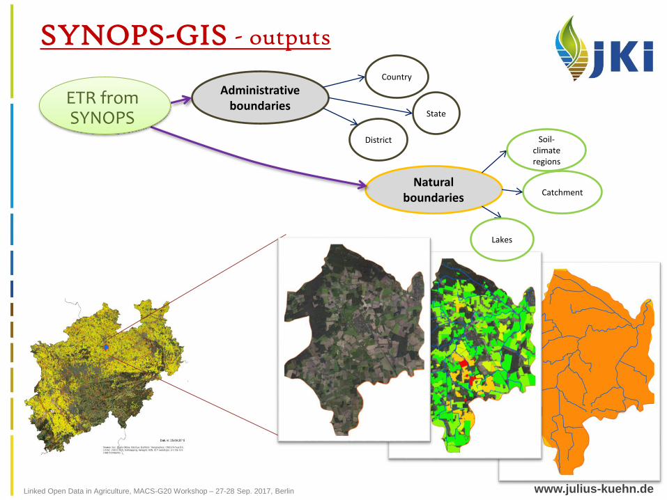
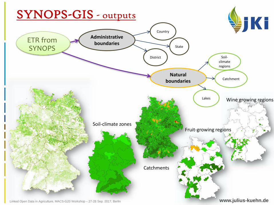
SYNOPS-GIS - outputs
Administrative boundaries
Natural boundaries
Country
State
District
Catchment
ETR fromSYNOPS
Soil-climateregions
Lakes
Linked Open Data in Agriculture, MACS-G20 Workshop – 27-28 Sep. 2017, Berlin www.julius-kuehn.de
SYNOPS-GIS - outputs
Administrative boundaries
Natural boundaries
Country
State
District Soil-climateregions
Catchment
Lakes
ETR fromSYNOPS
Wine growing regions
Fruit-growing regions
Catchments
Soil-climate zones
Linked Open Data in Agriculture, MACS-G20 Workshop – 27-28 Sep. 2017, Berlin www.julius-kuehn.de
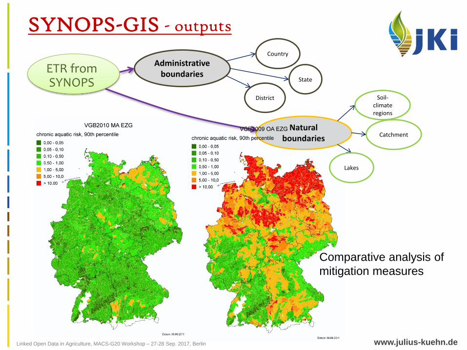
SYNOPS-GIS - outputs
Administrative boundaries
Natural boundaries
Country
State
District
Catchment
ETR fromSYNOPS
Comparative analysis of
mitigation measures
Soil-climateregions
Lakes
Linked Open Data in Agriculture, MACS-G20 Workshop – 27-28 Sep. 2017, Berlin www.julius-kuehn.de
year19961998199920002001200220042005200620072008200920102011201220132014
refe
ren
cep
erio
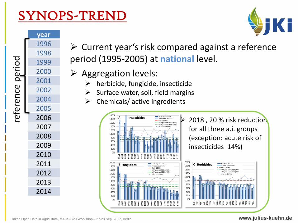
dSYNOPS-TREND
Current year‘s risk compared against a reference period (1995-2005) at national level.
Aggregation levels: herbicide, fungicide, insecticide Surface water, soil, field margins Chemicals/ active ingredients
2018 , 20 % risk reduction for all three a.i. groups(exception: acute risk of insecticides 14%)
Linked Open Data in Agriculture, MACS-G20 Workshop – 27-28 Sep. 2017, Berlin www.julius-kuehn.de
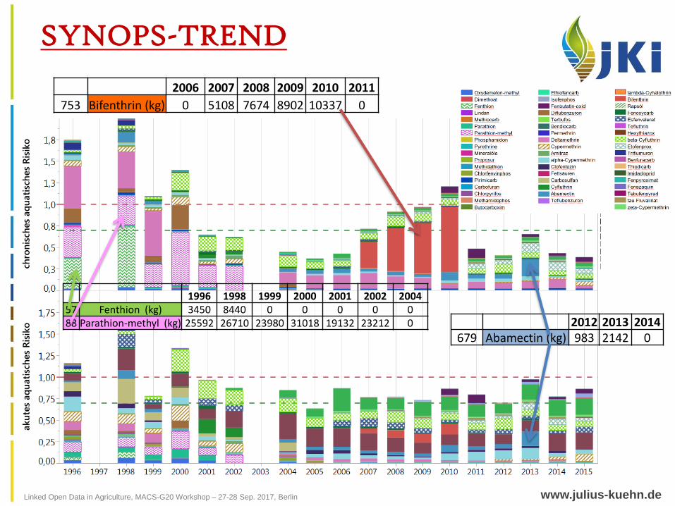
SYNOPS-TREND
2006 2007 2008 2009 2010 2011
753 Bifenthrin (kg) 0 5108 7674 8902 10337 0
2012 2013 2014679 Abamectin (kg) 983 2142 0
1996 1998 1999 2000 2001 2002 200457 Fenthion (kg) 3450 8440 0 0 0 0 088 Parathion-methyl (kg) 25592 26710 23980 31018 19132 23212 0
Linked Open Data in Agriculture, MACS-G20 Workshop – 27-28 Sep. 2017, Berlin www.julius-kuehn.de
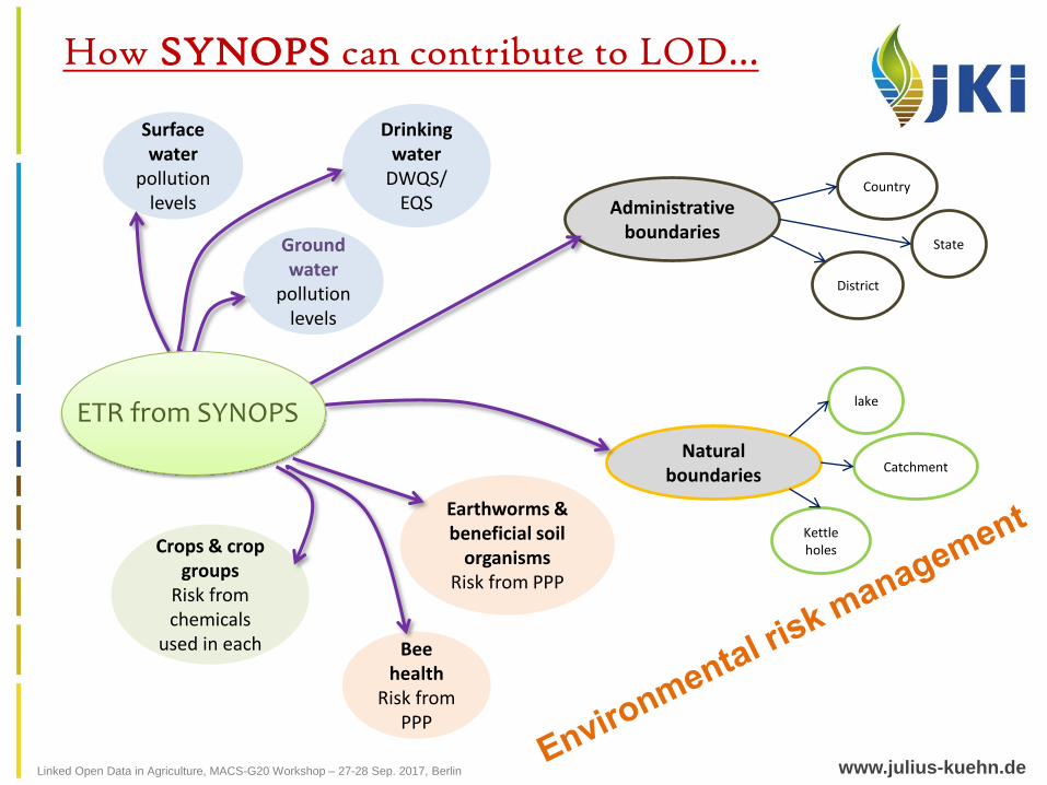
How SYNOPS can contribute to LOD…
Surface water
pollution levels
Ground water
pollution levels
Drinking water
DWQS/EQS
Bee health
Risk from PPP
Earthworms & beneficial soil
organismsRisk from PPP
Crops & crop groups
Risk from chemicals
used in each
Administrative boundaries
Natural boundaries
Country
State
District
lake
Catchment
Kettle holes
ETR from SYNOPS
Linked Open Data in Agriculture, MACS-G20 Workshop – 27-28 Sep. 2017, Berlin www.julius-kuehn.de
Thank you for your attention!