tasmania’s dairy regions · 3 a guide for investors purpose of this document tasmania has an...
TRANSCRIPT

Tasmania’s dairy regions
Tasmania Delivers...
www.cg.tas.gov.au
A guide for investorsApril 2016

ii
Tasmania’s dairy regions
3 Introduction
7 Far North West
14 North West
20 Central North
27 North East
35 South
43 King Island
Contacts
Disclaimer:The information in this paper has been prepared with care, but no warranty is given as to the accuracy of the information, or for any advice given, or for omissions from this paper. Readers rely on the information at their own risk and should seek their own independent legal and financial advice.
© State of Tasmania March 2016. Images courtesy of DairyTas, Ben Geard and Lis Beattie.
This marketing document was developed by the DairyTas in conjunction with Macquarie Franklin Pty Ltd. It is an initiative of the Into Dairy Project.

1
A guide for investors
2
Tasmania’s dairy regions
3
A guide for investors
Purpose of this documentTasmania has an established dairy industry with a proud history of innovation and growth, and the natural resources to double current milk production. The industry is pasture based with efficient high quality milk production. Industry output has increased in excess of 40 per cent over the last decade, and Tasmania is the only Australian state to achieve growth in that period. Industry and government are working in partnership to foster further growth through encouraging farm conversion, and attract skills and investment capital.
As an island, Tasmania has a temperate maritime climate. However climate, soil, topography and the availability of water for irrigation can vary considerably across Tasmania’s six dairy regions.
This document, Tasmania’s dairy regions, provides valuable information on local farming conditions and community infrastructure, and identifies areas with the potential for further dairy development. It has been prepared to assist dairy farmers and investors not familiar with Tasmania to gain a deeper understanding of the dairy industry, and adds to the existing information resources: The Dairy Industry in Tasmania – A guide for investors www.cg.tas.gov.au/home/publications/brochures and industry information available at www.intodairy.com.au
The prospect of further growth in the Tasmanian dairy industry is supported by the conclusions outlined below for each region. Four of the six regions, the Far North West, North East, Central North and South have the natural resources and most potential to host dairy development and growth.
Introduction

4
Tasmania’s dairy regions
Industry overview
Dairy farming in Tasmania occurs throughout the state but mainly across the north. There are six main dairy regions;
(1) Far North West (2) North West (3) Central North (4) North East (5) South and (6) King Island
All of which are productive dairy areas but with distinctive soil and climatic features.
Tasmanian dairy regionsRainfall varies greatly throughout the state but because of the prevailing winds rainfall tends to increase from the east and to be heavier in the west (Figure 2). In general terms it also increases from the coast inland.
Smithton
Flinders IslandKing Island
WynyardBurnie
Devonport
Queenstown
Deloraine
George TownScottsdale
Launceston
Campbell TownBicheno
Hobart
New Norfolk
Huonville
800–1000 700–800
1800
1800
1600140
0
1400
1200
1000
1000
2000
2200
2400
600
800
800
800
Rainfall
Average millimetres of precipitation per year
Source: vW Maps ©2009 Martin von Wyss, vW Maps Pty Ltd.
42˚S
Far North West (149 Dairy farms)
North East (67 Dairy farms)North West
(100 Dairy farms)Central North (89 Dairy farms)
South (14 Dairy farms)
Figure 1: Tasmanian dairy regions
Figure 2: Tasmania’s average annual rainfall
King Island (13 Dairy farms)

5
A guide for investors
Farm and cow numbersThe region with the highest number of dairy cows and farms is in the Far North West of the island, followed by the North West, Central North and North East. The farms located in the North West and King Island farms are generally smaller on average than the other regions (Table 1). Irrigation development in the Central North and North East regions is likely to result in land being converted to grazing land and potentially see these regions increase their contribution to the dairy sector.
Region Number of dairy farms
Number of cows
Average herd size
Far North West 149 68 471 460
North West 100 28 659 286
Central North 89 36 383 409
North East 67 24 388 364
South 14 5 625 401
King Island 13 3 585 275
Table 1: Farm and cow numbers by region
6
Tasmania’s dairy regions
Processor Proportion of state milk*
Processing sites Products Regions serviced
Fonterra 55% Spreyton (Devonport)
Skim milk powder, butter, dairy spreads
and buttermilk
Far NW, NW, Central N, NE and S
Wynyard Cheddar cheese, whey protein
concentrates, milk and whey permeate
Launceston Yoghurt
Murray Goulburn 21% Smithton Full cream milk powder, skim milk
powder, anhydrous milk fat
Far NW, NW, Central N (western)
Edith Creek Ultra-heat treated milk
Lion Dairy and Drinks
14% Burnie Specialty soft and hard cheeses
Far NW, NW, King Island Central N, S
Lenah Valley Liquid milk, cream
King Island Specialty soft and hard cheeses
Cadbury (Mondelez)
8% Burnie Chocolate/ confectionery
Far NW, NW, Central N (western)
Others 1-2%
Farm cheese operations
Specialty cheeses
*Estimated per cent of total volume of milk processed in Tasmania – indicative only.
Table 2: Milk processors in Tasmania
Milk processorsTasmania produces around 890 million litres of milk, with more than 90 per cent used in production of milk powder, cheese, butter etc and less than 10 per cent of that liquid milk.
There are four major processors (Table 2) with the New Zealand-based Fonterra taking more than half of the total state production. In recent years Murray Goulburn, a mainland Australian based cooperative, is increasing its
presence by purchasing an Ultra High Temperature (UHT) processing plant at Edith Creek and the Tasmanian Dairy Products factory at Smithton – both located in the Far North West.
Both Fonterra and Murray Goulburn have spare processing capacity so there is potential for further expansion in the industry. Lion has also undertaken a major upgrade of its processing plant at Burnie.
Suppliers of Murray Goulburn are expected to hold one share for each kilogram of milk solids produced.
Shares can be purchased through Murray Goulburn’s share offtake program or at any time up to the share standard. Since July 2015 the shares have traded between $1.77 and $2.40 per share.

7
A guide for investors
General descriptionThe Far North West region consists of the Municipality of Circular Head, extending from Rocky Cape to the west coast and south to Corinna. The region has a total population of approximately 8 300, a labour force of around 4 000 and a total area of 4 890 square kilometres. The main population centre is Smithton (population 3 150).
The region has a diverse range of industries including dairy and prime beef production and processing, vegetable production and processing, commercial fishing and aquaculture, forestry and timber production, iron ore pelletising, manufacturing and tourism.
The region is also home to one of Australia’s largest wind farms and the nation’s only Baseline Air Pollution Station.
The Far North West has traditionally been considered the best dairying region in Tasmania with more than 30 per cent of the state’s dairy farms and 40 per cent of the dairy herd located there. The climate is ideal for dairying with high rainfall (900+ mm), a mild maritime climate with warm summers and cool/cold winters with a low number of frosts.
There are three distinctive topographical features of the Far North West; the coastal plain on the north coast, hill country found inland and the wetland areas found both within inland river valleys and on some coastal areas.
The four major dairy processors, Fonterra, Murray Goulburn, Lion and Cadbury, all have suppliers located in the region.
Irrigation water is available from direct take summer allocations, winter storage, ground water and irrigation schemes.
While the area is well developed from a dairying point of view there is scope for new dairy conversion. For example, from large beef farming properties or by joining several smaller properties.
Far North West
Farms Estimated cows Average herd Average rainfall
149 68 471 460 970 mm

8
Tasmania’s dairy regions
Land pricesRecent dairy farm sales in this region have ranged from $13 500 to $22 000 per effective hectare. The average price paid per effective hectare including improvements was $18 500 (Opteon 2014). Improvements generally include herringbone dairies, dwellings and farm buildings.
Approximately half of all recent dairy land sales in the region have been with adjoining land owners, who for strategic reasons are also often prepared to pay a higher price.
The highest prices being achieved in the region are in the Mella and Togari areas with recent sales achieving $21 000 to $22 000 per effective hectare. These areas provide good summer pasture growth with limited requirement for irrigation. The total all-up capital investment for dairy farms in this region is generally in the range of $10 000 to $12 500 per cow. In the majority of cases young stock are grown out away from the dairy farm.
Climate and soils
ClimateThe Far North West dairy region is a high rainfall zone 900+ mm and has a mild maritime climate, with warm summers and cool/cold winters during which usually only a minimum of light frost events occur.
There is generally a rainfall/evaporation deficit from November to March. The level of impact that the low rainfall has, relates to the soil type, relative water table depth and topography. Much of the low lying swamp country, for example, has a relatively high water table and in most years can achieve sufficient dryland pasture growth rates throughout summer. Hill country pastures typically require irrigation throughout this period, along with pastures on the coastal plains growing on the free draining sandy soils.
High winter rainfall can result in periods of soil waterlogging, with the worst conditions experienced on the lower lying swamp and coastal plain country. Commonly used land management techniques such as drainage networks, paddock humps and hollow developments help to mitigate this issue.
Rainfall by monthRainfall is higher over the winter months, and increases inland to the south (Figure 4).
Temperature by monthMonthly average maximum and minimum temperatures are shown in Figure 5.

MarrawahMarrawah
WoolnorthWoolnorth
MontaguMontagu
TogariTogari Brittons SwampBrittons Swamp
SmithtonSmithton
StanleyStanley
ForestForest
IrishtownIrishtown
LileahLileahEdith CreekEdith Creek
Roger RiverRoger River
MawbannaMawbanna
Rocky CapeRocky Cape
MontumanaMontumana
Arthur RiverArthur River
Wel
com
e R
iver
Wel
com
e R
iver
Mon
tagu
Riv
er
Mon
tagu
Riv
er
Duc
k R
iver
Duc
k R
iver
Bla
ck R
iver
Bla
ck R
iver
Arthur River
Arthur River
Figure 3: Far North West dairy region
A guide for investors
9
Current dairy area (Landuse data)
Cleared agricultural land (TasVeg 3.0)
Major waterbody
Major town
Town
Highway
Major road
Road
Rail
Major watercourse

10
Tasmania’s dairy regions
Figure 4: Far North West rainfall by month
Figure 5: Far North West temperature by month
160
140
120
100
80
60
40
20
0
Mea
n m
onth
ly r
ainf
all (
mm
)
Jan Feb Mar Apr May Jun Jul Aug Sep Oct Nov Dec
Smithton Woolnorth South Forest
41.0
31.7
44.6 52
.0 58.1
58.6
85.1
82.6
107.
9 115.
4
113.
5
139.
0
122.
8
135.
2
96.6 10
5.6
79.6
92.8
59.6
73.9
59.6 64
.8
86.6
43.7
53.3
77.8
94.3
108.
3 120.
8
87.5
81.4
63.1
56.6
112.
0
42.5 46
.8
30
25
20
15
10
5
0
Mea
n m
inim
um a
nd m
axim
um te
mpe
ratu
re (°
C)
Jan Feb Mar Apr May Jun Jul Aug Sep Oct Nov Dec
Smithton (max) Woolnorth (max)
Smithton (min) Woolnorth (min)

11
A guide for investors
Soils and topographyThere are three distinctive topographic features; the coastal plain, hill country and the swamp country.
The coastal plain extends across much of the northern coastal area, is generally low lying (<20 m above sea level) with flat to gently undulating land occasionally subject to periods of soil water-logging. The plain is dissected by a number of waterways. Typical areas include Woolnorth, Scopus and Montagu. The plains are dominated by light textured sandy soils, which are typically poorly drained, and acidic prior to application of lime or dolomite. Significant drainage works have been undertaken throughout much of the coastal plain, including large scale strategic drainage networks as well as extensive hump and hollowing developments.
The hill country forms much of the inland area and is bisected by a series of river valleys and swamps. It consists of sloping and rolling country and
gently undulating plateau ground (30 to 250 m above sea level) and is typically well-drained. It includes the land adjacent to the Duck River Valley and inland areas such as Forest and Mawbanna, and Marrawah to the west. The soils associated with the hill country are dominated by deep red/brown krasnozem clay loams which are derived from tertiary basalt. They are generally well-structured and drained and may contain stone. The soils are well suited to both pasture production and cropping activities. They can be susceptible to pugging damage and soil compaction during periods of soil waterlogging, and it is important to limit paddock traffic during these times.
The swamp country occurs in the inland river valleys, marshlands and some of the coastal areas. It consists of flat and very gently sloping land, and is often subject to periods of soil water-logging during winter. Typical areas include Togari, Brittons Swamp and the Duck Valley.
Swamp country represents some of the most productive dairy country in Tasmania. Swamp country soils includes a range of sandy and clay soils formed from recent alluvium and some peaty soils. Significant drainage works have been undertaken throughout the swamp country, including large scale strategic drainage networks as well as extensive hump and hollowing developments.
Pasture production and utilisationTable 3 gives an indication of potential pasture production and utilisation for a number of sites in the far North West region. The potential pasture growth figure is an estimate by the Tasmanian Institute of Agriculture (TIA) of total production with fertility and drainage non-limiting. Very well managed pasture in the area can result in pasture utilisation of around 9 to 11 tonnes of dry matter per hectare for dryland pastures, and 14 to 15 tonnes under irrigation, but 6 to 7 tonnes dryland and 9 to 10 tonnes irrigated are not uncommon in practice.
Table 3: Far North West pasture production and utilisation
Region Dryland pasture Irrigated pasture
Potential pasture growth
Percent of potential growth Potential pasture growth
Percent of potential growth
75% 50% 75% 50%
t DM/ha/year t DM/ha/year t DM/ha/year t DM/ha/year t DM/ha/year t DM/ha/year
Edith Creek 14.7 11.0 7.4 19.9 14.9 10.0
Forest 14.7 11.0 7.4 19.9 14.9 10.0
Marrawah 13.4 10.1 6.7 19.4 14.6 9.7
Mawbanna 14.2 10.6 7.1 20.2 15.2 10.1
Redpa 14.3 10.7 7.2 19.4 14.5 9.7
Smithton 13.3 10.0 6.7 19.8 14.9 9.9
Togari 14.6 10.9 7.3 19.6 14.7 9.8
Woolnorth 12.3 9.3 6.2 19.7 14.8 9.9
Note: These figures are indicative total annual pasture utilisation based on the Tasmanian Regional Pasture Growth Rates Tool developed by the Tasmanian Institute of Agriculture.

12
Tasmania’s dairy regions
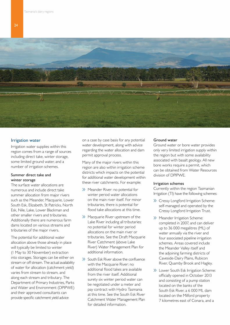
Irrigation waterIrrigation water supplies within this region can come from a range of sources including direct take, winter storage, ground water and irrigation schemes.
Summer direct take and winter storage Surface water allocations are numerous and include direct take summer allocation from major rivers such as the Duck, Montagu, Black, Welcome, Arthur and other smaller rivers and tributaries. There are also numerous farm dams in the area which are filled during the winter months.
The potential for additional water allocation above those already in place will typically be limited to winter (1 May to 30 November) extraction into on-stream or off-stream storages. The actual availability of water for allocation (catchment yield) varies from stream to stream, and varies along each stream and tributary. The Department of Primary Industries, Parks Water and Environment (DPIPWE) and their approved consultants can provide specific catchment yield advice on a case by case basis for any potential water development, along with advice regarding the water allocation and dam permit approval process.
Ground waterGround water or bore water is a major irrigation supply resource for the Mella, Broadmeadows, and Togari areas – from underlying dolomite geology. It also provides limited irrigation supply in other areas within the region.
Irrigation schemeTasmanian Irrigation (TI) is currently developing the Duck Irrigation Scheme, with water expected to be available for the 2017-18 irrigation season. The proposed delivery volume of the scheme is 5 000 ML, with 90 per cent of that volume
expected to be utilised for pasture based enterprises, and the balance for cropping. The scheme is proposed to deliver water at 95 per cent reliability, and will supply the Montagu, Stanley, Forest, Edith Creek, and Irishtown areas.
Indicative irrigation requirements Annual irrigation requirements and deficiency figures have been provided by the Tasmanian Institute of Agriculture and are shown in Table 4. Depending on application efficiency, irrigation requirements generally average in the range of 3 to 5 ML per hectare.
Region Mean water deficit
Irrigation requirement
90% application efficiency
75% application efficiency
(ML/ha) (ML/ha) (ML/ha)
Edith Creek 2.8 3.1 3.7
Forest 2.8 3.1 3.7
Marrawah 2.9 3.2 3.9
Mawbanna 3.1 3.4 4.1
Redpa 2.7 3.0 3.6
Smithton 3.2 3.6 4.3
Togari 2.7 3.0 3.6
Woolnorth 3.6 4.0 4.8
Note: These figures are indicative annual irrigation requirements taken from the Tasmanian Regional Pasture Growth Rates Tool developed by the Tasmanian Institute of Agriculture.
Table 4: Far North West irrigation requirements

13
A guide for investors
ProcessorsThe four main processors, Fonterra, Murray Goulburn, Lion and Cadbury all have suppliers in the Far North West (see Table 2).
Community and social infrastructure
ServicesMajor services in the region are centred on Smithton, including a hospital and Rural health centre, supermarket, post office, banks, sporting clubs, a large veterinary practice and rural supplies and services.
EducationThere are eight schools with the only two high schools located in Smithton (one government, one non-government). There are government primary schools in Smithton, Stanley, Forest and Redpa and two non-government primary schools in Smithton. There are also high schools located nearby in Wynyard and Burnie, 45 minutes and one hour drive from Smithton respectively.
There are two post-secondary technical colleges in Smithton, TasTAFE and Agritas Trade College, and the University of Tasmania’s Cradle Coast campus is located in Burnie.
For further information on education in the Far North West, visit the Tasmanian Department of Education website. www.education.tas.gov.au
RecreationThe main sports played in the Far North West are hockey, cricket and Australian Rules Football. The more popular recreational activities include bushwalking, gardening, fishing and bird watching. Annual recreational events include the Melbourne to Stanley yacht race, Circular Head Agricultural Show, Rip Curl West Coast Surf Classic and Twilight on the Duck (family entertainment and competitions, live music and food).
AccessThe Burnie airport at Wynyard is a 45 minute drive from Smithton and has a 55 minute flying time to Melbourne. Devonport airport further to the east is a 1.5 hour drive away. It also has 55 minute flights to Melbourne. In addition, the Spirit of Tasmania ferries depart daily from Devonport for Melbourne carrying people, vehicles and freight.
For more information on living in the Far North West, visit the Circular Head Council website, www.circularhead.tas.gov.au
Opportunities for future developmentThere is reasonable scope for new dairy conversions in the Far North West.
While there are large scale properties suitable for new dairy conversions, future developments might also involve combining several adjoining properties. Some of the land in the district, particularly on swamp ground, would require drainage as part of the conversion process. Compared to established farms, green field sites can provide efficiencies for irrigation and labour. But the downside being the time required to reach full production.
Recent and proposed conversions in this region have seen land previously used as dairy support converted to dairy and some cleared swamp country at Togari is proposed for dairy conversion. In general terms total investment, including plant and machinery and stock, should be no more than $10 000 to $12 500 per cow.

14
Tasmania’s dairy regions
General descriptionThe North West region consists of the municipalities of Burnie, Devonport, Waratah-Wynyard, Central Coast, Latrobe and Kentish. The region covers the area from Rocky in the west, east to Badger Head and inland to Cradle Mountain. The main population centres are Devonport and Burnie, with populations of 25 600 and 20 000 respectively. Other smaller towns include Wynyard, Ulverstone and Penguin on the coast, and Latrobe and Sheffield inland.
The region has a total population of approximately 99 500, a labour force of around 47 000 and a land area of 6 933 square kilometres.
The main industries include dairy, beef and sheep production and processing, vegetable cropping and processing (beans, onions, peas and potatoes),
other crops such as poppies and pyrethrum, forestry and tourism.
The North West region has historically had many dairy farms. Numbers have decreased over time due to competing uses for higher quality land and the trend towards larger herd sizes which has generally been more readily achieved in other regions.
The region is a moderate/high rainfall zone (750+ mm/yr), with a mild maritime climate, with warm summers and cool/cold winters during which usually only a minimum of light frost events occur – although frosts increase
inland to the south. It is dominated by extensive rolling hill country and a series of rivers and steep valleys.
The four major processors, Fonterra, Murray Goulburn, Lion and Cadbury all have suppliers in the region.
Irrigation water can be sourced from direct take summer allocations and winter storage, ground water supplies and irrigation schemes.
The region has relatively limited scope for dairy conversion due to competition from alternative land uses such as higher value vegetable cropping, and timber plantations in more marginal country.
Farms Estimated cows Average herd Average rainfall
100 28 659 286 970 mm
North West

15
A guide for investors
WynyardWynyard
BurnieBurnie
DevonportDevonportRidgelyRidgely
PenguinPenguin
RianaRiana
ElliotElliotYollaYolla
UlverstoneUlverstone
Gunns PlainsGunns Plains
LatrobeLatrobe
Port SorellPort Sorell
RailtonRailton
She�eldShe�eld
SomersetSomersetIn
glis
Riv
erIn
glis
Riv
er
Blythe
Rive
r
Blythe
Rive
r
Mersey River
Mersey River
Leven
Rive
r
Leven
Rive
r
Land pricesRecent dairy farm sales for this region have ranged from $10 500 to $22 500 per effective hectare including improvements and irrigation water. These farms were partially irrigated with improvements including herringbone dairies, dwellings and farms.
Better quality dairy farms in the region with between 75 to 100 per cent of the effective area irrigated, are in the range of $21 500 to $22 500 per effective hectare. Improvements on these farms generally include herringbone dairies, dwellings, centre pivot irrigation and farm shedding. Farms that fall into this price range are located from Sheffield to Wynyard. Many dairy farms in the North West region have soils that can be used for vegetable cropping or poppies and pyrethrum.
Climate and soils
ClimateThe North West dairy region is a moderate to high rainfall zone (750+ mm/yr), has a mild maritime climate, with warm summers and cool to cold winters during which usually only a minimum of light frost events occur – but increasing inland to the south. It features a number of river valleys and this in combination with the hilly topography results in some distinct microclimate effects.
Pasture production in some areas can be negatively affected by a rainfall/evaporation deficit from mid-October to March and periods of soil waterlogging through winter. The dry summer conditions on the hill country can produce low summer pasture growth
rates requiring irrigation throughout summer. River valley country soils generally have a higher water table and therefore the irrigation start-up date is comparatively later.
High winter rainfall can result in periods of soil water-logging, with the worst conditions experienced on the river valley country where some inundation can also occur. In order to mitigate this situation paddock drainage works are often beneficial.
Rainfall by monthRainfall is higher over the winter months, and increases inland as you move to the west and south (Figure 7).
Temperature by monthMean maximum and minimum temperatures are shown in Figure 8.
Figure 6: North West dairy region
Current dairy area (Landuse data)
Cleared agricultural land (TasVeg 3.0)
Major waterbody
Major town
Town
Highway
Major road
Road
Rail
Major watercourse

16
Tasmania’s dairy regions
Figure 7: North West rainfall by month
Figure 8: North West temperature by month
160
140
120
100
80
60
40
20
0
Mea
n m
onth
ly r
ainf
all (
mm
)
Jan Feb Mar Apr May Jun Jul Aug Sep Oct Nov Dec
Devonport Burnie Elliot
41.8
36.4
54.7
48.5 56
.4 60.3
91.8
74.7
119.
6 131.
3
95.6
156.
9
91.2
152.
2
74.1
119.
6
63.6
106.
4
57.8
78.0
53.0
76.0
76.4
43.4 52
.0
73.7
93.4 10
1.1
122.
8
87.6
84.7
68.5
63.5
110.
6
44.0 48
.6
30
25
20
15
10
5
0
Mea
n m
inim
um a
nd m
axim
um te
mpe
ratu
re (°
C)
Jan Feb Mar Apr May Jun Jul Aug Sep Oct Nov Dec
Devonport (max) Burnie (max) Elliot (max)
Devonport (min) Burnie (min) Elliot (min)

17
A guide for investors
Soils and topographyThe North West dairy region is dominated by extensive hill country and a number of river valleys.
The hill country is dissected by a series of rivers and consists of rolling country and gently undulating plateau ground (30 to 350 m above sea level). It is typically well drained and includes strong dairy areas such as Riana, Sheffield and Sisters Creek.
The soils associated with the hill country are dominated by red/brown clay loams (krasnozem) which are derived from tertiary basalt. They are relatively deep soils, well-structured and drained, may contain stone and/or rock fragments, and are well suited to both pasture based and cropping activities.
They can be susceptible to pugging damage and soil compaction during periods of waterlogging, and it is important to limit paddock traffic during these times.
Associated with all the major rivers, a series of steep valleys dissect the hill country with relatively steep sloping ground leading down a normally narrow valley floor with the sandy and clay soils derived from accumulation of sediment from the surrounding high ground. While the valley floors can be prone to flooding they are generally very productive. Typical areas are along the Forth, Inglis and Mersey Rivers. Some of the steep valleys do open up into more extensive flat areas, such as Gunns Plains (Leven River), Merseylea (Mersey River) and Flowerdale (Inglis River).
Pasture production and utilisationTable 5 gives an indication of potential pasture production and utilisation for a number of sites in the region. The potential pasture growth figure is an estimate by the Tasmanian Institute of Agriculture (TIA) of total production with fertility and drainage non-limiting. Very well managed pasture in the area can result in pasture utilisation of around 8 to 11 tonnes of dry matter per hectare for dryland pastures, and 15 to 16 tonnes under irrigation, but 6 to 7 tonnes dryland and 10 to 11 tonnes irrigated are not uncommon in practice.
Table 5: North West pasture production and utilisation
Region Dryland pasture Irrigated pasture
Potential pasture growth
Percent of potential growth Potential pasture growth
Percent of potential growth
75% 50% 75% 50%
t DM/ha/year t DM/ha/year t DM/ha/year t DM/ha/year t DM/ha/year t DM/ha/year
Burnie 11.5 8.6 5.8 20.2 15.2 10.1
Devonport 11.1 8.3 5.5 21.7 16.3 10.9
Gunns Plains 14.3 10.7 7.2 20.6 15.5 10.3
Sheffield 13.0 9.7 6.5 21.0 15.7 10.5
Ulverstone 12.2 9.2 6.1 21.3 16.0 10.7
Wynyard 12.4 9.3 6.2 20.1 15.1 10.1
Yolla 15.0 11.2 7.5 20.1 15.1 10.1
Note: These figures are indicative total annual pasture utilisation based on the Tasmanian Regional Pasture Growth Rates Tool developed by the Tasmanian Institute of Agriculture.

18
Tasmania’s dairy regions
Irrigation waterIrrigation water supplies within this region can come from a range of sources including direct take, winter storage, ground water and irrigation schemes.
Summer direct take and winter storage Surface water allocations are numerous and include direct take summer allocation from major rivers such as the Flowerdale, Inglis, Cam, Blythe, Leven, Forth, Mersey, Rubicon and other smaller rivers and tributaries. Additionally there are numerous farm dams located on various streams and tributaries of the major rivers.
The potential for additional water allocation above those already in place will typically be limited to winter (1 May to 30 November) extraction into storages. Storage can be either on stream or off stream. The actual availability of water for allocation (catchment yield) vary from stream to stream, and also vary along each stream and tributary. The Department of Primary Industries, Parks, Water and Environment (DPIPWE) and their approved consultants can provide specific catchment yield advice on a case by case basis for any potential water development, along with advice regarding the water allocation and dam permit approval process.
Ground waterGround water or bore water is a significant irrigation resource in the Wesley Vale/Sassafras area and also provides limited irrigation supply in other areas within the region, particularly with the basalt geology. All new bore works require a permit, which can be obtained from the Water Resources division of DPIPWE.
Irrigation SchemesTasmanian Irrigation (TI) has the following schemes within the region:
» Dial Blythe Irrigation Scheme: completed in 2015, with delivery of up to 2 855 ML at 95 per cent reliability to the Penguin and West Pine areas.
» Kindred North Motton Irrigation Scheme: completed in 2014, with delivery of up to 2 500 ML at 95 per cent reliability to the Forth, Kindred, Abbotsham, Clerkes Plains, Sprent, Gawler, and North Motton areas.
» Sassafras Wesley Vale Irrigation Scheme: operational since 2011, with delivery of 5 460 ML to the Sassafras, Wesley Vale and Moriarty areas.
» Rubicon Pipeline from the Meander River: as part of the Meander Irrigation Scheme, there is a pipeline that transfers water into the Rubicon catchment in the eastern section of the region.
Indicative irrigation requirements Depending on application efficiency, irrigation requirements generally average in the range of 3 to 6 ML per hectare.
ProcessorsThe four main processors, Fonterra, Murray Goulburn, Lion and Cadbury all have suppliers in the North West. Fonterra, Lion and Cadbury have also have processing plants located in this region. Refer to Table 2 for more information on processors.
Community and social infrastructure
ServicesThe North West region is serviced by Devonport and Burnie. Devonport and Burnie are the third and fourth largest cities, respectively, in Tasmania and have several supermarkets, sport and recreation clubs, veterinarians, rural supplies and service providers. Regional and private hospitals are located in Burnie, Devonport and Latrobe.
Region Mean water deficit
Irrigation requirement
90% application efficiency
75% application efficiency
(ML/ha) (ML/ha) (ML/ha)
Burnie 4.6 5.1 6.1
Devonport 5.1 5.7 6.8
Gunns Plains 3.3 3.7 4.4
Sheffield 4.2 4.7 5.6
Ulverstone 4.5 5.0 6.0
Wynyard 3.8 4.2 5.1
Yolla 2.8 3.1 3.7
Note: These figures are indicative annual irrigation requirements taken from the Tasmanian Regional Pasture Growth Rates Tool developed by the Tasmanian Institute of Agriculture.
Table 6: North West irrigation requirements

19
A guide for investors
There are major ports at Devonport and Burnie. The Port of Devonport handles cereal grains, cement and containerised goods outbound, fertilisers and other bulk cargo along with fuels and consumables inbound. The port is also home to TT-Line company ferries (Spirits of Tasmania I and II) that operate a daily service between Devonport and Melbourne.
The Port of Burnie services the major mines on the West Coast of Tasmania as well as handling most types of bulk cargo including, minerals, fuels, woodchips and logs and shipping container goods. The Burnie rail hub is a major distribution point for goods on Tasmania’s rail network.
EducationThe region is well serviced with government and non-government primary and high schools catering to students from Kindergarten to Year 12. Burnie and Devonport both have a post-secondary technical college campus, TasTAFE. Burnie also has a campus of The University of Tasmania, with a strong agricultural focus.
For further information on education in the North West, visit the Tasmanian Department of Education website, www.education.tas.gov.au
RecreationThe main sports played in the North West are Australian Rules football, hockey, netball and soccer. Other recreational events include cycling, bushwalking and fishing. Annual community events include Chocolate Winterfest, Latrobe Boxing Day Carnival, Lake Barrington Rowing events, Bloomin’ Tulips Festival, Devonport Food and Wine Festival, Devonport Jazz Festival, Burnie Challenge and the Burnie 10 & 321-GO Kids’ Race.
A major attraction in the area is Cradle Mountain in the Tasmanian Wilderness World Heritage Area. The coast-line has stunning beaches and wildlife, including Fairy Penguins. The region is well known for the food including cheese, chocolate, raspberries and cherries. There are numerous walking and cycling routes and mountain biking paths. Devonport and Burnie have a range of galleries, performances, exhibitions, restaurants and cafes and parks and gardens.
AirportsThe Burnie airport at Wynyard and the Devonport airport both have daily flights to Melbourne, each with a 55 minute flying time. In addition the Spirit of Tasmania ferries depart daily from Devonport for Melbourne servicing people, vehicles and freight.
For more information on living in the North West, visit the local council websites: www.devonport.tas.gov.au www.burnie.net www.warwyn.tas.gov.au www.centralcoast.tas.gov.au www.latrobe.tas.gov.au www.kentish.tas.gov.au
Opportunities for future developmentThis area has less scope for new dairy conversions than other regions because of the small size of many of the properties and the competition for land from intensive cropping on the better land. Base land prices are generally higher than in other prospective areas.

20
Tasmania’s dairy regions
General descriptionThe Central North region is made up of the municipalities of Launceston, George Town, West Tamar, Meander Valley and Northern Midlands. The region encompasses the Tamar Valley in the north, extends south to Tunbridge and to the west the Meander Valley. The main population centre, and second largest city in Tasmania, is Launceston (population 74 000). Other major towns include Deloraine, Longford and Campbell Town. The region has a total population of approximately 122 500, labour force around 61 500 and a total area of 11 200 square kilometres.
The main industries in the Central North include beef, meat and wool
sheep, cropping (vegetables, cereals, poppies and legumes), dairy, forestry and tourism.
The Central North region has historically been farmed for sheep, cattle and cropping to the south with dairies in the western arm of the region in the Meander Valley. Dairies are now extending to southern parts of the region with the development of irrigation schemes along with relatively cheap land allowing for new dairy conversions.
The Central North dairy region varies from relatively low rainfall (600 to 700 mm) in the east and south to relatively high (950 mm) at Deloraine in the west. Being further inland summers are generally warmer than the Far North West, North West and North East dairy regions. Winters are cool to cold with a number of medium/heavy frost events.
The region is typically gently undulating and rolling land with river flats associated with the Meander, Macquarie, South Esk, North Esk and Tamar rivers.
Farms Estimated cows Average herd Average rainfall
89 36 383 409 740 mm
Central North

21
A guide for investors
The four major processors, Fonterra, Murray Goulburn, Lion and Cadbury have suppliers in the region.
The main irrigation sources are direct take summer allocations and winter storage from surface water supplies, plus a number of recently completed irrigation schemes supplementing earlier ones.
There is significant potential for dairy conversion in the region with large properties providing potential for good scale with topography suited to centre pivot irrigation. Recently developed and proposed irrigation schemes are providing additional water for these developments. The variable rainfall across the region needs to be taken into consideration.
Land PricesThere have been limited recent dairy farm sales in this region in recent years. Sales have ranged from $11 000 to $24 000 per effective hectare including improvements and irrigation water. All sales were in the Meander Valley municipality. The higher $24 000 per effective hectare property had extensive improvements including a rotary dairy, centre pivot irrigation, several dwellings and irrigation water. Approximately three quarters of the effective area was irrigated. This farm was in productive dairy area.
Another dryland sale achieved $19 500 per effective hectare with improvements including a dwelling, herringbone dairy and farm shedding.
The farm was located in a productive traditional dairy farming area. The lower $11 000 per effective hectare property was located in an area now dominated by grazing and cropping properties and with limited irrigation water. Improvements included a dwelling and herringbone dairy.
Climate and soils
ClimateThe Central North dairy region has rainfall varying from relatively low (600 to 700 mm) in the east and south to close to 1 000 mm in the west (Deloraine and Dairy Plains). Summers can be warm to hot with cool/cold winters during which a number of medium/heavy frost events occur.
Li�ey RiverLi�ey River
Macquarie River
Macquarie River
Macquarie R
iver
Macquarie R
iver
South Esk River
South Esk RiverP
ipers River
Pipers R
iverNorth Esk RiverNorth Esk River
Rub
icon
Riv
erR
ubic
on R
iver
DeloraineDeloraine
LauncestonLaunceston
George TownGeorge Town
LongfordLongfordMole CreekMole Creek
MeanderMeanderCressyCressy
LilydaleLilydale
RossRoss
CampbelltownCampbelltown
Figure 9: Central North dairy region
Current dairy area (Landuse data)
Cleared agricultural land (TasVeg 3.0)
Major waterbody
Major town
Town
Highway
Major road
Road
Rail
Major watercourse

22
Tasmania’s dairy regions
Figure 10: Central North rainfall by month
Figure 11: Central North temperature by month
160
140
120
100
80
60
40
20
0
Mea
n m
onth
ly r
ainf
all (
mm
)
Jan Feb Mar Apr May Jun Jul Aug Sep Oct Nov Dec
Cressy Launceston Deloraine
30
25
20
15
10
5
0
Mea
n m
inim
um a
nd m
axim
um te
mpe
ratu
re (°
C)
Jan Feb Mar Apr May Jun Jul Aug Sep Oct Nov Dec
Cressy (max) Launceston (max)
Cressy (min) Launceston (min)
31.3
27.1
46.8
42.6 46
.2
58.3
59.2
70.4
61.0
50.8 55
.5
43.3
65.3
63.7
49.8
45.4 50
.9
72.4
86.4
101.
3
119.
5
115.
5
92.3
81.9
44.7
30.9
39.1
51.9
62.6 66
.8
76.8
86.9
66.6
50.8 52.9
46.9

23
A guide for investors
The key climate considerations that affect pasture production are based on a rainfall/evaporation deficit from October to April and, to a lesser extent, periods of soil water-logging and inundation can occur during winter and spring on land adjacent to waterways. Winter temperatures also limit pasture production relative to the Far North West and coastal areas in the North West and North East. The generally dry summer conditions in much of the region (especially in the east and south) result in a requirement for irrigation from mid-spring until early autumn.
Rainfall by monthRainfall is higher over the winter months, and in the western (Deloraine) part of the region (Figure 10)
Temperature by monthMean maximum and minimum temperatures are shown in Figure 11.
Soils and topographyThe Central North dairy region is dominated by the broad extensive northern midlands area, with the Meander Valley to the west and to a lesser extent the West Tamar to the north.
The Meander Valley extends out to the west of the northern dairy region and follows the Meander River and its associated tributaries. It is covered by typically gently undulating and rolling land. Some lower lying land in the Deloraine, Dairy Plains and Meander areas is subject to periods of waterlogging, in some cases potential flooding. The soils
present on the lower lying areas of the Meander Valley include a range of duplex, sandy and clay soils formed from recent alluvium, with some smaller areas of krasnozem clay loams derived from tertiary basalt on the more elevated rolling country surrounding Deloraine.
The northern midlands covers the northern areas of the Launceston basin. It is positioned between the Western Tiers and the foothills of the North East highlands, is covered by gently undulating and rolling land formed on relic river terraces, bisected by the Macquarie and South Esk Rivers and their associated tributaries.
Typical areas include Cressy, Perth and Symons Plains. The soils in the northern midlands vary widely from duplex, sandy and clay soils that are formed from alluvial sediments formed on the relic river terraces.
These soils are often poor to moderately well drained, typically shallow and sensitive to structure decline due to over cultivation and compaction. Areas of salinity are present throughout the northern midlands, which is a result of localised poor drainage and the accumulation of soluble salts or inherent saline soil conditions.
Drainage works are often restricted to shallow surface drains and where appropriate, and practical more strategic drainage networks have been developed to provide significant land productivity improvements.
The dairy region in West Tamar Valley extends to the North West of Launceston, is covered by flat land adjacent to the Tamar River and more undulating land and rolling country inland to the west.
Typical areas include Flowery Gully, Legana and Exeter. The soils of the West Tamar are quite variable ranging from the sandy, duplex and clay soils found on the lower lying land and associated with the rivers and waterways and are derived from the accumulation of sediment, and duplex and clay soils on the more elevated country.
Typically these soils are poorly to moderately well drained, low in fertility and often poorly structured.
Drainage works are necessary to improve the productivity of the lower lying country, with drainage networks largely limited to a property scale level. Similar soils are found in the East Tamar including the Lilydale area which has a number of very productive dairy farms.
Pasture production and utilisationTable 7 outlines potential pasture production and utilisation for a number of sites in the region. The potential pasture growth figure is an estimate by the Tasmanian Institute of Agriculture (TIA) of total production with fertility and drainage non-limiting. Well managed pasture in the area can result in pasture utilisation of around 8 to 9 tonnes of dry matter per hectare for dryland pastures, and 15 tonnes under irrigation, but 5 to 6 tonnes dryland and 10 tonnes irrigated are not uncommon in practice.
Table 7: Central North pasture production and utilisation
Region Dryland pasture Irrigated pasturePotential
pasture growth
Percent of potential growth Potential pasture growth
Percent of potential growth75% 50% 75% 50%
t DM/ha/year t DM/ha/year t DM/ha/year t DM/ha/year t DM/ha/year t DM/ha/year
Deloraine 11.2 8.4 5.6 20.3 15.2 10.2Mole Creek 12.8 9.6 6.4 20.5 15.4 10.3Lilydale 12.0 9.0 6.0 20.6 15.4 10.3Tamar 10.7 8.0 5.4 20.4 15.3 10.2
Note: These figures are indicative total annual pasture utilisation based on the Tasmanian Regional Pasture Growth Rates Tool developed by the Tasmanian Institute of Agriculture.
24
Tasmania’s dairy regions
Irrigation waterIrrigation water supplies within this region comes from a range of sources including direct take, winter storage, some limited ground water, and a number of irrigation schemes.
Summer direct take and winter storage The surface water allocations are numerous and include direct take summer allocation from major rivers such as the Meander, Macquarie, Lower South Esk, Elizabeth, St Patricks, North Esk, Nile, Lake, Lower Blackman and other smaller rivers and tributaries. Additionally there are numerous farm dams located on various streams and tributaries of the major rivers.
The potential for additional water allocation above those already in place will typically be limited to winter (1 May to 30 November) extraction into storages. Storages can be either on stream or off stream. The actual availability of water for allocation (catchment yield) varies from stream to stream, and along each stream and tributary. The Department of Primary Industries, Parks and Water and Environment (DPIPWE) and their approved consultants can provide specific catchment yield advice
on a case by case basis for any potential water development, along with advice regarding the water allocation and dam permit approval process.
Many of the major rivers within this region are also within irrigation scheme districts which impacts on the potential for additional water development within these river catchments. For example:
» Meander River: no potential for winter period water allocations on the main river itself. For minor tributaries, there is potential for flood take allocations at this time.
» Macquarie River upstream of the Lake River including all tributaries: no potential for winter period allocations on the main river or tributaries. See the Draft Macquarie River Catchment (above Lake River) Water Management Plan for additional information.
» South Esk River above the confluence with the Macquarie River: no additional flood takes are available from the river itself. Additional surety six winter period water can be negotiated under a meter and pay contract with Hydro Tasmania at this time. See the South Esk River Catchment Water Management Plan for detailed information.
Ground waterGround water or bore water provides only very limited irrigation supply within the region but with some availability associated with basalt geology. All new bore works require a permit, which can be obtained from Water Resources division of DPIPWE.
Irrigation schemesCurrently within the region Tasmanian Irrigation (TI) have the following schemes:
» Cressy Longford Irrigation Scheme: self-managed and operated by the Cressy Longford Irrigation Trust.
» Meander Irrigation Scheme: completed in 2007, and can deliver up to 36 000 megalitres (ML) of water annually via the river and four associated pipeline irrigation schemes. Areas covered include the Meander Valley itself and the adjoining farming districts of Caveside-Dairy Plains, Rubicon River, Quamby Brook and Hagley.
» Lower South Esk Irrigation Scheme: officially opened in October 2013 and consisting of a pump station located on the banks of the South Esk River, a 6 000 ML dam located on the Milford property 7 kilometres east of Conara, and a

25
A guide for investors
transfer pipeline. Winter flows from the river are extracted and pumped via the transfer pipeline and stored in the Milford Dam. Releases from the dam are via the transfer pipeline back to the river during each irrigation season. The scheme’s irrigators draw their water directly from the river further downstream. Up to 5 298 ML is available for each season.
» Midlands Water Scheme: operational since 2014. The scheme has the capacity to supply 38 500 ML of water over two delivery periods: 15 812 ML during a 150 day summer delivery period (October – February) and 22 688 ML during a 215 day winter delivery period (March – September). Water supplied in the irrigation district is sourced from Arthurs Lake. Water then flows under gravity into the supply line at the Arthurs Lake off-take, passing through a mini hydro-electric generator before being taken into storage at Floods Creek Dam. Water is delivered throughout the district by distribution pipelines and a number of natural water courses supplied by the pipelines including the Isis River and the Blackman and Macquarie Rivers.
» Whitemore Irrigation Scheme: capacity to supply 5 500 ML of water over a 150 day delivery period on which the summer irrigation season is based. Additional water can be supplied by the scheme outside the irrigation season. The district services agricultural land around the townships of Whitemore, Oaks, Bracknell, Bishopsbourne and Glenore.
» North Esk Irrigation Scheme: proposed to supply up to 2 850 ML of irrigation water to the Evandale, White Hills, and Relbia areas.
There are also a number of private irrigation schemes including:
» Macquarie Settlement Pipeline: delivers up 55 ML per day to
Macquarie Settlement area via approximately 16 kilometres of pipeline from Hydro Tasmania Poatina power station re-regulation dam.
» Elizabeth Macquarie Irrigation Trust (EMIT): manages the water supply in the Elizabeth and Macquarie Rivers from Tooms Lake and Lake Leake respectively, to existing water right holders within the irrigation district. Supply volumes are dependent on the annual catchment recharge to the lakes.
Indicative irrigation requirements Depending on application efficiency irrigation requirements are generally average in the range of 4.5 to 7 ML per hectare.
Region Mean water deficit
Irrigation requirement
90% application efficiency
75% application efficiency
(ML/ha) (ML/ha) (ML/ha)
Deloraine 4.7 5.2 6.3
Mole Creek 4.0 4.4 5.3
Lilydale 4.6 5.1 6.1
Tamar 5.3 5.9 7.1
Note: These figures are indicative annual irrigation requirements taken from the Tasmanian Regional Pasture Growth Rates Tool developed by the Tasmanian Institute of Agriculture.
Table 8: Central North irrigation requirements

26
Tasmania’s dairy regions
ProcessorsThe four main processors, Fonterra, Murray Goulburn, Lion and Cadbury have suppliers in the Central North. Refer to Table 2 for more information on processors.
Community and social infrastructure
ServicesLaunceston is the major service point for the Central North with a range of supermarkets, shopping centres, rural supplies and service providers and veterinary practices. Major regional towns including Deloraine, Longford and Campbell Town, also have their own supermarkets, veterinarians and rural supplies and service providers.
Launceston has two private hospitals and one public hospital. There are several medical centres, child care centres and aged care facilities available.
EducationLaunceston has numerous options for government and non-government education from Kindergarten to Year 12, some with boarding available. There are also several regional government primary and high schools in towns such as Campbell Town, Cressy and Deloraine. Launceston has campuses of the post-secondary technical college, TasTAFE, and the University of Tasmania. The Australian Maritime College has campuses at Launceston and further north on the Tamar River at Beauty Point.
For further information on education in the Central North, visit the Tasmanian Department of Education website, www.education.tas.gov.au
RecreationThe main sports played in the region include Australian Rules football, hockey, netball, soccer and cricket. Other recreational activities include cycling, trout fishing, snow skiing in the winter months and water skiing in the summer months.
The central north region includes the Tamar Valley which is famous for its dairy products and wineries. Other attractions in the region include wildlife parks with Tasmanian Devils, heritage buildings and historic towns, Ben Lomond ski village, road cycling, Australian Football League matches, village and farmers market, bush walking, caves, fishing and local produce.
Some of the annual events in the Central North include agricultural shows at Launceston, Longford and Campbell Town, Agfest, Festivale food and wine festival, horse racing, V8 Supercar racing, Launceston 10 road running race, the National Penny Farthing Championship, the Tasmanian Craft Fair and Pearns Steamworld Steam Spectacular.
AirportLaunceston airport is located 15 kilometres south of Launceston and there are several daily flights direct to Melbourne and Sydney. It is one hour’s flying time to Melbourne and 1 hour 45 minutes to Sydney. There is one direct flight to Brisbane with a flying time of 2 hours 35 minutes.
There is ample short and long term parking available at the airport as well as shuttle buses and taxis to and from Launceston. Most major car rental companies operate out of the airport or from Launceston.
For more information on living in the Central North, visit the local council websites: www.launceston.tas.gov.au www.georgetown.tas.gov.au www.wtc.tas.gov.au www.meander.tas.gov.au www.northernmidlands.tas.gov.au
Opportunities for future developmentThere is a significant area of land suitable for converting to dairy in the Central North. Many large properties running extensive cropping and livestock are well suited to dairying.
Rainfall in this region varies considerably and will need to be taken into account when selecting a potential conversion farm. Many of the farms have large historical water rights. Irrigation requirements are also relatively high due to lower summer rainfall (in some areas) and high evapotranspiration rates.
As outlined above, in the Deloraine area, the Meander Dam which was completed in 2008, has the capacity to provide an additional 23 900 megalitres to properties along the Meander River and via four pipelines installed in 2010 (Caveside, Rubicon, Quamby & Hagley).
The Northern Midlands is also reasonably prospective. The area has larger properties, with relatively low land prices, generally flat topography and current and on-going irrigation development in the area. The availability of irrigation water from schemes operated by Tasmanian Irrigation is expected to open up additional potential in the Midlands and Northern Midlands over the next few years. Several dairy conversions have already been undertaken in recent years. In fact, the 2015 Tasmanian Dairy Business of the Year winner was a conversion farm in the Northern Midlands, delivering 20.6 per cent return on capital.

27
A guide for investors
North East
General descriptionThe North East region is made up of the municipalities of Dorset and Break O’Day and covers the north eastern corner of Tasmania, from Bridport south to Bicheno. The region has a total population of approximately 13 500, a labour force of around 6 000 and a total area of 6 933 square kilometres. The main population centres are Scottsdale (1 900), St. Helens (1 500) and Bridport (1 200).
The main agricultural industries include dairy, beef, sheep, annual cropping (potatoes, vegetables and poppies) and grapes. Other industries include, forestry, fishing, mining and tourism.
The North East is one of the main dairy regions in the state and historically centred on the towns of Scottsdale, Ringarooma, Branxholm, Winnaleah, and Pyengana closer to the east coast.
There are some newer irrigated dairy developments near Bridport and Gladstone. The North East dairy region has a moderate/high rainfall level (700 to 1 000 mm/yr), with a relatively mild maritime climate, with warm/hot summers and cool/cold winters during which usually there are a number of light/moderate frost events – particularly for areas further inland from the north coast.
There are two distinctive topographical features in the North East being the traditional inland country and the northern coastal zone. The Fingal
Valley to the south is also a distinct topographical zone, but at this stage has no operational dairy farms.
The main irrigation sources in the North East are direct take summer allocations and winter storage allocation from surface water supplies, and irrigation schemes.
Fonterra is the sole processor collecting milk from this region.
There is opportunity for dairy conversion in the region with large areas of land being suitable for dairying and new irrigation schemes being developed in the region.
Farms Estimated cows Average herd Average rainfall
67 24 388 364 805 mm

28
Tasmania’s dairy regions
Land pricesThere have been limited recent dairy farm sales in the North East region. The only recent dairy farm sales have realised $12 500 to $19 000 per effective hectare including improvements and any irrigation water. Two of the three sales in this region were to adjoining owners. The third sale was a standalone farm which achieved a sale price of $14 000 per effective hectare. For this farm, approximately half the effective area was irrigated. Improvements included a herringbone dairy, dwelling and farm shedding. All three farms were approximately 100 hectares in size. The farm sales were in the Ringarooma and Legerwood areas where dairy is already a significant land use.
Climate and soils
ClimateThe North East dairy region is a moderate/high rainfall zone (700 to 1 100 mm/yr) which, in general, has a mild maritime climate, with warm/hot summers and cool/cold winters including a number of light/moderate frost events occur. Frosts tend to be more severe further inland and particularly so in the Fingal Valley to the south.
Most parts of the North East dairy region experience a rainfall/evaporation deficit from around October to March/April which is more pronounced in the coastal zone and in the Fingal Valley. Irrigation start-up dates vary due to differences relating to the soil
type, water table depth and general topography. Waterlogging can also limit pasture growth during the winter months, particularly in lower lying valley sites.
Rainfall by monthRainfall is higher over the winter months for most of the region (e.g. Scottsdale, Bridport, Ringarooma, Winnaleah) but more evenly distributed (on average) in the east (e.g. St Helens, Pyenganna) due to periodic summer rainfall events resulting from east coast lows (Figure 13).
Temperature by monthFigure 14 shows mean maximum and minimum temperatures by month.

29
A guide for investors
BridportBridport
ScottsdaleScottsdale
St HelensSt HelensL
ittle Forester River
Little Forester R
iver
Great F
orester River
Great F
orester River
Great M
usselroe River
Great M
usselroe River
Dorset R
iverD
orset River
Rin
garo
oma
Riv
er
Rin
garo
oma
Riv
erBoo
byal
la R
iver
Boo
byal
la R
iver
South Esk River
South Esk River
George RiverGeorge River
South Esk
Rive
r
South Esk
Rive
r
RingaroomaRingarooma
WinnaleahWinnaleah
WaterhouseWaterhouse
Rushy LagoonRushy Lagoon
PyenganaPyengana
FingalFingal
Figure 12: North East dairy region
A guide for investors
29
Current dairy area (Landuse data)
Cleared agricultural land (TasVeg 3.0)
Major waterbody
Major town
Town
Highway
Major road
Road
Rail
Major watercourse

30
Tasmania’s dairy regions
Figure 13: North East rainfall by month
Figure 14: North East temperature by month
160
140
120
100
80
60
40
20
0
Mea
n m
onth
ly r
ainf
all (
mm
)
Jan Feb Mar Apr May Jun Jul Aug Sep Oct Nov Dec
St Helens Bridport Scottsdale
50.3
60.4
39.6
62.7
56.1
58.2
79.4
43.0
97.4
100.
6
47.3
116.
3
64.4
121.
1
51.9
96.9
65.8
82.4
82.2
68.8
50.0
66.8
58.5
32.5
50.1
61.5 65
.5
81.0
76.9
71.8
57.6
51.9
46.6
91.0
52.9 56
.5
30
25
20
15
10
5
0
Mea
n m
inim
um a
nd m
axim
um te
mpe
ratu
re (°
C)
Jan Feb Mar Apr May Jun Jul Aug Sep Oct Nov Dec
St Helens (max) Bridport (max) Scottsdale (max)
St Helens (min) Bridport (min) Scottsdale (min)

31
A guide for investors
Soils and topographyThe North East dairy region has two main distinctive topographic features, the northern coastal plain and inland areas developed on red soils from basalt with some alluvial river flats. The Fingal Valley to the south is also a distinctive feature with broad river flats transitioning to steeper land on either side of the South Esk River. At this stage it does not have any operational dairy farms.
The coastal plain which extends along the north coast, consists of relatively low lying flat to gently undulating and rolling land (<60 m above sea level) and in places including relic sand dunes. The zone includes Bridport to the west through Waterhouse, Tomahawk and Boobyalla in the centre, to Gladstone and Rushy Lagoon in the east. There are a limited number of dairy farms in this zone, but there is considerable potential for expansion – subject to the availability of additional water storage for irrigation.
The soils on the coastal plain are dominated by light textured sandy soils which in their undeveloped state are relatively infertile, acidic, and susceptible to wind erosion if left exposed. At the same time, alluvial soils associated rivers running to the north coast are more fertile and have some potential for cropping. Some of the area is prone to water-logging in the winter months and there are pockets of acid sulphate soils and some potential for salinity.
The inland country largely consists of sloping and rolling country and gently undulating plateau ground (150 to 300 m above sea level), dissected by a series of river valleys and associated tributaries that run to the coast. The area is typically well drained and includes the land surrounding Scottsdale, Winnaleah, and Ringarooma.
The soils associated with this inland zone are dominated by krasnozem clay loams derived from tertiary basalt and gravelly granitic soils that are red/brown
in colour, relatively deep, and generally well-structured and drained with some stone. These soils are well suited to pasture production and cropping activities. The clay soils are susceptible to pugging damage and soil compaction during periods of waterlogging and it is important to limit paddock traffic during these times. The granitic soils on sloping ground are sensitive to soil erosion.
Pasture production and utilisationTable 3 outlines potential pasture production and utilisation for a number of sites in the region. The potential pasture growth figure is an estimate by the Tasmanian Institute of Agriculture (TIA) of total production with fertility and drainage non-limiting. Very well managed pasture in the area can result in pasture utilisation of around 9 to 11 tonnes of dry matter per hectare for dryland pastures, and 15 to 16 tonnes under irrigation, but 6 to 7 tonnes dryland and 10 tonnes irrigated are not uncommon in practice.
Table 9: North East pasture production and utilisation
Region Dryland pasture Irrigated pasture
Potential pasture growth
Percent of potential growth Potential pasture growth
Percent of potential growth
75% 50% 75% 50%
t DM/ha/year t DM/ha/year t DM/ha/year t DM/ha/year t DM/ha/year t DM/ha/year
Derby 14.8 11.1 7.4 20.9 15.7 10.5
Ringarooma 14.1 10.6 7.1 20.3 15.1 10.1
Scottsdale 12.7 9.5 6.4 20.2 15.2 10.1
Note: These figures are indicative total annual pasture utilisation based on the Tasmanian Regional Pasture Growth Rates Tool developed by the Tasmanian Institute of Agriculture.

32
Tasmania’s dairy regions
Irrigation waterIrrigation water supplies within this region come from a range of sources including direct take in the summer, winter storage, limited ground water supplies and irrigation schemes.
Summer direct take and winter storage Surface water allocations are numerous and include direct take summer allocation from major rivers such as the Great Forester, Tomahawk, Ringarooma, Great Musselroe, South Esk River, Break O’Day, the George and other smaller rivers and tributaries, such as the Brid and Little Forester. Additionally there are numerous farm dams located on various streams and tributaries of the major rivers.
The potential for additional water allocation above those already in place will typically be limited to winter (1 May to 30 November) extraction
into storage. Storage can be either on stream or off stream. The actual availability of water for allocation (catchment yield) varies from stream to stream, and also along each stream and tributary. The Department of Primary Industries, Parks, Water and Environment (DPIPWE) and their approved consultants can provide specific catchment yield advice on a case by case basis for any potential water development, along with advice regarding the water allocation and dam permit approval process.
Ground waterWhile there is some ground water associated with the geology, ground water or bore water provides limited irrigation supply within the region. All new bore works require a permit, which can be obtained from the Water Resources division of DPIPWE.
Irrigation schemesCurrently within the region Tasmanian Irrigation (TI) have the following schemes:
» Great Forester (Headquarters Road Dam) Irrigation Scheme: completed in 2011 with delivery of up to 1 980 megalitres (ML). The scheme delivers water at 95 per cent reliability, and supplies the Springfield and Scottsdale areas adjacent to the Great Forester River.
» Upper Ringarooma Irrigation Scheme: completed in 2015, and can deliver up to 5 700 ML at 95 per cent reliability to the Ringarooma, Legerwood, Branxholm areas.

33
A guide for investors
» Winnaleah Irrigation Scheme: commenced operation in 1987, delivering 3 254 ML of irrigation rights to the district from the Cascade Dam near Derby. A recent augmentation included the Frome Dam and increased the scheme’s capacity by a further 3 700 ML over the summer irrigation season and also extended the scheme’s range. The augmented scheme commenced operation in October 2012. The scheme supplies the Winnaleah, Telita and Derby areas.
» Scottsdale Irrigation Scheme: still under development and subject to reaching minimum water sales threshold to proceed. Will potentially provide up to 8 600 ML of water into the Scottsdale, Bridport, and Waterhouse regions.
Indicative irrigation requirements Depending on application efficiency, irrigation requirements generally average in the range of 4 to 5.5 ML per hectare.
ProcessorsFonterra is the sole processor collecting milk from this region (see Table 2).
Community and social infrastructure
ServicesMost of the towns in the North East have basic services including supermarkets and service stations. Rural supplies and services are readily available as the region has well developed livestock and cropping industries. There are veterinary practices in Scottsdale and St Helens.
There are rural hospitals in St Helens, St Marys and Scottsdale as well as doctors’ surgeries in Bridport, Scottsdale and St Helens. There are community nurses based in Scottsdale and St Helens. Aged care is available in Scottsdale and St Helens.
Region Mean water deficit
Irrigation requirement
90% application efficiency
75% application efficiency
(ML/ha) (ML/ha) (ML/ha)
Derby 3.4 3.8 4.5
Ringarooma 3.5 3.9 4.7
Scottsdale 4.1 4.6 5.5
Note: These figures are indicative annual irrigation requirements taken from the Tasmanian Regional Pasture Growth Rates Tool developed by the Tasmanian Institute of Agriculture.
Table 10: North East irrigation requirements

34
Tasmania’s dairy regions
The city of Launceston (population 74 000) is a major service point for the North East region and is a one hour drive from Scottsdale.
EducationThere are government primary schools in Bridport, Ringarooma, Scottsdale and Fingal and government high schools in Scottsdale and St Helens. Winnaleah and St Mary’s each have a district high school catering from Kindergarten to Year 10. Years 11 and 12 can be completed in St Helens, St Marys and Launceston. There is a daily bus service from Scottsdale and Bridport to Launceston. The Scottsdale Trades centre offers training in a number of trades such as building. The centre also provides training for local business in NBN technology.
For further information on education in the North East, visit the Tasmanian Department of Education website. www.education.tas.gov.au
RecreationThe North East region is known for its natural wilderness and spectacular coast-lines, including the Bay of Fires. Recreational activities include mountain biking, fishing, golf (Barnbougle Dunes and Barnbougle Lost Farm links courses), surfing, bushwalking and camping. The main sports played in the North East are Australian Rules football and netball.
Annual events include the Bridport Splash, Rotary Dorset Arts Festival, Ringarooma and Scottsdale Shows, Branxholm Flower Show, North East Rivers Festival, including the Derby River Derby, St Helens Game Fishing Challenge and dune buggy off-road racing. Mountain bike riding is becoming an important activity in the area with the recent development of the world-class Blue Derby track. A rail trail development has also been completed from Scottsdale to near Legerwood, with a major extension underway from Scottsdale to Launceston.
AirportsThe Launceston airport is the closest to the North East region. It is located 15 kilometres south of Launceston and has several daily flights direct to Melbourne and Sydney. It is one hours flying time to Melbourne and 1 hour 45 minutes to Sydney. There is one direct flight to Brisbane per day, flying time 2 hours 35 minutes.
There is ample short and long term parking available at the airport as well as shuttle buses and taxis to and from Launceston. Most major car rental companies operate out of the airport or from in Launceston.
For more information on living in the North East, visit the local council websites: www.dorset.tas.gov.au www.bodc.tas.gov.au
Opportunities for future developmentWhile the North East is already one of the main dairying areas in the state, there are opportunities for further development, particularly along the northern coastal strip from Bridport to Cape Portland – subject to the availability of irrigation water. The new irrigation schemes referred to above should assist in that regard and there is potential for further off-stream storage on several rivers.
Opportunities also exist in the Fingal Valley to convert grazing and cropping land to dairy. Properties in this area provide good scale and relatively low land prices. Due to the low summer rainfall, irrigation would be required. Some potential dairy conversion properties already have suitable irrigation infrastructure in place.
As well as the traditional inland dairy areas on the better-class clay loam soils there is also potential for large-scale dairy development on some of the sandy and sandy loam soils closer to the coast. While the soils are not as naturally productive, winter temperatures are higher with very few frosts.
In recent times many of these properties have installed irrigation (usually pivots) to grow crops such as potatoes and poppies. Some of the soils are not robust enough to withstand continuous cropping but are well suited to grazing and hence dairy farming. In some instances there may be the need to combine farms to get to commercially viable sizes; however there are also many larger farms in the area.

35
A guide for investors
South
General descriptionThe municipalities in the southern dairy region are Central Highlands, Southern Midlands, Derwent Valley, Clarence, Sorell and Huon. Dairy farms are mainly located along the Derwent River along with a recent conversion in the Midlands near Tunbridge.
The region covers a large part of southern central Tasmania between the Central Highlands and the foothills of the eastern highlands, south to the outskirts of Hobart. The main population centre within the region is New Norfolk (population 5 540). Smaller towns include Bothwell, and Oatlands. The southern region has good highway access to Tasmania’s capital city, Hobart (population 170 000). The region has a total population of approximately 18 500, a labour force
of around 9 000 and a total land area of 14 690 square kilometres.
The main agricultural industries are sheep, cropping (cereals and poppies) and, to a lesser extent, dairy. Other industries include viticulture, aquaculture, tourism and whisky distilling.
Along with King Island the south is currently one of the two smaller dairying regions in Tasmania. It has a relatively low rainfall (around 600+ mm/yr) and is generally warmer in the summer and colder in the winter than dairy regions across the
north of the state. Medium to heavy frost events often occur during the winter months.
There are a number of river valleys and this in combination with the hilly topography results in distinct microclimate effects such as variable rainfall, seasonal pasture growth rates and the incidence and severity of frost. The southern region is typically made up of flats and gently undulating rolling land, dissected by the Derwent River which flows to the south and the Macquarie Rivers flowing to the north, as well as smaller tributaries.
Farms Estimated cows Average herd Average rainfall
14 5 625 401 530 mm

36
Tasmania’s dairy regions
The main irrigation sources are direct take summer allocations and winter storage allocation from surface water supplies, and irrigation schemes. Proposed irrigation schemes are making dairy conversions possible in areas that have not been used for dairying previously.
Both Fonterra and Lion have suppliers in the southern region.
Land pricesDairy farms values in the southern region are largely determined by the standard of the dairy and the irrigation infrastructure in place. Land values range from $2 500 per effective hectare for dryland to $22 000 per effective hectare for irrigated land.
Climate and soils
Climate:The southern dairy region is a relatively low rainfall zone (500 to 600 mm/yr) with warmer weather in the summer and colder in the winter compared to dairy regions across the north of Tasmania. Medium to heavy frost events often occur in the winter months.
This region features a number of river valleys and this in combination with the hilly topography results in distinct microclimate effects such as variable rainfall, seasonal pasture growth rates and the incidence and severity of frost. There is normally a rainfall/evaporation deficit from mid-September to April. The negative productivity effects of the extended dry conditions results in nil/very low pasture growth rates during this period and irrigation is essential from mid-spring until mid-autumn.
Heavy winter and spring rainfall events can sometimes result in periods of soil water-logging and potential inundation which is confined to low lying land adjacent to waterways, such as in the Derwent Valley. Paddock drainage is used to improve productivity in these areas.
Rainfall by monthCompared to other dairy regions rainfall tends to be lower and more uniformly spread (Figure 16), although Ouse in the northern part of the Derwent Valley has a more pronounced winter peak.
Temperature by monthMean monthly maximum and minimum temperatures are shown in Figure 17.

37
A guide for investors
Derw
ent River
Derw
ent River
Jord
an R
iver
Jord
an R
iver
Jordan River
Jordan River
Tin D
ish Rivulet
Tin D
ish RivuletO
use River
Ouse R
iver
Coal R
iverC
oal River
Clyde
Riv
er
Clyde
Riv
er
OuseOuse
BothwellBothwell
New NorfolkNew Norfolk
HobartHobart
OatlandsOatlands
SorellSorell
HuonvilleHuonville
Derwent River
Derwent River
Figure 15: South dairy region
A guide for investors
37
Current dairy area (Landuse data)
Cleared agricultural land (TasVeg 3.0)
Major waterbody
Major town
Town
Highway
Major road
Road
Rail
Major watercourse

38
Tasmania’s dairy regions
Figure 16: South rainfall by month
Figure 17: South temperature by month
160
140
120
100
80
60
40
20
0
Mea
n m
onth
ly r
ainf
all (
mm
)
Jan Feb Mar Apr May Jun Jul Aug Sep Oct Nov Dec
Ouse Bothwell Oatlands
26.3 31
.3 38.7
31.1 39
.6
29.7
45.9
34.0 42
.7 47.5
48.1
43.1
64.2
45.5
67.8
42.4
54.5
52.9
39.5
51.1
33.7
54.5
41.8
37.8
37.1 45
.4
42.4
42.8
44.4
46.2 52
.5
51.2
50.2
49.1
37.7 42
.8
30
25
20
15
10
5
0
Mea
n m
inim
um a
nd m
axim
um te
mpe
ratu
re (°
C)
Jan Feb Mar Apr May Jun Jul Aug Sep Oct Nov Dec
Ouse (max) Bothwell (max) Oatlands (max)
Ouse (min) Bothwell (min) Oatlands (min)

39
A guide for investors
Soils and topographyThe southern dairy region features the southern midlands high country and the key river valleys associated with the Derwent, Coal and Jordan Rivers. Dairying is mainly limited to the Derwent Valley to the north of New Norfolk and a more recent development in the southern midlands.
The Derwent River Valley consists of flat to gently undulating and rolling land, with the lowest lying land potentially subject to waterlogging and possible inundation. The soils present in the river valleys consist of sandy, duplex and clay based soils that are derived from alluvial sediments and are relatively fertile but can be poor to moderately well drained. Areas of sandy or clay loam soils on the high ground along the sides of the valley that have developed from either sandstone or Dolerite geology and have variable fertility, are typically well drained with stone and rock fragments present. Drainage works often involves shallow surface
drains and where appropriate more significant drainage networks have been developed to provide productivity improvements.
The southern midlands high country has a diverse topography ranging from the flat and gently undulating country formed on relic river terraces, as associated with the Clyde River in Bothwell and also gently undulating and rolling land located on the hills and plateaus which is representative of Oatlands. The soils in the southern midlands vary widely from duplex, sandy and clay soils that are derived from alluvial sediments formed on the relic river terraces. These soils are often poorly to moderately well drained, typically shallow and sensitive to structure decline with over cultivation and compaction
Pasture production and utilisationTable 11 gives an indication of potential pasture production and utilisation for two sites in the region. The potential pasture growth figure is an estimate by the Tasmanian Institute of Agriculture (TIA) of total production with fertility and drainage non-limiting. Well managed pasture in the area can result in pasture utilisation of around 5 tonnes of dry matter per hectare for dryland pastures, and 10 tonnes under irrigation, but 3 tonnes dryland and 7 tonnes irrigated are not uncommon in practice.
Table 11: South pasture production and utilisation
Region Dryland pasture Irrigated pasture
Potential pasture growth
Percent of potential growth Potential pasture growth
Percent of potential growth
75% 50% 75% 50%
t DM/ha/year t DM/ha/year t DM/ha/year t DM/ha/year t DM/ha/year t DM/ha/year
Tunbridge 5.7 4.2 2.8 13.6 10.2 6.8
Bushy Park 6.7 5.0 3.4 13.7 10.3 6.9
Note: These figures are indicative total annual pasture utilisation based on the Tasmanian Regional Pasture Growth Rates Tool developed by the Tasmanian Institute of Agriculture.

40
Tasmania’s dairy regions
Irrigation waterIrrigation water supplies within this region can come from a range of sources including direct take, winter storage, ground water and irrigation schemes.
Summer direct take and winter storage Surface water allocations throughout the region are numerous and include direct take summer allocation from major rivers such as the Derwent, Clyde, Ouse, Little Swanport, and other smaller rivers and tributaries. Additionally there are numerous farm dams located on various streams and tributaries of the major rivers.
The potential for additional water allocation above those already in place will typically be limited to winter (1 May to 30 November) extraction
into storage. Storage can be either on stream or off stream. The actual availability of water for allocation (catchment yield) varies from stream to stream, and will also vary along each stream and tributary. The Department of Primary Industries, Parks, Water and Environment (DPIPWE) and their approved consultants can provide specific catchment yield advice on a case by case basis for any potential water development, along with advice regarding the water allocation and dam permit approval process.
Ground waterGround water or bore water provides only very limited irrigation supply within the region. All new bore works requires a permit, which can be obtained from DPIPWE.
Irrigation schemesCurrently within the region Tasmanian Irrigation (TI) have several irrigation schemes in operation and development. Not all are likely to be used for dairying, with intensive horticulture (vegetables, grapes, cherries, apricots etc) being major water users in the south east.
» Southern Highlands Irrigation Scheme (SHIS): under development at present. The SHIS will deliver 7 215 megalitres (ML) from a holding dam approximately 17 kilometres north-west of Bothwell to scheme participants via an approximate 58 kilometres underground pipeline distribution network. The scheme services properties from the holding dam to Bothwell and as far south as Hollow Tree.
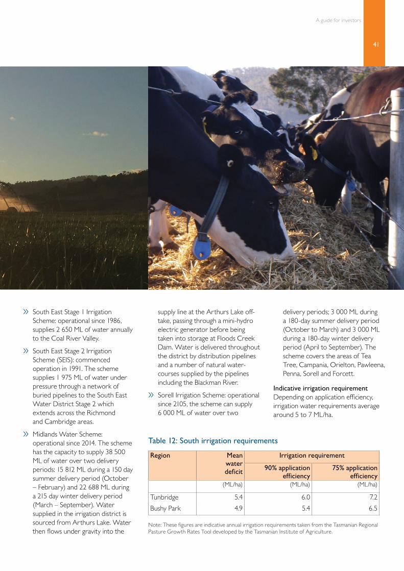
41
A guide for investors
» South East Stage 1 Irrigation Scheme: operational since 1986, supplies 2 650 ML of water annually to the Coal River Valley.
» South East Stage 2 Irrigation Scheme (SEIS): commenced operation in 1991. The scheme supplies 1 975 ML of water under pressure through a network of buried pipelines to the South East Water District Stage 2 which extends across the Richmond and Cambridge areas.
» Midlands Water Scheme: operational since 2014. The scheme has the capacity to supply 38 500 ML of water over two delivery periods: 15 812 ML during a 150 day summer delivery period (October – February) and 22 688 ML during a 215 day winter delivery period (March – September). Water supplied in the irrigation district is sourced from Arthurs Lake. Water then flows under gravity into the
supply line at the Arthurs Lake off-take, passing through a mini-hydro electric generator before being taken into storage at Floods Creek Dam. Water is delivered throughout the district by distribution pipelines and a number of natural water-courses supplied by the pipelines including the Blackman River.
» Sorell Irrigation Scheme: operational since 2105, the scheme can supply 6 000 ML of water over two
delivery periods; 3 000 ML during a 180-day summer delivery period (October to March) and 3 000 ML during a 180-day winter delivery period (April to September). The scheme covers the areas of Tea Tree, Campania, Orielton, Pawleena, Penna, Sorell and Forcett.
Indicative irrigation requirementDepending on application efficiency, irrigation water requirements average around 5 to 7 ML/ha.
Region Mean water deficit
Irrigation requirement
90% application efficiency
75% application efficiency
(ML/ha) (ML/ha) (ML/ha)
Tunbridge 5.4 6.0 7.2
Bushy Park 4.9 5.4 6.5
Note: These figures are indicative annual irrigation requirements taken from the Tasmanian Regional Pasture Growth Rates Tool developed by the Tasmanian Institute of Agriculture.
Table 12: South irrigation requirements

42
Tasmania’s dairy regions
ProcessorsFonterra and Lion both have suppliers in the southern region. Refer to Table 2 for more information on processors.
Community and social infrastructure
ServicesSmaller towns in the region have services such as a medical centre and general practitioner, general store or small supermarket and post office. Residents can travel to New Norfolk or Hobart for more comprehensive services. Rural supplies and services are available throughout the region, with providers in Oatlands and Bothwell as well as in the northern suburbs of Hobart. There are veterinary practices operating from the northern suburbs of Hobart.
Hobart has three private hospitals and one public hospital. There are several medical centres, child care centres and aged care facilities available.
EducationRegional government primary schools in the south include, Westerway, Bagdad, Fairview, New Norfolk and Molesworth. District high schools catering for Kindergarten to year 10 include Bothwell, Oatlands, Glenora and Ouse. Year 11 and 12 are completed in Hobart.
Hobart has a number of options for government and non-government primary and secondary school education, some with boarding available.
The post-secondary technical college, TasTAFE, and the University of Tasmania have campuses in Hobart.
For further information on education in the south, visit the Tasmanian Department of Education website. www.education.tas.gov.au
RecreationThe main sports played in the region are Australian Rules football and cricket. Other recreational activities include trout fishing, golf (Bothwell has the oldest golf course in the southern hemisphere), bush walking and snow skiing. The southern region is well known for trout fishing in the central highland lakes and rivers which are part of the Tasmanian Wilderness World Heritage area. There are also many historic towns and villages in the region.
Annual events include the Hamilton Show and Autumn Festival in New Norfolk. Bothwell hosts the Highland Bushfest and Bothwell Highland Spin-in biennially. Hobart has a vibrant events culture and is easily accessible via highways. For more information on events in Hobart visit Discover Tasmania. www.discovertasmania.com.au
AirportThe Hobart Airport is a 15 minute drive east from the Hobart city. There are daily flights available direct to Melbourne, Sydney and Brisbane. Short and long term car parking is available at the airport as well as taxis and shuttle buses into Hobart. Rental cars are also available at the airport.
For more information on living in the south, visit the local council websites:
www.centralhighlands.tas.gov.au www.southernmidlands.tas.gov.au www.derwentvalley.tas.gov.au
Opportunities for future developmentThere are large properties along the Derwent River with significant water rights suitable for conversion to dairying. The area has some of the warmest summer temperatures in Tasmania and with the aid of irrigation and increased soil fertility is capable of excellent pasture production. Local sources suggest that some of the better land lies away from the river and therefore water may need to be pumped or transferred over some distance. There are also good alluvial soils along the river itself. Lion and Fonterra currently buy milk in this region and would need to be agreeable to sourcing further supplies from the area.
There are also opportunities in the southern midlands on the back of existing water supplies plus the recently completed Midlands Irrigation Scheme. Some farms in this area already have irrigation infrastructure developed for poppy and cereal cropping and are looking to diversify into dairying.

43
A guide for investors
King Island
General descriptionThe municipality of King Island and has a population of approximately 1 600 permanent residents. The island is located on the western edge of Bass Straight, half way between Victoria and mainland Tasmania. The main population centre, Currie, is located on the west coast and has a population of 700. The two other villages on the island are Naracoopa on the east coast and Grassy to the south east. The island has a labour force of around 900 people a total area of 1 094 square kilometres.
The predominant industry on the island is agriculture – dairy and beef. Other industries include fishing, kelp harvesting and mining. King Island is known for its high quality food products including beef, cheese and seafood.
King Island is ideal for dairying with a moderate to high rainfall zone (800 to 1 000 mm/yr) and a mild maritime climate, with warm summers and cool winters.
The island consists of a relatively flat and gently undulating northern area with more elevated and rolling country to the south. There is limited scope for irrigation due to the lack of large streams and the generally flat topography. Some irrigation can be sourced from direct take summer allocations and winter storage allocation from surface water supplies and ground water supplies.
Lion is the sole processor on the island, manufacturing specialty cheeses. Lion are seeking additional milk supply on the island with a preference for year round supply.
There are large tracts of land suitable for conversion to dairying on King Island however, varying rainfall and soil types across the island need to be considered and as there is only one milk company, its requirement for additional milk will be a key prerequisite for any proposed investment.
Farms Estimated cows Average herd Average rainfall
13 3 585 275 856 mm

44
Tasmania’s dairy regions
Land pricesDeveloped dairy farms on King Island are generally valued at around $6 500 to $8 000 per effective hectare. Farm improvements would include a dairy, at least one dwelling and machinery sheds/barns. Irrigation water and infrastructure may be included. The cost of cows and machinery are additional to the land price. A total all-up capital cost of purchasing a dairy farm on King Island is likely to be in the range of $7 000 to $12 000 per cow, partly depending whether young stock are carried on the farm or agisted off.
Climate and soils
ClimateThe King Island dairy region has a moderate to high rainfall zone (800 to 1 000 mm/yr) which increases from north to south. It has a mild maritime climate with warm summers and cool winters.
The key climate considerations affecting pasture production are a rainfall/evaporation deficit from November to April and periods of soil water-logging that can occur through winter in lower lying areas. The negative productivity effects of the dry summer conditions are related to the soil type, relative water table depth and topography. Much of
the lower lying country has a relatively high water table and moderate dryland pasture growth rates can be achieved throughout summer in most years. More elevated sandy soil areas in the north of the island often experience low pasture production during this period.
Rainfall by monthRainfall on the island has a strong winter peak but, on average, there are reasonable falls in most months (Figure 19).
Temperature by monthMonthly mean maximum and minimum temperatures are shown in Figure 20.

45
A guide for investors
CurrieCurrie
GrassyGrassy
Figure 18: King Island dairy region
A guide for investors
45
Current dairy area (Landuse data)
Cleared agricultural land (TasVeg 3.0)
Major waterbody
Major town
Town
Highway
Major road
Road
Rail
Major watercourse

46
Tasmania’s dairy regions
Figure 19: King Island rainfall by month
Figure 20: King Island temperature by month
160
140
120
100
80
60
40
20
0
Mea
n m
onth
ly r
ainf
all (
mm
)
Jan Feb Mar Apr May Jun Jul Aug Sep Oct Nov Dec
Currie
38.5
30.1
51.8 57
.2
87.4
114.
8
115.
6
85.8
73.4
56.9
49.8
96.6
30
25
20
15
10
5
0
Mea
n m
inim
um a
nd m
axim
um te
mpe
ratu
re (°
C)
Jan Feb Mar Apr May Jun Jul Aug Sep Oct Nov Dec
Currie (max)
Currie (min)

47
A guide for investors
Soils and topographyKing Island consists of a relatively flat to gently undulating northern area with more elevated and rolling country to the south. It is dissected by a number of small streams and ephemeral creeks. Soils are dominated by light textured sandy and sandy loam soils that have developed on relic dune formations or derived from sedimentary rock. They are often poor to moderately well drained, acidic, susceptible to wind erosion if exposed. Strategic and paddock level drainage developments assist in improving pasture production.
Pasture production and utilisationTable 13 shows potential pasture production and utilisation for Currie which is roughly in the centre of the island. The potential pasture growth figure is an estimate by the Tasmanian Institute of Agriculture (TIA) of total production with fertility and drainage non-limiting. Well managed pasture in the area can result in pasture utilisation of around 8 tonnes of dry matter per hectare for dryland pastures, and 13 tonnes under irrigation, but 5 tonnes dryland and 9 tonnes irrigated are not uncommon in practice.
Achieving these levels of pasture utilisation requires good fencing to minimize losses to wildlife – wallaby numbers are very high on the island.
Irrigation waterKing Island has limited opportunity for irrigation due to the fact that there are no large streams and relatively flat topography. However, there is some irrigation on the island.
Summer direct take and winter storage Existing surface water allocations are limited to around 2 000 M. Of this volume less than 200 ML is for direct take during the summer period, with the balance relating to winter period allocations for dam filling.
The potential for additional water allocation above those already in place will typically be limited to winter (1st May to 30th November) extraction into storages. Storages can be either on stream or off stream.
The actual availability of water for allocation (catchment yield) varies from stream to stream, and will also vary along each stream and tributary. The Department of Primary Industries, Parks, Water and Environment (DPIPWE) and their approved consultants can provide specific catchment yield advice on a case by case basis for any potential water development, along with advice regarding the water allocation and dam permit approval process.
Ground waterGround water or bore water is utilised for stock and domestic purposes but the volumes available are typically not suited for large scale irrigation development. All new bore works require a permit, which can be obtained from DPIPWE.
Table 13: King Island pasture production and utilisation
Region Dryland pasture Irrigated pasture
Potential pasture growth
Percent of potential growth Potential pasture growth
Percent of potential growth
75% 50% 75% 50%
t DM/ha/year t DM/ha/year t DM/ha/year t DM/ha/year t DM/ha/year t DM/ha/year
Currie 10.5 7.9 5.3 17.8 13.4 8.9
Note: These figures are indicative total annual pasture utilisation based on the Tasmanian Regional Pasture Growth Rates Tool developed by the Tasmanian Institute of Agriculture.

48
Tasmania’s dairy regions
Indicative irrigation requirements Depending on application efficiency irrigation requirements are generally average in the range of 4 to 5 ML per hectare.
ProcessorsLion, trading as King Island Dairy Products is the sole milk processor on the island. Refer to Table 2 for more information on Lion Dairy and Drinks.
Community and social infrastructure
ServicesCurrie has two supermarkets and other services including a post office and bank. Fuel is available in Currie and Grassy. King Island has a rural supplies and services provider, veterinary practice and livestock transport and shipping service. Vehicles and machinery can be shipped to the island from Devonport or Melbourne.
A small hospital and aged care centre are located in Currie and doctors and family and community nurses permanently reside on the island. There are also specialists in rural health, psychology and physiotherapy. Several other specialists visit the island regularly. There is a Patient Travel Assistance Scheme providing financial assistance to local residents who need off island diagnosis or treatment.
EducationThere is a government district high school catering for Kindergarten to Grade 10. The Ballarat and Clarendon College has a non-government school campus at Grassy catering for year 9 students only. Further education is generally undertaken on mainland Tasmania or in Victoria. The island also has a child care and early learning centre in Currie.
For further information on education on King Island, visit the Tasmanian Department of Education website. www.education.tas.gov.au
RecreationThere are numerous sport and recreation clubs on King Island, including the island’s own Australian Rules football league. Other sporting clubs include cricket, golf, lawn bowls, tennis, swimming and yoga. Recreation groups also include horse riding, arts, dancing and music. There are several annual events including the Festival of King Island, King Island Agricultural, Horticultural & Pastoral Society Show, King Island Imperial 20 (coast to coast footrace), King Island Dramatic Society play, Queenscliff to Grassy Yacht Race, King Island Golf Open, pheasant season and the horse racing carnival. Two new word class golf courses are currently under development.
King Island is known for its natural environment and friendly people. There are numerous activities and attractions to suit all types of people, including beaches, surfing and diving, nature reserves, walking trails, golf courses, horse riding, fishing and enjoying the wildlife. There is a friendly atmosphere on the island and a great café and dining experience with several world renowned food products originating on the island.
AirportsThe King Island airport has daily flights to Tullamarine and Moorabbin airports in Melbourne and to Burnie airport at Wynyard, all with 45 minutes flying time.
For more information on living on King Island, visit the King Island Council website. www.kingisland.net.au
Opportunities for future developmentThere are large tracts of land suitable for conversion to dairying on King Island. However, variations in soil type and rainfall across the island need to be taken into account. Drainage, soil fertility and a few pockets of salinity are potential issues.
There is only one milk company on the island, King Island Dairies, owned by Lion and its requirement for additional milk will be a key factor in any proposed investment.
Region Mean water deficit
Irrigation requirement
90% application efficiency
75% application efficiency
(ML/ha) (ML/ha) (ML/ha)
Currie 3.9 4.3 5.2
Note: These figures are indicative annual irrigation requirements taken from the Tasmanian Regional Pasture Growth Rates Tool developed by the Tasmanian Institute of Agriculture.
Table 14: King Island irrigation requirements

49
A guide for investors

Contacts
DairyTas BoardPhone: +61 3 6432 2233 (International)Email: [email protected]: www.dairytas.com.au www.intodairy.com.au
Department of Primary Industries, Parks, Water and EnvironmentPhone: 1300 368 550 (Australia) +61 3 6233 8011 (International) Email: [email protected]: www.dpipwe.tas.gov.au
Department of State GrowthGPO Box 53622 Elizabeth StreetHobart TasmaniaAustralia 7000
Phone: +61 3 6777 2786Email: [email protected]: www.stategrowth.tas.gov.au
Office of the Coordinator-GeneralPO Box 1186Level 1 Cornwall Square12-16 St John StreetLaunceston TasmaniaAustralia 7250
Phone: +61 3 6777 2786Email: [email protected]: www.cg.tas.gov.au
Tasmanian Farmers and Graziers AssociationPhone: 1800 154 111 (Australia) +61 3 6332 1800 (International)Email: [email protected]: www.tfga.com.au
Tasmanian Institute of Agriculture (TIA) Dairy CentrePhone: +61 3 6430 4915 (International)Email: [email protected]: www.tia.tas.edu.au/centres/dairy-centre
Invest Tasmania
DairyTas IntoDairy