tech trends & the role of open standards an ogc...
TRANSCRIPT

Tech Trends & the Role of Open Standardsan OGC Perspective
Technical Chamber of Greece / Section of Central Macedonia:National Spatial Information Infrastructure
A vital tool for the developmentThessaloniki, GREECE, 1. December 2017
Athina TrakasServices Director Europe, Central Asia & Africa
Open Geospatial [email protected]

OGC®
© 2017 Open Geospatial Consortium – 2
Who am I?
http://www.opengeospatial.org/ogc/organization/staff/atrakas
● work in the field of GIS since 1998
● Finished university with a diploma in Geography.
● Worked for 10 year in the private industry
● Since 2009 I am OGC's Director for Regional Services forEurope, Central Asia & Africa
● I am the contact person for OGC in these regions,responsible for the Consortiums activities andnetworking, like planning and managing of OGCrecruitment, connecting with relevant stakeholderorganisations and members.
● Since 2008 I am charter member of OSGeo.

OGC®
© 2017 Open Geospatial Consortium – 3
Introduction

OGC®
© 2017 Open Geospatial Consortium – 4
The Open Geospatial Consortium
Africa (6)
Asia Pacific (92)
Europe (207)
Middle East (33)
North America (187)
South America (2)
Greece:➔ GET - Geospatial Enabling Technologies➔ Interbalkan Environment Center➔ National & Kapodistrian University Athens➔ Angelos Tzotsos➔ Dimitris Kotzinos
• Founded in 1994, not for profit, consensus based and voluntary
• International organisation leading development of geospatial standards
• 525+ member organisations (Nov 2017)

OGC®
© 2017 Open Geospatial Consortium – 5
The Open Geospatial Consortium
• 50+ standards (OGC WMS, WFS etc.)
• Thousands of implementations
• Broad user community implementation worldwide
• Alliances and collaborative activities with ISO and many other SDO’s
• Many Domain and StandardsWorking Groups
Commercial; 38%
Government; 27%
NGO; 7%Research; 6%
University; 22%
OGC®
© 2017 Open Geospatial Consortium – 6
6
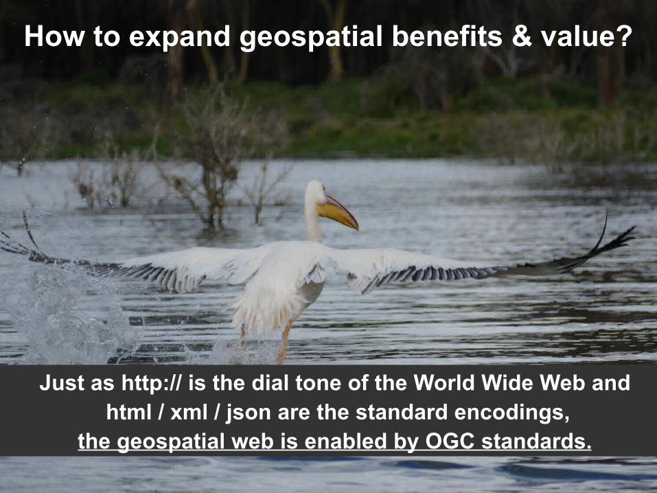
How to expand geospatial benefits & value?
Just as http:// is the dial tone of the World Wide Web and html / xml / json are the standard encodings,
the geospatial web is enabled by OGC standards.
OGC®
© 2017 Open Geospatial Consortium – 7
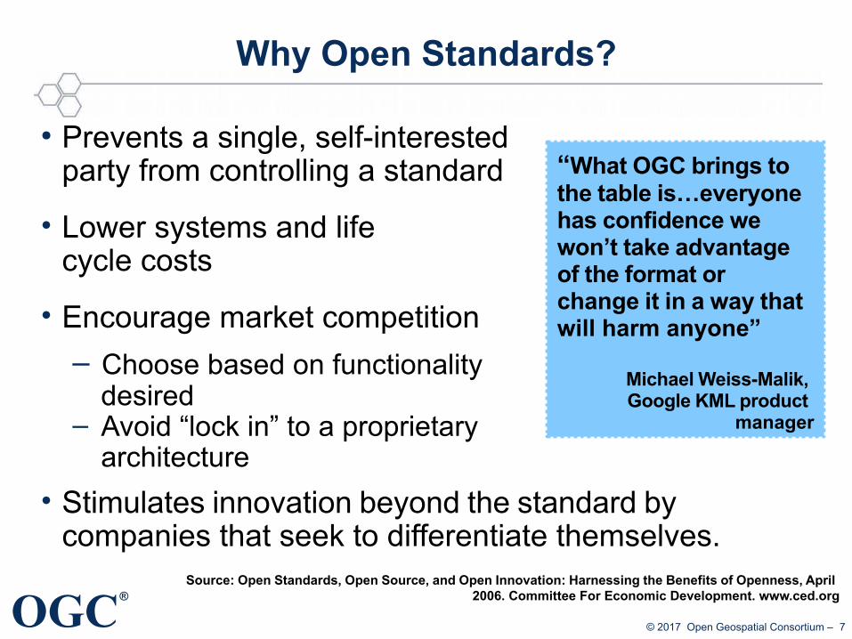
Why Open Standards?
● Prevents a single, self-interested party from controlling a standard
• Lower systems and life cycle costs
• Encourage market competition
– Choose based on functionality desired
– Avoid “lock in” to a proprietary architecture
• Stimulates innovation beyond the standard by companies that seek to differentiate themselves.
Source: Open Standards, Open Source, and Open Innovation: Harnessing the Benefits of Openness, April 2006. Committee For Economic Development. www.ced.org
“What OGC brings to the table is…everyone has confidence we won’t take advantage of the format or change it in a way that will harm anyone”
Michael Weiss-Malik, Google KML product
manager
OGC®
© 2017 Open Geospatial Consortium – 8
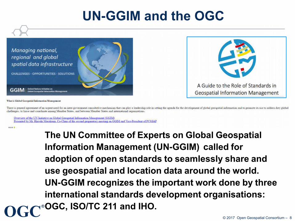
UN-GGIM and the OGC
The UN Committee of Experts on Global Geospatial Information Management (UN-GGIM) called for adoption of open standards to seamlessly share and use geospatial and location data around the world. UN-GGIM recognizes the important work done by three international standards development organisations: OGC, ISO/TC 211 and IHO.

OGC®
© 2017 Open Geospatial Consortium – 9
Geospatial Data to Knowledge
The trajectory from data to geospatial knowledge, enabled
by standards.
OGC®
© 2017 Open Geospatial Consortium – 10
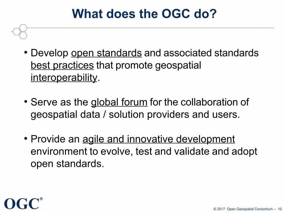
What does the OGC do?
● Develop open standards and associated standards best practices that promote geospatial interoperability.
● Serve as the global forum for the collaboration of geospatial data / solution providers and users.
● Provide an agile and innovative development environment to evolve, test and validate and adopt open standards.

OGC®
© 2017 Open Geospatial Consortium – 11
OGC Programs interaction
Requirements
OGC OGC
Compliance Program
Compliance Program
Engineering Reports
Adopted
Standards
Gaps and Enhancements
Innovation Program
Innovation Program
Product Implementations
Product Implementations
StandardsProgram
StandardsProgram
Rapid prototyping environment
Rapid prototyping environment
Communications & Outreach
Communications & Outreach
Requirements
Req
uir
em
en
ts
Req
uire
me
nts

®
®
OGC Tech TrendsBackground
OGC®
© 2017 Open Geospatial Consortium – 13
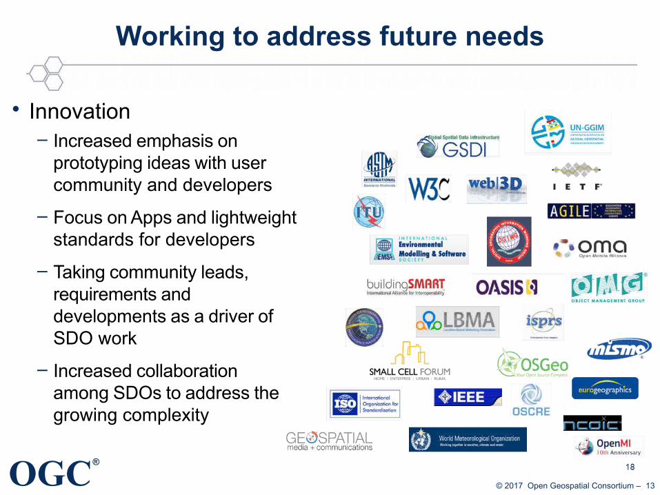
Working to address future needs
• Innovation– Increased emphasis on
prototyping ideas with user community and developers
– Focus on Apps and lightweight standards for developers
– Taking community leads, requirements and developments as a driver of SDO work
– Increased collaboration among SDOs to address the growing complexity
OGC®
© 2017 Open Geospatial Consortium – 14
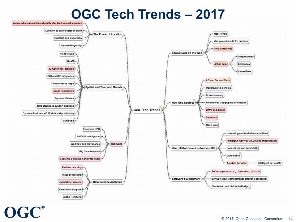
OGC Tech Trends – 2017

OGC®
© 2017 Open Geospatial Consortium – 15
Highlighted Topics – near term actions
• Power of Location– People who communicate
digitally tend to meet in person
• Spatial/Temporal Models– 3D Geo Model creation– Indoor positioning
• Big Data and Data Science– Machine Learning– Modeling, Simulation and
Prediction– Uncertainty and Veracity
• Spatial Data on the Web– APIs for the Web– Linked data
• New Geo Sources– IoT and Sensor Webs– Remote sensing on demand
• UAVs and drones• Smallsats
• User platforms & Networks– Immersive Geo– Ambient Services
• Software development– Federation, Pub-Sub

OGC®
© 2017 Open Geospatial Consortium – 16
OAB Tech Trends & the Innovation Program
• Current Initiatives– Testbed 13: Big data, Predictive models, Linked data, Pub-Sub
→ http://www.opengeospatial.org/projects/initiatives/testbed13
– Environmental Linked Features Interoperability Experiment– Underground Concept Development Study: 3D Geo Model
creation
• New initiative planning– Develop “prospectus” for trends– E.g., Indoor positioning; Ambient services, Immersive Geo
• Watch out for Testbed 14 – Call for Participation out in Dec 2017– http://www.opengeospatial.org/projects/initiatives/testbed14

®
®
OGC Tech TrendsWhere are we today?
Where do we go tomorrow?
More input and details on Githubhttps://github.com/opengeospatial/OGC-Technology-Trends

OGC®
© 2017 Open Geospatial Consortium – 18
Checkpoint Today
● SDI’s expand around the world● Influence of Crowdsourcing / VGI● IoT / Sensors – mobile, wearable,
and actively sensed● Mobile First● Cloud computing● Big Data / analytics● Linked Data● 3D City Models & BIM● From maps to models and
“mapless” decisions● Industry driving innovation● Technology disruption is the norm
http://www.slideshare.net/kleinerperkins/2012-kpcb-internet-trends-yearend-update
A Location Linked World

OGC®
© 2017 Open Geospatial Consortium – 19
OGC Smart City Activities
• OGC Testbed 11, Climate Resilience – Cities: San Francisco
– Sponsors: NASA, NGA, USGS,
• OGC Future Cities Pilot, Phase 1– Cities: Greenwich, Rennes,Sant Cugat del Valles, Berlin, Rotterdam
– Sponsors: Ordnance Survey GB, Sant Cugat del Valles, IGN, virtualcitySYSTEMS
• Indian OGC Interoperability Plugfest – Smart Cities and National GIS / National Spatial Data Infrastructure (NSDI) Missions
• New York City Pilot– Above ground CityGML model – complete 2015
– Below ground Infrastructure model – currently being planned
• ESPRESSO– OGC-led European Commission funded project on Smart Cities
• OGC Smart Cities Spatial Information Framework White Paper
Graphics: OGC, Future Cities Pilot

OGC®
© 2017 Open Geospatial Consortium – 20
Urban Heat Island
DTM for Flood Management
Telecommunication Coverage
Urban Air Flow Dynamic
Underground Infrastructure
Development Planning
3D City Models

OGC®
© 2017 Open Geospatial Consortium – 21
OGC CityGML & IndoorGML
Source: http://www1.nyc.gov/site/doitt/initiatives/3d-building.page
• Urban Planning / Operations• Emergency Mgt / Response• Transportation / Routing / Logistics• Indoor navigation• Retail Site analysis• Sustainable / Green Communities• City Services Management• Noise abatement• Telecommunications placement• Many other uses…
Source: www.directionsmag.com

OGC®
© 2017 Open Geospatial Consortium – 22
Google pictures

OGC®
© 2017 Open Geospatial Consortium – 23
Sensors Everywhere(Things or Devices)
50 billions Internet-connected things by 2020
Slide source: Steve Liang, Univ. Calgary

OGC®
OGC SensorThings for IoTToday: Proprietary Silos, No “World-Wide Web of Things”
SensorThings: IoT MashUp
• Builds on OGC Sensor Web Enablement (SWE) standards that are operational around the world
• Builds on Web protocols; easy-to-use
• Super light-weight: ideal for low power / low bandwidth devices
• OGC standard for open access to IoT devices Source: OGC IMIS IoT Pilot: http://www.opengeospatial.org/projects/initiatives/imisiot

OGC®
© 2017 Open Geospatial Consortium – 25
● OGC Sensor Web Enablement– WaterML2 (Profile of O&M)
Internet of Things and OGC Sensor Web
Cooking hacks

OGC®
© 2017 Open Geospatial Consortium – 26
Big Data
Source: http://technology.ie/big-data-looks-like/
OGC®
© 2017 Open Geospatial Consortium – 27
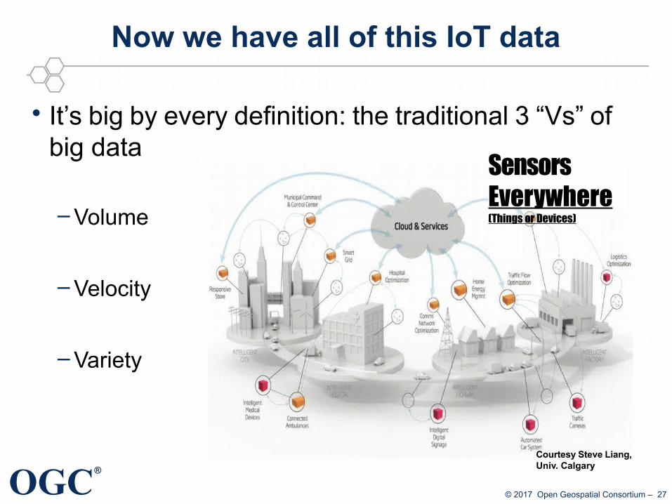
Now we have all of this IoT data
• It’s big by every definition: the traditional 3 “Vs” of big data
– Volume
– Velocity
– Variety
Sensors Everywhere(Things or Devices)
Courtesy Steve Liang, Univ. Calgary
OGC®
© 2017 Open Geospatial Consortium – 28
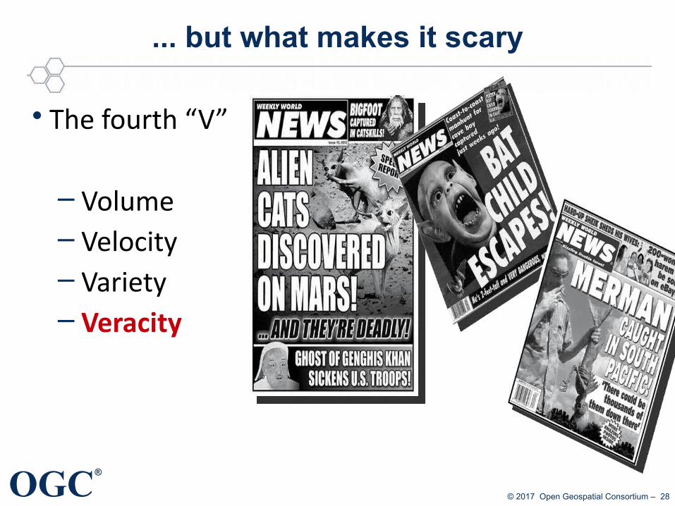
... but what makes it scary
• The fourth “V”
– Volume– Velocity– Variety– Veracity
OGC®
© 2017 Open Geospatial Consortium – 29
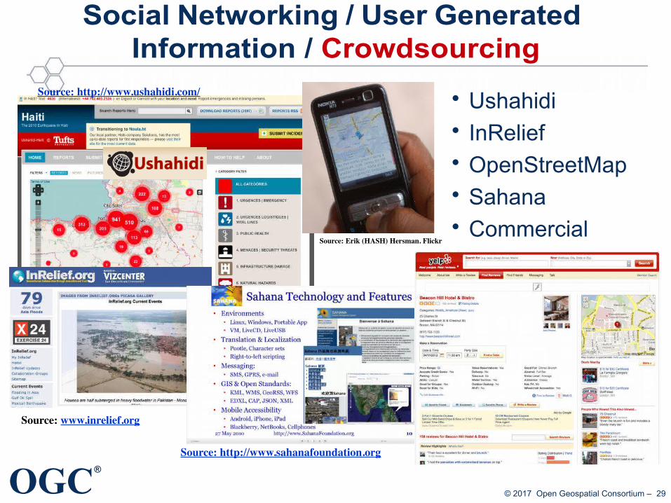
Social Networking / User Generated Information / Crowdsourcing
• Ushahidi• InRelief• OpenStreetMap• Sahana• Commercial
Source: http://www.sahanafoundation.org
Source: www.inrelief.org
Source: http://www.ushahidi.com/
Source: Erik (HASH) Hersman. Flickr

OGC®
© 2017 Open Geospatial Consortium – 30
Citizen Science (Domain Working Group)
OGC®
© 2017 Open Geospatial Consortium – 31
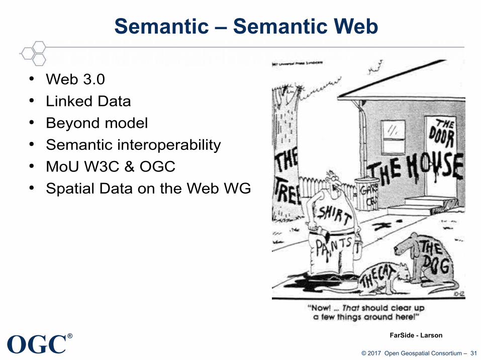
Semantic – Semantic Web
● Web 3.0● Linked Data● Beyond model ● Semantic interoperability● MoU W3C & OGC● Spatial Data on the Web WG
FarSide - Larson

OGC®
© 2017 Open Geospatial Consortium – 32
How to align ISO metadata, DCAT, DCAT-AP, and additional requirements?
How to ensure that linked data graphs are valid?
Can I use this for portrayal?
How to link between a service, a portrayal style, and a data set?
Slide by Ingo SimonisTestbed 13 – Challenges and Solutions
OGC®
© 2017 Open Geospatial Consortium – 33
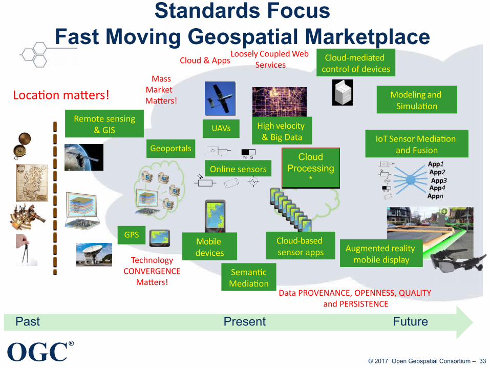
Standards FocusFast Moving Geospatial Marketplace
Past Present Future
TechnologyCONVERGENCE
Matters!Data PROVENANCE, OPENNESS, QUALITY
and PERSISTENCE
MassMarket Matters!
Cloud-mediated control of devices
Online sensors
Modeling and Simulation
Augmented reality mobile display
Remote sensing& GIS
Location matters!
IoT Sensor Mediation and Fusion
Mobile devices
UAVs
Cloud & Apps
Geoportals
Cloud-based sensor apps
GPS
High velocity & Big Data
SemanticMediation
CloudProcessing
*
CloudProcessing
*
Loosely Coupled Web Services
OGC®
© 2017 Open Geospatial Consortium – 34
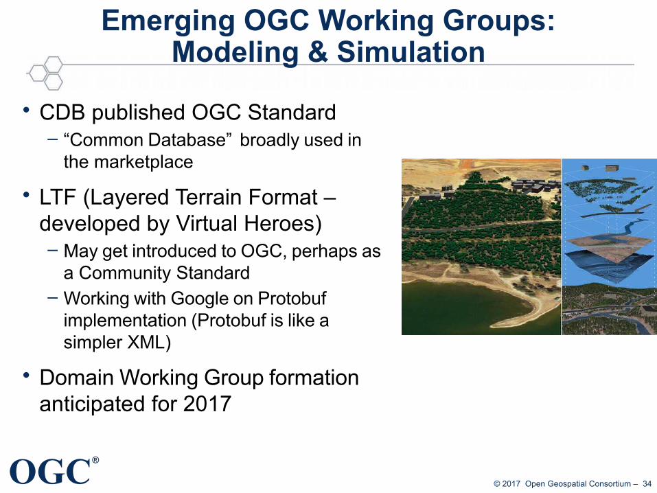
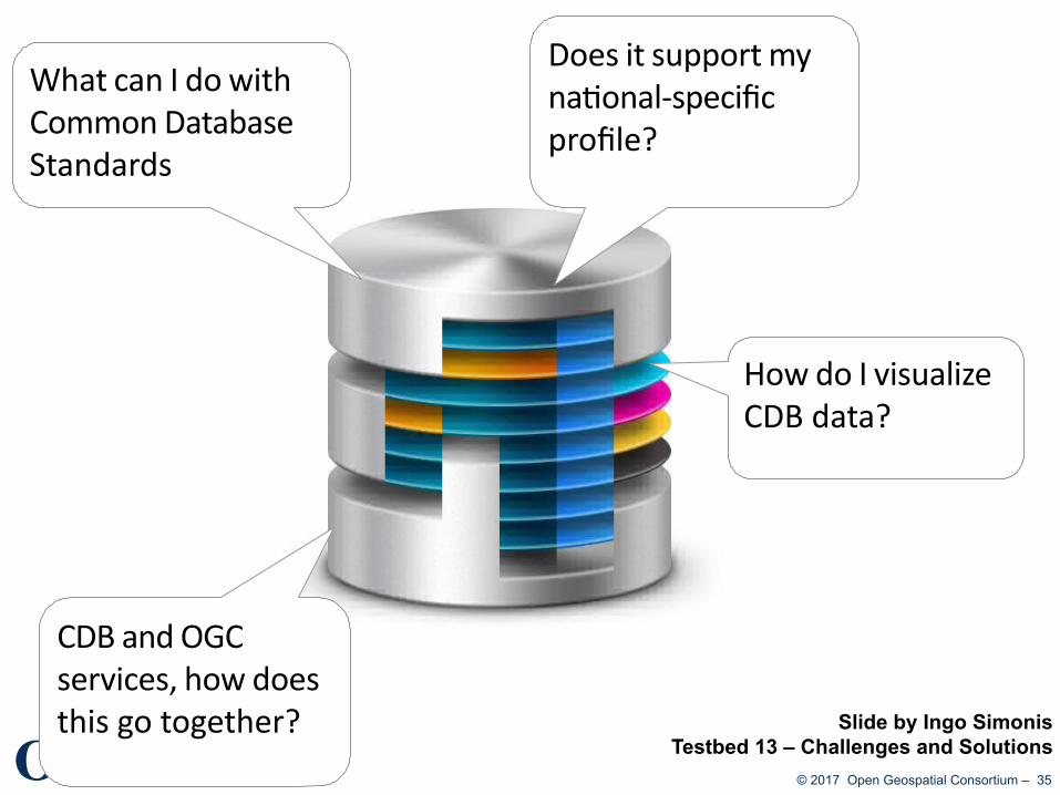
Emerging OGC Working Groups:Modeling & Simulation
• CDB published OGC Standard– “Common Database” broadly used in
the marketplace
• LTF (Layered Terrain Format – developed by Virtual Heroes)– May get introduced to OGC, perhaps as
a Community Standard– Working with Google on Protobuf
implementation (Protobuf is like a simpler XML)
• Domain Working Group formation anticipated for 2017
OGC®
© 2017 Open Geospatial Consortium – 35
Does it support my national-specific profile?
CDB and OGC services, how does this go together?
What can I do with Common Database Standards
How do I visualize CDB data?
Slide by Ingo SimonisTestbed 13 – Challenges and Solutions

OGC®
© 2017 Open Geospatial Consortium – 36
Emerging: Land Administration DWG
• Purpose / Scope:– Examine existing systems of land administration;– Develop best practices regarding standards-based implementations; – Identify potential interoperability experiments, pilots and testbeds to
validate interoperable solutions
• Emphasis on close coordination with partners in Land Administration– SDOs (ISO, OASIS, W3C etc.)– Associations (FIG, RICS, etc.)
• Open to OGC members and non-members
OGC®
© 2017 Open Geospatial Consortium – 37
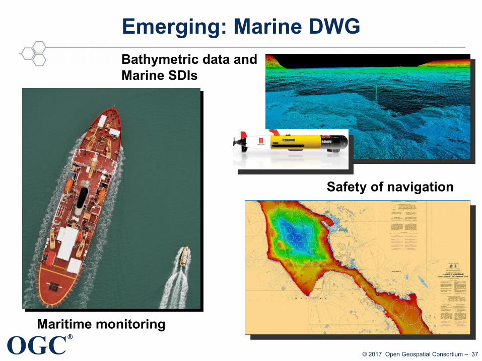
Emerging: Marine DWG
Maritime monitoring
Safety of navigation
Bathymetric data andMarine SDIs

OGC®
© 2017 Open Geospatial Consortium – 38
Emerging: Unmanned Systems
• New Domain Working Group• Initially conceived to focus on Unmanned Aerial Systems
(UAS), but scope has been broadened to all types of platforms– Focus will be on autonomous or remotely piloted platforms which
acquire data
• UAS use cases include:– Exchange of flight plans– Metadata for hobbyist sensors– Lightweight protocols for sensor management– Example Earth Observation: CERTH research
ECOPTENTIAL Project
Tree cover density Above Ground Biomass

OGC®
© 2017 Open Geospatial Consortium – 39
Stay curious and participate!
● → avoid re-inventing the wheel, duplication of work and efforts● → interoperability & open standards help to sustain investments● → key to success: contribution & cooperation on intern'l level
OGC®
© 2017 Open Geospatial Consortium – 40
Thank you for your attention!
Athina TrakasDirector Regional ServicesEurope, Central-Asia, Africa
eMail: [email protected] Twitter: @trakasa With input from I. Simonis, G. Percivall, S. Simmons – thxs!