texas land application permits: overview of geology and
TRANSCRIPT
Texas Land Application Permits:
Overview of Geology and
Groundwater Technical Resources
AMANDA PIRANI, P.G.
WATER QUALITY ASSESSMENT TEAM, WATER QUALITY DIVISION
OCTOBER 10, 2019
AUTUMN ENVIRONMENTAL CONFERENCE AND EXPO
Agronomy Review
Information contained in 30 TAC
§309.20
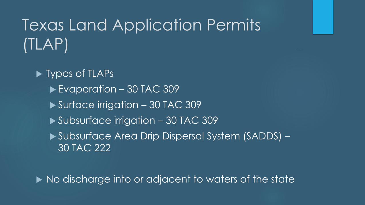
Texas Land Application Permits
(TLAP)
Types of TLAPs
Evaporation – 30 TAC 309
Surface irrigation – 30 TAC 309
Subsurface irrigation – 30 TAC 309
Subsurface Area Drip Dispersal System (SADDS) –
30 TAC 222
No discharge into or adjacent to waters of the state
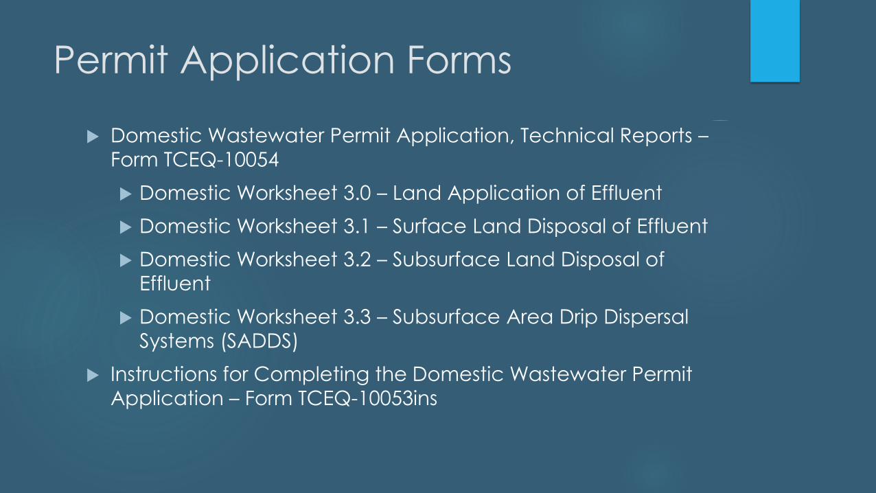
Permit Application Forms
Domestic Wastewater Permit Application, Technical Reports –
Form TCEQ-10054
Domestic Worksheet 3.0 – Land Application of Effluent
Domestic Worksheet 3.1 – Surface Land Disposal of Effluent
Domestic Worksheet 3.2 – Subsurface Land Disposal of
Effluent
Domestic Worksheet 3.3 – Subsurface Area Drip Dispersal
Systems (SADDS)
Instructions for Completing the Domestic Wastewater Permit
Application – Form TCEQ-10053ins

Water Quality Assessment Team
Determine compliance with TCEQ rules and policies
Determine whether the proposed land application
activities have the potential to impact groundwater
Two Types of Technical Reviews
Geology
Agronomy

Geology Review
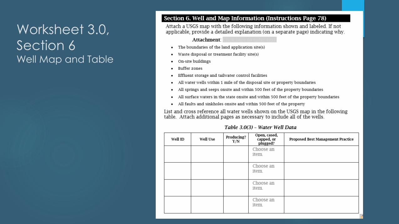
Worksheet 3.0,
Section 6Well Map and Table
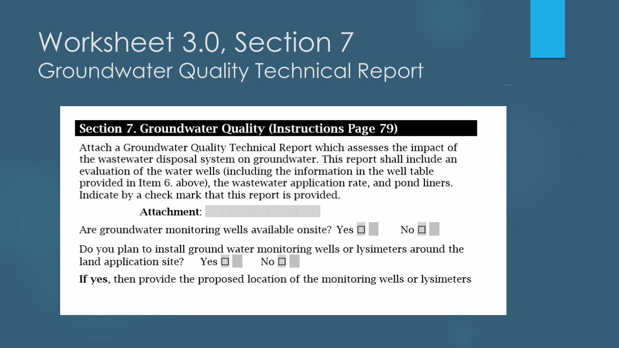
Worksheet 3.0, Section 7Groundwater Quality Technical Report
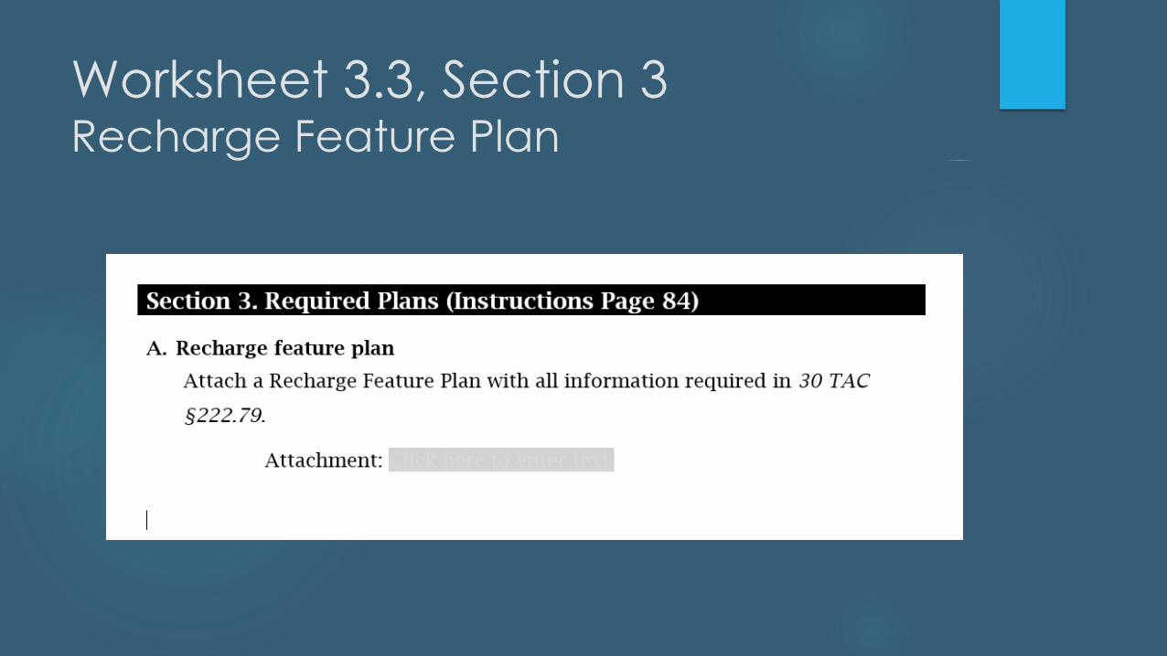
Worksheet 3.3, Section 3Recharge Feature Plan
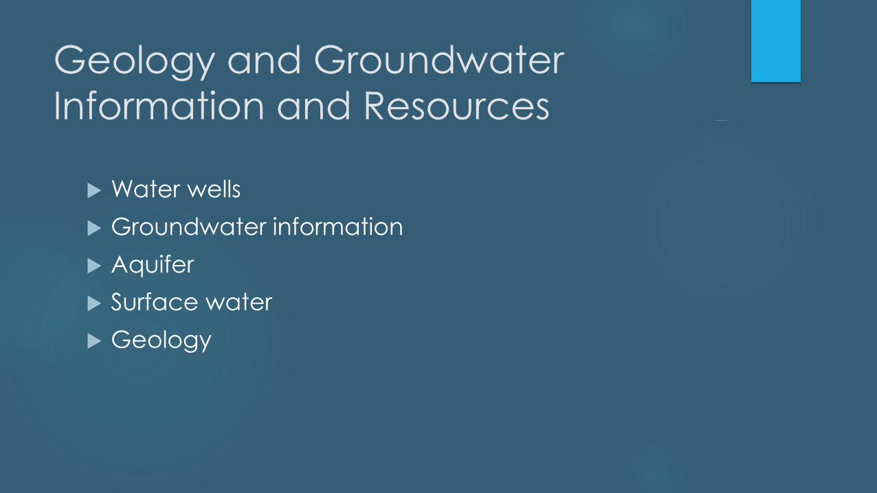
Geology and Groundwater
Information and Resources
Water wells
Groundwater information
Aquifer
Surface water
Geology
Water Wells
TWDB Water Data Interactive
TCEQ Drinking Water Watch
USGS topographic maps
Groundwater Conservation Districts
Site visit
Interview with property owner
Water wells must meet applicable buffer distances as
specified in 30 TAC 309.13(c)
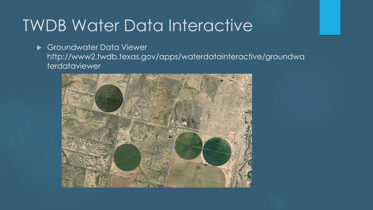
TWDB Water Data Interactive Groundwater Data Viewer
http://www2.twdb.texas.gov/apps/waterdatainteractive/groundwaterdataviewer
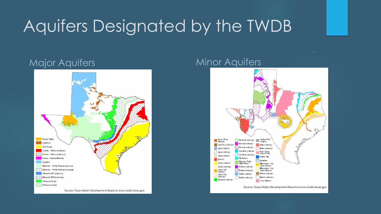
Aquifers Designated by the TWDB
Major Aquifers Minor Aquifers
Groundwater Information
Well drillers’ logs
Well plugging reports
Depth to groundwater
Groundwater use
Groundwater quality
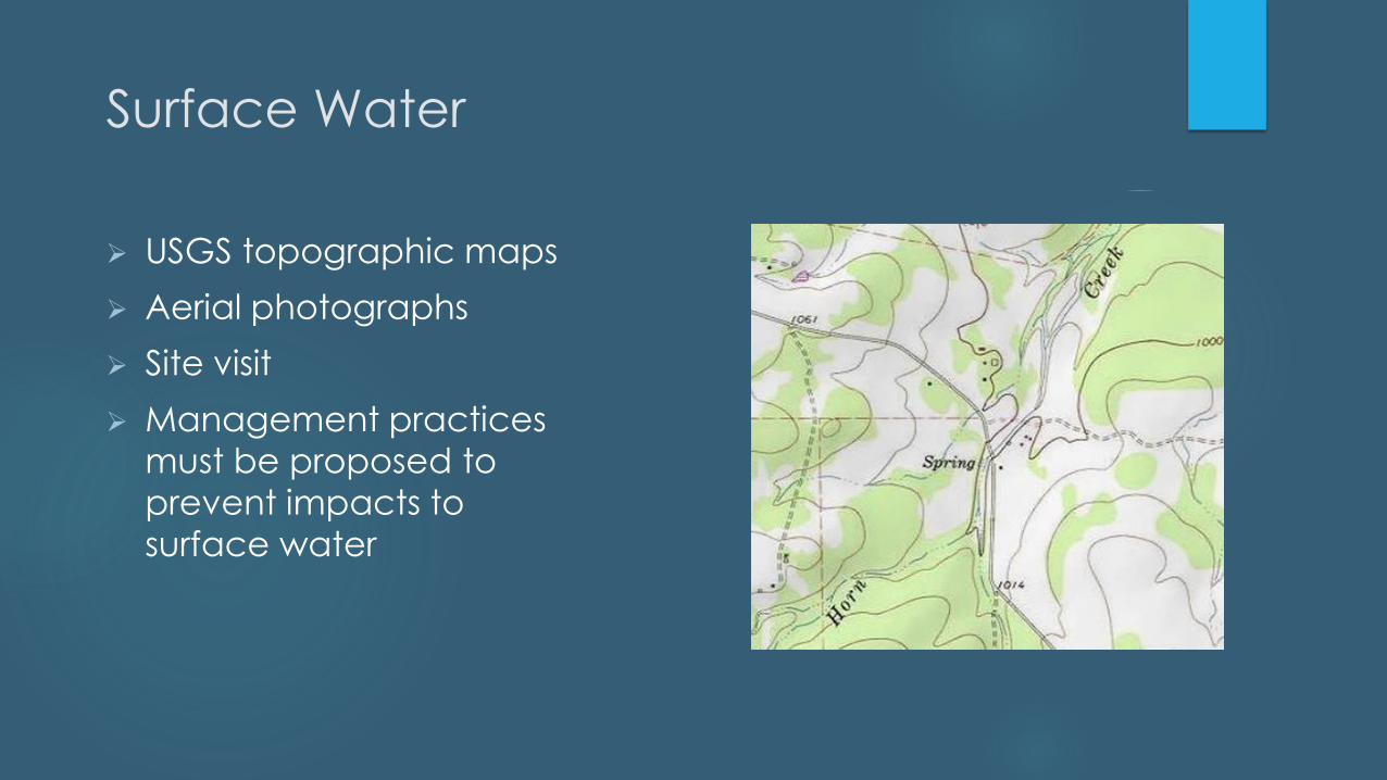
Surface Water
➢ USGS topographic maps
➢ Aerial photographs
➢ Site visit
➢ Management practices
must be proposed to
prevent impacts to
surface water

Geology
➢ Geologic Atlas of Texas
➢ Viewer at
https://txpub.usgs.gov/dss/te
xasgeology/
➢ Site visit
Wastewater Pond Liners
Wastewater holding and treatment ponds must be lined
in accordance with 30 TAC §217.203 and 30 TAC
§309.13(d)
Wastewater pond liners must certified by a Texas-
licensed professional engineer
The certification must state that the liner meet the
requirements of 30 TAC §217.203 and 30 TAC §309.13(d),
if applicable
Groundwater Quality Technical
Report
Fully assess the impact of the wastewater disposal system
on groundwater quality
Describe geology, groundwater, area wells, pond liners,
best management practices such as buffers, wastewater
application rate and any other practice designed to
protect groundwater quality
Edwards Aquifer and Subsurface
Irrigation Systems
Subsurface irrigation systems and SADDS are considered Class
V injection wells
30 TAC §213.8 (relating to the Edwards Aquifer) prohibits
waste disposal wells regulated under Chapter 331 (relating to
Underground Injection Control) on the Edwards Aquifer
Recharge Zone and Edwards Aquifer Transition Zone
If you have questions regarding whether or not 30 TAC §213.8
is applicable to a site, please contact the Water Quality
Division
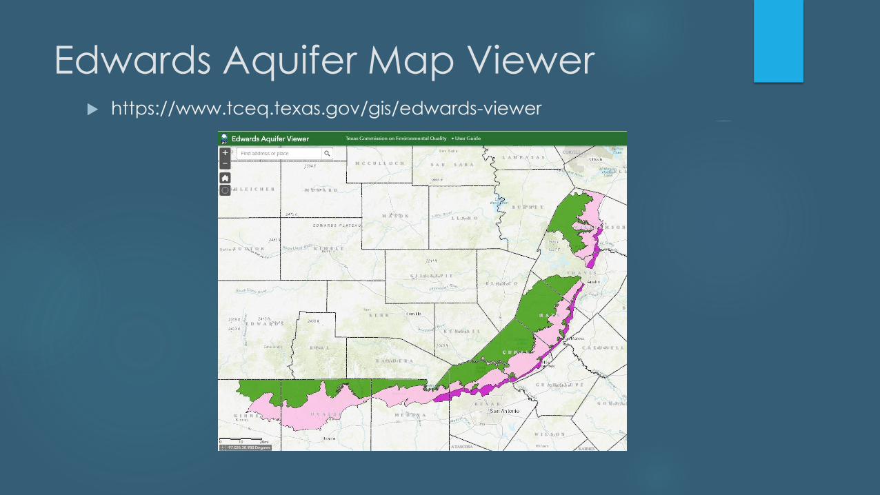
Edwards Aquifer Map Viewer https://www.tceq.texas.gov/gis/edwards-viewer
Subsurface Area Drip Dispersal
Systems (SADDS)
Defined as a waste disposal system that injects processed
commercial, industrial, or municipal waste into the ground at
ta depth of not more than 48 inches and spreads the waste
over a large enough area that the soil hydrologic absorption
rate and crop/plant absorption rate are not exceeded
Regulated under 30 TAC 222
Requires submittal of a Recharge Feature Plan – 30 TAC
§222.79
Recharge Feature Plan
Must be prepared by a Texas-licensed professional
geoscientist or a Texas-licensed professional engineer
Must document the presence or absence of recharge
features at the site
Provide a description of site-specific geology and
groundwater at the facility
Identify measures to prevent impact to groundwater
from any recharge features present
Applicable TCEQ Rules
213 – Edwards Aquifer
217 – Design Criteria for Domestic Wastewater Systems
222 – Subsurface Area Drip Dispersal Systems
309 - Domestic Wastewater Effluent Limitation and Plant
Siting
311 - Watershed Protection

Texas Land Application Permits:
Overview of Agronomy and Soil
Technical Resources
PAUL ASKENASY, PhD., P.G.
WATER QUALITY ASSESSMENT TEAM, WATER QUALITY DIVISION
(281) 486-1246
OCTOBER 10, 2019
AUTUMN ENVIRONMENTAL CONFERENCE AND EXPO

Agronomy Review
Information contained in 30 TAC
§309.20

Completeness
Daily Application Rate – GPD
Size, slope and location of application site(s)
Does applicant want option to irrigate year round? If so,
warm and cool season crops must be proposed.
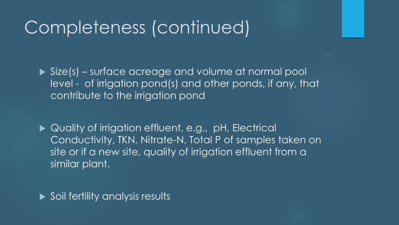
Completeness (continued)
Size(s) – surface acreage and volume at normal pool
level - of irrigation pond(s) and other ponds, if any, that
contribute to the irrigation pond
Quality of irrigation effluent, e.g., pH, Electrical
Conductivity, TKN, Nitrate-N, Total P of samples taken on
site or if a new site, quality of irrigation effluent from a
similar plant.
Soil fertility analysis results
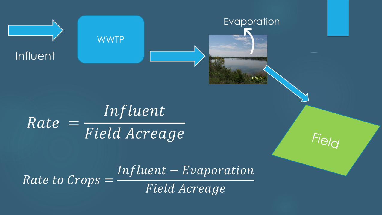
Influent
WWTP
𝑅𝑎𝑡𝑒 =𝐼𝑛𝑓𝑙𝑢𝑒𝑛𝑡
𝐹𝑖𝑒𝑙𝑑 𝐴𝑐𝑟𝑒𝑎𝑔𝑒
Evaporation
𝑅𝑎𝑡𝑒 𝑡𝑜 𝐶𝑟𝑜𝑝𝑠 =𝐼𝑛𝑓𝑙𝑢𝑒𝑛𝑡 − 𝐸𝑣𝑎𝑝𝑜𝑟𝑎𝑡𝑖𝑜𝑛
𝐹𝑖𝑒𝑙𝑑 𝐴𝑐𝑟𝑒𝑎𝑔𝑒
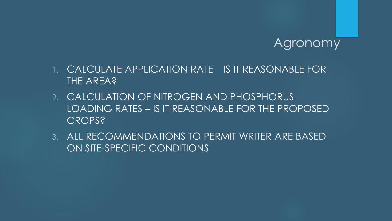
Agronomy
1. CALCULATE APPLICATION RATE – IS IT REASONABLE FOR
THE AREA?
2. CALCULATION OF NITROGEN AND PHOSPHORUS
LOADING RATES – IS IT REASONABLE FOR THE PROPOSED
CROPS?
3. ALL RECOMMENDATIONS TO PERMIT WRITER ARE BASED
ON SITE-SPECIFIC CONDITIONS

Agronomy
Volume GPD or
Tons/acre
Nutrient, mg/L
or mg/kg
ET
inchesDry
Matter,
Lbs/acre
Rooting
Depth,
inches
Area, acres

Contacts:Julian D. Centeno, Jr., P.E. [email protected] (512) 239-4608
Amanda Pirani, P.G.
(512) 239-1613
Paul Askenasy, Ph.D., P.G.
(281) 486-1246