the earthen embankment integrity program (eeip)
TRANSCRIPT
The Earthen Embankment Integrity Program (EEIP) Understanding the Embankment Management Guidebook and providing feedback on the program
1
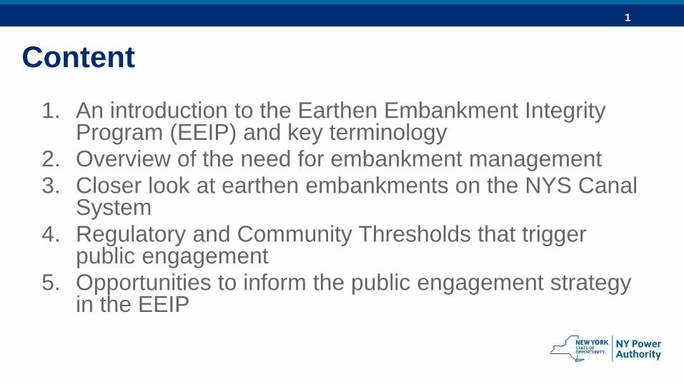
Content
1. An introduction to the Earthen Embankment Integrity Program (EEIP) and key terminology
2. Overview of the need for embankment management3. Closer look at earthen embankments on the NYS Canal
System4. Regulatory and Community Thresholds that trigger
public engagement5. Opportunities to inform the public engagement strategy
in the EEIP
2
Intro: The Earthen Embankment Integrity Program
3
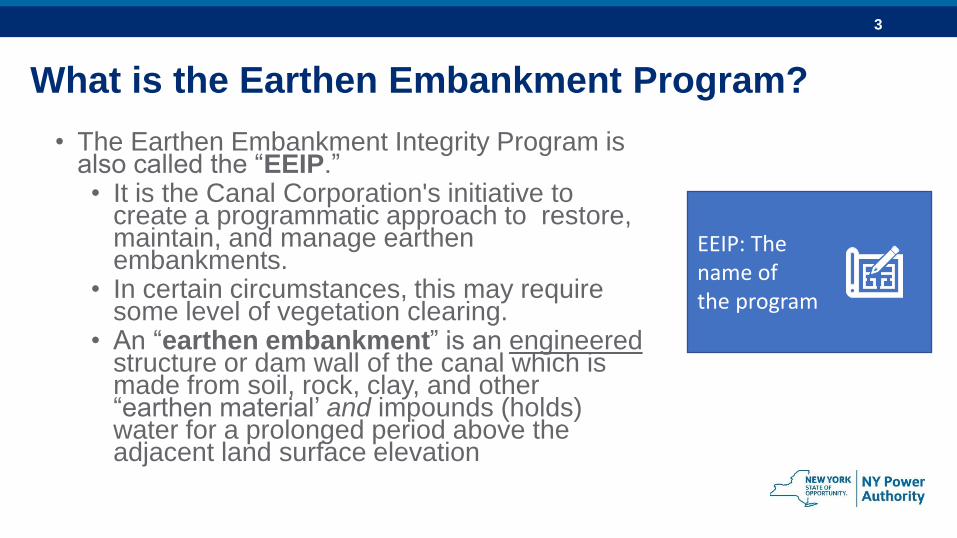
What is the Earthen Embankment Program?
• The Earthen Embankment Integrity Program is also called the “EEIP.”• It is the Canal Corporation's initiative to
create a programmatic approach to restore, maintain, and manage earthen embankments.
• In certain circumstances, this may require some level of vegetation clearing.
• An “earthen embankment” is an engineered structure or dam wall of the canal which is made from soil, rock, clay, and other “earthen material’ and impounds (holds) water for a prolonged period above the adjacent land surface elevation
EEIP: The name of the program
4
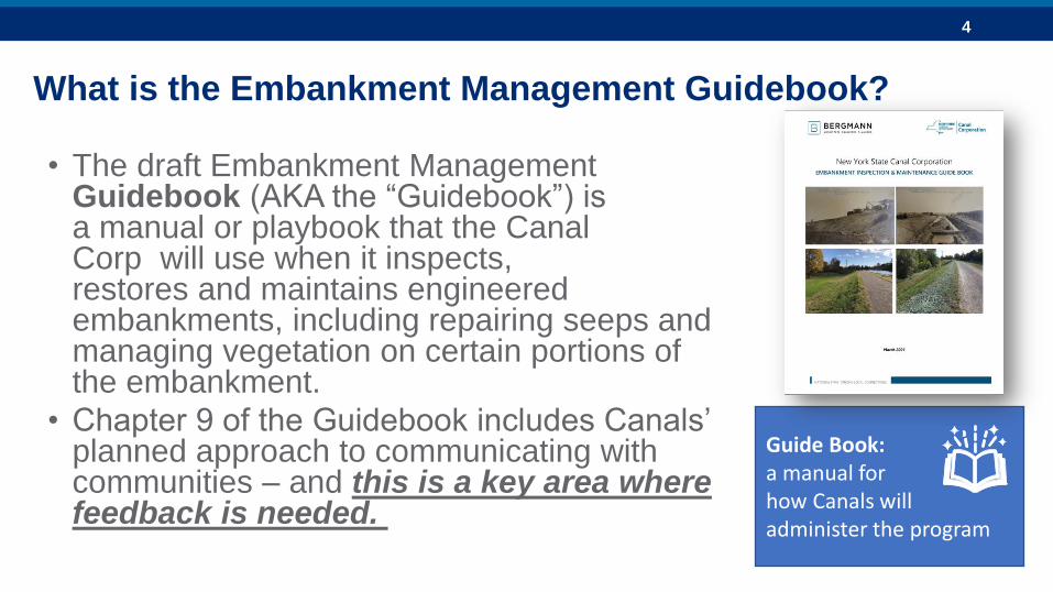
What is the Embankment Management Guidebook?
• The draft Embankment Management Guidebook (AKA the “Guidebook”) is a manual or playbook that the Canal Corp will use when it inspects, restores and maintains engineered embankments, including repairing seeps and managing vegetation on certain portions of the embankment.
• Chapter 9 of the Guidebook includes Canals’ planned approach to communicating with communities – and this is a key area where feedback is needed.
Guide Book: a manual for how Canals will administer the program
5
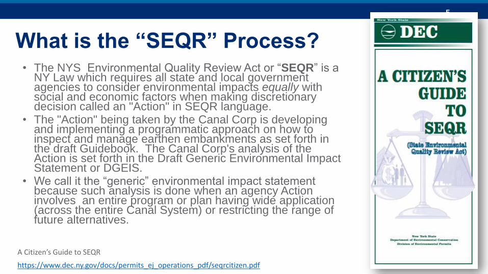
What is the “SEQR” Process? • The NYS Environmental Quality Review Act or “SEQR” is a
NY Law which requires all state and local government agencies to consider environmental impacts equally with social and economic factors when making discretionary decision called an "Action" in SEQR language.
• The "Action" being taken by the Canal Corp is developing and implementing a programmatic approach on how to inspect and manage earthen embankments as set forth in the draft Guidebook. The Canal Corp's analysis of the Action is set forth in the Draft Generic Environmental Impact Statement or DGEIS.
• We call it the “generic” environmental impact statement because such analysis is done when an agency Action involves an entire program or plan having wide application (across the entire Canal System) or restricting the range of future alternatives.
https://www.dec.ny.gov/docs/permits_ej_operations_pdf/seqrcitizen.pdf
A Citizen’s Guide to SEQR
6
Why we need embankment management
7
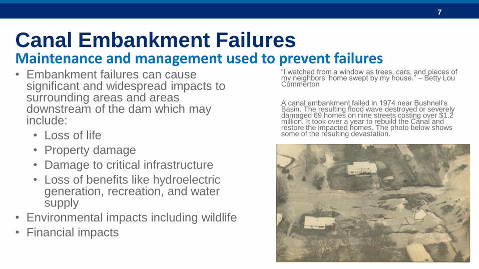
Canal Embankment Failures
• Embankment failures can cause significant and widespread impacts to surrounding areas and areas downstream of the dam which may include:
• Loss of life
• Property damage
• Damage to critical infrastructure
• Loss of benefits like hydroelectric generation, recreation, and water supply
• Environmental impacts including wildlife
• Financial impacts
“I watched from a window as trees, cars, and pieces of my neighbors’ home swept by my house.” – Betty Lou Commerton
A canal embankment failed in 1974 near Bushnell’s Basin. The resulting flood wave destroyed or severely damaged 69 homes on nine streets costing over $1.2 million. It took over a year to rebuild the Canal and restore the impacted homes. The photo below shows some of the resulting devastation.
Maintenance and management used to prevent failures
8
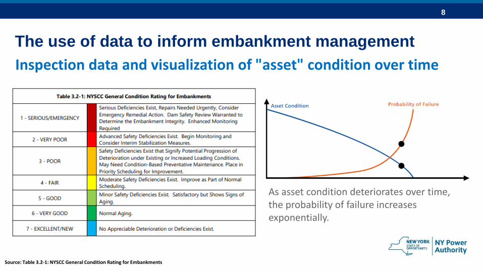
The use of data to inform embankment management
Inspection data and visualization of "asset" condition over time
As asset condition deteriorates over time, the probability of failure increases exponentially.
Source: Table 3.2-1: NYSCC General Condition Rating for Embankments
9
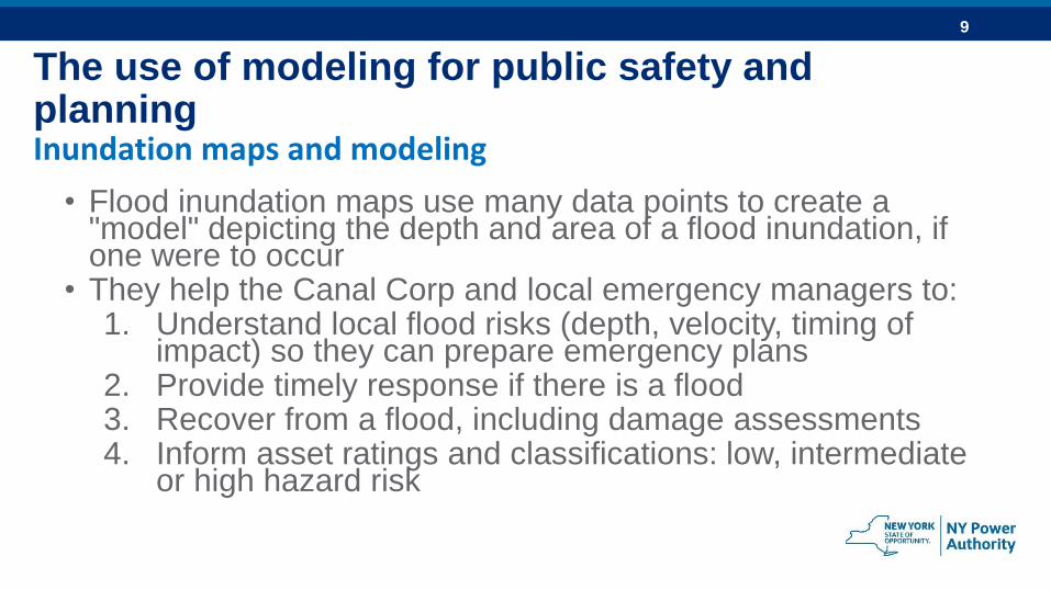
The use of modeling for public safety and planningInundation maps and modeling
• Flood inundation maps use many data points to create a "model" depicting the depth and area of a flood inundation, if one were to occur
• They help the Canal Corp and local emergency managers to:1. Understand local flood risks (depth, velocity, timing of
impact) so they can prepare emergency plans2. Provide timely response if there is a flood3. Recover from a flood, including damage assessments4. Inform asset ratings and classifications: low, intermediate
or high hazard risk
10
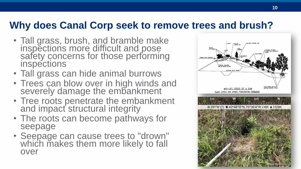
Why does Canal Corp seek to remove trees and brush?
• Tall grass, brush, and bramble make inspections more difficult and pose safety concerns for those performing inspections
• Tall grass can hide animal burrows• Trees can blow over in high winds and
severely damage the embankment• Tree roots penetrate the embankment
and impact structural integrity• The roots can become pathways for
seepage• Seepage can cause trees to "drown"
which makes them more likely to fall over
11
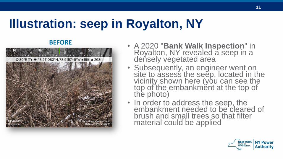
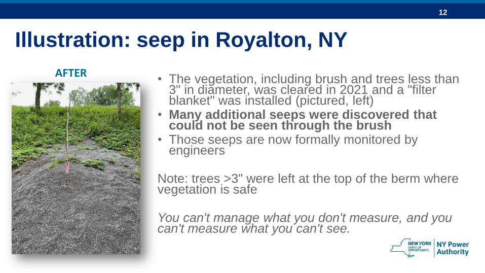
Illustration: seep in Royalton, NY
• A 2020 "Bank Walk Inspection" in Royalton, NY revealed a seep in a densely vegetated area
• Subsequently, an engineer went on site to assess the seep, located in the vicinity shown here (you can see the top of the embankment at the top of the photo)
• In order to address the seep, the embankment needed to be cleared of brush and small trees so that filter material could be applied
BEFORE
12
AFTER• The vegetation, including brush and trees less than
3" in diameter, was cleared in 2021 and a "filter blanket" was installed (pictured, left)
• Many additional seeps were discovered that could not be seen through the brush
• Those seeps are now formally monitored by engineers
Note: trees >3" were left at the top of the berm where vegetation is safe
You can't manage what you don't measure, and you can't measure what you can't see.
Illustration: seep in Royalton, NY
13
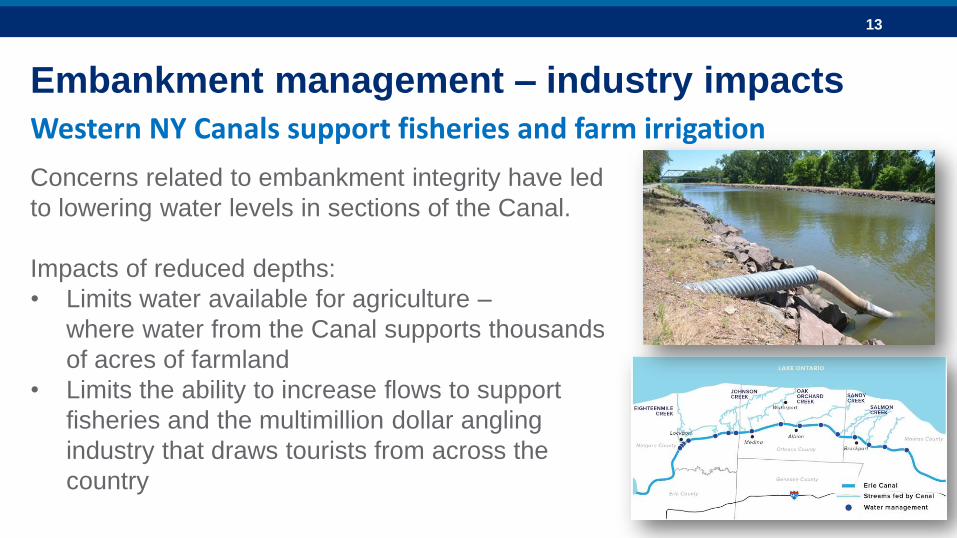
Embankment management – industry impacts
Concerns related to embankment integrity have led
to lowering water levels in sections of the Canal.
Impacts of reduced depths:
• Limits water available for agriculture –
where water from the Canal supports thousands
of acres of farmland
• Limits the ability to increase flows to support
fisheries and the multimillion dollar angling
industry that draws tourists from across the
country
Western NY Canals support fisheries and farm irrigation
14
Earthen embankments on the Canal System
15
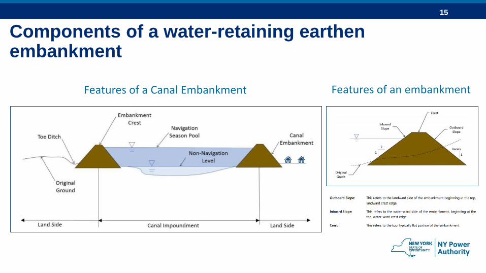
Components of a water-retaining earthen embankment
Features of a Canal Embankment Features of an embankment
16
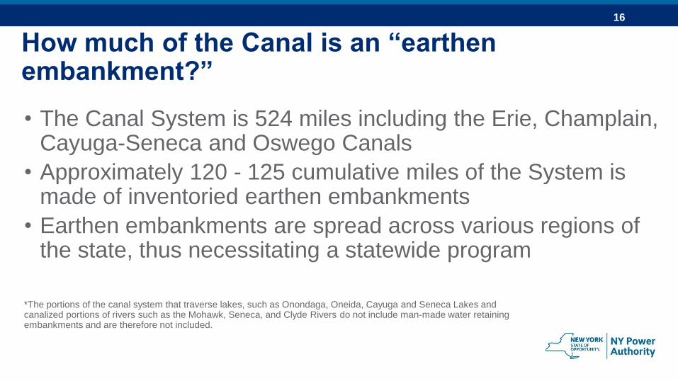
How much of the Canal is an “earthen embankment?”
• The Canal System is 524 miles including the Erie, Champlain, Cayuga-Seneca and Oswego Canals
• Approximately 120 - 125 cumulative miles of the System is made of inventoried earthen embankments
• Earthen embankments are spread across various regions of the state, thus necessitating a statewide program
*The portions of the canal system that traverse lakes, such as Onondaga, Oneida, Cayuga and Seneca Lakes and canalized portions of rivers such as the Mohawk, Seneca, and Clyde Rivers do not include man-made water retaining embankments and are therefore not included.
17
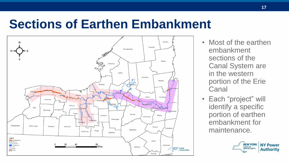
Sections of Earthen Embankment
• Most of the earthen embankment sections of the Canal System are in the western portion of the Erie Canal
• Each “project” will identify a specific portion of earthen embankment for maintenance.
18
Community Engagement in the Guidebook
19
Embankment Inspections and Assessments
• Bank Walk Inspections: the minimum inspection required, where the Canal Corp representative performs a visual inspection to identify defects or changes in embankment condition
• Informal Inspections and Enhanced Embankment Monitoring:Conducted to monitor devices or conditions related to a seepage at the embankment (in addition to Bank Walks)
• Formal Inspections: Performed by a NYS licensed engineer and resulting in a report including the hazard class, risk rating, and recommended maintenance activities.
• Special Inspections: Conducted in relation to an emergency (I.e., flood or earthquake)
The Canal Corp performs various types of embankment inspections
Note: it is the “assessment” that may trigger the design of a maintenance project.
20
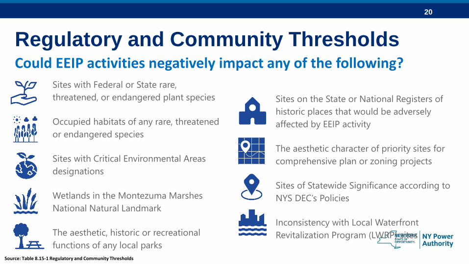
Regulatory and Community Thresholds
Sites with Federal or State rare,
threatened, or endangered plant species
Occupied habitats of any rare, threatened
or endangered species
Sites with Critical Environmental Areas
designations
Wetlands in the Montezuma Marshes
National Natural Landmark
The aesthetic, historic or recreational
functions of any local parks
Could EEIP activities negatively impact any of the following?
Sites on the State or National Registers of
historic places that would be adversely
affected by EEIP activity
The aesthetic character of priority sites for
comprehensive plan or zoning projects
Sites of Statewide Significance according to
NYS DEC’s Policies
Inconsistency with Local Waterfront
Revitalization Program (LWRP) sites
Source: Table 8.15-1 Regulatory and Community Thresholds
21
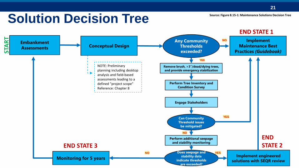
Embankment
Assessments Conceptual Design
Implement
Maintenance Best
Practices (Guidebook)
Any Community
Thresholds
exceeded?
Remove brush, >3”/dead/dying trees,
and provide emergency stabilization
Perform Tree Inventory and
Condition Survey
Engage Stakeholders
Can Community
Threshold issues
be mitigated?
Perform additional seepage
and stability monitoring
Does seepage and
stability data
indicate thresholds
are exceeded?
Monitoring for 5 yearsImplement engineered
solutions with SEQR review
YESNO
YES
YES
NO
NO
STA
RT
END STATE 3END STATE 2
END STATE 1
NOTE: Preliminary planning including desktop analysis and field-based assessments leading to a defined "project scope"Reference: Chapter 8
Solution Decision TreeSource: Figure 8.15-1: Maintenance Solutions Decision Tree
22
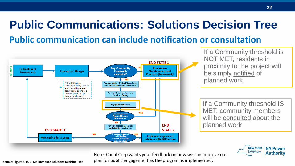
Public Communications: Solutions Decision Tree
If a Community threshold is NOT MET, residents in proximity to the project will be simply notified of planned work
Public communication can include notification or consultation
If a Community threshold IS MET, community members will be consulted about the planned work
Source: Figure 8.15-1: Maintenance Solutions Decision Tree
Note: Canal Corp wants your feedback on how we can improve our plan for public engagement as the program is implemented.
23
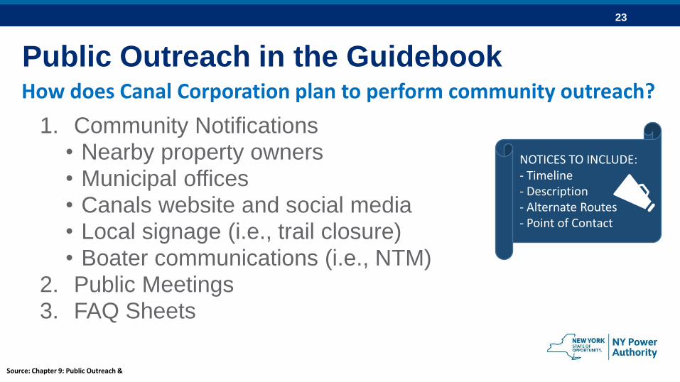
Public Outreach in the Guidebook
1. Community Notifications• Nearby property owners• Municipal offices• Canals website and social media• Local signage (i.e., trail closure)• Boater communications (i.e., NTM)
2. Public Meetings3. FAQ Sheets
How does Canal Corporation plan to perform community outreach?
NOTICES TO INCLUDE: - Timeline- Description - Alternate Routes- Point of Contact
Source: Chapter 9: Public Outreach &
24
Providing Comments on the Guidebook
25
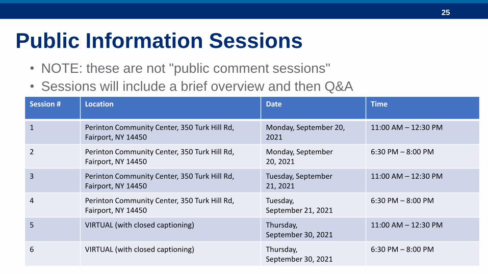
Public Information Sessions• NOTE: these are not "public comment sessions"
• Sessions will include a brief overview and then Q&ASession # Location Date Time
1 Perinton Community Center, 350 Turk Hill Rd, Fairport, NY 14450
Monday, September 20, 2021
11:00 AM – 12:30 PM
2 Perinton Community Center, 350 Turk Hill Rd, Fairport, NY 14450
Monday, September 20, 2021
6:30 PM – 8:00 PM
3 Perinton Community Center, 350 Turk Hill Rd, Fairport, NY 14450
Tuesday, September 21, 2021
11:00 AM – 12:30 PM
4 Perinton Community Center, 350 Turk Hill Rd, Fairport, NY 14450
Tuesday, September 21, 2021
6:30 PM – 8:00 PM
5 VIRTUAL (with closed captioning) Thursday, September 30, 2021
11:00 AM – 12:30 PM
6 VIRTUAL (with closed captioning) Thursday,September 30, 2021
6:30 PM – 8:00 PM
26
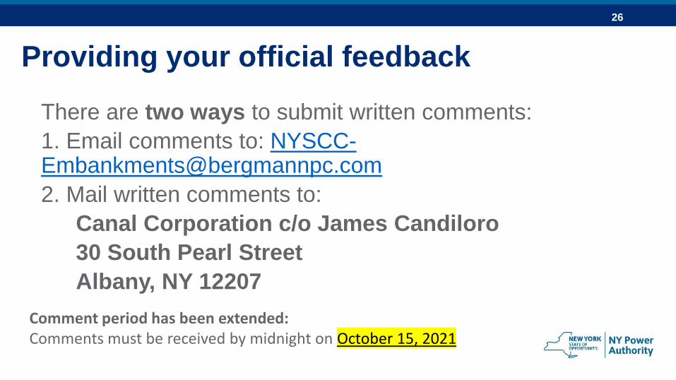
Providing your official feedback
There are two ways to submit written comments:
1. Email comments to: [email protected]
2. Mail written comments to:
Canal Corporation c/o James Candiloro
30 South Pearl Street
Albany, NY 12207
Comment period has been extended:Comments must be received by midnight on October 15, 2021
27