the following was presented at dmt’08 dmt’08 proceedings
TRANSCRIPT
DMT 2008
The following was presented at DMT’08(May 18-21, 2008).
The contents are provisional and will besuperseded by a paper in the
DMT’08 Proceedings.
See also earlier Proceedings (1997-2007)http://ngmdb.usgs.gov/info/dmt/
The Transition from Traditional to Digital Mapping: Maintaining Data Quality while Increasing
Geologic Mapping Efficiency in Alaska
J.E. Athey1, L.K. Freeman1, and K.A. Woods1
1Alaska Division of Geological & Geophysical Surveys (DGGS)
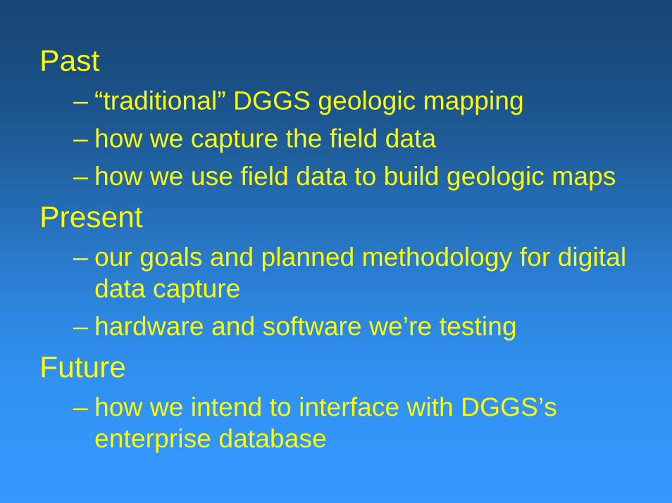
Past – “traditional” DGGS geologic mapping– how we capture the field data– how we use field data to build geologic maps
Present– our goals and planned methodology for digital
data capture– hardware and software we’re testing
Future– how we intend to interface with DGGS’s
enterprise database
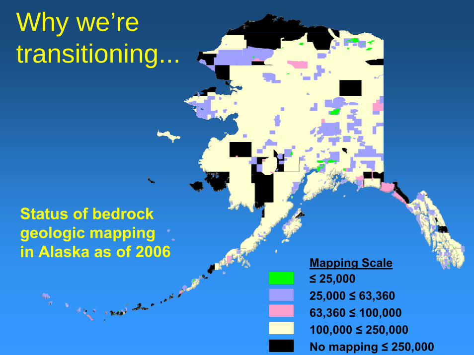
Why we’re transitioning...
25,000 ≤ 63,360
Status of bedrockgeologic mappingin Alaska as of 2006
63,360 ≤ 100,000100,000 ≤ 250,000No mapping ≤ 250,000
≤ 25,000Mapping Scale
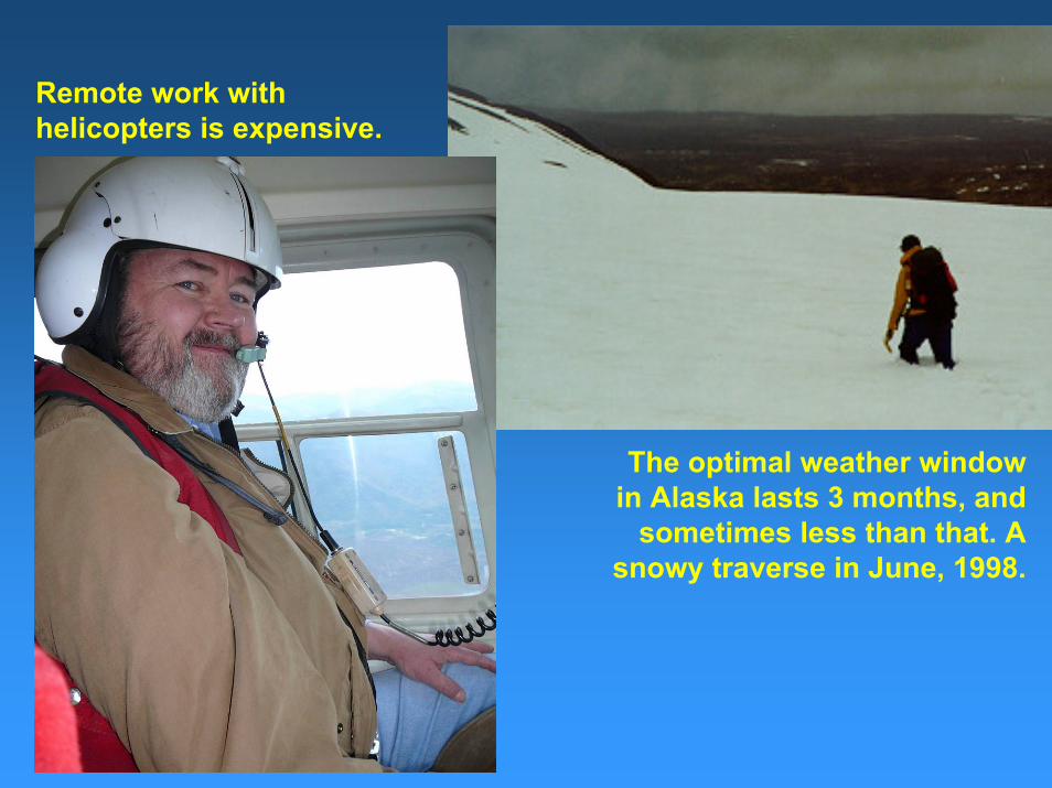
The optimal weather window in Alaska lasts 3 months, and
sometimes less than that. A snowy traverse in June, 1998.
Remote work with helicopters is expensive.
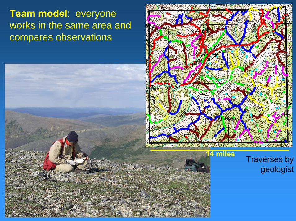
14 milesTraverses by
geologist
Team model: everyone works in the same area and compares observations
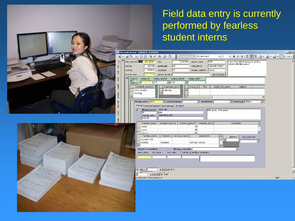
Field data entry is currently performed by fearless student interns
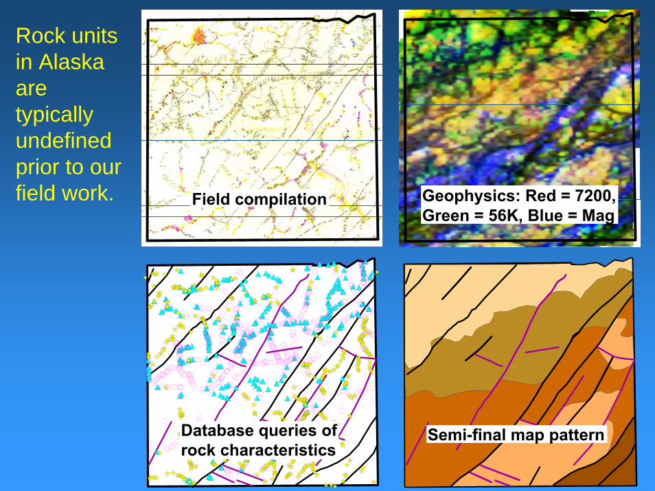
Database queries of rock characteristics Database queries of rock characteristics
Geophysics: Red = 7200, Green = 56K, Blue = Mag
Rock units in Alaska are typically undefined prior to our field work.
Semi-final map pattern
Field compilationField compilation
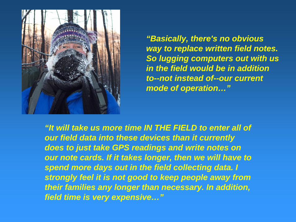
“Basically, there's no obvious way to replace written field notes. So lugging computers out with us in the field would be in addition to--not instead of--our current mode of operation…”
“It will take us more time IN THE FIELD to enter all of our field data into these devices than it currently does to just take GPS readings and write notes on our note cards. If it takes longer, then we will have to spend more days out in the field collecting data. I strongly feel it is not good to keep people away from their families any longer than necessary. In addition, field time is very expensive…”
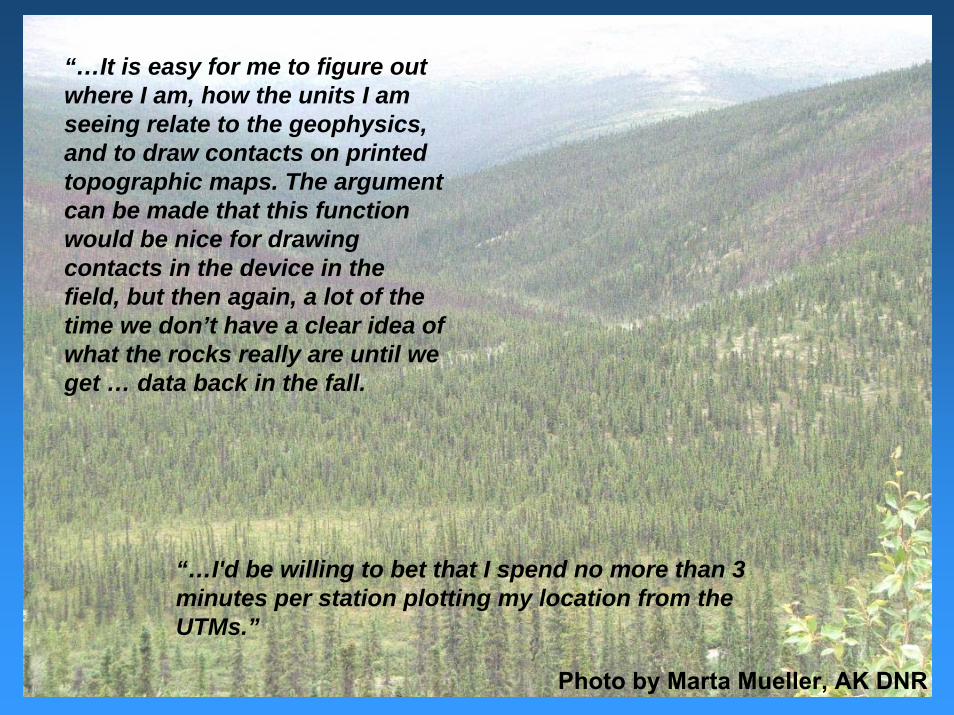
“…I'd be willing to bet that I spend no more than 3 minutes per station plotting my location from the UTMs.”
“…It is easy for me to figure out where I am, how the units I am seeing relate to the geophysics, and to draw contacts on printed topographic maps. The argument can be made that this function would be nice for drawing contacts in the device in the field, but then again, a lot of the time we don’t have a clear idea of what the rocks really are until we get … data back in the fall.
Photo by Marta Mueller, AK DNR
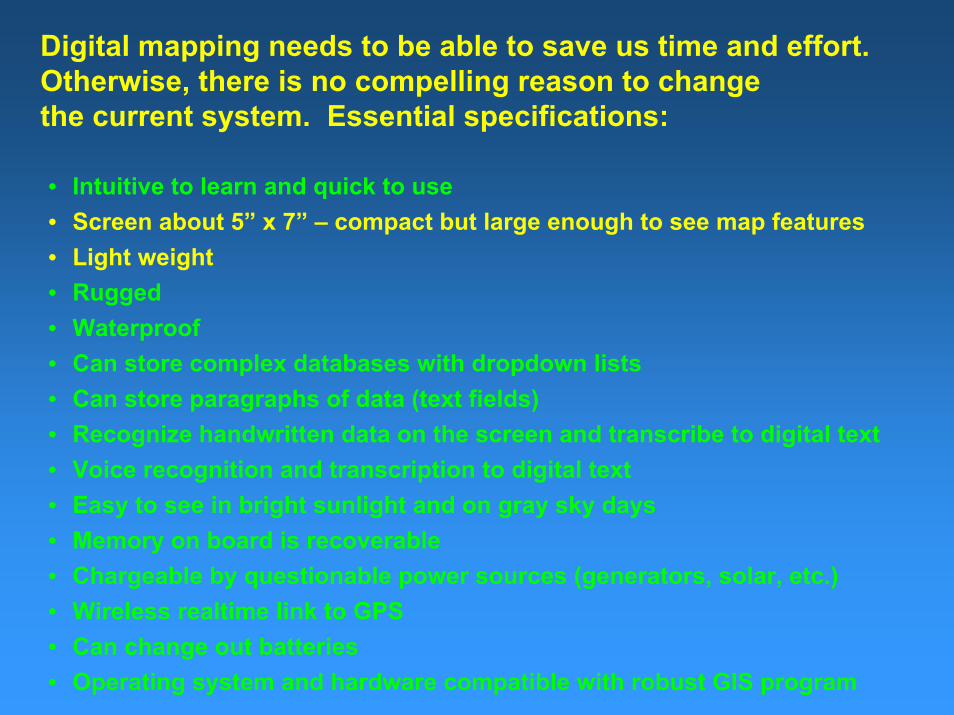
Digital mapping needs to be able to save us time and effort. Otherwise, there is no compelling reason to changethe current system. Essential specifications:
• Intuitive to learn and quick to use • Screen about 5” x 7” – compact but large enough to see map features• Light weight• Rugged• Waterproof• Can store complex databases with dropdown lists• Can store paragraphs of data (text fields)• Recognize handwritten data on the screen and transcribe to digital text• Voice recognition and transcription to digital text• Easy to see in bright sunlight and on gray sky days• Memory on board is recoverable• Chargeable by questionable power sources (generators, solar, etc.)• Wireless realtime link to GPS• Can change out batteries• Operating system and hardware compatible with robust GIS program
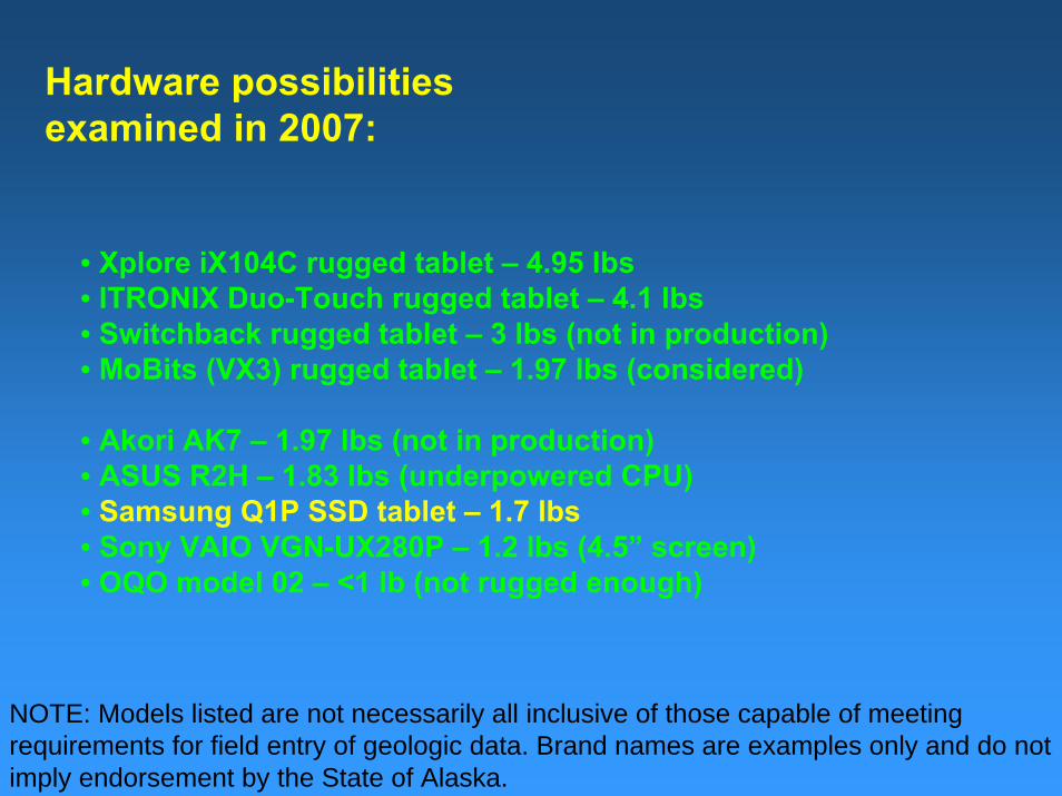
Hardware possibilities examined in 2007:
• Xplore iX104C rugged tablet – 4.95 lbs• ITRONIX Duo-Touch rugged tablet – 4.1 lbs• Switchback rugged tablet – 3 lbs (not in production)• MoBits (VX3) rugged tablet – 1.97 lbs (considered)
• Akori AK7 – 1.97 lbs (not in production)• ASUS R2H – 1.83 lbs (underpowered CPU)• Samsung Q1P SSD tablet – 1.7 lbs• Sony VAIO VGN-UX280P – 1.2 lbs (4.5” screen)• OQO model 02 – <1 lb (not rugged enough)
NOTE: Models listed are not necessarily all inclusive of those capable of meeting requirements for field entry of geologic data. Brand names are examples only and do not imply endorsement by the State of Alaska.
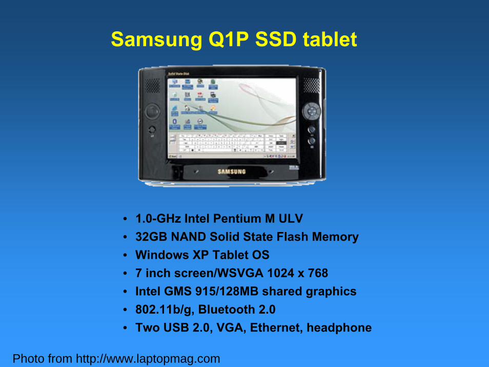
• 1.0-GHz Intel Pentium M ULV• 32GB NAND Solid State Flash Memory • Windows XP Tablet OS• 7 inch screen/WSVGA 1024 x 768• Intel GMS 915/128MB shared graphics• 802.11b/g, Bluetooth 2.0 • Two USB 2.0, VGA, Ethernet, headphone
Samsung Q1P SSD tablet
Photo from http://www.laptopmag.com
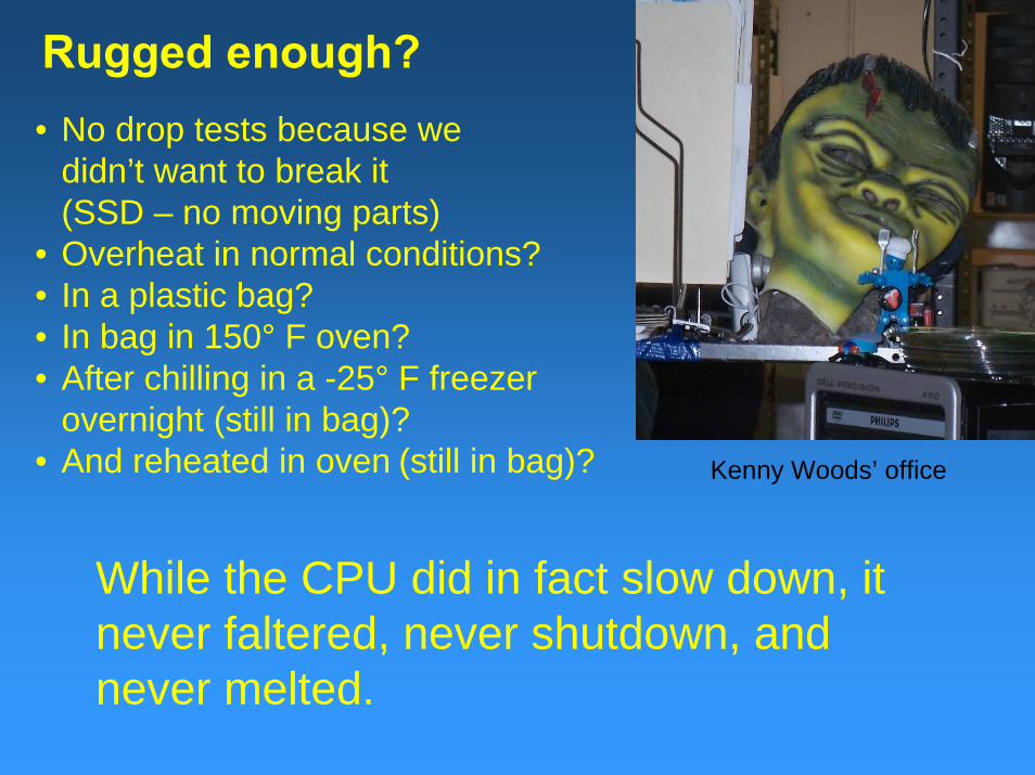
Rugged enough?• No drop tests because we
didn’t want to break it(SSD – no moving parts)
• Overheat in normal conditions?• In a plastic bag?• In bag in 150° F oven?• After chilling in a -25° F freezer
overnight (still in bag)?• And reheated in oven (still in bag)? Kenny Woods’ office
While the CPU did in fact slow down, it never faltered, never shutdown, and never melted.
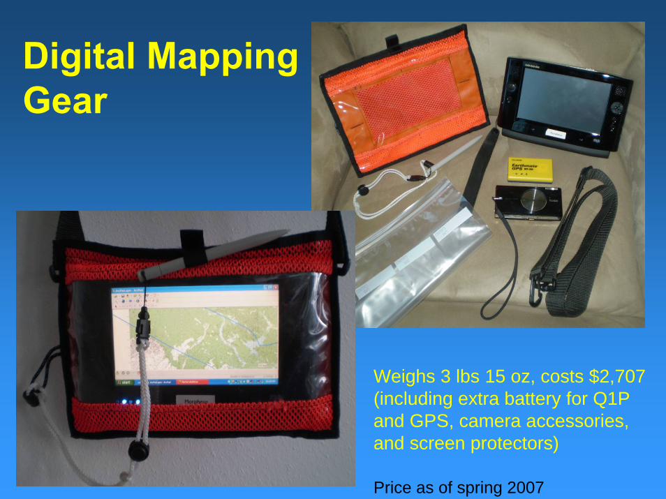
Digital MappingGear
Weighs 3 lbs 15 oz, costs $2,707 (including extra battery for Q1P and GPS, camera accessories, and screen protectors)
Price as of spring 2007
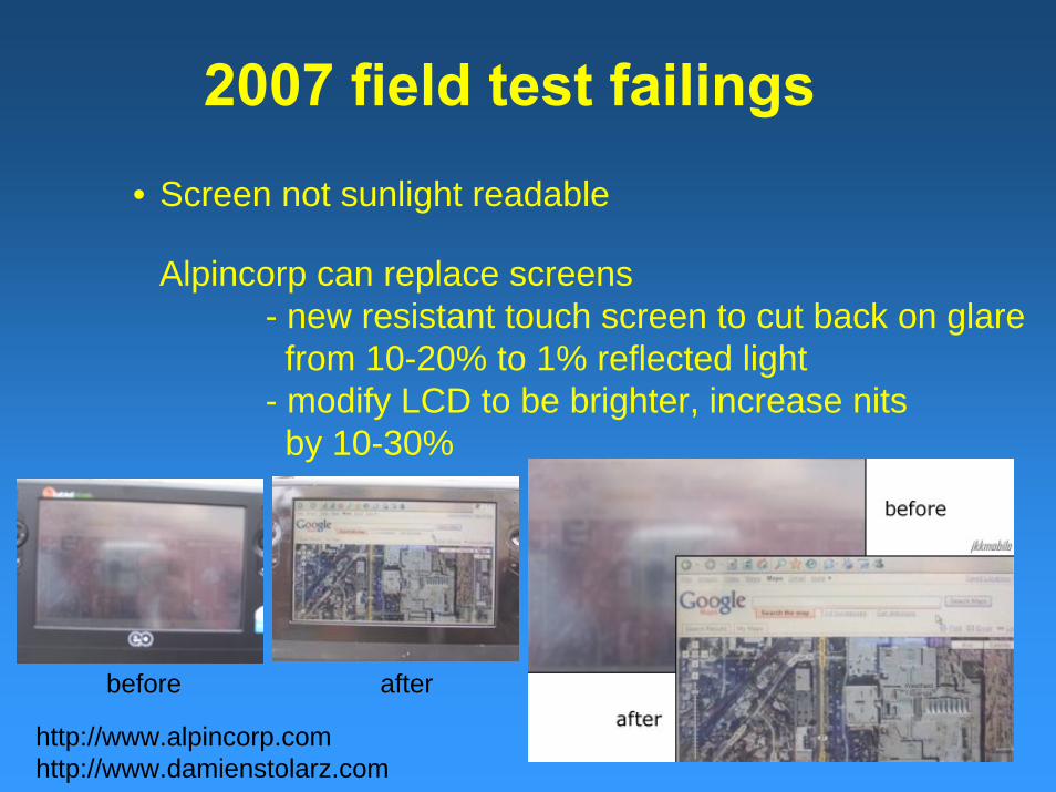
• Screen not sunlight readable
2007 field test failings
Alpincorp can replace screens- new resistant touch screen to cut back on glarefrom 10-20% to 1% reflected light
- modify LCD to be brighter, increase nitsby 10-30%
http://www.alpincorp.comhttp://www.damienstolarz.com
before after
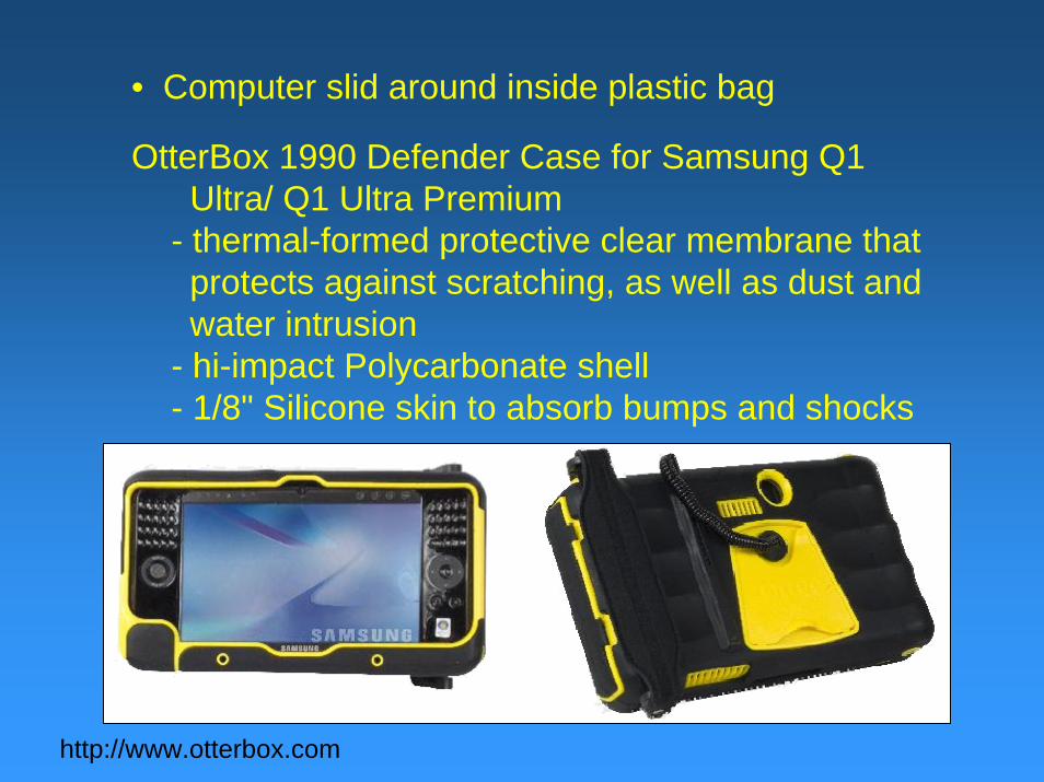
• Computer slid around inside plastic bag
http://www.otterbox.com
OtterBox 1990 Defender Case for Samsung Q1 Ultra/ Q1 Ultra Premium
- thermal-formed protective clear membrane that protects against scratching, as well as dust and water intrusion
- hi-impact Polycarbonate shell- 1/8" Silicone skin to absorb bumps and shocks
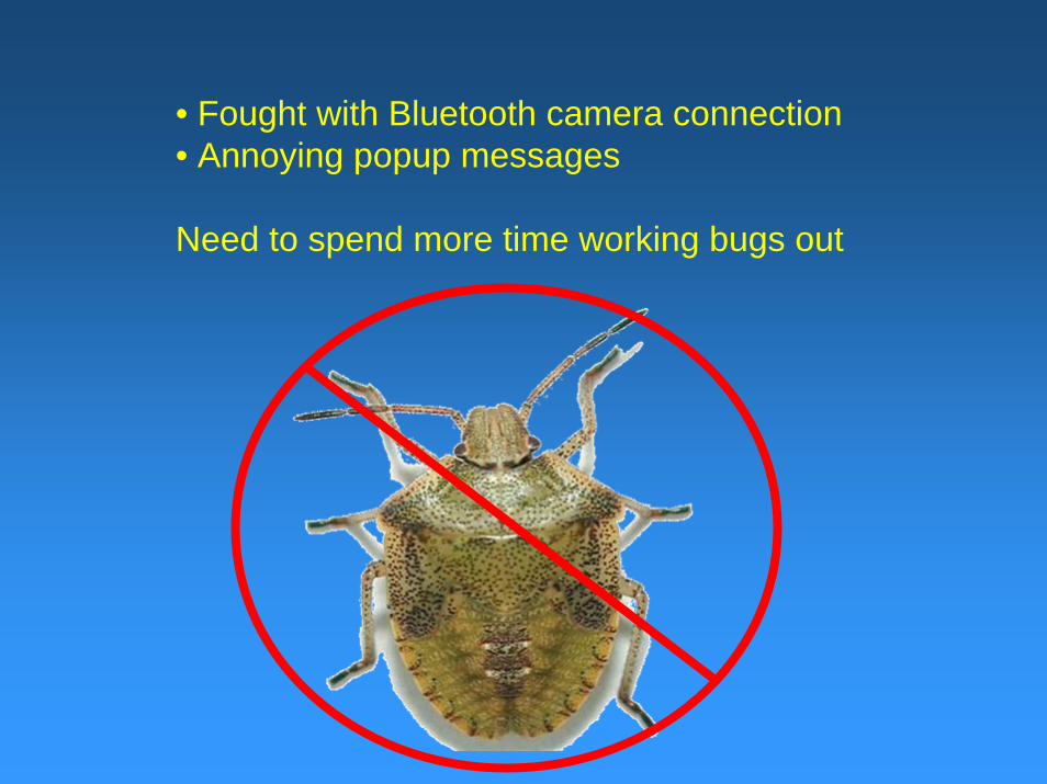
• Fought with Bluetooth camera connection• Annoying popup messages
Need to spend more time working bugs out

Software tested in 2007
• ArcPad (started at 7.0.1, now at 7.1)• Geologic Data Assistant applet for ArcPad
Evan E. Thoms and Ralph A. Haugerud, 2006, USGS Open-File Report 2006-1097, written for ArcPad version 6.0.3
• Microsoft OneNote for text blocks/text recognition and photo annotation
• GDA too different from our database. We’ll need to start from scratch.
• OneNote couldn’t translate geology terms. Need to update the geologic dictionary.
• OneNote kept breaking up text into blocks instead of one long paragraph. Need to try different program.
• Handwriting recognition can’t do letter-by-letter translation for abbreviations. Need to try different recognition software.
2007 field test failings
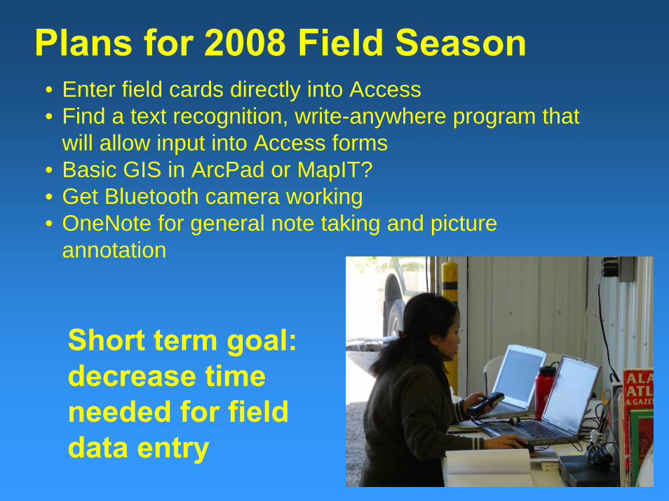
Plans for 2008 Field Season• Enter field cards directly into Access• Find a text recognition, write-anywhere program that
will allow input into Access forms• Basic GIS in ArcPad or MapIT?• Get Bluetooth camera working• OneNote for general note taking and picture
annotation
Short term goal: decrease time needed for field data entry
Ultimate Goal• Enter field data directly into GIS database• Share symbolized spatial data in the field• Dump the data into our enterprise Oracle database
after it is QC’d• Get all of DGGS onboard
Digital mapping should save us time and effort, and not cause any decrease in data quality
TimelineMid 2009
Start backing the structure out of our Oracle database and map it to a GIS database (in house)
Beginning 2010Create the forms for data entry and scripts for displaying geologic data (contract out?)
2011 Field SeasonTest application in the field
Hopefully, we’re on the right track…