the great australian bight research · pdf filethe partners of the great australian bight...
TRANSCRIPT

Building a bigger picture of the Bight
THE GREAT AUSTRALIAN BIGHT
RESEARCH PROGRAM 2016 Progress Report

DISCLAIMER
The partners of the Great Australian Bight Research Program advises that the information contained in this publication comprises general statements based on scientific research. The reader is advised that no reliance or actions should be made on the information provided in this report without seeking prior expert professional,
scientific and technical advice. To the extent permitted by law, the partners of the Great Australian Bight Research Program (including its employees and consultants) excludes all liability to any person for any consequences,
including but not limited to all losses, damages, costs, expenses and any other compensation, arising directly or indirectly from using this publication (in part or in whole) and any information or material contained in it.
The Great Australian Bight Research Program Progress Report is an Administrative Report that has not been reviewed outside the program and is not considered peer-reviewed literature. Material presented may later be
published in formal peer-reviewed scientific literature.
©2016

1
Building a bigger picture of the Bight
THE GREAT AUSTRALIAN BIGHT
RESEARCH PROGRAM 2016 Progress Report
The Great Australian Bight Research Program is a four-year, $20 million research program that aims to provide a whole-of-system understanding of the
environmental, economic and social values of the region, providing an information source for all to use.

The Great Australian Bight Research Program is a collaboration between BP, CSIRO, the South Australian Research and Development Institute (SARDI), the University of Adelaide and Flinders University.
GREAT AUSTRALIAN BIGHT
EXPLORATION PERMITS;
PORT LINCOLN
CEDUNA
Photo: Crystal Beckmann
AUSTRALIA
BP/Statoi l JV Chevron Austral ia Murphy/Santos JV Bight Petroleum
Building greater understanding of the unique ecosystems of the Great Australian Bight is critical to ensuring that future development in this region is ecologically sustainable.
THE GREAT AUSTRALIAN BIGHT RESEARCH PROGRAM
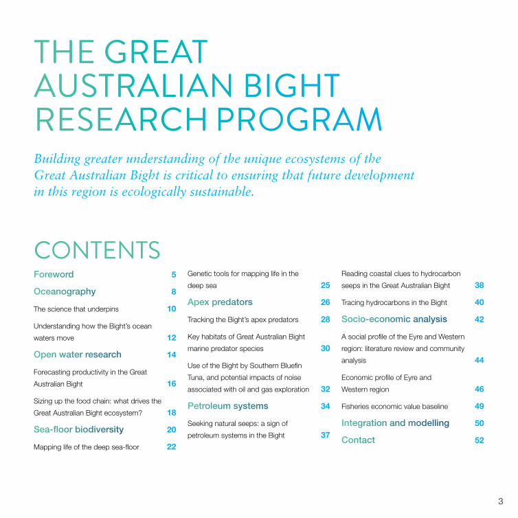
CONTENTSForeword 5
Oceanography 8
The science that underpins 10
Understanding how the Bight’s ocean
waters move 12
Open water research 14
Forecasting productivity in the Great
Australian Bight 16
Sizing up the food chain: what drives the
Great Australian Bight ecosystem? 18
Sea-floor biodiversity 20
Mapping life of the deep sea-floor 22
Genetic tools for mapping life in the
deep sea 25
Apex predators 26
Tracking the Bight’s apex predators 28
Key habitats of Great Australian Bight
marine predator species 30
Use of the Bight by Southern Bluefin
Tuna, and potential impacts of noise
associated with oil and gas exploration 32
Petroleum systems 34
Seeking natural seeps: a sign of
petroleum systems in the Bight 37
Reading coastal clues to hydrocarbon
seeps in the Great Australian Bight 38
Tracing hydrocarbons in the Bight 40
Socio-economic analysis 42
A social profile of the Eyre and Western
region: literature review and community
analysis 44
Economic profile of Eyre and
Western region 46
Fisheries economic value baseline 49
Integration and modelling 50
Contact 52
3

4

It is hard to believe that the Great Australian Bight Research Program has now reached the three-year mark, with less than 12 months to go. The program is a unique collaboration between BP, CSIRO, the South Australian Research and Development Institute (SARDI), the University of Adelaide and Flinders University. It aims to provide a whole‐of‐system understanding of the environmental, economic and social values of the region. So much has been achieved in the past three years, yet there is still so much to be delivered. This progress report gives us the opportunity to update stakeholders on progress so far and the pathway to program completion.
The Great Australian Bight Research Program commenced in April 2013 with one of the last voyages of the RV Southern Surveyor, operated by the CSIRO Marine National Facility. Benthic samples collected during this
important voyage, and processed by program participants and collaborators have identified 60 new species. Of course, planning for the voyage and the Great Australian Bight Research Program as a whole had already been two years in the making since BP was awarded the first Great Australian Bight exploration leases in 2011.
A great deal of scientific progress and new discoveries have been made since this original voyage, which are highlighted in the following pages. Rather than repeat the specific achievements of the program’s 7 themes and 16 projects, we will allow you to discover them at your own pace as you read through this short progress report. The report is intended to provide key highlights and achievements rather than detailed findings. We encourage stakeholders to go to the publications webpages of the Great Australian
The Great Australian Bight is a unique marine environment and an area of high conservation significance.
FOREWORD
Left: Crested terns are an important species in the Great Australian Bight region. This program is providing insights into their distribution and abundance. Photo: Lachie McLeay 5
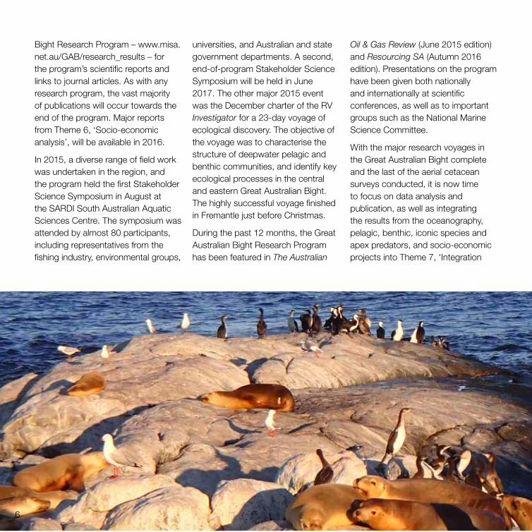
universities, and Australian and state government departments. A second, end-of-program Stakeholder Science Symposium will be held in June 2017. The other major 2015 event was the December charter of the RV Investigator for a 23-day voyage of ecological discovery. The objective of the voyage was to characterise the structure of deepwater pelagic and benthic communities, and identify key ecological processes in the central and eastern Great Australian Bight. The highly successful voyage finished in Fremantle just before Christmas.
During the past 12 months, the Great Australian Bight Research Program has been featured in The Australian
Oil & Gas Review (June 2015 edition) and Resourcing SA (Autumn 2016 edition). Presentations on the program have been given both nationally and internationally at scientific conferences, as well as to important groups such as the National Marine Science Committee.
With the major research voyages in the Great Australian Bight complete and the last of the aerial cetacean surveys conducted, it is now time to focus on data analysis and publication, as well as integrating the results from the oceanography, pelagic, benthic, iconic species and apex predators, and socio-economic projects into Theme 7, ‘Integration
Bight Research Program – www.misa.net.au/GAB/research_results – for the program’s scientific reports and links to journal articles. As with any research program, the vast majority of publications will occur towards the end of the program. Major reports from Theme 6, ‘Socio-economic analysis’, will be available in 2016.
In 2015, a diverse range of field work was undertaken in the region, and the program held the first Stakeholder Science Symposium in August at the SARDI South Australian Aquatic Sciences Centre. The symposium was attended by almost 80 participants, including representatives from the fishing industry, environmental groups,
6

and modelling’. As well as a wealth of new information, the Great Australian Bight Research Program will deliver state-of-the-art models that will be used to help manage the balance between human activity and sustainability in the region. Importantly, the program will provide a significant, freely available environmental and socio-economic information source for all to use – whether councils, environmental researchers and groups, industry or government.
Of course, a program of this size does not happen in isolation. The Great Australian Bight Research Program partners acknowledge
our important partnerships with the Integrated Marine Observing System (IMOS), the Australian Ocean Data Network (ADON), the Marine National Facility, the South Australian Museum, Museum Victoria, Geoscience Australia, the Bureau of Meteorology and many others.
We would also like to thank the invaluable contributions made by the six-member Independent Science Panel, chaired by Dr Ian Poiner, and BP’s subject matter experts from the United Kingdom and the United States of America, who conduct biannual meetings with the relevant project leaders.
We hope that you enjoy reading this progress report, and we thank you for your involvement in this important program.
Dr Rod Lukatelich Chair, Management Committee
Dr Steve Lapidge Research Director
7

OCEANOGRAPHY Broadscale movements of the oceans off Australia’s south coast are relatively well understood. However, the finer-scale variations provide the greatest insights into the connection between oceanography and the ecology of the region.
Project 1.1, ‘Physical oceanography of the Great Australian Bight: the science that underpins’, is focused on understanding ocean circulation at very fine scales – in particular, the opposing currents that flow on the continental shelf and the deep shelf slope, and the summer upwelling in the eastern Bight, which brings nutrient-rich waters up from depths of 200 m.
To understand current variations, researchers are developing models that simulate observations to ‘hindcast’ the day-to-day changes of ocean circulation over many years. The models are being ‘ground tested’ using measurements collected by satellites
and at sea, through the Southern Australian Integrated Marine Observing System (SAIMOS). The project draws on results from its companion project, Project 1.2, ‘Surface waves and their effects on circulation’. Project 1.2 seeks to represent the effects of the Bight’s unusually large waves in the hydrodynamic models used. The unique ocean properties of the Great Australian Bight, with its large waves and weak circulation, make it an ideal environment in which to couple waves with circulation models to determine whether the effect of waves can be simulated.
These models will underpin research aimed at determining regional connectivity for scenario studies of naturally occurring hydrocarbon seepage and movement; and understanding ecosystem variability, from phytoplankton to the distribution of top predators.
PublicationsRedondo Rodriguez A, King E and Doubell M (2015). Regional availability of MODIS imagery in the Great Australian Bight, GABRP Research Report 3, Great Australian Bight Research Program.
Redondo Rodriguez A, King E, Doubell M and van Ruth P (2015). Validation of MODIS imagery in the Great Australian Bight, GABRP Research Report 4, Great Australian Bight Research Program.
Redondo Rodriguez A, Middleton J and Proctor R (2015). Accessing IMOS satellite data into CSV format, GABRP Research Report 5, version 2, Great Australian Bight Research Program.
The Great Australian Bight is among the longest zonal shelves in the world. It hosts an ecosystem that is similar to those found elsewhere along eastern continental shelves, such as off California.
8

9
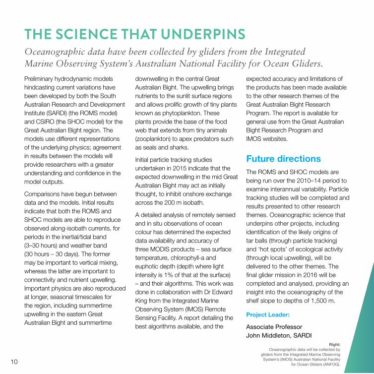
Preliminary hydrodynamic models hindcasting current variations have been developed by both the South Australian Research and Development Institute (SARDI) (the ROMS model) and CSIRO (the SHOC model) for the Great Australian Bight region. The models use different representations of the underlying physics; agreement in results between the models will provide researchers with a greater understanding and confidence in the model outputs.
Comparisons have begun between data and the models. Initial results indicate that both the ROMS and SHOC models are able to reproduce observed along-isobath currents, for periods in the inertial/tidal band (3–30 hours) and weather band (30 hours – 30 days). The former may be important to vertical mixing, whereas the latter are important to connectivity and nutrient upwelling. Important physics are also reproduced at longer, seasonal timescales for the region, including summertime upwelling in the eastern Great Australian Bight and summertime
downwelling in the central Great Australian Bight. The upwelling brings nutrients to the sunlit surface regions and allows prolific growth of tiny plants known as phytoplankton. These plants provide the base of the food web that extends from tiny animals (zooplankton) to apex predators such as seals and sharks.
Initial particle tracking studies undertaken in 2015 indicate that the expected downwelling in the mid Great Australian Bight may act as initially thought, to inhibit onshore exchange across the 200 m isobath.
A detailed analysis of remotely sensed and in situ observations of ocean colour has determined the expected data availability and accuracy of three MODIS products – sea surface temperature, chlorophyll-a and euphotic depth (depth where light intensity is 1% of that at the surface) – and their algorithms. This work was done in collaboration with Dr Edward King from the Integrated Marine Observing System (IMOS) Remote Sensing Facility. A report detailing the best algorithms available, and the
expected accuracy and limitations of the products has been made available to the other research themes of the Great Australian Bight Research Program. The report is available for general use from the Great Australian Bight Research Program and IMOS websites.
Future directions
The ROMS and SHOC models are being run over the 2010–14 period to examine interannual variability. Particle tracking studies will be completed and results presented to other research themes. Oceanographic science that underpins other projects, including identification of the likely origins of tar balls (through particle tracking) and ‘hot spots’ of ecological activity (through local upwelling), will be delivered to the other themes. The final glider mission in 2016 will be completed and analysed, providing an insight into the oceanography of the shelf slope to depths of 1,500 m.
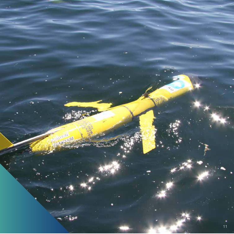
THE SCIENCE THAT UNDERPINSOceanographic data have been collected by gliders from the Integrated Marine Observing System’s Australian National Facility for Ocean Gliders.
Project Leader:
Associate Professor John Middleton, SARDI
Right: Oceanographic data will be collected by
gliders from the Integrated Marine Observing System’s (IMOS) Australian National Facility
for Ocean Gliders (ANFOG).10
11
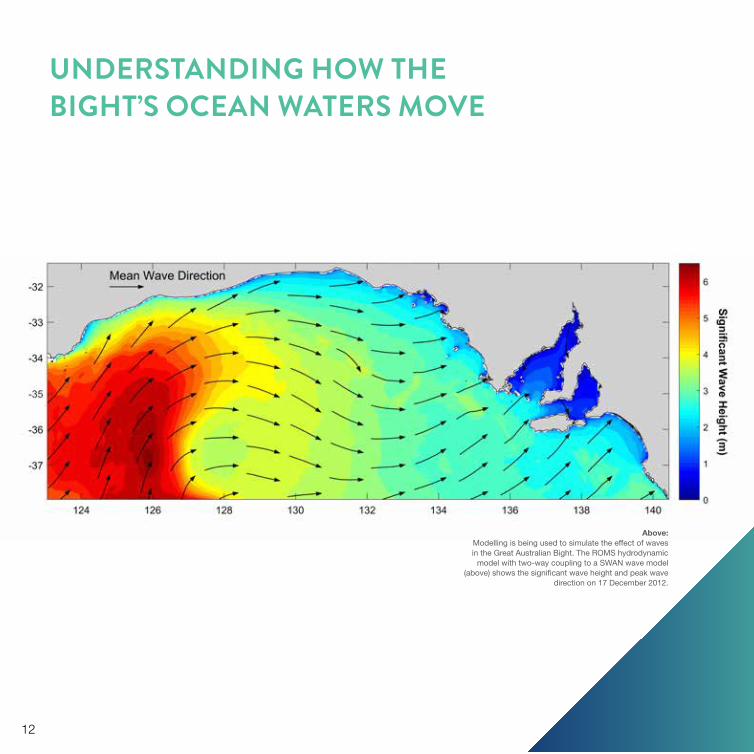
UNDERSTANDING HOW THE BIGHT’S OCEAN WATERS MOVE
Above: Modelling is being used to simulate the effect of waves in the Great Australian Bight. The ROMS hydrodynamic
model with two-way coupling to a SWAN wave model (above) shows the significant wave height and peak wave
direction on 17 December 2012.
12

Achievements to date Wave–current interaction models are being considered internationally. This project has drawn on the international discussion, completing an extensive literature review on the topic and developing collaborations with other researchers in the field.
Accurate information on the wave field over the past few years has been collected, as one of the first and crucial steps in simulating the impact of waves on ocean circulation.
Wave models have also been compared with independent datasets to determine the accuracy of the model. Results achieved suggest that wave models can confidently be used for the whole Great Australian Bight, including areas where there are no observations.
Coupled wave–current models have highlighted the complexities of algorithms used to simulate physical processes in the models, particularly accurate reproduction of the role of waves in the generation of small-scale turbulence that causes vertical mixing. Waves are also responsible for what is classically known as Stokes drift. Stokes drift itself is fairly well understood; what is not well understood is how Stokes drift interacts with the rotation of Earth to cause a reaction in the deeper layers of the ocean. We have now included these interactions in our ocean models but are still analysing the performance of the new models, and the impact of waves on surface drift and deeper circulation.
Future directions
The modelling component of this project is nearly complete. The new versions of the circulation models (that include the effect of waves) will be provided to Project 1.1 to analyse the transport pathways in the Great Australian Bight.
Project Leader:
Dr David Griffin, CSIRO
13
OPEN WATER RESEARCHUnderstanding the natural variability in the structure and function of the Great Australian Bight’s pelagic ecosystem is necessary for monitoring and assessing potential future human impacts.
The eastern Great Australian Bight is one of Australia’s most productive marine environments, but little is known about the systems that support its rich biodiversity.
In one of the first comprehensive studies of the deepwater pelagic (open water) ecosystem of this region, researchers have collected samples from a broad range of depths – from continental shelf waters less than 200 m deep to depths up to 3,000 m in offshore waters. Investigations are focusing on the abundance and biodiversity of microbes (viruses and bacteria), plankton (small plants and animals up to about 1 cm) and micronekton (crustaceans, small fish, squids and jellyfish) to assess food web dynamics in relation to changes in the physical and chemical environment.
Seasonal changes in oceanographic cycles, and the influence of upwelling and downwelling processes on nutrient enrichment and food web dynamics are being examined in Project 2.1, ‘Spatial and temporal variability in shelf microbial and plankton communities in the Great Australian Bight’. The project will characterise the influence of variations in upwelling and downwelling (or stratification and mixing) on the food web in shelf waters of the Great Australian Bight, focusing on the changes in size structure of the microbial and planktonic communities that have implications for overall ecosystem productivity. Typically, larger cells drive high productivity through an efficient ‘classic food web’ underpinned by newly upwelled nutrients. Smaller cells are expected
to thrive on nutrients regenerated through the less efficient ‘microbial food web’, but result in lower productivity.
Project 2.2, ‘Characterise spatial variability of offshore/slope plankton, and micronekton communities’, is exploring when and where pelagic food sources are plentiful, and what that means to the wider ecosystem, particularly the higher trophic levels that rely on this food source. Specifically, the project is examining the high density of micronekton supported above the slope and in deeper waters of the central Bight despite the year-round downwelling. A key question is whether the recycling of decayed organic matter is supporting the dominant planktonic food web over the Bight’s deep continental margin.
14

Understanding the drivers and shifts in food web dynamics will help us understand how physical oceanography affects the region’s food webs. This information will enable better estimates of the potential overall productivity of the region, and provides critical baseline data that can help predict the potential effects of future human activities.
Above: Samples collected from the deep waters of the Great Australian Bight have provided an understanding of the abundance and diversity of microbes, plankton and micronekton found in the region. These include the siphonophores, such as Praya reticulata (above), which is found at depths of around 250 m.
PublicationsKloser R, Williams A, van Ruth P, Tanner J, Downie R, Doubell M, Flynn A, Keith G, Ryan T and Hughes D (2016). RV Investigator voyage summary for the Marine National Facility, Great Australian Bight Research Program.
15
FORECASTING PRODUCTIVITY IN THE GREAT AUSTRALIAN BIGHT
16
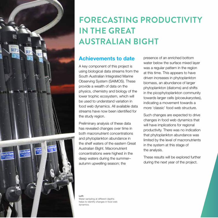
Left: Water sampling at different depths helps to identify changes in food web dynamics.
Achievements to dateA key component of this project is using biological data streams from the South Australian Integrated Marine Observing System (SAIMOS). These provide a wealth of data on the physics, chemistry and biology of the lower trophic ecosystem, which will be used to understand variation in food web dynamics. All available data streams have now been identified for the study region.
Preliminary analysis of these data has revealed changes over time in both macronutrient concentrations and phytoplankton abundance in the shelf waters of the eastern Great Australian Bight. Macronutrient concentrations were highest in the deep waters during the summer–autumn upwelling season; the
presence of an enriched bottom water below the surface mixed layer was a regular pattern in the region at this time. This appears to have driven increases in phytoplankton biomass, an abundance of larger phytoplankton (diatoms) and shifts in the picophytoplankton community towards larger cells (picoeukaryotes), indicating a movement towards a more ‘classic’ food web structure.
Such changes are expected to drive changes in food web dynamics that will have implications for regional productivity. There was no indication that phytoplankton abundance was limited by the level of macronutrients in the system at this stage of the analysis.
These results will be explored further during the next year of the project.

Future directions A focus for the remainder of the project will be more detailed investigations of microbial and planktonic size distributions, physiology and productivity, and their implications for food web dynamics.
A number of archived plankton samples will be analysed using a Laser Optical Plankton Counter to determine changes in plankton size
distributions over time. Seasonal variation in primary productivity will be assessed by examining carbon uptake and rates of photosynthesis, and physiological responses will be studied using FastOcean Fast Repetition Rate Fluorometers. Stable isotope analyses will provide information on changes in trophic linkages between the different components of the food web.
Additional physical data from SAIMOS and the Bureau of Meteorology will also be explored alongside observed changes in the lower trophic ecosystem. In doing this, researchers aim to identify and understand the drivers of change in water mass characteristics in shelf waters of the eastern Great Australian Bight, and the impact on nutrient enrichment, food web dynamics and productivity in the region.
Project Leader:
Dr Paul van Ruth, SARDI
17

SIZING UP THE FOOD CHAIN: WHAT DRIVES THE GREAT AUSTRALIAN BIGHT ECOSYSTEM?
Achievements to dateThe Great Australian Bight Research Program voyage in April 2013 provided some key insights into the offshore waters of the Bight that significantly advanced our understanding of the structure of the pelagic community in this region. Importantly, the outcomes informed the sampling protocol for the program’s second voyage in December 2015, one of the most significant events in the research program.
The sampling protocol for the 2015 voyage included the upwelling and downwelling regions of the eastern and central Great Australian Bight, respectively. It collected
primary productivity data to enable comparison of the food web dynamics of the upwelling and downwelling regions, which will improve understanding of the critical physiological processes that underpin these food webs.
The pelagic component of the 23-day voyage in 2015 on board the Marine National Facility’s RV Investigator explored ocean physics and nutrients; and pelagic microbes, plankton and micronekton. One aim of the voyage was to describe pelagic community structure and function, with a focus on the outer continental shelf, slope and ‘open ocean’ in the central Great Australian Bight (the Ceduna Terrace) and eastern Bight.
Initial results support those from the earlier voyage, showing a higher than previously reported biomass in the central offshore waters of the Great Australian Bight (200–3,000 m), even though this is a hypothesised downwelling region of low nutrients.
The extensive sampling of nutrients and biota (plants and animals) in these regions will explore size, biomass, and food web differences, as well as an understanding of the physiological mechanisms that drive production.
Results will be used to characterise the pelagic communities in a previously poorly sampled region. They will be incorporated into future ecosystem models and used to design monitoring programs.
18

Future directionsAnalysing results from the recent voyage will be a focus for the coming year. Key data include nutrient supply and production, species biomass, size and trophic linkage change between regions and slope to offshore waters. The results will provide a better understanding of production and biomass levels of the lower trophic ecosystem in the previously unsampled offshore waters of the central and eastern Great Australian Bight. These data and derived knowledge will be used as input into ecosystem models and to help formulate future monitoring programs for the sustainable management of marine resources in the region.
Right: A profiling multi-frequency acoustic and
optical system can be used to detect and quantify micronekton (small fish, squids,
crustaceans and larger gelatinous organisms).
Project Leader:
Dr Rudy Kloser, CSIRO
19

SEA-FLOOR BIODIVERSITYDespite the high conservation significance of the Great Australian Bight’s shallow benthic (sea-floor) ecosystems, little was known about benthic biodiversity in the region’s deep sea before this program.
Above: Globehead Whiptail (Cetonurus
globiceps) found at depths of 1,000 m. Samples collected from the deep ocean
of the Great Australian Bight will improve our understanding of the diversity,
distribution and ecology of the epifauna (invertebrates and fishes) in the region.
20

Benthic communities play a vital role in deep-ocean ecosystems – by engineering habitats and transferring energy up the food chain – but virtually nothing is known about the sea-floor habitats and associated biological communities in the deep waters of the Great Australian Bight. The high cost of sampling in these remote regions and the lack of existing knowledge about the organisms living there limit our ability to predict, assess and monitor the potential environmental impacts of activities in the region.
Project 3.1, ‘Great Australian Bight benthic biodiversity characterisation’, is the most comprehensive study to date in this region of the diversity, distribution and ecology of the infauna (invertebrates living in the sediment) and epifauna (organisms living on the sea-floor, such as corals,
be predicted at a regional scale. Characterising the biological structure of the sea-floor permits identification of ‘indicators’ that can be used to cost-effectively assess impacts of any development.
Project 3.2, ‘Molecular assessment of benthic and pelagic biodiversity in the Great Australian Bight’, will use DNA extracted from water and sediment samples collected in the Great Australian Bight to develop rapid and cost-effective methods of assessing biodiversity. A range of genetic tools will be developed. Small organisms found in sediments and the water column play a critical role in ecosystem functioning (as a food source for larger fish and invertebrates) and include known indicator taxa for environmental change in shallow waters. Species discovered in the Bight will be
naturally in response to hydrocarbon seeps and have the potential to bioremediate oils.
Development of a baseline record of deepwater marine habitats (deeper than 200 m) in the Great Australian Bight will provide a foundation for assessing any impacts of development in the region.
PublicationsKloser R, Williams A, van Ruth P, Tanner J, Downie R, Doubell M, Flynn A, Keith G, Ryan T and Hughes D (2016). RV Investigator voyage summary for the Marine National Facility, Great Australian Bight Research Program.
O’Hara TD and Harding C (2014). A new species of Sigsbeia and additional records of ophiuroids from the Great Australian Bight. Memoirs of Museum Victoria 72:131–140.
O’Loughlin M and Macintosh H (2015). New Prototrochus species of sea cucumber from Australia (Echinodermata: Holothuroidea: Synaptida: Myriotrochidae). Zootaxa 3995(1):264–270.
Williams A, Trefry C, Tanner J, Gowlett-Holmes K, Crooke E, Qi X, Fortney J, Martin T and Lewis M (2013). Southern Surveyor voyage report April 3–22 2013, Great Australian Bight Science Plan (benthic, pelagic and petroleum geochemistry themes).
echinoderms, crustaceans, molluscs and fishes). Researchers will relate information about the composition and distribution of benthic organisms collected at 200–3,000 m depths to environmental factors such as sediment composition, bathymetry (sea-floor topography), surface and water column productivity, and oceanography. This will enable biodiversity distribution to
identified by taxonomists before ‘barcoding’ using extracted DNA, to match whole organisms to DNA sequences – this will expand the barcoding library for marine organisms. Barcoding may also reveal cryptic species: suites of different species that look like each other. DNA samples will also be used to assess the presence of genes from hydrocarbon-degrading organisms (bacteria and fungi) that occur
21

MAPPING LIFE OF THE DEEP SEA-FLOOR
22
Achievements to dateCollections of infauna sampled during the large field survey undertaken on board the Marine National Facility RV Southern Surveyor in April 2013 provided the first characterisation of deep benthic communities in the Great Australian Bight. Sediment samples collected using a multi-corer provided collections of sediment infauna and microbes that were distributed to laboratories both within and outside Australia for analysis.
Sorting of infauna samples collected during the 2013 voyage and sent to Museum Victoria for identification revealed 128 distinct species from 74 families, covering 8 major taxonomic groups, predominantly crustaceans (amphipods and isopods) and annelids (polychaete worms). Around half of the species identified were new discoveries, and only a quarter of the species identified have been recorded elsewhere in Australia. Collectively, the data indicate that
the infaunal communities of the Great Australian Bight are made up of largely unknown, potentially endemic fauna.
Physical information collected from sediments will be built into a physical covariate dataset combining results with water sample data, spatial information from sample sites, and available satellite and modelled oceanographic datasets for the region. This will provide an understanding of the physical environment where species are found, enabling predictions of species distribution.
The project has also collated relevant historical information and samples to generate an additional dataset on benthic epifauna. This included compiling and mapping more than 20,000 deepwater invertebrate specimen lots in Great Australian Bight collections held by Australia’s museums. Collection of historical data focused on seven major phyla that are
known to constitute a large proportion of the Australian deepwater benthic fauna: Porifera (sponges), Cnidaria (cold-water corals and anemones), Mollusca, Echinodermata (sea stars, brittle stars and urchins), Arthropoda (crustaceans and sea spiders), Bryozoa (lace ‘corals’), Sipuncula (peanut worms) and Pisces (fishes). This work assists in understanding the benthic communities in the region and identifying informative faunal groups for any future monitoring.
The 2015 voyage on board the Marine National Facility RV Investigator complemented the earlier voyage by systematically sampling the benthic epifauna (invertebrates and fishes) from the deep ocean of the Great Australian Bight, including the previously unsampled central Bight. Once analysed, this collection will provide a benthic inventory of species from 200 to 3,000 m.

23
Future directions The next stage of the project will focus on processing samples collected from the 2015 voyage. This information will be combined with available datasets to describe the benthic infaunal and epifaunal composition and distribution in the Great Australian Bight.
A literature review on prospective indicator species and metrics of
ecological change in the deep sea will be completed to identify potential indicators of change for future monitoring.
Overall, the project will provide a rigorous baseline assessment of soft-sediment benthic assemblages in the deep Great Australian Bight. This will inform any future monitoring programs established in the region, and allow the benthos to be incorporated
into the ecosystem models, thus providing a means to assess potential consequences of future environmental changes for this important habitat.
Below: Crab (Pycnoplax victoriensis) collected at 400 m deep. Analysis of new and existing data will produce a benthic inventory of species from 200 to 3,000 m in the Great Australian Bight.
Project Leader:
Associate Professor Alan Williams, CSIRO

24
GENETIC TOOLS FOR MAPPING LIFE IN THE DEEP SEA
Achievements to dateOne of the key achievements of this project has been to characterise the diversity of microbial assemblages (bacteria and archaea) present in both the sediments and the water of the deep Great Australian Bight. The diversity of three key genes involved in hydrocarbon degradation has also been assessed: alkB, which is involved in alkane degradation; c23o, which is involved in the degradation of aromatic compounds; and pmoA, which metabolises methane. All sediment samples processed contained numerous copies of each gene, and water samples contained alkB and c23o. The gene sequences were different from those found anywhere else in the world, suggesting that the suite of hydrocarbon-degrading microbes found in the Great Australian Bight may respond differently to hydrocarbon inputs to those reported to date. Overall bacterial diversity was high, with a number of taxa known
to degrade hydrocarbons, while the archaea were less diverse.
A preliminary overview of the biodiversity of sedimentary assemblages in the Bight was established by processing samples collected on the 2013 voyage using ecogenomics – the application of genomics to sediment samples. This process identified the number of phyla present, finding large numbers of organisms that are too small (<300 µm) to be detected easily by routine manual sorting. Results will be compared with the counts from infauna samples to determine whether the same patterns exist and to determine the usefulness of this tool in providing an overview of benthic assemblages in the Great Australian Bight region.
Future directions The next phase of the project will focus on using molecular barcoding to identify biodiversity in samples
collected from the 2013 and 2015 voyages. Results will be linked to whole organisms previously identified, enhancing the barcoding library for marine organisms and identifying any cryptic species that may exist.
Sedimentary assemblages will be further characterised by processing sediment samples using microbiomics. DNA extracted from sediment samples collected on the 2013 voyage will be processed using additional primers that identify microbial DNA, to provide a more comprehensive overview of the microbial communities that exist.
This information will help to characterise the benthic assemblages, and provide options to be considered for rapid and cost-effective environmental monitoring in the case of future development.
Project Leader:
Associate Professor Jason Tanner, SARDI
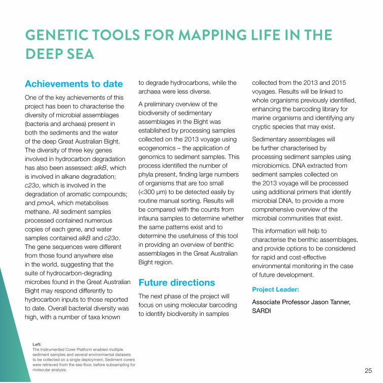
Left: The Instrumented Corer Platform enabled multiple sediment samples and several environmental datasets to be collected on a single deployment. Sediment corers were retrieved from the sea-floor, before subsampling for molecular analysis. 25

APEX PREDATORSThe Great Australian Bight is a regional hot spot for pelagic predators.
The Great Australian Bight is of global significance for a number of pelagic species. It is an important feeding ground for juvenile Southern Bluefin Tuna and Pygmy Blue Whales. More than 80% of Australian Sea Lions and Australia’s population of Long-nosed Fur Seals live there, as do large populations of Short-tailed Shearwaters. The region also supports Australia’s largest breeding aggregation of Southern Right Whales, which migrate to the Great Australian Bight in winter. However, there are many gaps in our understanding of how apex predators and iconic species use this region, and the significance of areas within the Bight that are used by a number of different species.
Analysis of existing and newly collected movement data and population counts through this program will provide an understanding of the abundance and distribution of apex predators in the Bight at different times of the year. This information will underpin future conservation and management frameworks.
The largest coordinated survey of marine megafauna in the Great Australian Bight has been undertaken through Project 4.1, ‘Status, distribution and abundance of iconic species and apex predators in the Great Australian Bight’. This project brings together historical and contemporary survey data to provide a detailed assessment of the status, distribution and abundance of marine mammals, seabirds and sharks in the region. Information from the project is increasing understanding of the population status of these species, which can be used for conservation and management purposes, including identification of potential impacts from human activities. It has also improved the scientific basis for the development of management strategies and monitoring programs.
Existing and newly collected data on the at-sea distributions of apex predators and iconic species in the Great Australian Bight are being integrated in Project 4.2, ‘Identifying areas of ecological significance for iconic species and apex predators in the Great Australian Bight’, to better
understand the distributions and habitats of individual species, and identify key regions within the Bight that are used by multiple species. Information collected will be used to relate biological and physical oceanographic features to foraging strategies and habitat preference, identifying changes in habitat selection through the seasons and across the region. Such information is important for identifying key habitats, and potential overlaps between human activities and apex predators and iconic species in the region.
Project 4.3, ‘Southern Bluefin Tuna: spatial dynamics and potential impacts of noise associated with oil and gas exploration’, is investigating variability in the movement and behaviour of Southern Bluefin Tuna in the Great Australian Bight across three decades, how this is influenced by the environment, and the potential to determine responses to activities such as oil and gas exploration.
If the movement and behaviour of Southern Bluefin Tuna in the Great Australian Bight have changed through time, potential drivers of
26

these changes will be investigated, and potential flow-on impacts on fishery monitoring, assessment and management will be determined. Quantification of any behavioural changes will guide the development of potential management measures to mitigate the impacts of activities in the Bight.
PublicationsBilgmann K, Parra GJ and Moller LM (2014). Inshore cetacean survey between Ceduna and Coffin Bay, eastern Great Australian Bight, GABRP Research Report 1, Great Australian Bight Research Program.
Evans K (2015). SBT research. TARfish Bulletin, January 2015.
Goldsworthy S, Mackay A, Shaughnessy P, Bailleul F and Holmann D (2015). Maintaining the monitoring of pup production at key Australian sea lion colonies in South Australia (2014/15), final report to the Australian Marine Mammal Centre, SARDI publication F2010/000665-5, SARDI Research Report Series 871, South Australian Research and Development Institute (Aquatic Sciences), Adelaide.
Mackay AI and Goldsworthy SD (2015). Monitoring Southern Right Whale abundance, distribution and
population dynamics at the Great Australian Bight aggregation, SARDI publication F2014/000052-2, SARDI Research Report Series 835, South Australian Research and Development Institute (Aquatic Sciences), Adelaide.
Above: Telemetry devices fitted to pelagic sharks, including white sharks, in the Great Australian Bight will provide important information on the distributions, movement patterns and habitat use of these species.
27

TRACKING THE BIGHT’S APEX PREDATORS
Achievements to dateSystematic surveys of apex predators during this project have provided crucial data on the distribution and abundance of these species across the Great Australian Bight, which assists in understanding the significance of this region.
The project supported surveys of key Australian Sea Lion breeding colonies. The survey results were integrated into the first state-wide census of Australian Sea Lions during
an 18-month breeding cycle, funded by the Australian Marine Mammal Centre, and the South Australian Department of Environment, Water and Natural Resources. Results show that population numbers of Australian Sea Lions continue to decline in South Australia, indicating that, although the species is currently listed as threatened, the South Australian population meets the criteria for endangered. Abundance estimates for Long-nosed Fur Seal pup production at Williams Island (a newly discovered
28
breeding site for the species) were also undertaken for the first time.
Surveys of Flesh-footed Shearwaters off the lower Eyre Peninsula provided data on the number of breeding pairs on Smith and Lewis islands, the only two known breeding locations for this species in South Australia.
Below: The Great Australian Bight is critical to the Australian Sea
Lion, with most of its breeding populations occurring in the region. However, there is concern over the species’
status as population numbers continue to decline.
The surveys provided the first quantitative estimates of abundance of Flesh-footed Shearwaters in the eastern Great Australian Bight. The project also provided estimates of abundance of Crested Terns at breeding sites across the eastern Great Australian Bight.
Information has been collected on the occurrence and density of cetaceans (whales and dolphins) in the region during systematic inshore and offshore aerial surveys, and a vessel-based visual and passive acoustic survey of the shelf edge and slope.
Inshore aerial surveys, covering nearly 30,000 square kilometres in the eastern Great Australian Bight in waters less than 100 m (Ceduna to Coffin Bay), detected five cetacean species: Southern Right Whales, Humpback Whales, a Minke Whale, and schools of Short-beaked Common Dolphins and Bottlenose Dolphins.
Vessel-based visual and passive acoustic surveys along the shelf edge and slope region of the eastern Great Australian Bight both visually sighted and acoustically detected Sperm Whales and Pilot Whales.
The majority of acoustic detections occurred during periods when no visual effort was undertaken.
Three aerial surveys, conducted by the Blue Whale Study, focused on the distribution and density of Pygmy Blue Whales and other cetaceans using offshore habitats of the Bight. Results will be analysed with survey data collected from the Great Australian Bight during November 2011 – March 2012 and December 2003 – March 2005.
The diversity of pelagic shark species across the shelf break, submarine canyons and ridges in the eastern and central Great Australian Bight was also assessed. Species recorded included Shortfin Mako Shark, Blue Shark, School Shark, Bigeye and Common Thresher Shark. Telemetry devices, including two types of satellite tags, were deployed on four species of pelagic sharks, including five Great White Sharks at the Neptune Islands. These tags provided important information on the distributions, movement patterns and habitat use of these species.
Future directionsResults of the offshore aerial and vessel-based visual and passive acoustic surveys will be analysed and reported in 2016. Observations have demonstrated the importance of the region to a number of cetacean species.
Data from all surveys will be analysed and reported, providing abundance and distribution data for iconic species in the Bight region. Telemetry data from tagged individuals during the offshore shark and teleost survey will be analysed to assess the distribution and movement patterns of these species. This information will be integrated into an animal tracking database as part of Project 4.2 (identifying key habitats in the region) and will form a key component of ecosystem models.
Project Leader:
Professor Simon Goldsworthy, SARDI
29

KEY HABITATS OF GREAT AUSTRALIAN BIGHT MARINE PREDATOR SPECIES
Achievements to dateTracking data collected over the past 14 years from nine species, including cetaceans, sharks, seabirds and pinnipeds (sea lions and fur seals), have been integrated into a central database, providing one of the most comprehensive collections of marine tracking data in the Southern Hemisphere. The database provides a tool to identify important regions in the Great Australian Bight that are used by a range of species.
Each species entered into the database provides a multitude of biological data (e.g. morphological measurements), location data, behavioural data (e.g. diving) and environmental data (e.g. temperature, light, fluorescence). The ‘raw’ location data that make up the individual tracks have been filtered to identify and correct any errors, to produce an estimated corrected track that can be used in future analyses. The database currently contains 4,600 tracks across the nine species that have been filtered to develop at-sea distribution models.
Future directionsThe animal tracking database will continue to develop as data become available, improving our understanding of the movement patterns and habitat preference of top-order predators in the Bight.
Satellite telemetry data collected from a range of teleosts and pelagic sharks in Project 4.1 will be analysed and integrated into the database in the next phase of this project.
At-sea distribution models for other species with non–satellite derived data, including observer data on Southern Bluefin Tuna (through Project 4.3), Pygmy Blue Whale, toothed whales and marine mammals, will be developed when survey results, analyses and datasets become available.
The location of animals will be related to environmental data, where possible, by extracting information from remote sensing data, to develop an understanding about the relationship between the behaviour
of animals and environmental variables. This will be used to develop habitat models.
A better understanding of the oceanographic processes in the Great Australian Bight region and how these influence the distribution of marine predators is expected from analysis of oceanographic data recorded by telemetry devices attached to Australian Sea Lions.
Right: Animal tracking datasets are helping to identify areas
of significance for iconic species and apex predators. A global view of some tracks for species that use the Great
Australian Bight is shown in the image.
Project Leader:
Professor Simon Goldsworthy, SARDI
30

31

USE OF THE BIGHT BY SOUTHERN BLUEFIN TUNA, AND POTENTIAL IMPACTS OF NOISE ASSOCIATED WITH OIL AND GAS EXPLORATION
Achievements to dateThe development of an updated geolocation method that integrates bathymetry and sea surface temperature has enabled the location
of Southern Bluefin Tuna to be estimated from the extensive historical archival tag datasets held by CSIRO.
Periods of residency and migration have been classified from these
32
data to identify important areas for foraging in the Bight, and in areas of the Indian Ocean and Tasman Sea, at different times of the year. Surfacing behaviour, a key behavioural trait used for fisheries monitoring, and

Left: Juvenile Southern Bluefin Tuna are tagged to monitor their movement patterns in the Great Australian Bight.
the environmental drivers that are associated with this behaviour are also being investigated. How this behaviour changes through time, whether it is associated with particular habitats and its physiological importance are being determined.
Future directionsRecovery of archival tags deployed on 125 juveniles in late 2014 is expected to begin during the 2016 harvest of farmed Southern Bluefin Tuna in Port Lincoln. These individuals were caught in the Great Australian Bight by Australian purse-seine vessels some 6–8 months earlier, in late 2015.
The data will extend the dataset from Southern Bluefin Tuna across three decades, and allow determination of multi-decadal variability in the movements and habitat use of the species. Characterisation of this variability will allow investigation of long-term changes in movement and habitat use, and the drivers for change. In association with this work, data on oil and gas activities in the Great Australian Bight are being compiled. The spatial and temporal distribution of these activities is being characterised to identify the likely soundscapes and potential impacts of associated noise on areas used by Southern Bluefin Tuna.
Movement and habitat characteristics of Southern Bluefin Tuna in the Great Australian Bight determined from this project will be integrated into Project 4.2, to contribute to the identification of areas of ecological significance for pelagic predators in the Bight, and ecosystem models in Project 7.1, to capture the ecological role of Southern Bluefin Tuna as an apex predator in the Great Australian Bight.
Project Leader:
Dr Campbell Davies, CSIRO
33

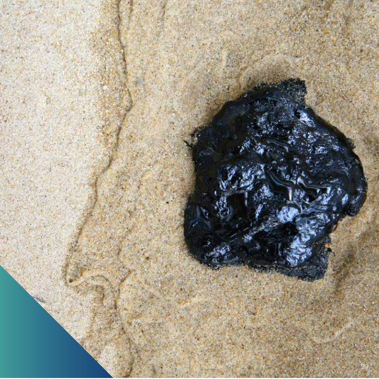
PETROLEUM SYSTEMSSmall balls of natural tar washed up on beaches along South Australia’s Bonney Coast in the South East provided the first tangible sign of potential oil and gas reserves in the canyon systems of the continental slope.
Evidence of hydrocarbon reserves in the Great Australian Bight exists in oil strandings – tar balls and harder, rock-like asphaltites that wash up on South Australian beaches – and in fluid inclusions (bubbles of liquid and gas contained in sand grains) in subsurface rock of deep exploratory wells, although no active seeps have been identified to date. Major knowledge gaps limit our understanding of what natural resources may be hidden in the depths of the Bight and how they are hidden, and whether these systems interact with the deepwater marine ecosystem.
An understanding of the potential petroleum systems in the Great Australian Bight will be developed by studying the subsurface geology to identify natural hydrocarbon seeps and subsurface migration pathways in Project 5.1, ‘Delineation and characterisation of cold hydrocarbon
seeps and their associated benthic communities’. This project, in collaboration with Project 3.1, ‘Great Australian Bight benthic biodiversity characterisation’, will also assess the benthic environment (sea-floor communities) and water column at potential seepage locations to gain an understanding of hydrocarbon baseline concentrations in the waters and sediments of the Bight Basin, and to characterise the benthic communities around seepage sites.
The natural hydrocarbon loading of South Australian beaches will be surveyed in Project 5.2, ‘Asphaltite and tar ball surveys’. Asphaltites and tar balls originating from hydrocarbon seeps will be collected – these materials are likely to have drifted beneath the surface or along the sea-floor to be deposited on the beaches of South Australia. They will be geochemically characterised, and, in combination with oceanographic and
geological modelling, their probable origins from local or remote sources outside the Great Australian Bight will be traced.
In addition to these approaches, techniques will be used to investigate oil hidden in microscopic fluid-filled cavities (fluid inclusions) within rocks in Project 5.3, ‘Fluid inclusion study’, to reveal hidden oil systems in the Bight Basin as potential sources for coastal bitumen strandings.
This information will increase our understanding of the potential oil and gas reserves in the Great Australian Bight. It will support environmental management by indicating natural levels of hydrocarbons in shoreline habitats of the region, and establish a baseline record and drift patterns that are needed for assessing and responding to the impact of any potential hydrocarbon release into the environment.
34

PublicationsBourdet J (2015). Pressure/temperature constraints of hydrocarbon migration in Gnarlyknots-1A & Greenly-1, Great Australian Bight, report to National Offshore Data and Core Repository.
Gong S (2015). GOI™ results from petroleum well in the Great Australian Bight, report to National Offshore Data and Core Repository.
Kempton R (2015). MCI geochemistry from Gnarlyknots-1A & Greenly-1, Great Australian Bight, report
to National Offshore Data and Core Repository.
Williams A, Trefry C, Tanner J, Gowlett-Holmes K, Crooke E, Qi X, Fortney J, Martin T and Lewis M (2013). Southern Surveyor voyage report April 3–22 2013, Great Australian Bight Science Plan (benthic, pelagic and petroleum geochemistry themes).
Above: Oil and gas can be identified from ‘fluid-filled sacs’ hidden within rocks taken from previously explored wells in the Great Australian Bight, using Grains with Oil Inclusion (GOI™) technology.
35

36

SEEKING NATURAL SEEPS: A SIGN OF PETROLEUM SYSTEMS IN THE BIGHT
Achievements to dateThe Great Australian Bight Research Program survey on board the RV Southern Surveyor in 2013 investigated potential areas of hydrocarbon seepage based on pre-survey geological investigations. No substantive evidence of the presence of thermogenic hydrocarbons was found at the baseline sample sites, suggesting that any hydrocarbons from seeps are localised to seep sites.
Despite this, results modelled from two-dimensional and three-dimensional seismic surveys identified regions in the Bight Basin within the Hammerhead geological sequence that could permit leakage through faults and seals under suitable geological conditions. Furthermore, mound-like features that have been identified in several parts of the Basin, associated with faults observed in the seismic data, have been interpreted as potential paleo-seepage features, providing evidence that conditions permitting leakage of hydrocarbons may have existed in the past.
Geomorphological and water column features typically associated with fluid escape were also identified, such as pock marks, cone-like features, acoustic blanking in sub-bottom profiler data and potential water column acoustic plumes. These features provide possible evidence that natural seepage of hydrocarbons may occur in the Bight Basin; however, further surveys are required to unequivocally determine whether they exist.
Future directionsA broader understanding of subsurface geology in the Bight and its relationship to the deepwater ecosystem will be developed by analysing bathymetry and acoustic water column data collected from the joint pelagic and benthic 2015 Great Australian Bight Research Program voyage on board the RV Investigator. Geological interpretation of these data will aid in understanding the geological context of sea-floor samples collected during the 2015 survey, identifying
the likely substrate type or origin associated with the benthic samples collected, and defining possible indicators of hydrocarbon leakage.
The additional data will also aid in the interpretation of 2013 survey data collected from potential hydrocarbon seep sites during the RV Southern Surveyor voyage. The data cover a larger spatial extent and include high-quality data collected from sites that were previously visited.
Project results to date have provided a good grounding for future investigations to delineate and characterise potential likely natural seepage locations. Results show evidence for modern-day seepage and paleo-seepage, which warrants future investigation. A complete analysis of results will be incorporated into a final report to be completed in 2016.
Left: Three-dimensional geological model of an area of the Great Australian Bight, showing faults, which may be conduits for fluid leakage from the subsurface.
Project Leader:
Dr Andy Ross, CSIRO
37

READING COASTAL CLUES TO HYDROCARBON SEEPS IN THE GREAT AUSTRALIAN BIGHT
Achievements to datePotential survey beaches between Eucla (Western Australia) and the Limestone Coast (near the South Australian – Victorian border) were analysed to identify key survey locations to map, quantify and analyse the contemporary natural hydrocarbon loading in the region. Survey sites were selected based on known sites for regular strandings, the predominant metocean conditions, beach slope and accessibility.
An extensive survey of 29 beaches along the Great Australian Bight was undertaken in November 2014. This area was surveyed again in September–October 2015 to assess interannual variability.
The 2014 beach survey identified 106 samples of waxy bitumens and asphaltites (naturally occurring solid hydrocardons). Another 125 samples were collected during the 2015 beach survey. A further 72 samples were donated to CSIRO by a beachcomber based at Coffin Bay.
Natural hydrocarbon deposits collected during the surveys have shown that the distribution of tar balls
and asphaltites extends along the length of the Great Australian Bight coastline. The greatest numbers were collected on the beaches of the Limestone Coast, South Australia.
Around 8% of the 303 samples collected have been classified as asphaltites, potentially originating from local hydrocarbon leakage points in the Bight. Further analysis will confirm their classification.
Samples collected are being investigated using a rigorous analytical program to develop detailed geochemical fingerprints. These will be compared with geochemical analysis of historical strandings and the findings of the final beach survey to be undertaken in 2016.
Comparative geochemical analysis of the interior versus exterior of the asphaltites and a selection of waxy bitumens has been completed, which will provide an understanding of the weathering of the materials. Interpretation of data on the screening and detailed weathering profile is under way, and more detailed geochemical analysis of selected samples will commence shortly.
Future directionsThe activities to date have provided a good basis for the final beach survey, to help understand differences in the distribution of natural hydrocarbon deposits along the South Australian coastline and variations in the distribution between years.
Oceanographic modelling and geochemical composition of oil inclusions in Project 5.3 will be integrated with the results to trace the probable origins of asphaltites washed ashore along the coastal region of the Great Australian Bight. This will potentially allow the natural leakage points from which they originate to be identified.
Right: Asphaltites and tar balls (right) collected from South
Australian beaches are being geochemically characterised to determine whether their origins can be linked to local
hydrocarbon seeps in the Great Australian Bight.
Project Leader:
Dr Andy Ross, CSIRO
38
39

40
TRACING HYDROCARBONS IN THE BIGHT
Left: Identifying traces of oil in sediments, such as sand grains from beneath the ocean floor (left), increases our understanding of the movement of hydrocarbons in the Great Australian Bight.
Achievements to dateHidden oil and gas, contained within fluid inclusions trapped in rocks, has been identified in the Great Australian Bight following analysis of archived samples from six petroleum wells using the Grains with Oil Inclusions (GOI™) technique. The identification of oil-bearing and, in some samples, gas-rich inclusions demonstrates that hydrocarbons have migrated through the rocks of this sparsely explored frontier basin. The implication is that effective source rocks for hydrocarbon generation exist within the Bight Basin, raising the prospectivity of the region.
To fingerprint the oil and gases, novel geochemical techniques, including molecular composition of oil inclusions (MCI), were successfully applied to several prospective intervals from the historical Gnarlyknots-1A and Greenly-1 wells. The results indicate differences in the types of organic matter input to
the hydrocarbons, from terrestrial plants to mixed terrestrial and algal material. Such results are a first for the Basin, improving on conventional hydrocarbon indicators, which are few and far between.
To understand when, in the geological past, these hydrocarbons moved through the rocks, fluid trapping conditions (pressure–temperature) and compositions were modelled in the Gnarlyknots-1A, Greenly-1, Duntroon-1 and Potoroo-1 wells. Results indicate that oil in Greenly-1, for instance, was probably trapped in one event from hot fluids, whereas
the hydrocarbons in Gnarlyknots-1A appear to have evolved in composition from oil to gas and were trapped over an extended period.
Fluid inclusions have so far proven to be a practical method for extracting information on key petroleum system elements in the Bight Basin that would otherwise remain hidden in the rocks. Information on source, migration, hydrocarbon type and timing is useful for calibrating basin models, which are fundamental for exploring frontier basins where there has been minimal drilling activity.
Future directionsThe project is due to be completed in 2016, including preparation of a final report.
The geochemical composition of liquid hydrocarbons contained within the fluid inclusions will be used in Project 5.2 linkage studies addressing the origins of coastal bitumen strandings.
Project Leader:
Dr Richard Kempton, CSIRO
41

SOCIO-ECONOMIC ANALYSISAny potential oil and/or gas industry in the Great Australian Bight may change the structure of regional communities in the aquaculture and dryland farming areas of the Eyre Peninsula and the West Coast region of South Australia.
The Eyre Peninsula is a major economic resource for South Australia and the nation, accounting for 30% of the State’s grains crop and a major share of fisheries production. It is also home to more than 30,000 people and a major tourism destination.
To assess any impacts on the Eyre Peninsula and West Coast region from future human activities in the Great Australian Bight, it is necessary to understand the nature and structure of these communities, as well as the economic profile of the region. As part of this, the impact of potential changes on commercial fishing and aquaculture will also be considered.
Project 6.1, ‘A social profile of the Eyre and Western region: literature review and community analysis’, uses social science approaches to develop an understanding of the social ecology of communities that will potentially be affected by any future development. Thorough consultation will be used to examine community perceptions of key issues relating to likely future activities, and the economic dependence of individual regional communities on activities related to the Great Australian Bight. In parallel with these initiatives, an economic model has been built of the region’s economy, and its influence on other parts of South Australia, Australia and the rest of the world.
The model, which was developed in partnership with the University of Adelaide and is maintained by Victoria University, enables estimates of changes in the economy of the Eyre Peninsula to be assessed. The model is primarily reliant on data collected by the Australian Bureau of Statistics and other sources. Its results can be incorporated into the narratives emerging from social profile data collected in Project 6.1. All modelling is being conducted through Project 6.2, ‘Economic profile of Eyre and Western region’.
The social and economic status of the fisheries and aquaculture sectors in the Bight will be assessed in Project 6.3, ‘Great Australian Bight fisheries
42

benchmark study’. This project will outline the economic status and contributions of fisheries in the region, provide a qualitative assessment of the potential impacts of development in the Bight on the fisheries sectors, and review approaches for assessing the social and economic impact of any potential release of hydrocarbon on the fisheries sectors.
These projects will establish a baseline of social and economic data, against which future development and change can be assessed.
PublicationsO’Neil M, Trevithick M, Whetton S, Wittwer G and Young M (2016). Great Australian Bight: economic baseline and model report, GABRP Research Report 6, Great Australian Bight Research Program.
Thredgold C, Beer A, Cutler C and Horne S (2015). Interim community profile and literature review, Project 6.1, Social profile of the Eyre Peninsula and West Coast region: literature review and community
analysis, GABRP Research Report 2, Great Australian Bight Research Program.
Below: A baseline of social and economic data of the Eyre Peninsula and West Coast region has been developed, against which future development and change can be assessed.
43

A SOCIAL PROFILE OF THE EYRE AND WESTERN REGION: LITERATURE REVIEW AND COMMUNITY ANALYSIS
44
Achievements to dateA preliminary characterisation of the social structure and processes currently driving change was developed for the Eyre Peninsula and West Coast region, based on an extensive literature review. Findings show that the region has a small, sparse population but is economically significant, with major export industries in grains production, fisheries and aquaculture, livestock production and minerals.
The region’s population growth is slower than the State average, with an overall ageing population. The exception is in Indigenous
populations, which are relatively young, especially in the urban centres of the Eyre Peninsula.
Educational attainment is below the State average. This is partly due to difficulties retaining top students, with 30% of young people expressing an intention of leaving the region to find employment or take up educational opportunities.
Employment in the region is largely dependent on primary industries, although Whyalla remains an important centre for manufacturing. Service industries account for a relatively small proportion of total employment. However, tourism –
specifically marine tourism – is an important part of the service economy.
Salaries are variable across the region. Some local government areas within the Eyre Peninsula have relatively high incomes, unlike elsewhere in the region.
A number of new mines have been proposed for the Eyre Peninsula, with a small number already developed and others in prospect. If all proposed projects proceed, significant labour shortages are expected, given the small labour force of the Eyre Peninsula.
Community perceptions about the potential impact of BP’s proposed

activities on the region, including the potential for onshore developments, were assessed through an online survey, face-to-face surveys and interviews with different community focus groups.
Some of the key issues to emerge from this consultation include a desire for additional training on the Eyre Peninsula to help the local workforce take advantage of opportunities that will arise. Landholder reactions to proposed mining developments on the land, and the strong environmental and lifestyle ethos in many parts of the
region were evident. Also evident was the local impact of some significant infrastructure gaps in the region, and the key role played by local governments in providing services in many communities.
Future directionsA detailed analysis of findings, providing an up-to-date assessment of the socio-economic structure of the Eyre Peninsula and West Coast region, will be presented in a final report, which will be available in 2016.
Data collected in this study will be integrated into modelling in Project 6.2 to support analysis of economic data, and in Project 7.1, ensuring that the social environment of the region is captured in the whole-of-system model for the region.
Left: Developing a social understanding of communities across the Eyre Peninsula and West Coast region is critical in understanding how offshore oil and/or gas activities in the Great Australian Bight may affect these communities.
Project Leader:
Professor Andrew Beer, University of Adelaide
45

ECONOMIC PROFILE OF EYRE AND WESTERN REGION
Achievements to dateThis project and Project 6.1, ‘A social profile of the Eyre and Western region: literature review and community analysis’, bring together an economic and social profile of the Eyre Peninsula and the West Coast, and a summary of the regional community consultations, to provide background on the economy and labour market of this region.
These data have been used to improve the existing economic model of regional communities embedded within Victoria University’s The Enormous Regional Model (TERM). TERM can be used to model the potential economic impacts of human activities, such as exploration, and offshore oil and gas development, in the Great Australian Bight.
The project presents data and analysis covering demography, economy, employment, education, health and the Yalata Aboriginal Reserve.
Analysis covers the region’s capacity to support future development associated with the oil and/or gas
industry, including future growth in, and demand for, labour, infrastructure, capital inputs and government funding. Discussions with councillors, community members and local business people have collated thoughts on the potential impact of oil and/or gas development in the Great Australian Bight, including its advantages and challenges.
To develop the capacity to more accurately model the potential impact on the Great Australian Bight of specific oil and/or gas strategies, a tailored version of TERM was developed for the Great Australian Bight. In developing this model, the underpinning database was aggregated to concentrate on regions straddling the Great Australian Bight. The model has dynamic capability, enabling a year-by-year comparison between a forecast baseline and policy scenarios. In the context of exploration and oil field development, the model enables the distinct phases of exploration, construction and operations to be assessed year by year.
Future directionsAs the work under this program comes together, a series of scenario-based model runs will be undertaken to predict likely economic consequences of discovering and developing oil and/or natural gas in the Bight Basin. The results from this work and the underlying response functions will then be incorporated into the whole-of-system modelling for Project 7.1.
Project Leader:
Professor Mike Young, University of Adelaide
Right: Although communities in the Eyre Peninsula and
West Coast region have been affected by a decline in conventional agriculture during the past three decades,
it continues to be an important part of their economy, accounting for 30% of the State’s grain crop.
46

47

48

FISHERIES ECONOMIC VALUE BASELINE
Achievements to dateA benchmark of the current economic condition of fisheries in the Great Australian Bight, and their contribution to local and state economies has been established, based on a review of existing social and economic studies in the region.
Figures for total gross value of production (GVP) highlight the importance of the growing aquaculture industry, which currently accounts for 50% of the GVP of the fisheries and aquaculture industries. South Australian fisheries also play a significant role, making up 40%. The remaining 10% is from Commonwealth fisheries; this is particularly important because it provides the stock for the tuna aquaculture industry. Combined, the $500 million GVP has remained steady over the past decade; this is a slight decline in real terms.
The Lobster Fishery off the south-west coast of Kangaroo Island is the most valuable industry, and the Marine Scalefish Fishery is the most extensive fishery, operating along the central and west coast. Although this fishery is relatively low in value and production, it is the highest in terms of participants and employment.
Southern Bluefin Tuna and oysters are the dominant aquaculture sectors. The oyster industry is forecast to increase by up to 10% per year.
The fishery and aquaculture industries make significant direct and indirect contributions to the economy of the region, with the total annual combined downstream and flow-on effects estimated to be $1.4 billion. Of this, around $300 million per year contributes directly to household incomes.
Recreational fishing also plays a significant role in local economies; it is estimated to contribute around $102 million per year in non-market benefits.
A qualitative assessment of potential impacts on fishing sectors of the development of the oil and/or gas industry in the Great Australian
Bight, based on a review of similar developments elsewhere, identified potential onshore and offshore issues. Based on these potential impacts and information on the different fishing sectors, a qualitative risk assessment considered which fishery (if any) might be at risk from potential oil and/or gas developments in the Great Australian Bight.
Approaches to assessing social and economic impacts of the effect of oil spills from other regions were reviewed. Although approaches varied, it was evident that the detailed economic data that have been collected on South Australian fisheries over many years will be important in estimating impacts if similar assessments are undertaken in the Great Australian Bight.
Future directionsA complete review and analysis will be provided in a final report, which will be made available in 2016.
Data will contribute to whole-of-system modelling in Project 7.1.
Project Leader:
Dr Sean Pascoe, CSIRO
Left: Commercial fishing continues to make a significant contribution to the economy of the Great Australian Bight region, with aquaculture and value adding on the rise over the past three decades.
49
INTEGRATION AND MODELLINGA major outcome of the Great Australian Bight Research Program will be the development of powerful state-of-the-art modelling tools that can be applied to the structure and dynamics of the Bight’s ecosystem.
The Great Australian Bight is a dynamic and complex region of environmental, social and economic significance. The Great Australian Bight Research Program will generate vast amounts of new knowledge about this region that needs to be integrated to improve understanding of how the Great Australian Bight ecosystem functions, and the potential impacts of individual and multiple activities in the Bight.
Project 7.1, ‘Knowledge and integration of socio-ecological systems of the Great Australian Bight’, uses different models – Atlantis and Ecopath with Ecosim – to bring together new and existing information, providing a synthesis of current understanding and how it is interconnected.
Each model has a complementary role in ecosystem-based management, with these roles
building a larger common understanding. The models are tools that will be used to assess the key physical, chemical and biological drivers of ecosystem structure; the vulnerability of key habitats and assemblages, trophic pathways and species to potential ecosystem stressors, and their combined effects; and the socio-economic and ecological trade-offs associated with multiple uses.
The integration of improved knowledge of all aspects of the system, combined with the tools developed in this project, will lead to a more cohesive understanding of the functioning of the Great Australian Bight and how it responds to change through time. It will also improve understanding of trade-offs among future activities, and cumulative impacts, which will underpin future ecologically sustainable management of the Great Australian Bight.
Future directionsBackground work has been undertaken to date, and the project will begin in 2016.
A qualitative modelling workshop, to be held in 2016, involving all researchers from the Great Australian Bight Research Program, will consider how the information generated from all aspects of this program will come together to develop ecosystem models of the Great Australian Bight, and confirm the content and timing of data input to the models.
A comprehensive overview of the socio-ecological systems of the Great Australian Bight will be presented in a scientific report. The report will include conceptual models of ecosystem function, and implications for future research, monitoring and management.
50

Above: Atlantis, a conceptual model developed in this project, will integrate knowledge of ecosystem processes and socio-economic values obtained in the other Great Australian Bight Research Program projects.
Project Leaders:
Associate Professor Tim Ward, SARDI
Dr Beth Fulton, CSIRO
Professor Simon Goldsworthy, SARDI
51

For further information about the research program, visit www.misa.net.au/GAB or contact the Research Office:
Dr Steven LapidgeResearch DirectorGreat Australian Bight Research ProgramPhone 0401 990 367 [email protected]
Ms Jane HamSenior Research OfficerGreat Australian Bight Research ProgramPhone (08) 8207 5458 or [email protected]
General publications
Brown E (2015). Great Australian Bight Research Program. Australian Oil & Gas Review June:10–11.
Lapidge SJ (2016). More than a mouthful. Resourcing SA Autumn 2:8.
Rogers P, Ward T, van Ruth P, Williams A, Bruce B, Connell S, Currie D, Davies C, Evans K, Gillanders B, Goldsworthy S,
Right: The Great Australian Bight Research Program’s 23-day
voyage on board Australia’s national research vessel, RV Investigator, will characterise the deepwater pelagic and benthic community structure, and identify key ecological
processes in the central and eastern Great Australian Bight. This information will assist in developing a whole-of-system understanding of the region, which will inform
future integrated and sustainable management.
Griffin D, Hardman-Mountford N, Ivey A, Kloser R, Middleton J, Richardson A, Ross A, Tanner J and Young J (2013). Physical processes, biodiversity and ecology of the Great Australian Bight region: a literature review, CSIRO.
Ward TM, Smith DC, Lukatelich R, Lewis R, Begg GA and Smith R (2014). Integrated approach to ecological and socio-economic research to support the oil and gas industry: the Great Australian Bight Collaborative Research Science Program. In: Proceedings of the 2014 International Oil Spill Conference, Savannah, Georgia, USA, 2193–2205.
Above: Multi-disciplinary teams are working together across the
research program. CONTACT
The $20 million Great Australian Bight Research Program has been funded by BP ($14 million), CSIRO ($3 million) and Marine Innovation Southern Australia partners: the South Australian Research and Development Institute (SARDI), the University of Adelaide and Flinders University ($3 million).
52

53