the intersection of cadastral surveys and floodplain maps in gis daniel dean yates undergraduate...
TRANSCRIPT

The Intersection of Cadastral The Intersection of Cadastral Surveys and Floodplain Maps in Surveys and Floodplain Maps in
GISGIS
Daniel Dean YatesDaniel Dean YatesUndergraduateUndergraduate
Department of Civil EngineeringDepartment of Civil EngineeringThe University of Texas at AustinThe University of Texas at Austin

The Cadastral MapThe Cadastral Map
Cadastral – adj., showing Cadastral – adj., showing or recording property or recording property boundaries, subdivision boundaries, subdivision lines, buildings, and lines, buildings, and related details.related details.
Commonly used for tax Commonly used for tax purposespurposes
Often referred to as plat Often referred to as plat mapsmaps
Source: The Cadastral Map in the Service of The State, Kain and Baigent, 1992

The Yates ParcelThe Yates Parcel
Plat map with delineated property parcels
“A plot rightly drawn by true information, describeth so the lively image ofa mannor, and every branch and member of the same, as the lord sittingin his chayre, may see what he hath, and where he lyeth, and in whole use and occupation of every particular is upon suddaine view.”
Surveyor’s Dialogue by John Norden, 1607Source: The Cadastral Map in the Service of The State, Kain and Baigent, 1992

Travis County ParcelsTravis County Parcels
Close up of Travis County Parcels and Structures
Source: Lower Colorado River Authority
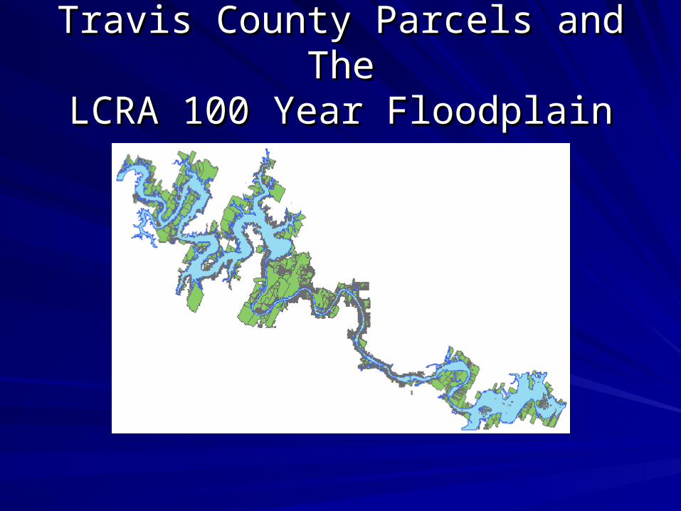
Travis County Parcels and TheTravis County Parcels and TheLCRA 100 Year FloodplainLCRA 100 Year Floodplain

Fun with DatabasesFun with Databases

Joining the tax appraisal roll Joining the tax appraisal roll database with the parcelsdatabase with the parcels

Organizing the DataOrganizing the Data
Separating the parcels by city
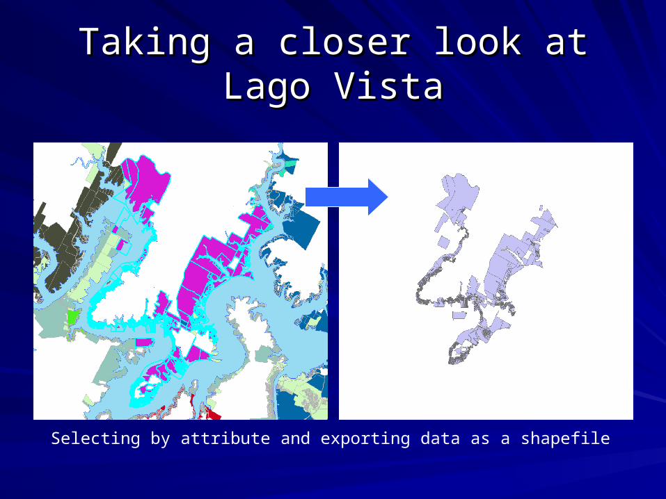
Taking a closer look at Lago VistaTaking a closer look at Lago Vista
Selecting by attribute and exporting data as a shapefile
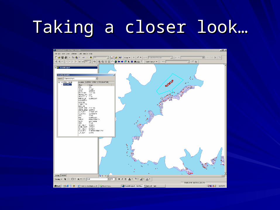
Taking a closer look…Taking a closer look…

Spatial JoinSpatial Join

Improvement Values by CityImprovement Values by City
Number of Parcels Intersecting 100
yr FloodplainImprovement value
per parcel Totals by CityAustin 233 570876 133014018Briarcliff 71 86215 6121264Del Valle 131 23108 3027134Eanes 212 196927 41748538Jonestown 64 17085 1093427Lago Vista 366 99056 36254397Lake Travis 526 60392 31766062Lakeway 130 285576 37124821Leander 273 68260 18634826Marble Falls 112 51969 5820525Westlake 3 210218 630653
Total 2121 315235665
3176 structures intersecting the 100 yr Floodplain

Del Valle NeighborhoodDel Valle Neighborhood

Del Valle NeighborhoodDel Valle Neighborhood
ThanksThanks
Lower Colorado River Authority Lower Colorado River Authority – Wes Birdwell, John McLeod, Sunny SimpkinsWes Birdwell, John McLeod, Sunny Simpkins
The University of Texas at AustinThe University of Texas at Austin– Dr. David Maidment Dr. David Maidment

Questions ?Questions ?
Boathouse going over Austin Dam, 1935 Flood