the mono lake decision “a work in progress”€¦ · state water resouces control board the mono...
TRANSCRIPT

STATE WATER RESOUCES CONTROL BOARD
THE MONO LAKE DECISION
“A WORK IN PROGRESS”
Photo courtesy of the Mono Lake Committee

STATE WATER RESOURCES CONTROL
BOARD

"The SWRCB’s mission is to preserve, enhance and restore the quality of California's water resources, and ensure their proper allocation and efficient use for the benefit of present and future generations."
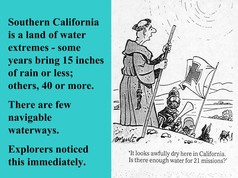
Southern California is a land of water extremes - some years bring 15 inches of rain or less; others, 40 or more.
There are few navigable waterways.
Explorers noticed this immediately.

The Growth of Los Angeles’Population
Year People1850 1,6001860 4,3001890 50,0001900 100,0001910 500,0002002 3,800,000
*Southern California Today 17,000,000
Officials in the Los Angeles area realized before 1900 that new sources of water, besides the Los Angeles River, would be needed to provide residents and agriculture with adequate supplies.
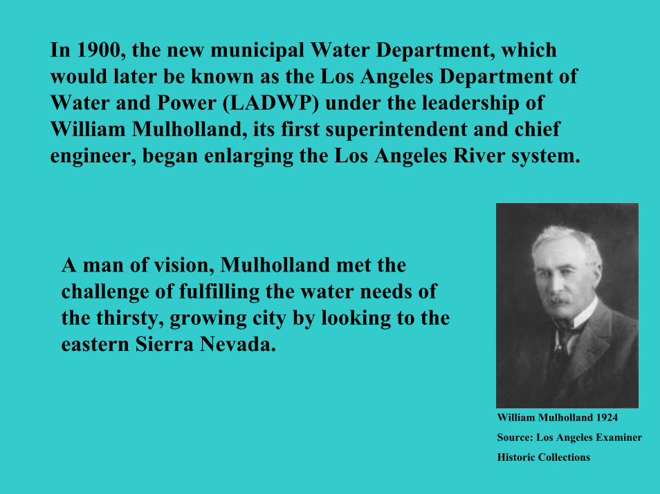
In 1900, the new municipal Water Department, which would later be known as the Los Angeles Department of Water and Power (LADWP) under the leadership of William Mulholland, its first superintendent and chief engineer, began enlarging the Los Angeles River system.
William Mulholland 1924
Source: Los Angeles Examiner
Historic Collections
A man of vision, Mulholland met the challenge of fulfilling the water needs of the thirsty, growing city by looking to the eastern Sierra Nevada.

Los AngelesAqueduct
Mono Lake
Mulholland conceived of an engineering marvel: a plan to build an aqueduct system that would transport water from the Eastern Sierra mountains to Los Angeles, using gravity to keep the water flowing.
Source: Department of Water Resources
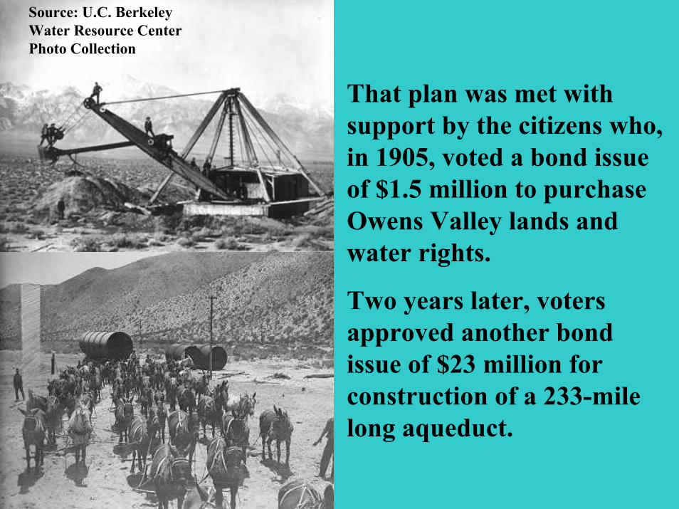
That plan was met with support by the citizens who, in 1905, voted a bond issue of $1.5 million to purchase Owens Valley lands and water rights.
Two years later, voters approved another bond issue of $23 million for construction of a 233-mile long aqueduct.
Source: U.C. Berkeley Water Resource Center Photo Collection
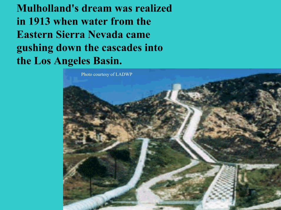
Mulholland's dream was realized in 1913 when water from the Eastern Sierra Nevada came gushing down the cascades into the Los Angeles Basin.
Photo courtesy of LADWP
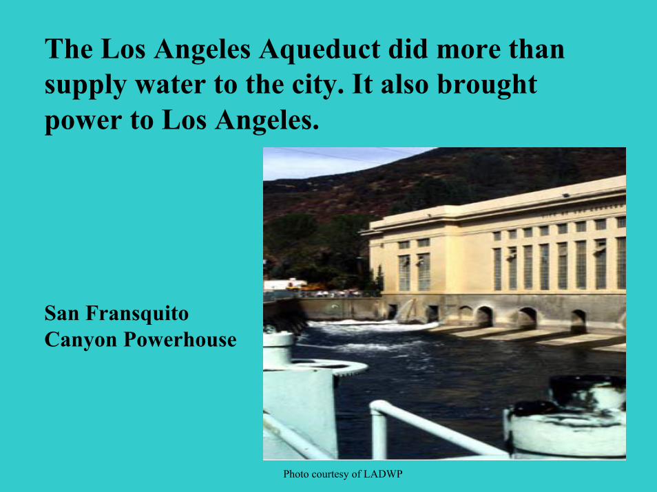
The Los Angeles Aqueduct did more than supply water to the city. It also brought power to Los Angeles.
San Fransquito Canyon Powerhouse
Photo courtesy of LADWP
Courtesy of LADWP
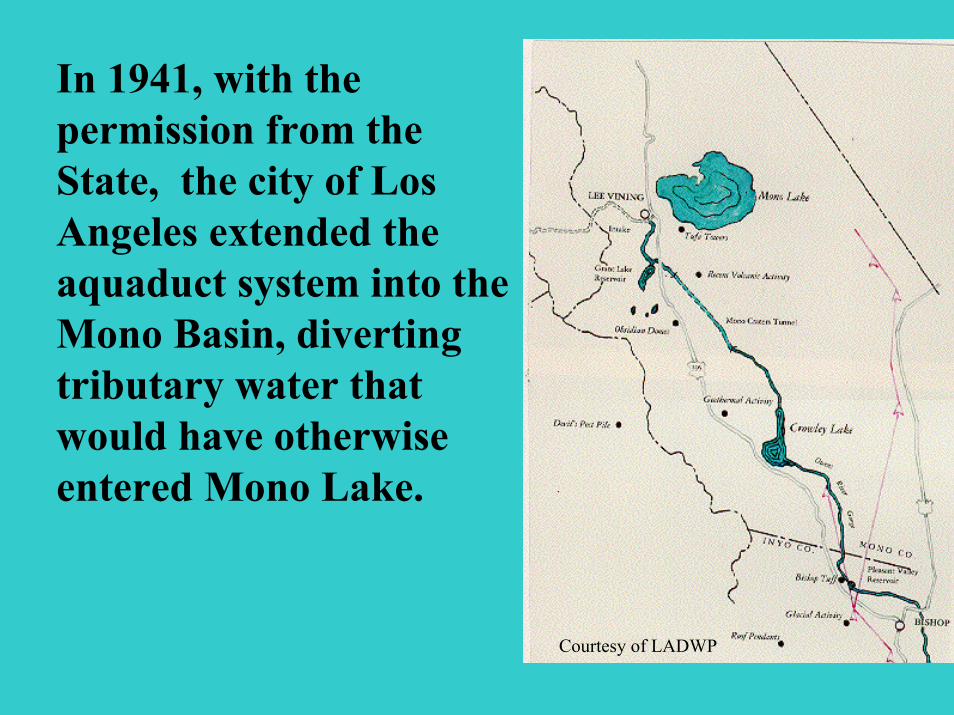
In 1941, with the permission from the State, the city of Los Angeles extended the aquaduct system into the Mono Basin, diverting tributary water that would have otherwise entered Mono Lake.
NASA Photo
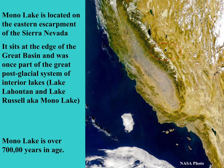
Mono Lake is located on the eastern escarpment of the Sierra Nevada
It sits at the edge of the Great Basin and was once part of the great post-glacial system of interior lakes (Lake Lahontan and Lake Russell aka Mono Lake)
Mono Lake is over 700,00 years in age.
NASA Photo
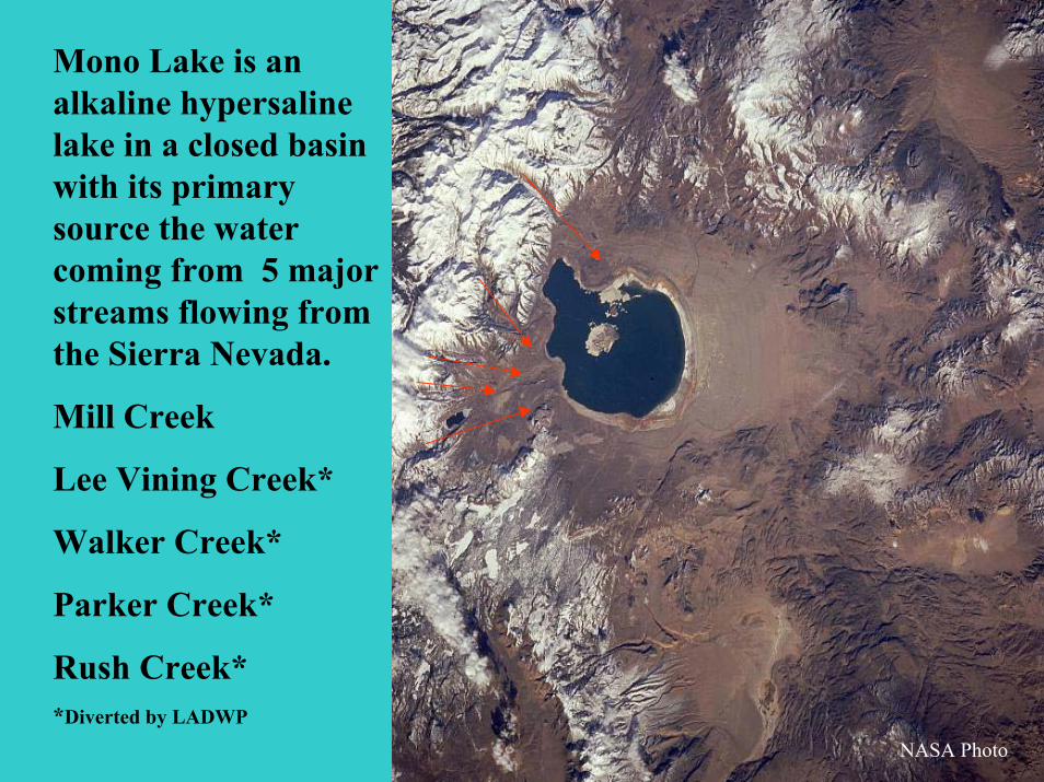
Mono Lake is an alkaline hypersaline lake in a closed basin with its primary source the water coming from 5 major streams flowing from the Sierra Nevada.
Mill Creek
Lee Vining Creek*
Walker Creek*
Parker Creek*
Rush Creek**Diverted by LADWP
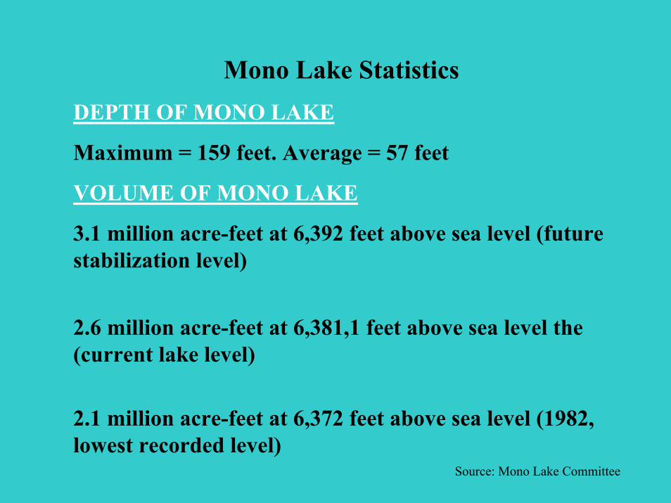
Mono Lake StatisticsDEPTH OF MONO LAKE
Maximum = 159 feet. Average = 57 feet
VOLUME OF MONO LAKE
3.1 million acre-feet at 6,392 feet above sea level (future stabilization level)
2.6 million acre-feet at 6,381,1 feet above sea level the (current lake level)
2.1 million acre-feet at 6,372 feet above sea level (1982, lowest recorded level)
Source: Mono Lake Committee
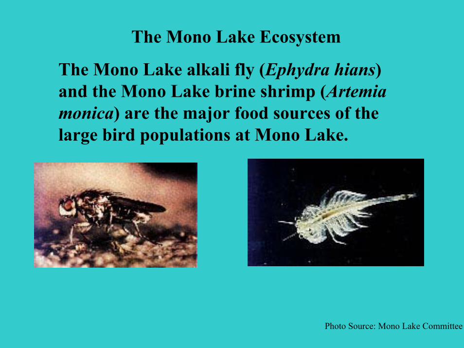
The Mono Lake Ecosystem
The Mono Lake alkali fly (Ephydra hians) and the Mono Lake brine shrimp (Artemia monica) are the major food sources of the large bird populations at Mono Lake.
Photo Source: Mono Lake Committee
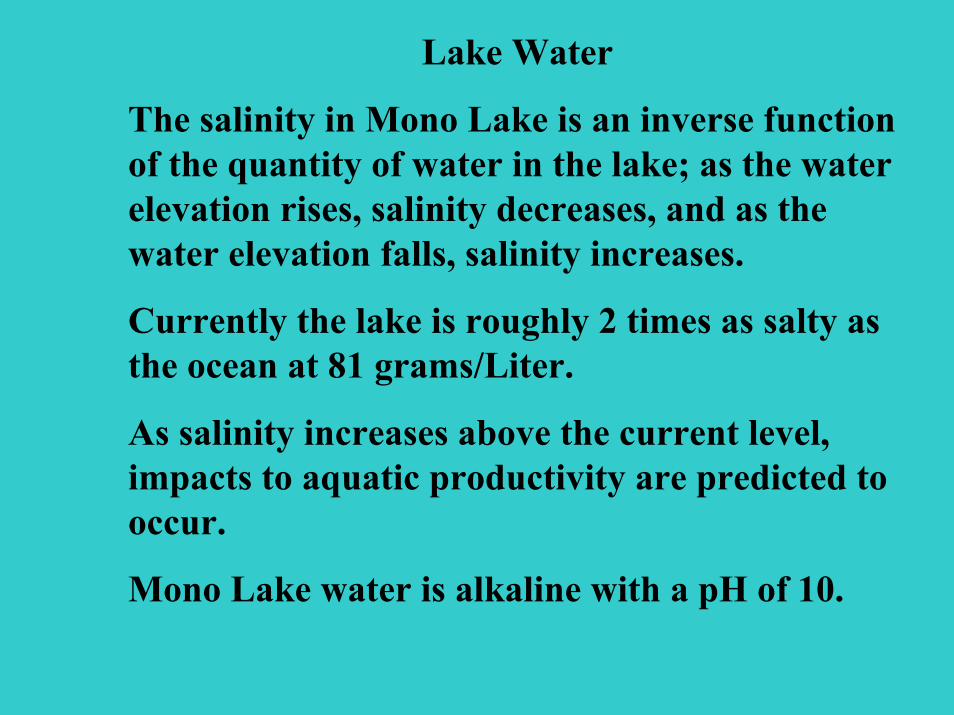
Lake Water
The salinity in Mono Lake is an inverse function of the quantity of water in the lake; as the water elevation rises, salinity decreases, and as the water elevation falls, salinity increases.
Currently the lake is roughly 2 times as salty as the ocean at 81 grams/Liter.
As salinity increases above the current level, impacts to aquatic productivity are predicted to occur.
Mono Lake water is alkaline with a pH of 10.
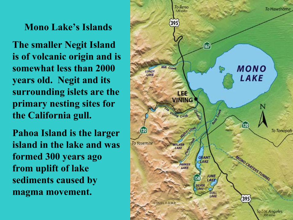
Mono Lake’s Islands
The smaller Negit Island is of volcanic origin and is somewhat less than 2000 years old. Negit and its surrounding islets are the primary nesting sites for the California gull.
Pahoa Island is the larger island in the lake and was formed 300 years ago from uplift of lake sediments caused by magma movement.
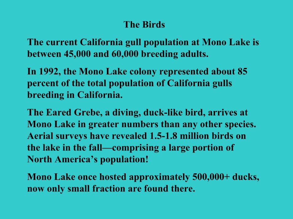
The Birds
The current California gull population at Mono Lake is between 45,000 and 60,000 breeding adults.
In 1992, the Mono Lake colony represented about 85 percent of the total population of California gulls breeding in California.
The Eared Grebe, a diving, duck-like bird, arrives at Mono Lake in greater numbers than any other species. Aerial surveys have revealed 1.5-1.8 million birds on the lake in the fall—comprising a large portion of North America’s population!
Mono Lake once hosted approximately 500,000+ ducks, now only small fraction are found there.

Mono Lake is a vital resting and eating stop for nearly 2,000,000 migratory waterbirds which include 35 species of shorebirds.
The lake is one of the main stopovers for the Wilson's Phalaropes; as many as 90,000 have been counted at one time.
Mono Lake is part of the Western Hemisphere Shorebird Reserve Network
Photo Source: Mono Lake Committee
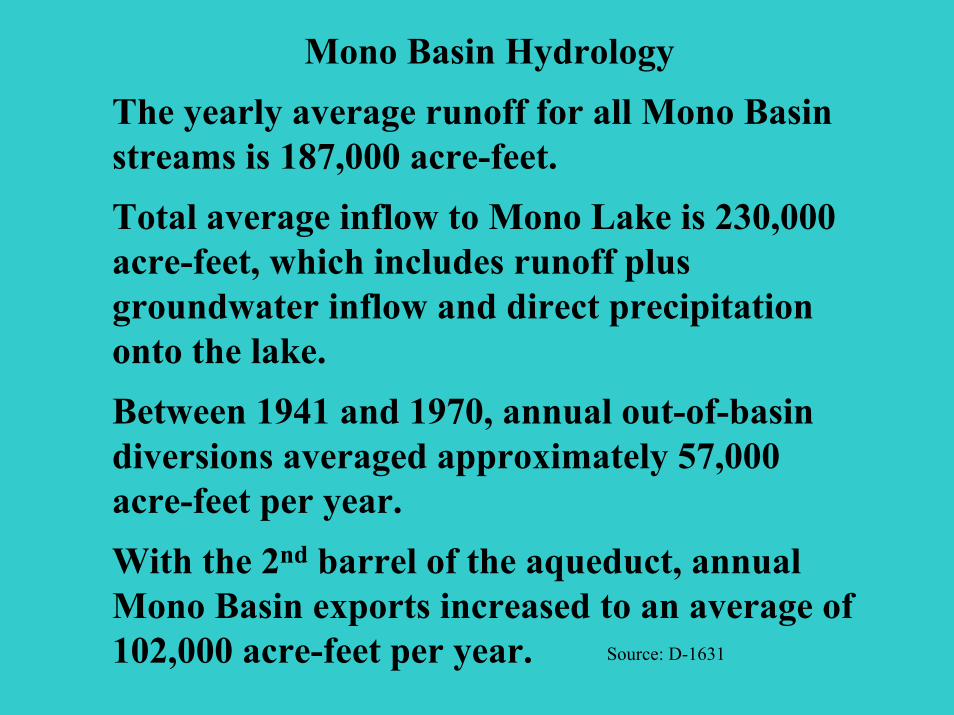
Mono Basin HydrologyThe yearly average runoff for all Mono Basin streams is 187,000 acre-feet. Total average inflow to Mono Lake is 230,000 acre-feet, which includes runoff plus groundwater inflow and direct precipitation onto the lake. Between 1941 and 1970, annual out-of-basin diversions averaged approximately 57,000 acre-feet per year. With the 2nd barrel of the aqueduct, annual Mono Basin exports increased to an average of 102,000 acre-feet per year. Source: D-1631

LADWP diversions left Mono Basin streams dry.
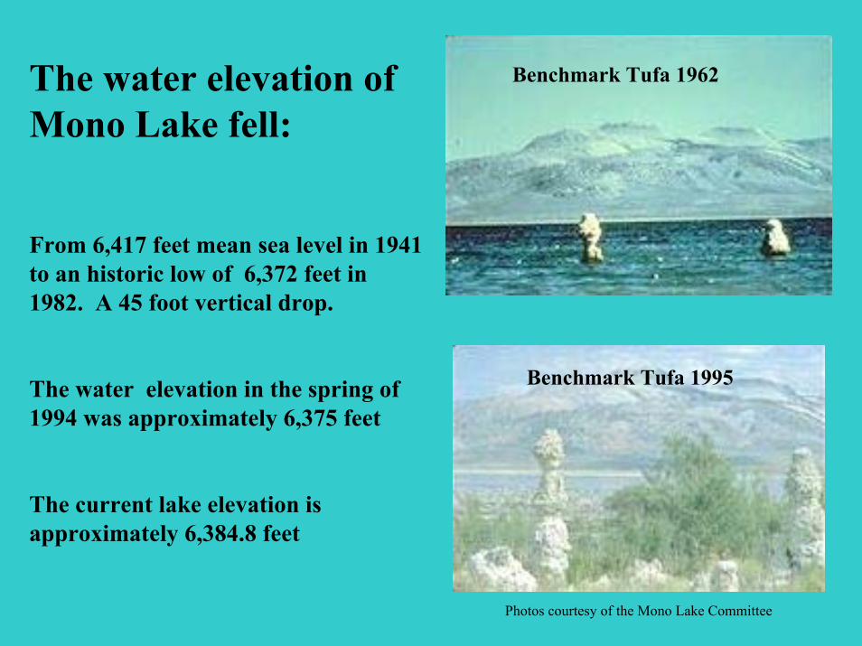
The water elevation of Mono Lake fell:
From 6,417 feet mean sea level in 1941 to an historic low of 6,372 feet in 1982. A 45 foot vertical drop.
The water elevation in the spring of 1994 was approximately 6,375 feet
The current lake elevation is approximately 6,384.8 feet
Benchmark Tufa 1962
Benchmark Tufa 1995
Photos courtesy of the Mono Lake Committee
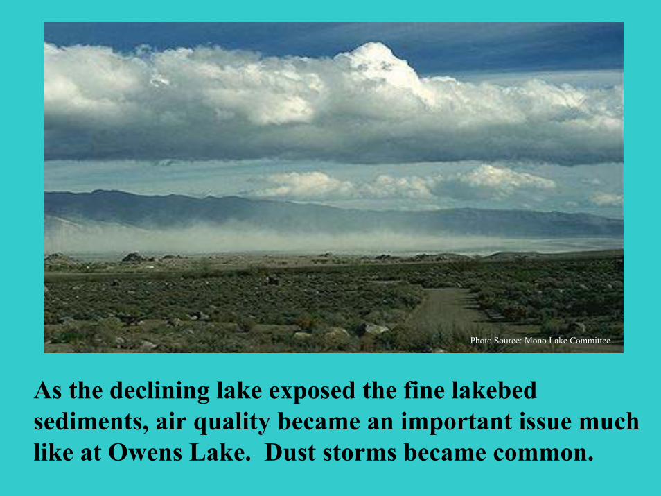
Photo Source: Mono Lake Committee
As the declining lake exposed the fine lakebed sediments, air quality became an important issue much like at Owens Lake. Dust storms became common.
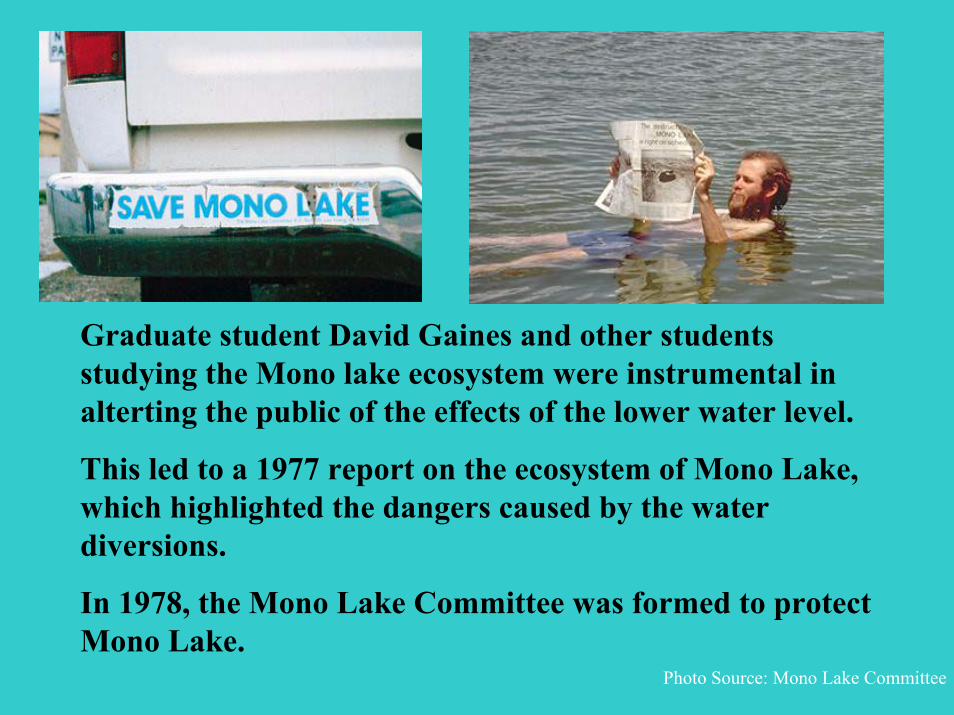
Graduate student David Gaines and other students studying the Mono lake ecosystem were instrumental in alterting the public of the effects of the lower water level.
This led to a 1977 report on the ecosystem of Mono Lake, which highlighted the dangers caused by the water diversions.
In 1978, the Mono Lake Committee was formed to protect Mono Lake.
Photo Source: Mono Lake Committee

Mono Lake became a symbol of the modern struggle over the use of Western water.
The question of who the water belongs to had been a long standing issue in California.
Photo Source: Mono Lake Committee

The Audubon Decision
In 1979, the National Audobon Society and others sued LADWP arguing that the diversions violated the public trust doctrine.
As a result of these challenges, the National Audubon Society suit eventually reached the California Supreme Court which entered its decision in 1983 .
(National Audubon Society v. Superior Court 33 Cal.3d 419, [189 Cal.Rptr. 346] cert. denied, 464 U.S. 977.)
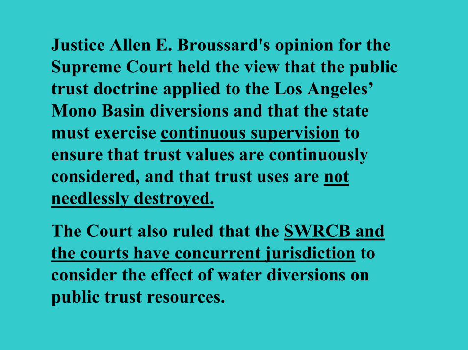
Justice Allen E. Broussard's opinion for the Supreme Court held the view that the public trust doctrine applied to the Los Angeles’Mono Basin diversions and that the state must exercise continuous supervision to ensure that trust values are continuously considered, and that trust uses are not needlessly destroyed.
The Court also ruled that the SWRCB and the courts have concurrent jurisdiction to consider the effect of water diversions on public trust resources.

California Trout v. State Water Resources Control Board
In 1989, the California Court of Appeal directed that the SWRCB amend the city's licenses to include the condition required by Fish and Game Code Section 5946. (California Trout Inc. v. State Water Resources Control Board ("Cal Trout I") 218 Cal.App. 187 [255 Cal.Rptr. 184, 213].)
In 1990, the Court of Appeal entered a second decision which specified language to be added as a condition to the city's licenses: (California Trout Inc. v. Superior Court ("Cal Trout II") 218 Cal.App 187 [266 Cal.Rptr.788].)
The Court of Appeal left determination of the precise long-term flow rates to the SWRCB and assigned the task of setting interim flow requirements to the Superior Court.
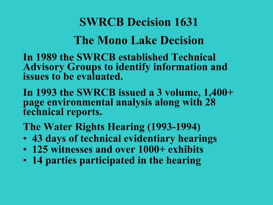
SWRCB Decision 1631The Mono Lake Decision
In 1989 the SWRCB established Technical Advisory Groups to identify information and issues to be evaluated.In 1993 the SWRCB issued a 3 volume, 1,400+ page environmental analysis along with 28 technical reports.The Water Rights Hearing (1993-1994)• 43 days of technical evidentiary hearings• 125 witnesses and over 1000+ exhibits• 14 parties participated in the hearing

The SWRCB’s Decision 1631 was adopted on September 28, 1994.D-1631 re-examines and amends the Mono Basin water right licenses of Los Angeles allowing diversions consistent with protecting the public trust values of Mono Lake, and public trust and fishery values associated with the four streams tributary to Mono Lake.
D-1631 sets instream flow requirements for each stream and establishes diversion criteria to protect wildlife and other environmental resources
D-1631 prohibits the export of water from Mono Basin until the Lake’s level reaches 6,377 feet and restricts diversions to allow Mono Lake to rise to a 6,391 level.
LADWP is required to develop plans for the restoration of the streams and lake-fringing waterfowl habitats.

“OUTSTANDING NATIONAL RESOURCE WATER”
D-1631 afforded Mono Lake this special designation under the federal Clean Water Act.
Only Lake Tahoe has received a similar designation in California!

LADWP is proceeding with flow management that mimics natural conditions to restore the streams’ fishery and riparian communities.
Restoration of the creeks are underway with monitoring and adaptive management as the key tools to track improvements.

Mono Basin streams are recovering!
Photo courtesy of the Mono County Tourism and Film Commission
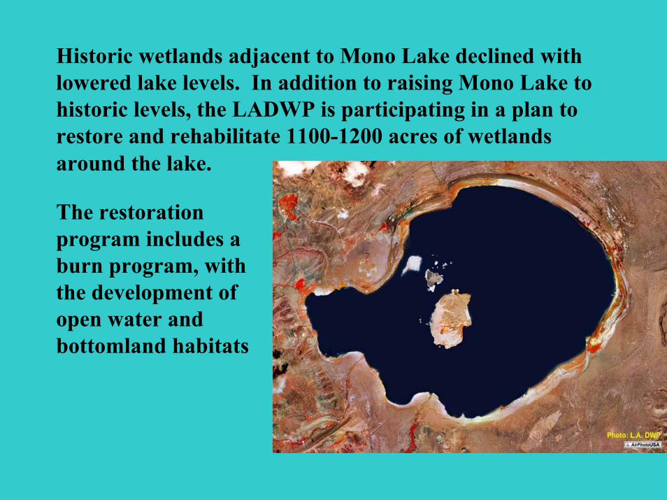
Historic wetlands adjacent to Mono Lake declined with lowered lake levels. In addition to raising Mono Lake to historic levels, the LADWP is participating in a plan to restore and rehabilitate 1100-1200 acres of wetlands around the lake.
The restoration program includes a burn program, with the development of open water and bottomland habitats

Ongoing Monitoring
California gull chick banding program
Researcher collecting dust samples

Ongoing ResearchThe are currently at least 40 ongoing scientific research projects in the Mono Basin watershed, including studies of
air quality,
hydrology,
birds,
geology,
lake limnology,
fisheries and,
mapping.
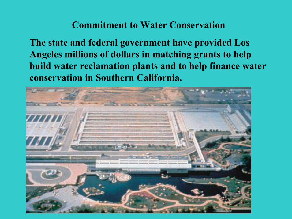
Commitment to Water Conservation
The state and federal government have provided Los Angeles millions of dollars in matching grants to help build water reclamation plants and to help finance water conservation in Southern California.
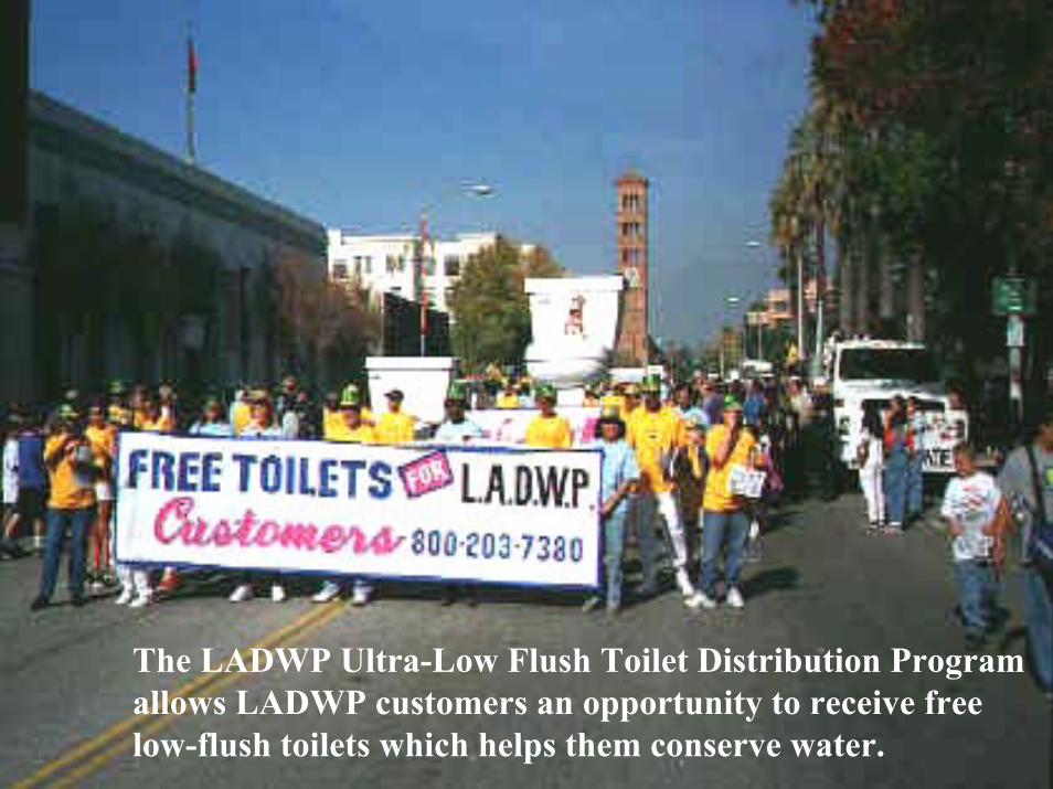
The LADWP Ultra-Low Flush Toilet Distribution Program allows LADWP customers an opportunity to receive free low-flush toilets which helps them conserve water.
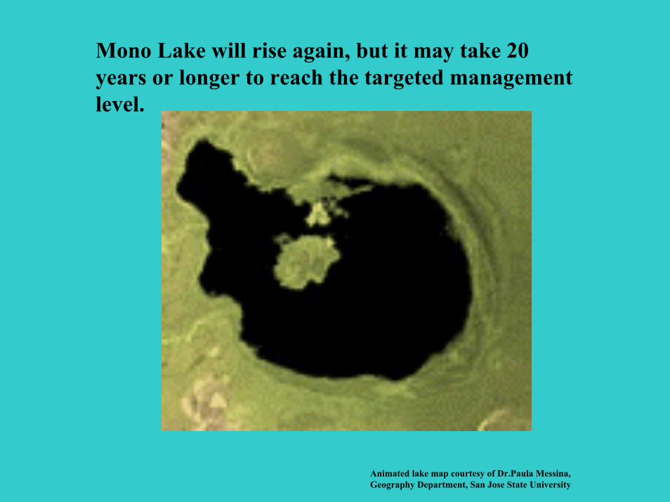
Mono Lake will rise again, but it may take 20 years or longer to reach the targeted management level.
Animated lake map courtesy of Dr.Paula Messina, Geography Department, San Jose State University
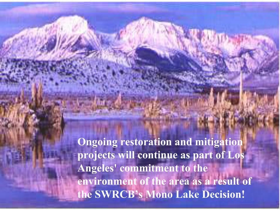
Ongoing restoration and mitigation projects will continue as part of Los Angeles' commitment to the environment of the area as a result of the SWRCB’s Mono Lake Decision!
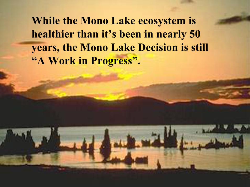
While the Mono Lake ecosystem is healthier than it’s been in nearly 50 years, the Mono Lake Decision is still “A Work in Progress”.