the northeast megaregion in a national infrastructure plan petra todorovich director, america 2050...
TRANSCRIPT

The Northeast Megaregion in a National Infrastructure Plan
Petra TodorovichDirector, America 2050
Multi-State, Multi-Regional Solutions: Transportation, Land Use and the Environment
November 6, 2008

2
Key National and Global Trends
Energy security and global climate change
Rapid population growth and demographic change

3
Globalization and rising foreign trade
Crumbling infrastructure

4
Changing spatial development patterns
Growing inequities and poverty

5
Uneven Growth PatternsPopulation Change 2000 - 2050

6
Emerging Megaregions
7
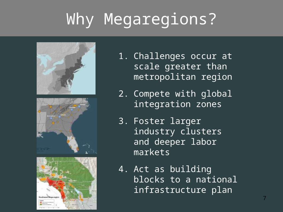
Why Megaregions?
1. Challenges occur at scale greater than metropolitan region
2. Compete with global integration zones
3. Foster larger industry clusters and deeper labor markets
4. Act as building blocks to a national infrastructure plan
8
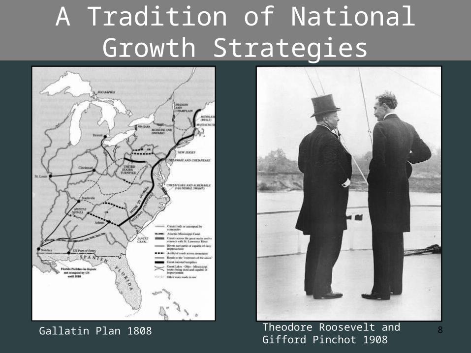
A Tradition of National Growth Strategies
Gallatin Plan 1808 Theodore Roosevelt and Gifford Pinchot 1908

9
National Resources Planning Board and the Interstate
System
National System of Interstate Highways, Public Roads Administration, 1947
Early interstate plan, from “Toll Roads and Free Roads,” National Resources Planning Board and Bureau of Public Roads, 1939

10
Toward a 21st Century
Infrastructure Investment Plan
Judith Rodin Earl Blumenauer
Ed Rendell Tom Donohue
Forum at Woodrow Wilson Center Washington, D.C. May 9, 2008

11
A Strategic Investment Framework
•High-speed rail
•Goods movement and ports
•Energy transmission
•Water infrastructure and protection
•Airports and regional connections

12
Boston
New York
Philadelphia
Baltimore
Washington
The Northeast Megaregion
• 49 million inhabitants
• 17% of U.S. population on 2% of the land area
• 20% of U.S. GDP• Will add 19
million additional people by 2050

13
Urbanized Areas 2000 - 2050
Source: RPA GIS Model, Woods & Poole County Population projections
25.2%39,128,555
2050
16.4%25,487,0872025
9.7%14,657,0282000
% of Total
AcresYear
Change in Urbanized Land 2000 - 2050

14
Transportation Infrastructure
Image: University of Pennsylvania

15
Commutes are Getting Longer 1990- 2000
Source: U.S. Census

16
650,000 people commute between metropolitan areas in the Northeast
Change in Commutation in the Northeast, 1990-2000
8%
23%
22%
37%
0% 10% 20% 30% 40%
Within MetropolitanAreas
Within Non-MetroAreas
Between Metro & Non-Metro Areas
Between Metro Areas
Source: U.S. Census
17
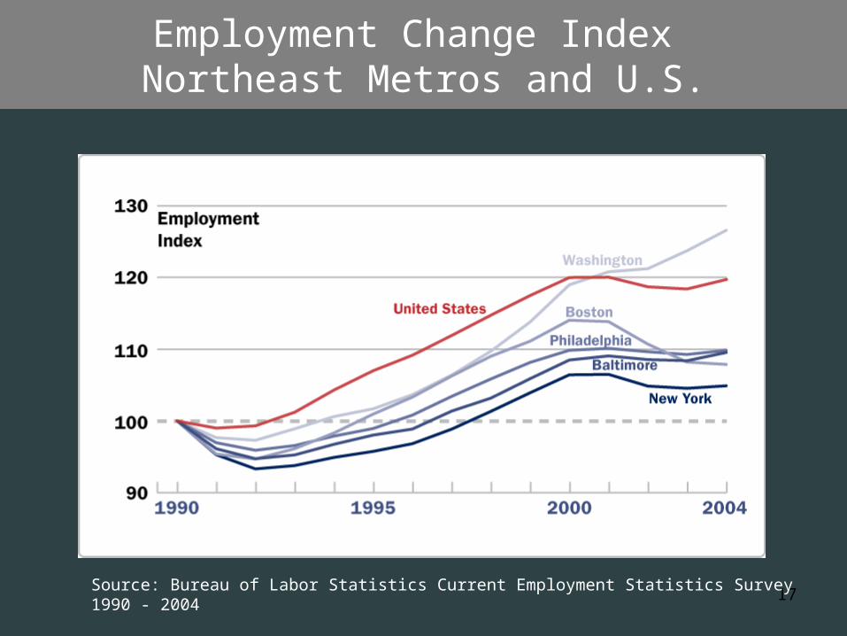
Employment Change Index Northeast Metros and U.S.
Source: Bureau of Labor Statistics Current Employment Statistics Survey 1990 - 2004

18
How do we build on the Northeast’s strategic
advantages?

19
Density Peaks: Hubs of Face-to-face Communication

20
Increase Capacity for Economic Growth
• Provide alternatives and redundancy to congested air travel, roads
• Increase frequency, speed, reliability, price of passenger rail
• Increase capacity of regional rail services

21
•Expand rail service to underperforming cities•Expand job markets and access to lower-cost housing •Focus investments around station areas - TOD
Connect Hot and Cold Growth Centers
Future Moynihan Station West – Hub on the NEC
“Hot and Cold” Index of the Northeast: U. Penn 2004

22
Meet Targets for Greenhouse Gas Reductions
• The transportation advantage.
• The cold climate and old buildings disadvantage.
23
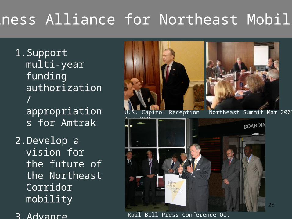
Business Alliance for Northeast Mobility
1. Support multi-year funding authorization/ appropriations for Amtrak
2. Develop a vision for the future of the Northeast Corridor mobility
3. Advance Northeast interests in 2009 transportation bill
Rail Bill Press Conference Oct 2008
Northeast Summit Mar 2007U.S. Capitol Reception Apr 2008

24
www.America2050.org