the proposal of realization the ogc geospatial web services
TRANSCRIPT

Grzegorz Olejarz*
The Proposal of Realization the OGCGeospatial Web Services’ Symbolization
1. Introduction
The pace of Internet in recent years provide to easy and free access to all kindof information, including geospatial data. These data are mostly used by publicadministration. However, private persons and institutions are more often inter-ested in viewing and analyzing geodata. It causes necessary of developing an ap-propriate system.
This system is Spatial Data Infrastructure, which is a set of technologies, polit-ical, economic and institutional projects that help in using and accessing to spatialdata [2].
The essence of SDI is to initiate the technical arrangements, agreements, normand laws, which improve access to spatial data and facilitate geoinformation us-age at various administrative levels – from local uses, through the national level,to the global range. The SDI can be also understood as standards and rules of themutual data sharing. The result of it is cost reduction of receiving and updatingdata and provides consistency of this data in databases [1].
SDI in Europe
The INSPIRE directive was published by the European Parliament on April25th, 2004. On May 15th, 2007 INSPIRE was ratified. Since then, European Mem-ber States had two years to adapt law to implement the directive.
INSPIRE requires from the Member States to build spatial data infrastructureby establishing the services: discovery, view, download and transformation [5].
69
GEOMATICS AND ENVIRONMENTAL ENGINEERING • Volume 5 • Number 2 • 2011
* AGH University of Science and Technology, Faculty of Mining Survying and Environmental En-gineering, Department of Mining Areas Protection, Geoinformatics and Mining Surveying,Krakow, Poland

Open Geospatial Consortium, Inc ®
The Open Geospatial Consortium, Inc. ® (OGC) standards are used for imple-mentation of the services contained in the INSPIRE. OGC is an association of 381companies, government agencies and universities founded for developing publicavailable specifications and standards. The OGC specifications are interoperable,open and free (Fig. 1).
2. Building the Spatial Web ServicesBased on the OGC Specifications
2.1. Data Preparation (Stage 1)
To create the system the data were saved as dgn and gml (with schema) for-mat used taken from master thesis written by Arkadiusz £ukowicz [4]. The filescontain the map of Zak³ady Górnicze “Lubin” (Mining Plant “Lubin”), part ofconcern KGHM Polska MiedŸ S.A. (Fig. 2).
The lack of open source software, able to read and edit gml files, there wasdecided to use a commercial TatukGIS Editor, which is a “Trial” version (with lim-ited use).
Layers created from the gml source file:– “filar_ochronny” (“protecting pillar”),– “granica_obszaru” (“mining area border”),– “parcele” (“parcels”),– “projektowane_pole” (“projected panel”),– “wyrobiska” (“mining excavations”).
For the parcels and projected field layers the topology procedure was used.The aim of it was receiving polygon features, The reason: this is the object type forthese layers.
70 G. Olejarz
Fig. 1. Schematic relations between OGC, ISO and INSPIRE

For text labels layers the dgn file was used. They were also read by TatukGIS.The layers were created:
– “parcele_etykiety” (“parcel_labels”),– “projektowane_pole_etykiety” (“projected_panel_labels”),– “wyrobiska_etykiety” (“mining excavation_labels”).
Next, layers were exported to shp data format. This procedure allowed to dis-tinct the point, line and polygon data types and provided to implement further steps.
2.2. Export to PostGIS Database (Stage 2)
In the second stage author of this article has saved prepared geodata toPostGIS database – PostgreSQL spatial extension. The PostGIS mechanism createspossibility of fast and convenient access to stored data. This is the main reasonwhy this database was chosen for spatial web services.
To view and export prepared data there was gvSIG (es. Generalitat ValencianaSistema de Información Geográfica) used. This program is a multiplatform (written inJava) client for creating and editing maps, distributed under the GNU GPL. (note: TheGNU GPL is a recursive acronym for “GNU is Not Unix General Public License”).
Before loading the data, there was coordinate reference system set to EPSG:2170, Zone IV, which means the Polish Coordinate System 1965. Next, there wereshp data files loaded. Figure 3 presenting the data.
Next, there was database prepared: there was new base with spatial optioncreated (using built-in template “template_postgis”). Next step the coordinate refer-ence system information record about “EPSG: 2170” was inserted into proper ta-ble. Data were exported from gvSIG to prepared database.
The Proposal of Realization the OGC Geospatial Web Services’ Symbolization 71
a) b)
Fig. 2. Map of Zak³ady Górnicze “Lubin” (Mining Plant “Lubin”): a) dgn file; b) gml fileSource: based on data [3]

2.3. Publishing Spatial Data Using “GeoServer”
GeoServer is a software based on Java Enterprise Edition, which allow to viewand transform spatial data. It uses open standards, which makes it flexible for cre-ating and sharing data. It needs only web browser to configure it. First, there wasnamespace created for new data. Namespaces separates data from differentsources. For the following project there was namespace created called “lubin”.Next, there was new Data Store set. In this case the data store is the connectionwith PostGIS database. When connection was properly set, there were object typesdefined in GeoServer. These are the layers, which were added to database before.The layers (databse tables) are listed as a combo box like:datasource_name:::layer (table)
After the new objects type was created, there was style given, coordinate ref-erence system assigned and there was bounding box generated.
2.4. Data Styling and Analysis of the Possibilities of Usingthe SLD Specification for the Cartographic Symbolization (Stage 4)
For data, which were added to GeoServer, there were simple styles assignedjust for pre-view. In order to adjust the map elements of the standards, an attemptto model specific graphic symbols in SLD was made. There was used the built-inGeoServer SLD editor. It provides only validation for compliance with the SLDschema.
72 G. Olejarz
Fig. 3. Visualisation of prepared data

Style for layer “filar_ochronny” (“protecting pillar”). For label style therewere GeoServer VendorOption parameters used to display text along the line. Un-fortunately, this effect due to software limitations is achieved with fairly largescale (approximately 1:300, see Fig. 4, 5). To style line there was Scalable VectorGraphic (SVG) file used. SVG is a markup language for two-dimential graphicsbased on XML (Extensible Markup Language [3].
The Proposal of Realization the OGC Geospatial Web Services’ Symbolization 73
Fig. 4. Protecting pillar borderSource: [6]
Fig. 5. Visualisation of protecting pillar

Style for layer “granica_obszaru” (“mining area border”). To style miningarea border there was Polish Standard used [6] (Fig. 6).
To obtain the line appearance there was Scalable Vector Graphic (SVG) fileused. The resulting map portrayal is presented at figure 7.
74 G. Olejarz
Fig. 6. Mining area borderSource: [6]
Fig. 7. Visualisation of mining area border

Style for layer “projektowane_pole_poligony” (“projected panel polygons”)
and “projektowane_pole_etykiety” (“projected panel labels”). To style these lay-ers there was dgn file used. The resulting map portrayal is shown at figure 8.
Style for layer “wyrobiska” (“excavations”) oraz “wyrobiska_etykiety” (“ex-
cavations labels”). To style these layers there was dgn file used. The map por-trayal is shown at figure 9.
The Proposal of Realization the OGC Geospatial Web Services’ Symbolization 75
Fig. 8. Visualisation of projected fields
Fig. 9. Visualisation of mining excavation

Style for layer “parcele” (“parcels”) and “parcele_etykiety” (“parcels labels”).
To style these layers there was dgn file used. The map portrayal is presented atfigure 10.
Style for parcels fill and an attempt to model the according to Polish Stan-dards. There has been selected three polygon patterns from norm [6] (Fig. 11).
Next, there were parcels selected and filled. These fills are not compatiblewith real mine, parcels were selected arbitrarily for the study purposes (Fig. 12).
2.5. Application – WMS Client (Stage 5)
The last stage of geospatial web services building was the WMS client cre-ation. To do it there was OpenLayers used. This is the open source library writtenin JavaScript for publishing maps in the Internet. Using OpenLayers API (Applica-tion Programming Interface) there is possible to create complex geospatial internetapplications.
76 G. Olejarz
Fig. 10. Visualisation of parcels
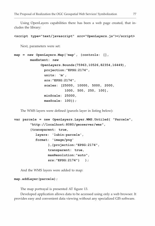
Using OpenLayers capabilities there has been a web page created, that in-cludes the library:
<script type="text/javascript" src="OpenLayers.js"></script>
Next, parameters were set:
map = new OpenLayers.Map(‘map’, {controls: [],
maxExtent: new
OpenLayers.Bounds(75963,10526,82354,16449),
projection:"EPSG:2174",
units: ‘m’,
srs:"EPSG:2174",
scales: [25000, 10000, 5000, 2000,
1000, 500, 250, 100],
minScale: 25000,
maxScale: 100});
The WMS layers were defined (parcels layer in listing below):
var parcele = new OpenLayers.Layer.WMS.Untiled( "Parcele",
"http://localhost:8080/geoserver/wms",
{transparent: true,
layers: 'lubin:parcele',
format: 'image/png'
},{projection:"EPSG:2174",
transparent: true,
maxResolution:"auto",
srs:"EPSG:2174"} );
And the WMS layers were added to map:
map.addLayer(parcele);
The map portrayal is presented AT figure 13.
Developed application allows data to be accessed using only a web browser. Itprovides easy and convenient data viewing without any specialized GIS software.
The Proposal of Realization the OGC Geospatial Web Services’ Symbolization 77

78 G. Olejarz
Fig. 13. Map rendered using OpenLayers

3. Summary
OGC standard and geospatial web services are still not well-known in Poland.Open source software is still being developed. According to fact, that the sourcecode is open it is possible to adjust the software to Polish standards.
Preparation of cartographic symbolisation for mining map required designingand creating the SVG files, which contains fillings and lines definitions. To prop-erly display SVG files on the map, there have been SLD files prepared, which con-tains rules and constrains for symbols placement.
During project developing there were few problems. One of them was theincompability the gml data with the available open-source software. Although thecontents of the file has been stored in accordance with the OGC GML standard,none of the “open” programs could not read the data. There could not be the OGCGML standard used for data transfer, so it was the shp format used. This opera-tion allowed non-problem data export to open source database PostGIS, and pub-lishing them with GeoServer. Prepared data in database, loaded to spatial servercan be defined as “data system based on the free standards”, because transformeddata no longer depend on any “closed” and commercial software.
The analyse of possibilities of using OGC standards for cartographic symboli-sation according to Polish norms showed that the OGC standards can be applied,but they do not compliance all the demand of cartographic content. The SLD stan-dard does not provide the symbolisation of complex lines and fills. Perhaps futureversions of the SLD will allow to use just this standard to style both simple andcomplex points, lines and fills. However SLD can be used independently withoutadditional resource files.
References
[1] GaŸdzicki J.: Kompedium infrastruktur danych przestrzennych (Spatial Data In-frastructure Compedium). Geodeta, 93, 2003.
[2] Gotlib D., Iwaniak A., Olszewski R.: GIS – Obszary zastosowañ. Wyd. Nauk.PWN, Warszawa 2007.
[3] Grygierzec J.: Analiza porównawcza modelu danych GML z modelem danychGIS/CAD (Comparative analysis of GML and GIS/CAD data model). AGH,Kraków 2007 (M.Sc. Thesis, unpublished).
[4] £ukowicz A.: Ocena mo¿liwoœci zastosowania jêzyka GML do standaryzacjiwybranych warstw mapy wyrobisk górniczych rud miedzi (Possibility of usingGML language for standardizing chosen layers of copper ore mining map).AGH, Kraków 2008 (M.Sc. Thesis, unpublished).
The Proposal of Realization the OGC Geospatial Web Services’ Symbolization 79

[5] Olejarz G.: Mo¿liwoœci realizacji symbolizacji treœci kartograficznych w serwisachus³ug geoprzestrzennych klasy OGC (Possibilities of cartography symbolizationin OGC Web Services and Spatial Data Infrastructure). AGH, Kraków 2009(M.Sc. Thesis, unpublished).
[6] Mapy górnicze. Umowne znaki granic (Mining maps. Conventional symbols ofborders). PKN, Warszawa 2004.
[7] Mapy górnicze. Umowne znaki podziemnych wyrobisk górniczych (Conventionalsymbols of underground excavations). PKN, Warszawa 2005.
80 G. Olejarz