the siskiyou loop - usda
TRANSCRIPT
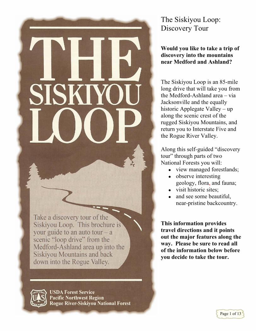
The Siskiyou Loop: Discovery Tour Would you like to take a trip of discovery into the mountains near Medford and Ashland? The Siskiyou Loop is an 85-mile long drive that will take you from the Medford-Ashland area – via Jacksonville and the equally historic Applegate Valley – up along the scenic crest of the rugged Siskiyou Mountains, and return you to Interstate Five and the Rogue River Valley. Along this self-guided “discovery tour” through parts of two National Forests you will:
view managed forestlands; observe interesting
geology, flora, and fauna; visit historic sites; and see some beautiful,
near-pristine backcountry. This information provides travel directions and it points out the major features along tway. Please be sure to read all of the information below befoyou decide to take the tour.
he
re
Page 1 of 13
SOME CAUTIONS and TRAVEL TIPS The Siskiyou Loop follows a route that includes a wide variety of travel conditions: four-lane freeway, two-lane paved highway, and about 25 miles of single-lane, graveled and dirt mountain road.
The steepest part of Road 20 is between mileposts 8 and 9 along Beaver Creek. Optional, short side-trips to Dutchman Peak Lookout and the summit of Mt. Ashland have some steeper, rougher sections.
Although the entire route over the Siskiyou Mountains has long been a popular summertime drive for local people in passenger cars, you may wish instead to drive only the shorter sections of the loop along the higher-standard roads – from Medford into the Applegate Valley or from Ashland to the Mount Ashland ski area – and leave the full loop, on unsurfaced sections of Forest Service Road 20, for a later discovery tour.
The Siskiyou Loop passes through forestland where livestock graze and timber is harvested. Logging trucks and cattle are common; drive slowly and cautiously, particularly when rounding bends in the road.
“Logistics”
There are no gas stations, restaurants, or other commercial services along the 40-mile section of the loop over the Siskiyou Mountains, between McKee Bridge and Interstate 5. Be sure to have a full fuel tank when starting your tour. (If weather is hot, you might take along some extra radiator water.)
Season of Use
Generally, the entire Siskiyou Loop is open for vehicle traffic between July 1 and early November. (Check with local Forest Service offices if traveling before July.) An average trip along the entire loop takes
about 4 to 5 hours. You may wish to bring along some lunch and cold beverages; other items to bring would include a litter bag, binoculars (for bird watching along the Siskiyou Crest), and (because cold temperatures are possible at higher elevations at any time of the year) a warm sweater or jacket. Cell phone coverage along the route can be “hit or miss.”
During the winter and spring, the higher elevation section of the route (along Forest Service Road 20 over the Siskiyou Mountains) is closed by snow.
During November through June, you can typically travel the lower sections, into the Applegate Valley from Jacksonville or up the Mt. Ashland access road (where, depending on daily conditions, snow traction devices may be required) to the ski area (where snow-park permits are required for parking between November 15 and April 30).
Toilet facilities are limited in the Siskiyou Mountains to a few Forest Service campgrounds.
Please respect the rights of private property owners along the route; National Forest lands, including several developed recreation sites, are open for your enjoyment along the way.
Road Conditions and Traffic
The Siskiyou Loop, in particular the high elevation section along Forest Service Road 20, is not recommended for large recreation vehicles or vehicles pulling trailers. (Note: Forest Service spur roads posted with vertical road numbers are not maintained for use by passenger vehicles.)
Finding Your Way
This brochure contains a sketch-map which is adequate to follow the route.
You may wish to purchase the Rogue River-Siskiyou National Forest visitor’s map (which provides better detail and additional information) from local Forest Service offices.
Some sections of Forest Service Road 20 are unsurfaced, bumpy, and single-lane without turn-out spaces. Be sure to stay to the right when rounding curves in the road; there could be on-coming traffic.
Page 2 of 13

Page 3 of 13
Welcome to the Siskiyou Loop Discovery Tour . . .
This self-guided tour begins in the Rogue River Valley and goes up into the forested Siskiyou Mountains. The Siskiyous, composed of some of the oldest rocks in Oregon, are also home to many unusual plant species, and they were the scene of some fascinating history during the frontier period.
The tour passes through privately-owned land as well as through parts of the Rogue River-Siskiyou National Forest and the Klamath National Forest. The USDA-Forest Service manages the National Forest and administers the various resources they contain: water, range, wildlife, timber, recreation and others. We hope you enjoy this discovery tour of your National Forests.
The Rogue River Valley and Medford
The Rogue River begins high in the volcanic mountains known as the Cascade Range. It flows down into a large valley, where the Rogue is joined by Bear Creek near the Table Rocks, and continues west through the Siskiyou Mountains on its way to the Pacific Ocean. From Medford, the foothills of the Cascades are visible to the north and east, and the Siskiyous rise along the south and west sides of the valley.
Medford, the beginning point for the tour, is the governmental and commercial center of the region. Located on the banks of Bear Creek in the heart of the Rogue River Valley, it was founded as a railroad town in the mid-1880s. The coming of the railroad during that time enabled the products of this formerly isolated valley to be sold almost anywhere in the nation. The pear orchard “boom” of the early nineteen-hundreds really put Medford on the map. Later, after 1920, lumber mills contributed to the city’s rapid growth.
Medford to Ashland
If you decide to travel the “clockwise” route, between Medford and Ashland, along Interstate Highway 5, the tour parallels Bear Creek through fertile orchard lands. First settled by American farmers during the early 1850s, the valley was originally home to two Indian groups, the Takelma and the Shasta – who, after their defeat in a series of conflicts with the settlers and the U.S. Army, were removed from their ancestral home in 1856 to a distant reservation in Oregon’s Coast Range.
Ashland, which grew up around a sawmill built in the early 1850s, was one of the Rogue River
Valley’s earliest farming communities. Located along the main wagon route over the mountains to California, the town expanded rapidly after completion of the railroad in 1887. Many historic homes – as well as famous Lithia Park – attest to Ashland’s prosperity during the late 19th and early 20th century period. The educational and cultural center of the region, Ashland is home to Southern Oregon University and the Oregon Shakespeare Festival.
The tour continues via Interstate 5 for about 10 miles between Ashland and the freeway’s Mt. Ashland exit. Take the Mt. Ashland exit (exit #5), continue straight ahead at the first junction (paralleling the freeway for half a mile), and then turn onto the Mt. Ashland access road (sign reads: “Colestin Rd./Mt. Ashland Ski Area”). Follow the access road (which in about 7 miles becomes Forest Service Road 20). Now you can use this brochure as your guide by “working back” from the final section which deals with Colestin Road and Siskiyou Pass.
Medford to Jacksonville
For the preferred “counter-clockwise” tour, from downtown Medford take State Highway 238 (West Main St.) west to Jacksonville. Driving through irrigated orchard lands towards the foothills of the Siskiyous, the route soon reaches the outskirts of historic Jacksonville (highway milepost 33). Continuing past the Jacksonville Museum (operated by the Southern Oregon Historical Society and well-worth a special stop) Highway 238 turns right onto California Street, the town’s main thoroughfare. Founded as a booming mining camp during the gold rush days of the early 1850s, Jacksonville was for a brief time the largest city in the Oregon Territory. It served as the seat of Jackson County until 1927 (by which time the railroad had created the area’s new economic center at Medford). Now a National Historic Landmark, Jacksonville can provide hours of interesting exploration through historic structures and along tree-shaded streets.
The Applegate Valley
The Applegate Valley was inhabited by the Dakubetede (“dah-koo-be-tee-dee”), who were among the last Indian groups to surrender to the U.S. Army in 1856. First visited by hordes of gold-hungry prospectors in the early 1850s, the then-remote valley attracted a small population of farmers, ranchers, miners, and their families during the late 19th century. Since the improved road system was built after World War II, the Applegate Valley has become much more accessible and populated. Many of the people who live here today commute to work in the Medford area.
Page 4 of 13

Ruch: The Siskiyou Loop discovery tour turns south off of Highway 238 at the community of Ruch (“roosh”) and travels south on the Upper Applegate Road. This junction is marked by signs pointing to Valley View Winery, Star Ranger Station, and Applegate Dam. The Upper Applegate Road follows the Applegate River upstream. The river was named for the famous pioneers Jesse and Lindsay Applegate, who passed by the river’s mouth in 1846 while laying out a southern route of the Oregon Trail. The aptly-named Valley View Vineyard provides a view across the Applegate Valley to where the river turns west, towards its confluence with the Rogue a few miles from the city of Grants Pass. (Since the 1970s, wine grapes have become an important addition to the farming economy of southwestern Oregon – this vineyard was one of the earliest to be established – but wines produced in this region are receiving wide recognition of their high quality.) Along this stretch of road are groves of Pacific madrone (sometimes called “laurel”), an evergreen broadleaf tree. Identified by its smooth, reddish-orange trunk, madrone is common in the low elevation “transition forest” zone of the Siskiyous. Other trees of the transition forest include Oregon white oak and ponderosa pine. Different plant species prefer different environments; the trees and shrubs that occur together at different elevations form distinct vegetation communities or zones. The five major zones of the eastern Siskiyou Mountains include the interior valley zone at the lowest elevations, followed by the transition forest zone, the mixed-conifer forest zone, the true fir forest
zone, and – at the highest peaks – the sub-alpine zone. 26 3 Approaching milepost 3, the road crosses the Little Applegate River, which comes in from the southeast. Looking up the Little Applegate Valley, you can see Wagner Butte in the distance, beyond which lies Ashland. According to local old-timers, there was once a Dakubetede village near the mouth of the Little Applegate, but large-scale gold mining by the Chinese washed away most of this village site. (You can learn more about Chinese mining activities by hiking the Gin Lin Trail, a short interpretive trail located near McKee Bridge; brochures are available at Star Ranger Station.) Upstream from the Little Applegate, large ponderosa pines grow on the level terraces between the road and Applegate River. On the hillsides next to the road, you may notice a red-barked shrub with round, light-green leaves. This is manzanita (Spanish for “little apple”); local Indians gathered the small red berries for food.
1
4
2 Just upstream from milepost 4 is the junction with the Eastside Road. Bear right here, continuing on the Upper Applegate Road, crossing the bridge over the river. The Applegate River was first seen by white men – French-Canadian fur trappers – in 1827, and they commented on its clear water. The river flows northward from its headwaters high in the Siskiyous.
Page 5 of 13
Star Gulch comes in from the west. Named for the Starr brothers (Ohio-born prospectors of the 1850s), Star Gulch – like the names of many other steams and peaks in the Siskiyous – recalls the gold rush era. Star Ranger Station is administrative headquarters of the Applegate Ranger District of the Rogue River National Forest. You drive through the Applegate Ranger District for much of Siskiyou Loop. The Ranger Station is located at a historic spot. A battle between Indians and miners took place near here in December 1855. In 1911, after using an abandoned miner’s cabin for a year or two, the Forest Service built its first ranger station here. This little building, which later came to be called the “Tack Room,” sits next to the road just before the ranger station office. It is one of the oldest Forest Service structures in the Pacific Northwest, and is listed on the National Register of Historic Places. (Historic photographs, maps, and other early-day Forest Service items are on display inside; ask the receptionist if you can view the interior.) A second ranger station office, located on the uphill side of the road, was built in 1936 by the Civilian Conservation Corps. Just upstream from the ranger station (near milepost 7), some jagged peaks – the Red Buttes and others – are visible on the far southern horizon. Located in California, they form part of the “Siskiyou Crest.” The 20,000-acre Red Buttes Wilderness, part of the nation’s Wilderness Preservation System, contains the rugged headwater canyons of the Applegate River McKee Bridge, located upstream from milepost 8, is also of historic interest. Take the turn-off, driving past the McKee Bridge Store (the last gasoline, telephone, and food services until the tour reaches Interstate 5 near Ashland). The covered bridge was
built during World War One to bring horse-drawn stage coaches up to the Blue Ledge copper mine, high in the Siskiyous. It is one of very few covered bridges left in southern Oregon.
6 The old Upper Applegate Grange Hall formerly stood near the store, and the river once contained a popular swimming hole just downstream from the bridge (the deep pool was partially filled with sediment by the big flood of 1964). During the 1930s, the Forest Service developed a recreation site at McKee Bridge. The shelter, mortared-rock fireplaces, and other facilities were built by the Civilian Conservation Corps. During the Great Depression, the “CCC” put thousands of unemployed young men to work in the national Forests and National parks. They left behind a legacy of replanted forests, miles of trails, and rustic picnic areas like this one. Both the covered bridge and the CCC-built shelter are on the National Register of Historic Places. Across the Upper Applegate Road from the McKee Bridge turn-off, in the pasture area, you may notice a large pile of rock cobbles and bounders. This is a pile of “tailings” which resulted from hydraulic gold mining during the late 19th century.
9 Gin Lin Trail: For a closer look at the results of hydraulic gold mining by the Chinese, turn onto Palmer Creek Road just before the concrete bridge over the river and drive the short distance to Flumet Flat. The ¾-mile long Gin Lin Trail begins just past the Campground. Interpretive brochures are usually available at the trailhead display board or at the Ranger Station.
8 Bridge Crossing and Junction with Road 20: Just after crossing the Applegate River above McKee Bridge, the Eastside Road rejoins the upper Applegate Road. Stay on the Upper Applegate Road for a short distance beyond the Eastside Road junction. About 100 yards beyond this junction, near the top of the rise, is another junction; turn left off the Upper Applegate Road onto Forest Service
Page 6 of 13

Road 20. This sudden turn-off is marked by a directional road sign which reads:
3
Beaver Creek Road Dutchman Peak L.O. 18 Approximately three miles up Road 20 from the Applegate River is Beaver-Sulphur Campground, which is available for reserved camping by groups. A fee-site for overnight camping, it has drinking water (a hand-pump located near the entrance), vault toilets, six campsites with tables, and shady Beaver Creek.
Mt Ashland Ashland 40
Important Reminder: Road 20 turns into an unsurfaced mountain road. It is not recommended for large recreation vehicles or those pulling trailers. If you decide to end your tour of the Siskiyou Loop here, you may wish to continue south on the Upper Applegate Road for another six miles to Applegate Lake. In season, this reservoir is popular for fishing, camping and swimming. Hart-tish Park (which has an entrance fee) has restroom facilities in addition to picnic sites and a large beach.
Alder, willow, and ash trees grow along this stretch of Beaver Creek. The transition forest has given way to the next higher vegetation zone, the mixed-conifer forest zone. Ponderosa pine still occurs but, aside from the riparian (steam-side) areas, broadleaf trees are few. Sugar pine (with its huge cones up to a foot or more long), incense-cedar, and especially Douglas-fir make up the other dominant conifers of this zone. The mixed-conifer forest is the region’s most important source of commercial timber. 5 Forest Service Road 20, which is marked at major
junctions, is paved for about 5 ½ miles beyond the junction with Upper Applegate Road. Road 20 is the route of the Siskiyou Loop almost all the way between the Applegate Valley and Interstate 5. It was first built in 1936-37 by the CCC to provide access to the high elevation forestlands of the eastern Siskiyous. Evidence of recent timber harvest is plentiful along some sections of the road, and logging trucks are common for the first 14 miles; drive defensively!
About half-a-mile east of milespost 5, Road 20 changes from a paved to a gravel-surfaced road. A number of mining claims are located in this vicinity. Although historically Beaver Creek has not been known as “promising ground,” the lure of gold still brings people to the Siskiyous.
8
The open pasture area below Road 20 is known as
“Beaver Ranch.” It is one of several parcels of private land located along the road. Along with the goldseekers of the 19th century, stockmen, too, came to the Siskiyous, raging their herds of sheep and cattle onto the mountain meadows. In the 1890s, the Cameron family cleared and irrigated this piece of land for summer pasture. Since the Forest Service came onto the scene in the early 1900s, grazing in the Siskiyous has continued by means of permits and allotments to local ranchers.
1 For much of its length, Road 20 follows Beaver Creek. Place-names like this one recall the quest for “soft gold” – beaver fur – which brought the first whites into the Siskiyou Mountains. These trappers worked for the British-owned Hudson’s Bay Company, headquartered at Fort Vancouver on the Columbia River.
Page 7 of 13

Most of the National Forest is “open range,” and cattle are commonly encountered along Road 20. The Siskiyou Mountains, especially in comparison to the relatively young Cascade Range, are ancient – dating to the Age of Dinosaurs and before (The Siskiyous are part of a larger mountain system called the Klamath mountains; other ranges of the Klamath’s include the Salmon Mountains, Trinity Mountains, and Scott mountains in northwestern California.) As Road 20 switchbacks across the slope, the roadcut exposes some of the geological secrets of the Siskiyous – sea-floor sediments and volcanic flows, deposited about 200 million years ago, that were later changed by the earth’s heat and pressure into the “metamorphic” rocks visible today. At the headwaters of Beaver Creek, a large clear-cut extends west from Road 20. Many of the trees growing in this area were blown down by heavy winds in the late 1970s and early 1980s. About 100 acres of the “windthrown” timber were then harvested by means of helicopter in 1983. The Forest Service’s Pacific Northwest Forest and Range Experiment Station used this salvage logging operation to conduct technological research on “payload” weights for helicopters. It also experimented with the use of an ungainly but effective vehicle called the “Spyder,” which moved across the steep slope “pre-bunching” the logs in order to lessen the helicopter’s flying time. The area has been planted with tree seedlings which are reforesting the open slope. Several sections of land visible along this stretch of Road 20 were once part of a vast land-grant given by Congress to the Oregon-and California Railroad in 1869. Much of it was later purchased by companies that logged the timber before the Forest Service acquired the land in recent years. Timber
management remains a major activity in the eastern Siskiyou Mountains. Just south of the ridge-top “saddle” between Beaver Creek and Yale Creek is a good viewing point from the road. To the east is the Little Applegate River drainage, with Wagner Butte (r.) and Goad Cabin ridge (l.) the dominant mountains. Visible between this, rising on the far-distant horizon, is the volcanic cone of Mount McLoughlin (9,495 feet above sea level), the highest point in southern Oregon.
9
Road 20 junction with Road 2015 (which goes to Maple Dell Gap): Stay (bear left) on Road 20, which continues towards Dutchman Peak. You are not 5,000 feet above sea level.
11
(“Road Narrows”)
10 A short distance above the junction with Road 2015, Road 20 passes another junction near milepost 11. Here, Road 835 comes in from the east. Continue straight ahead on Road 20. Beyond milepost 11 and several switchbacks is a vista of the upper Applegate River drainage. Below you is the canyon of Squaw Creek. In the distance the Siskiyou Crest, including the Red Buttes, forms the horizon. Distant Preston Peak (7,309 feet above sea level, located in California between the towns of Gasquet and Happy Camp) pokes up from behind the main crest of the Siskiyous. 12 This stretch of Road 20 passes through a beautiful stand of old-growth ponderosa pine and incense-cedar on the steep, southwest-facing slope. Attached to some of the trees you may notice ceramic insulators, all that remain of the Forest service telephone line that, before the era of radio communications, linked Dutchman Peak Lookout with the ranger station down in the Applegate Valley.
Page 8 of 13

Silver Fork Gap is the intersection of several Forest Service roads. Continue (bear left) on Road 20 towards Dutchman Peak. Do not take Road 2025 to Donomore Meadows. Beyond this junction, Road 20 narrows and steepens on the way to Jackson Gap. (Be particularly cautious at “blind turns”; drive on the right side of the road.) You are now well up into the true fir forest zone, where white fir, noble fir, Shasta red fir and mountain hemlock predominate. Along the Siskiyou Loop, the true fir forest is interspersed with numerous meadows. In prehistoric times, small bands of Indians came up into this high elevation country each summer to hunt deer and elk and to gather edible plants. Now a significant source of timber and grazing land, this mosaic of forest and meadows is also an important scenic and recreational area. Silver Fork Basin: Silver Fork flows from the Siskiyou Crest into Elliot Creek, which in turn joins the Applegate River just upstream from Applegate Lake. The upper part of Silver Fork Basin, visible here from Road 20, has the rounded profile typical of glacially-carved valleys. During the Ice Age, small glaciers like the one in Silver Fork Basin occupied the higher sections of the Siskiyou Crest. With the end of the Ice Age about 10,000 years ago, these glaciers melted away and left behind U-shaped valleys and small lakes. At one time, the circular-shaped, green area at the head of Silver Fork was probably a shallow lake; over the centuries, gradual down-cutting by the stream outlet (as well as filling by sediment) changed it into the most meadow visible today. A short distance beyond milepost 15 is Road 805 which goes to Dutchman Peak. Do not take this road; if you wish to drive to the lookout, continue
on Road 20 to Jackson Gap, where spur road 800 provides easier access to the lookout. 14 16 About a half-mile above milepost 16, Road 20 reaches the Siskiyou Crest at Jackson Gap. From the Gap, Road 800 (not maintained for passenger car use) ascends to the summit of Dutchman Peak, 7,418 feet above sea level. This access road (an optional side trip) passes up into the sub-alpine zone, where wind-contorted mountain-mahogany trees and hardy perennials survive the severe winters. During the summer, the meadows and rocky outcrops of this area contain many interesting and beautiful wildflowers. Enjoy the flowers of this fragile yet harsh environment, but please don’t pick them. The terracing on the northeast slopes of upper Silver Fork Basin was done in the late 1950s to slow the erosion caused by past grazing.
15 Dutchman Peak is said to have received its name in the 1870s, when a German-born (“Dutchman”) miner was caught here by a winter storm and perished. Built in 1927, Dutchman Peak Lookout is one of the very few “cupola style” fire lookouts left in the Pacific Northwest. Cupola lookouts (built between 1917 and 1929) had the living quarters below and a “fire-finder” room in the little cupola above. During World War Two like several other lookouts in the area, Dutchman Peak was used by the Aircraft Warning Service. A separate cabin housed a 2-person team of observers who endured the snow- and wind-swept winter atop Dutchman Peak, searching the skies for enemy aircraft (this was before radar had been installed along the West Coast, and fears of bombing attacks were high). Listed on the National Register and restored to its original appearance by the Forest Service, Dutchman Peak Lookout is a significant historic structure; it also continues to serve as an important
Page 9 of 13
Forest Service radio communication relay point for southwestern Oregon and northern California. From Jackson Gap, stay on Road 20, traveling toward Ashland. East of Jackson Gap, Road 20 crosses to the south side of the Siskiyou Crest. Here, you are in the Oak Knoll Ranger District of the Klamath National Forest, where all streams drain into the Klamath River. The Klamath, which originates in central Oregon, has carved a rugged canyon through the mountains on its way to the Pacific Ocean south of Crescent City, California. Located in the meadow below you is Sheep Camp Spring. Up until the early 20th century, sheep were a major livestock animal in the Siskiyous; their over-grazing led to serious soil erosion at some high elevation meadows. Road 20 continues to follow the Siskiyou Crest for much of the next 20 miles, winding along the divide between the Rogue River and Klamath River watersheds. Just over half-a-mile east of milepost 18, at Wrangle Gap, Road 20 comes to another intersection (road 40S19 from the south and Road 2030 from the north). The tour route continues on Road 20. Less than a mile down Road 2030 is Wrangle Camp, a small Forest service recreation site which includes picnic tables, vault toilets, and a one-of-a-kind “Cascadian rustic”-style shelter built by the CCC in 1936. Wrangle Camp also contains another 1930s structure, a shake-covered cabin erected by the Soil Conservation Service for use during winter-time “snow surveys.” Each winter, someone would ski or snowshoe up to Wrangle Camp to measure the depth and moisture content of the snowpack along a pre-determined “snow course.” This
information is crucial in providing accurate forecasts on the amount of irrigation water that will be available to Rogue Valley farmers each summer. The snow-survey cabin was restored by the Forest Service and a crew of its “Passport in Time” (PIT) volunteers in 2004. Also crossing at Wrangle Gap is the Pacific Crest National Scenic Trail which winds its way some 2,500 miles from Canada to Mexico. A nice hike along the Pacific Crest Trail (PCT) begins here at the Gap heading northeast along the slopes of Red Mountain. A mile or so of hiking east from Wrangle Gap provides views and a profusion of wildflowers in season. (The PCT is closed to use by motorized vehicles or bicycles.) 17 19 Note: “Milepost Reversal.” Near milepost 19 is the boundary between the Applegate and Ashland Ranger Districts. From this point, the milepost figures along Road 20 “reverse,” with decreasing distances shown in either direction of travel. Road 20 passes along the south slope of Red Mountain, which gets its name from the reddish-orange soil and rock; this color is caused by the weathering of iron in the peridotite and serpentine bedrock. The unusual chemical make-up (low calcium/high iron and magnesium) of serpentine soil is toxic to many kinds of plants. Because of this, places like Red Mountain support a distinctive plant community dominated by Jeffrey pine, western white pine, and incense-cedar over a “carpet” of beargrass.
18
Due to their complex geology, “transitional” geographic location, and additional factors, the Siskiyous and other parts of the Klamath Mountains support a very rich variety of plants. The area is famous among the world’s botanists.
Page 10 of 13
18 14/13
Red Mountain, like other serpentine deposits, contains chrome ore, which is important in the defense industry for the making of hard steel allows. Small amounts of chromite were mined from the higher slopes of Red Mountain during the 1950s Cold War as part of the U.S. Government’s “strategic minerals stockpile” program.
The section of Road 20 between mileposts 14 and 13 provides views to the north of McDonald Basin, with Wagner Butte (7,140 feet above sea level) looming beyond. Just below the road some portions of McDonald Basin (which drains into the Little Applegate River) still show the effects of grazing by sheep during the early nineteen-hundreds. The bare, sandy granite soils of this steep slope are easily eroded by heavy rains or off-road traffic, making revegetation a slow process.
17 An overlook, located near milepost 13, provides a
view south across the Klamath River drainage to Mt. Shasta, the Scott Mountains, and other high points. The Willamette Meridian crosses the Siskiyou Crest here. The Meridian is the north-south line which, together with the Willamette Base Line (an east-west line), has been used as the basis of public land surveys in Oregon and Washington since the 1850s. Here, as you cross the Meridian, you are approximately 238 miles south of the point-of-origin of these surveys: the “Willamette Stone,” a monument located in what is now a dense residential district of Portland, Oregon.
Just east of milepost 17 is Siskiyou Gap, where the Pacific Crest Trail recrosses Road 20. Siskiyou Gap is the geological “contact point” between serpentine rocks on the west and granite-like rocks on the east. The light-colored, crystalline granitic bedrock extends all the way along the route between Siskiyou Gap and Siskiyou Pass (near Interstate 5). This large area of “granite” (known to geologists as the Ashland Batholith) originated as molten magma that forced its way up close to the earth’s crust, where it slowly cooled beneath the surface. After Uplifting of the Siskiyou Mountains, centuries of erosion gradually exposed the granite rock as part of the Siskiyou Crest.
12 Just east of Siskiyou Gap, Road 20 intersects with Road 40S12 (which provides access to the Klamath River). Continue (bear left) on Road 20; do not take Road 40S12.
Near milepost 12, Road 20 enters the upper Grouse Creek Basin. Grouse Creek, a tributary of the Klamath River, drains the southwest slope of Mount Ashland, visibly directly across the basin. Mt. Ashland, at 7,533 feet above sea level, is the highest peak in the Siskiyou Mountains and the highest point in Oregon west of the Cascade Range. A ski lift, a television transmitter, and a weather radar station occupy the granite-studded summit. A rough spur road (#300) switchbacks its way to the top.
16 A short distance west of milepost 16, Road 20 passes through two more intersections. Driving from the Applegate Valley towards Ashland, the first is a junction with Forest Service roads 2040 (to the north) and 40S16 (to the south); the second intersection is with Forest Service Road 22 (which leads north towards Talent and Interstate 5). As at all other intersections, the Siskiyou Loop tour continues via Road 20.
Page 11 of 13
At Grouse Gap, on the watershed divide between Grouse Creek and Ashland Creek, is the junction with Forest Service Road 40S30, which crosses the Pacific Crest Trail and leads a short distance to a modern picnic shelter. The PCT is visible below
Road 20; this level stretched through Grouse Creek Basin is a popular day-hike for bird watchers, wildflower enthusiasts and family groups. Sagebrush and quaking aspen, uncommon this far west, are found in this basin. (This section of Road 20 is becoming popular with “mountain bikers”; although welcome on the road, bicycles are not allowed on the PCT or other off-road areas along the Siskiyou Crest). About half-a-mile east of milepost 10 is Mt Ashland Campground, a small Forest Service recreation site with vault toilets and picnic tables. During the winter, Road 20 between Mt. Ashland and Grouse Gap becomes a very popular cross-country ski trail. (During sky season, Road 20 is closed to motorized use between Mt. Ashland and Road 22.) Mileage point 9 is unmarked. Here, Road 20 passes the lodge and other buildings of the Mt. Ashland Ski Area. First opened in 1964, this ski area offers downhill skiing opportunities that range from the novice to expert level. (During the ski season, State snow-park permits are required at the parking lot; season or daily permits can be purchased at the ski area.) The ski area marks the point where Road 20 is a graveled/unsurfaced Forest Service road to the west and a paved, two-lane county road (the Mt. Ashland Access Road) to the east. Between mileposts 9 and 5, the road winds through the true fir forest zone along the Siskiyou Crest. A short distance east of milepost 5, at an outward curve, is a good vista-point with adequate room to pull off the road. Below, to the southeast, is the Cottonwood Valley (most of it within California), which drains into the Klamath River. If you face south, from right-to-left, the panorama includes the Marble Mountains and the Scott Mountains – like the Siskiyous, these are sub-ranges of the ancient Klamath Mountains. (Mt. Eddy, at 9,025 feet above
sea level, is the highest peak in the Scott Mountains) Next, filling much of the southern horizon is 14,162-foot high Mount Shasta – monarch of the southern Cascades. This huge volcano (which rises 11,000 feet from its base and is almost 80 cubic miles in volume) supports several glaciers on its summit. Located between Mt. Shasta and the Scott Mountains to the right is a much shorter volcanic cone, Black Butte. Black Mountain is the rounded eminence in front of Mt. Shasta; it lies in front of the Shasta Valley and just beyond the Klamath River, which flows to the west (right) out of the Cascade Range. Along the horizon to the left of Mt. Shasta is a series of geologically-recent volcanic peaks, Goosenest Mountain and others. The Cascade Range continues to the left, including the prominent basalt outcrop called Pilot Rock (5,910 feet above sea level).
10
Looking east, you can see where Interstate 5 crosses the mountains between Oregon and California. A short distance to the left is a “notch” in the ridge-line (beneath which the Southern Pacific railroad can be seen). This notch is the original Siskiyou Pass, the final stop on the Siskiyou Loop Discovery Tour.
9
2 About half-a-mile east of milepost 2 is the junction with Colestin Road, which leads down into the Cottonwood Valley. This road junction is located at Siskiyou Pass, famous in American frontier history. Although Siskiyou Pass (4,400 feet above sea level) may not look particularly dramatic, it is a very historic place. In terms of geologic history, Siskiyou Pass is the contact point between the Siskiyou Mountains and the much younger Cascades. On the west side of the Pass, the roadcut exposes the granite of the Ashland Batholith; on the east side, a series of light-colored volcanic ash deposits and darker lava flows dating from the Cascades’ early buildup is visible.
Page 12 of 13
Siskiyou Pass is rich in human history. In prehistoric times, an Indian trail crossed the mountains here. It was also the crossing point of the first Euro-American explorers into the region: Hudson’s Bay Company trappers under Peter Skene Ogden passed here on February 8, 1827 – on their way north from the Klamath River to the Rogue River. In his journal that evening Ogden wrote:
Page 13 of 13
“At 2 p.m. we succeeded in crossing the mountain with… less labour than expected. The greatest depth of snow did not exceed more than a foot.” During the 19th century, Siskiyou Pass became one of the most important passes in the Pacific Northwest, serving as the region’s main gateway to California. Following Ogden came other explorers during the 1830s and 1840s. A wagon road built over Siskiyou Pass in the 1850s was used from 1859 until 1887 by the stage coach line that linked Portland and Sacramento. The railroad finally overcame the rugged mountain barrier between Oregon and California in December 1887 …not by building tracks over Siskiyou Pass but by tunneling directly beneath it. Tunnel #13 was the final link in a railroad system that stretched from Puget Sound to southern California. (In 1923, the tunnel was the site of the DeAutremont brothers’ bungled attempt at a mail car hold-up; four innocent men were killed in what has come to be know as the “Last Great Train Robbery.”) Built in the early 20th century, the Pacific Highway crossed at Siskiyou Pass (Colestin Road follows this early-day automobile route to the south). Finally, in the 1960s, construction of the freeway (Interstate Highway 5) created an entirely new “Siskiyou Summit” a short distance to the east of the old Siskiyou Pass – where Indians, trappers, explorers, miners, settlers, and early-day tourists crossed the mountains on their way to help make the history of a region. From Siskiyou Pass, continue east on the paved county road and follow the signs to Interstate 5 and Ashland. Construction of I-5 has been just as significant to the area’s 20th century history as the railroad was in the 19th century. As you travel the freeway north towards Ashland and Medford, you
will enjoy some of the same views of the Rogue River Valley that greeted travelers of long ago. We hope you’ve enjoyed this tour of the Siskiyou Loop. If so, you might share this brochure with a friend.
FOR MORE INFORMATION Rogue River-Siskiyou National Forest
PO Box 520 333 West 8th Street Medford, OR 97501 (541) 858-2200 TTY: 1-866-296-3823 www.fs.fed.us/r6/rogue-siskiyou
Applegate Ranger District
6941 Upper Applegate Road Jacksonville, Oregon 97530-9314 (541) 899-3800
Ashland Ranger District
645 Washington Street Ashland, Oregon 97520-1402 (541) 552-2900
The U.S. Department of Agriculture (USDA) prohibits discrimination in all its programs and activities on the basis of race, color, national origin, age, disability, and where applicable, sex, marital status, familial status, parental status, religion, sexual orientation, genetic information, political beliefs, reprisal, or because all or part of an individuals income is derived from any public assistance program. (Not all prohibited bases apply to all programs.) Persons with disabilities who require alternative means for communication of program information (Braille, large print, audiotape, etc.) should contact USDA’s TARGET Center at (202) 720-2600 (voice and TDD). To file a complaint of discrimination, write to USDA, Director, Office of Civil Rights, 1400 Independence Avenue, S.W., Washington, DC 20250-9410, or call (800) 795-3272 (voice) or (202) 720-6382 (TDD). USDA is an equal opportunity provider and employer.