the south/southeast asia research initiative …sari.umd.edu/sites/default/files/sari_krishna.pdfthe...
TRANSCRIPT

The South/Southeast Asia Research Initiative (SARI)
Update and Meeting Objectives
Krishna Prasad VadrevuNASA Marshall Space Flight Center

• Background to the SARI initiative
• Meeting Objectives
Presentation topics

How it started - strong interest in a SARI from local scientists
Jan-10-13th, 2013-Regional Science Meeting, Coimbatore
Total participants =120US – 18 researchers
Nepal-3; Srilanka-2; Myanmar-1; Afghanistan, Myanmar, Bangladesh-1 eachPakistan, China invited but could not attend – Visa issues
India – University Researchers, Government, Non-Government, NGO’s

SARI Core Team (Remote Sensing/LCLUC pioneers)

Meeting Summary-Need for SARINASA The Earth Observer
March/April 2013
http://eospso.gsfc.nasa.gov/eos_homepage/for_scientists/earth_observer.php

SARI - GoalSARI is NASA LCLUC Program funded regional initiative
To develop an innovative research, education, and capacity building program involving state-of-the-art remote sensing, natural sciences, engineering and social sciences to enrich LCLUC science in South/Southeast Asia.
Involving National Researchers and Practitioners – Universities, Institutes and Operational Agencies;
Strong emphasis on Applied Research with regional / national societal applications and benefits.
Facilitate strengthening regional/national projects through co-design and collaborations;
SARI Priority
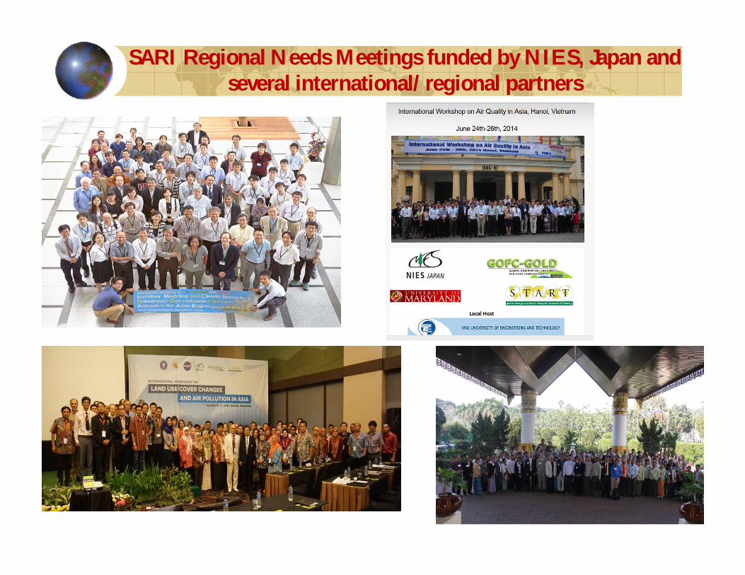
SARI Regional Needs Meetings funded by NIES, Japan and several international/regional partners

Collaborations are the Key !
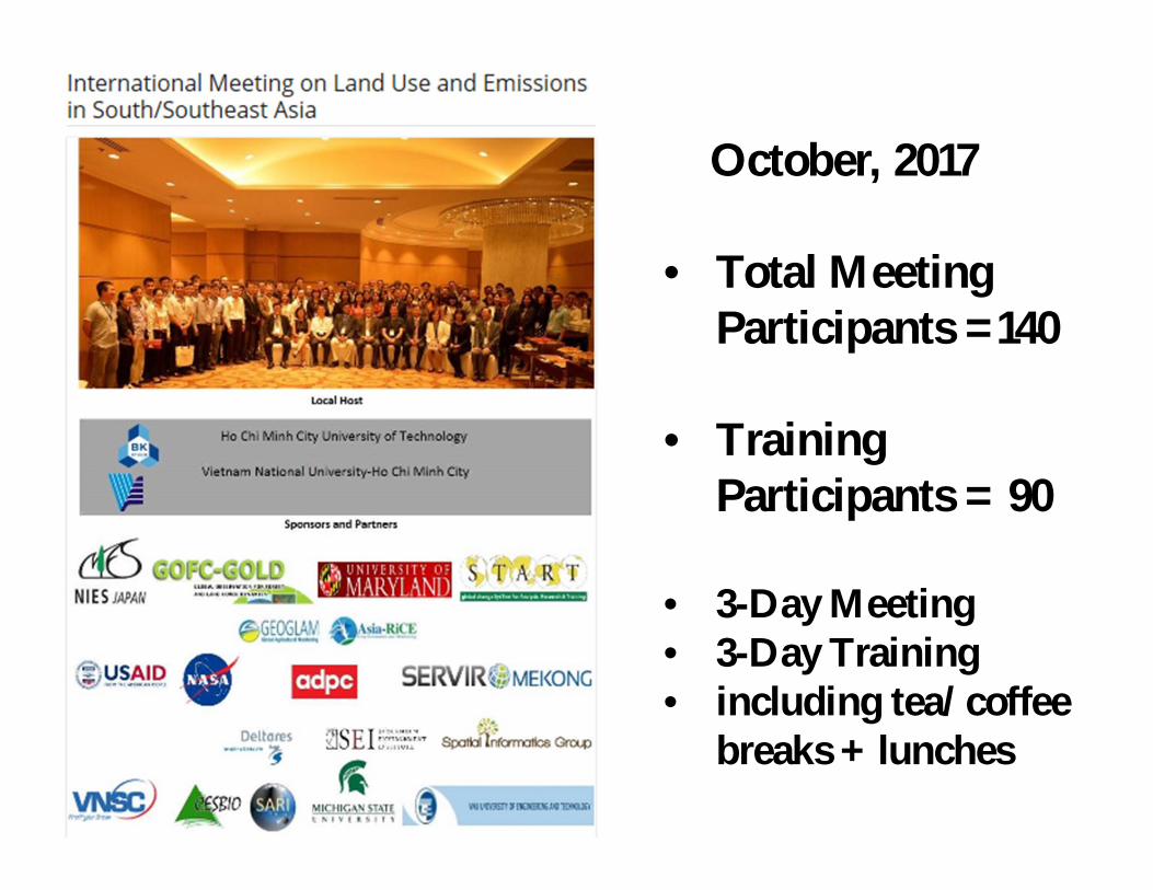
October, 2017
• Total Meeting Participants =140
• Training Participants = 90
• 3-Day Meeting• 3-Day Training• including tea/coffee
breaks + lunches

Ho Chi Minh City University of Technology
Vietnam National University-Ho Chi Minh City
22-different institutions contribution
22 different institutions/programs – Collaborations are the key to success !
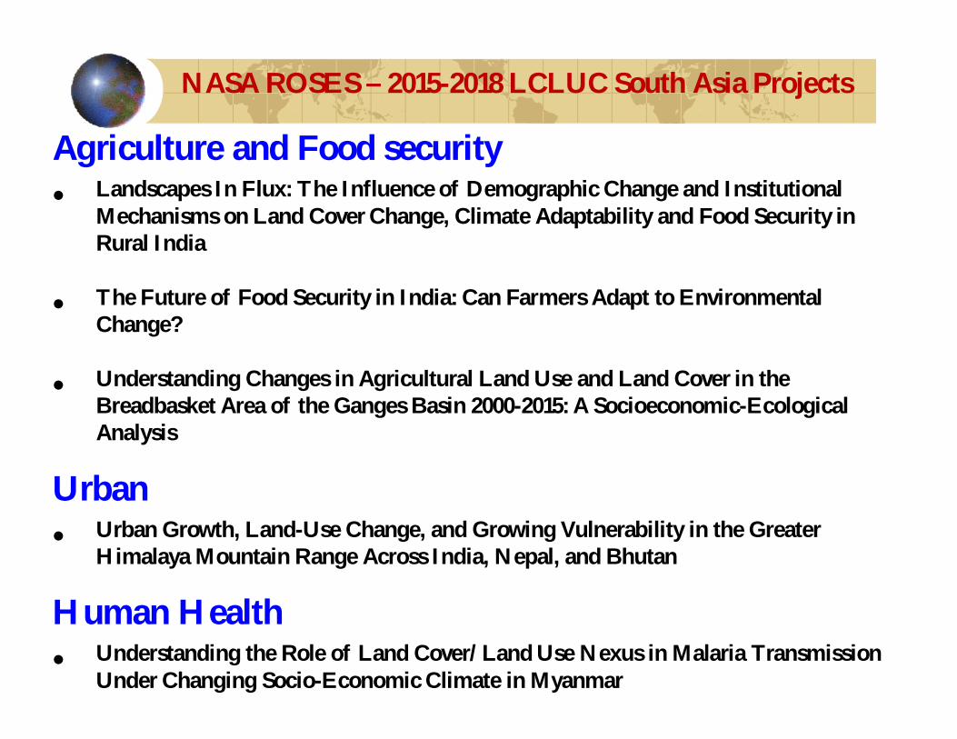
Agriculture and Food security • Landscapes In Flux: The Influence of Demographic Change and Institutional
Mechanisms on Land Cover Change, Climate Adaptability and Food Security in Rural India
• The Future of Food Security in India: Can Farmers Adapt to Environmental Change?
• Understanding Changes in Agricultural Land Use and Land Cover in the Breadbasket Area of the Ganges Basin 2000-2015: A Socioeconomic-Ecological Analysis
Urban• Urban Growth, Land-Use Change, and Growing Vulnerability in the Greater
Himalaya Mountain Range Across India, Nepal, and Bhutan
Human Health• Understanding the Role of Land Cover/Land Use Nexus in Malaria Transmission
Under Changing Socio-Economic Climate in Myanmar
NASA ROSES – 2015-2018 LCLUC South Asia Projects

Forests• Spatiotemporal Drivers of Fine-Scale Forest Plantation Establishment in
Village-Based Economies of Andhra Pradesh
• Consequences of Changing Mangrove Forests in South Asia on the Provision of Global Ecosystem Goods and Services
• Complex Forest Landscapes and Sociopolitical Drivers of Deforestation -The Interplay of Land-use Policies, Armed Conflict, and Human Displacement in Myanmar
• Impacts of Afforestation on Sustainable Livelihoods in Rural Communities in India
• Tropical Deciduous Forests of South Asia: Monitoring Degradation and Assessing Impacts of Urbanization
2015-2016 LCLUC South Asia Projects

Volume-I Volume-II
SARI - Peer Reviewed Publications

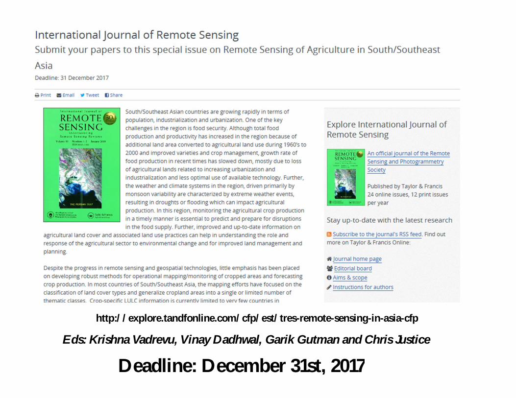
http://explore.tandfonline.com/cfp/est/tres-remote-sensing-in-asia-cfp
Deadline: December 31st, 2017Eds: Krishna Vadrevu, Vinay Dadhwal, Garik Gutman and Chris Justice
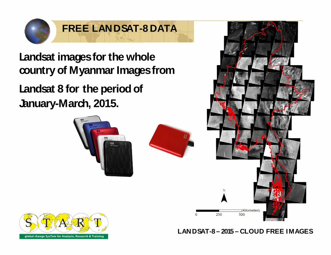
Landsat images for the whole country of Myanmar Images from
Landsat 8 for the period of January-March, 2015.
LANDSAT-8 – 2015 – CLOUD FREE IMAGES
FREE LANDSAT-8 DATA
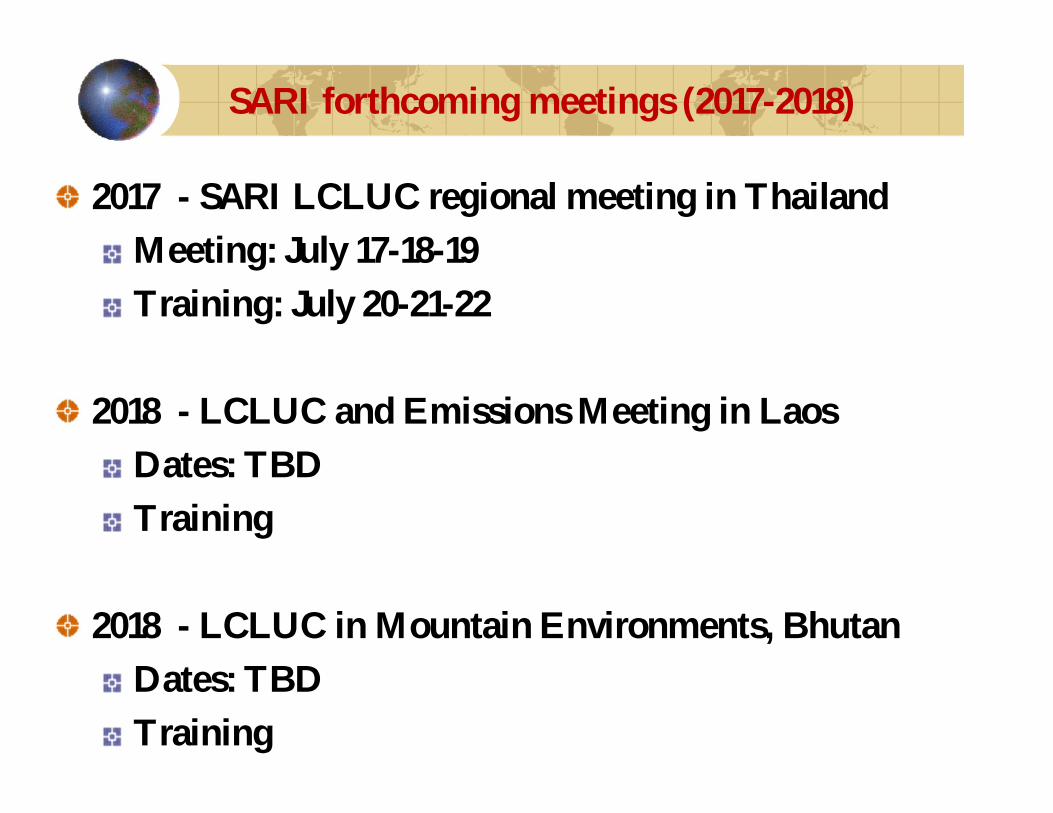
2017 - SARI LCLUC regional meeting in Thailand Meeting: July 17-18-19Training: July 20-21-22
2018 - LCLUC and Emissions Meeting in LaosDates: TBDTraining
2018 - LCLUC in Mountain Environments, BhutanDates: TBDTraining
SARI forthcoming meetings (2017-2018)

Agriculture Sector and Meeting Objectives
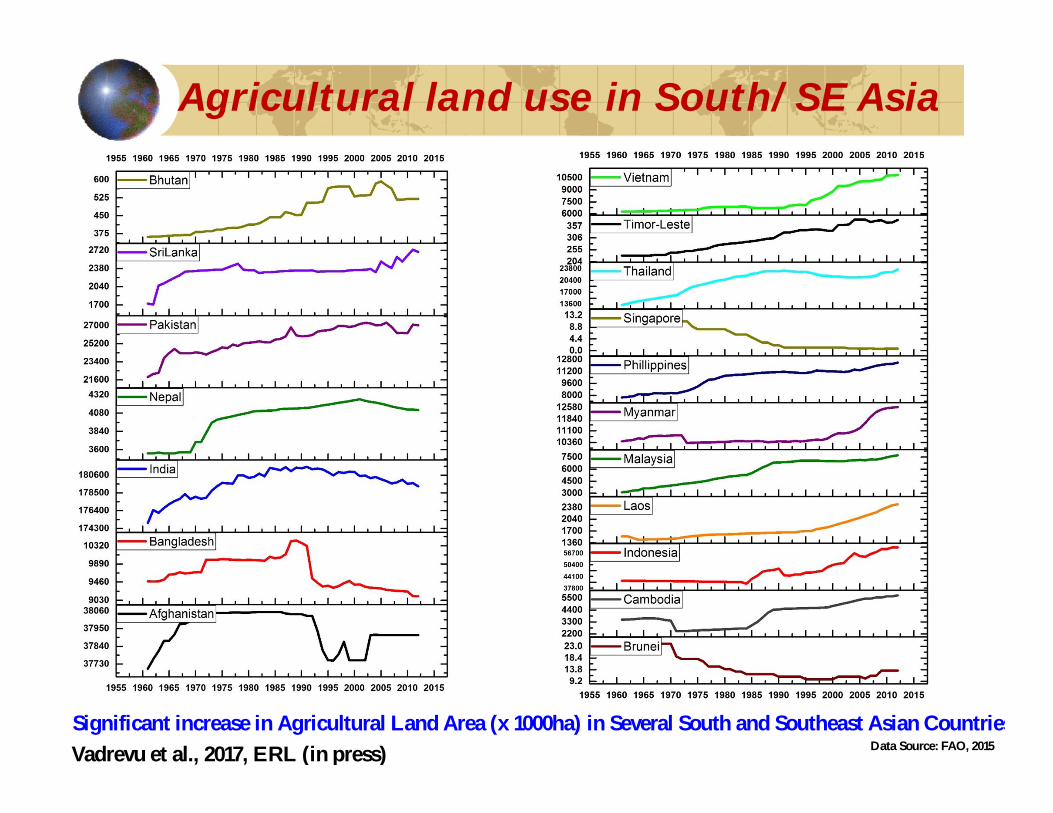
Agricultural land use in South/SE Asia
Significant increase in Agricultural Land Area (x 1000ha) in Several South and Southeast Asian CountriesData Source: FAO, 2015Vadrevu et al., 2017, ERL (in press)

Agriculture Long- term Food Security is a major concern for the region;
Agricultural production and land use is changing Crop water requirements; Extreme events (flooding and drought (almost every year!)Adaptation options needs to be explored to address food security questions
RS data needed to monitor agriculture (within season) and forecast crop production (integrating Landsat+ Sentinel + other high resolution data);
Transitioning from research to operational products3-year research projects (eg: 6-different teams working on Rice mapping in Mekong; coordination required and transitioning from research to operations;
• Crop type and area statistics• Production estimates• Yield forecasting
– GEOGLAM working on some of the above activities.
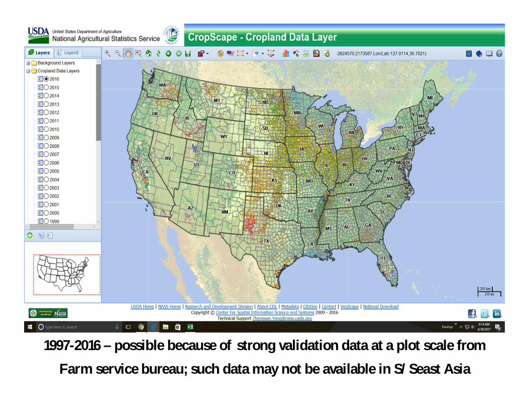
1997-2016 – possible because of strong validation data at a plot scale from
Farm service bureau; such data may not be available in S/Seast Asia
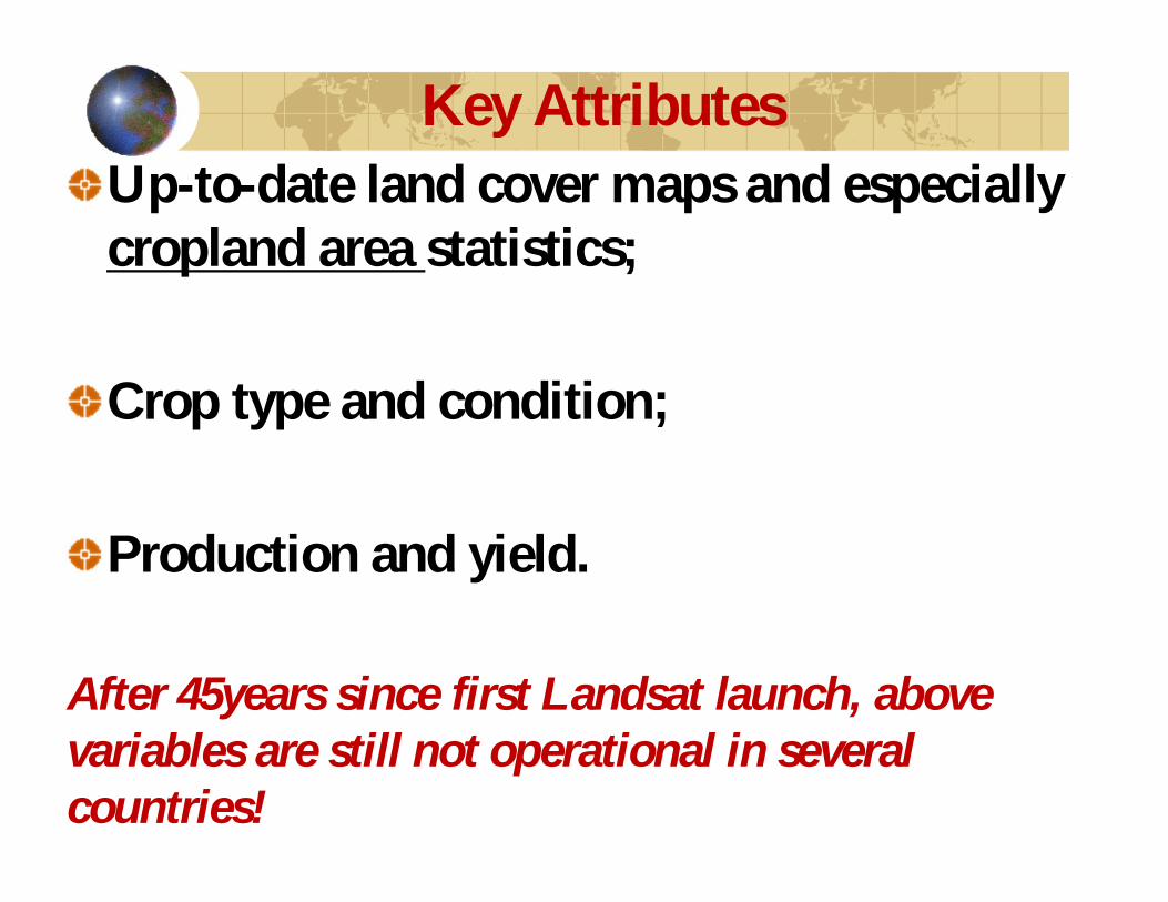
Up-to-date land cover maps and especially cropland area statistics;
Crop type and condition;
Production and yield.
After 45years since first Landsat launch, above variables are still not operational in several countries!
Key Attributes

Paddy
Leafy greens
Peppers
Tea
CLOUDS !
Harvested Potatoes
Mapping challenges! – Terrace farming in Shan State, Myanmar

Timing of sowing, harvesting, growing status, crop growth anomalies, crop calendars, crop damage w.r.t flooding, inundation, drought, disease, pest infestations, agrometeorological parameters, soil moisture, ET, improved rainfall estimates, land suitability, agroecologicalzoning status, nutrient status, crop residue mapping, disturbances, etc.
Other Attributes

Several countries in the region still lack spatial data infrastructure!

Review existing methodologies, sources of data relating to operational mapping/monitoring of crops in SARI region.
Gather information, share experiences identify needs and priorities;
Provide a forum for collaborations among the various initiatives/institutions relating to remote sensing of agriculture.
Meeting Objectives

Meeting SessionsSession-1 - Global/Regional Programs/Products Session-2 - Computational Tools and Decision Support Systems for Agricultural ResearchSession-3 - Biophysical Parameter Retrievals, Crop Type, Area and Yield Mapping/MonitoringSession-4 - Regional Land and Agricultural Mapping/Monitoring ActivitiesPanel Discussion (Day-2) : User community needs;Discussion Session (Day-3): Research needs and priorities.
http://explore.tandfonline.com/cfp/est/tres-remote-sensing-in-asia-cfp
Deadline: December 31st, 2017Eds: Krishna Vadrevu, Vinay Dadhwal, Garik Gutman and Chris Justice
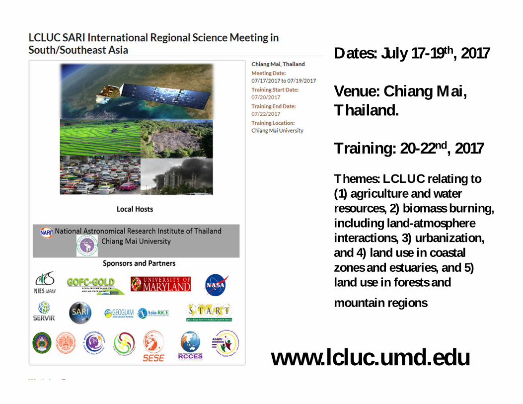
Dates: July 17-19th, 2017
Venue: Chiang Mai, Thailand.
Training: 20-22nd, 2017
Themes: LCLUC relating to (1) agriculture and water resources, 2) biomass burning, including land-atmosphere interactions, 3) urbanization, and 4) land use in coastal zones and estuaries, and 5) land use in forests and
mountain regions
www.lcluc.umd.edu

SARI website www.sari.umd.edu