the strategic challenges of ew and crises management in
TRANSCRIPT
The Strategic Challenges of EW and Crises Management in the Advent
of Big Data Era: Geoinformatics and Cartographic Ambitious
Milan KONECNY
ICA CCEW&CM
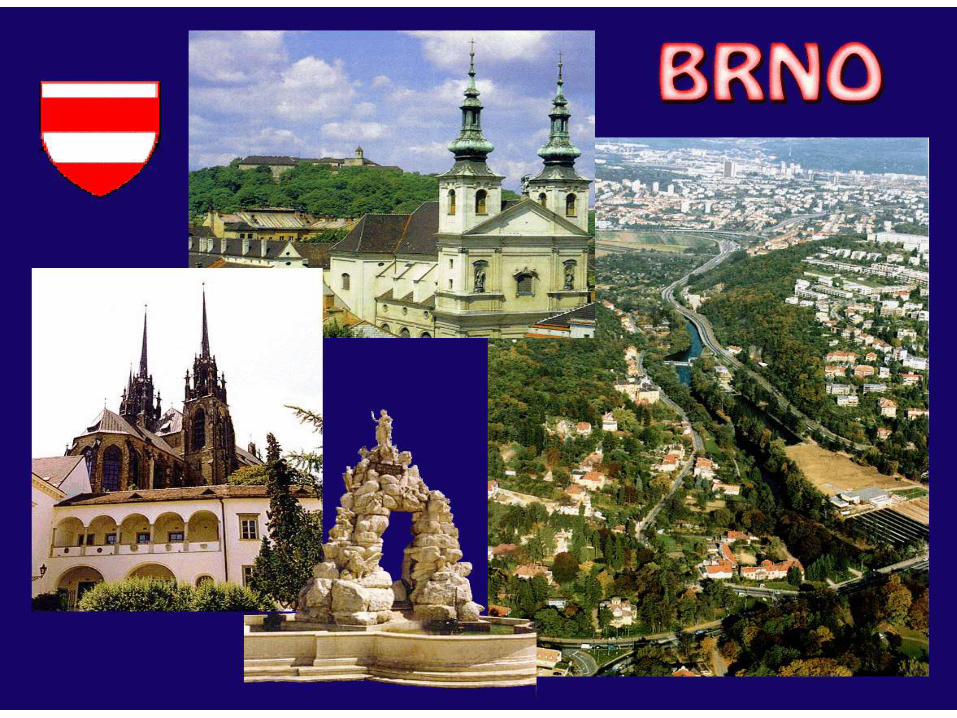
Masaryk University,, Brno, Czech Republic

CONTENT 1. Big Data – Concepts and Policies 2. Smart? What Does it Mean? 3. ICA Agenda: from DRM to DRR (Sendai 2015) 4. New trends inside geoinformatics and cartography Communication: VGI and VGE 5. Communication with specialists and wide community 6. Real-time support

1. Big Data: buzz word or reality?
Information superhighway, SDI´s, System of Systems concepts (GEO, GEOSS,..)

The development of the smart city
1993 1998 2006 2009
The "information
superhighway" starts
the information era
of the cities
Digital city Intelligent city
“The build of the digital
comfortable community”
marks the construction of
the digital city and digital
earth
IBM proposed a new
concept: “smart city”,
marking the digital
city into a new stage.
The new information
technologies such as
internet of things and
cloud computing
integrates the digital
city system.
The smart city is based on the information infrastructure and the digital city,
It pays more attention on the integration of the digital city with the real city
through ubiquitous sensor networks, puts more emphasis on the intelligent
control and the automatic feedback. It is a more advanced stage of the
digital city, and a high-degree integration of the industrialization
and information technology.
Informational-
ized city
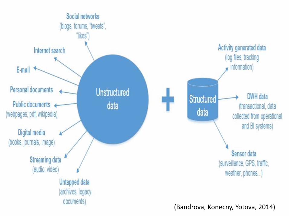
(Bandrova, Konecny, Yotova, 2014)
BD: Definitions

Zucker, S., (2014) : “a popular term used to describe the exponential growth and availability of data, both structured and unstructured” . ”There is no rigorous definition of big data. Initially the idea was that the volume of information had grown so large that the quantity being examined no longer fit into the memory that computers use for processing, so engineers needed to revamp the tools they used for analyzing it all” (Mayer-Schönberger V., Cukier K., 2013).
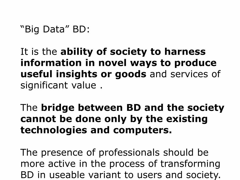
“Big Data” BD: It is the ability of society to harness information in novel ways to produce useful insights or goods and services of significant value . The bridge between BD and the society cannot be done only by the existing technologies and computers. The presence of professionals should be more active in the process of transforming BD in useable variant to users and society.

BD needs to establish teams with people coming from branches which did not work together to now. Design new complex approaches. Geographers (physical and human and economical ones), cartographers and geoinformatics + RS want to add their knowledge to enhance such linkages and develop paradigma for and supportive approaches of higher level usage of BD in everyday decision making, solving problems and improvement of life of inhabitants.
2. Smart? What Does it Mean?
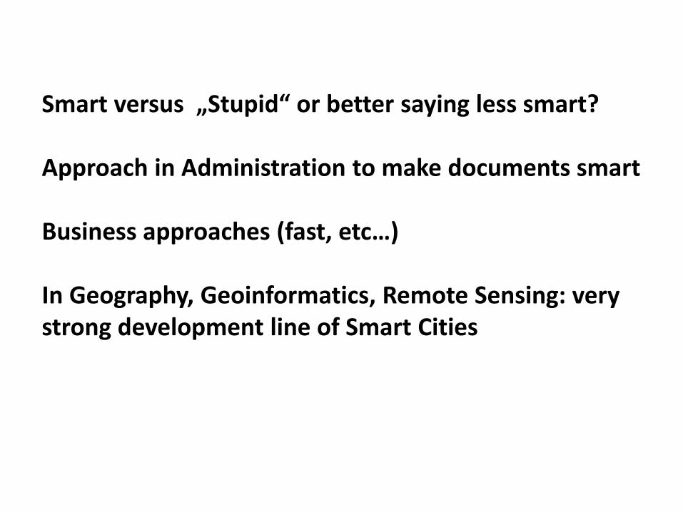
Smart versus „Stupid“ or better saying less smart? Approach in Administration to make documents smart Business approaches (fast, etc…) In Geography, Geoinformatics, Remote Sensing: very strong development line of Smart Cities

All sponsors here, Jack Dangermond, Trimble, etc,. are proclamating that if things are collected together it would guarantee smartness. Is really process giving new technologies together enough for smart solutions? And to be smart?

The success of geospatial application in any project depends upon the selection, collection, sorting and end-usage of data. As the amount of remote sensing and other geographic data keeps getting bigger every day, the traditional GIS systems are often insufficient for meaningful interpretation. Mapping and analysis become further complicated with the explosion of disruptive technologies like the cloud, embedded sensors, mobile and social media. Importance of Spatial CONTEXT. (GIS Lounge).

3. ICA Agenda: from DRM to DRR (Sendai 2015)

Jim Gray: the 4th Paradigm
第 15 页

Response •Dispatching of resources •Emergency telecom •Situational awareness •Command control coordination •Information dissemination •Emergency healthcare
Disaster Management Cycle
Prevention and Mitigation •Hazard prediction and modeling •Risk assessment and mapping •Spatial Planning •Structural & non structural measures •Public Awareness & Education..
Preparedness •Scenarios development •Emergency Planning •Training
Alert •Real time monitoring & forecasting •Early warning •Secure &dependable telecom •Scenario identification • all media alarm
Post Disaster •Lessons learnt •Scenario update •Socio-economic and environmental impact assessment •Spatial (re)planning
Recovery •Early damage assessment •Re-establishing life-lines transport &communication infrastructure
Disasters
Appreciation of Hyogo – HFA 2005
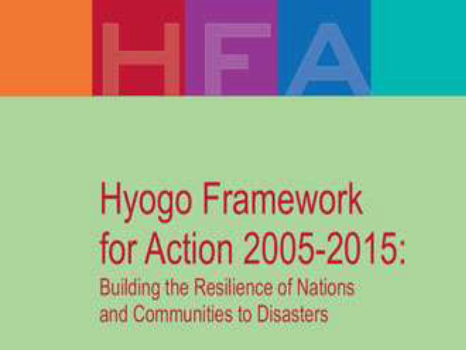

People-Centred Early Warning Systems The objective : - to empower individuals and communities threatened by hazards to act in sufficient time and in an appropriate manner so as to reduce the possibility of personal injury, loss of life, damage to property and the environment and of livelihoods.

Priorities for action – UN DRR Sendai Priority 1: Understanding disaster risk. Priority 2: Strengthening disaster risk governance to manage disaster risk. Priority 3: Investing in disaster risk reduction for resilience. Priority 4: Enhancing disaster preparedness for effective response and to “Build Back Better” in recovery, rehabilitation and reconstruction.

Priority 1: Understanding disaster risk. National and local level (c) To develop, periodically update and disseminate, as appropriate, location-based disaster risk information, including risk maps, to decision makers, the general public and communities at risk of exposure to disaster in an appropriate format by using, as applicable, geospatial information technology;

(f) To promote real time access to reliable data, make use of space and in situ information, including geographic information systems (GIS), and use information and communications technology innovations to enhance measurement tools and the collection, analysis and dissemination of data;
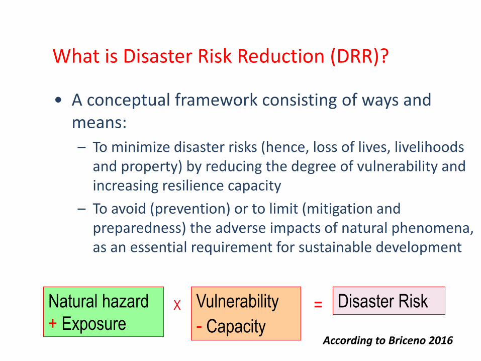
What is Disaster Risk Reduction (DRR)?
• A conceptual framework consisting of ways and means:
– To minimize disaster risks (hence, loss of lives, livelihoods and property) by reducing the degree of vulnerability and increasing resilience capacity
– To avoid (prevention) or to limit (mitigation and preparedness) the adverse impacts of natural phenomena, as an essential requirement for sustainable development
Natural hazard
+ Exposure X Vulnerability
- Capacity = Disaster Risk
According to Briceno 2016

The vision of disaster risk reduction:
building resilience into sustainable development
The six
principles of
sustainability www.colorado.edu/hazards/pu
blications/informer/infrmr3/infor
mer3c.htm

3. VGI and VGE

VGI Volunteer Geographic Information How to manage volunteer geographic information? Chaos or help?

Volunteer geographic information VGI: “The terms, “crowdsourcing” and “collective intelligence” draw attention to the notion that the collective contribution of a number of individuals may be more reliable than those of any one individual. The term VGI refers specifically to geographic information and to the contrast between the actions of amateurs and those of authoritative agencies.” Goodchild (2009, p. 18)

Traditional SDI versus VGI (podle McDougall, GSDI 12, Singapore)
Government-centric SDI User-centric VGI
SDI Structure Highly structured Ad-hoc and simplistic
Standards Close adherence to
standards
Loose based on communication
standards
Maturity of data
holdings
Highly mature New and current but variable
Spatial Accuracy Complying with mapping
standards
Variable
Metadata Contain detailed metadata Few standards – ICT based
Openness Highly controlled Often new data sets
Data Update Often slow and overly
bureaucratic
Fast and flexible
Potential data
maintenance and
collection base
Limited to the budget and
staffing
Potentially a huge user and
contributor base
Adaptability Low – retrained by mandate,
resources and bureaucracy
High
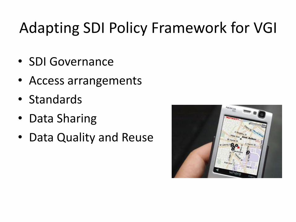
Adapting SDI Policy Framework for VGI
• SDI Governance
• Access arrangements
• Standards
• Data Sharing
• Data Quality and Reuse

Michael Batty first used the term ‘virtual geography’ in 1997 (Batty 1997), the term ‘Virtual Geographic Environments’ (VGEs) was formally proposed by Lin and Gong as a concrete study object of the discipline of virtual geography (Lin and Gong, 2001). Combined with the two terms above, a VGE can be regarded as a typical virtual-based geographic environment that allows users to ‘feel the geographic scenarios in person’ and ‘know the geographic laws beyond reality’ (Lin et al. 2013b).

New branch of Geographic Information Science (GIScience) Although the main concept remains the same, the development process indicates that VGEs have experienced a gradual evolution in terms of their content and functions. Overall, three primary stages are apparent. (1) The period from 1998 to 2002 can be regarded as the embryonic period of VGEs. BTW Five types of space (i.e. internet space, data space, 3D geographic space, personal perceptual and cognitive space, and social space) are defined to characterize VGEs.
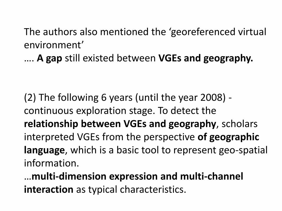
The authors also mentioned the ‘georeferenced virtual environment’ …. A gap still existed between VGEs and geography. (2) The following 6 years (until the year 2008) -continuous exploration stage. To detect the relationship between VGEs and geography, scholars interpreted VGEs from the perspective of geographic language, which is a basic tool to represent geo-spatial information. …multi-dimension expression and multi-channel interaction as typical characteristics.

(3) The most recent five years (2009-2013) are regarded as the explosive stage of VGEs. These five years clearly clarified and concentrated the conception of VGEs. Lin et al. (2013a, 2013b) re-described their proposed VGEs as a new generation of geographic analysis and computer-aided geographic experiment tools. VGEs are ‘a type of typical web- and computer-based geographic environment’ built ‘by merging geographic knowledge, computer technology, virtual reality technology, network technology, and geographic information technology’, …..

…. and ‘with the objective of providing open, digital windows into geographic environments in the physical world, to allow users to ‘feel it in person’ by a means for augmenting the senses and to ‘know it beyond reality’ through geographic phenomena simulation and collaborative geographic experiments’. VGE will ‘contribute to human understanding of the geographic world and assist in solving geographic problems at a deeper level’ (Lin et al. 2013b). ….. definition of a VGE has a closer relationship to geography.

Figure 1. Current structure of a complete VGE (modified from Lin et al. 2013b)
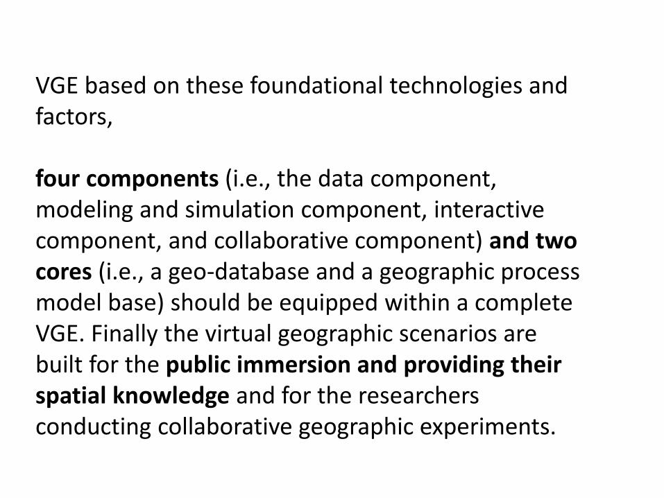
VGE based on these foundational technologies and factors, four components (i.e., the data component, modeling and simulation component, interactive component, and collaborative component) and two cores (i.e., a geo-database and a geographic process model base) should be equipped within a complete VGE. Finally the virtual geographic scenarios are built for the public immersion and providing their spatial knowledge and for the researchers conducting collaborative geographic experiments.

5. Communication with specialists and wide community

Hui Lin, Brno, 2011:
What are we looking for?
•Feeling it in person
•Knowing it beyond reality
A new framework for the communication of
geographic Information and knowledge.

Successful Response Starts with a Map: Improving Geospatial Support for Disaster Management, NRC (2007)
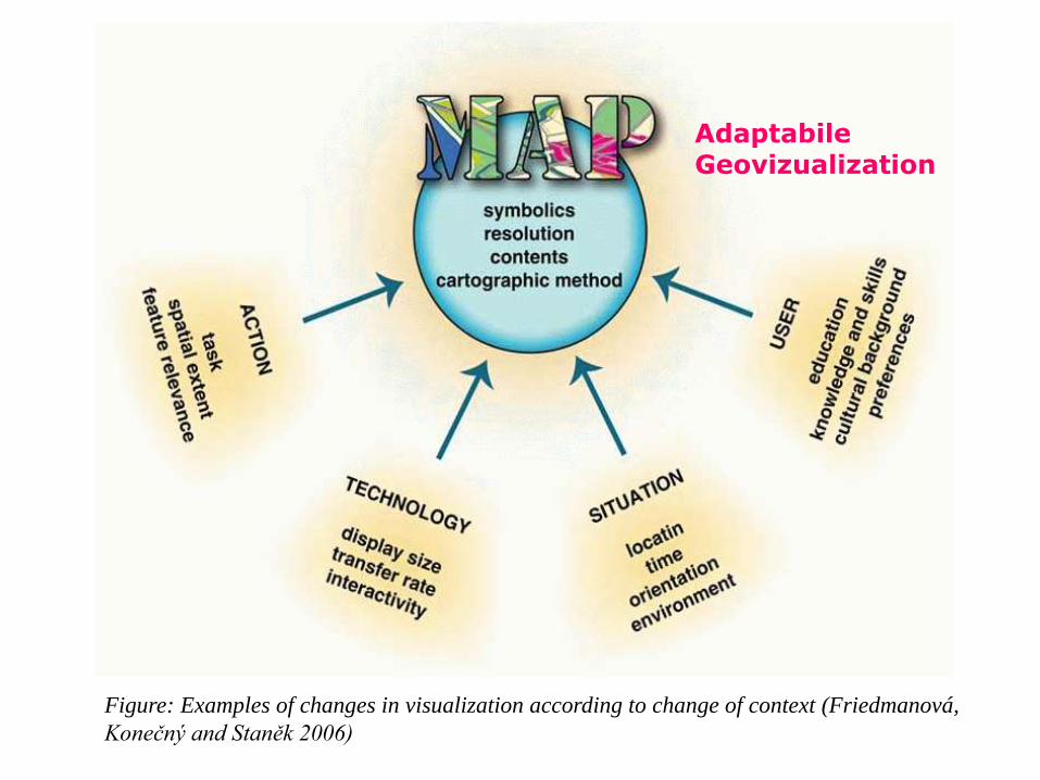
Adaptabile Geovizualization
Figure: Examples of changes in visualization according to change of context (Friedmanová,
Konečný and Staněk 2006)

Disaster management cycle
•User requirements and specifics differ within EM cycle
•Better cartographic support in all stages •Consequences: minimizing of losses
DYNAMIC GEOVISUALIZATION
in
CRISES MANAGEMENT CONTEXT and ADAPTIVE MAPPING
Prof. RNDr. Milan KONEČNÝ, CSc.
and Team

• Project by complex way investigated process of creation, updating, generalization and transmission of geoinformation to users and its visualization.
• Inspiration from floods (Morava-1997, Čechy-2002), catastrophes inthe World, tsunamis, etc.
• SDI – start of realization (GMES, INSPIRE, GEO)
• Underevaluating of the role of cartography, geoinformatics, geography; dynamize information support – important improvement of the quality of decision makig and management.
Philosophy of the project - 1

• Part of the project complex approache have been also
geoinformatics, geostatistics, cartographic, environmental and
psychological aspects, which fundamentaly influence acceptation
of personal using of geoinformation in practice.
• Effort to bring to the Czech environment unique knowledge from
theoretical-methodological solutions necessary for
implememntation of new EU and global projects and building of
national, regional and continental SDIs.
Philosophy of the project - 2
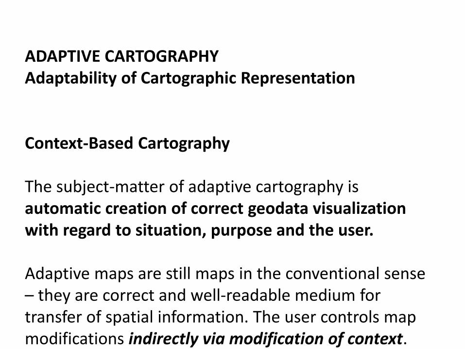
ADAPTIVE CARTOGRAPHY Adaptability of Cartographic Representation Context-Based Cartography The subject-matter of adaptive cartography is automatic creation of correct geodata visualization with regard to situation, purpose and the user. Adaptive maps are still maps in the conventional sense – they are correct and well-readable medium for transfer of spatial information. The user controls map modifications indirectly via modification of context.

Personality of map users
Cognitive style
Cognitive style or "thinking style" is a term used in cognitive psychology to describe the way individuals think, perceive and remember information, or their preferred approach to using such information to solve problems. Cognitive style differs from cognitive ability…. (Konecny et al., 2011 Usability of selected base maps for crises management – users perspectives. Applied Geomatics, DOI 10.1007/s12518-011-0053-1. Springer JW. 2011, pp. 1-10. ISSN 1866-9298.)
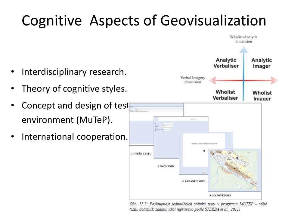
• Interdisciplinary research.
• Theory of cognitive styles.
• Concept and design of test
environment (MuTeP).
• International cooperation.
Cognitive Aspects of Geovisualization

6. Real-time information and support Sensors, Web’s But also elaborated information for public administraation (Lienert)


THANK YOU !!!!!
Xie, XieO Brigado
Bardzo Dziekuje Chvala
Muchas Gracias Terima KasimO Brigada
Kammsa Hamida Aligator
SHUKRAN BLAGODARJA
DĚKUJI ( in Czech)