the water planet the oceans cover 71% of the planet and regulate its climate and atmosphere
TRANSCRIPT
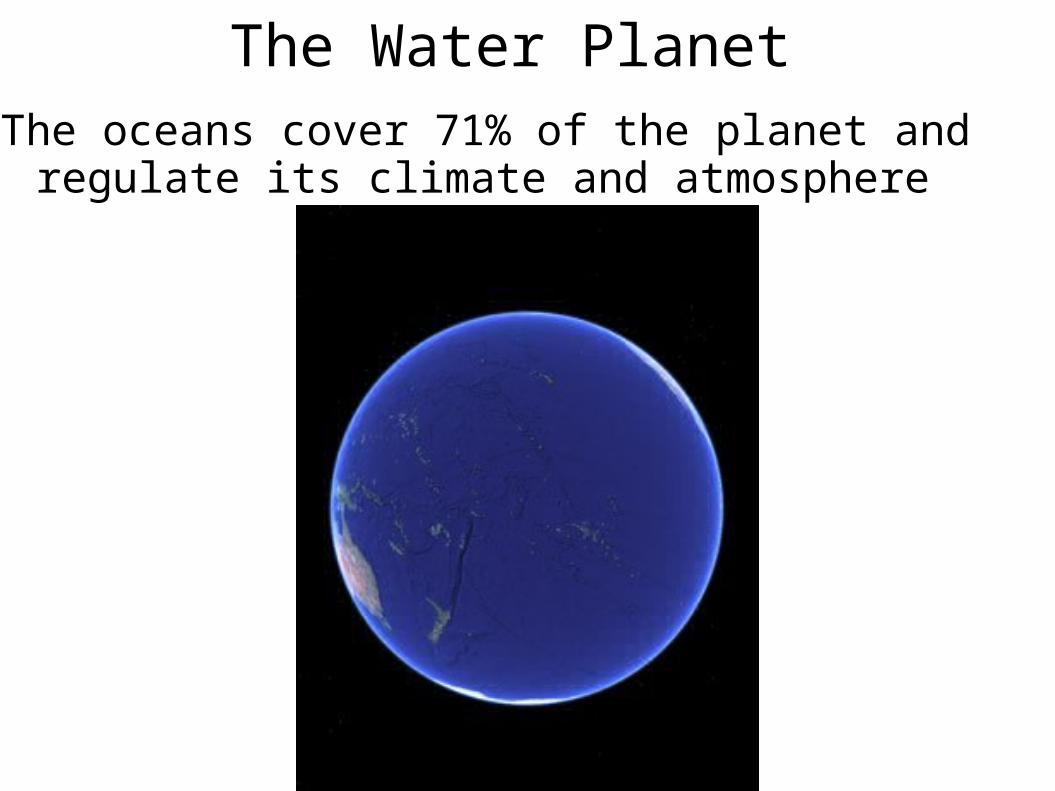
The Water Planet The oceans cover 71% of the planet and regulate its
climate and atmosphere
There are four ocean basins
1.Pacific – the deepest and largest
2.Atlantic
3.Indian
4.Arctic – smallest and shallowest
The Geography of the Ocean Basins

The Geography of the Ocean Basins
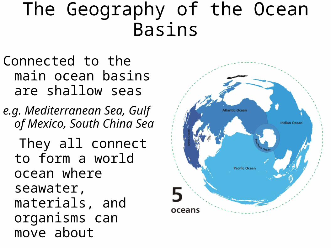
Connected to the main ocean basins are shallow seas
e.g. Mediterranean Sea, Gulf of Mexico, South China Sea
They all connect to form a world ocean where seawater, materials, and organisms can move about

The Structure of the Earth

In the early molten Earth, lighter materials floated toward the surface
• They cooled to form the crust
• The atmosphere and oceans then formed
• Earth is the right distance from the sun for liquid water, and life, to exist
Internal Structure

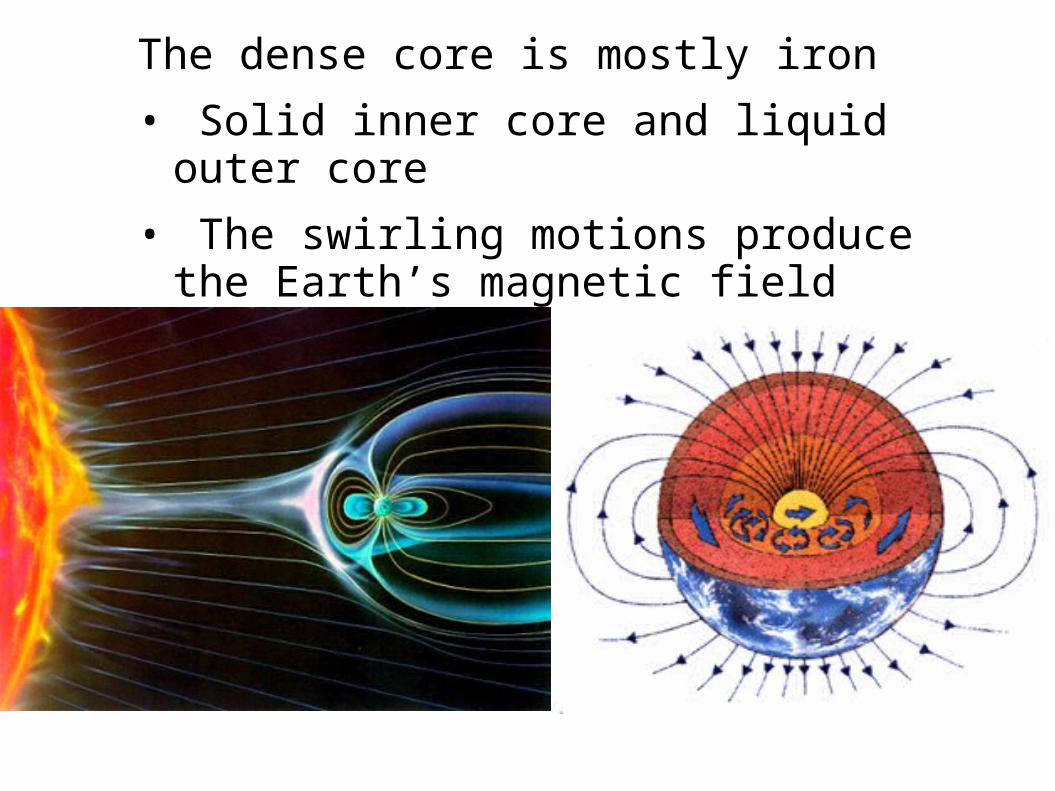
The dense core is mostly iron
• Solid inner core and liquid outer core
• The swirling motions produce the Earth’s magnetic field
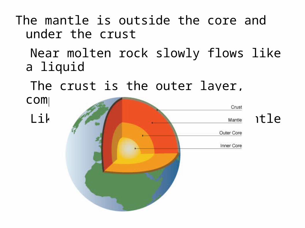
The mantle is outside the core and under the crust
Near molten rock slowly flows like a liquid
The crust is the outer layer, comparatively thin
Like a skin floating on the mantle
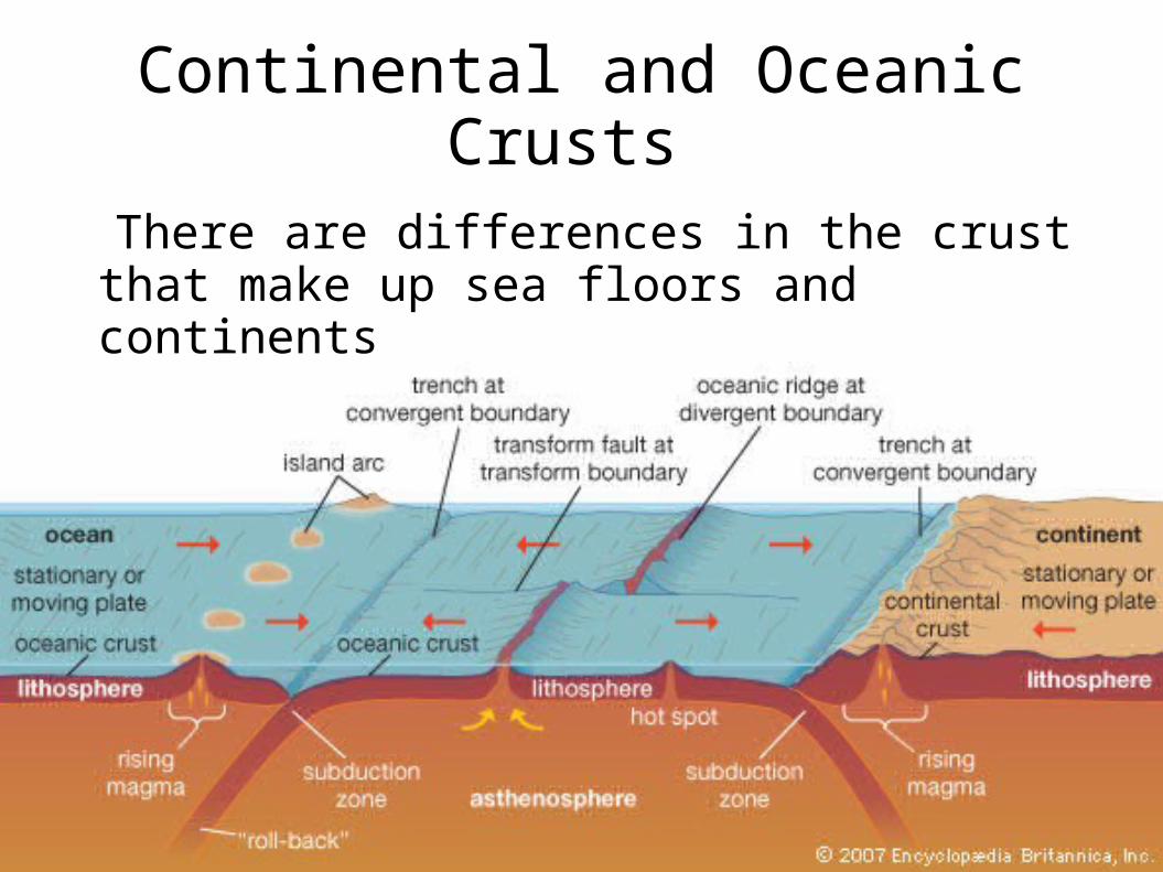
Continental and Oceanic Crusts
There are differences in the crust that make up sea floors and continents

Ocean crust
Made of basalt – a dark mineral
• More dense
• Thinner
• Younger rock; 200 mil years

Continental crust
Made of granite – lighter color
• Less dense
• Thicker
• Older rock; 3.8 bil years

So continental crust floats high on the mantle and ocean crust floats lower
That’s why ocean crust is covered by water

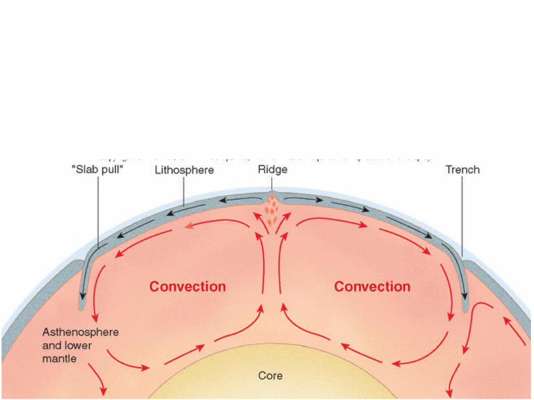
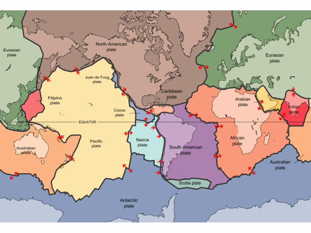
The plates float on a fluid layer of the upper mantle called the asthenosphere.
• At mid-ocean ridges the plates move apart
• If the plate has continental crust it carries the continent with it
• Spread 2-18 cm/year
• This explains continental drift
Asthenosphere

END

The plates colliding can be ocean ->continent
♦ Ocean plates always sinks below
♦ Produces earthquakes and volcanic mountain
ranges; e.g. Sierra Nevada

The plates colliding can be cont -> cont
♦ Neither plate sinks, instead they buckle
♦ Producing huge mountain ranges; e.g. Himalayas

The plates colliding can be ocean -> ocean
♦ Earthquakes and volcanic island arcs; e.g. Aleutian
Islands

The Origin and Structure of the Ocean Basins
The Earth is a world of constant transformation, where even the continents move

400 years ago Sir Francis Bacon noted the continental coasts of the Atlantic fit together like pieces of a puzzle
Later suggested the Americas might have been once joined to Europe and Africa
Geologic formations and fossils matched from opposing sides
Early Evidence of Continental Drift


Alfred Wegner gave hypothesis of Continental Drift in 1912
Suggested that all the continents had once been a supercontinent, named Pangea
Started breaking up ~180 mil years ago
Early Evidence of Continental Drift
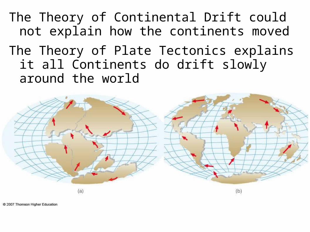
The Theory of Continental Drift could not explain how the continents moved
The Theory of Plate Tectonics explains it all Continents do drift slowly around the world
© 2011 Pearson Education, Inc.
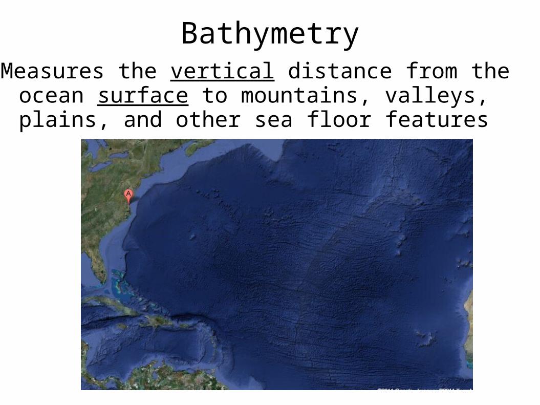
BathymetryMeasures the vertical distance from the ocean surface
to mountains, valleys, plains, and other sea floor features

© 2011 Pearson Education, Inc.
Bathymetry OverviewThe study of bathymetry
charts ocean depths and ocean floor topography.
Echo sounding and satellites are efficient bathymetric tools.
Most ocean floor features are generated by plate tectonic processes.
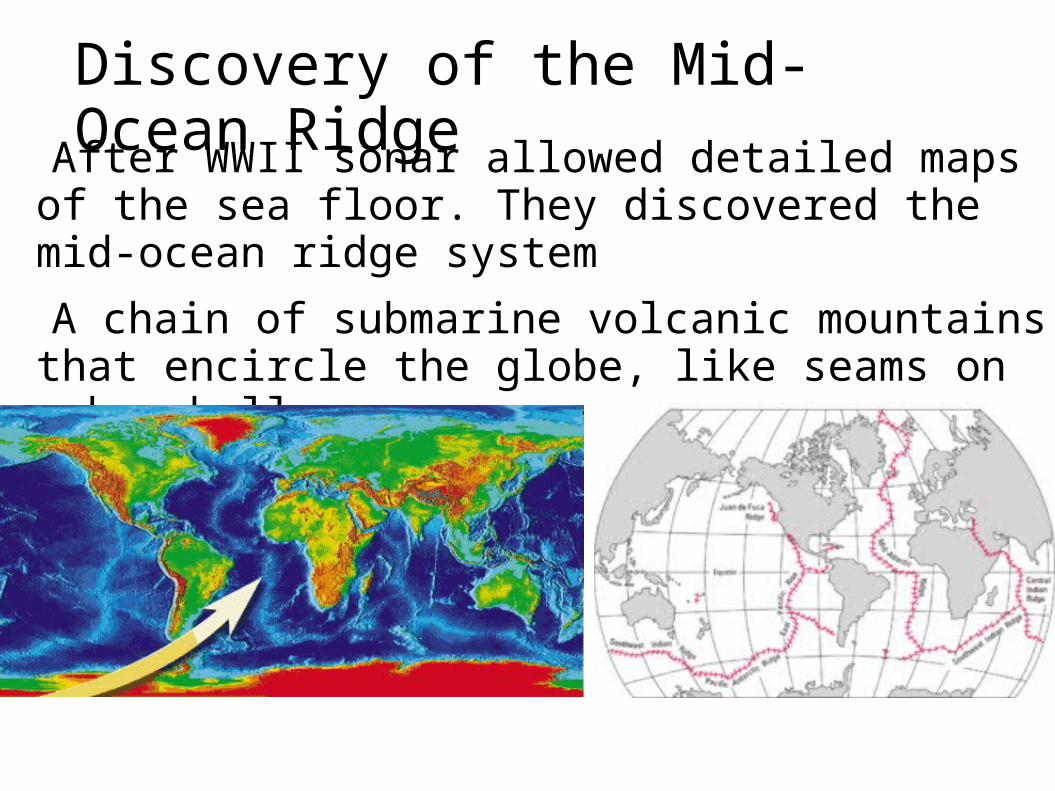
After WWII sonar allowed detailed maps of the sea floor. They discovered the mid-ocean ridge system
A chain of submarine volcanic mountains that encircle the globe, like seams on a baseball
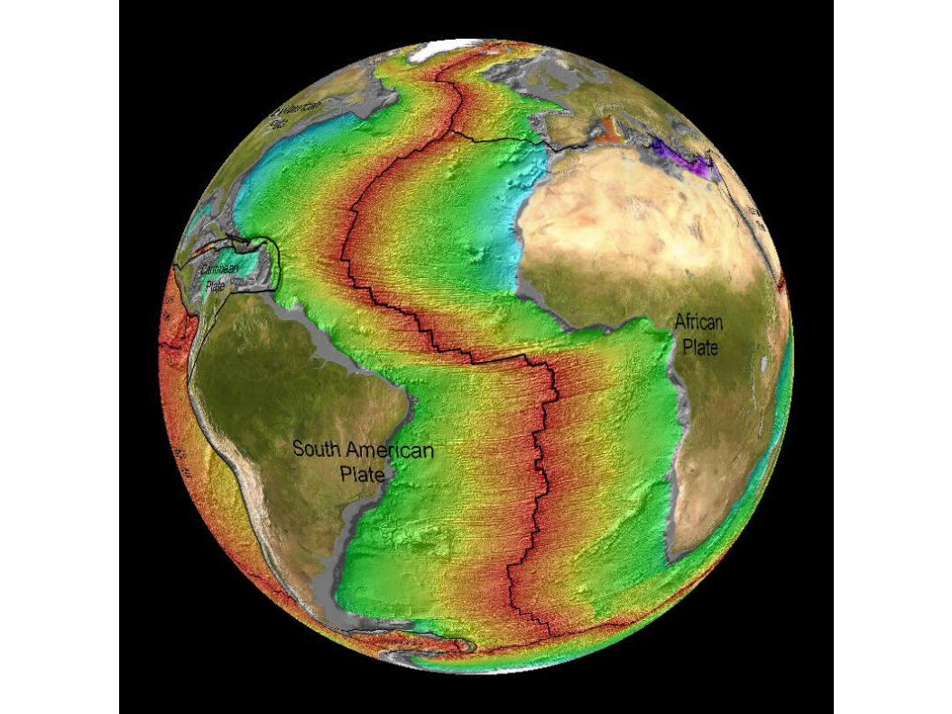
Discovery of the Mid-Ocean Ridge

The largest geological feature on Earth
Some of the mountains rise above sea level to form islands, e.g. Iceland
The mid-Atlantic ridge runs down the center of the Atlantic Ocean and follows the curve of the opposing coastlines
Mid-Ocean Ridge
Sonar also discovered deep trenches


Why are they there? How were they formed?
Lots of seismic and volcanic activity around
the ridges and trenches
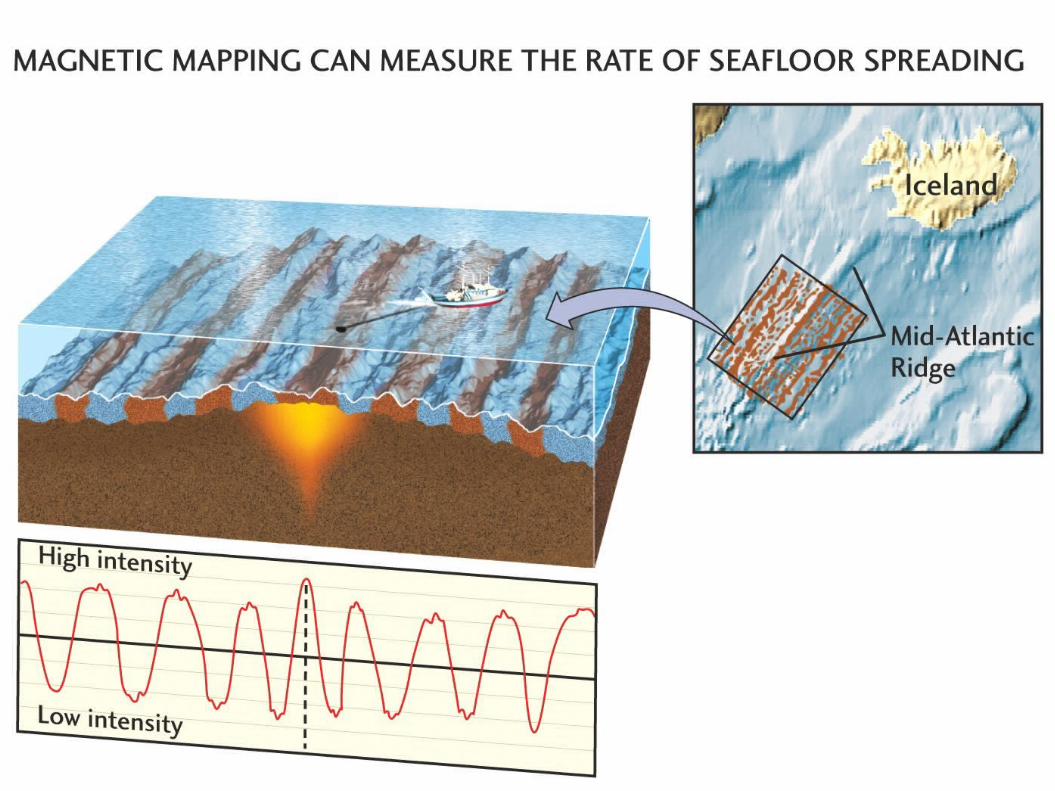
Rock near the ridge is young and gets older
moving away from the ridge
There is little sediment near the ridge, but it
gets thicker moving away
Significance of the Mid-Ocean Ridge
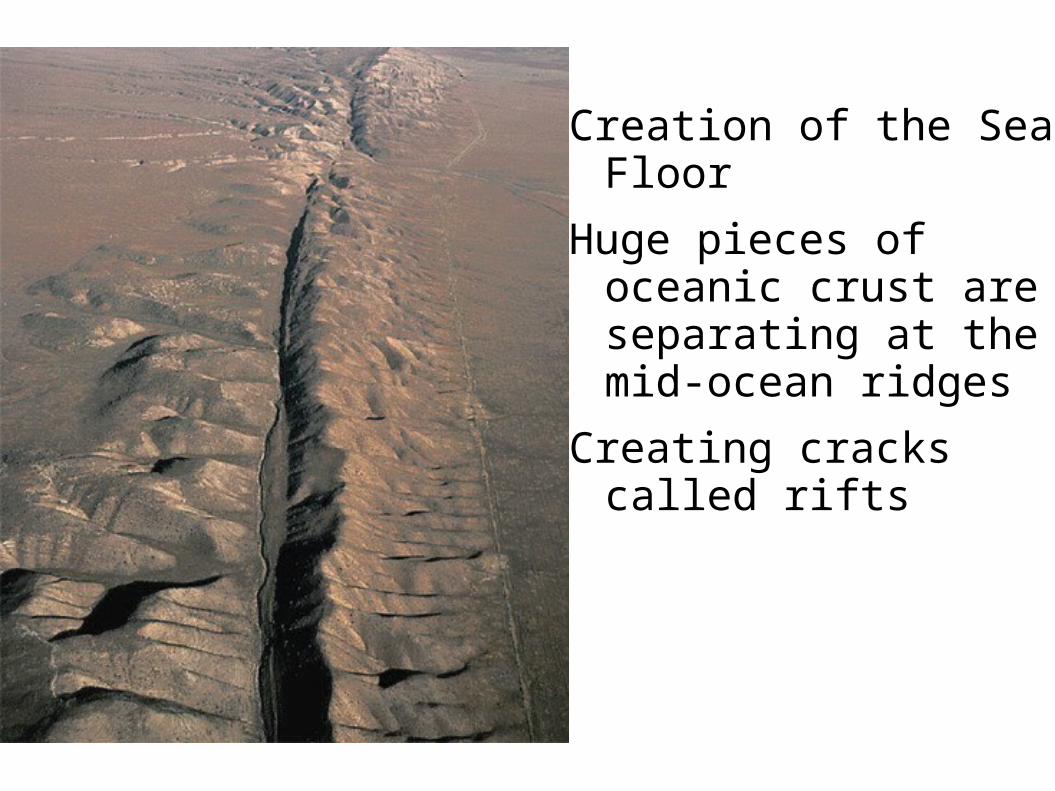
Creation of the Sea Floor
Huge pieces of oceanic crust are separating at the mid-ocean ridges
Creating cracks called rifts

Image: A diver swims between the Eurasian and North American plates in Thingvellir lake, Thingvellir National Park, Iceland. Iceland is one place where a mid-ocean ridge can be seen on land and in shallow waters.(credit: Wild Wonders of Europe/Lundgre)

The sea floor moves away from the ridge
This continuous process is called sea-floor spreading
New sea floor is created
Magma from the mantle rises through the rift forming the ridge

This explains why rocks are older and sediment is thicker as you move away from the ridge
This also explains the magnetic stripes found in the sea floor


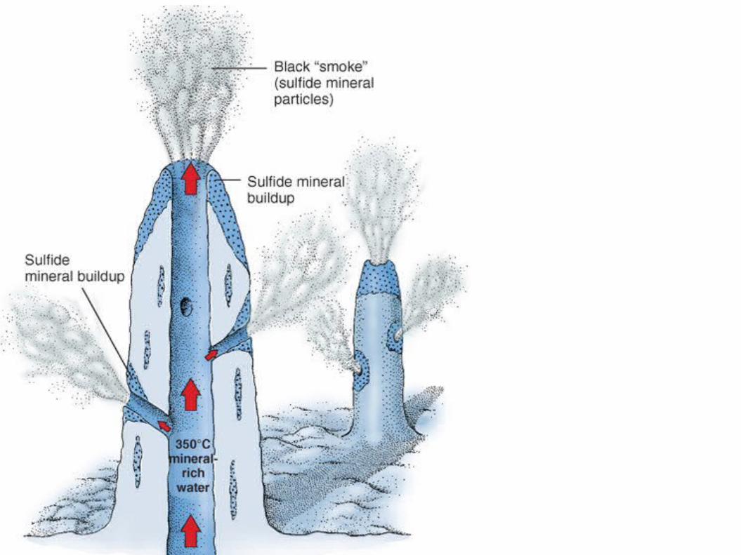
The Mid-Ocean Ridge and Hydrothermal Vents
At the center of the ridge, where the plates pull apart, is a central rift valley
Water seeps down through cracks, gets heated by the mantle, then emerges through hydrothermal vents 350oC (660oF)

Dissolved minerals from the mantle, like sulfides, are brought up
Black smokers form when minerals solidify around a vent
Marine life, including chemosynthesizers, exist around hydrothermal vents

END
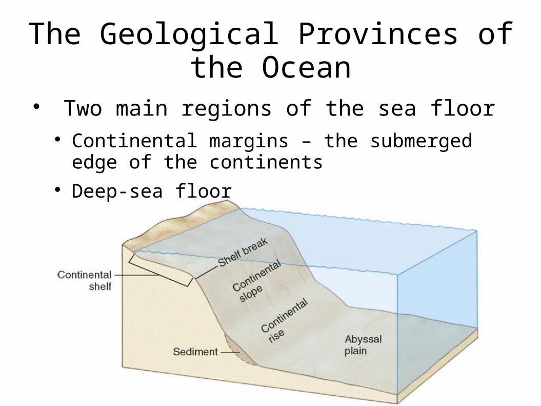
The Geological Provinces of the Ocean
Two main regions of the sea floor Continental margins – the submerged edge of the
continents Deep-sea floor
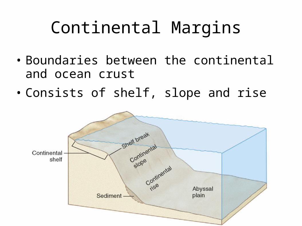
Continental Margins
• Boundaries between the continental and ocean crust
• Consists of shelf, slope and rise

The Continental Shelf
• The shallowest part
• Only 8% of the sea floor, but biologically rich and diverse
• Large submarine canyons can be found here
• Ends at the shelf break, where it steeply slopes down
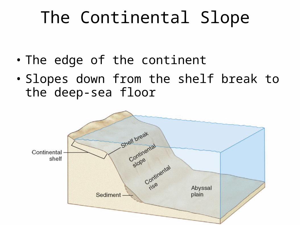
The Continental Slope
• The edge of the continent
• Slopes down from the shelf break to the deep-sea floor
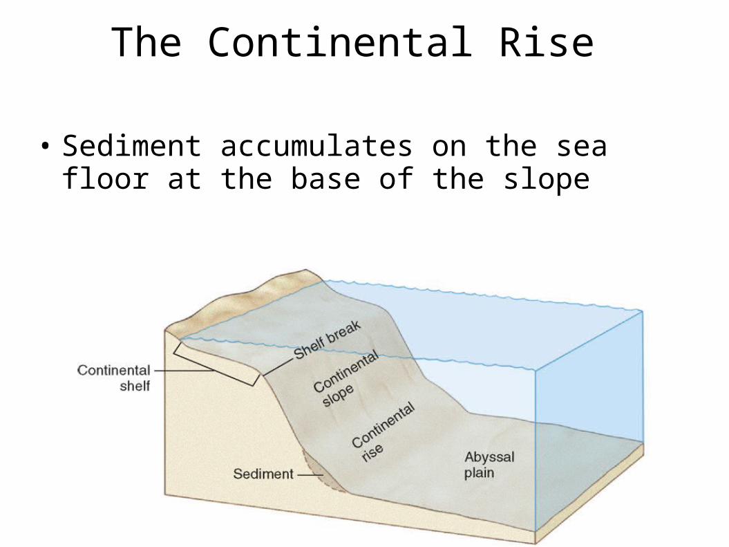
The Continental Rise
• Sediment accumulates on the sea floor at the base of the slope

Deep-Ocean Basins
• 10,000-16,000 ft
• Abyssal plain - flat region of the sea floor
• Seamounts – submarine volcanoes
• Guyots – flat-topped seamounts
• Both were once islands, but now covered with water
• Trenches – the deepest part of the ocean


END.