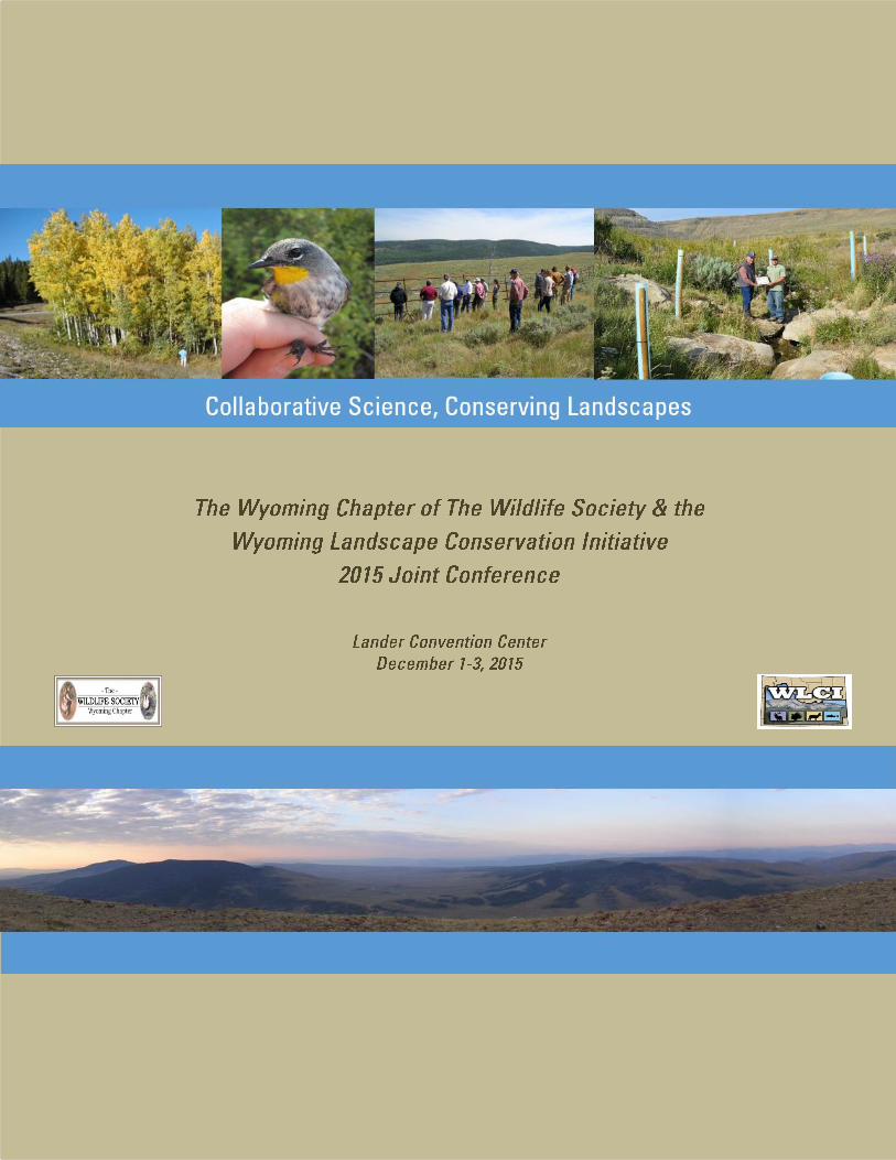
the wyoming chapter of the wildlife society – annual
TRANSCRIPT
1
9
9
15
19
19
24
30
36
41
47
58
62
62
62
63
64
1
2
3
4
5
6
7
8
9
(Presenting author underlined student presentations noted with an asterisk)
Management and conservation of Wyomingrsquos valuable natural resources require a thorough
understanding of a constantly changing landscape In this session we explore new methods and
tools to collect and analyze scientific data including new laboratory capabilities and enhanced
temporal and spatial analytical techniques to provide a landscape-level understanding of emerging
issues These presentations emphasize the use of these tools to improve research and operations
activities contributing to responsible resource development and management decisions by Federal
State and local governments academia and the private sector
GROUNDWATER AND SURFACE-WATER INTERACTION IN THE UPPER GREEN RIVER
BASIN
Cheryl A Eddy-Miller1 Jerrod D Wheeler2 and Ruth M Law2
1USGeological Survey Wyoming-Montana Water Science Center 521 Progress Circle Suite 6
Cheyenne WY 82007 USA Email cemillerusgsgov 2USGeological Survey Wyoming-Montana Water Science Center 1225 Market Street Riverton WY
82501 USA
The upper Green River Basin in southwestern Wyoming provides important habitat for a variety
of aquatic and terrestrial species as well as supporting multiple land uses including energy
extraction agriculture and tourism Groundwater and surface-water resources of this semi-arid
basin are critical to both wildlife and human activities Understanding the interaction between
streams and nearby groundwater in unconsolidated shallow aquifers is an important component
for describing stream dynamics In particular groundwater contribution to streamflow can
moderate stream temperature during the summer and provide a source of water during winter in
the form of base flow The USGS is using new methods for determining groundwater and
surface-water interaction by installing shallow wells on both stream banks at two existing long-
term streamgages in the upper Green River Basin These sites located on the New Fork River
near Big Piney Wyoming and on the Green River near LaBarge Wyoming are being utilized to
understand the dynamics of the groundwater and surface‐water system in that part of the Basin
Water elevation and temperature data from both the wells and streams are being used to
determine when the stream may be losing water to or gaining water from groundwater These data
will be input into a two-dimensional model to estimate the volume of water loss or gain to the
stream at that location Additionally geohydrologic analysis of the northern Green River
structural basin shows groundwater in select bedrock units that underlie the shallow aquifers in
some areas are under pressure Water from wells completed this bedrock can often flow without
a pump and a flowing (artesian) well was drilled near the New Fork River streamgage during
August 2015 Data from the flowing well will be used to describe potential groundwater flow
from the deeper pressurized bedrock into the shallow aquifers and subsequently into area
streams
10
SPATIAL AND TEMPORAL TRENDS OF DROUGHT EFFECTS ON ASPEN FOREST IN
SOUTHWESTERN WYOMING
Timothy J Assal1 Patrick J Anderson1 and Jason Sibold2
1US Geological Survey (USGS) Fort Collins Science Center 2150 Centre Avenue Fort
Collins CO 80526 USA Email assaltusgsgov 2Department of Anthropology Colorado State University 1787 Campus Delivery Fort Collins CO 80523
USA
Drought-induced forest mortality has been reported in western North America over the last
decade Of particular concern is decline in aspen forest which provides important habitat for
many wildlife species and domestic livestock Understanding patterns of mortality and forest
response to severe drought is important to resource managers given the frequency of these
events are expected to increase in the future Vegetation indices derived from remotely sensed
data can be used to analyze forest condition over large areas and over long time periods We
analyzed a 22-year (1985-2012) time series of satellite data to determine changes in forest that
experienced a relatively dry period since 2000 punctuated by two years of extreme drought We
modelled the relationship between satellite-derived productivity and field data then applied the
model to the long-term data series to uncover the location direction and timing of change The
Normalized Difference Moisture Index (NDMI) had the strongest correlation with plant area
index (R2 = 064) and canopy gap fraction (R2 = 065) Trends were not consistent with respect
to forest type or topography as northern aspects were most likely to exhibit a negative trend
During the study period over twice as much aspen forest (165) experienced a significant (p lt
005) negative trend compared to a positive trend (71) Field plots with a negative trend had a
lower live density and higher amounts of standing dead and down trees compared to plots with
no trend Our analysis identifies spatially explicit patterns of long-term trends anchored with
ground-based evidence to highlight areas of forest that are resistant persistent or vulnerable to
severe drought The results provide a long-term perspective on forest condition in this area and
can be used to inform management actions and monitoring at local scales
ESTIMATING RESOURCE LIMITATION IN MOOSE USING ENDOCRINE TOOLS
Brett R Jesmer12 Jacob R Goheen1 Kevin L Monteith12 and Matthew J Kauffman13
1 Program in Ecology Department of Zoology and Physiology University of Wyoming
Laramie WY 82071 USA Email bjesmeruwyoedu 2Wyoming Cooperative Fish and Wildlife Research Unit Department of Zoology and
Physiology University of Wyoming Laramie WY 82071 USA 3United States Geological Survey Wyoming Cooperative Fish and Wildlife Research Unit
Department of Zoology and Physiology University of Wyoming Laramie WY 82071 USA
The success of many management efforts rest on understanding how energy availability affects
population performance Because population-level energy limitations signal that a population is
near its carrying capacity methods for estimating energy-performance relationships are needed
To meet this need endocrinology has recently emerged as a popular tool for estimating energy-
performance relationships Endocrine markers such as glucocorticoids (GC) and
triiodothryonine (T3) reflect both energy reserves and energy intake in small-bodied animals and
in animals within controlled laboratory conditions It is unclear however whether these
endocrine markers translate to energy reserves and energy intake for large free-ranging animals
that possess greater fasting endurance and the ability to adjust their foraging behavior in
response to energy deficits We investigated relationships among endocrine markers and metrics
of energy reserves and energy intake in free-ranging moose (Alces alces) T3 increased as
energy reserves declined a pattern opposite to predictions derived from animals in controlled
11
laboratory conditions GC was poorly associated with energy reserves but increased predictably
with increased energy intake thus supporting a previously posited anti-stress hypothesis The
directionality of these relationships indicate moose forage in a state-dependent manner where
individuals with few reserves have greater energy intake than individuals with ample reserves It
is often assumed that GC and T3-energy relationships developed in the lab translate well to free-
ranging populations but our results indicate that we need to rethink how we apply endocrine
tools in the management of big game herds
MICROREFUGIA IN A WARMING WORLD CRITICAL RESOURCE OR SIMPLE PERK
Embere Hall1 Anna Chalfoun2 Erik Beever3 Anne Loosen4
1Wyoming Cooperative Fish and Wildlife Research Unit Department of Zoology and
Physiology University of Wyoming Laramie WY 82071 USA Email emberehallgmailcom 2US Geological Survey Wyoming Cooperative Fish and Wildlife Research Unit Department of
Zoology and Physiology University of Wyoming Laramie WY 82071 USA 3US Geological Survey Northern Rocky Mountain Science Center Bozeman MT 59715 USA 4University of Alberta Department of Biological Sciences Edmonton Canada
Rapid climate change affects nearly all biomes causing notable shifts in phenology community
ecology and extinction dynamics Favorable microclimates may buffer organisms against rapid
change thereby allowing time for populations to adapt The degree to which microclimates
facilitate the persistence of climate-sensitive species however is largely an open question We
addressed whether the importance of favorable microclimates was context-dependent in
mammalian thermal specialists using the American pika (Ochotona princeps) as a model
organism We tested four hypotheses about the relationship between microclimates and pika
occurrence 1) Local habitat hypothesis 2) Subsurface microrefugia hypothesis 3) Surface
temperature hypothesis and 4) Context-dependent hypothesis We examined pika occurrence at
146 sites arranged along a gradient of elevation Site characteristics such as slope aspect and
forage availability were measured at each site We deployed 40 pairs of temperature loggers at a
subset of points to quantify how much the subterranean environment moderated surface
temperatures Relative support for competing hypotheses was quantified using logistic-
regression models in an AICc framework We found unequivocal support for the subsurface
microrefugia hypothesis Pikas were more likely to occur at sites where the subsurface
environment substantially moderated surface temperatures Microrefugium (surface temperature
ndash subsurface temperature) was the single strongest predictor of pika occurrence independent of
other biotic characteristics By buffering ambient temperatures microrefugia likely influence
where temperature-limited animals can persist in rapidly warming environments As climate
change continues to manifest efforts to understand the changing dynamics of animal-habitat
relationships will be enhanced by considering both the availability and quality of microrefugia
MONITORING RIPARIAN FEATURES IN 3D
Samuel E Cox1 D Terrance Booth2 John C Likins3
1 USDI Bureau of Land Management Wyoming State Office 5353 Yellowstone Rd Cheyenne WY
82009 USA Email secoxblmgov 2USDA-Agricultural Research Service (retired) High Plains Grasslands Research Station 8408 Hildreth
Rd Cheyenne WY 82009 USA 3 USDI Bureau of Land Management (retired) Lander Field Office 1335 Main St Lander WY 82520
USA
Stereo aerial imagery has long been used to measure 3D terrain for products like topographic
maps Structure-from-Motion (SfM) is the process of recreating an objectrsquos three-dimensional
12
structure from a series of stereo images acquired from a moving camera and is useful for both
measurements and 3D visualization Here through three case studies involving riparian habitat
monitoring we describe the application of stereo imagery to create SfM terrain surfaces from
digital images acquired using handheld cameras Using these terrain models we were able to
measure surface roughness due to hummocks soil volume loss from headcuts and elevation
profiles that illustrate channel incision and floodplain connectivity We conclude that SfM
terrain models are useful for quantitative monitoring of riparian features and have the further
benefit of providing a permanent 3D representation of the resource at a point in time
MOUNTAIN SHRUB MAPPING USING REMOTELY SENSED DATA STATISTICAL
MODELS AND GROUND-TRUTHING
Geneva Chong1 Catherine Jarnevich2 Marie Dematitis2 Timothy Assal2 Patrick Anderson2 1US Geological Survey Northern Rocky Mountain and North Central Climate Science Centers 675 E
Broadway Jackson WY 83001 USA Email geneva_chongusgsgov 2US Geological Survey Fort Collins and North Central Climate Science Centers 2150 Centre Ave
Building C Fort Collins CO 80526-8118 USA
Traditional mapping is based on observation of existing vegetation ndash either current what was
there in the past (historical) or what is expected there based on understanding of the system
based on previous experience (historical) Given current analysis capacity we wanted to
combine observation of existing vegetation with spatial statistical modeling in an attempt to
develop a probabilistic map that could be improved through iterations with ground-truth
sampling Our objective was to develop a full-coverage map of the probability of occurrence of
mountain shrub communities in the Wyoming Landscape Conservation Initiative area Potential
mountain shrub predictor layers included topographic and remotely sensed variables
Topographic features were elevation slope eastness and solar radiation index The remotely
sensed variable was the normalized difference vegetation index (NDVI) calculated from SPOT
(Satellite Pour lrsquoObservation de la Terre - France) imagery from 19 June 2007 and 4 August
2012 Models were tested using field observations Three of four models tested had reasonable
results generalized linear models (GLM) multivariate adaptive regression splines (MARS) and
random forest (RF) Slope was the dominant predictive variable with NDVI in second in all
models Vegetation communities that occur in small isolated patches or are structurally similar
to different communities around them such as mountain shrub communities in southwest
Wyoming are difficult to map using traditional methods This work demonstrates an alternative
approach to vegetation mapping that could be applied in other areas with similar situations
APPLICATIONS OF eDNA FOR BIODIVERSITY MONITORING
Melanie Murphy12 Charlotte Gabrielsen12 A Elise Sulser34 Victoria Zero1 Andrew Gygli1 Wendy
Estes-Zumpf3 Rick Henderson4 Amy Pocewicz5 Teresa Tibbits5
1Department of Ecosystem Science and Management University of Wyoming Laramie WY 82071 USA
Email melaniemurphyuwyoedu 2Program in Ecology University of Wyoming Laramie WY 82071 USA 3Environment and Natural Resources University of Wyoming Laramie WY 82071 USA 4Medicine Bow ndashRoutt National Forest USDA Forest Service Steamboat Springs CO 80487 USA 5The Nature Conservancy ndash Wyoming Chapter Lander WY 82520 USA
Environmental DNA (eDNA) shed DNA in the environment is an emerging technique that can
be leveraged to monitor biodiversity to meet wildlife management goals Aquatic eDNA is
particularly useful for monitoring amphibian fish and invertebrate organisms As a technique
eDNA is extremely reliable detects presence for less than 3 weeks under tested conditions and
13
had higher detection rates than visual surveys To introduce eDNA to wildlife managers and
researchers we will present a background on how eDNA works protocols for eDNA collection
and relative costs We will present a set of case studies using visual DNA development of
eDNA quantitative PCR amphibian detection in plains systems amphibian detection in forested
systems relating fish presence with amphibian presence (both using eDNA methods) and
potential for eDNA for water quality monitoring We are able to detect amphibians with high
probability of detection particularly when there was evidence of breeding In addition we find
that chorus frogs are less likely to occur with the presence of fish In addition identification of
macroinvertebrates for water quality monitoring is promising We find the eDNA methods are
highly reliable for most situations but certainly not a substitution for visual surveys We discuss
under what conditions eDNA surveys may be most useful to meet research and management
goals
SUGGESTIONS FOR IMPROVEMENTS TO RESTORATION MONITORING
Michael Curran1 Peter Stahl2
1PhD Student Program in Ecology University of Wyoming 1000 E University Ave Department 3354
Laramie WY 82071 USA Email mcurran2uwyoedu 2Peter D Stahl Professor Soil Science and Director Wyoming Reclamation and Restoration Center 1000
E University Ave Department 3554 (Ecosystem Science and Management) Laramie WY 82071
USA
As with any type of project monitoring is critical to track progress evaluate success
identify problems and make informed decisions for future management Additionally for
projects to be successfully managed a clear definition of success is necessary On BLM lands
in Wyoming all oil and gas well pads undergoing reclamation are compared to an undisturbed
reference site which is often defined by a single 100 m transect In a heterogeneous landscape
a single 100 m reference transect fails to capture variability or depict an adequate representation
of a reference area Likewise a single transect on a site under reclamation may fail give an
accurate representation of the reclamation site as a whole In most cases field technicians
sample restoration sites and reference areas by selecting locations they believe to be most
representative of an area which should be avoided because it is subject to observer bias Since
sampling is representative and monitoring techniques vary between years analyzing vegetative
trends is difficult because reference sites are used as measuring sticks for success our ability
to define success and set restoration targets is limited by inconsistencies in monitoring and
may vary greatly from year to year In order to evaluate vegetative trends site stability and
self- sustainability long-term monitoring plans should be incorporated into overall reclamation
plans A sound monitoring plan must be unbiased statistically reliable repeatable and
economical Due to the increasing demand for vegetation monitoring sampling techniques
should strive to become more cost- efficient and information-rich than in the past While
there are pros and cons to different vegetation sampling techniques many studies have shown
significant differences in results when multiple methods are used Therefore a long-term
monitoring plan should incorporate standard techniques and permanent sampling areas to
identify trends and evaluate habitat quality site stability resiliency and self-sustainability This
talk will discuss strengths and weaknesses associated with different monitoring methodologies
and make suggestions on improvement
14
DESIGN METHODS AND PRODUCTS OF THE INTEGRATED MONITORING IN BIRD
CONSERVATION REGIONS (IMBCR) PROGRAM
Nick Van Lanen1
1Bird Conservancy of the Rockies 230 Cherry St Fort Collins CO 80524 USA Email
vanlanenbirdconservancyorg
In 2007 the North American Bird Conservation Initiative (NABCI) monitoring sub-committee
developed a report lsquoOpportunities for Improving Avian Monitoringrsquo (NABCI 2007) This report
outlined goals and recommendations to further improve avian monitoring programs including
using more rigorous statistical methodology integrating monitoring programs and making data
and results widely accessible to land managers and the public The Bird Conservancy of the
Rockies (formerly the Rocky Mountain Bird Observatory) with the help of numerous partners
has developed and implemented an avian monitoring program spanning all or portions of 13
states named Integrated Monitoring in Bird Conservation Regions (IMBCR) The IMBCR
program is well suited to address conservation issues and data needs identified by NABCI in
their 2007 report including (1) determine status and trends (2) inform management and policies
to achieve conservation (3) determine causes of population change (4) evaluate conservation
efforts (5) set population objectives and priorities and (6) inform conservation design
Continued monitoring under the IMBCR program will allow managers to detect trends in
density and occupancy estimates over time as well as provide the raw data needed to develop
tools to inform management on what to do and where to do it Information gathered through the
IMBCR program is made accessible to program partners and the public through the Rocky
Mountain Avian Data Center (RMADC) a high quality internet-accessible database The
RMADC is a regional node to the Avian Knowledge Network and serves as a ldquoone stop shoprdquo
for accessing datasheets protocols reports population estimates and raw count data
NATURAL RESOURCES AND ENERGY EXPLORER (NREX) THE NEXT GENERATION OF
GIS-BASED PLANNING SUPPORT TOOLS FOR WYOMINGrsquoS RESOURCES
Philip L Polzer1 Jeffrey D Hamerlinck1 Teal B Wyckoff1 Mary Flanderka2 and Nephi Cole3
1Wyoming Geographic Information Science Center University of Wyoming Laramie WY 82071 USA
Email wyckoffuwyoedu 2Wyoming Game and Fish Department Habitat Protection Program Cheyenne WY 82006 USA 3Policy Office of Governor Matt Mead Cheyenne WY 82002 USA
The Natural Resources and Energy Explorer (NREX) is an online geographic information
system (GIS)-based pre-planning support tool The application enables the discovery and
assessment of energy wildlife environmental cultural socioeconomic and infrastructure assets
for small user-defined areas of interest Governor Meadrsquos Wyoming Energy Strategy outlines
the need for geospatial tools to facilitate planning siting and analysis for energy development
and natural resource management Developed in response to this need the NREX application
advances the Energy Atlas concept within the Wyoming Energy Strategy by providing open
access to credible public geographic information to support place-based decision making based
on interpretation of existing conditions With the advancement of technology and data
reliability NREX is being built using innovative technology and incorporates web-based data
services accessed directly from partner agencies Data includes information from relevant state
and federal agencies including the Wyoming Game and Fish Department Wyoming
Department of Environmental Quality and the US Fish and Wildlife Service NREX will
ultimately replace the Wyoming Interagency Spatial Database amp Online Management System
(WISDOM) in 2016
15
Habitat loss mitigation and implementing habitat improvement activities are common terms
nowadays as we see declining abundance and changes in the distribution of Wyomings plant and
wildlife species Federal State non-profit organizations industry and a recent Presidential Memo
have recognized the need for mitigation policies Habitat mitigation helps preserve protect restore
and maintain the habitat which is ecologically rich It also involves protecting and preserving
species on the landscape in order to prevent their extinction their reduction in range and their
fragmentation This session explores how researchers biologists agencies and other partnerships
are implementing conservation efforts to evaluate successful on- and off-site habitat improvement
techniques
RECONNECTING AND RESTORING HABITATS IN THE LOWER ENCAMPMENT RIVER
DRAINAGE
Christina E Barrineau1
1Wyoming Game and Fish Department 528 S Adams St Laramie WY 82070 USA
Email christinabarrineauwyogov
The Encampment River flows north from the Continental Divide in Colorado into the Sierra
Madre Range in southeastern Wyoming As the river exits the mountains it flows through a
wide valley dominated by irrigated hay meadows and cottonwood galleries Within this lower
segment the Encampment River is characterized by unstable reaches with accelerated bank
erosion channel degradation and aggradation and poor connections with floodplain habitats
The legacy effects of tie drives mining channel dredging and land use have led to the present-
day channel and riparian habitat conditions Today the effects of beetle kill in forested
headwaters climatic extremes and altered stream flows exacerbate channel instability In
addition concrete and cobble push-up dam diversions limit seasonal wild trout movements in
the lower watershed Over the last 5 years the Wyoming Game and Fish Department Trout
Unlimited and Saratoga-Encampment-Rawlins Conservation District have partnered with the
Wyoming Landscape Conservation Initiative and many other partners to lead concentrated
efforts for reconnecting and restoring stream habitat riparian corridors and fish passage
throughout the lower watershed To date the partnership has restored over one mile of river and
riparian corridor and replaced two cobble push-up dams with fish-friendly diversion structures
Over the next five years the partners aim to restore two additional river miles replace two
cobble push-up dams and create fish passage at a concrete diversion dam These efforts will
reconnect habitats for wild trout and further strengthen relationships with local businesses
water users landowners and anglers
FISH PASSAGE IN THE WLCI BUILDING RESILENCY FOR THE FUTURE
Nick Scribner1 Erin Sobel2 and Nick Walrath3 1Wyoming Game and Fish Department 260 Buena Vista Lander WY 82520 USA Email
nickscribnerwyogov 2Wyoming Game and Fish Department 2820 Hwy120 Cody WY 82414 USA 3Trout Unlimited 520 Wilkes Dr Suite 4B Green River WY 82935 USA
Over the past century our western rivers have seen many alterations that have impacted fish and
wildlife stream function and riparian habitat Irrigation has been one of the primary
perturbations to our stream systems with the construction of instream diversions to deliver water
for both agricultural and municipal purposes In many instances instream diversions block
natural movement of fish cause entrainment in irrigation canals and can disrupt channel
morphology that leads to stream degradation In addition thousands of road crossings exist that
16
impact natural fish movements and healthy stream function as well To address these issues
Wyoming Game and Fish (WGF) officially began a fish passage program in 2009 Much of the
work to date has focused on inventory of irrigation diversions and road crossings prioritizing
watersheds for work developing partnerships with organizations such as Trout Unlimited and
delving into various projects to improve passage and reduce entrainment Efforts are underway
to increase the reach of this program through the Wyoming Water Strategy that was released by
the Governorrsquos office in January 2015 Fish passage was 1 of 10 initiatives identified in that
strategy to improve Wyomingrsquos water resources for the future A great deal of passage work has
already occurred in the Wyoming Landscape Conservation Initiative (WLCI) boundary where
efforts have focused on native species such as Colorado and Bonneville cutthroat trout bluehead
sucker flannelmouth sucker and roundtail chub Projects have included removal and
construction of barriers installation of fish screens and changes in water use through multiple
partnerships Reconnecting streams is vital for the future health of our fisheries and watersheds
that will improve the resiliency of these systems in light of more frequent weather extremes
Without such work we risk the loss of native species and further degradation of our water
resources
VEGETATION HEALTH AND SPECIES COMPOSITION ON FERRIS MOUNTAIN
INCLUDING THE PLANT RESPONSE FOLLOWING THE 2011 MANAGED WILDFIRE AND
2012 WILDFIRE AND SUBSEQUENT AERIAL TREATMENTS OF IMAZAPIC TO CONTROL
CHEATGRASS
Andy Warren1
1Supervisory Rangeland Management Specialist USDI-BLM Rawlins WY 82301 USA
Email a75warreblmgov
Ferris Mountain is a small mountain range comprising about 30000 acres located between
Casper and Rawlins Wyoming Prior to 2011 it was dominated by conifers including Douglasrsquo
and subalpine fir limber and lodgepole pine Engelmann spruce and Rocky Mountain juniper
Although the last major wildfire (circa 1940) had evolved into healthy stands of lodgepole pine
most other conifers were inflicted with insects and disease including mountain pine beetle
mistletoe and white pine blister rust The blister rust was particularly apparent in limber pine
affecting even small young trees Aspen and riparian habitat were largely encroached with
conifers and eighty year old photos showed conifer expansion into upland shrublands with
shrub species primarily comprised of mountain big sagebrush Wyoming three-tip sagebrush
and black sagebrush with scattered areas supporting bitterbrush and chokecherry A managed
wildfire in October 2011 resulted in 1400 acres burned and a wildfire in August 2012 burned an
additional 8600 acres Photos and 30 transects were established and browse quality evaluated
Studies were established to monitor vegetation response to help determine when livestock
grazing could occur to meet Greater Sage-Grouse core area policy and to incorporate findings
into future fire treatments on Ferris Mountain Initial fire response was dominated by early
successional species such as evergreen ceanothus ground smoke and wild hollyhock and re-
sprouting species that include snowberry chokecherry aspen Wyoming three-tip sage
bluebells bluebunch wheatgrass and king-spike fescue Species negatively impacted (in
addition to conifers) were bitterbrush black sagebrush and Idaho fescue Areas with higher
potential for cheatgrass expansion (2000 acres) were aerially treated with Imazapic in the fall of
2012 and 2014 Cheatgrass was reduced or non-existent while native perennial species grew and
expanded with a reduction of annual forb species Evergreen ceanothus response post-fire had
more than double the crude protein compared to other shrub species
17
RE-ESTABLISHMENT OF WYOMING BIG SAGEBRUSH USING CONTAINER GROWN
SEEDLINGS
David C Balthrop1 and Peter D Stahl2
1University of Wyoming Department of Ecosystem Science amp Management University of
Wyoming Laramie WY 82071 USA Email dbalthrouwyoedu 2University of WyomingWyoming Reclamation amp Restoration Center Department of
Ecosystem Science amp Management University of Wyoming Laramie WY 82071 USA
Wyoming big sagebrush (Artemisia tridentata ssp wyomingensis) has declined in distribution
and abundance over the past 50 years due to ecological and anthropogenic landscape alterations
such as wildfire invasive species eradication energy development and agricultural conversion
This decline has resulted in significant amounts of historical Greater Sage-Grouse habitat left
unsuitable for the birdrsquos survival requirements and in need of restoration The typical method of
broadcast seeding has proven difficult in areas with already established vegetation giving the
need to implement new restoration techniques This study attempts to develop an effective
method for transplanting Wyoming big sagebrush seedlings propagated from locally adapted
seed and soil that will maximize the amount of soil moisture available to them through snow
catchment fencing fabric mulch and seedling planting density 648 sagebrush seedlings were
planted in the spring of 2014 onto a 2 year old burn site using a randomized complete block
design Preliminary results show that the use of polypropylene fabric mulch to eliminate
interspecific competition and retain soil moisture significantly increases the growth and survival
rate of transplanted seedlings Management implications for this method include planting shrub
islands on burn areas in order to reintroduce a seed source or planting into critical habitat areas
where sagebrush has been lost or damaged
USING SPECIESrsquo TRAITS TO PREDICT SMALL MAMMAL RESPONSES TO INVASIVE
PLANTS
Ceradini1 and Anna Chalfoun2
1Wyoming Cooperative Fish and Wildlife Research Unit Department of Zoology and Physiology
University of Wyoming Laramie WY 82071 USA Email JoeCeradinigmailcom 2US Geological Survey Wyoming Cooperative Fish and Wildlife Research Unit Department of Zoology
and Physiology University of Wyoming Laramie WY 82071 USA
Invasive species threaten biodiversity worldwide and are considered the most significant
conservation threat after habitat loss and fragmentation Invasive plants can have direct and
indirect effects on wildlife by dramatically simplifying plant community composition and
structure Small mammals are an integral component of many ecosystems however the effects
of invasive plants on small mammals are poorly understood This study addresses a critical
information need by determining how small mammal occupancy abundance survival and
richness are altered by cheatgrass (Bromus tectorum) a common invasive plant in North
America In 2013 and 2014 we trapped small mammals on 16 sites across a gradient of
cheatgrass cover in Thunder Basin National Grassland WY We tested the predictive ability of 3
focal species traits and found the effect of cheatgrass on the probability of occupancy varied
with a speciesrsquo habitat association but not with diet preference or locomotion style In our
species- specific analysis cheatgrass had a negative effect on pocket mice (Perognathus spp)
occupancy primarily open habitat species By contrast occupancy for harvest mice
(Reithrodontomys spp) closed habitat species was positively correlated with cheatgrass There
was no effect of cheatgrass on occupancy for the Ordrsquos kangaroo rat (Dipodomys ordii) or the
13-lined ground squirrel (Spermophilus tridecemlineatus) Cheatgrass had a positive neutral
and negative affect on deer mice (Peromyscus maniculatus) depending on the metric Finally
18
there was no effect of cheatgrass on species richness however the occupancy results suggest
that small mammal community composition may shift as cheatgrass cover increases Speciesrsquo
traits partly predicted small mammal responses to cheatgrass suggesting that a focal traits
framework will help managers prioritize species based on their vulnerability to a specific habitat
alteration such as invasive plants
EMULATED NATURAL DISTURBANCE AS HABITAT RESTORATION FOR THE
WYOMING TOAD (ANAXYRUS BAXTERI)
James Vance1 Melanie Murphy12 Tyler Abbott3
1Department of Ecosystem Science and Management University of Wyoming Laramie WY 82071 USA
Email jvance5uwyoedu 2Program in Ecology University of Wyoming Laramie WY 82071 USA 3US Fish and Wildlife Service Ecological Services Cheyenne Wyoming 82009 USA
The Wyoming Toad was once abundant throughout the Laramie Basin but after declining
rapidly is now considered extinct in the wild A population at Mortenson Lake National
Wildlife Refuge maintained by the release of captive-bred individuals is one of the only known
extant populations Habitat alteration and disease are thought to be two causes of the Wyoming
toadrsquos decline Open riparian areas have been shown to be important for young individuals
likely facilitating growth and possibly limiting disease In the absence of disturbance however
these open areas quickly become overgrown We raised recently metamorphosed Wyoming
toads in enclosures in areas around Mortenson Lake where vegetation was treated with either
prescribed fire or cattle grazing Toads were measured (mass and length) every 4 to 6 days to
determine growth rate and upon release from the enclosure to determine final size We found
that toads raised in areas treated with fire had greater length and mass than toads raised in
untreated vegetation Toads in vegetation treated with cattle grazing were lighter than toads in
vegetation that was not grazed length was not significantly different between grazed and
ungrazed areas These results indicate that fire could be used as habitat restoration in areas
managed for Wyoming toads
19
As human expansion and development continue across the west so do conflicts between wildlife
and humans Understanding the impacts that a range of human activity has on wildlife is crucial to
helping mitigate those impacts At the same our demand for things like energy is growing a
balance must be found between human needs multiple land use needs and conservation of habitat
for wildlife species In this session we will explore a myriad of ways in which anthropogenic
activities are influencing natural systems throughout Wyoming
MECHANISMS UNDERLYING EFFECTS OF ENERGY DEVELOPMENT ON WILDLIFE AN
UPDATE ON WLCI SONGBIRD RESEARCH
Anna D Chalfoun1 Matthew G Hethcoat2 Tracey N Johnson23 Lindsey E Sanders2
1US Geological Survey Wyoming Cooperative Fish and Wildlife Research Unit Department of Zoology
and Physiology University of Wyoming Laramie WY 82071 USA Email achalfouuwyoedu 2Wyoming Cooperative Fish and Wildlife Research Unit Department of Zoology and Physiology
University of Wyoming Laramie WY 82071 USA 3Western Ecosystems Technology Inc 200 South 2nd St Suite B Laramie WY 82070 USA
The WLCI songbird project has provided a rare opportunity to investigate the mechanisms
underlying wildlife responses to energy development in a rigorous and spatially and temporally-
replicated manner Extraction of energy resources is a still-growing form of human-induced
rapid environmental change in Wyoming and globally and effective understanding of wildlife
effects and mitigation strategies rests not only on what effects are occurring but also how and
why Responses of the three sagebrush-obligate passerine birds (Brewerrsquos sparrow Spizella
breweri sagebrush sparrow Artemisiospiza nevadensis and sage thrasher Oreoscoptes
montanus) that nest in the WLCI area are particularly important because similar to the greater
sage-grouse all three are species of concern in Wyoming and declining throughout much of
their range The first phase of the project (2008-2009) demonstrated decreased abundance of two
of the three species with increased natural gas well density Because abundance can be a
misleading indicator of habitat quality however we also assessed nest survival which
decreased with well density and proximity to the nearest well pad for all species The vast
majority of nest losses were due to nest predation In Phase II (2011-2012) we deployed
infrared video camera systems at nests and learned that rodents (including deer mice
Peromyscus maniculatus) were the most important nest predators and that their relative activity
increased with surrounding habitat loss due to natural gas development Rodent activity
moreover was inversely related to nest survival Our current focus (2014) is to test alternative
hypotheses for why natural gas development appears to augment local populations of rodent nest
predators In the aggregate natural gas fields in western Wyoming appear to be functioning as
ecological traps for sagebrush songbirds as birds are settling equally across sites yet are
experiencing decreased reproductive fitness in areas with more surrounding energy
development
UNLOCKING THE RELATIONSHIP BETWEEN IRRIGATED WORKING LANDS
ANTHROPOGENIC DISTRUBANCE AND WILDLIFE HABITAT VALUE IN WYOMINGS
DYNAMIC WETLAND LANDSCAPES
Holly Copeland1 Teresa Tibbets1 Lindsey Washkoviak2 Steve Tessmann3 Susan Patla4
1The Nature Conservancy Lander WY USA email hcopelandtncorg 2Wyoming Natural Diversity Database University of Wyoming Laramie WY USA 3 Wyoming Game and Fish Department Cheyenne WY USA 4 Wyoming Game and Fish Department Jackson WY USA
20
Water management in western rangelands is intrinsically connected to a variety of biologically
productive wetland habitats Sustainability of traditional flood-irrigated rangeland and the
biologically rich habitats they provide is at risk as pressure increases on the current water system
to meet increasing domestic and industrial demands Using a statistically valid field based
approach we modeled wetland conditions and wildlife habitat value for three Wyoming basins
We found that levels of anthropogenic disturbance and hydrologic modification varied across
basins as well as among differing wetland types We piloted a tool to measure predicted avian
richness and habitat suitability for sampled wetlands Major changes in land use irrigation
practices and on-going climate change will likely have widespread implications to wetlands
For example in the Upper Green river basin results suggest that 40 of wet meadow wetlands
are created or supported by irrigation conversion to pivot irrigation could potentially affect an
estimated 50000 wetland acres and the wildlife habitat they provide Our results have relevance
for gaining a more holistic understanding of wetland systems that relates current patterns of
disturbance and hydrologic modification to habitat value for wildlife These results will support
better decision-making for wetland enhancement conservation and restoration
INFLUENCE OF OIL AND GAS DEVELOPMENT ON BIG GAME HUNTING SUCCESS IN
WYOMING USA
Monica A Dorning1 Steven L Garman1 Jay E Diffendorfer1 Darius J Semmens1 Todd J
Hawbaker1 and Kenneth J Bagstad1
1US Geological Survey Geosciences and Environmental Change Science Center PO Box 25046 DFC
MS 980 Lakewood CO 80225 USA Email mdorningusgsgov
Development from extracting oil and gas resources can have unintended impacts on multiple
ecosystem functions with cascading effects on wildlife ecosystem services and local
economies Big game hunting opportunities may be closely tied to these effects but empirical
analyses of the impacts of oil and gas development on hunting are scarce In this study we
examined spatial and temporal trends in hunting success and their relationships to oil and gas
development density We focused on hunting success within all hunt areas for three big game
species in Wyoming from 2008 to 2014 Cervus canadensis (elk) Odocoileus hemionus (mule
deer) and Antilocapra americana (pronghorn) Using harvest per hunter day as a response we
compared linear mixed-effects models for each species that included either total well density (all
wells constructed up to the year of record) or active well density (only those wells currently
producing oilgas in that year) as the key predictor variable The models also accounted for the
fixed effects of road density the proportion of the area that is public land unrestricted to hunters
the proportion of the area that is forested the year of observation and the average game
population density as well as random variation among hunt areas nested within associated game
herd units The presence of oil and gas wells had a positive influence on hunting success for elk
and mule deer with no overall influence on pronghorn though effects varied depending on the
animalrsquos life stage and sex Models that included active wells outperformed those that included
the cumulative total Changes in hunting success as a result of oil and gas development could
have subsequent impacts on hunter satisfaction and game populations issues relevant to both
hunters and wildlife managers
21
SIMULATION ASSESSMENT OF FUTURE OIL AND GAS DEVELOPMENT SCENARIOS
AND IMPACTS TO PYGMY RABBIT HABITAT
Steven L Garman1 and Stephen S Germaine2
1US Geological Survey Geosciences and Environmental Change Science Center Box 25046 DFC MS
980 Lakewood CO 80225 USA Email slgarmanusgsgov 2 US Geological Survey Fort Collins Science Center 2150 Centre Avenue Bldg C Fort Collins CO
80526 USA
In the sagebrush rangeland of southwestern (SW) Wyoming foreseeable oil and gas
development has the potential to degrade and fragment habitat and elevate risks to resident
populations of sagebrush-obligate species Advances in drilling technologies such as directional
and horizontal well bores however can help to minimize undesirable impacts while meeting
future energy-production demand In this study we used a unique energy-footprint simulator to
model future build-out designs that varied in numbers of vertical directional and horizontal
wells and determined potential impacts of designs to pygmy rabbit (Brachylagus idahoensis)
habitat Using the footprint simulator we spatially modeled future (30 years) wells pads and
roads in oil and gas project areas in SW Wyoming based on proposed and pending development
build-out designs We simulated a series of alternative design scenarios that successively
increased the number of directional and horizontal wells where geologically feasible for the
same targeted level of energy production Scenarios used the same number of proposed well
numbers but reduced the number of well pads (multi-well pads directional drilling) or reduced
both the number of wells and well pads (horizontal drilling) We scored scenario impacts on
pygmy rabbits using an empirically derived model that estimates habitat-occupancy probability
given the amount of pad and road surface disturbance within 1 km of suitable habitat Results
illustrate the potential to reduce impacts to pygmy rabbits with increasing use of directional and
horizontal drilling On average for every reduction of 100 pads there was a 170 ha decrease in
total surface disturbance and a 100 ha increase in the amount of rabbit habitat with a probability
of occupancy gt05 Patch sizes of rabbit habitat with gt05 probability of occupancy also
increased with decreasing pad numbers Overall results illustrate the ecological benefits of
employing directional and horizontal drilling technologies in future resource recovery
ON GAS FIELDS AND PYGMY RABBITS FACTORS EXPLAINING RABBIT PRESENCE
AND ABUNDANCE
Steve Germaine13 Sarah Carter1 and Drew Ignizio2
1US Geological Survey 2150 Centre Ave Bldg C Fort Collins CO 80526 USA Email
germainesusgsgov 2Cherokee Services Group 2150 Centre Ave Bldg C Fort Collins CO 80526 USA
Gas fields now cover more than 2300 mi2 of land in southwestern Wyoming Gas fields
fragment sagebrush habitats by converting native vegetation to roads well pads and utility
corridors Pygmy rabbits are a sagebrush-obligate species of greatest conservation need but
little information exists describing the relationship between gas fields and pygmy rabbits We
surveyed 120 plots on four major Wyoming gas fields (CrestonAtlantic Rim Jonah Moxa
Arch Pinedale Anticline Project Area) during 2011-2013 measured the amount of shrubsteppe
vegetation and each disturbance element present (eg roads well pads buried utility corridors)
within 1 km of each plot using ArcGIS and 2012 NAIP imagery then modeled the relationship
between gas field elements and pygmy rabbit presence and abundance Well pads adjacent
disturbance well pad spur roads and buried utility corridors comprised the majority of the
disturbance present (4 of total area on CrestonAtlantic Rim ndash 12 on Jonah) Rabbit presence
was lower on the Jonah field (16 of plots) than the other three gas fields (52-76 of plots)
22
Using logistic regression and accounting for variation among years and gas fields the most
parsimonious presenceabsence model contained the variables buried utilities (negative
association) a variable derived by pooling well pads associated disturbance and associated spur
roads (negative association) and residual shrub cover (positive association) We then used
boosted regression trees to analyze an index of abundance (number of active burrows) in plots
where rabbits were present Abundance varied among gas fields (mean = 54 burrowsplot at
CrestonAtlantic Rim versus ~10 burrowplot on the other gas fields) and that buried utilities
well pads adjacent disturbance and associated spur roads had a strong negative relationship
with abundance in one or both modeled years Conversion of shrubsteppe vegetation to gas field
elements has a measurable effect on pygmy rabbit distribution and abundance
THE EFFECTS OF OIL AND GAS DEVELOPMENT FOR AQUATIC HABITATS
Annika Walters1 and Carlin Girard2
1US Geological Survey Wyoming Cooperative Fish and Wildlife Research Unit Department of Zoology
and Physiology University of Wyoming Laramie WY 82071 USA Email
annikawaltersuwyoedu 2Teton Conservation District 420 W Pearl Ave PO Box 1070 Jackson WY 83001 USA
The rapid expansion of oil and natural gas development in southwest Wyoming has raised
concerns about the effects for key wildlife species and habitats Aquatic habitats are essential for
Wyomingrsquos fish and wildlife communities Oil and gas drilling practices and associated
infrastructure can alter aquatic habitats through increased road densities and vehicle traffic
fragmentation of habitat water use and pollution of air water and soil We examined habitat
and water quality across stream sites in southwest Wyoming that are overlaid by the LaBarge Oil
and Gas Field We found that stream reaches that were highly affected by oil and natural gas
development had degraded habitat conditions as indicated by reduced riparian cover increased
fine suspended sediment and reduced water quality These shifts in habitat quality are reflected
in the fish community Improved understanding of the effects of oil and gas development on
aquatic habitats will allow more explicit management and mitigation recommendations for the
protection of these habitats and the communities that depend on them
DOES OIL AND NATURAL GAS DEVELOPMENT AND HYDROLOGY INTERACT TO
AFFECT FISH POPULATION DYNAMICS
Richard Walker12 Carlin Girard3 and Annika Walters24
1Wyoming Cooperative Fish and Wildlife Research Unit Department of Zoology and Physiology
University of Wyoming Laramie WY 82071 USA Email rwalke15uwyoedu 2Program in Ecology University of Wyoming Laramie WY 82071 USA 3Teton Conservation District 420 W Pearl Ave PO Box 1070 Jackson WY 83001 USA 4US Geological Survey Wyoming Cooperative Fish and Wildlife Research Unit Department of Zoology
and Physiology University of Wyoming Laramie WY 82071 USA
Managers and ecologists are under increased pressure to quantify and understand how stressors
natural or anthropogenic interact to affect environmental and ecological change Oil and natural
gas development has expanded at an unprecedented rate and our understanding of how stressors
associated with these activities affect aquatic ecosystems is limited Hydrology is also an
important driver of chemical physical and biological processes in stream ecosystems Oil and
natural gas development and altered hydrology have been shown to individually affect stream
biota however less is known regarding how these stressors interact to affect ecological change
The objective of this study is to examine the potential interaction between oil and natural gas
development and natural annual variation in hydrology on fish population dynamics
23
Specifically we examined changes in the abundance of mottled sculpin (Cottus bairdii)
mountain sucker (Catostomus platyrhynchus) and Colorado River cutthroat trout
(Oncorhynchus clarki pleuriticus) at 60 sites in the Wyoming Range between 2012 and 2015
Overall very few mottled sculpin and no cutthroat trout were collected from high development
sites though mountain suckers were present in good abundances At sites with lower levels of
development all species exhibited similar oscillating patterns in abundance that could
potentially be linked with the previous yearrsquos stream discharge Preliminary results suggest that
mountain sucker abundance may shift through time in relation to interactions of development
and hydrology By understanding the interactions between anthropogenic and natural stressors
we can better inform managers and conservation biologists of best management practices that
may be needed to reduce negative effects for chemical physical and biological processes in
stream ecosystems
INVESTIGATION OF MERCURY INPUTS AND BIOGEOCHEMICAL CYCLING IN
BIGHORN LAKE BIGHORN CANYON NATIONAL RECREATION AREA MONTANA AND
WYOMING
Elliott P Barnhart12 Zachary Eddy12 and David L Naftz1
1 US Geological Survey Email epbarnhartusgsgov 2Center for Biofilm Engineering Montana State University Bozeman MT
Mercury (Hg) bioaccumulation is a major risk to aquatic ecosystems of national parks and
recreation areas in the western United States Elevated Hg concentrations in walleye and catfish
tissue samples obtained from in Bighorn Lake within the Bighorn Canyon National Recreation
(BICA) resulted in fish consumption advisories in Wyoming and Montana Management of this
issue is complex because there are several potential point sources of Hg near BICA (geothermal
and anthropogenic) as well as atmospheric sources An additional concern is the input of
selenium (Se) to Bighorn Lake and the associated antagonistic interaction of Se and Hg with
respect to toxicity modifications in fish High sedimentation rates in the upper part of Bighorn
Lake will require remediation in the near future Additional information on Hg cycling in the
reservoir is needed to assess the potential effects of sediment remediation on Hg
bioaccumulation in fish An increased understanding of Se and Hg sources entering BICA from
the major tributaries (Shoshone River and Bighorn River) and the biogeochemical cycling and
transfer of Hg through the food web to top predators could identify sediment management
strategies that also reduce metal concentrations in BICA fish We have begun to characterize the
sources and concentrations of Hg and Se entering BICA by collecting water and sediment
samples from 7 sites during a synoptic sampling event Near-surface sediment samples were
analyzed for Se total Hg total MeHg and ratios of selected Hg isotopes Whole-water and
filtered water samples from different depths were analyzed for Se Hg and MeHg Water
column and sediment samples were collected for microbial analysis at the 7 sites using sterile
techniques Geochemical and microbial results from this study will increase the understanding of
Se and Hg sources and cycling in BICA
24
Spatial and temporal interactions between species (including humans) are important components of
mitigation management and study In this session we explore how wildlife interact with their
surroundings including infrastructure and disturbance wildlife dispersal dietary overlap
population structure and dynamics habitat and water issues and the elements of management that
play roles in understanding these topics This session is presented with an underlying emphasis on
well-informed future management mitigation strategies and policies
META-ANALYSIS OF WILD HORSE DIET COMPOSITION AND CONFLICT WITH
LIVESTOCK AND WILD UNGULATES ON WESTERN RANGELANDS OF NORTH
AMERICA
Jeffrey L Beck1 J Derek Scasta1 and Catherine J Angwin1
1Department of Ecosystem Science and Management University of Wyoming Laramie WY 82071 USA
Email jlbeckuwyoedu
Wild horse (Equus ferus caballus) management on western North American is an escalating
concern for ecological integrity on these landscapes Identifying potential diet overlap between
horses livestock and wildlife will inform management decisions to optimize multiple interests
To understand dietary relationships we conducted a quantitative synthesis of microhistological
fecal studies for wild horse beef cattle (Bos spp) domestic sheep (Ovis aries) elk (Cervus
elaphus) pronghorn (Antilocapra americana) and mule deer (Odocoileus hemionus) diet
composition on western rangelands of North America Our search yielded 60 studies from 14
states 1 Canadian province and 2 Mexican states with 392 unique species-season samples We
summarized plant species into graminoid forb and browse functional groups For wild horses
seasonal diet composition means for graminoids (77 to 89) forbs (4 to 15) and browse (3 to
10) did not vary seasonally for any plant group (P le 005) Univariate analyses and the
calculation of effect sizes corroborated our finding that graminoid composition explained the
potential overlap of wild horses with cattle regardless of season with sheep and elk in the
spring with sheep in the summer and with elk in the fall and winter Although data indicate
wild horse diets are primarily composed of graminoids several studies reported unusual
regionally specific shifts in response to winter snow that limited graminoid accessibility leading
to higher browse composition Season plant composition and herbivore assemblage may all
influence dietary competition between wild horses and other large herbivores sharing western
North American rangelands however the low and non-significant heterogeneity values at alpha
001 for cattlehorse effect size comparisons suggest that cattle and horses respond to regional
and seasonal variation similarlymdasha result not observed for other herbivorehorse comparisons
Our meta-analysis provides a robust data set for evaluations of diet composition for wild horses
livestock and wildlife whereas no empirical studies have assessed all species together
WATER SHORTAGE CLIMATE CHANGE AND AGENCY LAND MANAGEMENT
DT Booth1 JC Likins2 and SE Cox3
1DT Booth USDA-ARS High Plains Grassland Research Station (retired) Cheyenne WY 82009 USA
Email TerryBootharsusdagov 2JC Likins USDI-BLM Lander Field Office (retired) Lander WY 82520 3SE Cox USDI-BLM Wyoming State Office Cheyenne WY 82009
Between 1966 and 2006 the total surface area of 44 Wind River Mountain glaciers decreased
38 Glaciers and other frozen ldquoassetsrdquo have supplied 75 of water for the western United
States Nonetheless annual April snowpack measurements taken between 1956 and 2014
document decreasing water yield from about 80 of western mountains Frozen-storage losses
25
could be mitigated by liquid storage in wetlands marshes beaver ponds peat beds and other
riparian features However these wetlands in order to retain or increase water yield must be in
proper functioning condition A majority of BLM-managed wetlands in the lower 48 states are
not in proper functioning condition We review data collected from public-land riparian systems
to illustrate what has been lost We also review successes in restoring riparian function These
successes have required 20 or more years to implement for a variety of reasons Land
management agency action to regain or protect proper functioning riparian systems has been
and will continue to be successful Under expected climate-change scenarios worsening West-
wide water shortages are likely to continue unless the liquid-water storage capacity of the region
can be restored
THE ELEMENTS OF SUCCESS IN FISH AND WILDLIFE MANAGEMENT LOOKING BACK
AT THE SUCCESSES AND FAILURES OF WILDLIFE CONSERVATION TO GUIDE THE
PROFESSION OVER THE NEXT 100 YEARS
Paul Hansen1 Rollie Sparrowe2 and Mark Damian Duda3
11155 Melody Creek Lane Jackson WY USA Email paulwhansenmecom 2 Box 415 Daniel WY 83115 USA 3 Responsive Management 130 Franklin Street Harrisonburg VA 22801 USA
In 2015 the 100th year of the North American Wildlife and Natural Resources Conference the
Wildlife Management Institute (WMI) and the Steering Committee for the Conference chose a
unique approach for the plenary keynote address Rather than have an outside keynote speaker
or even a conference official the committee took Paul Hansenrsquos suggestion to hear from the
profession itself For this project fish and wildlife professionals were surveyed for their
opinions and ideas concerning successes and failures over the past 100 years of fish and wildlife
management including the strategies that were responsible for those successes the strategies
that did not work and the implications of those successful and unsuccessful strategies for the
future of fish and wildlife management in the next 100 years in North America To achieve this
task as scientifically as possible WMI Paul Hansen and Rollin Sparrowe and the Steering
Committee partnered with Responsive Management to conduct the survey of fish and wildlife
professionals The results provided substantial insight into the strengths and weaknesses within
the fish and wildlife management profession While some of the findings may have been
expected other results were illuminating and thought-provoking Overall the fish and wildlife
management efforts that are considered by the professionals who implement them to be the most
successful over the past 100 years are dedicated funds (such as the Federal Aid in Wildlife and
Sport Fish Restoration funds and the Duck Stamp) species recovery and management the
Endangered Species Act (ESA) land conservation and the North American Model of Wildlife
Conservation However these initiatives and the Model itself have aspects that are problematic
in their implementation that were highlighted by professionals
IS THERE A CASE FOR AGE IN UNGULATES
Kevin L Monteith12
1 Haub School of Environment and Natural Resources University of Wyoming Bim Kendall
House 804 E Fremont St Laramie WY 82072 USA Email kevinmonteithuwyoedu 2 Wyoming Cooperative Fish and Wildlife Research Unit Department of Zoology and
Physiology University of Wyoming1000 East University Ave Laramie WY 82071
USA
Long-lived herbivores possess a conservative life-history strategy wherein individuals seek to
conserve their own survival at the cost of current reproduction Age is a key life-history
26
characteristic that has important effects on the behavior and performance of individuals from
influencing behavioral decisions reproduction and reproductive effort survival and mortality
rate and fat accretion and catabolism among other key components With little doubt data on
age of individual animals or age structure of populations is important for both research and
management To incorporate age as a covariate some researchers have employed techniques to
age individuals based on toothwear and replacement which in general is more subjective and
less accurate than cementum annuli but can be done without tooth extraction To provide a more
accurate estimate in the late 90s researchers began extracting a canine or incisiform canine
from study animals The consideration of whether to extract a tooth from ungulates for research
and monitoring was debated in the literature over a decade ago Since that time methods have
been modified strategies to mitigate pain have been refined and products to aid in achieving
hemostasis have been developed The primary consideration at this point is whether a tooth
should be extracted because the methods have been effectively worked out and no resulting
consequences of the extraction observed What remains is an ethical question ldquois the cost of
tooth extraction to the individual worth the gain in knowledge for the study population or
species in questionrdquo Through a literature review and post-hoc analyses of available data from
longitudinal captures of mule deer (Odocoileus hemionus) I evaluate the current evidence as to
the effects of tooth extraction and discuss the ethical aspects associated with tooth extraction in
ungulates
DEER-VEHICLE COLLISIONS IN WYOMING CHALLENGES AND OPPORTUNITIES
Corinna Riginos1 Morgan Graham2 Chauncey Smith1 and Melanie Davis3
1Northern Rockies Conservation Cooperative 185 Center Street Jackson WY 83001 USA
Email criginosgmailcom 2Teton County Conservation District 420 W Pearl Avenue Jackson WY 8300 USA 3US Geological Survey Western Ecological Research Center 100 Brown Farm Road NE Olympia WA
98516 USA
Collisions between vehicles and large mammals pose a threat to human safety and to wildlife
populations In Wyoming the majority of collisions involve deer averaging about 5000 deer
mortalities and costing $44-52 million per year Crossing structures (road under- or over-passes
coupled with fencing) are the most effective means of mitigating this problem In an analysis of
the patterns of wildlife-vehicle collisions across Wyoming we found that collisions were
strongly associated with agricultural land outside of major towns ndash areas where it may not be
feasible to install fencing and crossing structures In places such as this there is a need for
effective mitigations that allow animals to safely cross roads without completely isolating them
from the roadway Roadside ldquowildlife reflectorsrdquo are marketed to accomplish this ndash by reflecting
the beams of oncoming vehicles and ldquowarningrdquo animals not to cross However the evidence
supporting the effectiveness of these reflectors is equivocal We conducted a study of the
efficacy of Streiter-Lite reflectors in central WY In our first experiment reflectors were either
exposed or covered with white canvas bags In a follow-up experiment reflectors were either
exposed or covered with black canvas bags We found that carcass densities were 32 lower
when reflectors were exposed compared to black bags but 33 lower when covered with white
bags than when they were exposed Using direct observations of deer road-crossing behavior
we also found that deer were most likely to engage in safer more vigilant road crossing behavior
in the white bags treatment These surprising results suggest that the white canvas bags are not
only more effective than the reflectors but were more effective than any other currently-existing
mitigation that does not require fencing the roadway These results suggest a possible new
method for reducing the problem of wildlife-vehicle collisions in Wyoming and around the
world
27
FUNCTIONALITY OF LARGE CARNIVORE RANGE EXPANSION EMPLOYING FIELD
DATA AND MODELING EFFORTS TO EVALUATE MOUNTAIN LION RECOLONIZATION
Dan J Thompson1 Michelle LaRue2 Jonathan A Jenks3 Justin G Clapp1
1Wyoming Game and Fish Department Large Carnivore Section Lander WY 82520 USA
Email Danielthompsonwyogov 2University of Minnesota Earth Sciences Department Minneapolis MN 55455 USA 3South Dakota State University Natural Resource Management Brookings SD 57007 USA
Over the last decade a resurgence of large carnivoreomnivore populations has occurred with
range expansion being documented for mountain lions (Puma concolor) grizzly bears (Ursus
arctos) black bears (U americanus) and wolves (Canis lupus) in multiple locales across the
continent Dispersal plays a vital role in population ecology and is a driving factor of realized
range expansion of wildlife populations The naturally recolonized mountain lion population in
the Black Hills of South Dakota and Wyoming offers a long term dataset to evaluate the role of
dispersal in relation to true range expansion and recolonization of an apex predator in North
America Our primary objective was to document dispersal movements in relation to range
expansion of mountain lions captured within the Black Hills ecosystem of southwestern South
Dakota and eastern Wyoming with an updated focus on female dispersal within and beyond the
ecosystem We documented several (n = 8) long-distance dispersal movements (gt250 km) of
male mountain lions and hypothesize that males making long-distance movements were in
search of available mates Since initial publication of results we have documented several (n =
3) long-distance female dispersal movements In order to address the notions of recolonization
into eastern North America we quantified potential mountain lion habitat in the Midwest and
modeled two scenarios that could impact recolonization of mountain lions (annual harvest of
cougars in western populations vs no harvest) in a spatially-explicit population viability analysis
(PVA) Under both scenarios results suggested that female mountain lions are likely to
recolonize large patches of habitat in the Midwest within the next 25 years The dispersal
movements documented by our study indicate that range expansion and habitat recolonization
are occurring and further suggest proactive efforts to increase public knowledge of mountain
lion ecology in areas where they are recolonizing previously occupied range
POWER POLE DENSITY INFORMS SPATIAL PRIORITIZATION FOR MITIGATING AVIAN
ELECTROCUTION
James F Dwyer1 Rick E Harness1 Brian D Gerber2 Gary E Williams35 Melissa A Landon1 Paul
Petersen1 Daryl D Austin1 Brian Woodbridge34 Todd Lickfett36 Duncan Eccleston1 and Jason
Tack2
1EDM Inc Fort Collins CO 80525 USA Email gary_e_williamsfwsgov 2Colorado State University Fort Collins CO 80523 USA 3US Fish and Wildlife Service Western Golden Eagle Team 4Cheyenne WY 82009 USA 5Yreka CA 96097 USA 6Lakewood CO 80228 USA
Raptor and corvid electrocutions are a continental conservation concern Despite the scope of
the problem mitigation is typically implemented at the local scales of individual electric
utilities By not considering landscape-scale patterns conservation strategies may fail to focus
mitigation where efforts are needed most To enable resource managers to consider electrocution
risk at larger scales we developed a regional model of distribution power pole (pole) density in
a grid of 1 square kilometer (km2) cells throughout Wyoming and Colorado To do so we
obtained data on pole locations from a sample of electric utilities covering 31 of Colorado and
28
Wyoming to develop a predictive model using a Random Forest machine learning classification
procedure based on anthropogenic and natural land-cover characteristics We used out-of-sample
validation to test the model and then predicted pole density across Wyoming and Colorado Pole
density was influenced by road lengths number of oil and gas wells slope development and
land cover Poles were densest in areas with high road lengths high numbers of wells and
relatively flat terrain and in areas developed for agriculture or human residences When model
predictions are viewed together with species-specific habitat maps locations where high pole
densities overlap high-quality habitat suggest areas where mitigating electrocution risk could be
prioritized Communication between resource managers and local utilities could then clarify
whether poles in areas of concern were at-risk As an example we compared model predictions
with Golden Eagle (Aquila chrysaetos) nesting habitat in northeastern Wyoming to identify
candidate areas of high electrocution potential If poles in these areas were not built or
previously retrofitted to minimize electrocution risk retrofitting measures focused there may
offer substantial conservation impacts Thus the model provides a framework for systematic
spatial prioritization in support of regional conservation planning
EFFECTS OF CHRONIC WASTING DISEASE ON FREE-RANGING DEER POPULATIONS IN
WYOMING
Melia DeVivo1 David Edmunds1 Matthew J Kauffman2 Justin Binfet3 Bryan Richards4 Terry
Kreeger5 Brant Schumaker1 and Todd Cornish1
1Department of Veterinary Sciences Wyoming State Veterinary Laboratory University of
Wyoming 1174 Snowy Range Road Laramie WY 82070 USAEmail mdevivouwyoedu 2US Geological Survey Wyoming Cooperative Fish and Wildlife Research Unit Department of Zoology
and Physiology University of Wyoming Laramie WY 82071 USA 3Wyoming Game and Fish Department Casper Regional Office 3030 Energy Lane Casper WY 82604
USA 4USGS National Wildlife Health Center 6006 Schroeder Road Madison WI 53711 USA 5Wyoming Game and Fish Department Tom ThorneBeth Williams Wildlife Research Center at Sybille
2362 Highway 34 Wheatland WY 82201 USA
Few studies have investigated the persistence of wildlife populations in response to disease
Furthermore wildlife disease research often underscores pathogens that cause mass mortalities
rather than chronic diseases that cause high morbidity and mortality over longer timespans
Chronic wasting disease (CWD) an invariably fatal transmissible spongiform encephalopathy of
deer (Odocoileus spp) elk (Cervus elaphus nelsoni) and moose (Alces alces shirasi) provides a
framework to study the long-term effects of an endemic disease with incubation periods gt12
months on free-ranging cervid populations We hypothesized that CWD greatly reduces survival
and reproduction causing annual population declines Specifically we determined the effect of
CWD on mule deer (O hemionus) demography using a Leslie matrix model to calculate the
finite rate of population growth (λ) We captured adult (ge 15 years old) deer from 2010 ndash 2014
in southeastern Wyoming where CWD prevalence typically exceeded 20 annually Deer were
ante-mortem CWD tested using tonsil biopsies and monitored using radio-telemetry and global
positioning system collars We found that CWD decreased adult annual survival however fawn
production was not significantly influenced by infection We estimated λ = 081 suggesting an
annual population decline of 19 under current conditions However when CWD was excluded
from the model λ = 1 suggesting stable annual population growth rates in the absence of CWD
A study of sympatric white-tailed deer (O virginianus) found similar results with an annual
population reduction of 10 but an increasing population growth rate (λ = 107) when CWD
was omitted from their model These findings suggest endemic CWD is a population-limiting
disease of deer and chronic diseases with protracted incubation periods can cause significant
population declines
29
EVALUATING EFFECTS OF HABITAT CONDITION WEATHER AND PREDATOR
DENSITY ON SHIRAS MOOSE DEMOGRAPHY
Brendan A Oates1 Jacob R Goheen2 Gary L Fralick4 Kevin L Monteith1 Jerod A Merkle1
Matthew M Hayes1 Daniel R Stahler6 Douglas W Smith6 Sarah Dewey5 Steven L Cain5
Michael D Jimenez7 Matthew J Kauffman3
1Wyoming Cooperative Fish and Wildlife Research Unit Department of Zoology and
Physiology University of Wyoming Dept 3166 1000 E University Ave Laramie Wyoming 82071 USA
Email boates1uwyoedu 2Department of Zoology and Physiology University of Wyoming Dept 3166 1000 E
University Ave Laramie Wyoming 82071 USA 3US Geological Survey Wyoming Cooperative Fish and Wildlife Research Unit Department of
Zoology and Physiology University of Wyoming Dept 3166 1000 E University Ave Laramie Wyoming
82071 USA 4Wyoming Game and Fish Department PO Box 1022 Thayne WY 83127USA 5National Park Service Grand Teton National Park Moose WY USA
6National Park Service Yellowstone National Park Mammoth Hot Springs WY USA 7US Fish and Wildlife Service Jackson WY USA
Over the past two decades populations of Shiras moose (Alces alces shirasi) in western
Wyoming have declined Recent work on the Jackson herd in northwest Wyoming suggests that
the 1988 Yellowstone fires and regional drought contributed to a considerable decline in calf
recruitment which coincided with the recovery of grizzly bears (Ursus arctos horribilis) and
gray wolves (Canis lupus occidentalis) to the Greater Yellowstone Ecosystem (GYE) Predation
is also presumed to have contributed to declines in calf recruitment but the relative influence of
these predators has yet to be evaluated We analyzed a time series of vital rates to identify the
spatial extent and intensity at which predator density habitat condition and interacting abiotic
factors limit population growth We focused on neonate survival because calves are most
vulnerable at this time and because calf recruitment has been shown to be one of the most
important vital rates influencing population dynamics in large herbivores Variables affecting
neonate survival were calculated at the home range scale from 100 individuals in the Jackson
herd and 90 individuals in an adjacent herd directly to the south where moose are exposed to
markedly lower predator density The most influential variables for neonate survival were winter
severity from the previous year burn severity of summer home ranges and grizzly bear density
Our spatial analysis of individual fitness in these two herds suggests that Shiras moose in the
GYE have struggled to cope simultaneously with significant effects of sub-optimal habitat
conditions adverse weather and predator density highlighting the need to prioritize efforts to
conserve Shiras moose
30
In order to make informed decisions on the conservation and management of threatened or
endangered species it is vital that biologist adhere to the tenets of the scientific method and that
research and monitoring efforts produce results with applicability in the realm of on the ground
conservation and management efforts This session will explore research and applicable conservation
efforts for species of concern throughout the state spanning multiple classes and genera of Wyoming
wildlife
OCCUPANCY OF NORTHERN LONG-EARED BAT (MYOTIS SEPTENTRIONALIS) IN
WYOMING
Ian Abernethy1 Douglas Keinath1
1Wyoming Natural Diversity Database University of Wyoming Laramie WY 82071 USA Email
fisheruwyoedu
Bats are an important component of ecosystems worldwide Unfortunately many bat species
have undergone large population declines and are faced with increasing risk of extinction
Northern Long-eared Bat (NLEB) was petitioned for listing under the Endangered Species Act
in 2010 The primary factor threating the species cited in the petition was the large impact of
White-Nose Syndrome (WNS) to the species throughout a large portion of its range in eastern
North America In April 2015 USFWS determined the species warranted threatened species
status In Wyoming the species is limited to the Black Hills and Bear Lodge Mountains of
northeastern Wyoming Basic knowledge of habitat use and associations of NLEB in Wyoming
is limited In 2014 we placed paired acoustic recording devices at spatially balanced random
sample locations across the species range in Wyoming At these sites we collected extensive
habitat data to characterize forest structure Using these data we estimated detection probability
and occupancy probability of NLEB using a two-step modeling approach First we identified
the best model for estimating detection probability Then using the best detection function and
habitat covariates we identified the best model for estimating occupancy probability The best
detection function for NLEB did not include any covariates indicating that detection did not
vary with the covariates included in our detection models The estimated detection probability
for NLEB was low (p = 0273 SE = 0094) The highest ranked occupancy model estimated that
NLEB was present at approximately half of potential survey locations (ψ = 0489 SE = 0202)
This model contained covariates for the density and DBH of live trees and suggests that the
probability of occupancy increased with the density and DBH of live trees This model aligns
with our expectations because NLEB is a forest obligate species frequently found in relatively
dense forests
A REVIEW OF SPATIAL AND TEMPORAL PATTERNS IN GOLDEN EAGLE DIETS IN THE
WESTERN UNITED STATES WITH IMPLICATIONS FOR CONSERVATION PLANNING
Geoffrey Bedrosian12 Brian Woodbridge13 Gary E Williams14 Kent R Keller5 James Watson6
Charles R Preston7
1U S Fish and Wildlife Service Email geoffrey_bedrosianfwsgov 2Lakewood CO 80228 USA 3Cheyenne WY 82009 USA 4Yreka CA 96097 USA 5Salt Lake City UT USA 3Washington Department of Fish and Wildlife Concrete WA 98237 USA 4Draper Natural History Museum Buffalo Bill Center for the West Cody WY 82414 USA
31
Food habits of Golden Eagles (Aquila chrysaetos) are of increasing interest to wildlife managers
seeking to mitigate the impacts of energy development across the western United States We
compiled a geodatabase of published and unpublished Golden Eagle prey data in order to
characterize spatial and temporal patterns in prey use investigate ecological relationships
between Golden Eagles and prey communities and inform conservation planning We analyzed
30 studies identifying 42841 individual prey during the breeding season from 1954-2015 and
found principal prey groups differed among western ecosystems Dietary breadth varied from
136 to 1227 with lower breadth associated with desert and shrub-steppe ecosystems and higher
with mountain ranges and the Columbia Plateau Diets in the Wyoming Basin were
characterized by high frequencies of leporids while predation on sciurids varied (0ndash45) among
studies Analysis of long-term data from southwest Idaho indicated prey switching from leporid
to sciurid species in response to habitat change caused by wildfire and cheatgrass (Bromus
tectorum) invasion Similarly Golden Eagles in Central Utah fed more frequently on rock
squirrel (Otospermophilus variegatus) in years with decreased use of jackrabbits (Lepus spp)
and cottontails (Sylvilagus spp) These results support the conclusion that Golden Eagles are
opportunistic generalist predators that specialize on locally available prey species Spatial and
temporal variations in Golden Eagle diet likely reflect changes in prey community structure in
response to environmental factors such as drought and invasive species that affect prey species
abundance distribution and availability A diverse prey base could be important for allowing
Golden Eagles to shift among alternative prey in response to changing conditions Land
management practices that support or restore shrub-steppe ecosystem diversity should therefore
benefit Golden Eagles More information is needed on diet during the nonbreeding season to
determine what food resources such as carrion are important for over-winter survival
ROCKY MOUNTAIN AMPHIBIAN PROJECT BIOLOGISTS AND CITIZEN SCIENTISTS
WORKING TOGETHER TO MONITOR AMPHIBIANS
Wendy Estes-Zumpf1 Zachary Walker2 Charlotte Snoberger3 Brenna Marsicek4
1Wyoming Natural Diversity Database University of Wyoming Laramie WY 82071 USA Email
westesuwyoedu 2Wyoming Game and Fish Department Lander WY 82520 USA 3Wyoming Game and Fish Department Casper WY 82604 USA 4Biodiversity Institute University of Wyoming Laramie WY 82071 USA
Monitoring amphibians is necessary but difficult and rarely attempted at large spatial scales The
Rocky Mountain Amphibian Project (RMAP) monitors amphibians by coordinating annual
standardized surveys in predefined areas (catchments) on Forest Service lands in southern and
western Wyoming and northern Colorado The monitoring initiative began in 2012 and has
expanded to include over 350 wetland sites in 70 catchments In order to make the project
sustainable we began involving citizen scientists in 2014 to augment surveys conducted by
biologists and technicians Partners now include the Wyoming Natural Diversity Database
Wyoming Game and Fish Department UW Biodiversity Institute Medicine Bow-Routt
National Forests Bridger-Teton National Forest Wyoming Geographic Information Science
Center The Nature Conservancy Trout Unlimited USGS Amphibian Research and Monitoring
Initiative (ARMI) and Boy Scouts of America The RMAP study design incorporates USGS
ARMI guidelines for their mid-level occupancy-based modeling approach and methods closely
resemble those used in Yellowstone and Grand Teton National Parks Surveys follow
standardized protocols designed to accommodate estimation of species detection probabilities
Biologists and citizen scientists either attend trainings or watch training videos before
conducting surveys Volunteer commitment and data quality has been excellent In 2014 78
volunteers conducted 174 surveys at 95 wetland sites across 18 catchments and hiked over 273
miles of mountainous terrain We present preliminary results from 4 years of amphibian
32
monitoring We also compare the probability of detecting species and the quality and
completeness of survey data collected by volunteers and by biologists and technicians
Assistance from trained citizen scientists will allow resource managers to collect data annually
from a sufficient number of areas to track amphibian occupancy across large landscapes
BREEDING SUCCESS AND NON-BREEDING SEASON HABITAT USE PATTERNS OF
LONG-BILLED CURLEWS IN WESTERN WYOMING
Susan M Patla1 Jay Carlisle2 and Stephanie Coates2
1Wyoming Game and Fish Department PO Box 67 Jackson WY 83001 USA
Email susanpatlawyogov 2Intermountain Bird Observatory Dept of Biological Sciences Boise State University 1910 University
Dr Boise ID 83725-1515 USA
The Long-billed Curlew (Numenius americanus) a shorebird that nests in grassland habitats is
a designated Species of Greatest Conservation Need in Wyoming a US Fish and Wildlife
(USFWS) Species of Conservation Concern and a BLM sensitive species Wyoming Game and
Fish Department funded a study in the early 1980rsquos to survey breeding distributions in western
Wyoming and identified an area near Daniel as having the highest breeding density in the state
Roadside surveys since the 1990s suggest that numbers may have declined in WY Similarly
declines have been recently documented in some areas of Idaho To investigate the current status
of this species preliminary work began in 2014 when Intermountain Bird Observatory (IBO)
tagged the first Wyoming curlew with a satellite transmitter on the National Elk Refuge in
Jackson This female adult ended up wintering at a site on the coast of western Mexico where no
previously marked curlews from the Intermountain West had been documented In 2015 IBO
studied reproductive success at six breeding sites in Wyoming Idaho and Montana including the
two historic study areas in Pinedale and Daniel and a new site in Cody Seven additional curlews
were tagged in Wyoming and migration data from fall 2015 suggest that there may be a divide in
Wyomingrsquos birds Curlews from the Jackson and Pinedale areas migrated to sites in the Imperial
Valley and western Mexico compared to the Cody birds which moved to central Mexico This
talk will present preliminary demographic data from Wyoming and discuss conservation risks
and opportunities for this species Support for this study was generously provided by Wyoming
state legislative funds the Bureau of Land Management Wyoming Governors Big Game
License Coalition and the Meg and Bert Raynes Wildlife Fund
GOLDEN EAGLE DIET AND PRODUCTIVITY IN RELATION TO FLUCTUATIONS IN
PRIMARY PREY ABUNDANCE IN WYOMINGrsquoS BIGHORN BASIN
Charles R Preston1 Richard Jones2 Nathan Horton3
1Draper Natural History Museum Buffalo Bill Center of the West 720 Sheridan Ave Cody
WY 82414 USA Email cprestoncenterofthewestorg 2Ranger Consulting LLC 12 Equine Drive Cody WY 82414 USA
Between 2009 and 2015 Golden Eagle nesting success (number of nests producing at least one
chick to fledging agenumber of occupied nesting areas) ranged between 32 and 77 and
productivity ranged between 033 fledglingsoccupied nesting area and 125 fledglingsoccupied
nesting area Cottontails (Sylvilagus spp) were the most frequently occurring prey in the Golden
Eagle nesting diet (determined by prey remains in nest) in each year of our study ranging from
48 of individuals identified to 86 of individuals identified Hunter surveys indicate that
cottontails in Wyoming exhibit dramatic cyclic population fluctuations peaking approximately
every six to eight years Data we acquired through roadside spotlight surveys in the Bighorn
Basin are generally consistent with the statewide hunter survey data The number of cottontails
33
we detected during our peak year (2015) was nearly triple the number of cottontails we detected
in our trough year (2013) Golden Eagle nesting diet breadth increased when cottontail
abundance declined but no other single prey species gained singular importance Golden Eagle
nesting success and productivity plummeted when cottontail abundance dropped despite nesting
eagles exploiting a wider range of prey during years when cottontail abundance was low The
multiple-use sagebrush-steppe environment in the Bighorn Basin is undergoing profound
changes related to exurban sprawl energy development and recreational activities Thus a key
to Golden Eagle conservation at least in the changing world of the Bighorn Basin lies in
maintaining or enhancing environmental conditions that support robust albeit cyclic cottontail
populations
WYOMINGrsquoS SPINELESS WILDLIFE CURRENT STATUS OF RARE INVERTEBRATES IN
WYOMING
Lusha Tronstad1
1Wyoming Natural Diversity Database University of Wyoming Laramie Wyoming 82071 USA Email
tronstaduwyoedu
Wyomingrsquos wildlife is composed of vastly more invertebrates than vertebrates in fact about
99 of animal taxa in the state and on the planet lack spines Invertebrate animals increase plant
fecundity via pollination regulate plant biomass through herbivory make up a large fraction of
the diet of many vertebrate animals contribute to decomposition and nutrient cycling and affect
many other fundamental ecological processes Despite their high diversity ubiquity and various
contributions to ecosystems far less is known about invertebrate compared to vertebrate
animals The frequent lack of basic information makes identifying and managing rare and
sensitive invertebrates extremely difficult The Wyoming Natural Diversity Database at the
University of Wyoming summarized existing knowledge of rare invertebrates in the
state Currently 131 invertebrate taxa of concern (32 insects 28 crustaceans 71 mollusks) are
known to occupy the state No invertebrates are currently protected under the Endangered
Species Act in Wyoming however four insects and 11 mollusks are ESA-listed in neighboring
states ESA petitions for invertebrates appear to be increasing in frequency across the region and
three Wyoming invertebrates (Narrow-footed Predaceous Diving Beetle Monarch Butterfly
Regal Fritillary) are currently petitioned for ESA listing This presentation will introduce
Wyoming invertebrates of concern and discuss how ESA-listed invertebrates may impact the
state
DENSITY DEPENDENCE WHITEBARK PINE AND VITAL RATES OF YELLOWSTONE
GRIZZLY BEARS
Frank T van Manen1 Mark A Haroldson1 Daniel D Bjornlie2 Michael R Ebinger13 Daniel J
Thompson2 Cecily M Costello3 Gary C White4
1US Geological Survey Northern Rocky Mountain Science Center Interagency Grizzly Bear Study Team
2327 University Way Suite 2 Bozeman MT 59715 USA Email fvanmanenusgsgov 2Wyoming Game and Fish Department 260 Buena Vista Lander WY 82520 USA 3University of Montana College of Forestry and Conservation University Hall Room 309 Missoula MT
59812 USA 4Department of Fish Wildlife and Conservation Biology Colorado State University Fort Collins CO
80523 USA
Understanding factors influencing changes in population trajectory is important for effective
wildlife management particularly for populations of conservation concern Annual population
growth of the grizzly bear (Ursus arctos) population in the Greater Yellowstone Ecosystem
34
USA has slowed from 42ndash76 during 1983ndash2001 to 03ndash22 during 2002ndash2011 Substantial
changes in availability of a key food source and bear population density have occurred
Whitebark pine (Pinus albicaulis) the seeds of which are a valuable but variable fall food for
grizzly bears has experienced substantial mortality primarily due to a mountain pine beetle
(Dendroctonus ponderosae) outbreak that started in the early 2000s Positive growth rates of
grizzly bears have resulted in populations reaching high densities in some areas and have
contributed to continued range expansion We tested research hypotheses to examine if changes
in vital rates detected during the past decade were more associated with whitebark pine decline
or alternatively increasing grizzly bear density We focused our assessment on known-fate data
to estimate survival of cubs-of-the-year (cubs) yearlings and independent bears (ge2 yrs) and
reproductive transition of females from having no offspring to having cubs We used spatially
and temporally explicit indices for grizzly bear density and whitebark pine mortality as
individual covariates Models indicated moderate support for an increase in survival of
independent male bears over 1983ndash2012 whereas independent female survival did not change
Cub survival yearling survival and reproductive transition from no offspring to cubs all
changed during the 30-year study period with lower rates evident during the last 10ndash15 years
Cub survival and reproductive transition were negatively associated with an index of grizzly
bear density indicating greater declines where bear densities were higher Our analyses did not
support a similar relationship for the index of whitebark pine mortality The results of our study
support the interpretation that slowing of population growth during the last decade was
associated more with increasing grizzly bear density than the decline in whitebark pine Grizzly
bear density and its potential effect on vital rates and population trajectory warrant consideration
for management of the grizzly bear population in the Greater Yellowstone Ecosystem
DO SAGE-GROUSE CORE AREAS PROTECT NON-GAME WILDLIFE OF CONCERN
Jason D Carlisle1 Anna D Chalfoun2 Douglas A Keinath13 Shannon E Albeke4
1Wyoming Cooperative Fish and Wildlife Research Unit Department of Zoology and Physiology
University of Wyoming Laramie WY 82071 USA Email jasondcarlislegmailcom 2US Geological Survey Wyoming Cooperative Fish and Wildlife Research Unit Department of Zoology
and Physiology University of Wyoming Laramie WY 82071 USA 3Wyoming Natural Diversity Database University of Wyoming Laramie WY 82071 USA 4Wyoming Geographic Information Science Center University of Wyoming Laramie WY 82071 USA
Wyoming is among nearly a dozen western statesprovinces that have delineated core population
areas for the Greater Sage-Grouse (Centrocercus urophasianus) These semi-protected areas
contributed to the recent decision that sage-grouse do not warrant protection under the US
Endangered Species Act and will likely be maintained in the continued effort to stave of sage-
grouse population declines Many suppose that such protections for sage-grouse also support
hundreds of other species associated with sagebrush-steppe habitats however few studies have
documented the extent to which this is a valid assumption We addressed three questions 1)
How much overlap does the Core Area have with the suitable habitat of 52 of Wyomingrsquos
Species of Greatest Conservation Need (SGCN) 2) If the Core Area was bigger or smaller how
would that affect those SGCN species 3) Does the Core Area protect SGCN speciesrsquo habitat
just because the Core Area is really big 4) Which kinds of SGCN are best protected by the Core
Area We found that the proportion of each speciesrsquo habitat that overlaps the Core Area ranges
from 0-63 (median = 17) Second the bigger the Core Area the better it is for more SGCN
species Hypothetical Core Areas sited with no respect to sage-grouse populations moreover
but equal in size to the established Core Area protected as much or more SGCN habitat than
the established Core Area did for 40 of the 52 SGCN species Finally SGCN species most
similar to sage-grouse are the best served by the sage-grouse Core Area Our findings confirm
that many at-risk species receive some protection under the umbrella of sage-grouse
35
conservation but with important caveats about Core Area size and species attributes and species
that do not appear to fit under the sage-grouse umbrella
36
Successful management and conservation of sage-grouse and sagebrush habitats requires
understanding of dynamics of populations changes in habitat conditions and integration of the
influences of people on populations and habitats with other natural patterns In this session we
present a series of talks aimed at better understanding populations habitat conditions or both These
presentations each focus on a different aspect of these relationships (harvest management
population modeling habitat management and manipulation land-use and climate trends) providing
a demonstration of a wide-range of methods and illustrating the many facets to be considered when
managing widely distributed species and habitats
PREDICTION OF ANNUAL ESTIMATED HARVEST OF GREATER SAGE-GROUSE BASED
ON SEASON REGULATIONS SURVEY BIAS AND HUNTER ACCESS
Jonathan B Dinkins1 and Jeffrey L Beck1
1Department of Ecosystem Science and Management University of Wyoming Laramie WY 82071 USA
Email jdinkinsuwyoedu
During the past 100 years regulated harvest of greater sage-grouse (Centrocercus urophasianus
hereafter rdquosage-grouserdquo) has been overseen by 11 state and two provincial wildlife management
agencies throughout western North America These agencies progressively changed harvest
season regulations to reduce the potential for negative effects of hunter harvest on sage-grouse
populations Changes to season regulations (area open bagpossession limits season length and
season start date) are the primary mechanism that wildlife agencies use to manipulate the
number of upland game harvested annually However there has not been a robust assessment of
the relationship of each season regulation in manipulating numbers harvested The true number
of sage-grouse harvested annually is unknown but management agencies conduct harvest
surveys to estimate the number harvested each year Concurrently there has been recognition
that survey bias existed historically and factors outside of the control of management agencies
lead to differential exposure to harvest (ie cities human population density land ownership
roads and weather during the hunting season) We used generalized linear mixed models to
evaluate the influence of harvest season regulations harvest survey variables (hunt type [sage-
grouse versus upland game] and survey type [mail permit phone or web]) and exposure to
harvest variables on the annual estimated number of sage-grouse harvested Our analysis
spanned 1995 to 2013 and included harvest data from California Colorado Idaho Montana
Nevada Oregon Utah and Wyoming Estimated harvest numbers were positively associated
with possession limit earlier and wetter opening weekends and closer proximity to a city Mail-
in harvest surveys and upland game hunts produced higher harvest estimates compared to
permit phone and web surveys and sage-grouse specific hunts respectively Harvest
regulations implemented by management agencies were effective at reducing the number of
harvested sage-grouse however care needs to be taken when comparing harvest estimates with
different harvest survey methodologies
MULTI-SCALE STATEWIDE WYOMING GREATER SAGE-GROUSE POPULATION
VIABILITY ANALYSIS
David R Edmunds12 Michael S OrsquoDonnell2 Adrian P Monroe12 and Cameron L Aldridge12
1Natural Resource Ecology Laboratory Colorado State University 1499 Campus Delivery
Fort Collins CO 80523-1499 USA Email dedmundsusgsgov 2US Geological Survey Fort Collins Science Centre 2150 Centre Avenue Building C Fort
Collins CO 80526-8118 USA
37
Greater Sage-grouse (sage-grouse Centrocercus urophasianus) populations occupy 56 of
historic range in North America However Wyoming remains a stronghold for sage-grouse
representing approximately 37 of speciesrsquo distribution Research indicates widespread
population-level declines have occurred due to habitat loss and fragmentation Unprecedented
conservation efforts were required to prevent listing of sage-grouse under the Endangered
Species Act (September 2015) but sage-grouse remain a species of concern We investigated
trends for Wyoming sage-grouse populations We developed lek clusters using a minimum
spanning tree algorithm informed from sage-grouse habitat surrogates We then used population
viability analysis (PVA) and tested density-independent (DI) and density-dependent (DD)
models within each cluster to account for movements between leks Lek count data (Wyoming
Game and Fish Department) were used in models after averaging number of peak male counts
per lek annually Counts were limited to those collected from 1993 to 2015 during March 1ndash
May 31 and 30 minutes pre-sunrise to 90 minutes post-sunrise The DI model resulted in
lambda values (λ finite rate of population growth) of 101 statewide and lt10 for two out of ten
clusters for the period 1993-2015 (range 096 ndash 126) and 098 statewide and lt10 for seven out
of ten clusters for the period 1993-2014 (range 094 ndash 129) The DD models resulted in λlt10
for the statewide population and all ten clusters for both time periods Results indicate
population increase in 2015 had large impact on raising λ for DI model but not for DD models
Further monitoring is required to determine if populations will continue to increase Currently
we are further generating another spatially hierarchical cluster level to continue PVA at a finer
scale Clusters will allow managers to target populations that are in greatest need of
conservation attention based on our PVA and current and future threats on the landscape
A BAYESIAN STATE-SPACE MODEL TO ESTIMATE SAGE-GROUSE TRENDS IMPACTS
OF OIL AND GAS DEVELOPMENT
Adam W Green12 Cameron L Aldridge 12 Michael S OrsquoDonnell2
1Natural Resource Ecology Laboratory and Department of Ecosystem Science and Sustainability Colorado
State University in cooperation with US Geological Survey Fort Collins Science Center 2150
Center Ave Bldg C Fort Collins CO USA 80526 USA Email agreenusgsgov 2US Geological Survey Fort Collins Science Center 2150 Center Ave Bldg C Fort Collins CO USA
80526
Sagebrush ecosystems in the United States have experienced significant changes over the last
century resulting in an approximately 50 loss due to grazing fire and agricultural urban and
energy development The greater sage-grouse (Centrocercus urophasianus) is dependent on
sagebrush throughout its life history and therefore has also experienced large declines in
distribution and abundance One potential threat to populations is the increase in development
associated with oil and natural gas extraction Wyoming contains approximately 40 of sage-
grouse range-wide and has experienced a rapid increase in energy development with that trend
expected to continue with increased energy demands Understanding how these changes may
impact populations could help guide future management of populations We used a Bayesian
state-space model to estimate the impacts of energy development habitat and precipitation on
changes in lek attendance of male sage-grouse in Wyoming from 1984-2008 We explored these
covariates at various scales and time lags to account for demographic and behavioral responses
to development We found annual declines in lek attendance of 13 across the state with
regional trends ranging from -95 to 26 Well density within 64 km of a lek at a 4-year lag
provided the best predictive ability of all energy development metrics and had negative impacts
on lek attendance Sagebrush cover had no effect and average spring precipitation within 32 km
two years prior had a negative effect on changes in lek attendance Our findings suggest that
sage-grouse may experience further declines in Wyoming as energy development is expected to
increase in the future A combination of restrictions on development mitigating efforts and
38
restoration of sagebrush may offset the impacts of oil and gas development on sage-grouse
populations
MITIGATION BY DESIGN IN WYOMING MAKING THE CONNECTION BETWEEN
WILDLIFE DISTRIBUTION HABITAT RESTORATION AND MITIGATION
Daniel Manier1 Adam Green2 Adrian Monroe2 Cameron Aldridge12 and Michael OrsquoDonnell1
1USGS Fort Collins Science Center Fort Collins CO 80526 USA Email manierdusgsgov 2Colorado State University Fort Collins CO 80526 USA
Many areas within designated priority habitats including Core Areas are currently below
average condition such that habitat distributions at local and regional scales may be improved to
affect the long-term persistence of sage-grouse and other wildlife Securing andor improving
the condition of sagebrush habitats within currently important habitat areas is likely to provide
durable conservation benefit including population responses if well targeted and designed
Land managers and land-use planners have described the need for help in identifying valuable
habitat areas that also have high potential for cost-effective restoration for planning and
implementation across large landscapes Using a combination of habitat delineations and maps
with environmental conditions that affect habitat conditions and dynamics including restoration
potential we have developed models of locations and environmental conditions with strong
potential for successful restoration of both vegetation conditions and habitat utilization
Multivariate models are used to project the distribution of potential habitats based on
correlations between variables representing environmental conditions (eg soil climate) the
distribution of shrubs (esp sagebrush) and the distribution of species andor habitat (eg sage-
grouse leks) brood-rearing habitats and winter habitats The decision framework combines
seasonal habitat models and associated predictors (especially sagebrush cover) environmental
conditions including soil and climate and records from previous restoration efforts to describe
and project locations with best potential for restoration
GREATER SAGE-GROUSE RESPONSE TO GRAZING TIMING AND INTENSITY IN
WYOMING
Adrian P Monroe1 Cameron L Aldridge2 Timothy J Assal3 Kari E Veblen4 David A Pyke5
Michael L Casazza6
1 Natural Resource Ecology Laboratory Colorado State University in cooperation with the US Geological
Survey Fort Collins Science Center Fort Collins CO 80526 USA Email amonroeusgsgov 2 Natural Resource Ecology Laboratory and Department of Ecosystem Science and Sustainability Colorado
State University in cooperation with the US Geological Survey Fort Collins Science Center Fort
Collins CO 80526 USA 3 US Geological Survey Fort Collins Science Center Fort Collins CO 80526 USA 4 Department of Wildland Resources Utah State University Logan UT 84322 USA 5 US Geological Survey Forest and Rangeland Ecosystem Science Center Corvallis OR 97331 USA 6 US Geological Survey Western Ecological Research Center Dixon CA 95620 USA
Population declines of Greater sage-grouse (Centrocercus urophasianus) in recent decades have
been attributed to a number of land-uses including grazing because herbaceous cover is
important for sage-grouse nesting and brood rearing However sage-grouse population response
to grazing management has yet to be evaluated across large spatial extents The Bureau of Land
Management (BLM) currently oversees grazing on nearly 250000 km2 of sagebrush land and
their records provide a unique opportunity to assess the response of sage-grouse populations to
rangeland management We used grazing data collected by BLM from grazing allotments in the
state of Wyoming to test response of sage-grouse to the timing and intensity of grazing and
interactions with vegetation productivity We used annual counts of displaying males from 673
39
lek sites (2004-2014) and modeled population trends using state-space models in a Bayesian
framework We estimated a positive response to sagebrush cover whereas effects from grazing
timing and intensity varied with vegetation productivity Among drier sites with low vegetation
productivity early grazing was compatible with sage-grouse populations but at lower intensities
higher intensity grazing was permissible later in the growing season Conversely we found that
late-season grazing among mesic sites particularly at high intensities had a negative effect on
sage-grouse populations While the exact mechanisms behind these trends remain to be tested at
finer scales our findings may inform future grazing management policies by BLM and other
agencies as well as on private lands
LONG TERM SAGEBRUSH HABITAT MONITORING ACROSS WLCI WHAT IS CHANGING
AND WHAT DOES IT MEAN
Collin Homer1 Debbie Meyer2 George Xian3
1US Geological Survey 970 Lusk Street Boise Idaho 83706 USA Email homerusgsgov 2SGT EROS USGS Sioux Falls SD 57198 USA 3US Geological Survey EROS Sioux Falls SD 57198 USA
The USGS has been conducting sagebrush and vegetation change monitoring in WLCI with
field measurements every year since 2008 and with satellite remote sensing since1985 Remote
sensing offers the opportunity to scale up field measurements and subsequently provide wall to
wall WLCI vegetation monitoring We quantified sagebrush habitat as components of bare
ground shrub sagebrush herbaceousness and litter Once components were quantified using
current satellite measurements previous year satellite images from the Landsat archive were
then quantified to understand historical trends Analysis of imagery back to1985 shows
components of bare ground and herbaceous increasing over time and sagebrush decreasing over
time across the WLCI We then applied a linear model to relate the historical trend of the
component value for each pixel to the historical precipitation trend ndash and projected this into the
future for the year 2050 This process provides a way to quantify the potential impact of future
climate change on the quantity of sagebrush components Results indicate that with projected
2050 precipitation amounts sagebrush will continue to decline and bare ground to increase
across WLCI When 2050 quantities of change are translated to sage grouse habitat in a subset
of WLCI there is a projected loss of 4 of summer sage grouse habitat and 11 of nesting sage
grouse habitat by climate change alone Future work will provide more comprehensive analysis
of potential climate change and sage grouse habitat effects In addition a major new USGS and
BLM effort is underway to update sagebrush habitat components for all of Wyoming using 2015
satellite measurements These products will also provide per-pixel estimates of bare ground
sagebrush shrub herbaceousness annual herbaceousness shrub height and litter and are
designed to provide a new base for future monitoring
EFFECTS OF MOWING AND HERBICIDE TREATMENTS ON THE NUTRITIONAL
QUALITY OF SAGEBRUSH IN CENTRAL WYOMING
Kurt T Smith1 Naida Rizvic2 Jennifer S Forbey2 Jeffrey L Beck1 and Jason R LeVan1
1Department of Ecosystem Science and Management University of Wyoming Laramie WY
82071 USA Email ksmith94uwyoedu 2Department of Biological Sciences Boise State University Boise ID 83725
Wyoming big sagebrush (Artemisia tridentata wyomingensis) is the most widely distributed
subspecies of big sagebrush and has been treated through chemical application mechanical
treatments and prescribed burning to improve habitat conditions for species such as greater
40
sage-grouse (Centrocercus urophasianus) and mule deer (Odocoileus hemionus) Although the
response of structural attributes of sagebrush communities to treatments is well understood
there is a need to identify how sagebrush treatments influence the quality of winter food
available for wildlife The purpose of our research was to identify how mowing and herbicide
treatments intended to reduce sagebrush canopy cover influenced dietary quality of Wyoming
big sagebrush in treated Wyoming big sagebrush communities in central Wyoming Two study
areas were mowed in January and February 2014 and herbicide was applied in two study areas
in May 2014 We constructed six exclosures in each study area (24 total) which encompassed
30 m X 30 m areas of treated and untreated sagebrush within each exclosure Samples of current
annual growth were collected from 18 sagebrush plants from treatment sites and 12 plants from
control sites within each exclosure during November 2013 and 2014 Samples were analyzed for
crude protein and secondary metabolites known to influence dietary selection of sagebrush by
sage-grouse and other species Preliminary results suggest that mowing treatments may slightly
increase nutrient concentrations directly after treatments without immediate changes in
secondary metabolites Assessing dietary quality during additional years following treatments
and potential trade-offs with loss of biomass associated with treatments will allow us to
determine the influence of sagebrush treatments on dietary quality for sage-grouse and other co-
occurring wildlife
INVESTIGATING SAGE-GROUSE POPULATION TRENDS AMID INTENSE ENERGY
DEVELOPMENT IN NORTHEAST WYOMING
Nyssa I Whitford1 2 Joseph A Bishop2 Thomas J Christiansen3
1Wyoming Game and Fish Department Wildlife Division 260 Buena Vista Lander WY
82520 USA Email nyssawhitfordwyogov 2The Pennsylvania State University Department of Geography Masters in Geographic
Information Systems 302 Walker Building University Park PA 16802 USA 3Wyoming Game and Fish Department Wildlife Division 351 Astle Avenue Green River WY
82935 USA
Over the last 50 years sage-grouse populations have declined mostly due to habitat loss and
fragmentation which can be attributed in some part to energy development Sage-grouse in
northeast Wyoming subsist on a lower density of sagebrush and live with a higher density of
energy development compared to birds elsewhere in Wyoming When compared to other sage-
grouse populations affected by energy development there is a relatively dense population of
sage-grouse in the central portion of the Powder River Basin in northeast Wyoming To
determine why this population of sage-grouse appears to persist despite intensive development
we used spatial statistics within a geographic information system to examine the size and
orientation of active sage-grouse leks and compared those to the location and timing of well
development and associated surface disturbance Using these same methods we examined the
pattern and location of undeveloped or open space around the active sage-grouse leks within the
study area The results and management implications of these ongoing analyses will be
discussed Results could impact well distribution around active leks or management practices in
other regions and help balance the multiple uses that sagebrush habitats in Wyoming must
sustain
41
Migration is an important component of the ecology and life history of many wildlife populations in
Wyoming and throughout the world In this session we explore how new technology is being used
to better understand ungulate migratory behavior We will also explore how technology is allowing
research scientists and wildlife biologists to delineate ungulate migration habitat in a way that has
never before been possible Finally we will explore the relationship between migration migratory
habitat and development in order to better understand this emerging science and how best to apply it
in land use decision making
THE WYOMING MIGRATION INITIATIVE ADVANCING THE UNDERSTANDING AND
CONSERVATION OF WYOMINGS UNGULATE MIGRATIONS
Matthew J Kauffman1
1US Geological Survey Wyoming Cooperative Fish and Wildlife Research Unit Department of
Zoology and Physiology University of Wyoming Laramie Wyoming USA Email
mkauffm1uwyoedu
Wyoming harbors vast open landscapes still capable of supporting long-distance ungulate
migrations Herds of big game move across rugged landscapes up to 150 miles seasonally to find
adequate forage While this foraging strategy allows animals to exploit gradients in snowfall and
forage productivity it also requires that they cross multiple-use lands some of which are
changing rapidly Consequently ungulate migration as an ecological process is difficult to
manage and conserve Recent research has enhanced our understanding of both the benefits of
migration and the consequences of land-use change This talk will describe some of the most
pressing challenges to the conservation of ungulate migration routes in Wyoming and the West
Most importantly I will outline recent research indicating how the behavioral responses of
migrating ungulates to disturbance from energy and housing development holds the potential to
diminish the benefits of migration and lead to its loss across impacted landscapes Incorporating
new scientific information into the management and conservation of ungulate migrations is a
daunting task In 2012 we created the Wyoming Migration Initiative (WMI) whose mission is
To advance the understanding appreciation and conservation of Wyomings migratory
ungulates by conducting innovative research and sharing scientific information through public
outreach I will conclude with a description of some of WMIs recent work and the new
conservation tools that our bringing people agencies and NGOs together to make these
journeys easier for migrating big game
EVALUATING THE INFLUENCE OF DEVELOPMENT ON MULE DEER MIGRATIONS
Teal B Wyckoff13 Matthew J Kauffman2 Shannon E Albeke3 Hall Sawyer4 Steven L Garman5
1Department of Zoology and Physiology University of Wyoming Laramie WY 82071 USA 2US Geological Survey Wyoming Cooperative Fish and Wildlife Research Unit Laramie WY 82071
USA Email wyckoffuwyoedu 3Wyoming Geographic Information Science Center University of Wyoming Laramie WY 82071 USA 4Western EcoSystems Technology Inc Laramie WY 82071 USA 5US Geological Survey Geosciences and Environmental Change Science Center Denver CO 82071
USA
Impermeable barriers to migration have obvious and detrimental effects on migratory ungulate
populations but it is less clear how semipermeable barriers influence migratory behavior and
population performance We used GPS movement data to evaluate the influence of
semipermeable barriers on several migration behaviors of mule deer (Odocoileus hemionus) in
42
southwestern Wyoming USA We analyzed data collected from three study areas characterized
by different disturbance types energy (n = 163 deer) suburban housing (n = 121) and low
intensity rural development (n = 108) We used linear mixed modeling and regression analysis to
evaluate the influence of development on movement rate stopover use and route fidelity For
each collared deer in each season and year we selected paired segments representing intact and
developed locations along the route Deer avoided development when selecting stopover areas
and spent 35 less time in stopovers influenced by disturbance overall and 64 less in the
most highly disturbed energy development area Fidelity to migration routes (99 utilization
distribution) was not influenced by development as measured by the degree of spatial overlap
between seasons and years though fidelity to stopovers was reduced with rapid and high
development Our work indicates that deer modify behaviors - including speeding up stopping
over less and shifting the location of stopovers during migration - in developed portions of the
routes These findings indicate that development in migration routes will alter the migratory
behavior of mule deer with the clear potential to diminish the foraging benefit of migration and
facilitate the long-term decline of migratory populations
NUTRITIONAL RELATIONSHIPS BETWEEN MULE DEER BEHAVIOR AND HUMAN
DISTURBANCE
Samantha PH Dwinnell1 Hall Sawyer2 Matthew J Kauffman3 Gary L Fralick4 and Kevin L
Monteith15 1Wyoming Cooperative Fish and Wildlife Research Unit Department of Zoology and Physiology
University of Wyoming1000 East University Ave Laramie WY 82071 USA Email
sdwinneluwyoedu 2Western Ecosystems Technology Inc 200 South 2nd St Suite B Laramie WY 82070 USA 3US Geological Survey Wyoming Cooperative Fish and Wildlife Research Unit Department of Zoology
and Physiology University of Wyoming 1000 East University Ave Laramie WY 82071 USA 4Wyoming Game and Fish Department Jackson Regional Office 420 North Cache Jackson WY 83001
USA 5 Haub School of Environment and Natural Resources University of Wyoming Bim Kendall House 804 E
Fremont St Laramie WY 82072 USA
For North American ungulates availability of resources on winter ranges often is limited in
quality and abundance consequently individuals often rely on somatic-energy reserves (ie fat
and protein) during winter to promote reproduction and survival Encroachment of human
disturbance onto winter ranges may further exacerbate the nutritional bottleneck by prompting
avoidance of otherwise available habitat and altering foraging behavior Although behavioral
responses to human disturbance affect population dynamics the proximate mechanisms that
underpin these effects are difficult to identify We hypothesized that behavioral responses to
human disturbance that directly affect nutritional condition is the pathway by which human
disturbance may influence ungulate populations To test this hypothesis we evaluated winter
habitat condition browse use by herbivores and seasonal change in nutritional condition (ie
body fat) of 148 female mule deer (Odocoileus hemionus) equipped with GPS collars across
three discrete winter ranges that varied in intensity of human disturbance from energy
development We used these data to explore the relationships among behavior nutritional
condition winter habitat conditions and exposure to human disturbance Use of available
browse was affected most by proximity to energy development and annual production of
browse but browse use decreased closer to development Furthermore deer that resided near
development had increased movement rates and in turn movement rates negatively affected
nutritional condition Our results indicate mule deer on winter ranges exposed to human
disturbance alter behavior in a way that can negatively affect nutritional condition thereby
potentially revealing the link between human disturbance and the ensuing effects on population
dynamics
43
DOES DROUGHT AFFECT THE ABILITY OF MIGRATORY MULE DEER TO SURF THE
GREEN WAVE
Ellen Aikens12 Kevin Monteith1 Jerod Merkle1 Geneva Chong3 Samantha Dwinnell1 and
Matthew Kauffman4
1 Wyoming Cooperative Fish and Wildlife Research Unit Department of Zoology and Physiology
University of Wyoming Laramie WY 82071 USA Email eaikensuwyoedu 2 Program in Ecology University of Wyoming Laramie WY 82071 USA 3 Northern Rocky Mountain Science Center US Geological Survey Jackson WY 83001 USA 4 US Geological Survey Wyoming Cooperative Fish and Wildlife Research Unit Department of Zoology
and Physiology University of Wyoming Laramie WY 82071 USA
Migration is a strategy that allows herbivores to exploit high-quality resources available on one
seasonal range while avoiding resource deficiencies on the other Increasingly research
suggests that the migratory route is a critical habitat and not merely a means to connect seasonal
ranges The Green Wave Hypothesis predicts that migratory ungulates access young highly
nutritious forage while moving along the leading edge of the spring green-up ie the green
wave This hypothesis has seen limited evaluation and yet is central to understanding the
consequences of climate-induced phenological changes for migratory ungulates We tested the
Green Wave Hypothesis by evaluating the match between plant phenology and spring
movements (ie surfing) of migratory mule deer (Odocoileus hemionus) in western Wyoming
We also investigated the influence of drought on patterns of green-up and the subsequent
influence on the ability of deer to surf the green wave We quantified plant phenology along
migratory routes by calculating the instantaneous rate of green-up (IRG) from annual curves of
the Normalized Difference Vegetation Index (NDVI MODIS 250m) In support of the Green
Wave Hypothesis date of optimal IRG and the date of deer occupation during migration was
positively related (n=1216 locations r2=053 Plt0001) Individuals (n=38) varied in their
ability to surf the green wave 42 following it closely 55 tracked behind the green wave
and 2 deer tracked ahead of the green wave Based on annual time series of NDVI duration of
green-up decreased with increased drought severity (Palmer modified drought index r2=044
P=0004) increased temperature (r2=024 P=006) and earlier loss of snow cover (r2=034
P=002) Our work indicates that mule deer surf the green wave while migrating but continued
drought is likely to reduce the foraging benefit of migration by shortening the duration of spring
green-up along migration routes
44
STRAIGHT FROM THE MULE DEERrsquoS MOUTH USING BOTH SATELLITE DATA AND
DEER MIGRATION LOCATIONS TO EXPLORE TEMPORAL AND SPATIAL TRENDS IN
LANDSCAPE VEGETATION PRODUCTIVITY
Geneva Chong1 Ellen Aikens2 Marian Talbert3 Jeffrey Morisette4 Matthew Kauffman5 Timothy
Assal6 Brian Miller7
1US Geological Survey Northern Rocky Mountain and North Central Climate Science Centers 675 E
Broadway Jackson WY 83001 USA Enail Geneva_chongusgsgov 2Wyoming Cooperative Fish and Wildlife Research Unit Department of Zoology and Physiology
University of Wyoming Laramie WY 82071 USA 3US Geological Survey Fort Collins and North Central Climate Science Centers 2150 Centre Ave
Building C Fort Collins CO 80526-8118 USA 4US Geological Survey North Central Climate Science Center 1231 East Drive Fort Collins CO 80523
USA 5US Geological Survey Wyoming Cooperative Fish and Wildlife Research Unit Department of Zoology
and Physiology University of Wyoming Laramie WY 82071 USA 6US Geological Survey Fort Collins Science Center 2150 Centre Ave Building C Fort Collins CO
80526-8118 USA 7Colorado State University North Central Climate Science Center 1231 East Drive Fort Collins CO
80523 USA
Climate change models for the northern Rocky Mountains predict warming and changes in water
availability that may alter vegetation Changes to vegetation may include timing of plant life-
history events or phenology such as green-up flowering and senescence These changes could
make forage available earlier in the growing season but shifts in phenology may also result in
earlier senescence (die-off or dormancy) and changes in overall production Measures of plant
photosynthesis such as the normalized difference vegetation index (NDVI) are regularly used
to quantify plant growth and health over large areas using remotely sensed reflectance data Such
remote-sensing vegetation indices (VI) are often used as a spatial and temporal indicator of
productivity and habitat quality but an additional indicator of habitat quality is animal use In
this work we use stopover areas ndash where mule deer linger during their spring migrations ndash as
hypothesized vegetation productivity ldquohotspotsrdquo on the landscape ndash areas that are more
productive relative to their surroundings as indicated by VIs We compared the VI
characteristics of a subset of stopover polygons to an adjacent area and to a non-adjacent area
with the same vegetation cover classification on the migration route Comparisons were made
twice the relatively wet year of 2014 and the relatively dry year of 2013 Fitness (body fat and
reproductive status) of the individual deer identifying the sampled stopovers was noted for each
year Coupling animal use and fitness with greenness information provides additional insight
into habitat quality of stopover areas Detailed understanding of spatial and temporal use of the
landscape may allow more long-term strategic surface management
THE EXTRA MILE UNGULATE MIGRATION DISTANCE ALTERS USE OF SEASONAL
RANGE AND EXPOSURE TO ANTHROPOGENIC RISK
Hall Sawyer1 Arthur Middleton2 Kevin Monteith34 and Matthew Hayes3
1Western Ecosystems Technology Inc 200 South 2nd St Laramie WY Email
hsawyerwest-inccom 2Yale School of Forestry and Environmental Studies Yale University New Haven CT 3Wyoming Cooperative Fish and Wildlife Research Unit Department of Zoology and Physiology
University of Wyoming Laramie WY 4Haub School of Environment and Natural Resources University of Wyoming Laramie WY
Partial migration occurs across a variety of taxa and has important ecological and evolutionary
consequences Among ungulates studies of partially migratory populations have allowed
45
researchers to compare and contrast performance metrics of migrants versus residents and
examine how environmental factors influence the relative abundance of each Such studies tend
to characterize animals discretely as either migratory or resident but we suggest that variable
migration distances within migratory subpopulations may represent an important and overlooked
form of population structure with potential consequences for animal fitness We examined
whether the variation of individual migration distances (20 to 264 km) within a single mule deer
(Odocoileus hemionus) population was associated with several critical behavioral attributes of
migration including the timing of migration time allocation to seasonal ranges and exposure to
anthropogenic mortality risks We found that migration distance influenced both the timing of
migration and the amount of time animals allocated to seasonal ranges Animals migrating long
distances (150 to 250 km) initiated spring migration more than 30 days before those migrating
moderate (50 to 150 km) or short distances (lt 50 km) Long-distance migrants spent
approximately 100 more days migrating compared to moderate and short-distance migrants
Relatedly the winter residency of long-distance migrants was 70 days less than animals
migrating shorter distances We also found that anthropogenic mortality factors including
highways fences and harvest vulnerability varied strongly with migration distance Clear
differences in winter residency migration duration and levels of anthropogenic mortality risk
among the short moderate and long-distance migrants suggests distinct fitness tradeoffs among
the migratory segment of the population By reducing the amount of time that animals spend on
winter range long-distance migration may alleviate intraspecific competition for limited forage
supplies and effectively increase carrying capacity of the larger population
DO LARGE HERBIVORES SURF NDVI-BASED RATE OF GREEN-UP
Jerod A Merkle1 Matthew J Kauffman1 Kevin L Monteith12 Ellen O Aikens1 Matthew M
Hayes1 Kent R Hersey3 Brendan A Oates1 Hall Sawyer4 and Brandon M Scurlock5
1Wyoming Cooperative Fish and Wildlife Research Unit Department of Zoology and Physiology
University of Wyoming Laramie Wyoming USA Email jmerkleuwyoedu 2Haub School of Environment and Natural Resources University of Wyoming Laramie Wyoming 3Utah Division of Wildlife Resources Salt Lake City Utah USA 4Western Ecosystems Technology Inc Laramie Wyoming USA 5Wyoming Game and Fish Department Pinedale Wyoming USA
The Green Wave Hypothesis (GWH) states that migrating animals should track or ldquosurfrdquo the
leading edge of spring green-up where forage quality is highest To index such peaks in forage
quality recent work has proposed the instantaneous rate of green-up (IRG) or change in the
Normalized Difference Vegetation Index (NDVI) curve over time Despite this advancement no
study has tested the assumption that herbivores select habitat patches at peak IRG in accordance
with the GWH We evaluated this assumption using Step Selection Functions parameterized
with movement data during the green-up period from two populations each of bighorn sheep
(Ovis canadensis) mule deer (Odocoileus hemionus) elk (Cervus elaphus) moose (Alces alces)
and bison (Bison bison) totaling 463 individuals monitored 1ndash3 years between 2004 and 2014
After accounting for habitat attributes that typically influence selection by each species seven of
the 10 populations selected habitat patches exhibiting high IRG Elk and deer tended to select
habitat patches at the trailing edge of the IRG wave whereas all others except for a single bison
population selected habitat patches at the crest of the IRG wave In support of the GWH the
majority of the populations surfed a green wave of high quality forage in spring as indexed by
IRG Our finding that not all populations surf at the crest of the IRG wave indicates that there
may be other constraints to optimal surfing not captured by remotely sensed data Nonetheless it
appears that the NDVI-derived IRG provides a new framework for understanding and predicting
animal migration and movement across species and study areas Most importantly the IRG
metric now allows wildlife biologists researchers and managers to assess how habitat quality
46
changes over time throughout the growing season a dynamic that is becoming increasingly
important in the era of global climate change
PRIORITIZING CONSERVATION VIA PREDICTIVE MODELING OF MIGRATORY
HABITAT
Matthew M Hayes1 Kevin L Monteith12 Hall Sawyer3 Holly E Copeland4 and Matthew J
Kauffman5 1Wyoming Cooperative Fish and Wildlife Research Unit Department of Zoology and Physiology
University of Wyoming Laramie WY USA Email mhayes1uwyoedu 2Haub School of Environment and Natural Resources University of Wyoming Laramie WY USA 3Western Ecosystem Technologies Inc Laramie WY USA 4The Nature Conservancy Lander WY USA 5US Geological Survey Wyoming Cooperative Fish and Wildlife Research Unit Department of Zoology
and Physiology Laramie WY USA
Migratory animals face an increasingly uncertain future as migration routes are severed or
threatened by anthropogenic influences persistent and wide-ranging drought alters vegetation
communities and population trends edge downward Research and conservation efforts in recent
years have focused on understanding the importance of specific habitats such as stopovers or
bottlenecks To conserve migration routes in their entirety as opposed to specific sections of
some migration corridors an understanding of where migrations occur at the landscape-scale is
necessary To bridge the gap between current local knowledge of migration habitat and corridors
gleaned from intensive GPS collaring efforts we developed a machine learning model to predict
migratory areas for mule deer throughout the state of Wyoming We used landscape variables
including topographic metrics and plant phenology metrics which have been shown to be
important in previous migration research The model was highly accurate in predicting
migratory habitat matching known migratory data more than 85 of the time Although the
resulting prediction surface does not allow a complete understanding of factors influencing
habitat selection in migration corridors a statewide prediction of areas that are more or less
likely to be migratory habitat for mule deer will aid in targeting conservation measures and
conserving migration routes and migratory populations Our methodology to analyze and predict
migration habitat across vast landscapes allows migratory habitats to be mapped range-wide
where sufficient location data exists although our model focuses on mule deer the same
concept and model could be easily applied to other taxa Conservation efforts for declining mule
deer populations can benefit from these methods by identifying key areas to focus attention and
areas where future research should be conducted
47
(Presenting author underlined student presentations noted with an asterisk)
BIOFILM RESPONSE TO HEAVY METAL TOXICITY A POTENTIAL BIOMARKER OF
RIVER HEALTH
Elliott P Barnhart124 Chiachi Hwang24 Nicholas J Bouskill3 Michelle I Hornberger1
and Matthew
W Fields24
1 US Geological Survey 3162 Bozeman Ave Bozeman MT USA Email epbarnhartusgsgov 2Center for Biofilm Engineering Montana State University Bozeman MT 3Earth Sciences Division Lawrence Berkeley National Laboratory 4Department of Microbiology and Immunology Montana State University Bozeman MT
Microbial biofilms comprise the greenish-brown slime that is attached to rocks plants or other
surfaces in rivers Metal contamination from mining effluent can modify the biofilm community
structure diversity and activity The biofilm response to metal toxicity can be quantitatively
measured at a low cost with recent advances in high-throughput DNA sequencing technology
We have used this technology to identify the biofilm community at 11 historically monitored
sites in a designated superfund site in the Clark Fork Basin Montana The bacterial genus
Lysobacter was identified as a potential biomarker of metal contamination by integrating the
geochemistry at the sites with the biofilm community results Monitoring metal toxicity in rivers
has been difficult because complex biogeochemical processes and variable flow conditions can
mask direct relations between metal concentrations and toxicity Biofilms could be an effective
biomarker of metal toxicity because that are resistant to changes in flow rapidly respond to
environmental perturbation and play an important role determining metal mobility The
identification of a predictable biofilm response to heavy metal contamination could provide an
effective tool to monitor the estimated 20000 to 50000 mine sites that contribute to heavy metal
contamination and threaten many rivers in the western United States BOREAL TOAD HABITAT SELECTION AND SURVIVAL IN RELATION TO GRAZING
INTENSITY AND DISEASE PREVALENCE
Gabe Barrile1 Anna D Chalfoun2 Annika Walters2
1Wyoming Cooperative Fish and Wildlife Research Unit Department of Zoology and Physiology
University of Wyoming Laramie WY 82071 USA Email gbarrileuwyoedu 2US Geological Survey Wyoming Cooperative Fish and Wildlife Research Unit Department of Zoology
and Physiology University of Wyoming Laramie WY 82071 USA
In recent decades many amphibian populations have declined worldwide Human-induced
habitat disturbance and alteration have been cited as a dominate causes which can interact with
other stressors such as climate change and disease In the majority of cases however
mechanisms underlying declines are considered enigmatic therefore developing a better
understanding of the individual and interactive factors threating amphibians will be critical to
prevent further population declines and species extinctions To investigate the possible effects of
multiple stressors on amphibians we will assess how livestock grazing individually and in
conjunction with disease may affect boreal toad (Anaxyrus boreas) movement habitat selection
and survival in the Bridger-Teton National Forest in western Wyoming In 2015 we used radio-
telemetry to study the summer movements and habitat use of 61 adult boreal toads (40 male and
21 female) across sites varying in grazing intensity Additionally we swabbed individuals for
disease and inserted passive integrated transponder (PIT) tags into 302 adult toads We will
analyze habitat selection at the micro- and macro-scales by comparing sites used by radio-
48
tracked toads with paired and randomly selected sites In 2016 and 2017 we will conduct
recapture surveys to evaluate toad survival rates We will also test swab samples for
Batrachochytrium dendrobatidis (Bd) to evaluate disease status of boreal toads across several
drainages Findings from this study will provide valuable information to several agencies
working to improve management of toad populations in Wyoming More broadly by assessing
how multiple stressors may interact to influence amphibian behavior ecology and habitat
quality our study design may provide a framework for future research evaluating causative
factors in amphibian declines
FINDING THE BALANCE LANDSCAPE MANAGEMENT FOR MULTIPLE BIRD GUILDS IN
THUNDER BASIN GRASSLANDS WYOMING
Courtney J Duchardt1 Dr Jeffrey L Beck2 Dr David J Augustine3
1 Program in Ecology University of Wyoming Laramie WY 82071 Email cducharduwyoedu 2 Department of Ecosystem Science and Management University of Wyoming Laramie WY
82071 3 Rangeland Resources Research Unit USDA-ARS Fort Collins CO 80521
Management for one or a few focal species is a common practice but this technique is not
adequate in complex landscapes with diverse animal communities The Thunder Basin National
Grasslands (TBNG) of northeastern Wyoming are composed of a heterogeneous mosaic of
sagebrush (Artemisia spp) short-grass and mixed-grass plant communities Portions of TBNG
have been designated as core area for greater sage-grouse (Centrocercus urophasianus) these
areas are important for the conservation of this Wyoming Species of Greatest Conservation
Need (SGCN) as well as other sagebrush obligate birds The grasslands also support one of the
largest complexes of black-tailed prairie dogs (Cynomys ludovicianus) in North America and
have been prioritized as a reintroduction zone for the endangered black-footed ferret (Mustela
nigripes) These shortgrass prairie dog colonies also provide critical breeding habitat for the
mountain plover (Charadrius montanus) a Wyoming SGCN and USFS Species of
Conservation Concern Conservation of these diverse species in the same landscape requires
spatial optimization of management approaches and a better understanding of spatial tradeoffs
With this in mind we initiated a pilot study in summer 2015 to examine how shortgrass mixed-
grass and sagebrush obligate bird species are influenced by the composition and spatial
configuration of habitat patches in the Thunder Basin landscape We surveyed birds on transects
placed across sage grouse leks (ldquosagebrushrdquo n=10) prairie dog colonies (ldquoshortgrassrdquo n = 10)
and also across edges between colonies and adjacent habitat (ldquoedgerdquo n = 41) We will use data
collected over the next three years (2016ndash2018) to generate models of single species density as a
function of local and landscape habitat variables Based on these models we will identify
optimal habitat configurations of colonies and sagebrush to maximize habitat availability for
both sagebrush and grassland birds in the Thunder Basin landscape
COMPARING EFFICACY OF EDNA VS VISUAL SURVEYS FOR AMPHIBIAN
MONITORING
Andrew Gygli1 Melanie A Murphy14 Wendy Estes-Zumpf2 Rick Henderson3 1Department of Ecosystem Science and Management University of Wyoming Laramie WY 82072 USA
Email agygliuwyoedu
2Wyoming Natural Diversity Database University of Wyoming Laramie WY 82072 USA
3US Forest Service Hahnrsquos PeakBears Ears Ranger District Steamboat Springs CO 80477 USA
4Program in Ecology University of Wyoming Laramie WY 82072 USA
Many amphibians in the Medicine Bow-Routt National Forest (MBR) are state Species of
ConcernGreatest Conservation Need partly due to lack of information in part because of low
49
detection rates Using eDNA to establish amphibian presence could increase accuracy and
decrease costs of surveys increase the number of sites sampled per unit effort refine
distribution and extinction records and provide early detection of invasive species without any
risk to the local ecosystem Quality presenceabsence data responsibly inform effective
management decisions a critical factor in this era of dwindling resources To determine whether
and in what circumstances molecular surveys can augment efficiency of amphibian monitoring
and detection we will 1) Develop and troubleshoot molecular markers (quantitative PCR) for
all five local amphibian species (45 currently developed-Lithobates sylvaticus excepting) 2)
compare estimated rates of detection and occupancy by species for each method 3) use estimated
detection rates to conduct costbenefit analyses and 4) determine eDNArsquos ability to reliably
identify amphibian breeding sites In summer 2015 we implemented eDNA based survey efforts
into an existing long term amphibian monitoring effort in the MBR using 20 wetland catchments
stratified by elevation and known species presence This will allow effective occupancy
modeling to establish molecular efficiency of detection probability species rarity etc Collected
naiumlve detection rates are as follows Psuedacris maculata (383) Ambystoma mavortium (092)
Anaxyrus boreas (067) Lithobates pipiens (042) and Lithobates sylvaticus (133) Based on
previous similar work indicating up to two-fold detection improvements we expect to find
marked increases for more cryptic species like A mavortium A boreas and L sylvaticus
HABITAT USE PREDATION RISK AND RESOURCE AVALIBALITY FITNESS TRADE-
OFFS IN AN ISLAND ENDEMIC THE ISLAND SCRUB-JAY
Michael Hague1 Anna D Chalfoun2 Scott Sillett3
1 Wyoming Cooperative Fish and Wildlife Research Unit Department of Zoology and Physiology
University of Wyoming Laramie WY 82071 USA 2 US Geological Survey Wyoming Cooperative Fish and Wildlife Research Unit Department of Zoology
and Physiology University of Wyoming Laramie WY 82071 USA 3 Migratory Bird Center Smithsonian Conservation Biology Institute National Zoological Park MRC
5503 Washington DC 20013 USA
The leading cause of reproductive failure for most passerine birds is nest predation Because nest
predation can strongly limit fitness selection should favor birds that are able to assess predator
communities within their home range and adjust nest sites accordingly We are investigating the
mechanisms that drive nest site selection and nest success in the Island Scrub-Jay by 1)
comparing nest sites to paired non-use but available nest sites 2) identifying important nest
predator species and 3) quantifying reproductive investment nest survival and the abundance
of main nest predators (Common Ravens (Corvus corax) and Island Foxes (Urocyon littoralis)
across 2 habitat types Bishop Pine woodland and Oak Chaparral Between February 10 and
June 15 2015 we located and monitored 105 nests through fledge or fail and conducted
microhabitat analyses on each We deployed 24 hour infrared bullet cameras at a subset of nests
to capture predation events We used distance sampling of fox scat along transects and raven
point counts from a single high visibility location on each plot to estimate a relative index of
predator activity Preliminary results suggest a relatively low number of nest attempts and
smaller clutch sizes in the pines suggesting that pine habitat is suboptimal for breeding
However both the Common Raven and the Island Fox were detected in lower numbers and nest
success rates were higher in the pines This suggests that despite lower food availability there
was lower nest predation pressure in the pines offering survival benefits to pine residents Our
work in this system has broader implications in terms of understanding habitat choices in
different ecological contexts and fitness trade-offs of selecting habitats with contrasting resource
availability such as food and refugia from predation
50
UNDERSTANDING THE ARCHITECTURE OF OVERWINTER FOOD CACHES IN A
MONTANE MAMMAL
Rhiannon Jakopak1 Embere Hall 2 Anna Chalfoun3
1Wildlife and Fisheries Biology and Management Department of Zoology and Physiology University of
Wyoming Laramie WY 82071 USA Email rjakopakuwyoedu 2 Wyoming Cooperative Fish and Wildlife Research Unit Department of Zoology and
Physiology University of Wyoming Laramie WY 82071 USA 3US Geological Survey Wyoming Cooperative Fish and Wildlife Research Unit Department of
Zoology and Physiology University of Wyoming Laramie WY 82071 USA
Food caching the storage of food for future use is a strategy many animals use to combat times
of reduced food availability In many cases caches provide critical reserves that allow animals
to persist in environments where food is lacking or absent during much of the year Careful
arrangement of food within stores may further facilitate physical integrity of the cache improve
food preservation or ensure that cached resources meet future nutritional demands Although
many studies have addressed food caching as a strategy no published studies have examined
whether a systematic arrangement exists within individual food stores The American pika
(Ochotona princeps) a food caching montane mammal is an ideal study organism for
evaluating the extent to which animals organize and structure caches We evaluated variation in
cache structure by addressing four hypotheses regarding the number of caches per individual
relative age (adult or juvenile) cache volume and available vegetation We defined structure as
the presence of horizontal layers composed of homogeneous plant functional groups We
identified homogeneous layers using a modified line-intercept method Thirty-six percent of the
55 caches sampled showed evidence of within-cache layering at the level of plant functional
groups Subsequent analyses will consider the degree to which the distance to nearest vegetation
diversity in available vegetation number of haypiles per individual individual stage
(juvenileadult) and haypile volume influence haypile structure Understanding the extent to
which animals organize over-winter reserves will provide insight to the range of food-caching
strategies employed in variable environments This understanding may provide a platform from
which future researchers can explore the relationship between cache structure and individual
fitness
INFLUENCE OF BARK BEETLE EPIDEMIC ON ELK AND HUNTER MOVEMENTS AND
INTERACTIONS
Bryan Lamont1 Matthew J Kauffman2 Kevin L Monteith3 Tony W Mong4
1Wyoming Cooperative Fish and Wildlife Research Unit Department of Zoology and Physiology
University of Wyoming Laramie WY 82071 USA Email blamont1uwyoedu 2US Geological Survey Wyoming Cooperative Fish and Wildlife Research Unit Department of Zoology
and Physiology University of Wyoming Laramie WY 82071 USA 3Haub School of Environment and Natural Resources Wyoming Cooperative Fish and Wildlife Research
Unit Department of Zoology and Physiology University of Wyoming Laramie WY 82071 USA 4Wyoming Game amp Fish Department Green River WY 82935 USA
For large ungulates factors such as nutrition energetics and hiding and thermal cover all
influence resource selection For nearly two decades the forests of the Rocky Mountains (USA)
have been experiencing a bark beetle epidemic of severity and duration that has not been seen in
over a 100 years Between northern Colorado and southern Wyoming the mountain pine beetle
(Dendoctronus ponderosae) alone has caused mortalities in over 15 million hectares of
lodgepole pine (Pinus contorta) forest As the epidemic changes the structure and characteristics
of the forest the ungulates that inhabit these areas may alter their resource selection patterns to
adapt to changing habitats Moreover ungulate distributional shifts may also lead to changes in
51
the hunting patterns of humans which are the primary predator of adult ungulates in affected
forests We are evaluating how the resource selection of elk (Cervus elaphus) is being
influenced by the bark beetle epidemic in the Sierra Madre Mountains of southeast Wyoming
By employing global positioning system (GPS) technology to document the movements of elk
we are quantifying how elk move about a forest with increased downed trees and understory
vegetation and a potential reduction of thermal and hiding cover Specifically we will use a
satellitendashderived land classification to develop resource selection functions for elk to examine
resource selection during various stages of beetle killed forests In addition we are coupling our
analysis of elk resource selection with an analysis of how beetle kill is influencing hunter
movements and interactions with elk This work is done through voluntary monitoring of hunter
movement paths during the fall hunting season Our work will provide novel insights into how
the bark beetle epidemic will influence elk resource selection and hunter effort and this
information will inform wildlife and land management decisions regarding ungulates and
hunting in beetle killed forests
RESPONSE OF GREATER SAGE-GROUSE TO HABITAT TREATMENTS IN WYOMING BIG
SAGEBRUSH
Jason LeVan1 Jeffrey Beck1 and Kurt Smith1
1University of Wyoming Department of Ecosystem Science and Management 1000 E
University Ave Dept 3354 Laramie WY 82071 USA Email jlevanuwyoedu
Wyoming big sagebrush (Artemisia tridentata wyomingensis) has been historically treated through
chemical application mechanical treatments and prescribed burning to increase amount and
quality of herbaceous forage Treatments are generally intended to rejuvenate sagebrush stands by
killing older sagebrush plants to promote growth of younger sagebrush plants and increase
resources for herbaceous production However information regarding greater sage-grouse
(Centrocercus urophasianus) response to treatments is limited Identification of specific habitat
treatments that promote positive negative or neutral sage-grouse demographic response is
necessary to evaluate the utility of sagebrush habitat treatments for sage-grouse and other co-
occurring wildlife species Our Before-After Impact-Control study began in the spring of 2011
Pre-treatment data collection continued through 2013 until mowing and Spike 20P treatments
were applied in the winter and spring of 2014 respectively Post-treatment data collection began
in spring 2014 and will include up to 5 years Our study is primarily designed to evaluate sage-
grouse nesting success brood survival and adult female survival in response to mowing and
herbicide treatments in central Wyoming In addition we are also evaluating 1) nutritional quality
of treated Wyoming big sagebrush 2) dietary resources used by chick sage-grouse in treated and
untreated areas and 3) habitat selection patterns of grouse exposed to treatments Our study uses
data collected from approximately 100 radio-marked female sage-grouse that use 6 study areas
each year There are 2 study areas each that were mowed aerially applied with Spike 20P or serve
as untreated controls In our poster we report preliminary findings associated with habitat
selection and demographic responses from 2011 through 2015
GROUNDWATER AND GEOHYDROLOGY OF THE LOWER TERTIARY AQUIFER
SYSTEM NORTHERN GREEN RIVER BASIN WYOMING
Cheryl A Eddy-Miller1 Timothy T Bartos1 and Laura L Hallberg1
1USGeological Survey Wyoming-Montana Water Science Center 521 Progress Circle Suite 6
Cheyenne WY 82007 USA Email cemillerusgsgov
In cooperation with the Bureau of Land Management groundwater levels in wells located in the
52
northern Green River Basin in Wyoming an area of ongoing energy development were
measured by the US Geological Survey from 2010 to 2014 The wells were completed in the
uppermost aquifers of the Green River Basin lower Tertiary aquifer system which is a complex
regional aquifer system that provides water to most wells in the area Drilled depth of the wells
was observed as a useful indicator of depth to groundwater such that deeper wells typically had a
greater depth to groundwater Comparison of a subset of wells included in this study that had
historical groundwater levels that were measured during the 1960s and 1970s and again between
2012 and 2014 indicated that overall most of the wells showed a net decline in groundwater
levels The groundwater-level measurements were used to construct a generalized
potentiometric- surface map of the Green River Basin lower Tertiary aquifer system
Groundwater-level altitudes measured in nonflowing and flowing wells used to construct the
potentiometric-surface map ranged from 6451 to 7307 feet (excluding four unmeasured
flowing wells used for contour construction purposes) The potentiometric-surface map indicates
that groundwater in the study area generally moves from north to south but this pattern of flow
is altered locally by groundwater divides groundwater discharge to the Green River and
possibly to a tributary river (Big Sandy River) and two reservoirs (Fontenelle and Big Sandy
Reservoirs)
MECHANISMS UNDERLYING INCREASED SONGBIRD NEST PREDATION RATES WITH
NATURAL GAS DEVELOPMENT
Sanders Lindsey1 and Anna Chalfoun2
1Wyoming Cooperative Fish and Wildlife Research Unit Department of Zoology and Physiology
University of Wyoming Laramie WY 82071 USA 2US Geological Survey Wyoming Cooperative Fish and Wildlife Research Unit Department of Zoology
and Physiology University of Wyoming Laramie WY 82071 USA
Energy development has become a primary source of anthropogenic habitat alteration in the
western US with the majority of development occurring within sagebrush dominated
landscapes Previous research in the Upper Green River Basin WY demonstrated decreased
daily nest survival rates of the three sagebrush-obligate songbird species (Brewerrsquos sparrow
sagebrush sparrow and sage thrasher) with increased surrounding habitat loss due to natural gas
development This decreased nest success was due to increased predation with three quarters of
observed nest depredation events attributed to rodents The objectives of our current study are to
identify the relationship between songbird nest predation rates and small mammal abundance
and examine possible mechanisms driving the increased abundance of rodent nest predators We
are testing two main hypotheses to assess increases in rodent abundance surrounding natural gas
development 1) a mesopredator release hypothesis and 2) a food augmentation hypothesis Data
collection occurred from May-August 2015 and will continue in 2016 Nest monitoring small
mammal trapping and mesopredator surveys were conducted across a gradient of habitat loss to
address our first hypothesis that predators for which rodents are a primary prey item may be less
abundant near energy development To address our second hypothesis we assayed body
condition of captured small mammals to assess whether reclaimed areas near well pads which
are primarily composed of native and non-native grasses and forbs rather than sagebrush are
providing supplemental food to rodents Preliminary data suggest that songbird nest survival
decreased with surrounding habitat loss small mammals (deer mice and chipmunks) are
consistently the main nest predators and small mammal abundance was inversely related to nest
survival Identifying the drivers of nest predation in this system will improve understanding of
how anthropogenic habitat change via energy development is affecting wildlife species of
concern
53
PICTURE THIS MONITORING MIGRATORY ELK HERDS USING REMOTE
PHOTOGRAPHY
Travis J Zaffarano1 Matthew J Kauffman2 Doug McWhirter3 Gregg Anderson4 Alyson
Courtemanch5
1Wyoming Cooperative Fish and Wildlife Research Unit Department of Zoology and
PhysiologyUniversity of Wyoming Laramie WY 82071 USA Email traviszuwyoedu 2US Geological Survey Wyoming Cooperative Fish and Wildlife Research Unit Department of Zoology
and Physiology University of Wyoming Laramie WY 82071 USA 3Wyoming Game and Fish Department Cody Regional Office Cody WY 82414 USA 4Wyoming Game and Fish Department Lander Regional Office Lander WY 82520 USA 5Wyoming Game and Fish Department Jackson Regional Office Jackson Hole WY 83001 USA
Population estimates of big games species are essential for biologists to manage productive
herds while still maintaining annual hunter harvests Many state agencies conduct herd
composition surveys via helicopter or fixed wing aircraft which are both costly and potentially
dangerous to the biologists involved Further complicating the estimation of herd productivity is
the aggregation of migratory and resident herds on seasonal habitats Several migratory elk
(Cervus elaphus) herds in northwestern Wyoming share winter habitat with resident herds
making it difficult to attain herd-specific composition data To gather composition data
pertaining to each of these herds separately and to better understand patterns in the timing of
migration we deployed remote trail cameras at geographic lsquobottlenecksrsquo to monitor migrating
elk herds Bottlenecks were identified with fine temporal scale GPS collar data in isolated
regions were several migration routes overlapped A total of 29 and 32 trail cameras were
deployed at potential monitoring sites in the fall of 2014 and 2015 respectively Cameras were
left in place throughout the winter and spring months to capture both seasonal migrations
Although our results are preliminary the camera data allow for several useful comparisons
namely i) variation in peak migration timing between herds ii) the timing of fall migration for
bulls versus cows and iii) indices of calf survival The duration of the peak fall migration varied
with geographic region ranging from two to five weeks The duration of peak spring migration
ranged from two to four weeks across regions The majority of adult bulls migrated with the
earliest groups in spring and up to two weeks later than cow and calf groups in the fall We were
not able to assess overwinter calf survival due to difficulty classifying yearling elk however
summer survival rates were approximated showing a general decrease in calf survival from
spring to fall Successful camera locations have potential to be used as a long term monitoring
network where migratory herds can be predictably photographed year after year Long-term data
on compositional trends and timing of spring and fall migrations will aid in developing herd
management objectives and reduce annual survey costs
CLARIFYING THE DISTRIBUTION AND HABITAT USE OF SMALL MAMMAL SPECIES OF
GREATEST CONSERVATION NEED IN WYOMING
Kristina Harkins1 Douglas Keinath2 Merav Ben-David1
1Zoology and Physiology Program University of Wyoming Laramie WY 82071 USA Email
kharkin1uwyoedu 2Wyoming Natural Diversity Database University of Wyoming Laramie WY 82071 USA
Little is known about the role habitat plays in structuring small mammal communities of the
high intermountain basins of the Rocky Mountains particularly as they relate to small mammal
species that are rare and considered poor competitors Further development of energy resources
has grown at increasing rates over the last few decades Considering global and national demand
for energy resources it is likely that development will continue to expand throughout the
American and Canadian West Due to the risk of energy development there is a need to better
54
define distribution and habitat use of small mammal species that are rare and difficult to detect
The first goal is to create repeatable small mammal survey protocols designed to optimize the
detection of rare and difficult to detect species such as pocket mice when they co-occur with
abundant competitors such as deer mice The second goal is to develop an occupancy-based
monitoring plan for my target small mammal species which will result in baseline occupancy
estimates across Wyomingrsquos basins and allow accurate evaluation of habitat associations that
accounts for low detectability The resulting data will be used to reassess the distribution and
conservation status the target species The third goal is to conduct habitat analysis based on
survey data to clarify habitat associations of the target species in Wyoming The expected result
is improved habitat data for the sensitive and rare small mammal species surveyed in this project
which may lead to more informed effective management decisions Having a better
understanding of the habitat requirement niche partitioning and occupancy of these small
mammal communities will lead to more effective conservation of these rare species
INORGANIC MINERAL RESOURCES IN THE WYOMING LANDSCAPE CONSERVATION
INITIATIVE (WLCI) STUDY AREA
Anna Burack Wilson1
1US Geological Survey Lakewood CO 80225 USA Email awilsonusgsgov
Historically mining was a major and diverse industry in southwestern Wyoming In recent years
only a few mineral resources (other than coal which is an organic fuel resource and therefore
not included in this study) are actively being sought or exploited in the Wyoming Landscape
Conservation Initiative (WLCI) study area Over the past century there has been a significant
shift away from small gold copper or iron mines Today hard rock mining is virtually non-
existent in the study area but other mineral extractions such as for uranium and trona are
significant A series of maps shows areas where mineral resources have been identified and
therefore where there are likely to be past present or future impacts on the landscape due to
mining activities Base- and precious-metals formerly the target of active mining are no longer
being produced Most of these dormant deposits are in well-defined mineralized areas or mining
districts Iron remained an important commodity in Wyoming until recent decades Uranium is
being mined by in situ recovery in the northern part of Sweetwater County and additional
uranium exploration and development projects have been proposed Several non-metallic
industrial minerals have been produced from the WLCI study area Trona mined for soda ash is
a significant commodity in Sweetwater County Former phosphate mines (such as at Leefe and
South Mountain) and prospects in the western part of the study area appear to have been either
abandoned or reclaimed Sand and gravel is being actively sought and produced from
unconsolidated deposits aggregate and crushed stone are produced from Paleozoic and younger
sedimentary rock units Other industrial commodities such as dimension and building stone
gypsum barite clay bentonite helium and sulfur are not included in this study
NATIONAL BIOGEOGRAPHIC EFFORTS FOR REGIONAL SCIENCE AND MANAGEMENT
Daniel Wieferich1 R Sky Bristol1 Alexa McKerrow1
1 US Geological Survey Core Science Analytics Synthesis and Libraries Denver CO
There is a growing need for landscape-scale efforts to quantify assess and prioritize
management of our nationrsquos natural resources The US Geological Survey is working to
integrate multiple biogeographic information resources (eg land cover species distribution
models protected areas threats) into a single national product to assist research and
management of natural resources To help ensure the success and utility of such efforts we are
55
seeking interactions with and opportunities to learn from regional initiatives such as the WLCI
and partner agencies to help refine our plans for synthesis and visualization This poster displays
biological information from the initial phases of the national efforts placed into the context of
WLCI goals and objectives in hopes of encouraging feedback and suggestions to help direct
future work
SURVIVAL OF RED DESERT PRONGHORN IN THE FACE OF ENVIRONMENTAL AND
ANTHROPOGENIC CHANGE
Adele K Reinking1 Jeffrey L Beck1 Tony W Mong2 Kevin L Monteith3 and Mary Read4
1Department of Ecosystem Science and Management University of Wyoming Laramie WY
82071 USA Email areinkinuwyoedu 2Wyoming Game and Fish Department Baggs WY 82321 3Wyoming Cooperative Fish and Wildlife Research Unit Department of Zoology and
Physiology University of Wyoming Laramie WY 82071 4Bureau of Land Management Rawlins Wyoming 82301
Greater than 50 of the worldwide pronghorn population is found within the state of Wyoming
where the state-wide pronghorn population has declined by almost 35 from highs reached in
2007 Concurrently Wyoming has experienced drastic changes in environmental conditions
particularly in the form of severe droughts and harsh winters which have the potential to result
in decreased survival rates Nation-wide Wyoming has also seen some of the greatest increases
in energy production particularly in natural gas Impacts of infrastructure associated with
energy development can affect wildlife by altering resource selection patterns and vital rates
and many recent conservation science and policy efforts are based on reducing these impacts to
wildlife populations Between November 2013 and 2014 we captured and equipped 186 adult
female pronghorn with GPS or VHF transmitters to evaluate the influence of anthropogenic and
environmental factors on demographic patterns across four sites impacted by varying levels of
energy extraction in south-central Wyoming The objectives of our survival study include
assessing the individual effects of environmental and anthropogenic change on risk as well as
the possible interactive effects of these potential stressors We estimated survival rates using the
Kaplan-Meier product limit estimator modified for staggered entry To model risk of survival
we used the Andersen-Gill formulation of the Cox Proportional Hazards model to assess
survival as intervals of risk Our work will increase knowledge of pronghorn demographic
responses to increasing climatic variability and human presence on the landscape As
environmental conditions change and the demand for energy expands our ability to separate and
understand the influence of environmental change and resource extraction on pronghorn
populations will be critical to guide efforts to manage and mitigate for their effects
A NEW METHOD TO ASSESS LANDSCAPES FOR WILDLIFE THE HABITAT RAPID
ASSESSMENT
Jerry Altermatt1 Ryan Amundson2 Todd Caltrider3 Jill Randall4 Will Schultz5 Ian Tator6
1Wyoming Game and Fish Department Cody WY USA Email jillrandallwyogov 2Wyoming Game and Fish Department Wheatland WY USA 3Wyoming Game and Fish Department Sundance WY USA 4Wyoming Game and Fish Department Pinedale WY USA 5Wyoming Game and Fish Department Saratoga WY USA 6Wyoming Game and Fish Department Cheyenne WY USA
56
Widespread acceptance of the importance of habitat in relation to wildlife population
management is not a new concept For decades wildlife and habitat managers have attempted to
manage one in concert with the other However increasing limitations on habitat and depressed
wildlife populations relative to 30 years ago have forced managers to develop new tools to
assess carrying capacity for the purpose of managing herds by objective Opposed to the
traditional model of monitoring several permanent locations over time the authors developed
standardized inventory methods to assess conditions of large-scale landscapes important to
wildlife These rapid assessments provide managers with understanding of how current habitat
conditions function relative to big game population levels (ie population numbers are too high
balanced or less than available habitat conditions) A secondary benefit of completing these
assessments is the identification of areas suitable for management actions to benefit wildlife and
overall watershed health To date assessments have been developed for shrubrangeland aspen
and riparian communities with plans to develop additional assessment for conifer and mountain
herbaceous communities in the next year Additionally the authors will work with population
managers to integrate the assessment data into the objective review process in identified mule
deer herds across the state
USING DATA TO DELINEATE ELK SEASONAL RANGES ACCOMPLISHING THE
ELUSIVE RESEARCH-BASED MANAGEMENT
Cheyenne Stewart1 and Brandon Scurlock1
1Wyoming Game and Fish Department Brucellosis-Feedground-Habitat Group PO Box 850 Pinedale
WY 82941USA Email cheyenneburnettwyogov
State wildlife management agencies have a long history of determining and designating seasonal
wildlife ranges The accuracy of these ranges is important because they guide key management
decisions such as seasonal area closures development and disturbance restrictions and research
project study boundaries Traditionally seasonal wildlife ranges were delineated by local
wildlife managers by hand-drawing polygons on maps based on their knowledge of animal use
patterns in areas of their responsibility In Wyoming the Wildlife Observation System (WOS)
has been used to supplement range delineations with observational data however this dataset
has drawbacks including road-bias locations based on township and range sections and
inconsistent sampling effort Since 2006 Wyoming Game and Fishrsquos Brucellosis-Feedground-
Habitat (BFH) group has worked with multiple collaborators to deploy over 400 GPS collars and
almost 300 vaginal implant transmitters (VITs) on elk in western Wyoming The primary
objective of these efforts is to better understand elk behavior and disease ecology to reduce the
incidence of Brucella abortus in elk and reduce the risk of disease spillover to livestock
However with such a large quantity of precise location data amassed we were in a unique
position to update elk seasonal range delineations for the seven herd units where collars and
VITs were deployed We followed the Wyoming Chapter of The Wildlife Societyrsquos
Standardized Definitions for Seasonal Wildlife Ranges however we did deviate from these
guidelines when defining parturition dates based on our data documenting live births and
defining crucial winter range dates based on local expert knowledge We applied a local convex
hull model to the GPS data and a kernel density model to the WOS and VIT data and allowed
managers to manually edit the resulting ranges based on their local expertise This effort is an
excellent example of implementing research-based management and using research data for
multiple purposes
57
WYOMING GAME AND FISH DEPARTMENT AQUATIC HABITAT PROGRAM
Paul Dey1 1Wyoming Game and Fish Department 5400 Bishop Blvd Cheyenne WY 82006 USA
Email pauldeywyogov
Personnel in the Wyoming Game and Fish Departmentrsquos Aquatic Habitat Section work to
protect and restore water and watersheds to conserve aquatic wildlife and their habitats for
future generations Aquatic habitat biologists implement restoration under a classic project cycle
entailing assessment design implementation and monitoring Key principles and approaches
include planning and prioritizing under the Departmentrsquos Strategic Habitat Plan (SHP)
protecting the best first working with natural processes remembering to first ldquodo no harmrdquo
following through by monitoring and focusing on landscapes and connectivity The poster
describes the Aquatic Habitat Section program and provides project examples
EFFECTS OF WILDFIRE SEVERITY ON UNGULATE FORAGE QUALITY AND
HABITAT USE IN BRIDGER-TETON NATIONAL FOREST WYOMING
Alyson Courtemanch1 Ben Wise1 and Kerry Murphy2
1Wyoming Game and Fish Department PO Box 67 420 North Cache St Jackson WY 83001 USA
Email alysoncourtemanchwyogov 2US Forest Service Bridger-Teton National Forest Jackson Ranger District PO Box 1689 25
Rosencrans Lane Jackson WY 83001 USA
Studies typically show that the nutritional value of plants (ie percent crude protein
digestibility) increases following fire yet burn severity is rarely considered Climate change is
predicted to increase the frequency and intensity of wildfires in the western United States
Therefore we need to improve our understanding of how wildfire burn severity affects ungulate
forage quality and habitat use The 2011 Red Rock Fire which burned over 9000 acres in the
Gros Ventre watershed in Bridger-Teton National Forest presents a unique opportunity to
monitor short and long-term changes in the nutritional content of ungulate forage based on burn
severity Percent crude protein and digestibility of forage are directly related to ungulate
reproduction lactation and juvenile survival There is currently little information on burn
severity affects plant nutritional content over time We mapped and sampled 57 sites exposed to
low moderate and high severity burns as well as areas that were unburned We sample 12
plant species annually at these sites to track nutritional changes over time We are interested in
tracking both short (1-5 years) and long-term (5-10+ years) plant responses post-fire We have
collected three years of data and preliminary results show a marked increase in crude protein
related to burn intensity Elk were fitted with GPS collars prior to the fire therefore we
monitored pre and post-fire habitat use and observed a 6 increase in elk use within the burn
perimeter particularly in the moderate and high burn severity areas This is one of the first
studies of its kind to monitor changes in ungulate habitat use and forage quality as they relate to
wildfire burn severity over the short and long term
58
The Wyoming Governorrsquos Sage-Grouse Executive Order (SGEO) was implemented in 2008 by then
Governor Dave Freudenthal as a policy to guide conservation policy for 82 of Wyomingrsquos breeding
population of greater sage-grouse in 31 core areas that encompass 24 of Wyomingrsquos landscape
The SGEO was adopted by current Matt Mead Wyomingrsquos current governor in 2011 The SGEO
was designed to thwart listing of the greater sage-grouse under the Endangered Species Act of 1973
As such this broad conservation policy influences consideration of a broad spectrum of natural
resource management activities within core areas thus being of great interest to attendees of the 2015
joint conference of WY-TWS and WLCI
Jeff Beck Department of Ecosystem Science and Management UW
Pat OToole Private Rancher
Pam Murdock BLM
Mark Sattleberg USFWS
Mary Flanderka WGFDSGIT
Joe Budd WDA
Garry Stephens NRCS
THE THIRTY-THOUSAND FOOT VIEW NUTS AND BOLTS OF THE WYOMING SAGE-
GROUSE EXECUTIVE ORDER
Tom Christiansen1
1Wyoming Game and Fish Department 351 Astle Ave Green River Wyoming 82535
Former Governor Dave Freudenthal released an Executive Order in 2008 that created
Wyomingrsquos Sage-Grouse Core Area Strategy The scientific basis for this strategy was an
analysis of sage-grouse breeding density as well as the results of research assessing the impacts
of anthropogenic activity to sage-grouse demographics and habitat use The Governorrsquos Sage-
Grouse Implementation Team used the breeding density analysis as well as areas of existing or
permitted anthropogenic activities to define the perimeters of the Core Areas Core Area
boundaries and executive order provisions were refined in 2010 under Freudenthalrsquos direction
and again in 2015 as directed by current Governor Matt Mead Core Areas cover approximately
25 of the state and provide protection for 81 of male sage-grouse counted on leks as well as
the nesting brood-rearing and winter habitat associated with those leks The Executive Order
stipulates that while existing land use rights should be recognized and respected new
development within Core Areas should be authorized only when it can be shown that the activity
will not cause declines in sage-grouse populations The U S Fish and Wildlife Servicersquos 2010
and 2015 listing decision documents supported Wyomingrsquos Core Area Strategy as an effective
regulatory mechanism if implemented as planned
59
SGEO POLICY INFLUENCE ON SAGE-GROUSE CONSERVATION ENERGY
DEVELOPMENT AND MALE LEK COUNTS INSIDE AND OUTSIDE CORE AREAS
R Scott Gamo1 2 1Wyoming Game and Fish Cheyenne WY 2Department of Ecosystem Science and Management University of Wyoming Laramie WY 82071
Greater sage-grouse (Centrocercus urophasianus) populations have declined across their range
due to human-assisted factors driving large-scale habitat change In response Wyomingrsquos
Executive Order for Sage-grouse (SGEO) implemented the Wyoming Sage-Grouse Core Area
Protection policy in 2008 as a voluntary regulatory mechanism to minimize anthropogenic
disturbance within defined sage-grouse core population areas Our objectives were to evaluate
the influence of the SGEO policy on 1) oil and gas well pad development and 2) peak male lek
attendance in core and non-core sage-grouse populations We conducted our evaluations at the
statewide and Western Association of Fish and Wildlife Agencies management zone (MZ I and
MZ II) scales We used ANCOVA modeling to evaluate change in well pad development from
1986ndash2014 and peak male lek attendance from 958 leks with consistent lek counts within
increasing (1996ndash2006) and decreasing (2006ndash2013) timeframes for core and non-core sage-
grouse populations Oil and gas well pad development was restricted in core areas Trends in
peak male sage-grouse lek attendance were greater in core areas compared to non-core areas at
the statewide scale and in MZ II but not in MZ I during the period of increase Trends in total
male lek attendance did not differ between core and non-core population areas statewide in MZ
I or MZ II during the period of decrease Our results provide support for the effectiveness of the
Wyoming SGEO policy in maintaining sage-grouse populations but also indicate the need for
restorative actions to increase sage-grouse populations in MZ I
EFFECTIVENESS OF CORE AREA CONSERVATION METRICS FOR SAGE-GROUSE
CAN WE IDENTIFY DISTURBANCE THRESHOLDS
Christopher P Kirol1 Jeffrey L Beck1 Nicholas E Graf2 Jonathan B Dinkins1 Chad W
LeBeau3 Thomas L Maechtle4 Kurt T Smith1 Andrew L Sutphin4
1Department of Ecosystem Science and Management University of Wyoming Laramie WY 82071 USA 2Wyoming Geographic Information Science Center University of Wyoming Laramie WY 82071 USA 3Western Ecosystems Technology Inc 200 South 2nd St Suite B Laramie WY 82070 USA 4Big Horn Environmental Consultants 730 E Burkitt Sheridan WY 82801 USA
The Wyoming Core Area policy for greater sage-grouse (Centrocercus urophasianus hereafter
sage-grouse) limits infrastructure development within areas of high sage-grouse population
densities Management of Core Areas mainly focuses on limiting surface disturbance as a proxy
to regulate landscape change regardless of type (eg natural gas exurban development
prescribed fire) We are evaluating implications of the 5 surface disturbance maximum the
disturbance cap set by the Wyoming Core Area policy on sage-grouse nest and brood
productivity and sage-grouse female habitat use during these critical life-stages Our analysis
focuses on surface disturbance that have been quantified by explicitly following Density and
Disturbance Calculation Tool (DDCT) methodology To explore these relationships we are
using nest locations (n = 1049) and brood-rearing locations (n = 2726 locations from VHF and
GPS-marked females) compiled from 6 distinct study areas across Wyoming including Atlantic
Rim and Stewart Creek (2008-2011) Southwest (2008-2011) Seven Mile HillSimpson Ridge
(2009-2010) Jeffrey City (2011-2013) and Powder River Basin Wyoming (2008-2011)
Consequently our sample of female sage-grouse were exposed to a variety of different
landscapes and development types throughout Wyoming from natural gas (eg CBNG)
conventional oil and gas development wind farm development to landscapes with very little
human habitat-alteration We will be presenting preliminary results in regards to sage-grouse
60
exposure to different levels of surface disturbance across different management scales both
within and outside of sage-grouse Core Areas Results will focus on habitat selection and
productivity during the sage-grouse nesting period and relationships to exposure to different
levels of surface disturbance and how these results relate to the 5 surface disturbance cap
CORE AREA PROTECTIONS RELATIVE TO WINTER CONCENTRATION AREAS FOR
GREATER SAGE-GROUSE
J B Dinkins1 KT Smith1 K J Lawson1 J L Beck1 and A C Pratt1
1Department of Ecosystem Science and Management College of Agriculture and Natural Resources
University of Wyoming Dept 3354 1000 E University Ave Laramie Wyoming 82071
Our studies aimed to delineate summer and winter concentration areas for greater sage-grouse
(Centrocercus urophasianus hereafter sage-grouse) during 2008ndash2015 In our first study we
evaluated overlap of summer and winter concentration areas within 8 current Wyoming Sage-
grouse Core Areas To delineate seasonal concentration areas we constructed kernel density
contours (75 and 95) using 7692 summer and 1488 winter sage-grouse locations from 5
distinct study areas We compared the proportion of sage-grouse seasonal concentration areas
that were within or outside of Core Areas The proportion of summer concentration areas that
overlapped with Core Areas was substantial with 069 of summer areas within a Core Area
whereas 050 of winter concentration areas were within Core Areas Ratios of individual
summer to winter concentration area overlap indicated high variability (range of 094 to 367) in
protection provided by Core Areas for winter concentration areas In our second study we used
44000 winter locations obtained from 72 GPS-collared female sage-grouse across 2 study areas
within 5 Core Areas to evaluate winter habitat selection Resource selection functions indicated
sage-grouse were selecting habitats in response to shrub characteristics topography and roads
Across studies we found that generalizing winter habitat selection across study areas was
inappropriate and selection should be assessed on a regional basis Land use decisions used to
construct Core Area boundaries resulted in removing some areas used by female sage-grouse in
the winter from Core Area protection The size and shape of constrained Core Areas relative to
available sage-grouse breeding habitat in these areas resulted in more grouse locations falling
outside Core Area protection during the breeding (15 Mar to 30 Jun) and winter (1 Dec to 15
Mar) seasons This suggests seasonal use restrictions and other means to avoid impacts should
be afforded to areas of winter concentration outside designated Core Areas
USING CHANGES IN SAGE-GROUSE ABUNDANCE TO PREDICT LANDSCAPE
HEALTH
Curtis Burkhalter1 Matthew Holloran2 Holly Copeland3 Bradley Fedy4 Robert Crabtree5
Steven Jay5
1 Audubon Rockies 116 N College Ave Suite 1 Ft Collins CO 80524 Email
curtisburkhaltergmailcom 2 Wyoming Wildlife Consultants 1612 Laporte Ave Ft Collins CO 80524 3 The Nature Conservancy Wyoming 258 Main St Lander WY 82520 4 University of Waterloo Dept of Environment and Resource Studies 200 University Avenue
West Waterloo ON N2L 3G1 5 Yellowstone Ecological Research Center 2048 Analysis Drive B Bozeman MT 59718
The increasing realization that large-scale patterns and processes influence the functioning of
wildlife habitat has led many researchers and conservation practitioners to set conservation
targets that explicitly incorporate landscape-level metrics However landscape-scale
conservation policy presents a myriad of challenges for land managers A science-based
61
approach to conservation ensures transparency across stakeholders quantification of
effectiveness through rigorous monitoring and adaptation of strategies depending on project
outcomes and changing environmental conditions An example of a species for which there is
significant concern about its viability and commensurate conservation action is the Greater
sagegrouse a species that ranges across sagebrush-steppe habitats of western North America
including 11 US states and 2 Canadian provinces Concern for the long-term population
viability of the species is due in part to continued contraction of their historical range and
declining populations We investigated sage-grouse trends using counts of males on leks from
2006 to 2013 and related these trends to landscape-scale changes in biological and
anthropogenic variables across core areas in Wyoming Annual estimates of male abundance
were used to categorize the functionality of the landscape for sage-grouse through time
according to predicted lek size and trend We used the results of these investigations to evaluate
spatial and temporal changes in the landscape-scale integrity of habitats designated as lsquocorersquo in
Wyoming The process initiated here provides a framework for relating changes in landscape
conditions to sage-grouse population abundance for iteratively assessing the efficacy of
conservation actions
PREDICTING HABITAT USE FOR GREATER SAGE-GROUSE USING A SPATIALLY-
EXPLICIT DEMOGRAPHIC APPROACH IN WYOMING
Julie A Heinrichs12 Cameron L Aldridge1 Michael S OrsquoDonnell3 Nathan H Schumaker4
1 Natural Resource Ecology Laboratory Colorado State University Fort Collins CO in cooperation with
US Geological Survey Fort Collins Science Center Fort Collins CO 2 School of Environmental and Forest Sciences University of Washington Seattle WA 3 US Geologic Survey Fort Collins Science Center Fort Collins CO 4 US Environmental Protection Agency Western Ecology Division Corvallis OR
Identifying and prioritizing habitats that are important for conserving species is a challenging
task particularly for those with fluctuating populations and spatially and temporally differing
habitat needs such as the greater sage-grouse (Centrocercus urophasianus) in Wyoming To
assess the long-term use of sage-grouse habitat and occupancy of core areas we developed a
spatially explicit individual-based model informed by lek counts habitat selection maps life
history information population dynamics movement and behavior (ie nest site fidelities)
Using a range of possible population trajectories we quantified the contribution of areas inside
and outside of protected core areas to population abundance We also compared
characterizations of important habitats generated from habitat selection (resource selection
function) models with simulated habitat use influenced by population dynamics Although the
majority of birds occupy protected core areas during nesting summer and winter (up to 77 77
and 71 respectively) occupancy depended in part on the season and population size with a
higher proportion of birds occupying cores during population downturns When we simulated
avoidance of areas outside of cores due to habitat loss and degradation disproportionate
population declines (up to ~ 45 of the population) indicated that non-core areas are likely to be
important for accessing complementary habitats among seasons and locating and providing
under-used habitats during population peaks Explicit consideration of movement and population
dynamics yielded habitat use predictions that emphasized the importance of high density
central and accessible habitats that coincided or were near other seasonal habitats particularly
for summer and winter seasons In contrast habitat selection surfaces over-valued peripheral and
isolated areas and those without overlap or linkages to other seasonal habitats The addition of
habitat selection population dynamics and movement considerations may provide valuable
insights into future assessments or prioritizations of important sage-grouse habitat and should
help with conservation and restoration planning
62
Tom Ryder Past President The Wildlife Society Deputy Chief Wildlife Division
WGFD (Retired)
Nicole Cudworth TWS Leadership Institute Graduate (2011) Wildlife Biologist
WGFD
Tony Mong TWS Leadership Institute Graduate (2011) Wildlife Biologist WGFD
Initiated in 2006 The Wildlife Societyrsquos Leadership Institute (TWSLI) has become a valuable
tool for training tomorrowrsquos generation of TWS leaders and Wyoming is proud to have 6
graduates of this prestigious training Graduates include Nick Kaczor and Sarah Bucklin in
2009 Martin Grenier in 2010 Nicole Cudworth and Tony Mong in 2011 and Jared Merkle in
2015 Instructors of this 4-hour workshop will present a condensed version of TWSLI divided
into 4 1- hour segments The first segment will discuss why strong leaders are necessary in the
natural resources profession and outline success characteristics of previous conservation leaders
Segment two will delve into the basic principles of leadership Participants will then be provided
with techniques to develop a vision and personal leadership goals in segment three This
workshop will conclude with a discussion of why utilizing a team leadership approach is the
most successful way to accomplish goals Attendance will be restricted to 20 individuals and can
include undergraduate and graduate students and early-career professionals (ie 5-7 years of
experience)
Julie Lutz Environmental Engineer Tronox Alkali
Numerous wildlife professions play non-traditional roles in Wyoming working for
industry These positions often guide and lead their companyrsquos efforts in balancing the need for
the critical products and services their industry provides with the desire to protect and enhance
wildlife populations and habitat Often personnel in these roles have numerous opportunities to
network and work collaboratively with other industry governmental and non-governmental
entities other resource users and public stakeholders on wildlife and environmental issues
These roles responsibilities and opportunities will be discussed This panel will share
experiences of biologists whorsquos career path eventually lead them to satisfying and successful
positions working for industry Panelists represent the major industrial sectors in Wyoming as
well as wildlife consulting Panelist have varied backgrounds including past or present TWS
membership worked for government agencies andor serve(d) on statewide or regional boards
in addition to their industry careers Panelists will share examples of collaborative projects they
have participated in as well as contributions they have made to wildlife management or
conservation through their positions with industry Conservation planning reclamation raptor
protection and education sensitive wildlife studies and opportunity for collaboration with
industry are some of the particular topics that will be covered by the participants Panelists will
share insights on the benefits to working for and with industry and have satisfying careers in
their positions This workshop is designed to share information with other wildlife professionals
63
other agency personnel and potential partners who may be unaware of these opportunities and
potential collaborators
Panelist
Julie Lutz Environmental Engineer Tronox Alkali She is the Wyoming Mining
Association (WMA) Regulatory Affairs Committee Wildlife Subgroup Chair and serves
as the Mining Representative Southwest Local Working Group (Sage-grouse)
Penny Bellah Senior Regulatory analyst Sampson Resources She serves on the
Petroleum Association of Wyoming (PAW) Public Land Committee and Governorrsquos
Wyoming State Sage-grouse Implementation Team Member representing Oil amp Gas
Sherry Liguori Avian Program Manger PacifiCorp (Rocky Mountain PowerPacific
Power) She is current Vice Chair of the Avian Power Line Interaction Committee and
was the project manager and primary author of Suggested Practices for Avian Protection
on Power Lines The State of the Art in 2006
Josh Skorcz Environmental Engineer Black Butte Coal Company He has extensive
experience in permitting and project design reclamation and construction
Nathan Wojcik Ecologist SWCA Environmental Consultants He has extensive
experience in statistical data collection habitat modeling ecological restoration and
conservation planning
The purpose of this seminar is to look at the opportunities that can be exploited to engage new
stakeholders in the conversation surrounding wildlife research and 21st Century conservation
efforts This segment will be facilitated by the Muley Fanatic Foundation a 501 C (3) non-profit
conservation organization that was established in 2012 by Joshua Coursey and Joey Faigl
Headquartered in Green River Wyoming MFF is the epitome of a grass roots effort that aims to
ensure the conservation of mule deer and their habitat and to provide supporting services to
further the sport of hunting and sound wildlife management
To date MFF has put over 1 million dollars on the ground since its inception and one of the key
cornerstones of MFF has been from the beginning to be a proactive proponent for obtaining the
latest science available ldquoWith a steady decline of mule deer over the last 20 years it is clear that
we need to better understand the variables limiting mule deer numbers There is no simple
answer An ever changing landscape with shrinking habitat predators development drought
disease competition and changes to migration movements are all having an impact on mule
deer It is our responsibility as a community to foster the necessary proponents to address these
concerns Collaborative efforts to bring new stakeholders to the table are critical in furthering
such work
64
Program R is a free software environment for statistical computing and graphics (httpwwwr-
projectorg) and R is increasingly popular among scientists across many disciplines including
wildlife R is notorious for having a steep learning curve so we offer this 4-hour workshop (two
two-hour sessions across two days) to provide a very basic introduction to Program R and its
uses and to guide beginning R users through what may be their first encounter with R via
RStudio a program that makes the power of R more approachable (httpwwwrstudiocom)
Each participant must provide hisher own computer (with software-installation privileges) and
instructions will be sent to participants in advance to download the free software used in the
workshop Example datasets and materials will be distributed at the workshop Multiple assistant
instructors will be on hand to assist with troubleshooting any issues that arise We suggest
attending both parts but participants may choose to attend one day or the other This workhop
is designed for pre-beginner (those who may have never seen Program R) and beginner (those
who may have dabbled lightly and would like to learn more) R users Those users who are
comfortable with R but unfamiliar with RStudio may also benefit To help participants gain the
basic skills needed to begin using Program R (with or without RStudio) and introduce resources
for continued learning
Par
t I
What R is (and is not)
Par
t II
Basic data summary
Accessing R with RStudio Basic plots
Getting Data inout of R Basic statistics
Basic data manipulation and management
Intro to resources for continued learning