tim stryker
TRANSCRIPT
National Civil Earth ObservationsPlanning and Assessment:
An OSTP Perspective
National Research CouncilCommittee on Earth Science and Applications from Space
April 1, 2015
Timothy StrykerDirector, U.S. Group on Earth Observations Program
National Science and Technology CouncilWhite House Office of Science and Technology Policy
1
•NASA Authorization Act (Oct 2010)•National Earth Observations Task Force Earth Observation Assessment (2012‐2013)
•U.S. National Strategy for Civil Earth Observations (Apr 2013)•Re‐chartering of USGEO Subcommittee (Apr 2013)•OSTP establishes USGEO Program (Aug 2013) •U.S. National Plan for Civil Earth Observations (July 2014)•Extension of int’l Group on Earth Observations (GEO) (Nov 2014)• Initiation of second Earth Observation Assessment (Nov 2014)
Background
2
U.S. Group on Earth Observations
• Chartered as a subcommittee of the National Science and Technology Council (NSTC) Committee on Environment, Natural Resources and Sustainability (CENRS)
• Chaired by the Office of Science and Technology Policy (OSTP) with NASA, NOAA, and USGS vice‐chairs
• Threefold Purpose: • To coordinate, plan, and assess Federal Earth observation activities in
cooperation with domestic stakeholders (Assessment WG)• To foster improved Earth system data management and
interoperability throughout the Federal Government (Data Mgmt WG)• To engage international stakeholders by formulating the U.S. position
for, and coordinating U.S. participation in GEO (Int’l Activities WG)
3
National Plan for Civil Earth Observations
•Released by OSTP in July 2014• Informed by the results of the first Earth Observation Assessment (EOA)•Defines a new framework for constructing a balanced portfolio of Earth observations and observing systems
•Employs a measurement‐driven approach •Classifies Earth‐observation activities according to two broad categories:–Sustained Observations: Measurements generally taken for seven years or more
–Experimental Observations: Measurements taken for a limited observing period generally for research or development purposes
5
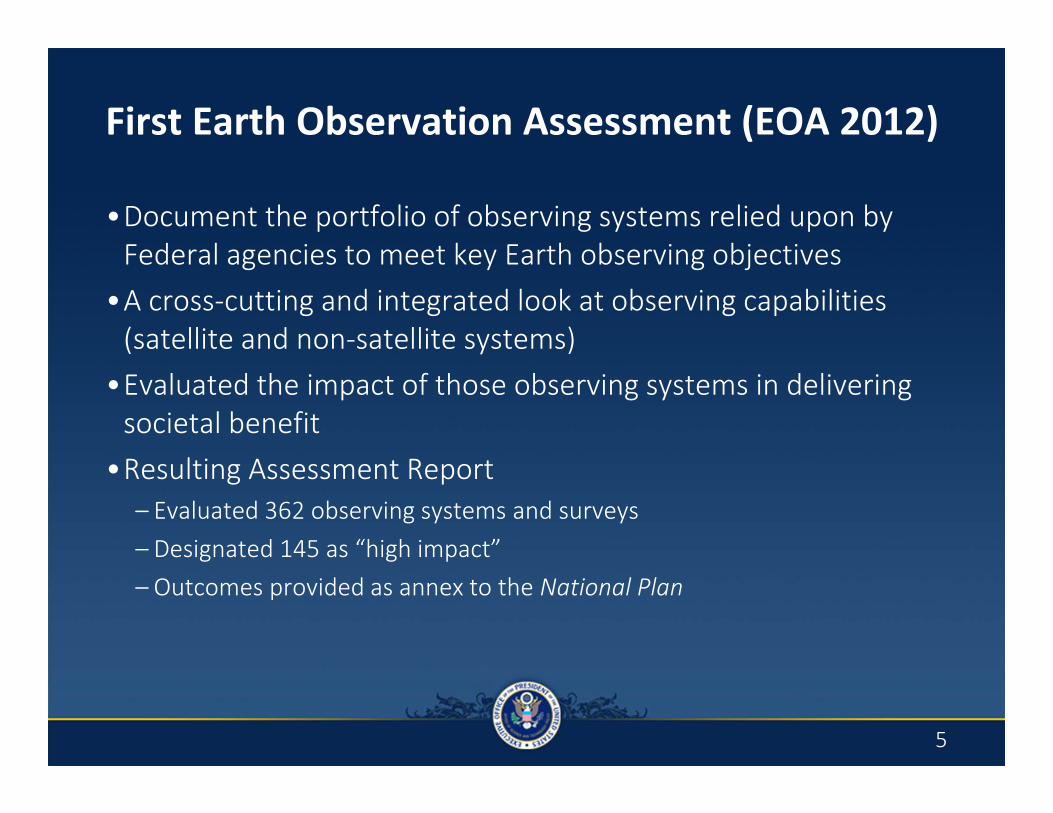
First Earth Observation Assessment (EOA 2012)
•Document the portfolio of observing systems relied upon by Federal agencies to meet key Earth observing objectives
•A cross‐cutting and integrated look at observing capabilities (satellite and non‐satellite systems)
•Evaluated the impact of those observing systems in delivering societal benefit
•Resulting Assessment Report – Evaluated 362 observing systems and surveys– Designated 145 as “high impact”– Outcomes provided as annex to the National Plan
5

EOA 2016 Deliverable
• The second National Earth Observation Assessment is scheduled to be completed in June 2016
• Final assessment will include:• A snapshot of the current national observing system portfolio
• A baseline assessment of the current portfolio, tiered by relative criticality, for individual Societal Benefit Areas (SBA) and an overall integrated assessment
• A recommended portfolio (current, planned, and new capabilities required), tiered by relative criticality over a 10‐year planning horizon, for individual SBAs and the overall government
7
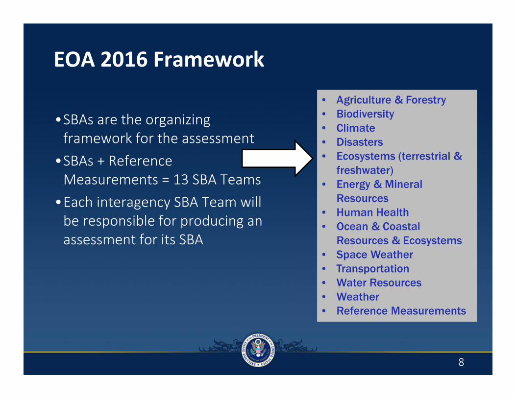
•SBAs are the organizing framework for the assessment
•SBAs + Reference Measurements = 13 SBA Teams
•Each interagency SBA Team will be responsible for producing an assessment for its SBA
• Agriculture & Forestry• Biodiversity• Climate• Disasters• Ecosystems (terrestrial &
freshwater)• Energy & Mineral
Resources• Human Health• Ocean & Coastal
Resources & Ecosystems• Space Weather• Transportation• Water Resources• Weather• Reference Measurements
EOA 2016 Framework
8
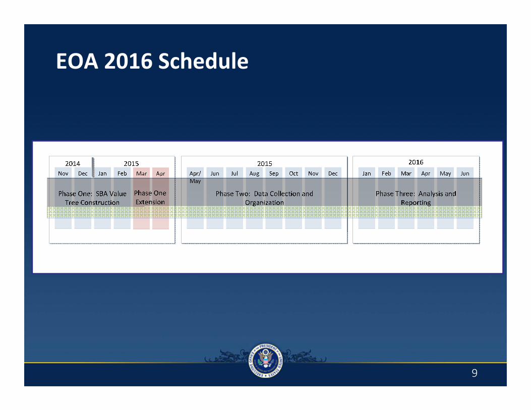
EOA 2016 Schedule
9
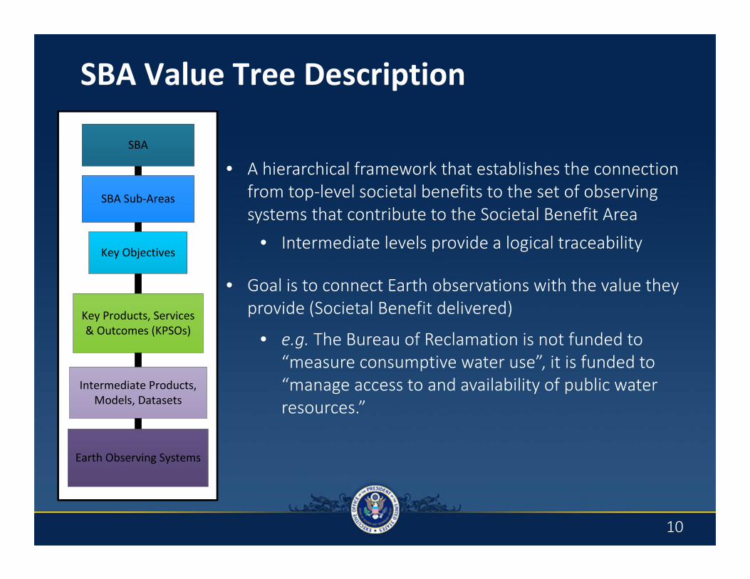
SBA Value Tree Description
• A hierarchical framework that establishes the connection from top‐level societal benefits to the set of observing systems that contribute to the Societal Benefit Area
• Intermediate levels provide a logical traceability
• Goal is to connect Earth observations with the value they provide (Societal Benefit delivered)
• e.g. The Bureau of Reclamation is not funded to “measure consumptive water use”, it is funded to “manage access to and availability of public water resources.”
SBA
SBA Sub-Areas
Key Objectives
Key Products, Services & Outcomes (KPSOs)
Intermediate Products, Models, Datasets
Earth Observing Systems
10
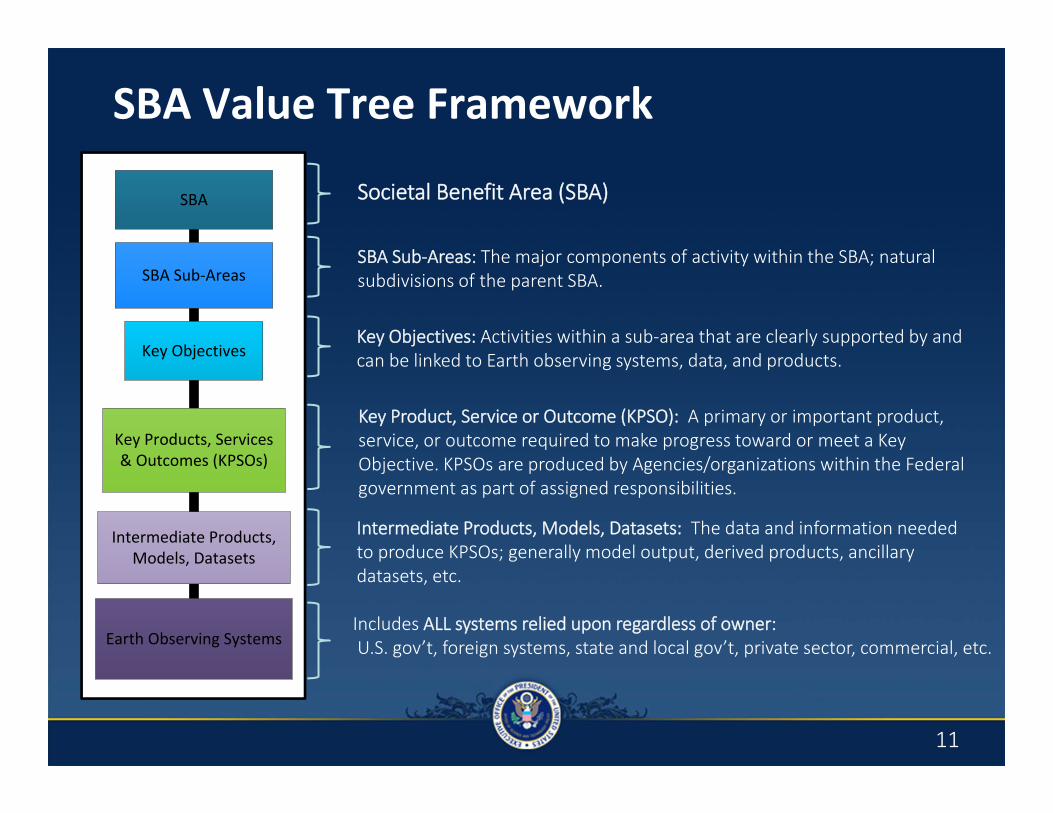
Societal Benefit Area (SBA)
SBA Sub‐Areas: The major components of activity within the SBA; natural subdivisions of the parent SBA.
Key Objectives: Activities within a sub‐area that are clearly supported by and can be linked to Earth observing systems, data, and products.
Key Product, Service or Outcome (KPSO): A primary or important product, service, or outcome required to make progress toward or meet a Key Objective. KPSOs are produced by Agencies/organizations within the Federal government as part of assigned responsibilities.
Intermediate Products, Models, Datasets: The data and information needed to produce KPSOs; generally model output, derived products, ancillary datasets, etc.
SBA Value Tree Framework
SBA
SBA Sub-Areas
Key Objectives
Key Products, Services & Outcomes (KPSOs)
Intermediate Products, Models, Datasets
Earth Observing SystemsIncludes ALL systems relied upon regardless of owner:U.S. gov’t, foreign systems, state and local gov’t, private sector, commercial, etc.
11
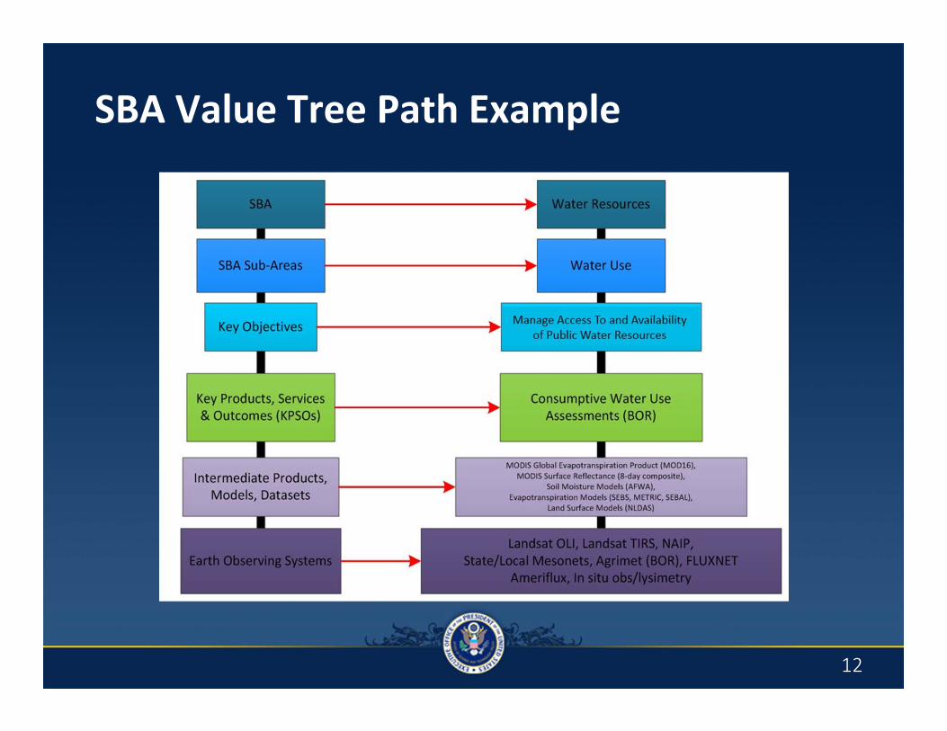
SBA Value Tree Path Example
12
Data Collection & Organization (Phase 2)
•For each Key Product, Service, and Outcome (KPSO) SMEs will be asked to:– Identify the list of input data sources
• Direct observations from observing systems, datasets, intermediate products, model output, etc. that contribute to the delivery of the KPSO
–Evaluate the data sources – two elements• Relative criticality• Performance
•Judgments about relative criticality and performance will be quantified using a standardized scale
•Input used to build a structure for each KPSO that will map into the Societal Benefit Area (SBA) value tree as specified by the SBA Team
13
Lessons Learned from EOA 2012
•Process elements have been strengthened based on lessons learned are now included in the guidance for EOA 2016– Guidance for more consistently including research activities/needs within the assessment
– Guidance for weighting tree components (all levels)
– Guidance to ensure more standardized Societal Benefit Area (SBA) value tree structures
•More robust agency representation on SBA Teams and strategies to mitigate gaps
•Split responsibilities for constructing and evaluating the value tree between the SBA Teams and Subject Matter Experts within the agencies
14
Thank You!
USGEO Website: http://www.usgeo.gov
National Plan for Civil Earth Observations:http://www.whitehouse.gov/sites/default/files/microsites/ostp/NSTC/2014_national_pla
n_for_civil_earth_observations.pdf
15