tools of oceanography
TRANSCRIPT

Tools of OceanographyOcean Currents• Drift Bottles and Dyes: measures speed and
direction of ocean currents.

Ekman Current Meters: measures speed and direction of currents in deep water.

Ocean Water Sampling
Measures:
• Temperature
• Salinity
• Productivity (plants and animals)
• Density (specific gravity)

Nansen Bottle (Niskin Bottle)
http://www.youtube.com/watch?v=3ngRI3X8-Oo
Nansen Bottle:
collects samples of ocean water at specific depths.

Salinometer: Uses electric current to measure how salty ocean water is.

Bathythermograph: towed in the water to measure continuous temperatures.
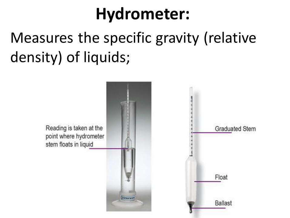
Hydrometer:
Measures the specific gravity (relative density) of liquids;

Light Measurement
Measures:
• Turbidity (sediments),
• Productivity (phytoplankton, zooplankton)

SECCHI Disk:
http://www.youtube.com/watch?v=yGJ5uV4jAPohttp://www.youtube.com/watch?v=xuH_xLTjmOQ
A white and black circular disk that is lowered in the water until it disappears and reappears.

Ocean Life SamplingPlankton Net: Cone shaped net that traps phytoplankton and zooplankton. Towed along surface.

Otter TrawlA large underwater net that uses boards and floats to open and collect marine organisms.

Fishing Dredge: A large metal or canvas bag that is scraped along the ocean floor to collect seafloor creatures such as oysters, clams, sea cucumbers. It destroys the ocean floor.

Seine Net: a long net (seine or dragnet)attached to two poles used in tidal pools or along the shore to catch marine fish and other organisms.

Ocean Floor SamplesBottom Grabber
Scoops up loose sediment on the ocean floor.

Corer (Phleger or box)Drilled into the sea floor to extract samples of ocean floor sediments.

Depth and Bathymetry
Echo sounding or ‘SONAR’: Use of sound to determine depth and seafloor profile.
SONAR: Sound Navigation and Ranging

Scientists and Sonar

2. Sounding (lead line):
Use of rope and weight to find the depths of the ocean floor.

Echo Sounder (Fathometer) transmits and receives
soundwaves that are reflected off of the ocean floor and submarine objects. It can sense depth of the ocean, schools of fish, shipwrecks, mudslides, and sea floor features such as submarine canyons and seamounts.

Underwater Equipment
SCUBA:
Self Contained Underwater Breathing Apparatus
Invented by Jacques Cousteau (documentarian).

Atmospheric Diving Suits used for deep
dives. Maintains atmospheric pressure, so, decompression is not needed.

Research Vessels
Glomar Challenger- drilling vessel that collected ocean floor samples used to prove seafloor spreading and plate tectonics.

Joides Resolution - deep sea drilling vessel used today.

RV Atlantis IICarries Alvin. Modern Ocean research vessel. WHOI.

Underwater Research Vessels (URV’s):
Bathysphere: A spherical deep-diving chamber in which persons are lowered by a cable to study the oceans and deep-sea life.

Bathyscaphe: A free-diving deep-sea submarine with a crew of 2-3 people. Ex: Alvin and Trieste
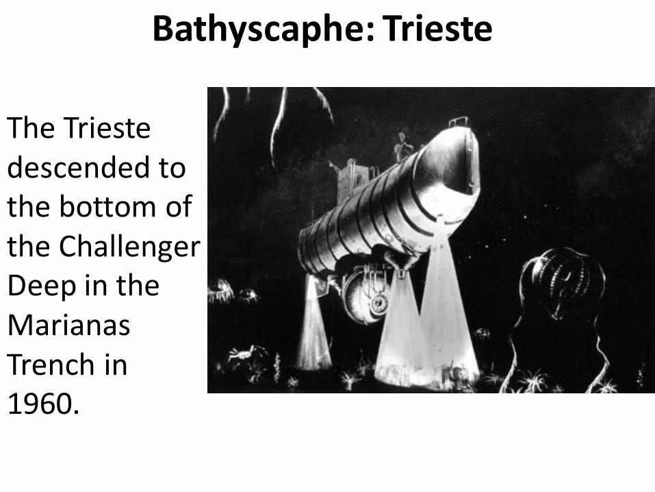
Bathyscaphe: Trieste
The Trieste descended to the bottom of the Challenger Deep in the Marianas Trench in 1960.

Bathyscaphe: AlvinThis bathyscaphe was used to locate a missing H-bomb in the 1960’s and to explore the mid-ocean ridge. Still used today.

ROV: Remotely Operated Vehicles “drones of the seas”
Argo-Jason System: A robot (drone) that explored the Titanic and helped with the “BP oil spill”.

Remote Sensing: Satellites• SEASAT: A series of satellites used to monitor
the oceans and atmosphere. Can measure sea level, productivity, temperature, CO2, ice, etc…
• GPS: Global
Positioning System
• Trackers and tracers.
• Tsunami and
Hurricane
Alert Systems

Scripps Institution of Oceanography:
Near San Diego California- west coast of USA.
It is one of the oldest and best institutes for oceanography research and training.

Institutes of OceanographyWHOI: Woods Hole Oceanographic Institute in New England (Mass.). East coast of USA. http://www.whoi.edu/