topography and landform...
TRANSCRIPT

Topography andLandform Survey
Shahpori Dwip & St. Martin Island
Supervised By
Professor Dr. M. Shahidul Islam
Professor Dr. Hafiza Khatun
Professor Borhan Uddin,
Assistant professor Faruk HossAIN

Team Members • Presented By: Afrida Asad(Roll:20) On behalf of,Dola Dutta (28)
Meher Negar
Tuli (202)
Md. Nazmul
Hossain (46)
Raisa Noor (206)
Sadia Afrin (27)
Hafsa Binta
Yunus (148)
Rabeya Islam
(207)
Khadiza Akter
Rema (132)
Flora Nasrin (45)
Mst. Nisat
Taranum Akter
(114 )
Golam
Mohiuddin
Masum (36)
Md. Tanvir Al
Imamhasan(43)
MD Nurullah (30)
Rakibul Islam (38)
Md.Tanvir Ahmed (51)
Shahed Ahmed (17)
Jahiduzzaman Rajib (80)
Halima Khatun (104)
Amar Shanti Chakma (118)
Tahmid Hossain Rafid (04)
Nazia Nowrin Rob (144)
Kabir Hasan (138)
Khondokar Tahmina Nasrin (16)
Shudipto Biswas (52)

Study Area
17/10/2016 (Shahpori Dwip, Teknaf)
19/10/2016
ST.Martin Island

Survey Under Topography & Landform Study
• TASK 1: Leveling to study the elevation of Shahpori Dwip, Teknaf from the sea level.
• TASK 2: Sand dune profile study in St. Martin Island.
• TASK 3: Vegetation or ecological survey of the sand dune in St. Martin Island.

Levelling survey
Levelling is a branch of surveying, the object of which is to find the elevationof a given point with respect to the given or assumed datum. Establish a pointat a given elevation with respect to the given or assumed datum.So, leveling is the measurement of geodetic height either from the sea level orother known value (BM value)

Study Area
• Area: ShahporirDwip, Teknaf.

Instruments used in levelling
Tools Used in Levelling Survey:
• Angle measuring instrument
• Two ranging rod
• Measuring tape
• Rope
• Leveler

Method That We Followed
• At first the location of mean sea level were identified where the
elevation is zero.
• A rod was held vertically on that point and the instrument
Sunnometer was used to read the rod scale. This gave the height of
the instrument above the starting (backsight) point and allowed the
height of the instrument (H.I.) above the datum to be computed.
• The rod was then held on an unknown point and a reading was
taken in the same manner, allowing the elevation of the new
(foresight) point to be computed.
• The procedure was repeated until the destination point was
reached.

Glimpse of Levelling Survey

Outcomes of Our Survey
• Highest elevation : 1.57 meters(Primary School)
• Average elevation: 1 meter
• Drilling point elevation: 0.2 meter

0
5
10
15
20
25
0 5 10 15 20 25 30 35
Ele
vati
on
cm
Distance m
Elevation of drilling location
0
0.05
0.1
0.15
0.2
0.25
0.3
0 20 40 60 80
Ele
vati
on
(m
)
Distance (m)
Elevation of DCP
Elevation m
Outcomes of Our Survey

A Map showing the pathway of the survey

Analysis
From above Data representation we can say the area is not that much higher in elevation where the highest relies in approximately 1.6 meter ( a primary school) above sea level. The drilling survey point, the penetration points elevation, profile survey elevation are shown which are also very close to sea level.

Challenges whichWe Faced
• Insufficiency in GPS tools
• Prior observation of whole area should be done before starting survey

Sand dune study

A dune is a hill of loose sand which occur in different shapes and
sizes, formed by interaction with the flow of air or water. It occur in some
deserts and along some coasts. Some coastal areas have one or more
sets of dunes running parallel to the shoreline directly inland from the
beach which protect the land against potential ravages by storm
waves from the sea.
Sand Dune

• Protect island from coastal water intrusion.
• Resilient barrier to the destructive forces of wind and waves.
• Important ecosystems supporting unique flora and fauna
including rare and endangered species.
Importance of Sand dunes


Our Survey Area
Sand Dunes studied in St Martin Island.
1. Near Golachipa
2.North West part

Method That We Followed
• Leveling method were followed using angle measuring instrument (suuntometer) to measure the elevation of sand dunes from the shoreline.
• Six stations were selected in both survey areas.
• From five stations (1-5) leveling started toward the sand dunes perpendicularly and one (station 6) horizontally.
• GPS value were taken from each stations.
• The Land use of both sand dunes were observed.

Glimpse of Sand Dune Survey

• Place: Golachipa
• Highest Elevation: 3.00 m
• Land Use: A resort and a
fisherman’s house
Dune Survey 1

• Place: North West of St Martin
Island
• Highest Elevation: 2.67 m
• Land Use: There were hotels &
Resort
Dune Survey 2

As we know sand dune protects coastal habitat from storm and sea level rise.
Our surveyed sand dune with not more than 3 m elevation shows that it is still
in the young stage but can be disrupted due to the excessive human
intervention as hotels, resorts and homes were spotted and these sand dunes
played a part in allowing these to be built by creating a high ground safe
from sea. Some interesting observations may be shared. People placed rocks
to reduce erosion of the dunes. Keya trees were found growing inclined.
Also, if the wind was sufficient, some movement of sand could be observed.
We need to pay heed on protecting these sand dunes as it protects the
coast.
Analysis

• We could have analyzed the soil quality and compaction of sand
dune.
Limitation and challenges:

Vegetation surveyof Sand dunes

Vegetation of St. Martin Island
Surveying the enormous diversity of the world’s vegetation and for biodiversity conservation, research on ecology and environment of an area; vegetation survey is a must which is basically a technique or method to identify, monitor the flora, plants of an area and creating the biodiversity index.

Our survey
Area: Vegetation over Sand Dunes which have studied before.

Study Areas of Vegetation Survey (zoomed view from satellite image)

Method That We Followed
Quadrate Method:
• We decided our survey area first where we found
• We selected 2500 meter square covering area that we were interested in with 25 grid squares each with 100 meter square.
• These 13 grids were chosen by ‘simple random sampling numbers’.
• then collected the specimen of plants from13 grid out of 25 grid for later identification.
Grid
1
Grid
2
Grid
3
Grid
4
Grid
5
Grid
6
Grid
7
Grid
8
Grid
9
Grid
10
Grid
11
Grid
12
Grid
13
Grid
14
Grid
15
Grid
16
Grid
17
Grid
18
Grid
19
Grid
20
Grid
21
Grid
22
Grid
23
Grid
24
Grid
25

Glimpse of Vegetation Survey
Outcome of Our Survey
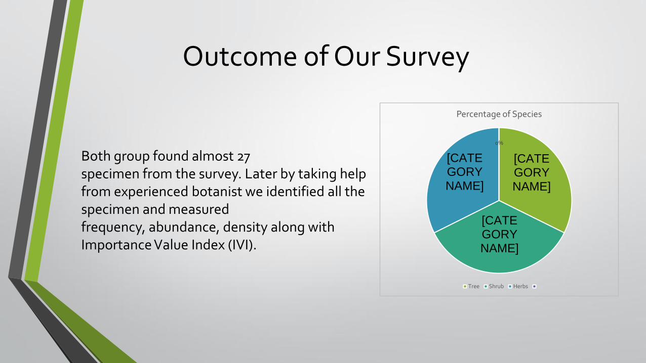
Both group found almost 27 specimen from the survey. Later by taking help from experienced botanist we identified all the specimen and measured frequency, abundance, density along with Importance Value Index (IVI).
[CATEGORY NAME]
[CATEGORY NAME]
[CATEGORY NAME]
0%
Percentage of Species
Tree Shrub Herbs

• Scientific Name: Pandanus fascicularis
• Type: A shrub or a small tree, many
areal roots, narrow leaves up to 150cm
long, fragrant flowers, large fruit of
pineapple-like shape, grows all over
India.
• IVI : 25.68
Some Abundant Species
KEYA

Some Abundant Species
• Scientific Name: Cocos nucifera
• Type : The Coconut Palm is a long-lived plant that may live as long as 100 years. It has a single trunk, 20-30m tall.
• IVI : 12.5
COCONUT

Some Abundant Species
• Scientific Name : Ipomoea pescaprae
• Type: Growth Form: It is a latex-bearing, trailing creeper, with up to 30 m-
long stems, and deep tap roots.
• IVI: 5.66
SHAGORLOTA

Some Abundant Species
• Scientific Name: Acanthus
ilicifolius
• Type : It is a small shrub
growing along lakes and
marshes and sea shores.
• IVI: 6.06
NISHINDA

Analysis
The flora of St. Martin’s Island is similar to that of the mainland. However, it has been significantly changed due to human interventions from 1880s.St. Martin Island still has quite diverse vegetation. The “morning glory“ (Ipomeapescaparea) is an unique species found in sand dune area.

Challenges That We Faced
• 50 meter square area was not enough to cover enough vegetation
• Due to our preservation method, some specimens were quite unrecognizable because of humidity and lack of light.
• fruits and flowers should be taken along with 12 inch size.
• In these case enough photographs should be taken

Conclusion
From our topographic survey of Shahpori Dwip we can see the elevations of different locations from sea level are not so high. The average elevation that we measured is almost 1 m from the sea level which indicates that the area is a low land like many other areas of Bangladesh. Some parts are gone under water during the high tide and during the low tide the scenario is just opposite. The landform survey of Dune gave us the idea of how dune is formed and the land use pattern of it. We also learned the main vegetation of the St Martin Island of our survey which gave us basic knowledge of the ecology of St Martin Island.