tornadoes. tornado rapidly rotating wind around center of extreme low pressure, in which rotation...
TRANSCRIPT
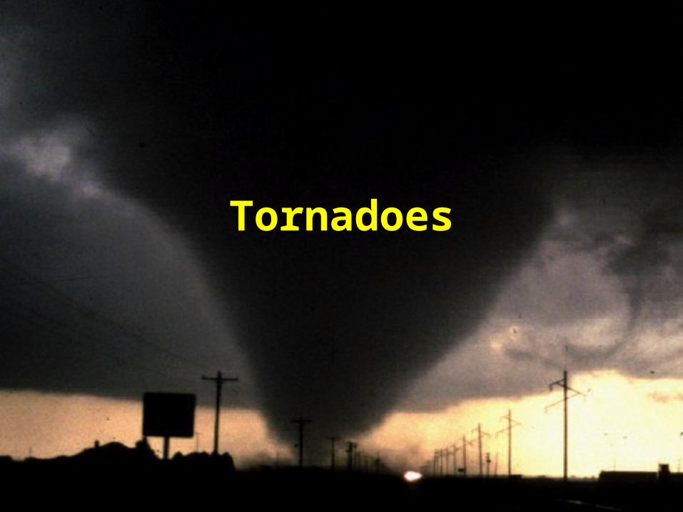
Tornadoes

tornado
rapidly rotating wind around center of extreme low pressure, in which rotation reaches the ground.

– N. Hem are c-clkws (from above)– windspeeds 250 mph (up to 300 mph)– >1000/yr US (2004: 1,722)– 100 fatalities/yr US (45% mobile homes)– diameter: 300 - 2000 ft (ave: 330 ft)– 60 mph; from SW to NE
• Ave path 4 mi; few minutes

Ingredients:• Warm moist air at surface from south
(mT)• cold drier air approaching from
northwest (cP) : cold front• warmer dry air from central Mexico
aloft (cT) (6500 ft; 2 km)– Provides inversion cap
• Dryline (dew point front) between 2 dry air masses and warm moist air from Gulf


These conditions lead to formation of Supercell
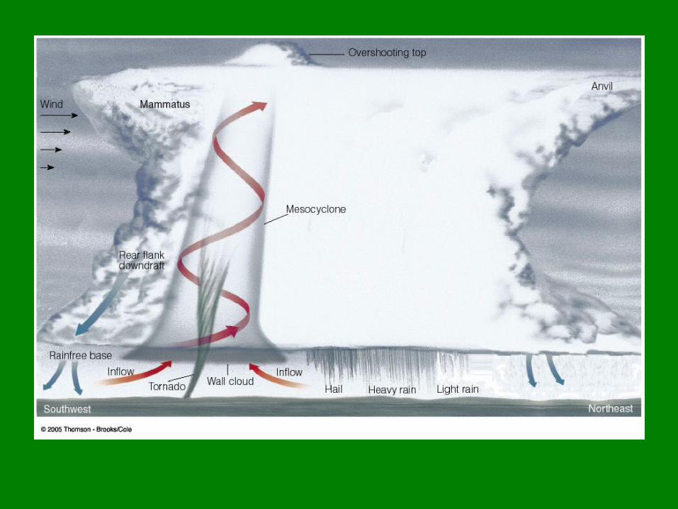
Thunderstorm• Large single-cell thunderstorm with
rotating updraft.– Rotating updraft is “mesocyclone”
• Extremely strong updraft– (150 – 175 mph)


Rotating updraft:
1. surface air rotates horizontally

2. Strong updraft pulls vortex into cloud, becomes a vertical rotating mass of air in south side of supercell (mesocyclone)


Mesocyclone
• Up to 6 mi. diameter; inside supercell
• Draws in moist air; energy• Rotation speed increases• stretches vertically
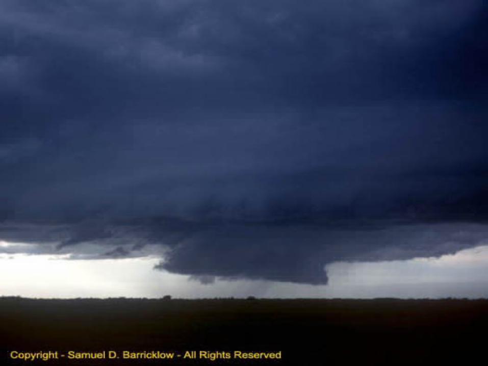
• Visible as wall cloud beneath supercell
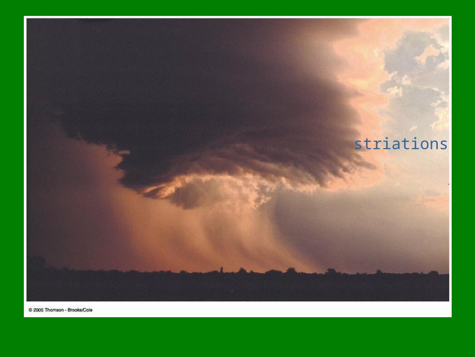
striations


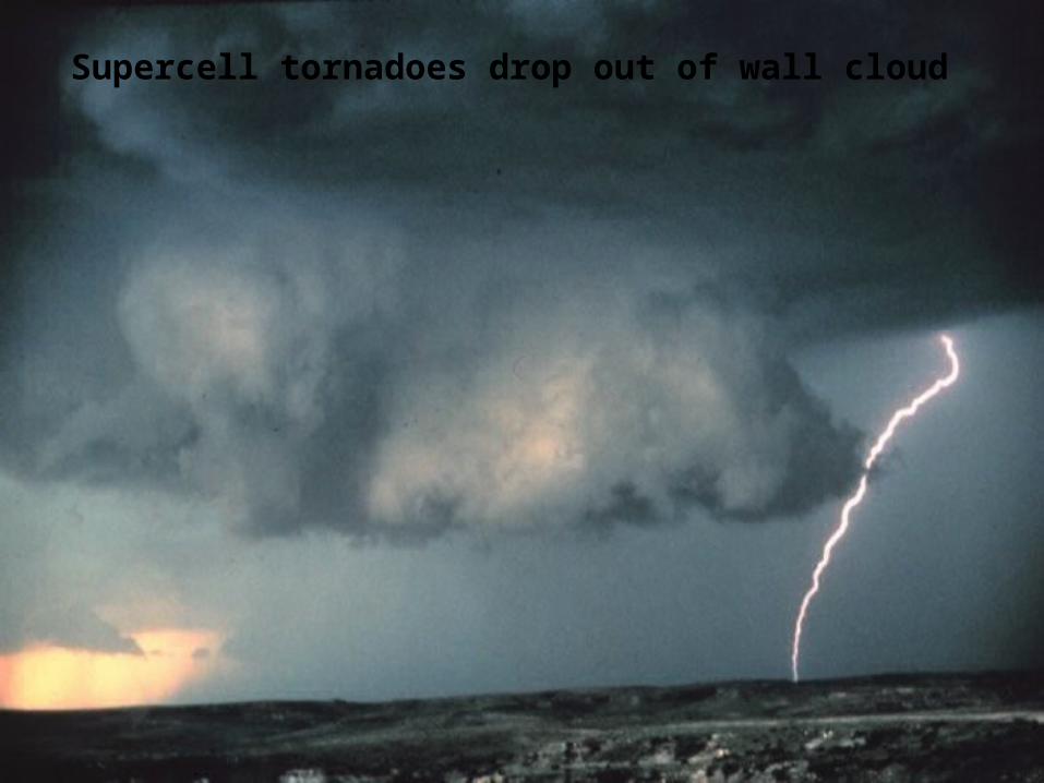
Supercell tornadoes drop out of wall cloud


• Warm, moist air at surface– Southerly wind
direction
• Mid level inversion“cap”layer of stable, warm air
• Upper level cold, dry air– westerly
altit
ude
temperature
Sounding profile
Air temp
Dew pt
Warm, moistConditionally stable
Inversion cap; stable
Dry, coldConditionally stable

Role of inversion lid:
• As surface air heats up (hot afternoon), it punches through lid; allows more air to be vented upward; rises very rapidly in cold, dry air aloft: creates strong updraft

• 0.1 % thunderstorms become supercells
• <15% supercells produce tornadoes
• 50% mesocyclones spawn tornadoes

• Inflow under mesocyclone draws air into LOW pressure
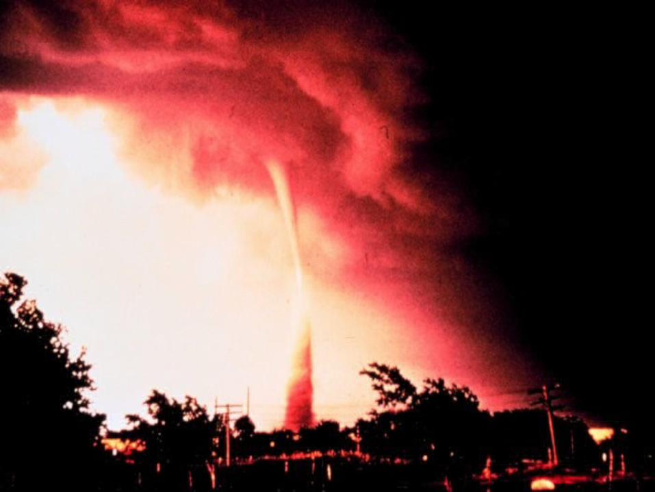
• Condenses into visible cloud (funnel cloud)
• At ground , picks up debris• Mesocyclone stretches vertically,
shrinks horizontally (Conservation of Angular Momentum); accelerates circulation

Condensation
funnel


Debris cloud


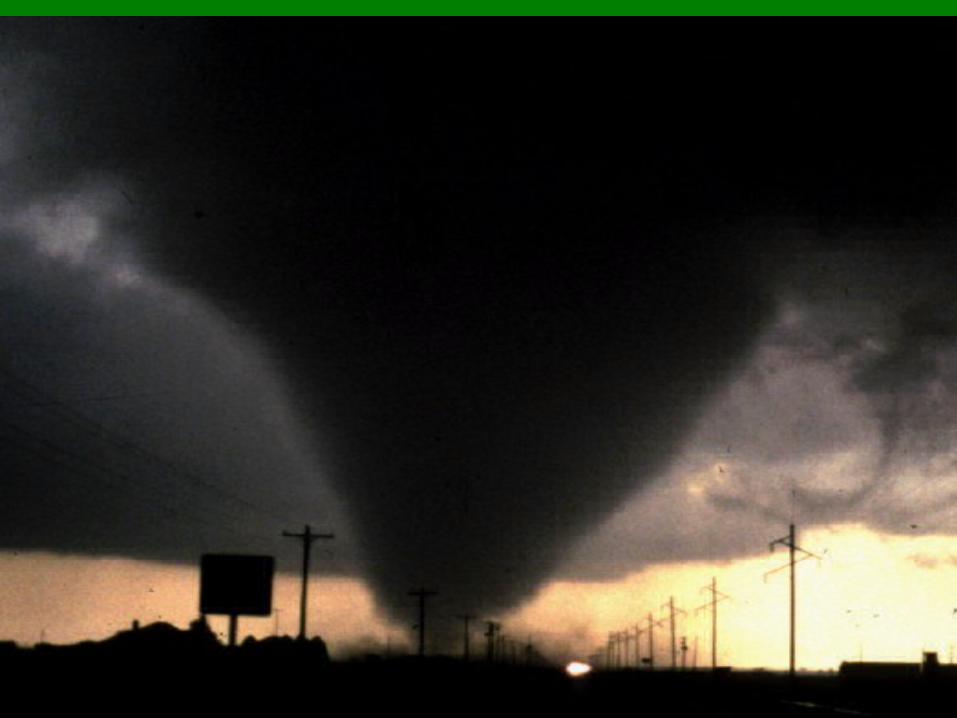
Stages
1. Dust Whirl
Dust kicked up from ground
Small funnel cloud
Little damage

2. OrganizingMore intenseMore damageFunnel drops lower

3. Mature
Funnel more verticalAs wide as it getsMost damageMost intense


4. Shrinking
decrease in widthfunnel tiltsnarrowing damage
path

5. Decay
StretchesRope-like


Don’t always have funnel

• Most frequent……
– place (in U.S.) : “tornado alley”– time of year (in U.S.) : March - July (esp.
May)– time of day: late afternoon
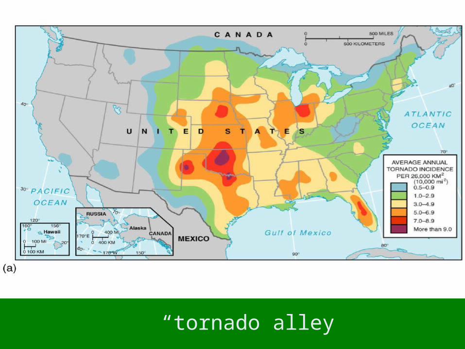
“tornado alley”


Tornado Outbreaks
• 6 or more• March 12, 2006• May 3-4, 1999 (Oklahoma City)• Superoutbreak:
– “Terrible Tuesday”: April 3-4, 1974– 16 hours, 148 tornadoes, 13 states, 307
deaths, 6000 injured, $600 million– combined path: 4,181 km.


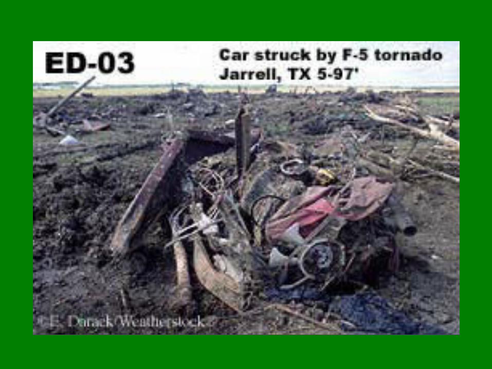
Fujita scale

In US:69% F0, F129% F2, F32% F4, F5

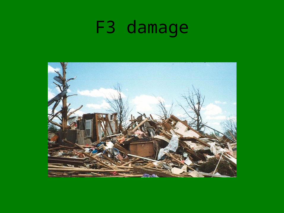
F3 damage
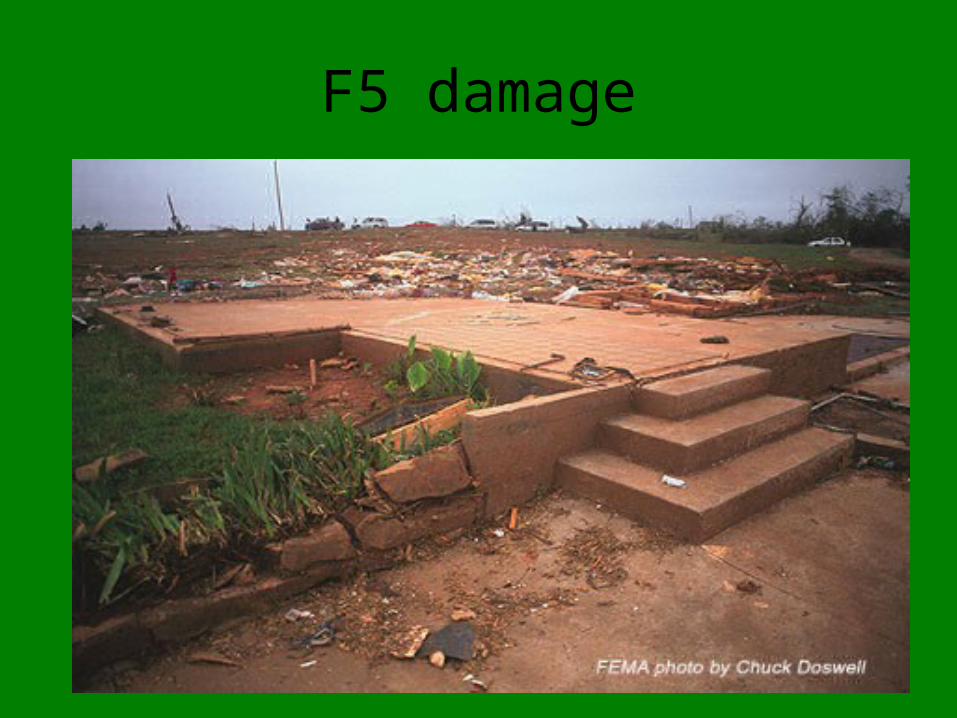
F5 damage

F5 damage

Safety
INDOORS:stay away from windowsbasement; mattresssmall interior roomunder stairs

• Go to lowest floor• Crouch down, cover head• Under table, chair• In mobile home, get outside, to
shelter or low spot, lie flat

OUTDOORS:Stop carGet to sturdy building if nearbyGet in ditch or low areaLie flat, away from trees or carsDon’t go under bridges or overpasses

Don’t try to outrun a tornado in a car!

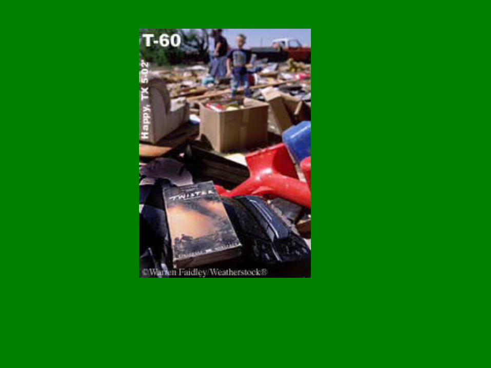
flying debris is a major hazard

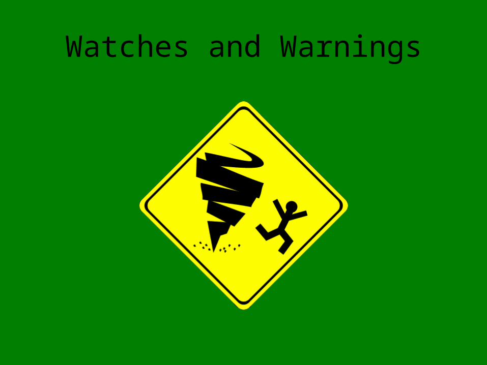
Watches and Warnings

TORNADO WATCH
Issued when conditions are conducive to tornado development
4 – 6 hours
from Storms Prediction Center, Norman OK

TORNADO WARNING
Issued if tornado is seen on radar or by an eye witness
(spotters look for tornadoes when a watch is issued).
from NWS
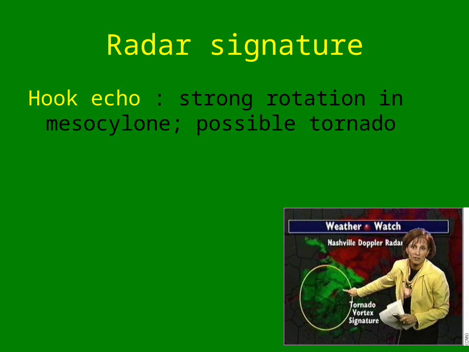
Radar signature
Hook echo : strong rotation in mesocylone; possible tornado

2 hook echos, May 3 1999
