traffic data collection with bluetoothconferences.illinois.edu/traffic/2010pdf/file_10_galas.pdf ·...
TRANSCRIPT

Traffic Data Collection With
Bluetooth
Jeff Galas
October 21, 2010

Traffic Systems Center
Provide real time traffic information
Archive traffic volume and flow data

Current Installation
Network of over 2400 pavement sensors
– Majority Cut Loop detectors
– Embedded loop detectors
– RTMS
– Microloops

Current Installation
Vehicle Counts
Occupancy
Calculated Speed and Congestion
TRAVEL TIMES

Travel Time Distribution
42 Freeway Dynamic Message Signs
14 Arterial Dynamic Message Signs

Travel Time Distribution
LMIGA Website
Radio stations
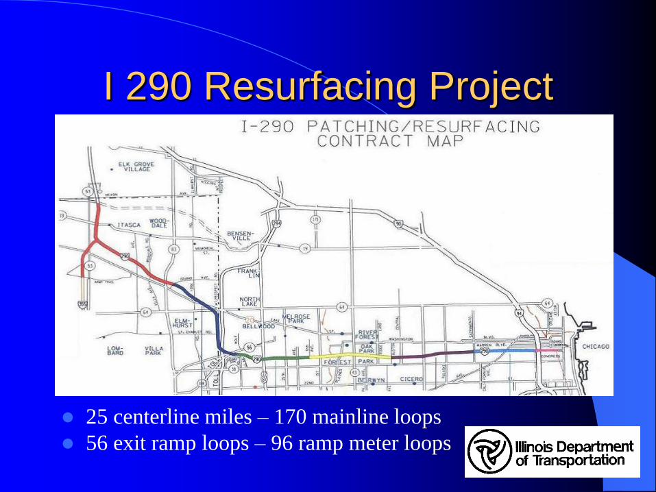
I 290 Resurfacing Project
25 centerline miles – 170 mainline loops
56 exit ramp loops – 96 ramp meter loops

Temporary Traffic Sensors
• Dan Ryan Reconstruction
•I80 Reconstruction
• RTMS units
• $390 K for 7 miles
• Need alignment
with stage changes
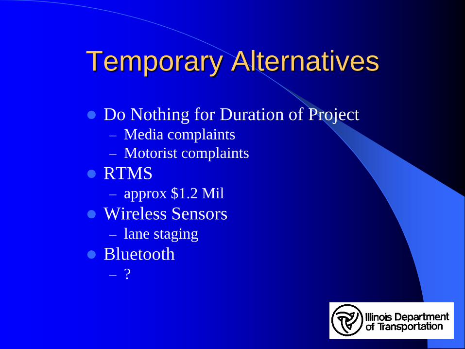
Temporary Alternatives
Do Nothing for Duration of Project– Media complaints
– Motorist complaints
RTMS – approx $1.2 Mil
Wireless Sensors – lane staging
Bluetooth– ?

Bluetooth
Success in Indiana
Favorable results in Pennsylvania
Recent Trial in City of Chicago on Arterial
Multiple Vendors
Non-Invasive
Reasonable Cost
Quick Deployment

Added to Construction Contract
Temporary Vehicle Detection System
Roadside Detector - each
Service Provider – cal month
ATMS Interface – L sum
Temp Det Sys Mo Maint – cal month
Temp Det Sys Rem Salv – L sum
TOTAL Bid Cost: $441,460

Project Team
Aldridge Electric Roadside Installation
Traffic Control Corp Facilitator
Traffic Cast BlueTOAD
Delcan ATMS Integration
U of I LMIGA website

What is
Wireless technology standard for exchanging data over short distances using 2.4 GHz radio freqencies
Swedish “Blatand” – epithet of 10th century king Harald I of Denmark who united dissonant tribes into a single kingdom

What is
Traffic Cast
Bluetooth
Travel-time
Origination
And
Destination

Roadside Device

How Does it Work ?
Media Access Control

Software LEDs
Heartbeat and Network Monitor
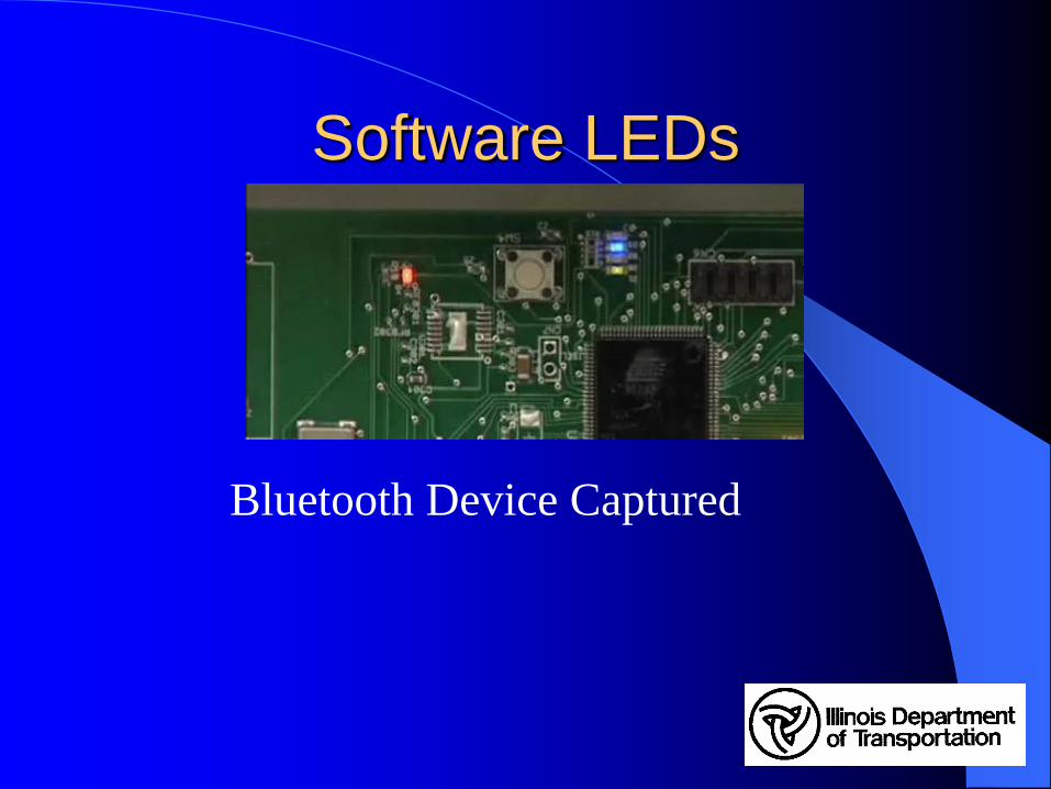
Software LEDs
Bluetooth Device Captured

Media Interest

Media Interest

Concerns

Location of Stations
Approx 2 mile spacing
Located at major arterial crossings

Installation
Median Lightpole
Support 40 lb
Solar panel
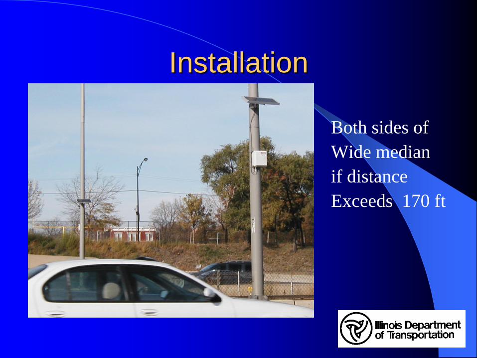
Installation
Both sides of
Wide median
if distance
Exceeds 170 ft

Installation
High Mast Lightpole
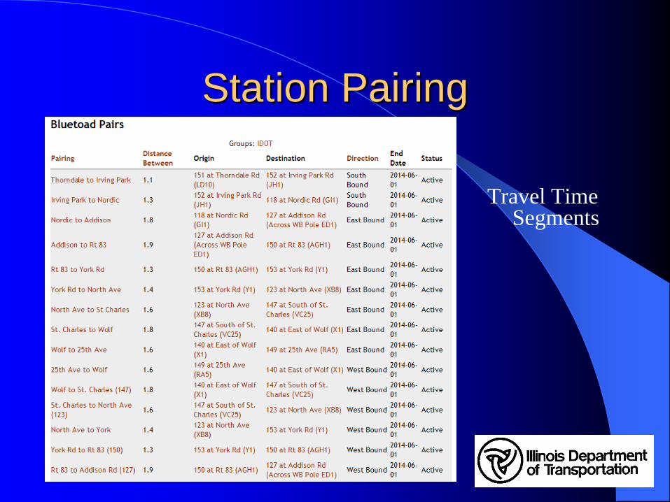
Station Pairing
Travel Time Segments


Web Page Reports
Sample Report
East of Wolf to Harlem Ave
Can be exported to spread sheet

BlueTOAD during Eisenhower
Flooding July 24, 2010

Pairing Matches - Weekday

ATMS Integration

ATMS DMS Integration

LMIGA integration

LMIGA Integration

Anomalies
Light Rail (CTA trains)
Frontage Roads
Collector / Distributor Lanes
Construction Vehicles
Stopped Traffic

How Does it Work ?
Compared Actual Driving
Time to Archived Segments
Overall Distance
Compared to Loops

What it Can do
Accurate Travel Time
Determine Average Speeds
Origin – Destination Pairing
What it Can’t do
Accurate Vehicle Counts
Occupancy or Density
Quickly Detect Stopped Traffic

Applications After I290
On to the next Resurfacing
Arterial Monitoring
Remote Area Monitoring
Fill in Voids
Become Self-sufficient

Longevity
Current Technology – Good
Cars / Phones / Computers / GPS
Lifespan ?
– Analog Phones
– Audio Cassettes
– CDs
– Betamax
