trajectory validation using tracers of opportunity such as fire plumes and dust episodes narendra...
TRANSCRIPT
Trajectory validation using tracers of opportunity such as fire plumes and dust episodes
Narendra Adhikari
March 26, 2007ATMS790 Seminar (Dr. Pat Arnott)
Outline
• Introduction
• Data and Methods
• Case Studies
-Fire episodes
-Dust episodes
Introduction
• Problem with model trajectories
• Errors associated– Physical (inadequate data: spatial and
temporal)– Computational (numerical truncation)– Forecast (error from forecast data)
• HYSPLIT trajectory model –for evaluation
Introduction- contd.HYSPLIT
• The HYSPLIT(Hybrid Single-Particle Lagrangian Integrated Trajectory) created and maintained by NOAA ARL
• The HYSPLIT model is a complete system for computing trajectories, complex dispersion and deposition simulations using either puff or particle approaches
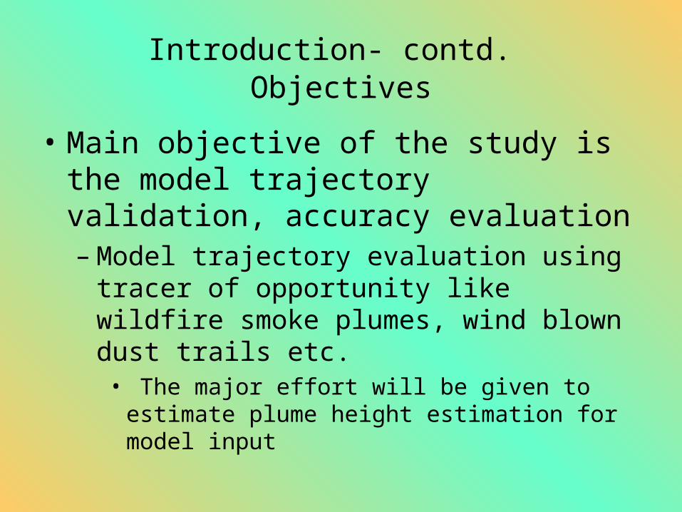
Introduction- contd. Objectives
• Main objective of the study is the model trajectory validation, accuracy evaluation – Model trajectory evaluation using tracer of
opportunity like wildfire smoke plumes, wind blown dust trails etc.
• The major effort will be given to estimate plume height estimation for model input
Introduction- contd. Importance?
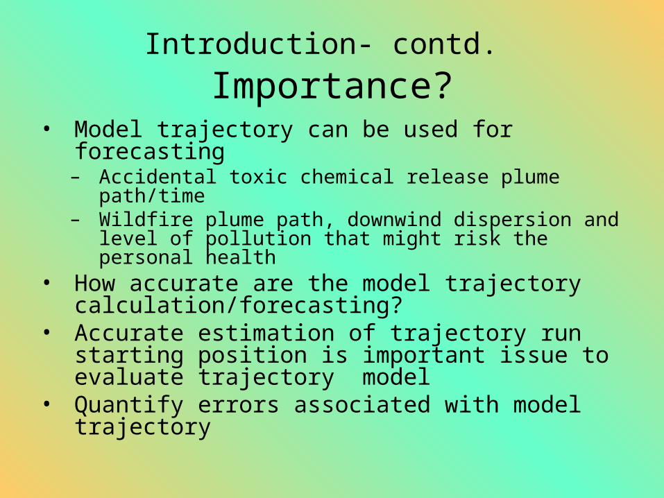
• Model trajectory can be used for forecasting – Accidental toxic chemical release plume path/time– Wildfire plume path, downwind dispersion and level
of pollution that might risk the personal health• How accurate are the model trajectory
calculation/forecasting?• Accurate estimation of trajectory run starting
position is important issue to evaluate trajectory model
• Quantify errors associated with model trajectory
Focus In this presentation
• Tracers of opportunity
• Dust and smoke plumes
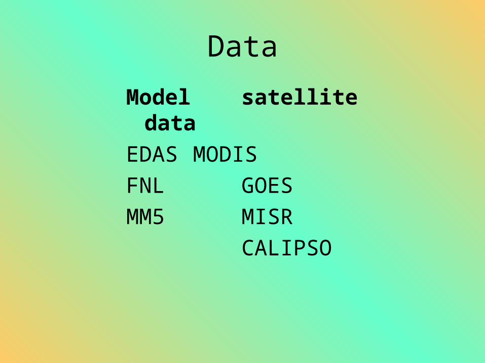
Data
Model satellite data
EDAS MODIS
FNL GOES
MM5 MISR
CALIPSO
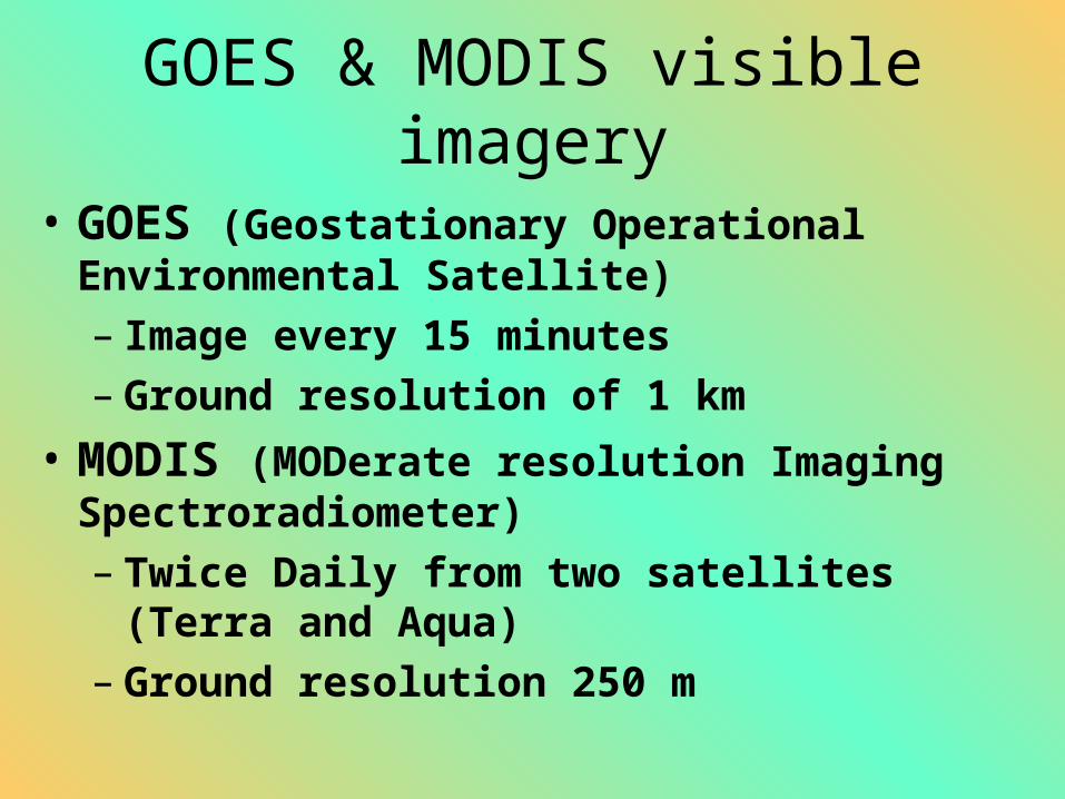
GOES & MODIS visible imagery
• GOES (Geostationary Operational Environmental Satellite)– Image every 15 minutes– Ground resolution of 1 km
• MODIS (MODerate resolution Imaging Spectroradiometer)– Twice Daily from two satellites (Terra and
Aqua)– Ground resolution 250 m
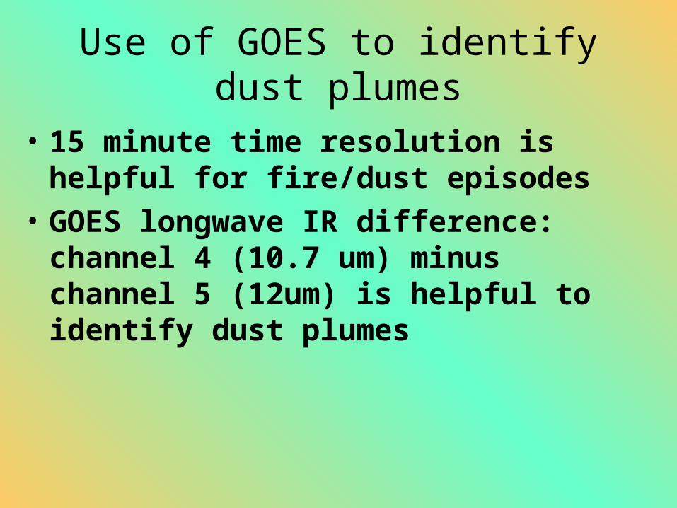
Use of GOES to identify dust plumes
• 15 minute time resolution is helpful for fire/dust episodes
• GOES longwave IR difference: channel 4 (10.7 um) minus channel 5 (12um) is helpful to identify dust plumes
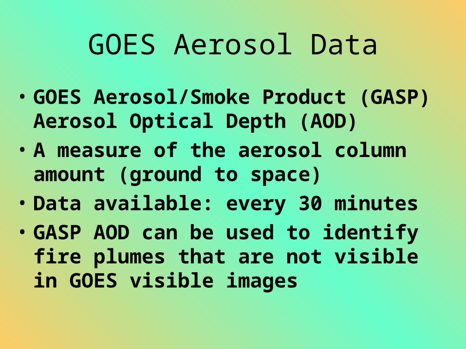
GOES Aerosol Data
• GOES Aerosol/Smoke Product (GASP) Aerosol Optical Depth (AOD)
• A measure of the aerosol column amount (ground to space)
• Data available: every 30 minutes
• GASP AOD can be used to identify fire plumes that are not visible in GOES visible images
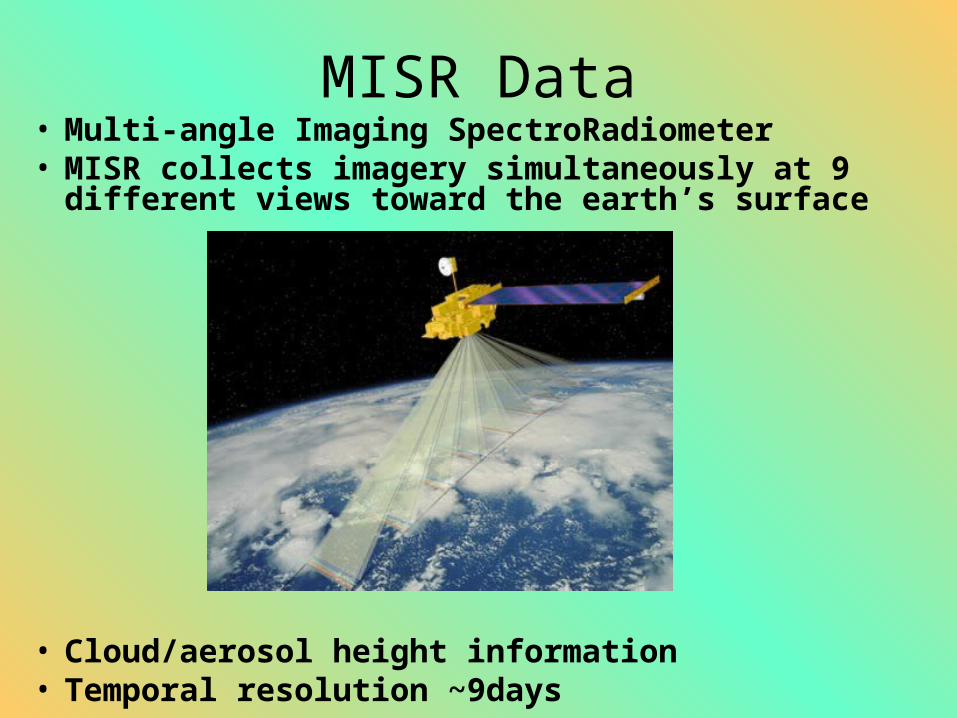
MISR Data• Multi-angle Imaging SpectroRadiometer• MISR collects imagery simultaneously at 9
different views toward the earth’s surface
• Cloud/aerosol height information• Temporal resolution ~9days
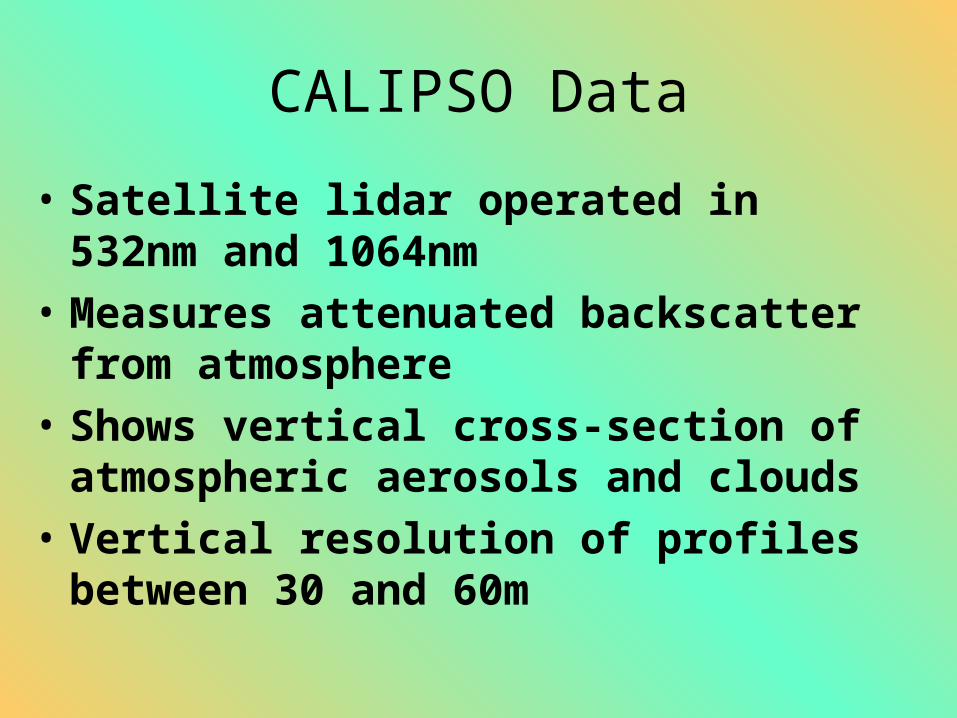
CALIPSO Data
• Satellite lidar operated in 532nm and 1064nm
• Measures attenuated backscatter from atmosphere
• Shows vertical cross-section of atmospheric aerosols and clouds
• Vertical resolution of profiles between 30 and 60m
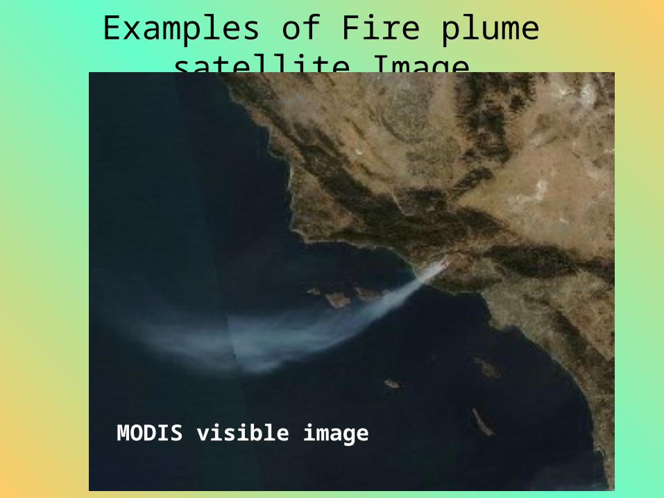
Examples of Fire plume satellite Image
MODIS visible image
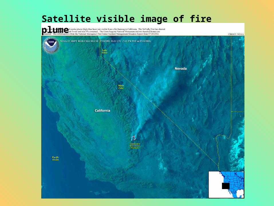
Satellite visible image of fire plume
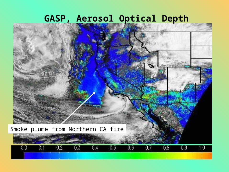
GASP, Aerosol Optical Depth
Smoke plume from Northern CA fire
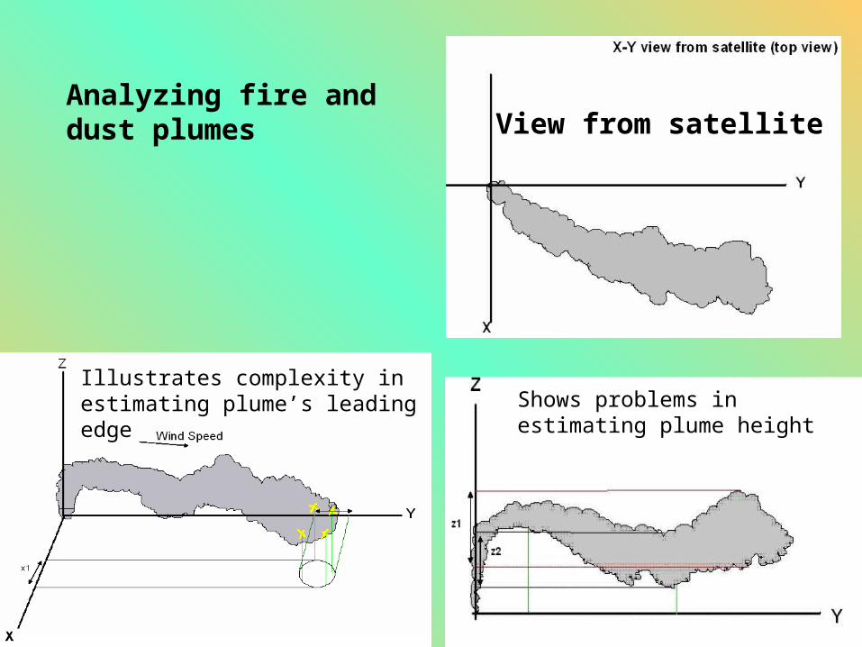
Analyzing fire and dust plumes View from satellite
Illustrates complexity in estimating plume’s leading edge Shows problems in estimating
plume height
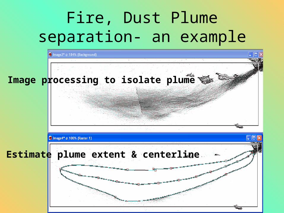
Fire, Dust Plume separation- an example
Image processing to isolate plume
Estimate plume extent & centerline
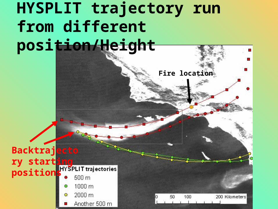
HYSPLIT trajectory run from different position/Height
Backtrajectory starting positions
Fire location

MISR Satellite image of fire plume- an example
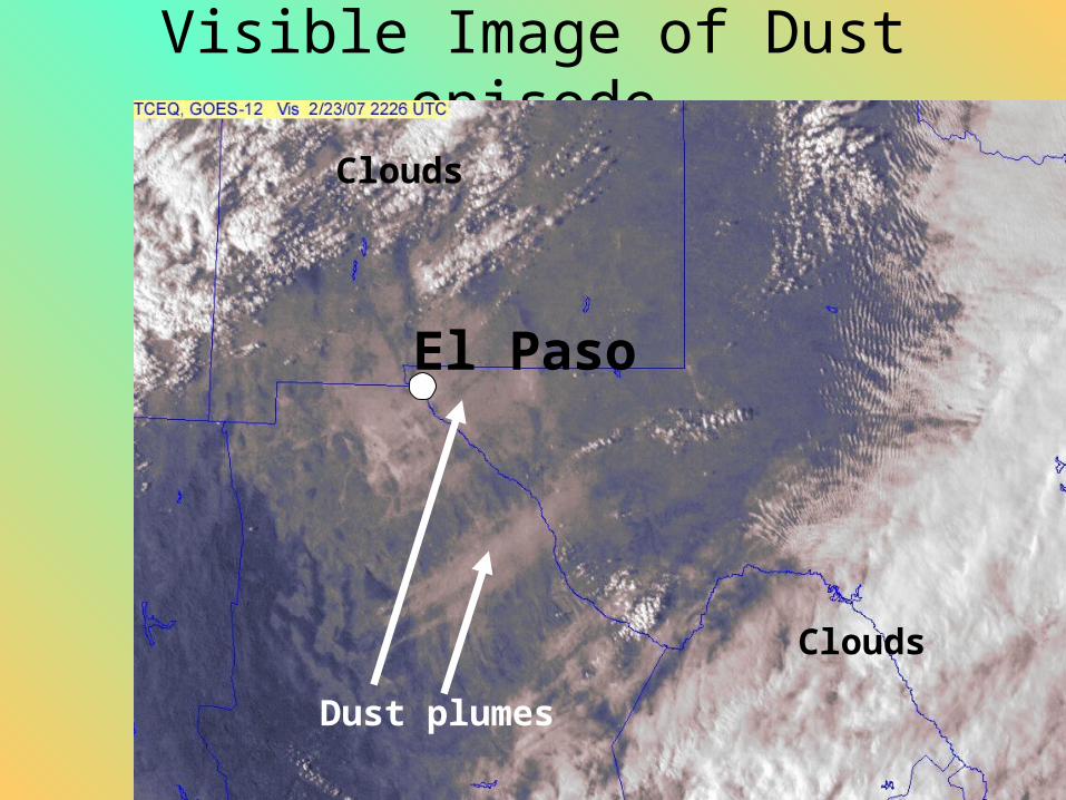
Visible Image of Dust episode
El Paso
Dust plumes
Clouds
Clouds
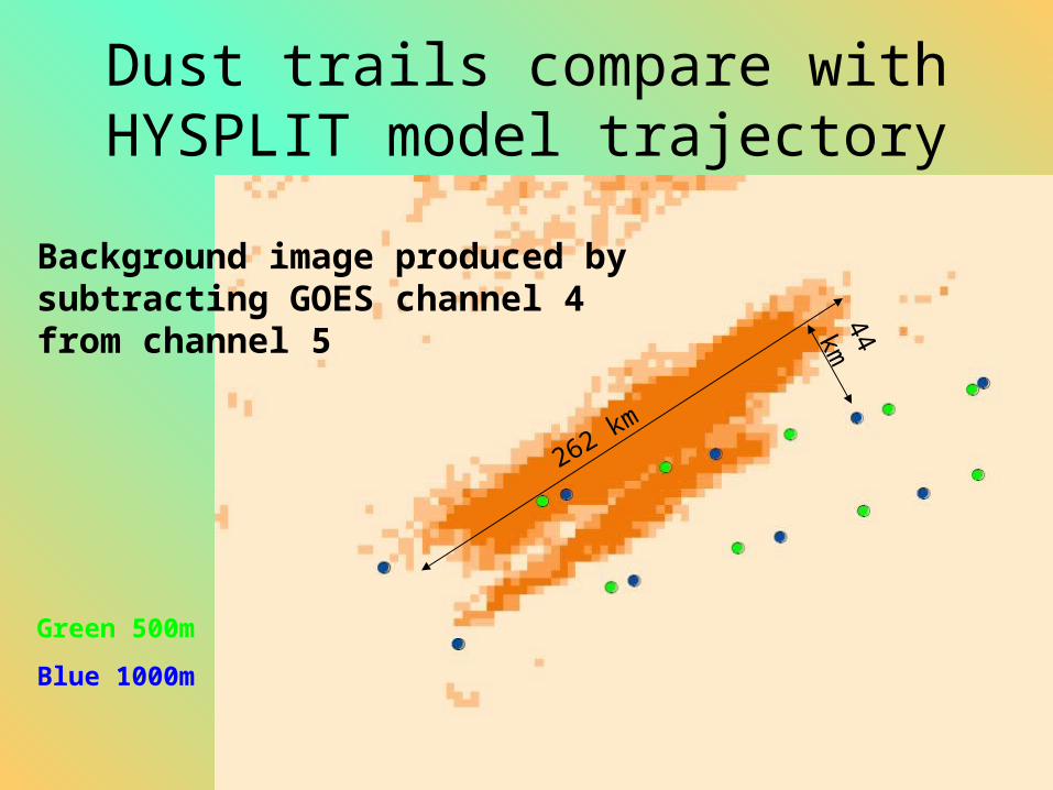
Dust trails compare with HYSPLIT model trajectory
262 km
44 km
Green 500m
Blue 1000m
Background image produced by subtracting GOES channel 4 from channel 5
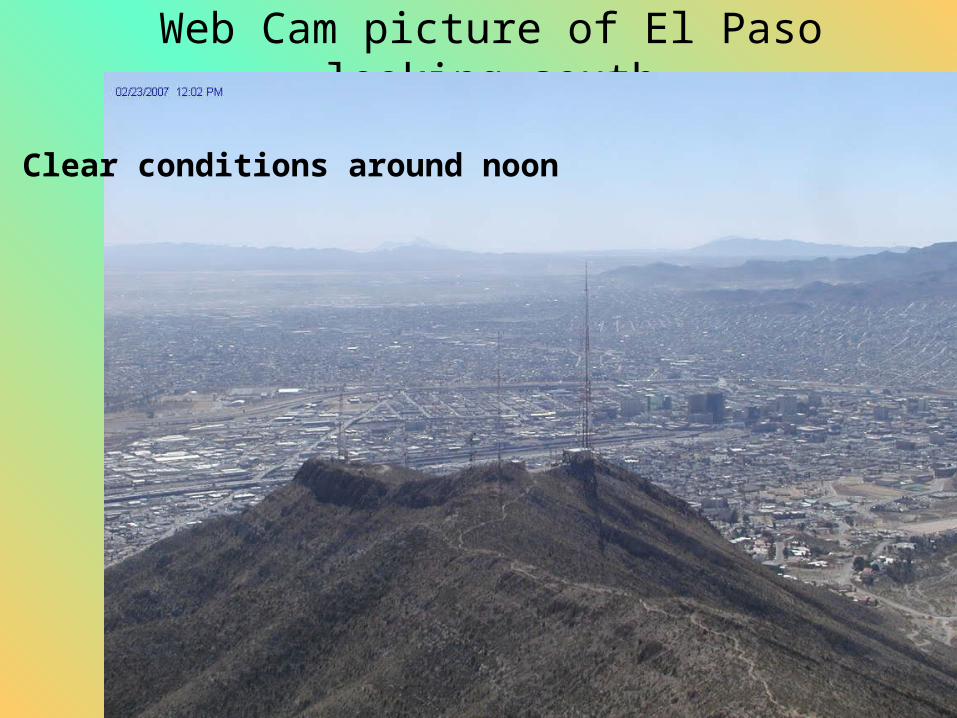
Web Cam picture of El Paso looking south
Clear conditions around noon
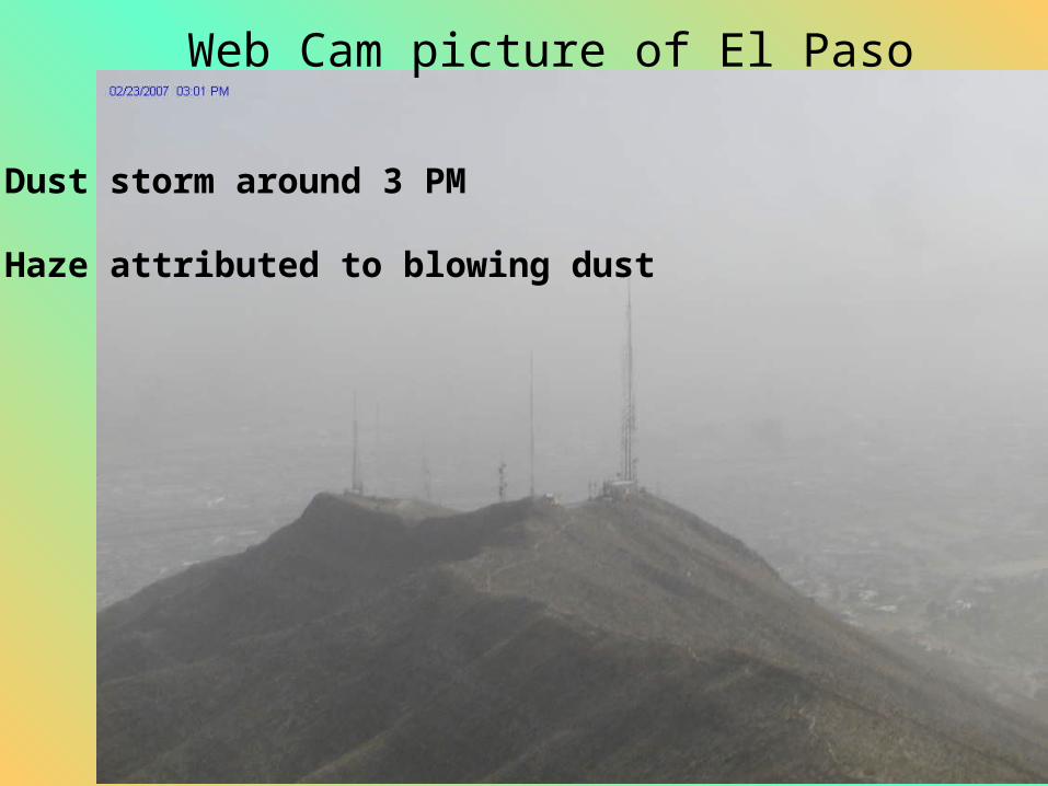
Web Cam picture of El Paso
Dust storm around 3 PM
Haze attributed to blowing dust
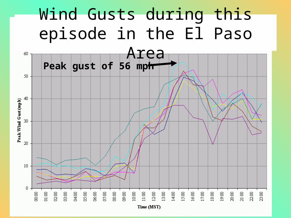
Wind Gusts during this episode in the El Paso Area
Peak gust of 56 mph
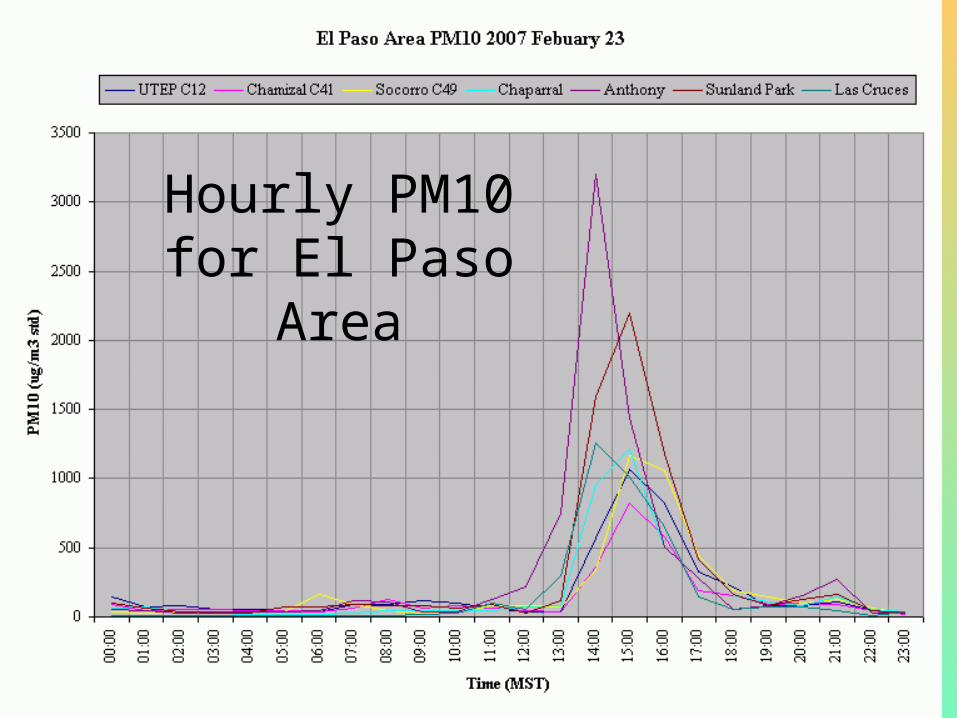
Hourly PM10 for El Paso Area
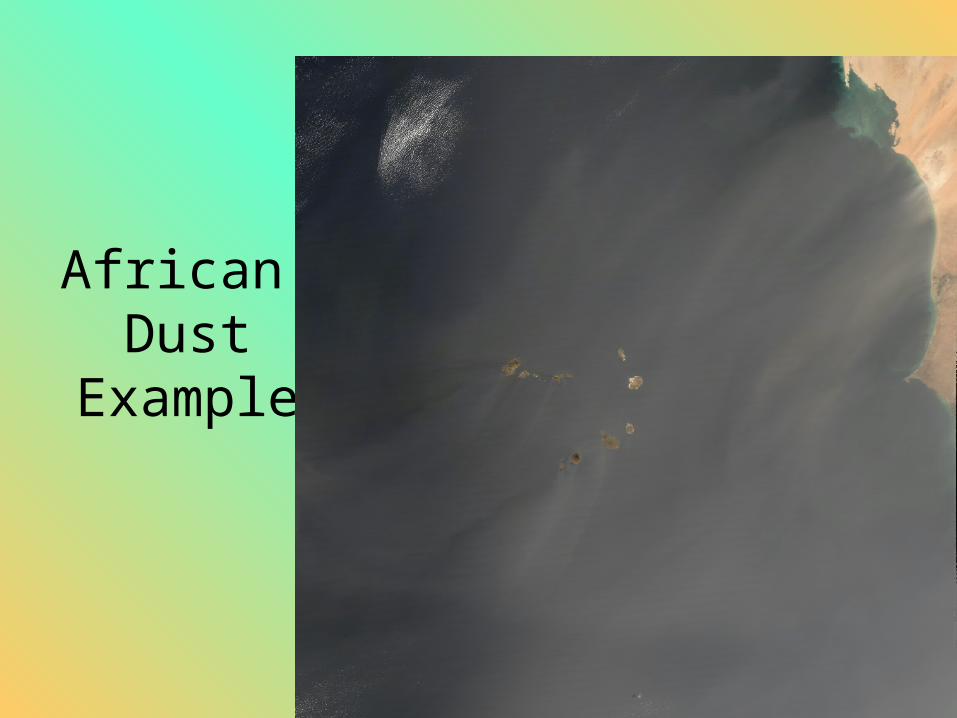
African Dust
Example
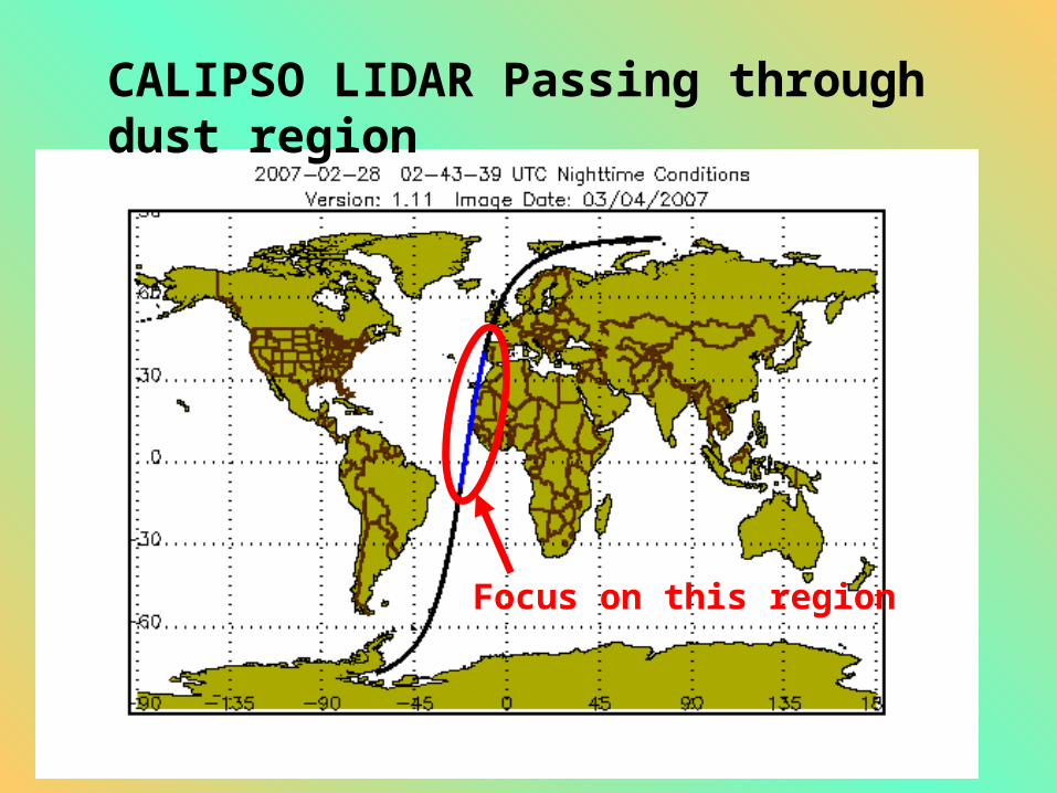
CALIPSO LIDAR Passing through dust region
Focus on this region
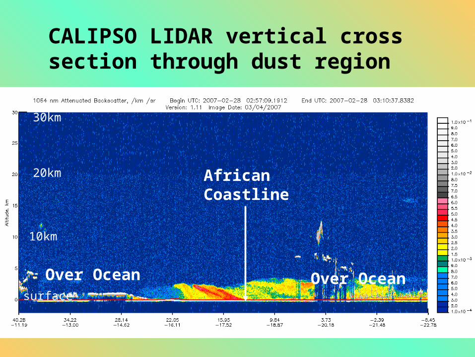
CALIPSO LIDAR vertical cross section through dust region
Over Ocean
AfricanCoastline
Over Ocean
30km
20km
10km
surface
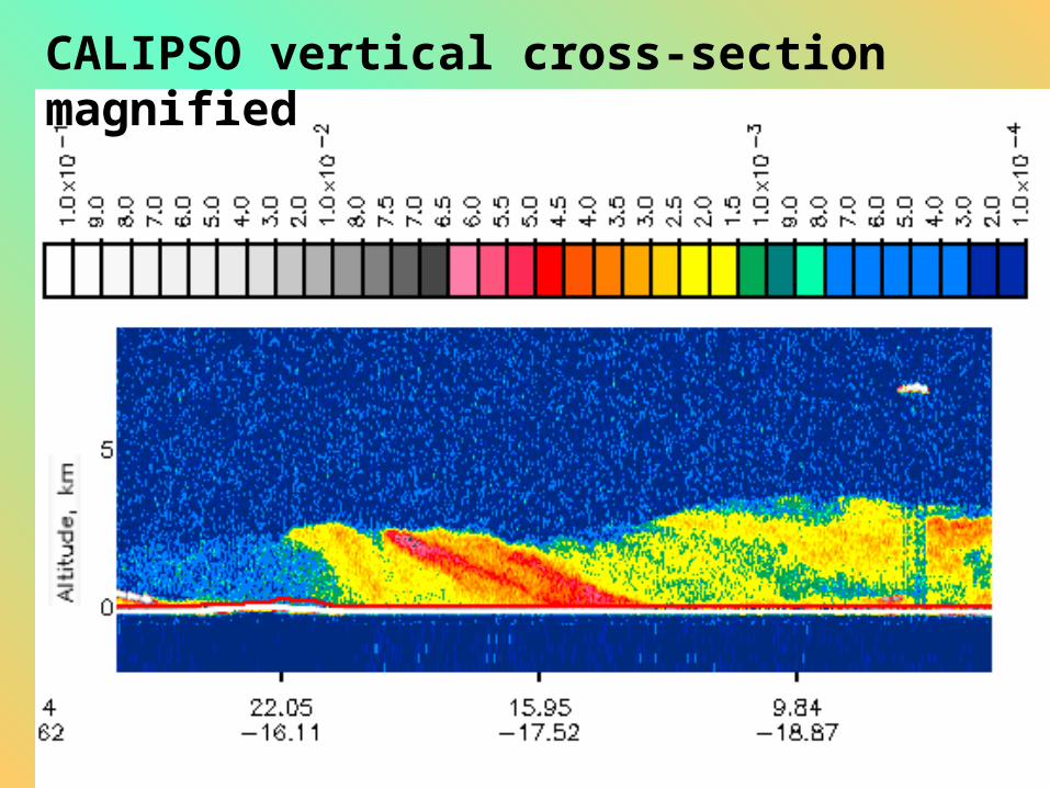
CALIPSO vertical cross-section magnified
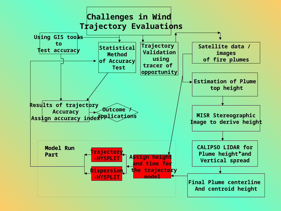
Challenges in Wind Trajectory Evaluations
Trajectory Validation
usingtracer of
opportunity
Using GIS tools to
Test accuracy
Results of trajectory Accuracy
Assign accuracy index
Outcome /applications
Satellite data / images
of fire plumes
Estimation of Plume top height
MISR StereographicImage to derive height
CALIPSO LIDAR forPlume height and
Vertical spread
Final Plume centerline And centroid height
Assign height and time for
the trajectory model
Trajectory-HYSPLIT
Dispersion-HYSPLIT
Model Run Part
Statistical Method
of Accuracy Test
Model Run Part

Acknowledgement
Thanks for the Advisors:
Prof. Mark Green
A. Prof. Dave DuBois

Questions/comments?
Thank you