transboundary groundwater governance in the … · transboundary groundwater governance in the...
TRANSCRIPT

Transboundary Groundwater Governance in the Western U.S.-Mexico (AZ-Sonora) Border Region
Piecemeal Pragmatism vs. Comprehensive Idealism
Robert G. Varady, Christopher A. Scott, Sharon B. Megdal, and Margaret O. Wilder
University of Arizona
Presented at “An Uncommon Dialogue on
U.S.-Mexico Transboundary Water Issues”
Organized by the Bill Lane Center for the American West
Stanford University Palo Alto, CA
2 June 2014

Mileposts for today’s talk
• The Arizona-Sonora part of the U.S.-Mexico border region • Transboundary asymmetries • History of transboundary environmental institutions • Evolution of research on water & climate • Groundwater use & management in the region • The U.S.-Mexico Transboundary Aquifer Assessment Program
• Piecemeal pragmatism vs. comprehensive idealism

Background Conditions in the region
• Monsoon-dependent & water-short; frequent drought, occasional heavy flooding
• Traditional economy: cattle ranching, copper mining, irrigated agriculture • Fragile ecosystems, bird flyways, wildlife, rare plant species • Growing urbanization, economic development • Rising populations

Transboundary asymmetries
• Culture/language/educational systems
• Economy
• Taxation & revenue-generation
• In Sonora, border region is among most prosperous; in AZ, among least
• Legal framework: Napoleonic vs. British
• Administration: federal vs. decentralized
• Human resources & expertise
• Physical infrastructure, nexus sectors
• Regulation & enforcement
• Robustness of institutions & civil society

Transboundary similarities
• Landscape & environment do not respect political borders
• Aridity/water scarcity
• Communities & environments are vulnerable to climate variability & change
• Both sides are distant from the capitals
• Problems require attention at different scales—e.g., in parts of AZ, water is managed via Active Management Areas (AMAs), but basins can cross AMAs & other jurisdictions
• A number of binational environmental institutions are in place
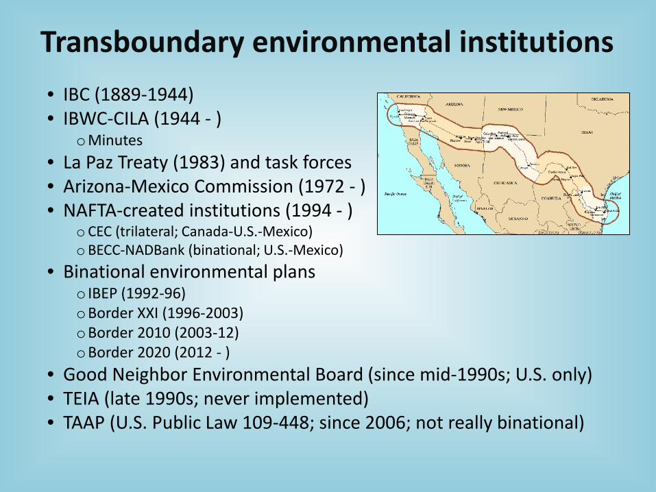
Transboundary environmental institutions • IBC (1889-1944) • IBWC-CILA (1944 - )
oMinutes • La Paz Treaty (1983) and task forces • Arizona-Mexico Commission (1972 - ) • NAFTA-created institutions (1994 - )
o CEC (trilateral; Canada-U.S.-Mexico) oBECC-NADBank (binational; U.S.-Mexico)
• Binational environmental plans o IBEP (1992-96) oBorder XXI (1996-2003) oBorder 2010 (2003-12) oBorder 2020 (2012 - )
• Good Neighbor Environmental Board (since mid-1990s; U.S. only) • TEIA (late 1990s; never implemented) • TAAP (U.S. Public Law 109-448; since 2006; not really binational)

Border environmental-policy research c. 1980s-90s
• Mostly technical/engineering studies
• New attention following La Paz Treaty of 1983
• Formation of binational, thematic working groups via EPA & SEDUE
• Rise of environmental NGOs in U.S.
• Interest in binational copper-smelter-related air quality in late 1980s
• Strong private-foundations support for community-oriented research—e.g., Ford, Hewlett, Mott, Pew

Water-climate research in border region • Impact of NAFTA—new institutions: o harmonize regulations (CEC/CCA) o fund environmental-infrastructure projects, esp. water (BECC/COCEF, NADBank/BANDAN)
• Existing institutions re-energized (e.g., CONAGUA, IBWC/CILA, EPA, ADWR, other agencies)
• New approach to environ. decisionmaking: stakeholders participation, sustainability, transparency
• Advent of Integrated Water Resources Management (IWRM)
• Increased focus on demand management, role of governance, groundwater use, nexus concept
• Incorporation of these paradigms in research
• New work on policy, governance, equity, conflict, and “soft-path” approaches to development & water security

Groundwater in the AZ-Sonora portion of the western U.S.-Mexico
border region

Groundwater governance A working definition
Groundwater governance
The overarching framework of groundwater-use laws, regulations, & customs, as well as processes of engaging the public sector,
private sector, and civil society. It may involve coordinating administrative actions and decisionmaking between/among
different jurisdictional levels.
(Megdal, et al. 2014)

Groundwater use & management Aquifers in the world—and in the U.S.-Mexico border region
U.S.-Mexico border region
Santa Cruz
San Pedro
AZ
Sonora

21105 AF 25.0 MCM
309 AF 0.38 MCM
23300 AF 28.7 MCM
23595 AF 29.1 MCM
16920 AF 20.9 MCM
Santa Cruz, Arizona
Nogales Wash, Sonora
Santa Cruz, Sonora
San Pedro, Sonora
San Pedro, Arizona
Use/availability in two Arizona-Sonora basins
12
Sources: ADWR, CONAGUA, USPP
Water withdrawn by basin/nation per year
Santa Cruz Basin San Pedro Basin

Sectoral distribution of groundwater use Rio Sonora Basin, Mexico
87.6%
1.6% 0.2% 1.7%
8.6% 0.2%
CONSUMO POR USO
AGRICOLA
INDUSTRIAL
MULTIPLE
PECUARIO
PUBLICO URBANO
SERVCIOS
Arizona
Sonora

Groundwater Balance & Management
• Upper Santa Cruz o SCAMA tasked with maintaining
sustainable yield o Nogales, Sonora, has at times
been forced to purchase water from Nogales, AZ
• Upper San Pedro o In 2004 stakeholders charged with
restoring & maintaining sustainable yield in AA
o Drawdowns noted of up to 3 meters between 1995-2000 along river channel in Mexico
14

Groundwater management plans for Santa Cruz Basin
15
• Important to recognize different nature of water management
• How do contrasting management regimes interact across the border within shared basins?
• U.S. Santa Cruz Fourth plan far behind schedule

Management responsibilities for agencies within basins Arizona • AZ Department of Water Resources o Administers & enforces state groundwater
code
• U.S. Geological Survey o collects info. needed to understand water
resources
• U.S. Bureau of Land Management o Manages nation's public lands &resources….
balancing recreational, commercial, scientific & cultural interests and striving for long-term protection of renewable & nonrenewable resources
• Utilities
Sonora • National Water Commission (CONAGUA) o Administers & preserves national waters to
achieve sustainable use
• State Water Commission o Promote coordinated development &
efficiency of water resources in Sonora
• Municipal Utilities o Provisions a& supplies urban users
16

Binational cooperation & initiatives on groundwater
• Arizona-Mexico Commission oState-level work group since 1959 with
13 binational committees (incl. water)
• Border Environment Cooperation Commission oPreserves, protects, enhances human health & environ. along border
• Transboundary Aquifer Assessment Program (TAAP)
17

United States-Mexico Transboundary Aquifer Assessment Program
(TAAP) Currently designated priority transboundary aquifers
• U.S. Public Law 109-448 (2006) • Secy. of Interior to assess priority
transboundary aquifers • Santa Cruz & San Pedro identified on
AZ/Son. border • Approved 10-year appropriation of
US $50M • U.S. funds can be expended in
Mexico with 50% match • Collab. project betw. USGS & Water
Resource Centers in TX, NM, and AZ (CA opted out)
• Binational Santa Cruz & San Pedro reports in Eng. & Span. under review to be released end 2015 (?)

• Complex binational, bicultural environ.
• Rapid economic growth
• Border population >12 million and rising
• Aridity., declining water tables, contamin., lack of sewage treatment in some Mex. cities
• Occasional flooding during monsoon season
• Aquifers are sole or next available source of water
• Knowledge of quantity, quality, movement of transboundary groundwater is inadequate
Transboundary Aquifer Assessment Program (TAAP) Background

Binational partnership • USGS & Univ. Arizona’s Water Resources
Research Center (by U.S. law)
• Additional players on U.S. side o Government agencies at different levels o NGOs
• International Boundary & Water Commission – U.S. Section & Mexican Section (CILA)
• Mexican Government Agencies o Comisión Nacional del Agua (CONAGUA) o Comisión Estatal del Agua de Sonora
• University of Sonora o Contractors for technical work funded by CILA
20

Priority studies • Examine existing models & create hydrologic model of
each basin that o is physically-based o Is binational o integrates surface/ground/unsaturated-zone water
• Summary of Approach o Integrated assessment of priority aquifers o Improve and share data & information Compile extant data Identify data gaps
o Develop unified hydrologic framework o Model construction, calibration, estimate of uncertainty o Model prediction: climate change, urbanization, drought o Create scientific products that Can be widely disseminated Provide scientific information to managers on both sides who have
insufficient data for effective planning
Binational Workplan

Extension with TAAP Stakeholders
Mexico govt. Mexican academic
U.S. govt. U.S. academic Binational Non-govt.
Comisión Nacional del Agua (CONAGUA)
Univ. de Sonora, Instit. Tecnológico de Sonora (ITSON)
Arizona Dept. of Water Resources (ADWR)
Univ. of Arizona IBWC/CILA Friends of the Santa Cruz River (FOSCR)
Upper San Pedro Partnership
Comisión Estatal del Agua (CEA) Sonora
Colegio de Sonora U.S. Bureau of Reclamation (USBOR)
NMSU Sonoran Institute
Organismo Operador Municipal de Agua Potable, Alcantarillado y Saneamiento (OOMAPAS) Nogales
Centro de Estudios Superiores del Estado de Sonora (CESUES)
City of Nogales, Arizona
TAMU UNESCO Intl. Shared Aquifer Resources Management (ISARM) program
Water Committee of Arizona-Mexico Commission

Calidad del Agua
1997 2003 2005 2007
Niveles estáticos medidos
58 30 25 49
Mínima profundidad medida 1.97 5.39 2.79 1.60
Máxima profundidad medida 78.75 83.92 93.83 89.95
Estadísticas de piezometría Acuífero Río San Pedro
Data Sharing with Mexico

“Ground Zero” for Climate Change Spatial distribution multi-model mean change in no. of days > 100° F
U.S.-Mexico Border Region
Source: Adapted from Wilder et al., 2013. Border Communities, in Southwest Region Report (Garfin, et al. 2013). Projections show that days with maximum temperatures greater than 100°F will increase in all parts of the Southwest border region, with largest increases, 30-35 days per year, in AZ-Sonora border region.
NARCCAP, SRES A2 ANNUAL NO. DAYS TMAX > 100° F Difference 2041-2070 minus 1971-2000

Groundwater depletion
• Rising population + urbanization growing demand • Climate change reduced recharge • Growing demand + climate change overdraft • Overdraft = lowered water table = less storage capacity = less availability
Serrat-Capdevila, et al., 2007
Predicted decline in San Pedro aquifer recharge due to climate change
Overexploitation of aquifers in Mexico

Institutional framework for transboundary groundwater governance
• International protocols o Bellagio Model Treaty (drafted by Hayton & Utton, 1989) o Convention on Transboundary Aquifers Modeled on Convention on the Law of Non-Navigational Uses of Intl. Watercourses UN Gen. Assembly adopted Resol. A/RES/63/124 in draft form in Dec. 2009 , but
ratification highly unlikely in near future
• AZ Groundwater Management Act (1980) o Applies to AMAs & Irrigation Non-expansion Areas (INAs)
• Irrigation districts, Sonora—actions in Sonora only o Retiring wells o Selling ejidos’ water rights o Trying to limit “third party” effects
• No formal binational agreement for managing transboundary aquifers
• Science-policy dialogues o e.g., TAAP—does not have force of treaty

Ingredients of effective transboundary science-policy dialogues
• Public participation in decisionmaking by stakeholders from all sectors
• Robust communities of practice that link policymakers, managers, scientists & social scientists
• Strong institutions, esp. binational/multinational institutions • Recognition of interconnectedness & inseparability of all sectors • Access to comparable data & reliable information flows • Significance of governance and soft-path solutions
• Need for Trust for genuine transnational, transborder cooperation

Formal vs. informal arrangements for transboundary groundwater governance
Formal arrangements require • Comparable needs & objectives • Country-to-country, state-to-state,
jurisdiction-to-jurisdiction negotiations • Legal instruments such as treaties & laws • Enforcement mechanisms & compliance • Matching resources & commitments • Trust • Idealism
Informal arrangements entail • Common & specific, short-term, small-to-medium-scale
objectives that are achievable • Access to reliable science & information • Ability to generate & influence research • Continuing participation of decisionmakers, managers,
academics, community groups, NGOs, other stakeholders • Locally- or regionally-developed action plans • Trust • Pragmatism

Transboundary Groundwater Governance in the Western U.S.-Mexico Border Region
This presentation is partly based on work within the Americas component of the
International Water Security Network, which is funded by Lloyd’s Register Foundation, a charitable foundation helping to protect public life and property by supporting
engineering-related education, public engagement and the application of research. For more information, see: lrfoundation.org.uk
Additional support has been provided by the Inter-American Institute for Global Change Research, National Oceanic and Atmospheric Administration, National Science
Foundation, Transboundary Aquifer Assessment Program, U.S. Geological Survey, and Morris K. & Stewart L. Udall Foundation