transit assets and opportunities study
TRANSCRIPT
Transit Assets and Opportunities
Study
STAKEHOLDERS MEETING # 2THE STRAZ CENTER FOR THE
PERFORMING ARTSMAESTRO’S RESTAURANT
WEDNESDAY, JANUARY 22, 2014
WelcomeSTUDY SPONSORS• Hillsborough County MPO
• The Tampa Downtown Partnership
WelcomePROJECT MANAGEMENT TEAM
Agenda
• Overview of Stakeholders Meeting #1
• Needs Assessment• Regional Opportunities

Overview of Stakeholders Meeting #1

Discussion #1•Which area(s) of Downtown Tampa is the current focus of development?
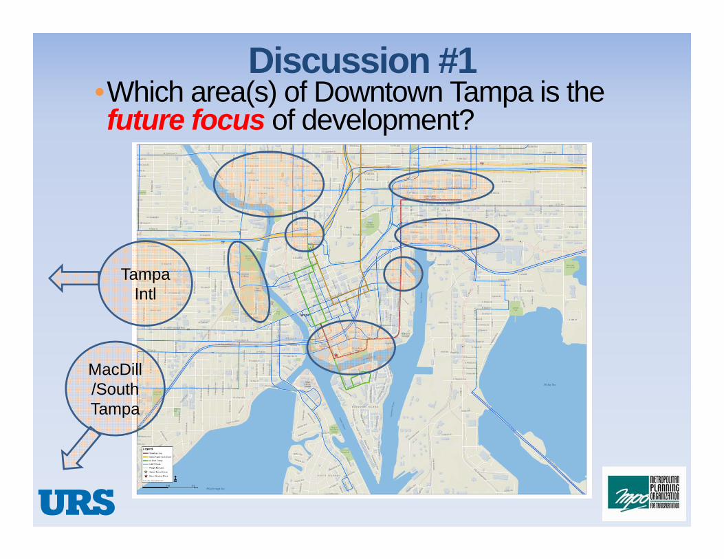
Discussion #1•Which area(s) of Downtown Tampa is the future focus of development?
Tampa Intl
MacDill/South Tampa
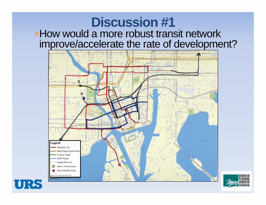
Discussion #1•How would a more robust transit network improve/accelerate the rate of development?

Discussion #1•How do you feel transit best serves development?
• Moves more people• Low cost transportation option • Provides service to uses beyond
home and work
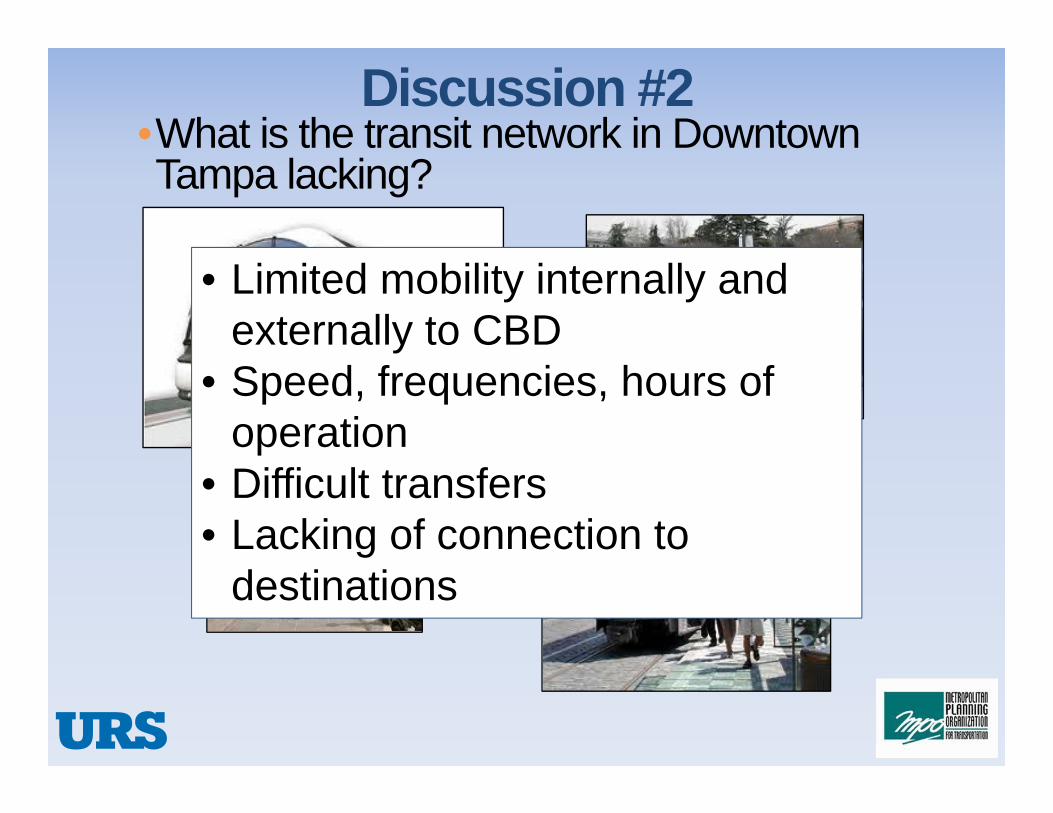
Discussion #2•What is the transit network in Downtown Tampa lacking?
• Limited mobility internally and externally to CBD
• Speed, frequencies, hours of operation
• Difficult transfers• Lacking of connection to
destinations

Discussion #2•What are the 2 things that could/would make it work better?
• More consumer oriented• Account for Florida weather• Inconsistencies in cost of transit
passes• Market as a “mobility” option for
all trips/destinations
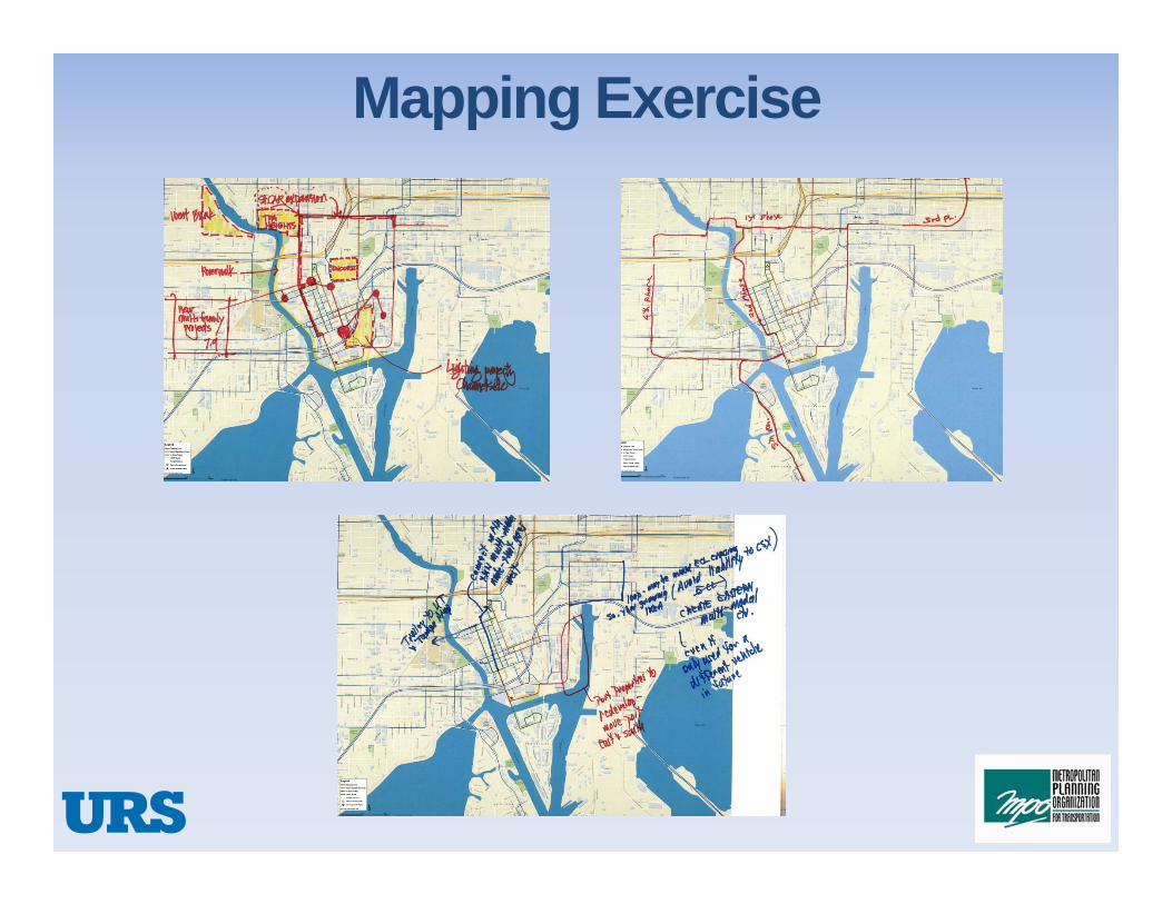
Mapping Exercise
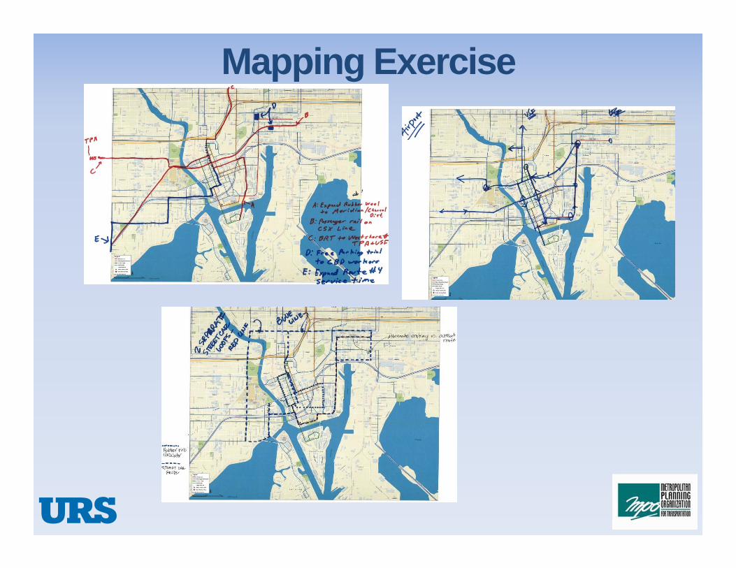
Mapping Exercise
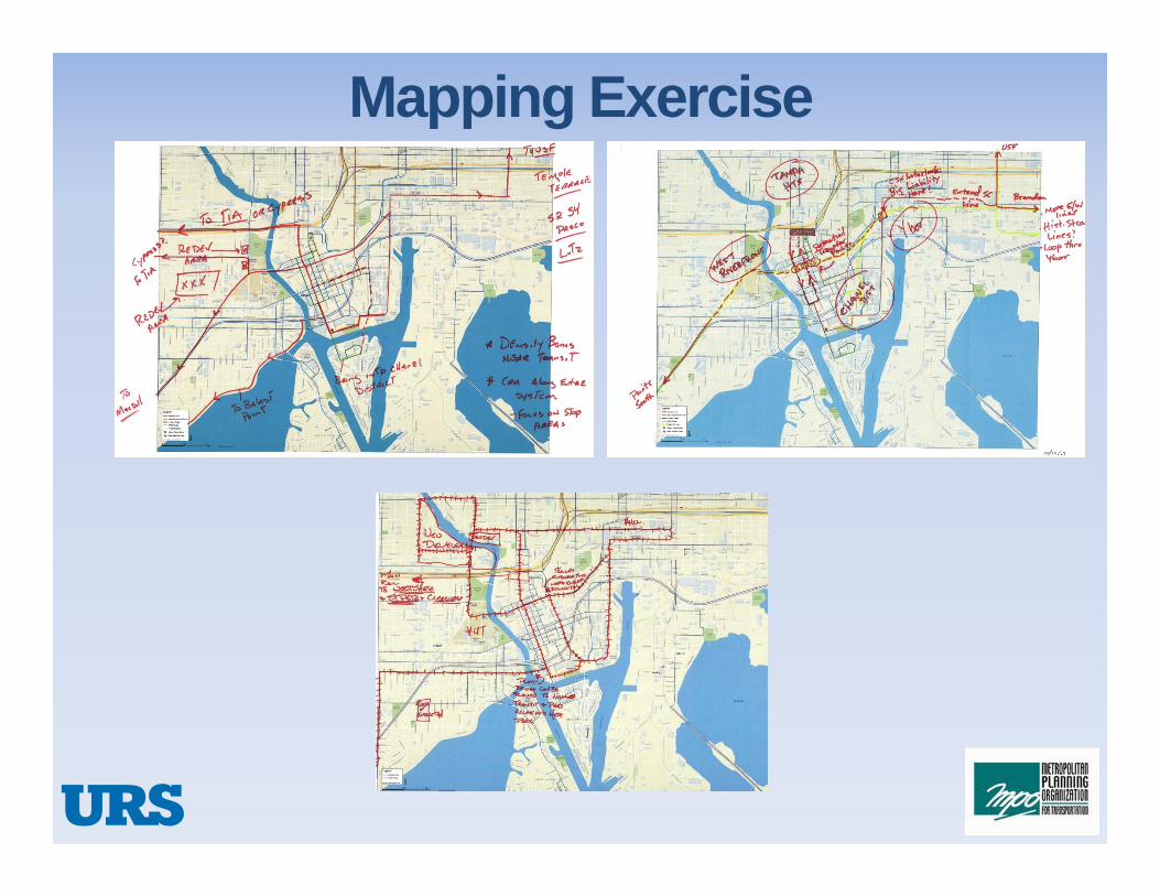
Mapping Exercise

Discussion #3•What role do you see development opportunities playing in possible revenue streams for the transit network?• Incentivize mixed-use opportunities• Changes to parking requirements
that allow developers to use funds to support transit
• Sponsorships, naming rights• P3s, Joint Ventures

Discussion #3•In your opinion(s) does transit network enhance the development or does the development enhance the transit network?
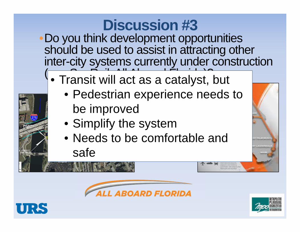
Discussion #3•Do you think development opportunities should be used to assist in attracting other inter-city systems currently under construction (e.g. SunRail, All Aboard Florida)? • Transit will act as a catalyst, but
• Pedestrian experience needs to be improved
• Simplify the system• Needs to be comfortable and
safe

Status of the Needs Assessment

Purpose
• Evaluation of Transit Operations •Time of Day•Route Structure
• Identification of Under-Served Markets• Basis for Opportunities Assessment

Methodology
• Element 1•Assessment of Transit Service in the Central City Area of Tampa
•Movement of Residents, Employees, and Visitors
• Element 2•Assessment of Regional Connections
•Access Between the Central City Area of Tampa and Areas More Distant (County and Regional)

Element 1Transit Operations Assessment
• Assessment of Existing Transit Coverage • Portion of the Central City Area within a “Reasonable” Transit Trip
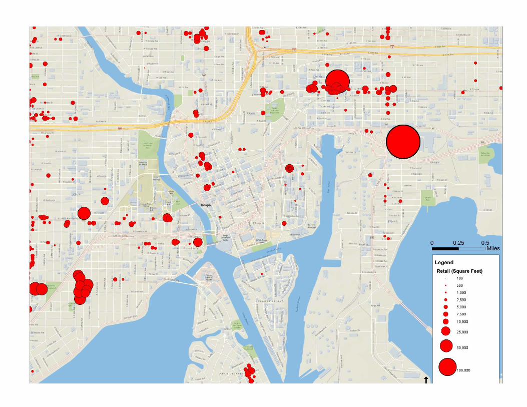
• Assessment of Service to Existing Population and Activity Centers Within the Central City
• Residential, Retail, Employment, Entertainment
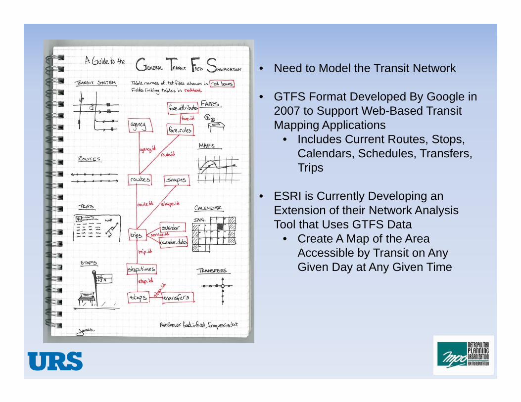
• Need to Model the Transit Network
• GTFS Format Developed By Google in 2007 to Support Web-Based Transit Mapping Applications
• Includes Current Routes, Stops, Calendars, Schedules, Transfers, Trips
• ESRI is Currently Developing an Extension of their Network Analysis Tool that Uses GTFS Data
• Create A Map of the Area Accessible by Transit on Any Given Day at Any Given Time
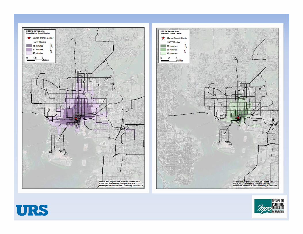
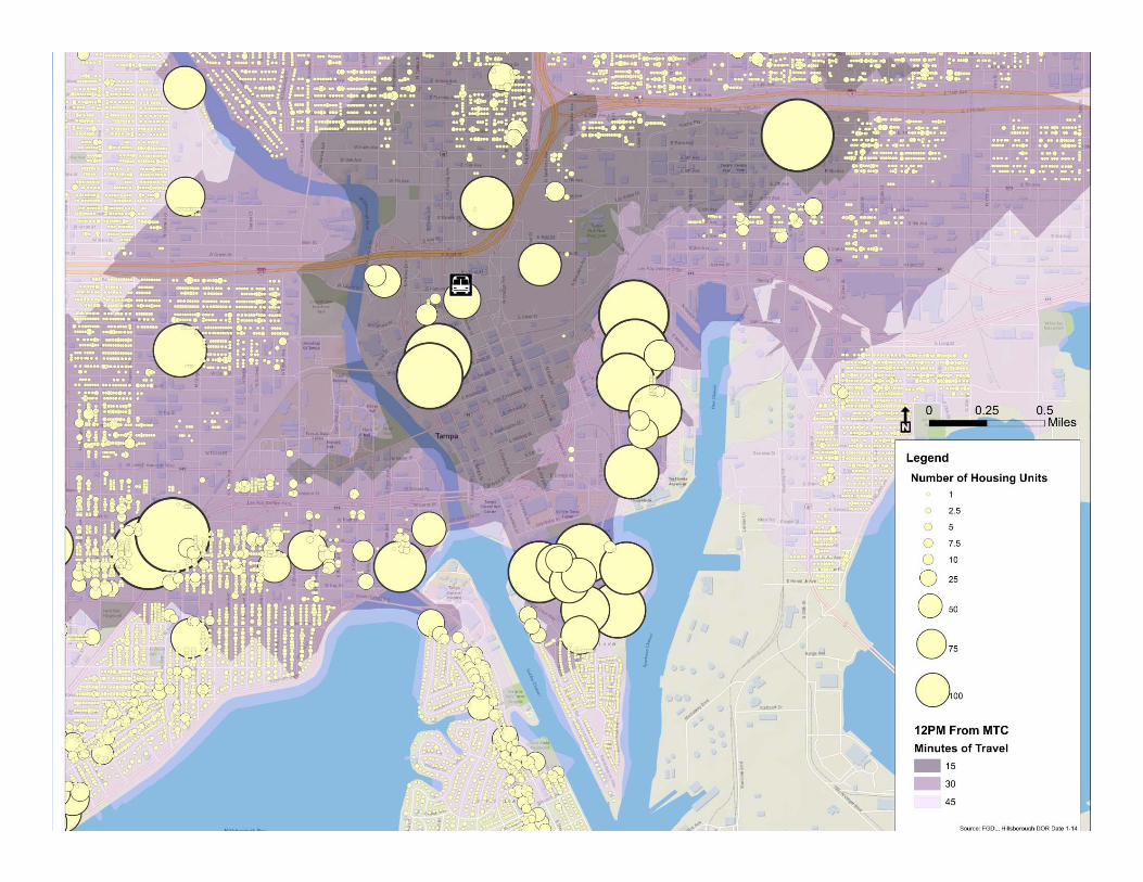
Travel-shed originating FROM the MTCWednesday
4:00 am through 12:15 am• Every 30 minutes
• Walking plus transit


Travel-shed traveling TO the MTCWednesday
4:00 am through 12:15 am• Every 30 minutes
• Walking plus transit

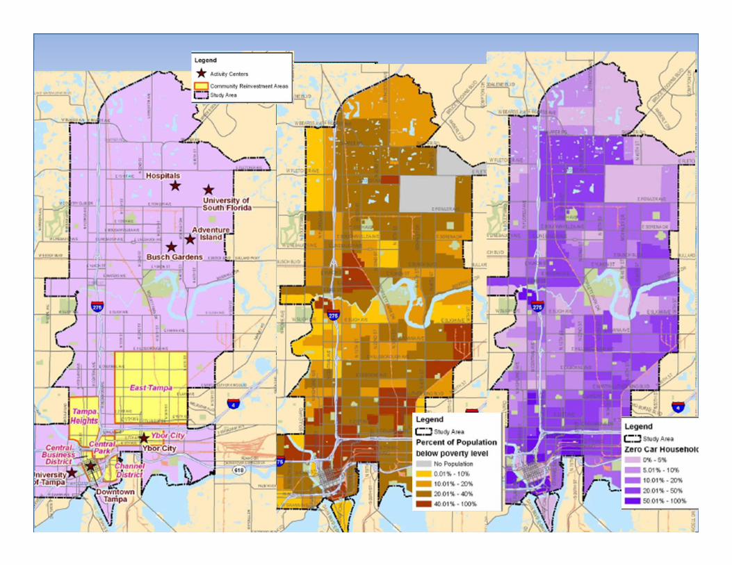
Identification of Existing Population and Activity Centers
• Location and Intensity of Use• Distinct Use in Downtown Serviced by Transit
• Residential • Daily Needs
• Workers• Access In and Out• Mid-Day Attractors
• Tourists • Special Events• Major Attractors


Element 2
• Assessment of Connections Beyond Central City Area
• Expand the Assessment of Existing Population and Activity Centers to County Level
•Draw from Previous Work •Consider Travel Demand•Consider Congestion Analysis•Consider Travel Times
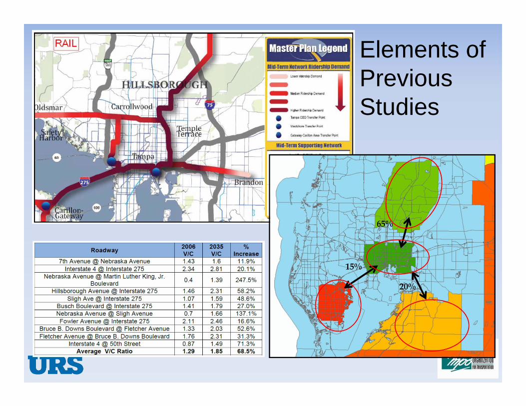
Elements of Previous Studies

Regional Opportunities

Goals and Objectives
• GOAL – Create a regional transit network maximizing the TECO Line Streetcar System.
•OBJECTIVE – Identify projects for the 2040 LRTP
•OBJECTIVE – Identify projects for the 2014 HART TDP

Goals and Objectives• GOAL – Maximize utilization of existing transit
assets and expand service markets.•OBJECTIVE – Identify opportunities along existing freight rail corridors.
•OBJECTIVE – Identify opportunities for effective integration of technologies (rail and bus).
•OBJECTIVE – Identify rail technologies that maximize flexibility existing rail lines.

Regional Focus

Regional High-Capacity Transit Plans• Existing
• TECO Line Streetcar System• HART Metro Rapid
• Proposed Plans• Hillsborough County MPO (2035, 2040 strategy B&C)• HART Metro Rapid East-West• FDOT Express Lanes Master Plan• TIA People Mover• SunRail/All Aboard Florida• TBARTA
• Stakeholder Meeting #1 input

Regional High-Capacity Transit Plans
LEGEND
Existing TransitPossible Future Transit Elements
Commuter RailLight Rail TransitExpress Bus in Express LnBus Rapid TransitInter-Region RailFerry
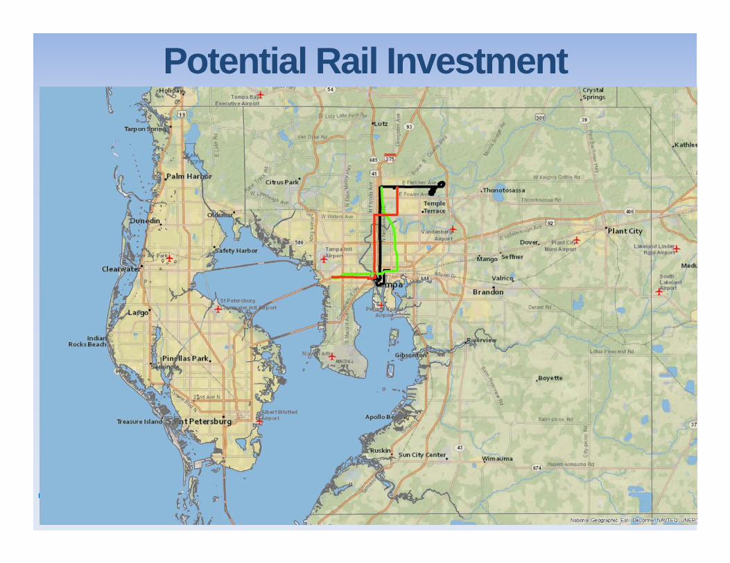
Potential Rail Investment
General Mode & Vehicle Considerations
• Ridership:•Service frequency•Vehicle capacity•Train size
• Performance:•Acceleration and braking
•Maximum speed
• Compliance:•FRA•ADA•Buy America•EPA
• Other Benefits & Constraints
• Cost

High-Capacity Transit Modes

High-Capacity Transit Vehicles
Commuter Rail: Diesel Multiple Unit (DMU)
Commuter Rail: Locomotive Hauled Coach (LHC)
Light Rail Transit
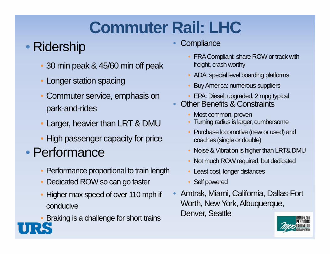
Commuter Rail: LHC• Compliance
• FRA Compliant: share ROW or track with freight, crash worthy
• ADA: special level boarding platforms• Buy America: numerous suppliers • EPA: Diesel, upgraded, 2 mpg typical
• Other Benefits & Constraints• Most common, proven• Turning radius is larger, cumbersome • Purchase locomotive (new or used) and
coaches (single or double)• Noise & Vibration is higher than LRT& DMU• Not much ROW required, but dedicated• Least cost, longer distances• Self powered
• Amtrak, Miami, California, Dallas-Fort Worth, New York, Albuquerque, Denver, Seattle
• Ridership• 30 min peak & 45/60 min off peak
• Longer station spacing
• Commuter service, emphasis on park-and-rides
• Larger, heavier than LRT & DMU
• High passenger capacity for price
• Performance• Performance proportional to train length• Dedicated ROW so can go faster• Higher max speed of over 110 mph if
conducive• Braking is a challenge for short trains

Commuter Rail: DMU• Ridership
• 30 min peak & 45/60 min off peak
• Longer station spacing
• Commuter service, emphasis on park-and-rides
• Larger, heavier than LRT, lower profile, smaller than LHC, single or double-decker
• Economical for smaller passenger volume• Performance
• Distributed power – performance does not degrade with train length
• Faster acceleration and deceleration• Dedicated ROW so can go faster
• Lower max speed of over 90 mph if conducive
• Compliance• FRA Compliant: share ROW or track with
freight, FRA waivers needed• ADA: some require level boarding platform• Buy America: limited suppliers • EPA: Diesel, meet standard, 1 mpg typical
• Other Benefits & Constraints• Least common• Turning radius is same as LHC,
cumbersome • More human scale, TOD potential
increases• Noise & Vibration is lower than LHC• Not much ROW required, but dedicated• Longer distances• Self powered• Greater fuel efficiency
• Austin, Denton, Portland, San Diego
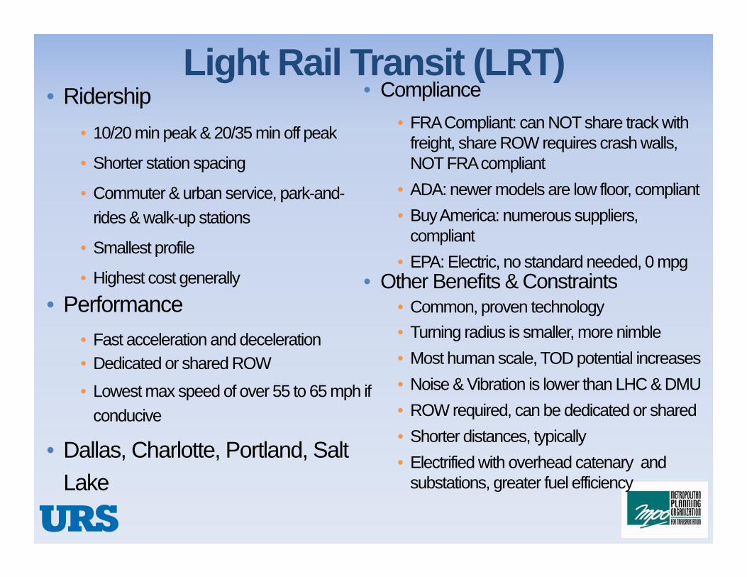
Light Rail Transit (LRT)• Ridership
• 10/20 min peak & 20/35 min off peak
• Shorter station spacing
• Commuter & urban service, park-and-rides & walk-up stations
• Smallest profile
• Highest cost generally
• Performance• Fast acceleration and deceleration• Dedicated or shared ROW• Lowest max speed of over 55 to 65 mph if
conducive
• Dallas, Charlotte, Portland, Salt Lake
• Compliance• FRA Compliant: can NOT share track with
freight, share ROW requires crash walls, NOT FRA compliant
• ADA: newer models are low floor, compliant• Buy America: numerous suppliers,
compliant• EPA: Electric, no standard needed, 0 mpg
• Other Benefits & Constraints• Common, proven technology• Turning radius is smaller, more nimble• Most human scale, TOD potential increases• Noise & Vibration is lower than LHC & DMU• ROW required, can be dedicated or shared• Shorter distances, typically• Electrified with overhead catenary and
substations, greater fuel efficiency

Comparison of Vehicles: Cost and Capacity
240’280 seats
270’200 seats
Bi-Level LHC
DMU Compliant
~ $6 to $7.5 million (new coaches, used loco)
~ $15 to $20 million
DMU Not Compliant~ $6 to $10 million270’
200 seats
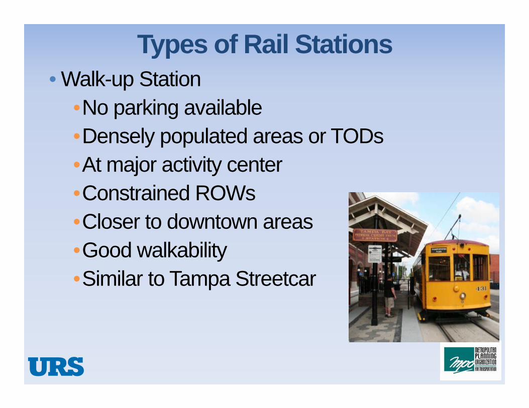
Types of Rail Stations• Walk-up Station
•No parking available•Densely populated areas or TODs•At major activity center•Constrained ROWs•Closer to downtown areas•Good walkability•Similar to Tampa Streetcar

Types of Rail Stations: Walk-Up

Types of Rail Stations
• Park-and-Ride Station•Catch a large area of riders•Parking and drop off available•Suburban areas•Near major roads or highways•Available ROWs•Connection to pedestrian and bike trails
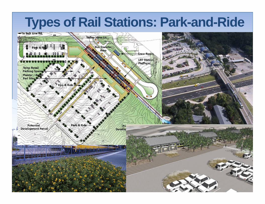
Types of Rail Stations: Park-and-Ride

Types of Stations: Aerial

Potential Rail Investment
Why North Corridor?

Why North Corridor?• Major activity centers – USF, University Hospital,
VA, Moffet Cancer Research Facility, Busch Gardens, Seminole/Tampa Heights neighborhoods, Ybor City
• Existing freight rail ROW• Redevelopment/Infill deveolpment: Ybor City,
East Tampa, Sulfur Springs & Florida (historic streetcar path)
• Work trips: Downtown, USF, Hospitals, Busch Gardens, Ybor City
• Live/Play trips: Downtown, Ybor City, Busch Gardens, Seminole Heights
• Extend to: north suburban communities, Pasco County BRT east-west corridor, west on CSX to West Chase and Pinellas

North CorridorCR: 11 miles
• 3 Park-and-Rides• 2 Walk-Up stations
• CR in CSX ROW sharing track• Serves: Downtown, Ybor, Hillsborough,
Bush Gardens, USF• Travel time USF from Downtown: 35 minLRT: 11 miles
• 9 Park-and-Rides• 1 Walk-Up
• LRT in-street (Florida)• Serves: Downtown, Tampa Heights, Busch
Gardens, Tampa Industrial Park, USF• Travel time USF from Downtown: 36 min

Why West Corridor?

Why West Corridor?• Major activity centers – Westshore largest by
square footage office complex in state, TIA, WMC
• Work trips: Downtown, Westshore, TIA • Live/Play trips: Downtown, UT, TIA, Westshore• Future Extensions: Pinellas County, South
Peninsula (Hyde Park, AFB), Veterans
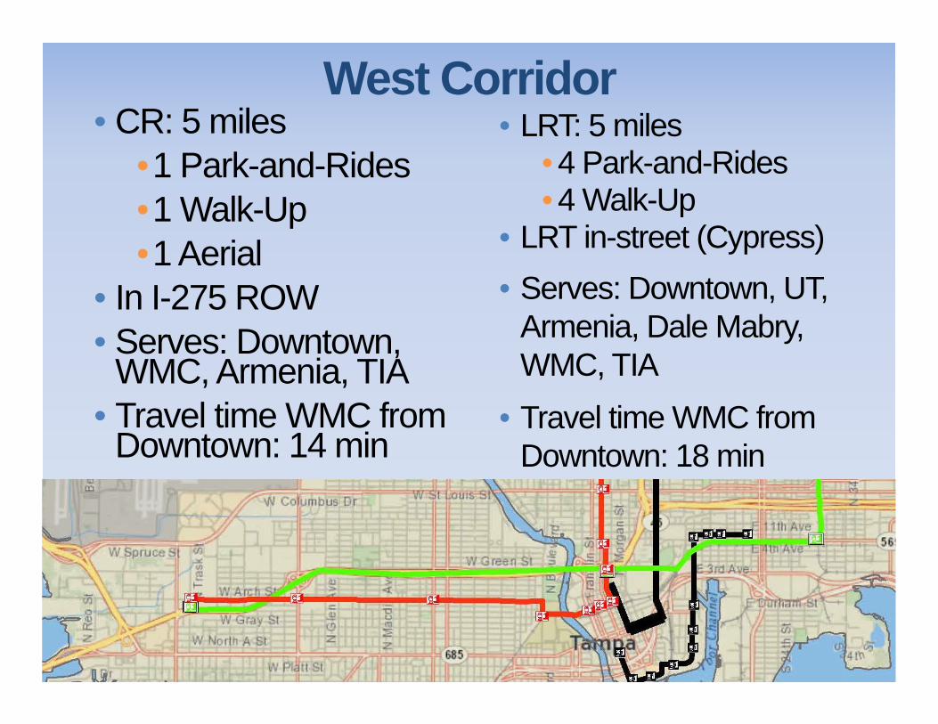
West Corridor• CR: 5 miles
•1 Park-and-Rides•1 Walk-Up•1 Aerial
• In I-275 ROW• Serves: Downtown,
WMC, Armenia, TIA• Travel time WMC from
Downtown: 14 min
• LRT: 5 miles• 4 Park-and-Rides• 4 Walk-Up
• LRT in-street (Cypress)• Serves: Downtown, UT,
Armenia, Dale Mabry, WMC, TIA
• Travel time WMC from Downtown: 18 min
Suggested Next Meetings
•Meeting #3: week of February 17, 2014
•Public Meeting # 1: Early March 2014
•Meeting #4: week of March 17, 2014