unified development code
TRANSCRIPT

UNIFIEDDEVELOPMENTCODE
USER'S MANUAL
PRODUCED BY CAMIROS

-- This Page Intentionally Blank --

UNIFIED DEVELOPMENT CODE USER'S MANUAL
How do I Use This Manual? This User’s Manual is intended to provide a brief overview of the organization of the Spring Hill UDC, the general purpose of the various Articles of the UDC, and summaries of some of the key code sections -- including zoning districts, uses, parking standards, site development standards, subdivision, and administration.
This manual is for informational purposes only. It should be used as a reference only, and not to determine official development regulations, or for legal purposes. Please refer to the full Unified Development Code and Zoning Map for further information.
City of Spring Hill | Unified Development Code User’s Manual | Introduction & Contents
User’s Manual ContentsCode Organization ..................................................................................................................................................01
Zoning Districts .......................................................................................................................................................05
Uses .........................................................................................................................................................................11
Site Development, Parking, Landscape & Signs .....................................................................................................15
Administration & Nonconformities .........................................................................................................................27
Subdivision & Right-of-Way Standards ..................................................................................................................31
Design Review .........................................................................................................................................................35
Enforcement ...........................................................................................................................................................35
1
2
3
4
5
6
7
8
What is the Unified Development Code? A Unified Development Code combines the relevant development regulations into a single code. The UDC is the “rule book” for land development and building within the City of Spring Hill, Tennessee. Four major components of the Unified Development Code are:
Zoning Ordinance. Zoning regulates what structures and land are used for, where a structure may locate on a lot, and how big that structure can be. It also regulates other elements of site development, such as accessory structures, parking, and landscape. Zoning regulations are divided into zoning districts, so that use, dimensional, and design regulations are tailored to the character of the particular zoning district.
Subdivision Regulations. Subdivision regulations provide the rules for dividing up land into buildable lots as well as the rules for public improvements that serve those lots.
Design Review. Tennessee authorizes the City to create a Design Review Commission, which Spring Hill has designated as the Planning Commission. The UDC incorporates design standards and their review and administration per the Tennessee Code Annotated (TCA).
Zoning Map. The Zoning Map identifies the location of the zoning districts, thereby specifying the land use and development requirements affecting each parcel of land within the City of Spring Hill.

-- This Page Intentionally Blank --

City of Spring Hill | Unified Development Code User’s Manual | Ordinance Organization 1
1. Code OrganizationThe Spring Hill Unified Development Code is organized into 19 Articles, each one containing information on a specific regulatory category and purpose. The table below briefly describes the general purpose of each of these Articles.
ARTICLE GENERAL PURPOSE
Title, Purpose, and Applicability
Article 1 introduces the purpose of the Unified Development Code through a series of purpose statements, describes how the UDC applies to land within the City of Spring Hill, and contains the rules for transitioning between the previous ordinances and the new UDC, and future amendments to the UDC.
Definitions and Rules of Measurement
Article 2 includes two major items of general applicability throughout the UDC: 1) Definitions for all the terms used generally throughout the Code; and 2) Rules of Measurement for various dimensional requirements, which ensures consistency.
Zoning Districts and Zoning Map
Article 3 identifies all of the zoning districts included in the UDC, and provides an introduction to the Zoning Map.
Residential Districts
Article 4 includes zoning regulations for each residential district established by the Unified Development Code. Dimensional standards for each residential district are provided in a table. Additional standards pertaining to the R-MH Manufactured Home District are included to ensure safe and well-designed manufactured home parks. The following districts are included in Article 4:
Commercial Districts
Article 5 contains regulations for each of the commercial districts and three commercial sub-districts included in the Unified Development Code. Dimensional and design standards are provided for each of the districts in table format. The following districts are included in Article 5:
Industrial Districts
Article 6 contains zoning regulations, including dimensional and design standards, for the UDC’s three industrial districts. The following industrial districts are included in Article 6:
Residential Districts
• R-A Rural Agricultural District
• R-R Rural Residential District
• R-1 Single-Family District
• R-2 Single-Family District
• R-3 Single-Family District
• R-4 Single-Family District
• R-5 Single-Family and Two-Family District
• R-6 Multi-Family District
• R-7 Multi-Family District
• R-MH Manufactured Home District
Commercial Districts
• C-1 Neighborhood Commercial District
• C-2 Professional Office District
• C-3 Corridor Commercial District
• C-4 General Commercial District
• C-G Gateway Mixed-Use District
• C-D Downtown District
· C-D-C Downtown Center Sub-District
· C-D-E1 Downtown Edge 1 Sub-District
· C-D-E2 Downtown Edge 2 Sub-District
1
2
3
4
5
6Industrial Districts
• I-1 Light Industrial District
• I-2 General Industrial District
• RD Research and Development District

City of Spring Hill | Unified Development Code User’s Manual | Ordinance Organization2
ARTICLE GENERAL PURPOSE
Special Purpose Districts
Article 7 includes dimensional and design regulations for six special purpose districts established by the UDC. The Article’s last section is reserved for the potential future development of the H Historic Overlay District. Zoning regulations for the following districts are included in Article 7:
Uses
Article 8 contains the Use Matrix, a matrix that shows which uses are permitted, special, or prohibited in each district. Article 8 also contains general use regulations, definitions for all of the principal and temporary uses allowed within the zoning districts, and use standards for certain principal and temporary uses that may have additional impacts. The use standards included in Article 8 are designed to mitigate impacts or design concerns associated with these specific uses.
On-Site Development Standards
Article 9 includes regulations that apply to lots, aside from the principal dimensional standards contained within the districts. These regulations include standards relating to lighting, accessory structures and uses, encroachments into setbacks, and environmental performance standards.
Off-Street Parking and Loading
Article 10 contains the standards for parking, which include the required number of vehicle parking, bicycle parking, and loading spaces. This article also includes standards for the design of all parking areas and driveways, parking exemptions and flexibilities, and shared parking provisions.
Landscape
Article 11 contains regulations related to landscaping requirements for both residential and non-residential districts, including site landscape, parking lot landscape, and required landscape buffer yards. The landscape design standards included in the article address minimum planting size, species diversity, and berming.
SignsArticle 12 contains the regulations and design standards for signs, including prohibited signs, exempt signs, and signs that require a permit. Regulations related to billboards are also included in Article 12.
Zoning Applications
Article 13 describes how to file an application, requirements for notice, and the procedures for the following zoning applications:
7
8
9
10
11
12
13
Special Purpose Districts
• IC Institutional Campus District
• AG Agricultural District
• PR Public Recreation District
• NA Natural Areas District
• F-1 Open Floodways District
• HS Hillside Slope Overlay District
• Zoning Text and Map Amendment
• Special Use
• Variance
• Planned Development
• Site Plan Review
• Zoning Interpretation
• Sign Permit
• Temporary Use Permit
• Zoning Appeals
Commercial Districts - Article 5 Landscape - Article 11
City of Spring Hill | Unified Development Code User’s Manual | Ordinance Organization 3
ARTICLE GENERAL PURPOSE
Nonconformities Article 14 includes regulations related to the control of nonconforming uses, structures, lots of record, and signs.
Required Public Improvements and Bonds
Article 15 contains regulations for lots created by subdivision, including standards relating to public improvements, lot configurations, common open space, storm water management, utilities, easements, and performance bonds.
Right-of-Way Design and Access Management
Article 16 includes right-of-way and access standards that apply to all new construction, reconstruction, and reconfiguration of City rights-of-way. These regulations relate to connectivity and the design of rights-of-way, blocks, sidewalks, pedestrian access points, bike lanes, street lights, and street signs.
Subdivision Approval
Article 17 describes the purpose and process for subdivision approvals under the UDC. This article establishes the regulatory authority over approval based on subdivision type, and contains application requirements, public noticing, and approval procedures.
Design ReviewArticle 18 describes the process of review before the Design Review Commission for non-residential and multi-family residential projects.
Enforcement Article 19 describes the rules for enforcement.
14
15
16
17
18
19
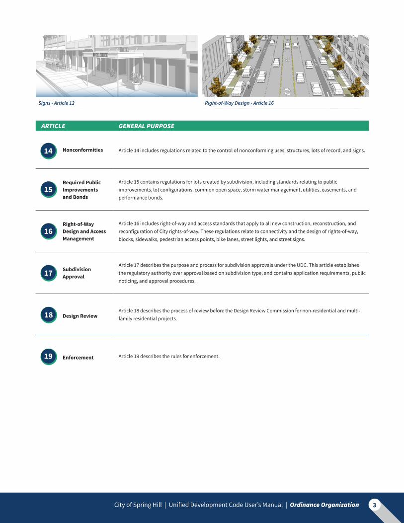
Signs - Article 12 Right-of-Way Design - Article 16

City of Spring Hill | Unified Development Code User’s Manual | Ordinance Organization4
-- This Page Intentionally Blank --

City of Spring Hill | Unified Development Code User’s Manual | Zoning Districts 5
2. Zoning DistrictsAll of the districts within the Spring Hill Unified Development Code are described in the table below. The table includes a description of the purpose for each district, and indicates the location of key dimensional standards, design standards, and unique requirements for each district in the Code. Refer to the Zoning Map to determine the location of zoning districts.
Residential Districts - Article 4
DISTRICT PURPOSE KEY DIMENSIONAL STANDARDS
ADDITIONAL STANDARDS
R-A Rural Agricultural
District
The R-A District is intended for limited single-family residences within agricultural areas. All residences within this district must be compatible with surrounding agricultural operations, with regulations that ensure compatibility with the larger surrounding agricultural character.
Table 4-1 in Section 4.3 provides key dimensional standards for each residential district, including:
• Minimum Lot Area and Lot Width
• Maximum Building Height
• Maximum Building Coverage and Impervious Surface Coverage
• Minimum setbacks for front, rear, interior side, corner side, and reverse corner sides as applicable
The use standards of Article 8 provide design standards for the dwelling types: single-family, two-family, three-family, townhouse, and multi-family.
R-RRural Residential
District
The R-R District is intended for large-lot, estate-type residential areas within a low density environment that relate to a more rural character. Limited non-residential uses are allowed that are compatible with the low density, open character of the district.
R-1Single-Family
District
The R-1 District is intended to provide for a neighborhood environment of single-family detached dwellings located on lots of 20,000 square feet or larger. Limited non-residential uses that are compatible with the residential neighborhood may be permitted.
R-2Single-Family
District
The R-2 District is intended to provide for a neighborhood environment of single-family detached dwellings located on lots of 10,000 square feet or more. Limited non-residential uses that are compatible with the residential neighborhood may be permitted.
R-3Single-Family
District
The R-3 District is intended to provide for a neighborhood environment of single-family detached dwellings located on lots of 8,000 square feet or more. Limited non-residential uses that are compatible with the residential neighborhood may be permitted.

City of Spring Hill | Unified Development Code User’s Manual | Zoning Districts6
Residential Districts (continued) - Article 4
DISTRICT PURPOSE KEY DIMENSIONAL STANDARDS
ADDITIONAL STANDARDS
R-4 Single-Family
District
The R-4 District is intended for higher density detached single-family development. Limited non-residential uses that are compatible with the residential neighborhood may be permitted. Table 4-1 in Section 4.3
provides key dimensional standards for each residential district, including:
• Minimum Lot Area and Lot Width
• Maximum Building Height
• Maximum Building Coverage and Impervious Surface Coverage
• Minimum setbacks for front, rear, interior side, corner side, and reverse corner sides as applicable
The use standards of Article 8 provide design standards for the dwelling types: single-family, two-family, three-family, townhouse, and multi-family.
R-5Single-Family and
Two-Family District
The R-5 District is intended for the highest density detached single-family and two-family development. Limited non-residential uses that are compatible with the residential neighborhood may be permitted.
R-6Multi-Family
District
The R-6 District accommodates a variety of residential structures, such as two-family dwellings, townhouses, and multi-family housing. The R-6 District is intended for areas where adequate public utilities and other infrastructure exists that can serve higher density development, as well as areas where such development will not negatively impact lower density residential neighborhoods. Limited non-residential uses that are compatible with the residential neighborhood may be permitted.
R-7Multi-Family
District
The R-7 Multi-Family District is intended to provide for a higher density residential environment of townhouse and multi-family dwellings. The R-7 District is intended for areas where adequate public utilities and other infrastructure exists that can serve higher density development, as well as areas where such development will not negatively impact lower density residential neighborhoods. Limited non-residential uses that are compatible with the residential neighborhood may be permitted.
R-MHManufactured Home District
The R-MH District is intended for manufactured home parks, which are areas containing manufactured home sites arranged on a large tract, typically under single ownership, and designed to accommodate manufactured homes.
Additional dimensional standards apply to manufactured home parks located within the R-MH Manufactured Home District. These standards are found in Section 4.4.

Commercial Districts - Article 5
DISTRICT PURPOSE KEY DIMENSIONAL STANDARDS
ADDITIONAL STANDARDS
C-1 Neighborhood
Commercial District
The C-1 District is intended for small-scale commercial uses that primarily serve residents in the nearby neighborhoods. This district can be integrated into select residential neighborhoods to achieve the goals of mixed-use neighborhood development in the Comprehensive Plan. Low intensity mixed-use is encouraged, with dwellings above the ground floor allowed in addition to basic commercial uses. Development standards focus on compatibility with surrounding neighborhoods.
Table 5-1 in Section 5.3.C provides key dimensional standards for the C-1, C-2, C-3, C-4, and C-5 Districts, including:
• Minimum Lot Area and Lot Width
• Maximum Gross Floor (if applicable)
• Minimum Building Height (if applicable)
• Maximum Building Height
• Maximum Impervious Surface Coverage
• Minimum Setbacks for front, rear, interior side, and corner sides
Table 5-2 in Section 5.4.A contains design standards for the C-1, C-2, C-3, C-4, and C-5 Districts. Standards include the categories of façade design, fenestration design, entryway design, roof design, commercial center site design, site elements, and prototype design.
C-2Professional Office
District
The C-2 District is intended to address areas in the City suitable for professional offices, including medical offices, which can serve as a transition between residential and commercial areas. This district is oriented to low-intensity office developments.
C-3Corridor
Commercial District
The C-3 District is intended to address the commercial corridors that are primarily oriented toward a mix of retail, personal service, and office uses along the arterials and collectors in the City. Both mixed-use development and auto-oriented uses can be accommodated in these areas.
C-4General Commercial
District
The C-4 District is intended for higher-intensity mixed-use commercial corridors and commercial intersections. The district standards address its relationship to adjacent neighborhoods due to the higher intensity of use, especially access, connectivity, and buffering.
C-5Regional
Commercial District
The C-5 District is intended to for areas with a variety of retail, personal service, entertainment, and offices that serve both the local and regional markets within larger-scale, auto-oriented developments that generate a sizeable amount of traffic and a significant demand for off-street parking.
City of Spring Hill | Unified Development Code User’s Manual | Zoning Districts 7

Commercial Districts (continued) - Article 5
DISTRICT PURPOSE KEY DIMENSIONAL STANDARDS
ADDITIONAL STANDARDS
C-DDowntown District
The C-D District is intended to recognize the historic significance of properties located within the district while facilitating development and redevelopment as envisioned in the Comprehensive Plan. Standards focus on preserving and enhancing historic character while also facilitating the creation of a vibrant, pedestrian-friendly, mixed-use district identifiable as the center of the City.
Table 5-3 in Section 5.5.B provides dimensional standards for the three C-D Downtown District sub-districts.
Section 5.5.C contains design standards for the C-D District.
C-D-CDowntown Center
Sub-District
The C-D-C Downtown Center Sub-District is intended to facilitate the creation of a compact, walkable environment that promotes a sense of place and community, and encourages active living and community interaction. It accommodates moderate to high density mixed-use development that may include a mix of residential, professional office, retail, entertainment, and cultural uses.
Table 5-3 in Section 5.5.B provides key dimensional standards for each Downtown District sub-district, including:
• Minimum Building Height
• Maximum Building Height
• Maximum Impervious Surface Coverage
• Minimum Setbacks for front, rear, interior side, and corner sides
• Required Build-to Percentages for front and corner sides
Section 5.5.C contains design standards for the three C-D District sub-districts. Standards include the categories of residential conversions, façade design, fenestration design, roof design, site elements, and prototype design.
C-D-E1Downtown Edge 1
District
The C-D-E1 Downtown Edge 1 Sub-District is intended to address areas of transition between the higher intensity environment of the Downtown Center and adjacent residential districts and small-scale neighborhood commercial. The C-D-E1 Sub-District is intended to facilitate mixed-use development with standards that focus on compatibility with adjacent development. The C-D-E1 Sub-District includes specific standards related to the reuse and redevelopment of existing residential structures located within the Downtown.
C-D-E2Downtown Edge 2
District
The C-D-E2 Downtown Edge 2 Sub-District is intended to address areas of transition from the C-D-E1 Sub-District to lower-intensity residential districts. The C-D-E2 Sub-District is intended to facilitate mixed-use development, with standards that focus on compatibility with adjacent development. The C-D-E2 Sub-District includes specific standards related to the reuse and redevelopment of existing residential structures, as well as a set of use restrictions designed to create a lower-intensity mixed-use environment.
C-GGateway Mixed-Use
District
The C-G District is intended for the highest intensity of development in the City. The district is a very high intensity mixed-use district allowing for a variety of uses.
Table 5-4 in Section 5.6.A provides dimensional standards for the C-G District.
Section 5.6.B contains design standards for the C-G District.
City of Spring Hill | Unified Development Code User’s Manual | Zoning Districts8

Industrial Districts - Article 6
DISTRICT PURPOSE KEY DIMENSIONAL STANDARDS
ADDITIONAL STANDARDS
I-1 Light Industrial
District
The I-1 District is intended to provide for a wide variety of light manufacturing, fabricating, processing, testing and scientific laboratories, wholesale distributing, and warehousing uses. Light industrial uses are enclosed, low-intensity, non-nuisance light fabrication and assembly-type manufacturing, as well as office and research and development facilities with little to no outside impacts.
Table 6-1 in Section 6.3 provides key dimensional standards for each industrial district, including:
• Minimum Lot Area and Lot Width
• Maximum Gross Floor (if applicable)
• Maximum Building Height
• Maximum Impervious Surface Coverage
• Minimum Setbacks for front, rear, interior side, and corner sides
Table 6-2 in Section 6.4.A contains design standards for the industrial districts. Standards include the categories of façade design, roof design, entrance design, site design, and site elements.
I-2General Industrial
District
The I-2 District is intended to provide for a wide variety of general manufacturing, fabricating, processing, wholesale distributing and warehousing uses. The industrial uses include fabrication, warehousing and assembly-type manufacturing, as well as office and research and development facilities, which may result in some moderate external effects such as smoke, noise, glare or vibration, and typically include outdoor storage and related outdoor activities.
RDResearch and Development
District
The RD District is intended as an innovation district that would accommodate research and development, technology, and medical facilities, and may include some light industrial uses. The district is oriented to large-scale office complexes, which may include ancillary services for employees within the campus such as personal services, restaurants, and retail.
City of Spring Hill | Unified Development Code User’s Manual | Zoning Districts 9

Special Purpose Districts - Article 7
DISTRICT PURPOSE KEY DIMENSIONAL STANDARDS, DESIGN STANDARDS, AND UNIQUE REQUIREMENTS AND PROVISIONS
ICInstitutional
Campus District
The IC Institutional Campus District is intended to accommodate governmental uses, larger public and private educational facilities, cultural facilities, institutional uses, and similar uses located within the City.
Table 7-1 in Section 7.1.C provides key dimensional standards for the IC Institutional Campus District. Design standards for the district are contained in Section 7.1.D and include provisions related to façade design, roof design, building materials, and site elements.
AGAgricultural District
The AG Agricultural District is intended to promote and protect agricultural land. The standards of the district promote the continuation of farming, and protect agricultural land uses from encroachment of incompatible developments.
Table 7-2 in section 7.2.C includes key dimensional standards for the AG Agricultural District.
PRPublic Recreation
District
The PR Public Recreation District is intended to provide for and protect open space and public recreational facilities, both outdoor and indoor. Larger regional open spaces/parks may include both active and passive recreation areas and certain ancillary commercial activities, such as cultural facilities, performance venues, and eating establishments.
Table 7-3 in section 7.3.C provides key dimensional standards for the PR Public Recreation District. Design standards for the district are contained in Section 7.3.D and include provisions related to façade design, roof design, and building materials.
NANatural Areas
District
The NA Natural Areas District is intended to protect and preserve existing natural areas and undeveloped sites that are of historic or cultural significance. These areas are maintained in a predominantly undeveloped, natural state, with very limited improvements that allow only for passive recreation, such as trails, and educational purposes.
Table 7-4 in section 7.4.C includes key dimensional standards for the NA Natural Areas District.
F-1Open Floodway
District
The purpose of the F-1 Open Floodway District is to minimize public and private losses due to flood conditions in specific areas. The district is designed to restrict uses which are vulnerable to water or erosion hazards, require protections against flood damage, control the alteration of natural floodplains, and prevent the construction of flood barriers which will increase flood hazards to surrounding areas.
Section 7.5.G contains provisions for flood hazard reduction in the F-1 Open Floodway District.
HSHillslide Slope
District
Hillsides constitute significant natural topographic features of the community and create aesthetic settings, often visible citywide. In order to insure hillside preservation, the HS Overlay District regulations are established to recognize development in hilly areas. Special considerations are given for unique situations that result from the slope of the land.
Section 7.6.C provides hillside development regulations related to slope, density, impervious surface coverage, building height, and stabilization.
Special Development Types - Section 13.5
Planned Development (PD) is included in the Unified Development Code in Article 13 as a special type of development intended to encourage and allow more creative and flexible development of land than is possible under base district zoning regulations. Planned Development is not a zoning district, but rather a special approval granted under the provisions of Article 13. Planned Developments are permitted in all districts but the R-MH, AG, PR, and NA Districts.
City of Spring Hill | Unified Development Code User’s Manual | Zoning Districts10

City of Spring Hill | Unified Development Code User’s Manual | Uses 11
3. UsesArticle 8 contains the Unified Development Code’s Use Matrix, use definitions, general use regulations, and use standards for Principal Uses and Temporary Uses.
A Principal Use is the main use of land or structures. The use matrix identifies three types of use allowances:
Permitted Use - A permitted use is a use that is allowed by right, which is specifically authorized in a particular zoning district. Permitted uses are indicated in the Use Matrix with a “P”.
Special Use - A special use is a regulated use that is permitted pursuant to approval by the Board of Zoning Appeals. Special uses are generally those that would have greater impact on the surrounding neighborhood environment, and therefore require special consideration and approval. Special uses are indicated in the Use Matrix with an “S”.
Prohibited Use - Any use that is not listed in the Use Matrix is prohibited in all districts. If a cell in the Use Matrix is blank, the use is prohibited in that district.
Temporary Use - A temporary use is a use that is not of a permanent nature, such as a farmer’s market or outdoor entertainment event. Unless otherwise indicated within the Code, all temporary uses require a temporary use permit. The UDC only controls temporary uses on private property; Temporary uses located within the public right-of-way are regulated separately by the City Code. Temporary uses are indicated at the end of the Use Matrix with a “T”.
The Use Standards, an additional set of requirements that must be met before a use is allowed, are provided in Article 8. These apply to both permitted and special uses. If use standards exist for a use listed in the Use Matrix, they are referenced in the last column of the matrix.
All Principal and Temporary Uses are defined and regulated in Article 8. All accessory structures and uses, such as chicken coops and book exchange boxes, are defined in Article 2 and regulated in Article 9 of the UDC.
Generic Use Approach
The Unified Development Code utilizes what’s called the Generic Use Approach to group specific uses like “shoe store,” “clothing store,” “record store,” and “hardware store,” into generic categories, such as “retail goods establishment.” This eliminates the need for a long, extensive list of uses, and makes the Code much more flexible and user friendly.
It is important to note that a use that is specifically listed cannot be included in any other category. This means, for example, that because “drive-through facility” is listed as its own principal use, it cannot be included as part of any other use, such as “restaurant,” but instead must be allowed specifically within a district.
Clothing Store
Shoe Store
Record Store
Hardware Store
SHOE SALESCLOTHING SALES RECORD STORE HARDWARE STORE
Retail Goods Establishment
RETAIL GOODSESTABLISHMENT

Transition Rules - Section 1.5
City of Spring Hill | Unified Development Code User’s Manual | Uses12
Transition Rules are located in Section 1.5 of the Unified Development Code, and describe how the Code handles changes from the previous zoning ordinance related to existing uses, structures, and lots. Section 1.5 also includes provisions relating to building permits and variances granted prior to the effective date of the Unified Development Code, and rules for handling pending applications during the transition to the UDC.
TRANSITION RULES: EXISTING USES
IF AND THEN
THE USE OR STRUCTURE WAS PREVIOUSLY CLASSIFIED AS:
UNDER THE UDC, THE USE OR STRUCTURE IS:
WHAT HAPPENS?
Permitted PermittedThe use continues to operate as a permitted use. However, it may
be subject to use standards per Article 8 of the Unified Development
Code.
Permitted Special Use
The use is deemed a lawful special use as of the effective date of the
Unified Development Code. Any subsequent addition, enlargement, or
expansion of the use must conform to the procedural and substantive
requirements of the UDC for special uses.
Use on Appeal Special UseThe use is deemed a lawful special use as of the effective date of the
Unified Development Code and is subject to any conditions placed
upon its approval.
Use on Appeal Permitted
The use is deemed a lawful permitted use as of the effective date
of the Unified Development Code. The use is no longer subject to
any conditions placed upon its approval. However, the continued
operation and/or any subsequent addition, enlargement, or
expansion of the use must conform to the procedural and substantive
requirements of the UDC for such use.
Permitted Use or Use on Appeal Prohibited
The use is deemed a nonconforming use as of the effective date of
the Unified Development Code, and is controlled by the provisions of
Article 14 - Nonconformities.

The Use Matrix is organized to clearly communicate where the uses defined within Article 8 are permitted, require a special use permit, or are not permitted. Use standards, if applicable, are also listed within the matrix, providing cross references to direct users to the appropriate ordinance section.
City of Spring Hill | Unified Development Code User’s Manual | Uses 13
TABLE 8-1: SPRING HILL UDC USE MATRIX (EXCERPT)P = Permitted Use S = Special Use T = Temporary Use Blank = Use not allowed in the district
PRINCIPAL USE R-A
R-R
R-1
R-2
R-3
R-4
R-5
R-6
R-7
R-M
H
C-1
C-2
C-3
C-4
C-5
C-D
C-G USE
STANDARD
Children’s Home S S S S
Community Center P P P P P P P P P P P P P P
Community Garden P P P P P P P P P P Sec. 8.3.E
Conservation Area
Contractor’s Yard P Sec. 8.3.F
Country Club S S S S
Cultural Facility P P P P P P
Day Care Center P P P P P P P Sec. 8.3.G
The “S” in this cell indicates that country clubs require a special use permit in the R-3 District.
The “P” in this cell indicates that a community garden is permitted in the R-7 District.
This reference indicates that community gardens are subject to additional use standards found in Section 8.3.E.
The blank cell indicates that contractor’s yards are prohibited in the C-3 District.

-- This Page Intentionally Blank --

City of Spring Hill | Unified Development Code User’s Manual | Site Development, Parking, Landscape & Signs 15
4. Site Development, Parking, Landscape & Signs
On-Site Development Standards - Article 9On-Site Development Standards, including exterior lighting, accessory structures and uses, permitted encroachments, and environmental performance standards are located in Article 9 of the Unified Development Code. General Requirements are included in Section 9.1.
Exterior Lighting - Section 9.2The UDC regulates exterior lighting on private property in order to ensure that it is well designed, does not create a nuisance, and that impacts on adjacent properties are controlled. For instance, the Code requires all luminaires to be of the cut off design with an angle of 75° or less. Exceptions to the lighting standards, such as for temporary emergency lighting, are contained in Section 9.2.D.
Accessory Structures and Uses - Section 9.3An accessory structure is a structure located on the same lot as the principal building, which may be detached or attached, that is incidental to the use of the principal building. Chicken coops and detached garages are examples of accessory structures.
An accessory use is a use of land or of a building, or portion thereof, customarily incidental and subordinate to the principal use of the land or building. Home-based businesses are an example of an accessory use.
Section 9.3 contains a full range of common accessory structures and uses with standards for the location, dimensions, and design of each. Accessory structures and uses are permitted in all districts unless specifically prohibited by the Code.
Permitted Encroachments - Section 9.4An encroachment is the extension or placement of any structure, or component of such, into a required setback. The Unified Development Code regulates the types of allowable encroachments, where they are permitted, and how far into the setback they may encroach. For example, a deck is allowed to encroach a maximum of six feet into a required interior or corner side setback, but is not allowed to encroach into a required front setback.
Permitted encroachments are listed in Table 9-1 in Section 9.4 . An excerpt from Table 9-1, explaining how the table is used, can be found on the following page.
Cut-Off Luminaire - Article 9

City of Spring Hill | Unified Development Code User’s Manual | Site Development, Parking, Landscape & Signs16
Environmental Performance Standards - Section 9.5Environmental performance standards are included in Section 9.5 of the Unified Development Code to ensure protection of human health and the environment. Uses are required to comply with standards relating to noise, glare and heat, vibration, dust and air pollution, discharge and disposal of hazardous waste, electromagnetic interference, odors and fire and explosion hazards. Basic requirements are outlined below. See Section 9.5 for details.
NOISE. No activity or use may be conducted in a manner that generates a level of sound as measured on another property greater than that allowed by federal, state, and local regulations, as amended from time to time.
DISCHARGE AND DISPOSAL OF RADIOACTIVE AND HAZARDOUS WASTE. The discharge of fluid and the disposal of solid radioactive and hazardous waste materials must comply with applicable federal, state, and local laws, and regulations. See section 9.5 for details.
GLARE AND HEAT. Activities or operations that produce glare or head must be conducted so that no glare or heat is detectable at any point off the lot on which the use is located. Flickering or intense sources of light must be controlled or shielded so as not to cause nuisance across lot lines.
ELECTROMAGNETIC INTERFERENCE. Electromagnetic interference from any operation of any use must not adversely affect the operation of any equipment located off the lot on which such interference originates.
VIBRATION. No earthborne vibration from the operation of any use may be detectable at any point off the lot on which the use is located.
ODORS. Any condition or operation which results in the creation of odors of such intensity and character as to be detrimental to the public health and welfare, or which interferes unreasonably with the comfort of the public, must be removed, stopped or modified so as to remove the odor.
DUST AND AIR POLLUTION. Dust and other types of air pollution, borne by the wind from sources, such as storage areas, yards, roads, conveying equipment and the like, within lot boundaries, must be kept to a minimum by appropriate landscape, screening, sheltering, paving, fencing, wetting, collecting, or other acceptable means.
FIRE AND EXPLOSION HAZARDS. Materials that present potential fire and explosion hazards must be transported, stored, and used only in conformance with all applicable federal, state, and local regulations.
TABLE 9-1: PERMITTED ENCROACHMENTS INTO REQUIRED SETBACKS (EXCERPT) Y = PERMITTED N = PROHIBITED
FRONT SETBACKCORNER SIDE
SETBACKINTERIOR SIDE
SETBACKREAR SETBACK
Accessibility Ramp Y Y Y Y
Air Conditioner Window UnitMax. projection of 18” from building wallNo building permit required
Y Y Y Y
Arbor (Attached or Freestanding)No building permit required
Y Y Y Y
Where specific encroachment standards for accessory structures are not included, general accessory structure requirements apply.
Some accessory structures have their encroachment permissions described within the table itself.

City of Spring Hill | Unified Development Code User’s Manual | Site Development, Parking, Landscape & Signs 17
Parking Standards - Article 10
Article 10 includes regulations for the required number of off-street vehicle parking, bicycle parking, and loading spaces. It also contains regulations related to the design and location of vehicular and bicycle parking spaces, surfacing requirements, and driveway design.
Table 10-2 lists off-street vehicle parking requirements for all of the uses in the UDC that require off-street parking. In some cases, uses that are considered part of a generic use category are listed with specific vehicle parking requirements -- these uses are listed only for the purposes of the parking section, and do not indicate whether such uses are permitted or special uses within any district in the UDC. Certain uses listed within the Use Matrix in Article 8 are not listed in Table 10-2 and therefore do not have minimum vehicle parking requirements.
TABLE 10-2: OFF-STREET VEHICLE PARKING REQUIREMENTS (EXCERPT)
USE MINIMUM REQUIRED
Amusement Facility - Indoor 1 per 500sf GFA
Movie Theater 1 per 4 seats for first 400 seats + 1 per 6 seats after first 400
Amusement Facility - Outdoor 1 per 500sf of total site area
Animal Care Facility 1 per 500sf GFA
Animal Kennel/Breeder 4 spaces
Art Gallery 1 per 500sf GFA
Arts Studio 1 per 500sf GFA
Maximum Vehicle Parking Limitations - Section 10.1.E
The Code establishes a maximum parking limitation for non-residential uses over 50,000 square feet in gross floor area, excluding parking garages. For such uses, the number of vehicle parking spaces provided may not exceed 150% of the required minimum. Allowances above this limitation may be approved by the Planning Commission as part of site plan review.
Parking that exceeds 125% of the minimum requires such excess parking area to be constructed of pervious paving.
Movie Theater is considered part of the generic use of Amusement Facility - Indoor and is listed only for the purposes of the parking section.
4 spaces total are required for an Animal Kennel/Breeder.
For an Arts Studio, 1 vehicle parking space is required for every 500 square feet of Gross Floor Area.

City of Spring Hill | Unified Development Code User’s Manual | Site Development, Parking, Landscape & Signs18
Computation of Parking Requirements - Section 10.2
Table 10-2 provides the requirements for off-street vehicle parking spaces, Section 10.4 provides the requirements for off-street bicycle parking spaces, and Table 10-3 provides the requirements for off-street loading requirements.
Where multiple uses with different parking requirements occupy the same structure or lot, the required vehicle parking and loading spaces is the sum of the requirements for each use computed separately, unless otherwise permitted by this Code. See shared parking flexibility described on page 19.
Space allocated to any off-street loading space may not be used to satisfy the requirement for any off-street vehicle parking space or access aisle, or portion thereof. Conversely, the area allocated to any off-street vehicle parking space may not be used to satisfy the replacement for any off-street loading space or portion thereof.
Design of Vehicular and Bicycle Parking Spaces and Loading Spaces - Sections 10.6 - 10.8
Article 10 includes regulations for the design and location of surface parking lots, driveways, parking structures, and loading areas. These regulations are intended to ensure safe, efficient, and attractive parking and loading facilities.
Regulations related to the design and location of vehicular and bicycle parking include the following:
Design of Vehicle Parking Facilities - Section 10.6
• Permitted vehicle parking locations for both residential and non-residential uses (10.6.A)
• Dimensions of vehicle parking spaces (10.6.B)
• Access requirements for off-street parking areas (10.6.C)
• Striping (10.6.D)
• Curbing and wheel stops (10.6.E)
• Surfacing (10.6.F)
• Drainage (10.6.G)
• Lighting (10.6.H)
• Landscape and screening (10.6.I, in accordance with the requirements of Article 11 of the UDC)
• Turnaround space (10.6.J)
• Pedestrian walkway design within parking areas (10.6.K)
A fraction of less than one-half is disregarded, and a fraction of one-half or more is counted as one space.
For uses where patrons or spectators occupy benches, pews, or open floor areas used for service, each 48 linear inches of benches, pews, or permanent seating areas, or five square feet of open floor areas used for seating is counted as one seat for the purpose of determining the requirement for the required number of spaces.
Off-Street Parking Space Dimensions - Article 10
Parking Lot Design - Article 10

Parking Exemptions and Flexibilities - Section 10.3.D
The Unified Development Code contains a number of parking flexibilities and exemptions:
Properties 10,000 square feet in area or less and located within the C-D District are exempt from the off-street vehicle parking requirements of Table 10-1.
In the commercial districts, on-street parking spaces located along the front or corner side lot line may be counted toward required off-street parking spaces for commercial uses. New on-street parking spaces may also be created to count toward required off-street parking but must be located along the front or corner side lot line.
Existing non-residential structures that currently do not provide any parking on the lot to accommodate parking are exempt from off-street vehicle parking requirements of Table 10-1, regardless of a change in use or intensity of use. Such non-residential structures may expand their footprint or gross floor area so long as the expansion is on the same lot and no additional lot area is added. Once the principal building is demolished, this exemption is no longer valid. In addition, if the lot area is expanded, this exemption is no longer valid.
City of Spring Hill | Unified Development Code User’s Manual | Site Development, Parking, Landscape & Signs 19
Design of Off-Street Bicycle Spaces - Section 10.7
• Design of bicycle parking spaces (10.7.A)
• Location of bicycle parking spaces (10.7.B)
• Bicycle rack specifications (10.7.C)
• Bicycle rack anchoring specifications (10.7.D)
Design of Loading Spaces - Section 10.8
• Location of off-street loading spaces (10.8.A)
• Dimensions of loading spaces (10.8.B)
• Surfacing of off-street loading spaces (10.8.C)
• Drainage (10.8.D)
• Access control (10.8.E)
• Lighting (10.8.F, in accordance with the requirements of Article 9)
• Landscape and screening (10.8.G, in accordance with the requirements of Article 11)
Driveway Design - Section 10.9
• Design of driveways for single-family (detached or attached) and two-family dwelling driveways (10.9.A)
• Design of driveways for townhouse and multi-family dwelling, and non-residential driveways (10.9.B)
• Curb cuts (10.9.C)
• Cross-access easements (10.9.D)
Concrete Wheel Strips - Article 10
Cross-Access Easements - Article 10

The numbers are totaled within each timeframe and the highest sum total in a timeframe is the required number of spaces.
In the above example, with a standard parking calculation, 190 spaces would be required;
however, the shared parking provision would allow this mixed-use development to provide only 178 spaces (the highest number of spaces within the various timeframes in the “TOTAL” row).
City of Spring Hill | Unified Development Code User’s Manual | Site Development, Parking, Landscape & Signs20
Shared Parking Provisions - Section 10.3.E
Within the non-residential districts, off-street parking spaces for separate uses may be provided collectively at a reduced amount of the total number of spaces provided it meets the calculation of Table 10-1. Adjacent sites may use the shared parking option but must provide the City with a copy of the agreement between the property owners, and full site access between sites must be granted 24 hours a day. The shared parking provision allows the required amount of parking to reflect shifts in demand that occur throughout the day, based on use. For example, restaurant parking is often in highest demand in the evening hours, and resident parking is often in highest demand during overnight hours. The shared parking provision is based on a formula that calculates the number of required spaces for a given use mix based on how peak parking demand varies for each use by time of day, and day of the week. Table 10-1 in the UDC establishes the peak periods for each type of land use.
TABLE 8-3: SHARED PARKING CALCULATION
LAND USEWEEKDAY WEEKEND
MID-7AM 7AM-6PM 6PM-MID MID-7AM 7AM-6PM 6PM-MID
Residential 100% 100% 100% 100% 100% 75%
Commercial 0% 100% 80% 0% 100% 60%
Restaurant 50% 70% 100% 45% 70% 100%
Hotel/Motel 100% 50% 90% 100% 65% 80%
Indoor/Outdoor Recreation 0% 70% 100% 5% 70% 100%
Office/Industrial 5% 100% 5% 0% 40% 10%
LAND USEREQUIRED
BY CODE
MID-7AM 7AM-6PM 6PM-MID MID-7AM 7AM-6PM 6PM-MID
% # % # % # % # % # % #
Residential N/A 100% N/A 100% N/A 100% N/A 100% N/A 100% N/A 75% N/A
Commercial 30 0% 0 100% 30 80% 24 0% 0 100% 30 60% 18
Restaurant 20 50% 10 70% 14 100% 20 45% 9 70% 14 100% 20
Hotel/Motel 60 100% 60 50% 30 90% 54 100% 60 65% 39 80% 48
Indoor/Outdoor Recreation
80 0% 0 70% 80 100% 80 5% 4 70% 27 100% 80
Office/Industrial N/A 5% N/A 100% N/A 5% N/A 0% N/A 40% N/A 10% N/A
TOTAL 190 70 154 178 73 110 166SAM
PLE
CALC
ULA
TIO
N
Parking requirements are plugged into the table, and using the percentages allotted to each use for each time of day, are calculated as total spaces required per timeframe.

City of Spring Hill | Unified Development Code User’s Manual | Site Development, Parking, Landscape & Signs 21
Landscape Standards - Article 11
Article 11 of the UDC contains a comprehensive set of landscape regulations addressing the design, installation and maintenance of all required landscape elements such as buffer yards, parking lot landscape and screening, required shade tree plantings, and right-of-way landscape. These regulations are intended to ensure adequate buffers where desired between uses, and to improve both the visual appearance and ecological function of development within Spring Hill. A landscape plan is required as part of a site plan review application for multi-family and non-residential (including mixed-use) development, townhouse development, and planned unit development
Landscape Design and Maintenance - Sections 11.3 - 11.4
Section 11.3 of the Unified Development Code contains standards addressing a variety of elements including plant selection, installation and maintenance. Landscape materials depicted on approved landscape plans are considered a required site element. As such, the owner of record or the business or homeowner’s association is responsible for the maintenance, repair, and replacement of all landscape materials, fences, steps, retaining walls, and similar landscape elements.
Section 11.4 contains landscape design requirements relating to planting sizes, species diversity and berming. Diversity of plant material is required for visual interest and to reduce the risk of losing a large population of trees due to disease. The plan diversity requirements are provided in Table 11-1.
TABLE 11-1: PLANT DIVERSITY REQUIREMENTS
TOTAL NUMBER OF PLANTS PER PLANT TYPE MAXIMUM NUMBER OF ONE SPECIES MINIMUM NUMBER OF SPECIES
1-4 100% 1
5-10 60% 2
11-15 45% 3
16-75 40% 5
76-500 25% 8
500-1,000 30% 10
1,000 + 15% 15
For example, if a development requires 45 shade trees, no more than 18 trees (40%) can be of one species, and there must be a minimum of five different species within the 45 trees.

City of Spring Hill | Unified Development Code User’s Manual | Site Development, Parking, Landscape & Signs22
Parking Lot Landscape - Sections 11.5 - 11.6
Section 11.5 of the Unified Development Code contains parking lot perimeter landscape yard requirements. A perimeter landscape yard is required for all parking lots that abut a public right-of-way and must be established along the edge of the parking lot to screen vehicle parking. A perimeter landscape yard is also required where a parking lot abuts a public space such as a plaza, public seating area, or park. The landscape treatment must run the full length of the parking lot perimeter and must be located between the lot line and the edge of the parking lot.
Section 11.6 of the UDC contains requirements for interior parking lot landscape. All parking lots consisting of 15 or more spaces require interior parking lot landscape, with standards relating to parking lot islands, shade tree planting, and live groundcover.
Site Landscape - Section 11.7
Section 11.7 of the Unified Development Code contains standards for site landscape. Areas of any lot that are not covered by structures or pavement must be planted with live landscaping, a portion of which may be stone, mulch or other permeable landscape materials. Foundation landscape may be required for multi-family and non-residential (including mixed-use) developments.
Buffer Yard - Section 11.8
Section 11.8 establishes standards for the dimension and required landscape for buffer yards between land uses and zoning districts. A buffer yard must be at least 15 feet in width and be planted with one shade or evergreen tree for every 25 linear feet of length.
Parking Lot Perimeter Landscape - Article 11
Parking Lot Interior Landscape - Article 11
Foundation Landscape - Article 11

City of Spring Hill | Unified Development Code User’s Manual | Site Development, Parking, Landscape & Signs 23
Street Trees and On-Site Trees - Section 11.9
In order to restore and preserve the urban canopy, shade trees are required to be planted both on-site and/or in the curb lawn of rights-of-way that are of an arterial or collector classification. Table 11-2 lists the requirements for each district. Existing trees are counted toward this required minimum number.
TABLE 11-2: REQUIRED SHADE TREE PLANTING
DISTRICT ON-SITE TREESALONG ARTERIAL OR COLLECTOR STREET: TREES IN CURB LAWN PER LINEAR FEET OF LOT ABUTTING THE CURB LAWN
R-A 4 None
R-R 4 None
R-1 1 None
R-2 1 None
R-3 1 None
R-4 1 None
R-5 1 None
R-6 Townhouse: 2 per building | Multi-Family: 2 per building None
R-7 Townhouse: 2 per building | Multi-Family: 4 per building None
R-MH 2 per acre 1 per 35’ linear feet
C-1 None 1 per 35’ linear feet
C-2 None 1 per 35’ linear feet
C-3 None 1 per 35’ linear feet
C-4 None 1 per 35’ linear feet
C-5 2 per acre 1 per 35’ linear feet
C-D None 1 per 35’ linear feet
I-1 2 per acre 1 per 35’ linear feet
I-2 None 1 per 35’ linear feet
RD 2 per acre 1 per 35’ linear feet
IC 2 per acre 1 per 35’ linear feet
Tree Preservation - Section 11.10
Existing significant trees should be preserved to the maximum extent feasible to act as buffers between adjoining developments and as site amenities in common areas and open spaces. Where preservation is not feasible, trees that are removed should be replaced on-site or elsewhere in the City. Any existing significant trees preserved on a site that are of good health are credited towards fulfillment of the landscape requirements based on the ratios in Table 11-3: Tree Preservation Ratio. These ratios indicate credit for trees preserved within required landscape areas.

City of Spring Hill | Unified Development Code User’s Manual | Site Development, Parking, Landscape & Signs24
Sign Standards - Article 12
Article 12 contains a comprehensive set of sign standards that govern the display, design, construction, installation, illumination, and maintenance of signs. Signs are measured in accordance with the rules established in Article 2. Table 12-1 (below) indicates which permanent and temporary signs require a sign permit, and which do not, and where such signs are permitted to be located.
TABLE 12-1: SUMMARY OF SIGN PERMISSIONS
SIGN TYPEEXEMPT
SIGN(SECTION 12.5)
PERMIT REQUIRED(SECTION 12.6)
PERMITTED LOCATIONS
A-Frame Sign • C-1, C-3, C-4, and C-D Districts
Attention-Getting Device • Non-residential uses in the non-residential districts
Auction Activity Sign • On a lot where an auction activity is taking place in all districts
Awning Sign • Multi-family dwellings and non-residential uses in all district
Canopy Sign: Non-Structural Canopy Signs • Multi-family dwellings and non-residential uses in all district
Canopy Sign Structural: Attached To Principal Building • Non-residential uses in the commercial and industrial districts
Canopy Sign Structural: Freestanding • Gas stations and drive through facilities in any district
Construction Activity Sign • On a lot where active construction is taking place in all districts
Freestanding Signs – Standard • Multi-family dwellings and non-residential uses in all districts
Freestanding Signs – Multi-Tenant Retail Center • Multi-tenant retail centers in all districts
Freestanding Signs – Residential Subdivision • Residential subdivisions in all districts
Government Sign • All districts
Holiday and Seasonal Decorations • All districts
Light Pole Banner • Light pole banners on private property in all districts
Marquee • Non-residential uses in C-4, C-5, C-G
Memorial or Historic Event • Where a structure or lot is related to a historic person, event, structure, or site in all districts
Menuboard • Drive through facilities in all districts
Multiple Tenant Building Entryway • Entryways for multiple tenant buildings (multi-family dwellings and non-residential and mixed-use developments) in all districts
Noncommercial Message • All districts
Not-for-Profit Community Event • All districts
Off-Premise Commercial Sign - Temporary • All districts
Parking Lots and Structures • Parking lot/structures for each entrance/exit, driveway intersection, drive-through lane, and other circulation points in all districts
Projecting Signs • Commercial districts
Real Estate Activity • When a structure or lot is offered for sale, lease, or rent in all districts
Wall Sign • Non-residential uses in all districts
Wall Sign - Skyline • Non-residential uses in non-residential districts only for structures over 75 feet in height
Window Sign • Non-residential uses in all districts

City of Spring Hill | Unified Development Code User’s Manual | Site Development, Parking, Landscape & Signs 25
In addition to the general design and construction standards listed in Section 12.2, and the illumination standards listed in Section 12.3, the Code contains standards for specific sign types in Sections 12.5 and 12.6. Billboards are addressed in Section 12.8 of the UDC.
Prohibited Signs - Section 12.4
All signs not expressly allowed by the Code are prohibited. In addition, the following sign types are specifically prohibited:
Banners used as permanent signs, including banners wrapped around a permanent sign structure.
Balloon signs that exceed one square foot in area, including inflatable advertising displays.
Electronic message signs.
Flashing or animated signs.
Moving signs.
Neon or LED signs, with the exception of permissions for window signs.
Obsolete signs and sign structures.
Portable reader-board signs.
Roof signs.
Strobe lights, moving or fixed spotlights, floodlights/searchlights.
Signs that constitute a traffic hazard (Section 12.4.K for details).
Vehicle signs placed for the primary purpose of attracting attention to an occupant’s presence within a building at which the vehicle is being parked.
Video display signs.
Awning Sign - Article 12
Canopy, Structural & Attached - Article 12
Menuboard - Article 12
Wall Sign - Article 12
Canopy, Nonstructural - Article 12
Canopy, Structural & Freestanding - Article 12

City of Spring Hill | Unified Development Code User’s Manual | Site Development, Parking, Landscape & Signs26
Billboards - Section 12.8
The Unified Development Code specifically addresses billboards in Section 12.8, regulating the location, spacing, design, and size of all billboard devices. The purpose of these billboard regulations is to promote the health, safety, and welfare of all citizens in Spring Hill, and to enhance the beauty, order and attractiveness of the City to the benefit of residents, tourists, and visitors.
Permitting - Section 12.8.A
All new billboards and modifications to existing billboards require a sign permit. Modifications do not include changing the advertising on the billboard face.
Location - Section 12.8
Billboards are permitted only within 660 feet of the nearest edge of Interstate 65 on properties zoned industrial or commercial districts. However, billboards are prohibited along any right-of-way that has been designated as a scenic route.
A billboard located along a particular street must be located a minimum of 500 feet from the nearest lot line of any residentially zoned property that has frontage on either side of the street and a minimum of 100 feet from the nearest lot line of any residentially zoned property without said street frontage.
Billboards must be set back from the edge of the right-of-way a minimum of ten feet, as measured from the edge of the billboard closest to the right-of-way.
Spacing - Section 12.8.D
Billboards located on the same side of a right-of-way must be spaced a minimum distance of 1,000 feet from one another.
Design - Section 12.8.F
Billboards may only be mounted as freestanding pole signs and must be of a monopole-type construction.
Size - Section 12.8.F
Billboards are limited to a maximum height of 35 feet. The sign area per sign face for a billboard is a maximum of 672 square feet. A billboard may have a maximum of two sign faces, so long as the sign faces are constructed back-to-back and are separated by no more than ten feet.
Electronic Billboards - Section 12.8.K
Electronic billboards are permitted if constructed and maintained in accordance with the standards of Section 12.8.K. The message display time must remain static for a minimum of eight seconds with a maximum change time of two seconds. Video, continuous scrolling messages and animation are prohibited. The minimum spacing of electronic billboards on the interstate system or controlled access highways is 2,000 feet. No nonconforming billboard may be converted to an electronic billboard.

City of Spring Hill | Unified Development Code User’s Manual | Administration & Nonconformities 27
5. Administration & Nonconformities
Zoning Applications - Article 13
Details regarding administration of the Unified Development Code are provided in Article 13. This article describes the processes and requirements relating to the submittal, review, and approval or denial of zoning applications.
TABLE 13-1: ZONING APPROVALS REQUIRED NOTICE
ZONING APPLICATION PUBLISHED MAILED POSTED ON PROPERTY
Zoning Text AmendmentNotice for Public Hearing •Zoning Map AmendmentNotice for Public Hearing • • •Special UseNotice for Public Hearing • • •VarianceNotice for Public Hearing • • •Zoning AppealsNotice for Public Hearing •
TABLE 13-2: VESTING TIMELINE
APPLICATION APPROVAL EFFECTIVE DATE
VESTING PERIOD
TOTAL VESTING PERIOD
REQUIRED ACTIONS PHASING
Planned Development Concept Plan Not Applicable Not Applicable Not
Applicable Not Applicable Not Applicable Not Applicable
Planned Development Preliminary Plan BOMA Approval Date of Approval 3 years 3 years Receive Final Plan Approval Not Applicable
Planned Development Final Plan
Planning Commission Approval Date of Approval 5 years 10 years
(with construction)Site Preparations: Complete
Construction; and Maintain Permits 15 years
Site Plan Planning Commission Approval Date of Approval 5 years 10 years
(with construction)Site Preparations: Complete
Construction; and Maintain Permits 15 years
General Processes - Section 13.1
Section 13.1 of the Unified Development Code contains standards that apply to each type of zoning application. Complete zoning applications must be filed with the Planning Department. Prior to submittal, the applicant is strongly encouraged to schedule a preapplication with Planning Department staff. The Planning Department will examine all applications within ten days of filing to determine completeness. If the application does not include all the submittal requirements, the Planning Department will reject the application and take no further steps to process the application until all deficiencies are remedied.
An application requiring a public hearing must be noticed in accordance with Table 3-1, below, and Section 3.1.B. Details relating to the public hearing process are included in Section 3.1.C.
Section 13.1.E of the UDC contains regulations pertaining to the vesting of developments through zoning applications, in accordance with Tennessee law.
Table 13-2 provides for vesting within the City, under state law, for the types of plans approved, the vested right, and what action triggers the vesting. During the vesting periods listed, the adopted standards in effect on the date of approval of the required preliminary approval or final development approval, where preliminary approval is not required, remain the development standards applicable to the property.

City of Spring Hill | Unified Development Code User’s Manual | Administration & Nonconformities28
UNIFIED DEVELOPMENT CODE: ZONING APPLICATIONS
APPLICATION PURPOSE
Zoning Text and Map
Amendment Section 13.2
In accordance with Section 13.2, a Text Amendment is used to amend or otherwise propose a change to the text of the UDC and a Map Amendment is used to amend or otherwise propose a change to the Zoning Map. The process for amendment is intended to allow modifications in response to omissions or errors, changed conditions, or changes in City policy. Amendments are not intended to relieve particular hardships or confer special privileges or rights upon any person or party.
Special UseSection 13.3
The UDC is based upon the division of the City into districts. Within each district the use of land and structures are substantially uniform. It is recognized, however, that there are certain uses which, because of their unique characteristics, cannot be properly classified in a particular district or districts without consideration of the impact of those uses upon neighboring land and of the public need for the particular use at the particular location. A Special Use Permit application is used to request approval of such use, designated as a “Special Use” in the Use Matrix (Table 8-1).
VarianceSection 13.4
Zoning variances are intended to address unnecessary hardships or practical difficulties resulting from the strict application of zoning-related standards. The purpose of the variance process is to provide a narrowly circumscribed means by which relief may be granted from unforeseen applications of the zoning regulations of this Code that create practical difficulties or particular hardships.
Planned Development
Section 13.5
Planned Developments (PD) are intended to encourage and allow more creative and flexible development of land than is possible under district zoning regulations and should only be applied to further those applications that provide enhanced amenities or design features to the City. The underlying zoning district dimensional, design, and use regulations apply to a PD unless specifically modified through the approval process. Through the flexibility of the planned development technique, a PD is intended to:• Encourage flexibility in the development of land and in the design of structures.
• Encourage a creative approach to the use of land that results in better development and design than might otherwise be accomplished under the strict application of other sections of this Code.
• Allow for the design of developments that are architecturally and environmentally innovative, and that achieve better utilization of land than is possible through strict application of standard zoning controls.
• Combine and coordinate architectural styles, building forms, and structural/visual relationships within an environment that allows mixing of different uses in an innovative and functionally efficient manner.
• Provide for the efficient use of land to facilitate a more effective arrangement of land uses, structures, circulation patterns, and utilities.
• Encourage land development that, to the greatest extent possible, preserves natural vegetation, respects natural topographic and geologic conditions, and refrains from adversely affective flooding, soil, drainage, and other natural ecologic conditions.
• Facilitate the implementation of adopted City land use policies, particularly with respect to areas planned for potential redevelopment.
Site Plan Review
Section 13.6
The site plan review process is intended to promote orderly development and redevelopment, and to assure that such development or redevelopment occurs in a manner that is harmonious with surrounding properties, is consistent with City’s adopted land use policies, and promotes the public health, safety, and welfare of the City. Section 13.6 provides standards by which to determine and control the physical layout and design to achieve compatibility of land uses and structures, efficient use of land, minimization of traffic and safety hazards, and incorporation of stormwater management and sustainable design techniques.
Zoning Interpretation
Section 13.7
The interpretation authority is intended to recognize that the provisions of the UDC, though detailed and extensive, cannot, as a practical matter, address every specific zoning issue. However, this zoning interpretation authority is not intended to add or change the essential content of the Code.
Sign PermitSection 13.8
No sign, except those identified as exempt by this Code, may be erected, constructed, altered, or relocated without first obtaining a sign permit.
Temporary Use Permit
Section 13.9
A temporary use permit allows for the short-term use and/or placement of structures on a lot. The temporary use permit regulates temporary uses that occur entirely on and within a lot. Temporary uses located within the public right-of-way are regulated separately by the City Code.
Zoning AppealsSection 13.10
The zoning appeals process is intended to provide appropriate checks and balances on the administrative authority of the Planning Director.
Zoning Applications - Sections 13.2 - 13.10
The table below provides a brief description each type of zoning application and its purpose. Refer to Sections 13.2 through 13.10 for more information.

City of Spring Hill | Unified Development Code User’s Manual | Administration & Nonconformities 29
Article 13 includes a series of diagrams illustrating the various zoning application processes.

City of Spring Hill | Unified Development Code User’s Manual | Administration & Nonconformities30
Nonconformities - Article 14
The Unified Development Code contains a series of provisions related to nonconformities in Article 14. The UDC contains specific provisions related to different types of nonconformities including: nonconforming uses, nonconforming structures, nonconforming lots of record, and nonconforming signs. Each type of nonconformity is described below.
Authority to Continue - Section 14.1.A
Under the UDC, Any use, structure, or lot that legally existed as a nonconformity as of the effective date of this Code, and any use, structure, or lot that has been made nonconforming due to any subsequent amendments, may continue subject to the provisions of Article 14 so long as it remains otherwise legal.
Nonconforming Use - Section 14.2
A nonconforming use is the use of a structure or land that at one time was an allowed use within a zoning district or within the county prior to annexation, but because of this Code, or a subsequent amendment to this Code, is no longer allowed. This includes nonconformities created by prior zoning ordinances or amendments to those ordinances.
Nonconforming Structure - Section 14.3
A nonconforming structure is a principal or accessory structure that at one time conformed to applicable zoning regulations, but because of this Code, or a subsequent amendment to this Code, does not conform. This includes nonconformities created by prior zoning ordinances or amendments to those ordinances.
Nonconforming Lot of Record - Section 14.4
A nonconforming lot of record is a lot of record that at one time conformed to the lot dimension requirements of the zoning district in which it is located, but because of this Code, or a subsequent amendment to this Code, does not conform. This includes nonconformities created by prior zoning ordinances or amendments to those ordinances.
Nonconforming Signs - Section 14.5
A nonconforming sign is a sign that at one time conformed to the sign requirements of the Code, but because of this Code, or a subsequent amendment to this Code, does not conform. This includes nonconformities created by prior zoning ordinances or amendments to those ordinances.

City of Spring Hill | Unified Development Code User’s Manual | Subdivision & Right-of-Way Standards 31
• Sidewalks and Pedestrian Access Design - Section 16.6
• Bicycle Lane Design - Section 16.7
• Streets Signs and Street Lights - Section 16.8
• Right-of-Way Dimensions - Section 16.9
6. Subdivision & Right-of-Way StandardsArticles 15 - 17 contain the Unified Development Code’s requirements for subdivision, including required public improvements and bonds, right-of-way design and access management, and the approval process. These requirements are intended to establish a reasonable set of standards for the subdivision of land, to ensure adequate facilities are provided for future growth within the City, and to protect and provide for the public health, safety, and welfare of the citizens of Spring Hill.
Subdivision Regulations - Required Public Improvements and Bonds - Article 15
Article 15 includes standards to ensure that land proposed for subdivision is adequately served by existing public facilities and services. All required improvements must be constructed and/or installed by the subdivision applicant at his/her expense. Any provisions for reimbursement by the governing body or any utility agency must be stipulated clearly in the provisions of any bond. Provisions established in Article 15 for performance bonds, building performance bonds, and maintenance bonds ensure required improvements are properly constructed and/or installed, and maintained.
Subdivision Regulations - Right-of-Way Design and Access Management - Article 16
Article 16 of the UDC contains regulations that address the design of blocks, streets, sidewalks, and bicycle lanes to ensure proper integration with the existing and proposed system of public rights-of-way and dedicated rights-of-way as established in the Major Thoroughfare Plan. Design and capacity must take into consideration land use traffic generators and the density of residential neighborhoods. Public rights-of-way must be laid out to conform as much as possible to the topography, permit efficient drainage and utility systems, and provide convenient and safe access to abutting lots.
Article 15 contains regulations that specifically address the following components of subdivision:
• Public Ways and Utilities - Section 15.3
• Lot Configuration - Section 15.4
• Common Open Space - Section 15.5
• Natural Land Characteristics - Section 15.6
• Storm Water Management - Section 15.7
• Drainage And Stormwater Sewers - Section 15.9
• Water Facilities - Section 15.10
Article 16 includes regulations that specifically address the following:
• General Right-of-Way Arrangement - Section 16.2
• Required Connectivity - Section 16.3
• Blocks - Section 16.4
• Right-of-Way Design - Section 16.5
• Wastewater Sewers - Section 15.11
• Utilities And Utility Easements - Section 15.12
• Public Uses - Section 15.13
• Easements - Section 15.14
• Subdivision Name - Section 15.15
• Monuments - Section 15.16

City of Spring Hill | Unified Development Code User’s Manual | Subdivision & Right-of-Way Standards32
Sidewalks and Pedestrian Access Design - Section 16.6
Section 16.6 of the Unified Development Code contains requirements for sidewalks, multi-use trails, and other pedestrian access improvements. Such improvements must be included as part of any arterial, collector, or local street, and as shown on the Major Thoroughfare Plan, Bicycle and Greenway Plan, or as determined by the Planning Commission during subdivision approval. Sidewalks are not required in the AG, R-A, and R-R Districts.
Bicycle Lane Design - Section 16.7
Section 16.7 defines and provides examples of different types of bicycle facilities. Where bicycles lanes are required per the Bicycle and Greenway Plan and/or included in right-of-way construction, appropriate designs include, but are not limited to, the types of design described in this section. Where installed, bicycle facilities should be constructed in accordance with the Manual on Uniform Traffic Control Devices (MUTCD) and the Urban Bikeway Design Guide published by the National Association of City Transportation Officials (NACTO).
Right-of-Way Dimensions - Section 16.9
Section 12.5 of the Unified Development Code contains a series of right-of-way types with design and dimensional requirements. All rights-of-way must meet the right-of-way dimensions of this section, which may be modified as needed by the Planning Commission and verified by the City Engineer to address specific site conditions. Right-of-way dimensions and designs must implement the policies of the Major Thoroughfare Plan.
Section 12.5 section provides the minimum dimensions for rights-of-way types and well as the components that make up these rights-of-way. The minimum right-of-way width for each type must be reserved, however the components within that area are determined by the applicant and the Planning Commission, verified by the City Engineer, subject to the requirements of this Code.
Rights of way are divided into multiple classifications:
• Arterial streets are designed to move traffic and provide some access to major developments.
• Collector streets collect traffic from local streets and other collectors and distribute the traffic to roadways with higher classifications.
• Local streets primarily provide direct access to abutting land and are lower speed facilities.
• Alleys are a vehicular drive located to the rear of lots providing access to service areas, parking, and outbuildings, and often containing utility easements.
Section 16.6 includes design guidelines for multi-use paths, which are encouraged but not required.
Example of a Paved Multi-Use Path - Article 16
Example of a Bike Lane - Article 16 Example of a Buffered Bike Lane - Article 16
Right-of-Way Components - Article 16

City of Spring Hill | Unified Development Code User’s Manual | Subdivision & Right-of-Way Standards 33
Example of a Collector Street - Article 16
Illustrative examples in Section 16.9 show potential configurations for each right-of-way type. All dimensions indicated are minimums, unless otherwise noted.
Subdivision Regulations - Approval Process- Article 17
Article 17 of the UDC describes the process and requirements relating to the approval of sudivisions in the City of Spring Hill. The article provides a classification of subdivision types, describes the varying procedures for approval and recording, and outlines the development vesting rights established by state law. Acceptance of dedication offers, revisions to approved final plats, vacation of plats, and enforcement are also included in Article 17.
TABLE 17-1: SUBDIVISION PROCESS SUMMARY
TYPE OF SUBDIVISION
SUBMITTALSADMINISTRATIVE
SUBDIVISION: 2 OR LESS LOTS
MINOR SUBDIVISION: 2 TO 4 LOTS
MAJOR SUBDIVISION: 5 OR MORE LOTS
Pre-Application Conference • • •Neighborhood Concept Plan •Preliminary Plan •Final Plat • • •
Table 17-1 describes the required process steps for each of the types of subdivision application.

City of Spring Hill | Unified Development Code User’s Manual | Subdivision & Right-of-Way Standards34
Vesting of Development - Section 17.8
Table 17-3 provides for vesting within the City, under state law, for: the types of plans approved, the vested right, and what action triggers the vesting. During the vesting periods listed below, the adopted standards in effect on the date of approval of the required preliminary approval or final development approval where preliminary approval is not required remain the development standards applicable to the property. The vesting period outlined in Table 17-3 may be terminated upon conditions listed in Section 17.8.C.
TABLE 17-3: VESTING OF DEVELOPMENTS FOR SUBDIVISION APPLICATIONS
APPLICATION APPROVAL EFFECTIVE DATE
VESTING PERIOD
TOTAL VESTING PERIOD
REQUIRED ACTIONS PHASING
Neighborhood Concept Plan Planning Commission
3 years from date of approval 3 years 3 years
Receive Preliminary Plat Approval Not Applicable
Preliminary Plat Planning Commission
3 years from date of approval 3 years 3 years Receive Final Plat
Approval Not Applicable
Final Plat (Requiring a Preliminary Plat)
Planning Commission
5 years from date of approval 5 years 10 years (with
construction)
Site Preparations;Complete construction; and maintain permits
15 years
Minor SubdivisionMajor Subdivision (2-4 Lots)
Planning Commission
Date of approval of Final Plat 5 years 10 years (with
construction)
Site Preparations;Complete construction; and maintain permits
Not Applicable
Administrative Subdivision Planning Department
Date of approval of Final Plat 5 years 10 years (with
construction)
Site Preparations;Complete construction; and maintain permits
Not Applicable

City of Spring Hill | Unified Development Code User’s Manual | Design Review & Enforcement 35
7. Design Review
8. Enforcement
Articles 18 - 19 contain the Unified Development Code’s requirements for design review and enforcement of the UDC.
Design Review - Article 18
Article 18 of the UDC cites Tennessee Code Annotated § 6-54-133, which authorizes a municipality to create a Design Review Commission and develop general guidelines for the exterior appearance of non-residential property, multi-family residential properties, and any entrance to a non-residential development within the municipality.
The intent of incorporating design guidelines is not to limit growth or development within the City of Spring Hill or to restrict creative design solutions, but to encourage development that reinforces the vision of Spring Hill as a quality place to live, work, and raise a family while maintaining its uniqueness and an authentic sense of place. Implementation of design review guidelines serves the following general purposes:
• Educate property owners, designers, developers, the public, and plan reviewers on what is expected and desired for all non-residential property, multi-family residential properties, and any entrance to a non-residential development throughout the City of Spring Hill.
• Improve the overall quality of commercial and multi-family residential developments in Spring Hill.
• Ensure the compatibility of new and revitalized developments with surrounding land uses.
• Enhance pedestrian safety and walkability.
• Present clear principles and priorities for achieving this vision.
• Provide an objective and fair basis for reviewing projects whether administratively by staff or by the Design Review Commission.
Enforcement - Article 19
Article 19 of contains regulations pertaining to enforcement of the Unified Development Code. The article establishes the enforcement official and describes the application of penalties and fines. Subdivision enforcement is controlled by Section 17.13 of the UDC.
Prior to application for a building permit, all non-residential properties, multi-family residential, and any entrances to residential or non-residential development will be submitted to the Design Review Commission, along with plans, elevations, and landscape plans. A preliminary submittal prior to completion of detailed plans and specifications is recommended but not mandatory. Details regarding the application and process of review by the Design Review Commission are located in Section 18.4 of the UDC.

For more information, contact:
City of Spring Hill Planning & Zoning Department(931) 486-2252, ext. 214
www.springhilltn.org