unified subdivision ordinance of tippecanoe county indiana
TRANSCRIPT

UNIFIED SUBDIVISION ORDINANCE
OF TIPPECANOE
COUNTYAMENDED AND REPRINTED
JUNE 1987 NOVEMBER 1988 DECEMBER 1991
APRIL 1996 JUNE 1996
FEBRUARY 1998 FEBRUARY 2000
July 2002 AMENDED, REFORMATTED AND REPRINTED
JANUARY 2003 JANUARY 2015
MAY 2019
JURISDICTION ENACTMENT DATE EFFECTIVE DATE TIPPECANOE COUNTY NOVEMBER 19, 1979 RECORDED MAY 23, 1980 DAYTON DECEMBER 3, 1979 RECORDED MAY 23, 1980 LAFAYETTE DECEMBER 3, 1979 RECORDED MAY 23, 1980 WEST LAFAYETTE DECEMBER 3, 1979 RECORDED MAY 23, 1980 BATTLE GROUND MARCH 3, 1980 RECORDED MAY 23, 1980 CLARKS HILL APRIL 1, 1996 RECORDED APRIL 22, 1996


AN ORDINANCE FOR THE CONTROL OF THE SUBDIVISION OF LAND
ORDINANCE NO. 79-31, (Tippecanoe County)
ORDINANCE NO. 79-47, (City of Lafayette)
ORDINANCE NO. 20-79, (City of West Lafayette)
ORDINANCE NO. 169, (Town of Battle Ground)
ORDINANCE NO. 79-9, (Town of Dayton)
ORDINANCE NO. 96-5 (Town of Clarks Hill)
An ordinance adopting, as a part of the Comprehensive Plan of the County of Tippecanoe, the City of Lafayette, the City of West Lafayette, the Town of Battle Ground, the Town of Dayton, and the Town of Clarks Hill, provisions for the control of land subdivision, and the approval of plats and replats within the area over which the Tippecanoe County Area Plan Commission has jurisdiction according to authority granted by enabling legislation of the General Assembly of the State of Indiana, and repealing Ordinance No. 101 (Tippecanoe County), 61-10 (City of Lafayette), 15-61 (City of West Lafayette) and 72-5 (Town of Dayton).
WHEREAS, the General Assembly of the State of Indiana has enacted legislation which states that a County Area Plan Commission shall establish a Comprehensive Plan of the County and the participating cities and towns; and
WHEREAS, such Comprehensive Plan is designed to assure the promotion of public health, safety, comfort, convenience, and general public welfare, for the sake of efficiency and economy in the process of development; and
WHEREAS, the Tippecanoe County Area Plan Commission may include, as a part of such plan, provisions for the control of the subdivision of land and the approval of plats and replats; and
WHEREAS, such provisions are essential to the proper development of Tippecanoe County, the City of Lafayette, the City of West Lafayette, the Town of Battle Ground, the Town of Dayton, and the Town of Clarks Hill.
NOW THEREFORE, BE IT ENACTED ON THE 19TH DAY OF NOVEMBER, 1979 BY THE COMMISSIONERS OF TIPPECANOE COUNTY, ON THE 3RD DAY OF DECEMBER, 1979 BY THE COMMON COUNCIL OF THE CITIES OF LAFAYETTE AND WEST LAFAYETTE AND THE TOWN BOARD OF DAYTON, ON THE 3RD DAY OF MARCH, 1980 BY THE TOWN BOARD OF BATTLE GROUND, AND ON THE 1ST DAY OF APRIL, 1996 BY THE TOWN COUNCIL OF CLARKS HILL, INDIANA AS FOLLOWS:


TABLE OF CONTENTS Section 1. GENERAL PROVISIONS .......................................................................... 1
1.1 Citation ....................................................................................................... 1 1.2 Policy ......................................................................................................... 1 1.3 Purpose ..................................................................................................... 2 1.4 Authority ..................................................................................................... 3 1.5 Jurisdiction ................................................................................................. 3 1.6 Enactment .................................................................................................. 3 1.7 Interpretation, Conflict, and Separability .................................................... 3 1.8 Saving Provision ........................................................................................ 4 1.9 Repealer .................................................................................................... 5 1.10 Conditions .................................................................................................. 5 1.11 Resubdivision of Land................................................................................ 5 1.12 Variance ..................................................................................................... 5 1.13 Enforcement, Violations, and Penalties ..................................................... 6
Section 2. DEFINITIONS ............................................................................................ 8 2.1 Usage ........................................................................................................ 8 2.2 Words and Terms Defined ......................................................................... 8
Section 3. SUBDIVISION APPLICATION PROCEDURES AND APPROVAL PROCESSES .......................................................................................... 20
3.1 General Procedure .................................................................................. 20 3.2 Major and Minor Subdivisions: Sketch Plan Application Procedure ......... 21 3.3 Major Subdivisions ................................................................................... 22
FIGURE 1. CHECKPOINT AGENCIES .............................................. 23 FIGURE 2. MAJOR SUBDIVISION APPROVAL PROCESS .............. 24
3.4 Minor Subdivisions ................................................................................... 32 FIGURE 3. MINOR SUBDIVISION APPROVAL PROCESS .............. 33
3.5 Parcelization ............................................................................................ 39 3.6 Rural Estate Subdivisions ........................................................................ 45
FIGURE 4. Rural Estate Subdivision Approval Process ..................... 46
Section 4. ASSURANCE FOR COMPLETION AND MAINTENANCE OF IMPROVEMENTS .................................................................................... 55
4.1 Improvements and Performance Bond .................................................... 55 4.2 Inspection of Public Improvements .......................................................... 57 4.3 Maintenance of Public Improvements ...................................................... 58 4.4 Waiver of Required Public Improvements ................................................ 58 4.5 Issuance of Building Permits .................................................................... 59
Section 5. REQUIREMENTS FOR IMPROVEMENTS, RESERVATIONS AND DESIGN ................................................................................................... 60
5.1 General Improvements ............................................................................ 60 5.2 Lot Improvements .................................................................................... 62 5.3 Roads ...................................................................................................... 64

TABLE 1. DESIGN STANDARDS FOR PUBLIC ROADS .................. 68 5.4 Drainage and Storm Sewers .................................................................... 72 5.5 Water Facilities ........................................................................................ 75 5.6 Sewerage Facilities .................................................................................. 76 5.7 Sidewalks ................................................................................................. 76
TABLE 2. REQUIRED SIDEWALKS WITH URBAN CROSS SECTION ............................................................................................................ 76
5.8 Utilities ..................................................................................................... 77 5.9 Parks, Playgrounds, Recreation Areas and Other Community Facilities . 77 5.10 Preservation of Natural Features and Amenities ..................................... 79 5.11 Nonresidential Subdivisions ..................................................................... 79 5.12 Multi-Family Subdivisions ........................................................................ 80 5.13 Rural Estate Subdivisions ........................................................................ 83
Section 6. SPECIFICATIONS FOR DOCUMENTS TO BE SUBMITTED ................ 86 6.1 Sketch Plan .............................................................................................. 86 6.2 Preliminary Plat ........................................................................................ 87 6.3 Construction Plans ................................................................................... 89 6.4 Final Subdivision Plat............................................................................... 90
Appendix A. REQUIRED FORMS AND CERTIFICATES ............................................ 92
APPENDIX B. ILLUSTRATIVE EXAMPLES ......................................................... 112 B.1 Lot and Frontage Examples ................................................................... 113 B.2 Yard Areas and Street Improvements .................................................... 114 B.3 Example of a Sketch Plan ...................................................................... 115 B.4 Example of a Preliminary Plat ................................................................ 116 B.5 Example of a Final Plat .......................................................................... 117 B.6 Flood Plain Delineation .......................................................................... 118 B.7 Subdivision of Flood Plain ...................................................................... 119 B.8 Typical Urban Cross Section for Major Roadways ................................. 120 B.9 Typical Rural Cross Section for Major Roadways .................................. 121 B.10 Typical Rural Estate Road Cross Sections ............................................ 122

UNIFIED SUBDIVISION ORDINANCE 1
Section 1. GENERAL PROVISIONS
1.1 Citation
This ordinance shall hereafter be known, cited and referred to as the Subdivision Ordinance of the Cities of Lafayette and West Lafayette, the Towns of Battle Ground, Dayton and Clarks Hill, and Tippecanoe County, Indiana, hereafter referred to as the participating jurisdictions.
1.2 Policy
(1) It is hereby declared to be the policy of the participating jurisdictions to consider the subdivision of land and the subsequent development of the subdivided plat as subject to the control of the participating jurisdictions pursuant to the official Comprehensive Plan of the participating jurisdictions for the orderly, planned, efficient, and economical development of the participating jurisdictions.
(2) Land to be subdivided shall be of such character that it can be used safely for building purposes without danger to health or peril from fire, flood or other menace, and land shall not be subdivided unless adequate public facilities and improvements exist or requirements for drainage, water supply and sewer facilities are met and provisions for necessary public capital improvements have been made.
(3) The existing and proposed public improvements shall conform to and be properly related to the proposals shown in the Comprehensive Plan and the capital budget and program of the participating jurisdictions, and it is intended that these regulations shall supplement and facilitate the enforcement of the provisions and standards contained in building and housing codes, zoning ordinances, Comprehensive Plan and land use plan, capital budget and program of the participating jurisdictions.
(4) The subdivision of land is the joint responsibility of the subdivider and the Tippecanoe County Area Plan Commission (hereinafter called the Commission). The former has the prime responsibility of planning subdivisions, and the creation of stable desirable neighborhoods that become a complementary part of the community. The latter has the responsibility of recommending standards of development and design, of recommending policy for land usage to participating jurisdictions for passage in the form of ordinances, of increasing public awareness of all ordinances so enacted, and of administering such ordinances.

UNIFIED SUBDIVISION ORDINANCE
2
1.3 Purpose
The standards of this ordinance are adopted for the following specific purposes:
(1) To protect and provide for the public health, safety, and general welfare of the participating jurisdictions.
(2) To guide the future growth and development of the Comprehensive Plan.
(3) To provide for adequate light, air, and privacy, to secure safety from fire, flood, and other danger, and to prevent overcrowding of the land and undue congestion of population.
(4) To protect the character and the social and economic stability of all parts of the participating jurisdictions and to encourage the orderly and beneficial development of all parts of the participating jurisdictions.
(5) To protect and conserve the value of land throughout the participating jurisdictions and the value of buildings and improvements upon the land, and to minimize the conflicts among the uses of land and buildings.
(6) To guide public and private policy and action in order to provide adequate and efficient transportation, water, sewerage, schools, parks, playgrounds, recreation, and other public requirements and facilities.
(7) To provide the most beneficial relationship between the uses of land and buildings and the circulation of traffic throughout the participating jurisdictions, having particular regard to the avoidance of congestion in the streets and highways, and the pedestrian traffic movements proximate to the various uses of land and buildings, and to provide for the proper location and width of streets and building lines.
(8) To establish standards of design and procedures for subdivisions and resubdivisions, in order to further the orderly layout and use of land, and to insure proper legal descriptions and monumenting of subdivided land.
(9) To insure that public facilities and services are available and will have sufficient capacity to serve proposed subdivisions.
(10) To prevent the pollution of air, streams, and ponds, to assure the adequacy of drainage facilities, to safeguard the water table, and to encourage the wise use and management of natural resources throughout the participating jurisdictions in order to preserve the integrity, stability, and beauty of the community and the value of the land.
(11) To preserve the natural beauty and topography of the participating jurisdictions and to insure appropriate development with regard to these natural features.

UNIFIED SUBDIVISION ORDINANCE 3
(12) To provide for open spaces through the most efficient design and layout of the land, including the use of average density in providing for minimum width and area of lots, while preserving the density of land as established in the Unified Zoning Ordinance adopted by the participating jurisdictions.
1.4 Authority
By authority established by the adopting ordinance the Commission does hereby exercise the power and authority to review, approve, and disapprove subdivisions within the limits of the participating jurisdictions.
1.5 Jurisdiction
(1) This Subdivision Ordinance shall apply to all subdivisions of land, as defined herein, located within the legal boundaries of the participating jurisdictions.
(2) No land shall be subdivided within the legal boundaries until the subdivider or his subdivision agent shall have fulfilled the procedures and requirements of this ordinance.
1.6 Enactment
In order that land may be subdivided in accordance with these purposes and policy, these subdivision standards are hereby adopted as part of this ordinance.
1.7 Interpretation, Conflict, and Separability
(1) In their interpretation and application, the provisions of this ordinance shall be held to be the minimum requirements for the promotion of the public health, safety, and general welfare.
(2) Conflict with Public and Private Provisions.
(a) Public Provisions.
The provisions of this ordinance are not intended to interfere with, abrogate, or annul any other ordinance, rule or regulation, statute, or other provisions of law. Where any provisions of this ordinance impose restrictions different from those imposed by any other ordinance, or other provision of law, whichever provisions are more restrictive or impose higher standards shall control, unless otherwise stated herein. However, those provisions within the Unified Zoning Ordinance shall always control, where the standards under this ordinance are less restrictive than those of the Unified Zoning Ordinance.

UNIFIED SUBDIVISION ORDINANCE
4
(b) Private Provisions.
Neither this ordinance, nor any provision herein, is intended to abrogate any easement, covenant or any other private agreement or restriction, provided that where the provisions of this ordinance are more restrictive or impose higher standards or regulations, the provisions of this ordinance shall govern.
(3) If any section, subsection, paragraph, subparagraph, clause, phrase, word, provision, or portion of this ordinance shall be held to be unconstitutional or invalid by any court of competent jurisdiction, such holding or decision shall not affect or impair the validity of this ordinance as a whole or any part thereof, other than the section, subsection, paragraph, subparagraph, clause, phrase, word, provision, or portion so held to be unconstitutional or invalid.
1.8 Saving Provision
(1) This ordinance shall not be construed as abating any action now pending under or by virtue of the pre-existing subdivision ordinance, or as discontinuing, abating, modifying, or altering any penalty accruing or about to accrue, or as affecting the liability of any person, firm or corporation, or as waiving any right of a participating jurisdiction under any section or provision existing at the time of adoption of these regulations, or as vacating or annulling any rights obtained by any person, firm or corporation, by lawful action of the participating jurisdictions except as shall be expressly provided for in these regulations.
(2) Any proposed or actual subdivision of land having been granted preliminary and/or final plat approval by the Commission under the previous subdivision control ordinance shall be held to the provisions of that previous ordinance only and not to the provisions of this ordinance, including existing provisions of time extension for preliminary plat approval. Any proposed subdivision of land for which a complete application seeking preliminary plat approval and fee have been submitted to the Executive Director prior to the date of enactment of this ordinance shall be held to the provisions of the previous subdivision control ordinance only, and not to the provisions of this ordinance.
(3) Any division of land, or any act done prior to the enactment of this ordinance, and subsequent to July 1, 1978, which division or act was in violation of any ordinance repealed by this ordinance, shall be subject to all remedies, penalties and defenses under the repealed ordinance.
(4) Any subdivision qualifying under paragraphs (1) or (2) of Subsection 1.8, having been granted either sketch plan, preliminary, or final approval under previous ordinances and prior to September 1, 1982, and subsequently

UNIFIED SUBDIVISION ORDINANCE 5
having completed the requirements for recording under those ordinances, may be signed by the designated officials as having been granted secondary approval and permitted to record the plat.
1.9 Repealer
Upon the adoption of this ordinance according to law, the Subdivision Control Ordinance for Lafayette, West Lafayette, Battle Ground, Dayton and Tippecanoe County, Indiana, being Ordinance No. 61-10 (Lafayette), 15-61 (West Lafayette), 72-5 (Dayton) and 101 (Tippecanoe County), as amended, is hereby repealed except as provided in Section 1.8.
1.10 Conditions
Regulation of the subdivision of land and the attachment of conditions as provided for in this ordinance to land subdivision is an exercise of valid police power delegated by the State to these participating jurisdictions. The developer has the duty of compliance with conditions laid down by this ordinance to be reviewed by the Commission for design, dedication, improvement, and restrictive use of the land so as to conform to the physical and economical development of these participating jurisdictions and to the safety and general welfare of the future plot owners in the subdivision and of the community at large.
1.11 Resubdivision of Land
(1) Procedure for Resubdivision.
For any change in a plat of an approved or recorded subdivision plat, if such change affects any street layout shown on such plat, or area reserved thereon for public use, such plat shall be considered by the Commission by the same procedure, rules, and regulations of a subdivision.
(2) Procedure for Subdivisions where Future Resubdivision is Indicated.
Whenever a parent tract is subdivided and the subdivision plat shows one or more lots containing more than one acre of land and there are indications that such lots will eventually be resubdivided into small building sites, the Commission may require that such plat allow for the future opening of streets and the ultimate extension of adjacent streets. Easements providing for the future opening and extension of such streets may be made a requirement of the plat.
1.12 Variance
Where the rigid enforcement of the requirements, standards and specifications imposed by this ordinance, because of the unusual conditions of an individual plat, would result in extraordinary hardship peculiar to the particular land or deny the reasonable use of the land involved therein, the subdivider at the time of making

UNIFIED SUBDIVISION ORDINANCE
6
application for approval of a preliminary plat of a subdivision and with said applications, may make written request for modification by stating what requirements, standards and specifications that the applicant desires modified and to what extent. Such requested modifications shall be referred immediately to the appropriate participating jurisdiction for their approval or rejection. If such participating jurisdiction approves of such modifications in writing, or fails to either approve or disapprove within thirty (30) days after the same has been referred to them, the Commission may modify such requirement, standards and specifications so as to promote the public health, safety, and welfare, and prevent detriment to the use and value of said land, provided however, that nothing herein shall be construed as altering or conflicting with the powers and duties of the Board of Zoning Appeals pursuant to Chapter 138 of the Acts of the Indiana General Assembly for 1957, as amended. No authority to modify shall exist in the Commission if the appropriate participating jurisdiction by writing disapproves such modification.
1.13 Enforcement, Violations, and Penalties
(1) General.
(a) It shall be the duty of the Executive Director of the Commission to enforce this ordinance and to bring to the attention of the Commission Attorney any violations or lack of compliance herewith.
(b) The division of any land into a subdivision, as defined in this ordinance, by the use of metes and bounds description for the purpose of sale, or transfer, or lease resulting in the creation of one or more new building sites shall not be permitted. All such described divisions shall be subject to all of the appropriate requirements of this ordinance.
(c) No Improvement Location Permit or Building Permit required under the Uniform Building Code, the Unified Zoning Ordinance or this ordinance shall be issued on any property subject to this ordinance until the provisions of this ordinance have been complied with.
(2) Limits of Land Transfers.
No owner, subdivider, or subdivision agent of the owner, of any land located in a proposed subdivision shall transfer or sell or lease any such land for purposes of subdivision as defined in this ordinance before a final plat of such subdivision has been signed by the designated officials and recorded in accordance with the provisions of this ordinance.

UNIFIED SUBDIVISION ORDINANCE 7
(3) Violations and Penalties.
Any person who violates a provision of this ordinance or any regulations herein contained, shall be guilty of a misdemeanor and, upon conviction, shall be fined not less than ten dollars ($10.00) and not more than three hundred dollars ($300.00) for each day's violation.
(4) Restraining Provisions.
(a) Any land within the participating jurisdictions subdivided in violation of the terms of this ordinance after the effective date hereof, is hereby declared to be a common nuisance, which may be restrained, enjoined or abated in any appropriate action or proceeding.
(b) The Commission may institute an injunction suit requesting an individual or governmental unit be directed to remove a structure erected in violation of this ordinance, or to make the same comply with its terms. If the Commission is successful in its suit, the respondent shall bear the costs of the action.
(c) The Commission may institute a suit for mandatory injunction requesting an individual or governmental unit be directed, where such individual or governmental unit has violated any provisions of this ordinance, to comply with the provisions of this ordinance.

UNIFIED SUBDIVISION ORDINANCE
8
Section 2. DEFINITIONS
2.1 Usage
(1) For the purpose of this ordinance certain terms and words used herein shall be used, interpreted, and defined as set forth in this section.
(2) Unless the context clearly indicates to the contrary, words used in the present tense include the future tense; words used in the plural number include the singular; the word "herein" means "in this ordinance"; the masculine pronoun is used to mean any individual, male or female.
(3) A "person" includes an individual, a corporation, a partnership, and an unincorporated association of persons such as a club; "shall" is always mandatory.
2.2 Words and Terms Defined
ACCESSORY BUILDING. A subordinate structure, the use of which is incidental to that of the dominant use of the primary building or land.
ACT. Area Planning Act, Chapter 138, Acts of 1957, Indiana General Assembly (approved March 12, 1957, and all acts amendatory thereto).
ALLEY. A public right-of-way designed to serve as secondary access to the side or rear of those properties whose principal frontage is on some other right-of-way.
APPLICANT. The owner of land proposed to be subdivided, or his agent, or his legal representative.
ARTERIAL. Either a PRIMARY ARTERIAL or a SECONDARY
ARTERIAL as defined in this section.
BLOCK. A tract of land bounded on all sides by streets, or by a combination of streets and public parks, cemeteries, railroad rights-of-way, shorelines of waterways, or boundary lines of municipalities, or other types of definite barriers.
BOND. Any form of security including a cash deposit, certificate of deposit, surety bond, letter of credit, or instrument of credit.
BUILDING. Any structure, or part thereof, built for the support, shelter, or enclosure of persons, animals, chattels, or moveable property of any kind.
BUILDING PERMIT. A certificate issued by the Administrative Officer of a participating jurisdiction permitting a person, firm or corporation to erect, construct, enlarge, alter, repair, move, improve, remove, convert, or demolish any building or structure within that participating jurisdiction, or cause the same to be done.
UNIFIED SUBDIVISION ORDINANCE 9
BUILDING SETBACK LINE. The line indicating the minimum horizontal distance between the right-of-way of any street, and the foundation of any building nearest the right-of-way of any street.
BUILDING SITE. Any piece of land qualifying under both this ordinance and the Unified Zoning Ordinance for an Improvement Location Permit for a primary use building.
CAPITAL IMPROVEMENTS PROGRAM. A proposed schedule of all future projects, listed in order of construction priority, together with cost estimates and the anticipated means of financing each project. All major projects over and above the annual local government's operating expenses, requiring the expenditure of public funds for the purchase, construction, or replacement of the physical assets of the community are included.
CENTRAL SEWERAGE SYSTEM. Either a community sewer system, including collection and treatment facilities established by a developer to serve a new subdivision in an outlying area, or an existing public sewer system.
CENTRAL WATER SYSTEM. Either a private water company, including water treatment and distribution facilities established by a developer to serve a new subdivision in an outlying area, or an existing public water system.
CERTIFICATE. The signed and attested document which indicates that a subdivision has been granted secondary approval by the Commission subsequent to proper public notice of it hearing.
CHECKPOINT AGENCY. A public agency or organization called upon by the Commission to provide expert counsel with regard to a specific aspect of community development.
COLLECTOR ROAD. A road intended to move traffic from local roads to secondary arterials. A collector road serves the needs of a neighborhood or large subdivision.
COMMISSION. The Area Plan Commission of Tippecanoe County, Indiana.
COMMISSION ATTORNEY. The licensed attorney designated by the Commission to furnish legal assistance for the administration of this ordinance or as provided by statute.
COMPREHENSIVE PLAN. An overall plan for the development of the local community, prepared and adopted by the Commission and participating jurisdictions pursuant to the State Acts, and including any part of such plan separately adopted and any amendment to such plan, or parts thereof.
CONSTRUCTION PLANS. The maps or drawings accompanying a subdivision plat, showing the specific location and design of improvements to be installed in

UNIFIED SUBDIVISION ORDINANCE
10
the subdivision in accordance with requirements of this ordinance as a condition of the approval of the plat, and any ordinances enacted by the participating jurisdiction.
CORNER LOT. A lot situated at the intersection of two (2) streets, and the shortest side of which constitutes its frontage.
CORNER OF LOT. A point on a land boundary, at which two (2) or more boundary lines meet.
CUL-DE-SAC. A local street with only one (1) outlet and having an appropriate terminal for the safe and convenient reversal of traffic movement.
DEAD-END ROAD. A road or a portion of a street with only one (1) vehicular traffic outlet.
DESIGNATED OFFICIALS. The President and Secretary of the Tippecanoe County Area Plan Commission or their nominees who may sign subdivision documents per I.C. 36-7-4-700
SERIES-SUBDIVISION CONTROL.
DEVELOPER. The owner of land proposed to be subdivided, or his representative.
EASEMENT. A grant by a property owner for the use by another, for a specific purpose, of any designated part of his property.
FARM. An area used for agricultural operations, including truck gardening, forestry, the operating of a tree or plant nursery, or the production of livestock and poultry.
FARMSTEAD. The residence (primary use building) of a farm, which must have an area of 30 acres or more. The farmstead land area may include accessory buildings and adjacent service areas of the farm. For the purposes of this definition, the original farmstead must have been built prior to November 19, 1979.
FARMSTEAD PARCELIZATION. The one parcelization lot including the farmstead of a parent tract.
FINAL SUBDIVISION PLAT. The map or drawing, described in this ordinance, on which the subdivider's plan of subdivision is presented to the Executive Director of the Commission for secondary approval, and which if approved and signed by the designated officials, may be submitted to the County Recorder for filing.
FLAG LOT. A piece of land meeting all definitional requirements for a lot or parcel, which is situated behind one or more lots or parcels having frontage on a public or private street. The “flag” portion contains the primary use building, meeting
UNIFIED SUBDIVISION ORDINANCE 11
setback requirements from the designated front lot line. The “pole” portion fronts on a public or private street, is a minimum of 20-ft. wide and contains the driveway connecting the “flag” to the street.
FLOOD HAZARD AREAS. Those Flood Plains which have not been adequately protected from flooding by the Regulatory Flood by means of dikes, levees, or reservoirs, and are shown on the Floodway-Flood Boundary Maps of the Federal Insurance Administration or maps provided to the Commission from the Natural Resources Commission.
FLOOD PLAIN. The area adjoining the river or stream, which has been or may hereafter be covered by floodwater from the Regulatory Flood.
FLOOD PROTECTION GRADE. The elevation of the lowest point around the perimeter of a building at which floodwaters may enter the interior of the building.
FLOODWAY. See REGULATORY FLOODWAY.
FLOODWAY FRINGE. Those portions of the Flood Hazard Areas lying outside the Floodway, shown on the Floodway-Flood Boundary Maps of the Federal Insurance Administration.
FOUNDATION. The supporting member of a wall or structure.
FRONT YARD. A yard as defined herein, encompassing the horizontal space between the nearest foundation of a building to the right-of-way line and that right-of-way line, extending to the side lines of the lot, and measured as the shortest distance from that foundation to the right-of-way line. The front yard of a corner lot shall be that yard abutting the street upon which the lot has its least frontage, EXCEPT AS DEED RESTRICTIONS SPECIFY OTHERWISE. (Amended 10-91)
FRONTAGE. That side of a lot abutting on a street and ordinarily regarded as the front of the lot except as provided for on a corner lot.
FRONTAGE STREET. Any street to be constructed by the developer or already existing, along which development shall take place on both sides.
GRADE. The slope of a road, street, or other public way, specified in percentage (%) terms.
HEALTH DEPARTMENT AND HEALTH OFFICER. The agency designated by State Law and the person designated by the participating jurisdiction to administer the health regulations of the local government.
HIGHWAY, LIMITED ACCESS. See LIMITED ACCESS HIGHWAY.
IMPROVEMENT. See LOT IMPROVEMENT or PUBLIC IMPROVEMENT.
UNIFIED SUBDIVISION ORDINANCE
12
IMPROVEMENT LOCATION PERMIT. See BUILDING PERMIT.
INDIVIDUAL SEWAGE DISPOSAL SYSTEM. A septic tank or any similar sewage treatment device approved by the Health Department.
INTERESTED PARTIES. As per I.C. 36-7-4-706, interested parties shall be those adjoining or adjacent property owners as shown on the sketch plan.
JOINT OWNERSHIP. Ownership by more than one person; each shall be considered as sole owner and joined for approval purposes.
LIMITED ACCESS HIGHWAY. A freeway, or expressway, providing a trafficway for through traffic, in respect to which owners or occupants of abutting property or lands and other persons have no legal right to access to or from the same, except at such points and in such manner as may be determined by the public authority having jurisdiction over such trafficway.
LOCAL GOVERNMENT ENGINEER. The licensed engineer designated by the participating jurisdictions to furnish engineering assistance for the administration of this ordinance.
LOCAL ROAD. A road intended to provide primary access to other roads from individual property.
LOT. A tract, plot, portion of a subdivision, parcel, or other piece of land intended as a unit for the purpose, whether immediate or future, of transfer of ownership or of building development.
LOT, CORNER. See CORNER LOT.
LOT, CORNER OF. See CORNER OF LOT.
LOT IMPROVEMENT. Any building, place, or other object, constituting a physical betterment of real property, or any part of such betterment, which requires an improvement location permit.
MAJOR STREET PLAN. See OFFICIAL MAP.
MAJOR SUBDIVISION. Any subdivision not classified as a minor or rural estate subdivision, including but not limited to subdivisions of five (5) or more lots, or any size subdivision requiring any new street or extension of the local governmental facilities, or the creation of any public improvements.
MAP. A representation of a part or the whole of the earth's surface, in signs and symbols, on a plane surface, at an established scale, with a method of orientation indicated.
UNIFIED SUBDIVISION ORDINANCE 13
MARKER. A stake, pipe, rod, nail, or any other object, which is not intended to be a permanent point for record purposes.
MINOR SUBDIVISION. Any subdivision not classified as rural estate of not more than four (4) lots, all with frontage on a perimeter street, or any further subdivision or resubdivision of a nonresidential development whose lots may or may not have frontage on a perimeter street which does not include any improvement to a public road, provided such subdivision activity involves neither the construction of any new street or road, nor the imposition of any adverse effect upon the use of the remainder of the land or adjoining property as determined by the Commission, and provided such activity conflicts with neither any provision or portion of the Comprehensive Plan, Official Map, or Unified Zoning Ordinance, nor any of the regulations set forth herein.
MODEL HOME. A dwelling unit used initially for display purposes which typifies the units that will be constructed in the subdivision.
MONUMENT. A physical structure, which marks the location of a corner or other survey point.
MULTI-FAMILY SUBDIVISION. A subdivision intended to be the site of more than one multi-family structure each such structure containing two or more dwelling units.
MUNICIPALITY. See PARTICIPATING JURISDICTION.
NONRESIDENTIAL SUBDIVISION. A subdivision whose intended use is other than residential, such as commercial or industrial.
NON-TILLABLE. Covered with brush or scattered trees with less than 50% canopy cover, or permanent pasture land with natural impediments (ditches, water channels, rocks, etc.) that deter use of the land for crop production.
OFFICIAL MAP. A combination of maps established by the participating jurisdictions pursuant to law, showing the streets, highways, parks, drainage systems and setback lines theretofore laid out, adopted and established by law, and any amendments or additions thereto resulting from the approval of subdivision plats by the Commission and the subsequent filing of such approved plats.
OFFICIAL MASTER PLAN. See COMPREHENSIVE PLAN.
ORIGINAL EXEMPTION A (OE A) TRACT. A lot greater than or equal to 10 acres and less than 20 acres in size, eligible as a primary use building site that was created by Exemption A (from the definition of Subdivision) after the enactment date of this ordinance (November 19, 1979) and prior to June 1, 2018. For the purposes of this definition, a lot is "created" on the date of its recording or of the surrounding properties’ recording.

UNIFIED SUBDIVISION ORDINANCE
14
ORIGINAL EXEMPTION A (OE A) TRACT PARCELIZATION. The two lot parcelization permitted per OE A Tract.
PAD GRADE. Grade of the designated building site on the approved construction drawings.
PARCEL. A lot created by parcelization.
PARCELIZATION. Any division of land complying fully with subsection 3.5 of this ordinance.
PARCELIZATION TYPES. Farmstead Parcelization, OE A Tract Parcelization and Standard Parcelization.
PARENT TRACT. A piece of land, the location, shape and size of which is determined by the official record of the last transfer of its ownership transacted before this ordinance was enacted or the last division by recordation of a plat prior to the enactment of this ordinance provided such plat is not in violation of any previous ordinance. This ordinance was enacted on November 19, 1979 in Tippecanoe County; December 3, 1979 in Lafayette, West Lafayette and Dayton; March 3, 1980 in Battle Ground; and April 1, 1996 in Clarks Hill.
PARTICIPATING JURISDICTIONS. Those governmental jurisdictions adopting this ordinance.
PDF. See PORTABLE DOCUMENT FORMAT.
PERIMETER STREET. Any existing street to which the parcel of land to be subdivided abuts on only one (1) side.
PLACE. A short residential street, cul-de-sac, or court with a maximum development potential of ten (10) residential units.
PLAT. A map indicating the subdivision or resubdivision of land filed or intended to be filed for record with the County Recorder.
PORTABLE DOCUMENT FORMAT (PDF). A universal digital file format, originally developed by Abode Systems, now a formal open standard known as ISO 32000 maintained by the International Organization for Standardization.
PRELIMINARY SUBDIVISION PLAT. The drawing or drawings indicating the proposed manner of layout of the subdivision meeting conditions of the Subdivision Ordinance to be submitted to the Commission for primary approval and prepared by a Registered Land Surveyor or Engineer.
PRIMARY APPROVAL. An approval or approval with conditions imposed, granted to a subdivision by the Commission after having determined in a public hearing
UNIFIED SUBDIVISION ORDINANCE 15
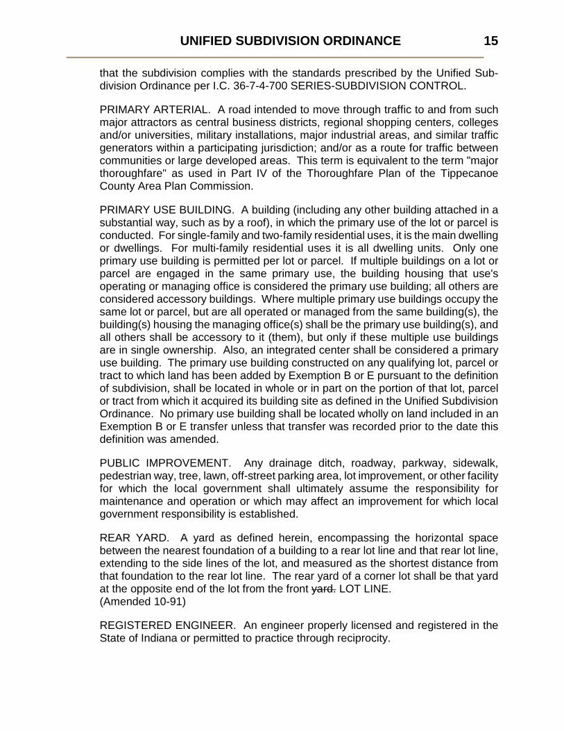
that the subdivision complies with the standards prescribed by the Unified Sub-division Ordinance per I.C. 36-7-4-700 SERIES-SUBDIVISION CONTROL.
PRIMARY ARTERIAL. A road intended to move through traffic to and from such major attractors as central business districts, regional shopping centers, colleges and/or universities, military installations, major industrial areas, and similar traffic generators within a participating jurisdiction; and/or as a route for traffic between communities or large developed areas. This term is equivalent to the term "major thoroughfare" as used in Part IV of the Thoroughfare Plan of the Tippecanoe County Area Plan Commission.
PRIMARY USE BUILDING. A building (including any other building attached in a substantial way, such as by a roof), in which the primary use of the lot or parcel is conducted. For single-family and two-family residential uses, it is the main dwelling or dwellings. For multi-family residential uses it is all dwelling units. Only one primary use building is permitted per lot or parcel. If multiple buildings on a lot or parcel are engaged in the same primary use, the building housing that use's operating or managing office is considered the primary use building; all others are considered accessory buildings. Where multiple primary use buildings occupy the same lot or parcel, but are all operated or managed from the same building(s), the building(s) housing the managing office(s) shall be the primary use building(s), and all others shall be accessory to it (them), but only if these multiple use buildings are in single ownership. Also, an integrated center shall be considered a primary use building. The primary use building constructed on any qualifying lot, parcel or tract to which land has been added by Exemption B or E pursuant to the definition of subdivision, shall be located in whole or in part on the portion of that lot, parcel or tract from which it acquired its building site as defined in the Unified Subdivision Ordinance. No primary use building shall be located wholly on land included in an Exemption B or E transfer unless that transfer was recorded prior to the date this definition was amended.
PUBLIC IMPROVEMENT. Any drainage ditch, roadway, parkway, sidewalk, pedestrian way, tree, lawn, off-street parking area, lot improvement, or other facility for which the local government shall ultimately assume the responsibility for maintenance and operation or which may affect an improvement for which local government responsibility is established.
REAR YARD. A yard as defined herein, encompassing the horizontal space between the nearest foundation of a building to a rear lot line and that rear lot line, extending to the side lines of the lot, and measured as the shortest distance from that foundation to the rear lot line. The rear yard of a corner lot shall be that yard at the opposite end of the lot from the front yard. LOT LINE. (Amended 10-91)
REGISTERED ENGINEER. An engineer properly licensed and registered in the State of Indiana or permitted to practice through reciprocity.

UNIFIED SUBDIVISION ORDINANCE
16
REGISTERED LAND SURVEYOR. A land surveyor properly licensed and registered in the State of Indiana or permitted to practice through reciprocity.
REGULATORY FLOOD. That flood having a peak discharge which can be equaled or exceeded on the average of once in a one hundred (100) year period, as calculated by a method and procedure which is acceptable to and approved by the Natural Resources Commission; this flood is equivalent to a flood having a probability of occurrence of one percent (1%) in any given year.
REGULATORY FLOODWAY. The channel of a river or stream and those portions of the Flood Plains adjoining the channel which are reasonably required to efficiently carry and discharge the peak flow of the Regulatory Flood of any river or stream shown on the Floodway-Flood Boundary Maps of the Federal Insurance Administration.
RESTRICTIVE COVENANTS. Limitations on the usage of lots within a subdivision in various ways, proposed by the subdivider, and, in the case of public health, safety and welfare by the Commission, that are recorded with the plat and run with the land.
RESUBDIVISION. A change in a map of a plat having secondary approval or a recorded subdivision plat if such change affects any street layout on such map or area reserved thereon for public use, or any lot line, except as otherwise exempted in this ordinance.
RIGHT-OF-WAY. A strip of land occupied or intended to be occupied by a street, sidewalk, railroad, road, electrical transmission line, oil or gas pipeline, water main, sanitary or storm sewer main, shade trees, or other special use.
ROAD, DEAD-END. See DEAD-END ROAD.
ROAD RIGHT-OF-WAY WIDTH. The distance between property lines measured configuratively or radially to the centerline of the street.
RURAL ESTATE ROAD. A road built as part of a rural estate subdivision providing access to and/or through an RE zone, built to specific minimum standards found in the Unified Subdivision Ordinance. This road may be designated as either a private road to be maintained by a homeowners’ association, or a public street, dedicated to the public and accepted for public maintenance.
RURAL ESTATE SUBDIVISION. A unified rural residential development zoned RE, rural estate zone, or RE and FP. (The FP-zoned portion may include tilled land, and may make up portions of residential lots.) A rural estate subdivision shall not be located within an IURC approved service area (CTA) of a sanitary sewer provider or within the service area of a municipally owned sewer system unless it is farther than ½ mile, measured radially, from the nearest sanitary sewer line or lift station having unused capacity for twelve (12) lots. Proposed RE-zoned sites, or FP-zoned portions of rural estate subdivisions may be located closer than ½

UNIFIED SUBDIVISION ORDINANCE 17
mile, measured radially, from the nearest sanitary sewer line or lift station having unused capacity if outside the IURC approved service area (CTA) of a sanitary sewer provider or outside the service area of a municipally owned sewer system. More than 50% of its acreage is either: (1) wooded and untilled, (2) non-tillable, or (3) not mechanically harvested for at least 3 of the 5 years between 1997 and
2001, or a combination of any 2 or 3 of the 3 above conditions equaling more than 50%. A rural estate subdivision has a maximum density of no more than 1 dwelling unit per 2 acres, and a minimum residential lot area of 1 acre, exclusive of any outlot containing drainage easements and/or rural estate roads, and exclusive of any public street right-of-way.
RURAL ESTATE ZONE. A rural zone containing part or all of a rural estate subdivision. Proposed RE-zoned sites, or FP-zoned portions of rural estate subdivisions shall not be located within an IURC approved service area (CTA) of a sanitary sewer provider or within the service area of a municipally owned sewer system unless it is farther than ½ mile, measured radially, from the nearest sanitary sewer line or lift station having unused capacity for twelve (12) lots. Proposed RE-zoned sites, or FP-zoned portions of rural estate subdivisions may be located closer than ½ mile, measured radially, from the nearest sanitary sewer line or lift station having unused capacity if outside the IURC approved service area (CTA) of a sanitary sewer provider or outside the service area of a municipally owned sewer system. More than 50% of the acreage of the rural estate subdivision of which it is a part is either: (1) wooded and untilled, (2) non-tillable, or (3) not mechanically harvested for at least 3 of the 5 years between 1997 and
2001, or a combination of any 2 or 3 of the 3 above conditions equaling more than 50%. A rural estate zone request includes no more than 12 residential lots, and shall include no FP-zoned lands; FP-zoned land cannot be rezoned.
SECONDARY APPROVAL. An approval granted to a subdivision with Primary Approval, found to be in conformance with the Primary Approval by the Staff, or the Commission at a Public Hearing, after adequate assurances have been provided to the Commission to cover the installation and completion of improvements in compliance with the ordinance, signed and certified by the Designated Officials to permit recordation.
SECONDARY ARTERIAL. A road intended to collect and distribute traffic in a manner similar to primary arterials, except that these roads service minor traffic-generating areas such as community/commercial areas, primary and secondary educational facilities, hospitals, major recreational areas, churches and offices, and/or are designed to carry traffic from collector streets to the system of primary

UNIFIED SUBDIVISION ORDINANCE
18
arterials. This term is equivalent to the term "collector street" as used in Part IV of the Thoroughfare Plan of the Tippecanoe County Area Plan Commission.
SIDE YARD. A yard as defined herein, encompassing the space between the nearest foundation of a building to the side lot line and that side lot line, extending from the rear line of the front yard to the front line of the rear yard, and measured as the shortest distance from that foundation to the side lot line.
SKETCH PLAN. The initially submitted graphic representation of a proposed major or rural estate subdivision, drawn to approximate scale, either superimposed upon a print of a topographic survey, or presented in any other suitable graphic medium or form acceptable to the Commission; and, in the case of a minor subdivision, the drawing or drawings indicating the proposed manner of layout of the subdivision meeting the conditions of the subdivision ordinance to be submitted to the Commission for primary approval and prepared by a Registered Land Surveyor or Engineer.
STANDARD PARCELIZATION. The four lot parcelization permitted per parent tract.
STATE PLANE COORDINATES SYSTEM. A system of plane coordinates, based on the Transverse Mercator Projection for the Western Zone of Indiana, established by the United States Coast and Geodetic Survey for the State of Indiana.
STRUCTURE. Anything constructed or erected that requires location on or in the ground or attachments to something having a location on or in the ground.
SUBDIVIDER. Any person having a proprietary interest in land, who causes it to be divided into a subdivision.
SUBDIVISION. The division of a parent tract or other piece of land into at least two (2) smaller parcels so that either now or in the future the subdivider can do any of the following with one or more of the subdivided lots:
1. transfer ownership 2. construct buildings 3. create new building sites for leasehold.
The actual location, shape, and size of a parent tract to be divided is determined by the official record of the last transfer of its ownership transacted before this ordinance was enacted or by its last conditional transfer of ownership by recorded contract transacted before this ordinance was enacted. The following kinds of divisions are not subdivisions and are exempt from the rules of this ordinance:
A. A division of land into two (2) or more tracts all of which are at least ten (10) acres in size;

UNIFIED SUBDIVISION ORDINANCE 19
B. A division of land for the transfer of a tract or tracts to correct errors in an existing legal description, provided that no additional primary use building sites are created by the division;
C. A division of land pursuant to an allocation of land in the settlement of a decedent's estate or a court decree for the distribution of property;
D. A division of land for federal, state or local government to acquire street right-of-way; and
E. A division of land for the transfer of a tract or tracts between adjoining lots provided that no additional primary use building sites are created by the division. The lots so created hereunder shall have only one primary use building site each.
Additionally, any division of land complying fully with subsection 3.5 of this ordinance is not a subdivision and shall be called a PARCELIZATION. SUBDIVISION AGENT. Any person who represents, or acts for or on behalf of, a subdivider or developer in representing, selling, leasing, or developing, or offering to sell, lease or develop any interest, lot, unit or plat in a subdivision, except an attorney-at-law whose representation of another person consists solely of rendering legal services. SUBDIVISION, MAJOR. See MAJOR SUBDIVISION. SUBDIVISION, MINOR. See MINOR SUBDIVISION. SUBDIVISION, NONRESIDENTIAL. See NONRESIDENTIAL SUBDIVISION. SUBDIVISION PLAT, FINAL. See FINAL SUBDIVISION PLAT. SUBDIVISION PLAT, PRELIMINARY. See PRELIMINARY SUBDIVISION PLAT. TEMPORARY IMPROVEMENT. Any improvement built and maintained by a subdivider during construction of the subdivision, which will be ultimately eliminated by the installation of a permanent improvement. THOROUGHFARE PLAN. That part of the Comprehensive Plan, now or hereafter adopted, which includes an ordinance and map, which designates the location and characteristics, and use of roads located within the County and designates their classification. URBANIZED AREA. The area so mapped and defined by the United States Bureau of the Census. YARD. A space on the same lot with a main building, such space being open, unoccupied and unobstructed by buildings or structures from ground to sky except where encroachments and accessory buildings are expressly permitted. YARD, FRONT. See FRONT YARD. YARD, REAR. See REAR YARD. YARD, SIDE. See SIDE YARD

UNIFIED SUBDIVISION ORDINANCE
20
Section 3. SUBDIVISION APPLICATION PROCEDURES AND APPROVAL PROCESSES
3.1 General Procedure
(1) Classification of Land Divisions.
All land to be divided shall be categorized into one of three (3) main classes of land division indicated within this ordinance's definition of subdivision. These classes are:
(a) subdivisions, major, minor and rural estate
(b) parcelizations, and [except that the actual location, shape, size and boundaries of a parcel established by a recorded parcelization shall not be changed, altered, added to or reduced by any provision, exempt division or exemption provided for in this ordinance except by dissolution of the parcelization or a parcel thereof under section 3.5(7) of this ordinance.] [Effective 6-3-96 in West Lafayette, Battle Ground and Dayton]
(c) exempt divisions.
Exempt divisions are not subject to the requirements of this ordinance. Lots created by exempt division shall be ten (10) or more acres in size to be eligible as primary use building sites (Exemption A in the definition of subdivision), unless such lots have been created by order of a court (Exemption C). Subsequent to the adoption of this amendment (on June 6, 1988 by the Tippecanoe County Commissioners; on July 11, 1988 by the Lafayette City Council; on June 6, 1988 by the West Lafayette City Council; on July 5, 1988 by the Battle Ground Town Board; on July 11, 1988 by the Dayton Town Board; on April 1, 1996 by the Clarks Hill Town Council), no primary use building site created through Exemption A shall be reduced below ten (10) acres unless by subdivision, parcelization, or order of a court (Exemption C). For purposes of this paragraph, a lot is "created" on the date of its recording.
Before any permit shall be granted for a structure to be erected on land to be subdivided, the subdividing owner or his subdivision agent shall apply for and secure approval of the proposed subdivision in accordance with Section 3.6, or Section 3.2 and either Section 3.3 or Section 3.4 of this ordinance. Before any permit shall be granted for a structure to be erected on land to be parcelized, the land divider or his agent shall certify to the satisfaction of the Staff of the Commission that all requirements for parcelization have been met, as detailed in Section 3.5 of this ordinance.

UNIFIED SUBDIVISION ORDINANCE 21
(2) Discussion of Requirements.
Prior to submitting any of the materials required by this ordinance, the applicant or his representative should discuss with the Staff of the Commission the nature of the land division being proposed, so that the applicant may be instructed as to the need to either subdivide or parcelize and the procedures that must be followed in either case. Where subdivision is called for, requirements as to general layout of streets and for reservations of land, street improvements, drainage, sewerage, fire protection, and similar matters, as well as the availability of existing services should be discussed. The Staff shall also advise the applicant, where appropriate, to discuss the proposed land division with those officials who must eventually approve those aspects of the parcelization or subdivision plat coming within their jurisdiction. The distinction between major, minor and rural estate subdivision as defined in this ordinance, shall be made by the Staff when the applicant submits an application for sketch plan approval.
However the further division of a parent tract from which four (4) minor subdivision lots or four (4) standard parcels (or a combination of both) eligible as primary use building sites have already been created, shall be classified as a major subdivision, unless this further division is classified as a Rural Estate Subdivision, or exempt by Original Exemption A Tract Parcelization or Farmstead Parcelization, or complies with Exemption A or C in the definition of Subdivision. For purposes of this paragraph, a lot is "created" on the date of its recording.
3.2 Major and Minor Subdivisions: Sketch Plan Application Procedure (1) Application Requirements.
In order to begin the subdivision process the applicant shall file an application for review of sketch plan and certificate with the Commission's Staff and be entitled to a signed receipt for same. This application shall: (a) Be made on forms available at the Office of the Commission and
signed by the owner. (b) Include indication of all contiguous holdings of the owner including
land in the same ownership, with an indication of the portion which is proposed to be subdivided, accompanied by an affidavit of ownership, which shall include the dates the respective holdings of land were acquired, together with the book and page of each conveyance to the present owner as recorded in the County Recorder's Office. The affidavit shall advise as to the legal owner of the property, the contract owner of the property, optionee of the property, and the date contract of sale was executed. If any corporations are involved, the Commission may request a complete list of all directors, officers, and a listing of stockholders if less than ten (10) in number.

UNIFIED SUBDIVISION ORDINANCE
22
(c) Be presented to the Staff of the Commission in duplicate. (d) Be accompanied by a minimum of three (3) paper prints and a PDF
digital copy of the sketch plan. (e) Be accompanied by a fee specified in the Bylaws of the Tippecanoe
County Area Plan Commission. (f) Include an address and telephone number of an agent located within
the territory of the Commission who shall be authorized to receive all notices required by this ordinance.
(g) Include a listing signed by the checkpoint agencies indicating that they have received a copy of the proposed sketch plan or a certification that it has been sent.
(2) Checkpoint Submission. In order to fulfill this last application requirement, a copy of the proposed plan shall be submitted to each of the agencies appropriate to the plan's location so that comment may be made to the Staff. The checkpoint agencies appropriate to each participating jurisdiction in which a plat may be located are listed in Figure 1. The Executive Director shall request that all officials and agencies to whom a request for review has been made, submit a written report to him within fifteen (15) days after receipt of the request. No response from an agency shall be interpreted as meaning "no objection".
(3) Classification of Subdivision. With an application for sketch plan approval submitted, the Staff shall classify the proposed subdivision either major or minor as defined in this ordinance. The required procedures and approvals that make up the major subdivision are described in Section 3.3; corresponding information concerning the minor subdivision process is provided in Section 3.4.
3.3 Major Subdivisions (1) General Procedures.
Should the Staff, upon examination of the sketch plan application, classify the proposed land division as a major subdivision, the subdivider shall follow the procedures and be subject to the processes outlined in Figure 2, and detailed in this Section. In addition to a sketch plan which is reviewed by the Commission's Staff and checkpoint agencies, the applicant seeking approval of a major subdivision plat to be approved, conditionally approved or rejected by the Commission at a public meeting, and a final subdivision plat which must be granted secondary approval and signed by the Designated Officials in order to be recorded per I.C. 36-7-4-700 SERIES-SUBDIVISION CONTROL.

UNIFIED SUBDIVISION ORDINANCE 23
FIGURE 1. CHECKPOINT AGENCIES
proposed subdivision in unincorporated Tippecanoe County
(1) Highway Engineer (2) Drainage Engineer (3) Tippecanoe County Soil and Water
Conservation District (4) County Health Board (5) County Park Board (6) Appropriate Fire Departments (7) Appropriate School Corporations
proposed subdivision within City of Lafayette
(1) City Engineer (2) Tippecanoe County Soil and Water
Conservation District (3) City Board of Health (4) City Board of Parks and
Recreation (5) City Fire Chief (6) City Police Chief (Traffic) (7) Appropriate School Corporation
proposed subdivision within City of West Lafayette
(1) City Engineer (2) Tippecanoe County Soil and Water
Conservation District (3) City Board of Health (4) City Board of Parks and
Recreation (5) City Fire Chief (6) City Police Chief (Traffic) (7) Appropriate School Corporation (8) City Environmental Review Board (9) City Community Development
Board (10) City Housing Authority
proposed subdivision within incorporated Towns, including Dayton, Battle Ground, Clarks Hill
(1) Town Board (2) County Health Board (3) Tippecanoe School Board (4) Local Fire Department (5) Town Marshall (6) Tippecanoe County Soil and Water
Conservation District

UNIFIED SUBDIVISION ORDINANCE
24
If rejected, subdivider may refile
FIGURE 2. MAJOR SUBDIVISION APPROVAL PROCESS
SKETCH PLAN 31 days prior to submittal of
Preliminary Plat
Staff & Checkpoint agencies meet with subdivider within 20 days, and
then provide written report
Subdivider submits PRELIMINARY PLAT to Staff 30 days prior to
Commission meeting
Executive Committee sets agenda on Staff recommendation
Surveyor or Engineer prepares CONSTRUCTION PLANS
Staff submits report
At meeting, Commission approves, conditionally approves or rejects
Surveyor prepares FINAL PLAT & submits for review
If found OK by reviewing agencies, Staff stamps approval
Improvements made or surety posted
Subdivider’s Choice
Plat reviewed by Staff for compliance
If found not in compliance President & Secretary sign
Subdivider records plat
Staff & Checkpoint agencies review
61 C
alen
dar d
ays
At le
ast 3
0 da
ys
Staff distributes for comments
Subdivider requests & Commission holds hearing on compliance

UNIFIED SUBDIVISION ORDINANCE 25
(2) Official Submission Dates.
The deadline for submittal of a sketch plan and application for certificate of approval shall be sixty-one (61) calendar days prior to the date of the public meeting at which the subdivider intends to have his preliminary plat submission heard, and thirty-one (31) calendar days prior to the deadline for the submission of the preliminary plat. Thus, as a minimum, sketch plan submission shall precede preliminary plat submission by no less than thirty-one (31) calendar days, which in turn shall precede the public meeting at which it is intended to be heard by no less than thirty (30) calendar days.
(3) Sketch Plan Review Process.
Within twenty (20) calendar days of the subdivider's sketch plan application submittal, the Commission's Staff shall have studied the proposal, reviewed checkpoint reports received, and met with the subdivider to discuss pertinent aspects of the proposed subdivision and possible modifications and/or changes that may be suggested or required by this ordinance. The Executive Director shall request that a representative of each checkpoint agency wishing to be involved in a sketch plan review be present to participate in the sketch plan review meeting. In taking into consideration the requirements of this ordinance, particular attention shall be given to the arrangement, location, and width of streets, their relation to the topography of the land, sewage disposal, drainage, lot size and arrangement, the further development of adjoining lands as yet unsubdivided, and the requirements of the Official Map and Comprehensive Plan as adopted by the participating jurisdictions. Subsequent to the meeting, the Commission's Staff shall provide the participants with a written record of the proceedings of that meeting.
(4) Preliminary Subdivision Plat Procedure.
(a) Submission Requirements.
Following the submission, review and report on the sketch plan application, the subdivider may file for primary approval of a preliminary plat. This submission shall:
(i) Be made on forms available at the office of the Commission and be submitted with a fee specified in the Bylaws of the Tippecanoe County Area Plan Commission.
(ii) Include indication of all land which the applicant proposes to subdivide and all land immediately adjacent extending one hundred (100) feet therefrom, or of that directly opposite thereto, extending one hundred (100) feet from the street frontage of such opposite land, with the names of the owners as shown in the Auditor's files. This information may be

UNIFIED SUBDIVISION ORDINANCE
26
shown on a separate current Plat Map reproduction from the Auditor's Office showing the boundaries of the subdivision superimposed thereon.
(iii) Be presented in duplicate to the Staff of the Commission no later than thirty (30) calendar days prior to the regular meeting of the Commission at which it is intended to be heard.
(iv) Be accompanied by three (3) paper prints and a PDF digital copy of the preliminary plat as described in this ordinance.
(v) Generally comply with the sketch plan as reviewed.
(vi) Include a listing signed by the checkpoint agencies indicating that they have received a copy of the preliminary plat or a certification that it has been sent.
(b) Placement on the Commission Agenda.
Subsequent to the submission for primary approval, the Commission shall place the matter on its next regular meeting agenda for formal action.
(c) Staff Review.
Subsequent to placement on the agenda, and prior to the date of public hearing, the Commission's Staff shall review the proposal and prepare a written report to the Commission and applicant indicating Staff's recommendation with regard to the subdivision being proposed.
(d) Public Hearing Notification and Sign Posting Requirements.
The Commission shall hold a public hearing on the preliminary plat and notice of such hearing shall be in two local newspapers of general circulation ten (10) days prior to the hearing (per I.C. 5-3-1) at the applicant's expense. At the time of the public hearing, the applicant shall submit an affidavit stating that the applicant has placed posters advising interested parties of the hearing provided by the Staff of the Commission at the locations designated by the Staff on the proposed subdivision property at least ten (10) days prior to the public hearing and show proofs of publication that the notices of public hearing were published at least ten (10) days prior to the public hearing. Interested parties shall be notified by the applicant of the time, date, place, and purpose of the public hearing on the subdivision at least ten (10) days in advance of the hearing by certified mail. The applicant shall file with the Commission at the time of the public hearing an affidavit so testifying.

UNIFIED SUBDIVISION ORDINANCE 27
(e) Approval of the Preliminary Plat (Primary Approval).
After the Commission has held a hearing upon the preliminary plat, the Staff's report, checkpoint recommendations, and testimony and exhibits submitted at the public hearing, the applicant shall be advised of any required changes and/or additions. The Commission shall at a public meeting, grant primary approval, or disapprove the preliminary plat. One (1) copy of the preliminary plat shall be returned to the applicant with the date of approval, conditional approval, or disapproval and the reasons therefore accompanying the plat within five (5) days of the public hearing. Before the Commission grants primary approval of a plat showing park reservation or land for other local government unit, the Commission shall obtain approval of the park or land reservation from the participating jurisdiction. Primary approval by the Commission is subject to review by certiorari. Secondary approval of a subdivision cannot occur until a minimum of thirty (30) days has elapsed since the granting of primary approval, per I.C. 36-7-4-708 (d).
(f) Field Trip.
The Commission, at its discretion, upon hearing the request for primary approval, may elect to continue the matter until its next regularly scheduled public meeting, and may schedule a field trip to the site of the proposed subdivision, accompanied by the applicant or his representative.
(g) Effective Period of Primary Approval.
Unless extended, the primary approval of a major subdivision preliminary plat shall be effective for a period of ten (10) years at the end of which time secondary approval on the entire subdivision must have been obtained and certified by the Designated Officials of the Commission. Any major subdivision final plat not receiving secondary approval within the period of time set forth herein shall be null and void. To restart the process the subdivider shall be required to submit a new application for major sketch plan review and certificate subject to all the zoning restrictions and subdivision regulations and procedures in effect at the time of resubmission. The 10-year effective period shall be applied retroactively to all major subdivision primary approvals granted from January 1, 2003 forward.
(h) Primary Approval Extensions.
Prior to the end of the ten (10) year effective period of the primary approval and upon request of the subdivider the Commission or Executive Committee may extend the primary approval of a major

UNIFIED SUBDIVISION ORDINANCE
28
subdivision preliminary plat in increments of two (2) years beyond an expiration date without further notice and public hearing. Additional two (2) year extensions may be granted by the Commission or Executive Committee prior to an expiration date.
(i) Belated Primary Approval Extensions
Within two (2) years after the expiration date of a major subdivision primary approval effective period (original or extended), the subdivider may submit an application to request authorization from the Commission or Executive Committee for a belated primary approval extension of two (2) years. The application to authorize and to hear such a belated request shall be made on forms available at the office of the Commission and be submitted with a fee specified in the Bylaws of the Tippecanoe County Area Plan Commission. No belated primary approval extension applications can be submitted more than two (2) years after the expiration date of a major subdivision primary approval effective period (original or extended).
(5) Approval of Construction Plans.
(a) Submission Procedure and Requirements.
Following the review of the sketch plan and prior to submission for secondary approval, the applicant, if he wishes to proceed with the subdivision, shall file with the Executive Director of the Commission, before starting work on any improvements, three (3) sets of the detailed plans and specifications thereof for approval.
(b) Review Process.
The Executive Director shall immediately refer these plans to the appropriate agencies of the effected participating jurisdictions for review. Once these agencies indicate their approval of the construction plans or fourteen (14) working days have elapsed since their distribution without a written response, the Executive Director shall stamp the plans approved and return one (1) set to the applicant. In no event shall secondary approval be given prior to approval of the construction plans.
(c) Installation of Improvements.
The installation of improvements shall be inspected by the appropriate participating jurisdiction. Such inspections are required in all instances regardless of whether the work is performed before or after secondary approval. Failure to request inspection of work performed after the date of this ordinance and before secondary approval may be cause for denial of secondary approval.

UNIFIED SUBDIVISION ORDINANCE 29
(6) Final Subdivision Plat Procedure.
(a) Submission Requirements.
Following primary approval and approval of construction plans, the applicant, if he wishes to proceed with the subdivision, shall file with the Executive Director of the Commission a request for secondary approval of a subdivision plat. The application shall:
(i) Be submitted on forms available at the Office of the Executive Director of the Commission.
(ii) Include the entire subdivision, or section thereof which derives access from an existing State, County, or local government roadway.
(iii) Be accompanied by ten (10) paper prints and a PDF digital copy of the final subdivision plat as described in this ordinance and the digital data submission as required by the Tippecanoe County Code Ordinance No. 2006-04-CM.
(iv) Totally comply with the ordinance and the terms and conditions of primary approval.
(v) Be accompanied by the performance bond, if required, in a form satisfactory to the Commission Attorney and in an amount established by the Commission upon recommendation of the participating jurisdiction and shall guarantee the completion of all required subdivision and off-site public improvements.
(vi) Be accompanied by restrictive covenants in a form approved by the Commission, where proposed by the subdivider or required by the Commission.
(b) Determination of Conformance (Secondary Approval).
In order to be recorded, a final subdivision plat shall be found to be in conformance with the primary approval either by the Staff, or by the Commission at a public meeting. If the final subdivision plat deviates from the preliminary plat that received primary approval, the subdivision shall be resubmitted to the Commission at a public meeting for a new primary approval. The subdivider submitting a final plat conforming to the primary approval shall choose as to whether this review is performed by the Staff, or by the Commission at a public meeting.

UNIFIED SUBDIVISION ORDINANCE
30
(i) Should the subdivider not choose Commission review, the Staff shall within ten (10) working days, review the items submitted as per Section 3.3(6)(a) in order to ascertain conformance with the primary approval. If the submission is found to be in conformance and complete, the Staff shall recommend the signing of the certificate granting secondary approval.
(ii) Should the subdivider choose Commission review, the Commission shall perform the same function but at a public meeting. The subdivider shall request in writing Commission review no less than thirty (30) calendar days prior to the date of the public meeting at which he intends to have his final plat reviewed. The Commission shall place the matter on its next regular meeting agenda.
Staff shall review the proposal and submit a written report and recommendations to the Commission and the applicant; and the Commission, at the public meeting shall approve or disapprove the final plat. If granted secondary approval it shall be signed by the Designated Officials. If not granted secondary approval then the subdivider shall be informed as to the insufficiency of his submittal.
(c) Sectionalizing Plats.
Prior to granting secondary approval of a major subdivision final plat, the Commission may permit the plat to be divided into two (2) or more sections and may impose such conditions upon the filing of the sections as it may deem necessary to assure the orderly development of the plat. The Commission may require that the performance bond be in such amount as is commensurate with the section or sections of the plat to be filed and may defer the remaining required performance bond principal amount until the remaining sections of the plat are offered for filing. Such sections must contain at least twenty (20) lots or ten percent (10%) of the total number of lots contained in the approved plat, whichever is less. The approval of all remaining sections not filed with the Staff shall automatically expire after ten (10) years of the date of primary subdivision approval of the subdivision plat, unless the expiration date has been extended.
(7) Signing and Recording a Plat.
(a) Signing of a Plat.
(i) When a bond is required, the Designated Officials shall endorse secondary approval on the plat by signing the

UNIFIED SUBDIVISION ORDINANCE 31
certificate after the bond has been approved, and all conditions of the primary approval have been satisfied.
(ii) When installation of improvements is required the Designated Officials shall endorse secondary approval on the plat by signing the certificate after all conditions of the primary approval have been satisfied and all improvements satisfactorily completed. There shall be written evidence that the required public facilities have been installed in a manner satisfactory to the participating jurisdiction as shown by a certificate signed by the Board of Works, County Commissioners, Town Board or County Drainage Board that the necessary improvements have been accomplished.
(b) Assurance to Subdivider.
If the subdivider elects to install all improvements before he applies for secondary approval and it is shown that the conditions of the ordinance have been met, and if the final plat completely conforms to the primary approval, the Commission shall grant secondary approval.
(c) Recording of Plat.
(i) The Designated Officials shall sign the certificate granting secondary approval on all paper prints of the final subdivision plat.
(ii) It shall be the responsibility of the sub-divider in the presence of the Executive Director or his designee to file the plat with the County Recorder within thirty (30) days of the date of signature.

UNIFIED SUBDIVISION ORDINANCE
32
3.4 Minor Subdivisions
(1) General Procedures.
Should the Staff, upon examination of the sketch plan application, classify the proposed land division as a minor subdivision, the subdivider shall follow the procedures and be subject to the process outlined in Figure 3, and detailed in this Section. In addition to a sketch plan which is reviewed by the Commission's Staff and checkpoint agencies, for primary approval by the Commission or its Executive Committee, the applicant seeking approval of a minor subdivision shall submit a final subdivision plat which must be granted secondary approval and signed by the Designated Officials in order to be recorded per I.C. 36-7-4-700 SERIES-SUBDIVISION CONTROL.

UNIFIED SUBDIVISION ORDINANCE 33
FIGURE 3. MINOR SUBDIVISION APPROVAL PROCESS
SKETCH PLAN 30 days prior to Commission
meeting or Executive Committee meeting
Staff & Checkpoint agencies meet with subdivider within 20 days, and
then provide written report
Commission or its Executive Committee approves, conditionally
approves or rejects Sketch Plan
Surveyor prepares FINAL PLAT
Subdivider’s Choice
Staff checks for compliance
If found not in compliance President & Secretary sign
Subdivider records plat
If rejected, subdivider may refile
Staff & Checkpoint agencies review
At le
ast
30 d
ays
Subdivider requests & Commission holds hearing on compliance
At le
ast
30 d
ays

UNIFIED SUBDIVISION ORDINANCE
34
(2) Official Submission Date and Placement on the Agenda.
An application for primary approval of a minor subdivision sketch plan shall be submitted no less than thirty (30) calendar days prior to either a regularly scheduled public meeting of the Commission or a regularly scheduled meeting of the Commission's Executive Committee at which the proposal is intended to be acted upon. Staff shall place such application on the agenda of the first regularly scheduled meeting of the Commission or its Executive Committee to occur thirty (30) days after the date the application is submitted.
(3) Sketch Plan Review Process.
Within twenty (20) calendar days of the subdivider's sketch plan application submittal, the Commission's Staff shall have studied the proposal, reviewed checkpoint reports received, and met with the subdivider to discuss pertinent aspects of the proposed subdivision and possible modifications and/or changes that may be suggested or required by this ordinance. The Executive Director shall request that a representative of each checkpoint agency that wishes to be involved in a sketch plan review be present to participate in the sketch plan review meeting. In taking into consideration the requirements of this ordinance, particular attention shall be given to sewage disposal, drainage, lot size and arrangement, the further development of adjoining lands as yet unsubdivided, and the requirements of the Official Map and Comprehensive Plan as adopted by the participating jurisdictions. Subsequent to the meeting, the Commission's Staff shall provide the participants with a written record of the proceedings of that meeting.
(4) Staff Review.
Subsequent to placement on the agenda, and prior to the date of public hearing, the Commission's Staff shall review the proposal and prepare a final written report to the Commission and applicant indicating Staff's recommendation with regard to the subdivision being proposed.
(5) Public Hearing Notification and Sign Posting Requirements.
The Commission shall hold a public hearing on the sketch plan and notice of such hearing shall be in two local newspapers of general circulation ten (10) days prior to the hearing (per I.C. 5-3-1) at the applicant's expense. At the time of the public hearing, the applicant shall submit an affidavit stating that the applicant has placed posters advising interested parties of the hearing provided by the Staff of the Commission at the locations designated by the Staff on the proposed subdivision property at least ten (10) days prior to the public hearing and show proofs of publication that the notices of public hearing were published at least ten (10) days prior to the public hearing.

UNIFIED SUBDIVISION ORDINANCE 35
Interested parties shall be notified by the applicant of the time, date, place, and purpose of the public hearing on the subdivision at least ten (10) days in advance of the hearing by certified mail. The applicant shall file with the Commission at the time of the public hearing an affidavit so testifying.
(6) Approval of the Sketch Plan (Primary Approval).
After the Commission or its Executive Committee has, at a regularly scheduled meeting, examined the sketch plan, Staff's report, checkpoint recommendations and testimony and exhibits submitted, the Commission or its Executive Committee shall grant primary approval or disapprove the sketch plan. One (1) copy of the sketch plan shall be returned to the applicant with the date of approval, conditional approval, or disapproval and the reasons therefore accompanying the sketch plan within five (5) days after the public meeting. Primary approval by the Commission is subject to review by certiorari. Secondary approval of a subdivision cannot occur until a minimum of thirty (30) days has elapsed since the granting of primary approval, per I.C. 36-7-4-708(d).
(a) Effective Period of Primary Approval – Residential Minor Subdivision Sketch Plan.
Unless extended, the primary approval of a residential minor subdivision sketch plan shall be effective for a period of five (5) years at the end of which time secondary approval on the entire subdivision must have been obtained and certified by the Designated Officials of the Commission. Any residential minor subdivision final plat not receiving secondary approval within the period of time set forth herein shall be null and void. To restart the process, the subdivider shall be required to submit a new application for minor sketch plan review subject to all the zoning restrictions and subdivision regulations and procedures in effect at the time of resubmission.
(b) Primary Approval Extensions.
Prior to the end of the five (5) year effective period of the primary approval and upon request of the subdivider the Commission or Executive Committee may extend the primary approval of a residential minor subdivision sketch plan in increments of two (2) years beyond an expiration date without further notice and public hearing. Additional two (2) year extensions may be granted by the Commission or Executive Committee prior to an expiration date.
(c) Effective Period of Primary Approval – Nonresidential Minor Subdivision Sketch Plan.
Unless extended, the primary approval of a nonresidential minor subdivision sketch plan shall be effective for a period of ten (10)

UNIFIED SUBDIVISION ORDINANCE
36
years at the end of which time secondary approval on the entire subdivision must have been obtained and certified by the Designated Officials of the Commission. Any nonresidential minor subdivision final plat not receiving secondary approval within the period of time set forth herein shall be null and void. To restart the process, the subdivider shall be required to submit a new application for minor sketch plan review subject to all the zoning restrictions and subdivision regulations and procedures in effect at the time of resubmission. The 10-year effective period shall be applied retroactively to all nonresidential minor subdivision primary approvals granted from January 1, 2003 forward.
(d) Primary Approval Extensions.
Prior to the end of the ten (10) year effective period of the primary approval and upon request of the subdivider the Commission or Executive Committee may extend the primary approval of a nonresidential minor subdivision sketch plan in increments of two (2) years beyond an expiration date without further notice and public hearing. Additional two (2) year extensions may be granted by the Commission or Executive Committee prior to an expiration date.
(7) Final Subdivision Plat Procedure.
(a) Application Requirements.
Following primary approval of the sketch plan, the applicant, if he wishes to proceed with the subdivision, shall file with the Staff of the Commission an application for secondary approval of a subdivision plat. The application shall:
(i) Be submitted on forms available at the Office of the Commission.
(ii) Include the entire subdivision.
(iii) Be accompanied by ten (10) paper prints and a PDF digital copy of the final subdivision plat as described in this ordinance and the digital data submission as required by the Tippecanoe County Code Ordinance No. 2006-04-CM.
(iv) Totally comply with the ordinance and the terms and conditions of primary approval.
(v) Be accompanied by the performance bond, if required, in a form satisfactory to the Commission Attorney and in an amount established by the Commission upon recommendation of the participating jurisdiction and shall

UNIFIED SUBDIVISION ORDINANCE 37
guarantee the completion of all required subdivision and off-site public improvements.
(vi) Be accompanied by restrictive covenants in a form approved by the Commission, where pro-posed by the subdivider or required by the Commission.
(b) Determination of Conformance (Secondary Approval).
In order to be recorded, a final subdivision plat shall be found to be in conformance with the primary approval either by the Staff or by the Commission at a public meeting. If the final subdivision plat deviates from the sketch plan that received primary approval, the subdivision shall be resubmitted to the Commission at a public meeting for a new primary approval. The subdivider submitting a final plat conforming to the primary approval shall choose as to whether this review is performed by the Staff, or by the Commission at a public meeting.
(i) Should the subdivider not choose Commission review, the Staff shall within ten (10) working days, review the items submitted as per Section 3.4(7)(a) in order to ascertain conformance with the primary approval. If the submission is found to be in conformance and complete, the Staff shall recommend the signing of the certificate granting secondary approval.
(ii) Should the subdivider choose Commission review, the Commission shall perform the same function but at a public meeting. The sub-divider shall request in writing Commission review no less than thirty (30) calendar days prior to the date of the public meeting at which he intends to have his final plat reviewed. The Commission shall place the matter on its next regular meeting agenda; Staff shall review the proposal and submit a written report and recommendations to the Commission and the applicant; and the Commission, at public meeting shall approve or disapprove the final plat. If granted secondary approval it shall be signed by the Designated Officials. If not granted secondary approval then the subdivider shall be informed as to the insufficiency of his submittal.
(c) Sectionalizing Plats.
Prior to granting secondary approval of a minor subdivision plat, the Commission may permit the plat to be divided into two (2) or more sections and may impose such conditions upon the filing of the sections as it may deem necessary to assure the orderly

UNIFIED SUBDIVISION ORDINANCE
38
development of the plat. The Commission may require that the performance bond be in such amount as is commensurate with the section or sections of the plat to be filed and may defer the remaining required performance bond principal amount until the remaining sections of the plat are offered for filing.
(8) Signing and Recording a Plat.
(a) Signing a Plat.
(i) When a bond is required, the Designated Officials shall endorse secondary approval on the plat after the bond has been approved, and all conditions of the primary approval have been satisfied.
(ii) When installation of improvements is required the Designated Officials shall endorse secondary approval on the plat by signing the certificate after all conditions of the primary approval have been satisfied and all improvements satisfactorily completed. There shall be written evidence that the required public facilities have been installed in a manner satisfactory to the participating jurisdiction as shown by a certificate signed by the Board of Works, County Commissioners, Town Board or the County Drainage Board that the necessary improvements have been accomplished.
(b) Assurance to Subdivider.
If the subdivider elects to install all improvements before he applies for secondary approval and it is shown that the conditions of the ordinance have been met, and if the final plat completely conforms to the primary approval, the Commission shall grant secondary approval.
(c) Recording of Plat.
(i) The Designated Officials shall sign the certificate granting secondary approval on all paper prints of the final subdivision plat.
(ii) It shall be the responsibility of the subdivider in the presence of the Executive Director or his designee to file the plat with the County Recorder within thirty (30) days of the date of signature.

UNIFIED SUBDIVISION ORDINANCE 39
3.5 Parcelization
(1) General Procedure.
Pre-submission discussion between the prospective land divider or his agent and the Staff of the Commission will clarify the land divider's eligibility to use the parcelization process. Following such discussion, the land divider or his agent shall then file an application for parcelization review with the Staff and provide the documents specified below. The Staff and the Executive Director shall then review the complete submission for compliance with this section of the ordinance, and the Staff shall notify the land divider or his agent of the results of that review. The land divider or his agent shall then file the approved parcelization with the County Recorder within thirty calendar days of the end of the review process. Failure to so record shall automatically void the approved parcelization.
(2) Application Requirements.
The application for parcelization review shall:
(a) Be made, in duplicate, on forms available at the Office of the Commission;
(b) Include all documentation required in subsection 3.5(4);
(c) Include ten sets of parcelization documents with legal descriptions for all parcels (under ten acres in area) being created. The land divider may, instead, submit ten sets of parcelization drawings, using subsection 6.4(1) (b,c,d,f,g,i,j,l,m) as a basis for the drawings' format; and
(d) Include the notarized consent of the legal owner or contract owner or optionee of the property (parent tract, lot or parcel) to be parcelized, if such person is different from the land divider.
(3) Standards.
(a) Number and Area of Parcels.
Parcelization shall not be permitted inside incorporated areas. The maximum number of parcels that can be created from a parent tract as defined in subsection 2.2 of this ordinance, and the minimum area of those parcels shall be as follows:

UNIFIED SUBDIVISION ORDINANCE
40
Parcelization Type
Maximum Number of Lots permitted
Minimum Lot Area (Exclusive of R-O-W)
Farmstead 1 per parent tract 2 acres OE A Tract 2 (per OE A Tract) 2 acres Standard 4 per parent tract 2 acres
Parcelization land divisions are only permitted in the Agricultural (A), Select Agricultural (AA) and Agricultural Wooded (AW) zones.
A parcel may contain some FP-zoned land as well, but only if there is sufficient land within the non-FP portion to place a primary use building and its accessory buildings and paved areas and still conform with the Unified Zoning Ordinance and Tippecanoe County Ordinance 99-30CM or its successors. Parcel area shall be measured exclusive of right-of-way.
(b) Parcels Abutting a Public Road.
For parcels that abut a public road, the minimum parcel width shall be 200 feet. Parcel width shall be measured along the right-of-way line of the public road. For parcels abutting more than one public road, parcel width standards need only apply to one public road abutted. For parcels abutting a public road that cannot derive access from that road, an easement for vehicular access and utility placement, connecting all such parcels to a public road, shall be provided at the time of parcelization. Where a physical impediment or the shape of the parent tract prevents a proposed parcel from meeting the minimum 200-ft of frontage standard, the Executive Director may waive this requirement; however, the parcel width may never be less than the minimum lot width required by the Unified Zoning Ordinance for that particular zone.
(c) Parcels Not Abutting a Public Road.
For parcels that do not abut a public road, the minimum parcel width shall be in accordance with the requirements of Tippecanoe County Ordinance 99-30CM, The Private Sewage Disposal Ordinance of Tippecanoe County, or its successors, but in no case less than 100’. For each such parcel, either a front lot line and all necessary setbacks or a building setback of 25 feet from all property lines, shall be included either on the drawings or recorded as a covenant. An easement for vehicular access and utility placement, connecting all such parcels to a public road, shall be provided at the time of parcelization.

UNIFIED SUBDIVISION ORDINANCE 41
(d) Sewage Disposal.
Each parcel shall be served either by sanitary sewer or on-site sewage disposal system. Sanitary sewer is required when the sewer provider (city, town or American Suburban Utilities) determines in writing that service is available and a sewer line is located no farther than 300’ from the lot line of the nearest proposed parcel. For proposed parcels not meeting the requirements for sanitary sewer on-site sewage disposal systems that meet the standards of Tippecanoe County Ordinance 99-30CM or its successors shall be required.
(e) Right-of-Way.
If a parcel abuts a public road along which full right-of-way width has not yet been obtained, the land divider shall, by appropriate instrument, convey to the public sufficient right-of-way for one-half the required width for that specific road (as indicated in the Thoroughfare Plan for Tippecanoe County or its successor), for the full width of that parcel along that roadway.
(f) Conflict with Public Provisions.
The provisions of subsection 3.5 are not intended to interfere with, abrogate, or annul any other ordinance, rule or regulation, statute or other provisions of law. Where any provisions of this subsection impose restrictions different from those imposed by any other ordinance, or other provision of law, whichever provisions are more restrictive or impose higher standards shall control, unless otherwise stated herein.
(g) Public Improvement.
Any proposed division of land necessitating the creation or extension of a public improvement shall not qualify as a parcelization.
(h) Saving Provision.
All parcelizations recorded, or approved and still eligible to be recorded, shall remain valid. A parcelization application submitted prior to October 1, 2002, shall be reviewed under the previous ordinance, but only if it meets all requirements of Unified Subdivision Ordinance section 3.5(2) by the close of business on September 30, 2002.

UNIFIED SUBDIVISION ORDINANCE
42
(4) Documentation.
(a) Parcelization Certificate.
The Parcelization Certificate shall be included on the parcelization drawing or in the parcelization document. See form A.1(11) in Appendix A.
(b) Sewage Disposal.
If the property to be parcelized is located outside the Cities of Lafayette and West Lafayette or the Towns of Dayton, Battle Ground, and Clarks Hill but within an area served by a sanitary sewer system from an incorporated city or town, the land divider shall submit written documentation from the appropriate service provider as to whether sanitary sewer would be available for use. If such service is unavailable, or if the property is located beyond the areas served by the systems, the land divider shall provide written documentation that the County Board of Health has been satisfied that the standards of Tippecanoe County Ordinance 99-30, or its successors, have been met to assure the continued operation or the proper installation of an on-site sewage disposal system on each parcel.
(c) Right-of-Way.
If additional right-of-way is required as per subsection 3.5(3)(e) the land divider shall show said required right-of-way on the parcelization drawing or include in the parcelization document, along with the Parcelization Certificate, a legal description of said required right-of-way prepared by a registered land surveyor.
(d) Easements for Private Drives.
Should the land divider at the time of parcelization provide an easement for a private drive connecting parcels to a public road, the land divider shall submit ten copies of the description of that easement prepared by a registered land surveyor, and signed by all owners and notarized. Where applicable, a statement shall be appended to each legal description of each parcel as follows: "This parcel is subject to an easement for ingress and egress recorded in _____ Record _____, Page _____." Should the land divider choose to submit parcelization drawings, the description should appear on the face of the drawings and be signed by all owners and notarized. An additional statement must accompany any such easement description indicating that private driveways constructed in these easements shall not be accepted for maintenance by any participating jurisdiction.

UNIFIED SUBDIVISION ORDINANCE 43
(5) Private Driveways.
The construction and maintenance of private driveways built to provide access to parcels shall be the responsibility of the owner or owners of the land. These driveways shall not be accepted for maintenance by participating jurisdictions. A private driveway shall not be named if it serves less than six (6) parcels, lots and or tracts. A private driveway shall be named by the land divider when it serves at least six (6) parcels, lots and/or tracts. The name shall first be approved by the Commission's Staff, the 911 Coordinator and the U.S. Postal Service as not duplicating, or too closely approximating phonetically, the name of any other street whether public or private, in the area covered by this ordinance. A sign indicating the name of the private driveway only may be erected, provided that the sign is not constructed with white letters on a green background, and is not constructed using any other format or color scheme used by a participating jurisdiction to identify a publicly maintained street or road. The words "private drive" shall be placed after the name. Placement of the sign shall be approved by the Executive Director of the County Highway Department or his designee at the time of the driveway permit issuance.
(6) Review, Approval and Recordation.
(a) An application for parcelization shall not be considered complete until all items in subsections 3.5(2) and 3.5(4) have been submitted to the Commission's Staff. Within three working days of the submission of the completed application, the Commission's Staff shall review all items and notify the land divider as to their compliance or deficiencies with regard to all requirements of subsection 3.5.
(b) Upon a finding of compliance, the Executive Director or his designee shall sign all ten sets of legal descriptions or drawings. Once signed, the approved parcelization is eligible to be recorded.
(c) It shall be the responsibility of the land divider in the presence of the Executive Director or his designee to file the approved parcelization with the County Auditor and Recorder within thirty (30) days of the date of signature. Failure to so file and record shall automatically invalidate the approval, rendering it null and void and requiring resubmittal for approval.
(7) Dissolution.
(a) A recorded parcelization or portion thereof may be dissolved by the property owner or owners if, in doing so, no provision of this or any other ordinance, rule, regulation, statute or provision of law is violated. To do so, ten copies of a statement dissolving the

UNIFIED SUBDIVISION ORDINANCE
44
parcelization (or any part of it) shall be submitted to Staff for review of compliance with above-stated ordinances, rules, etc. This statement, signed by all legal owners, contract buyers, and optionees of the property and notarized, shall contain the parcelization number and legal descriptions of the parcels involved.
(b) Upon a finding of compliance, the Executive Director or his designee shall sign all ten statements. Once signed, the approved dissolution is eligible to be recorded.
(c) It shall be the responsibility of the land divider in the presence of the Executive Director or his designee to file the approved dissolution with the County Auditor and Recorder within thirty (30) days of the date of signature. Failure to so file and record shall automatically invalidate the approval, rendering it null and void and requiring resubmittal for approval.
(d) Upon recording the dissolution statement, the land involved, for purposes of land division, is restored to its pre-parcelization status.
(8) Creating New Building Sites Over Approved Parcels
(a) Tracts zoned residential, commercial or industrial, which were the subject of one or more prior recorded parcelizations may be included in a Major Subdivision. Such Major Subdivision shall be proposed by the owner or owners of all land included therein, and may be proposed without dissolving the prior parcelization. Upon recording the Major Subdivision, all lot lines, covenants, restrictions, building restrictions and easements which were a part of the parcelization, whether created at the time of or subsequent to the parcelization either by deed or operation of law, shall be revoked and be void. Any right-of-way granted or dedicated to the public under Section 3.5, or any easement utilized by a utility, providing access and/or drainage rights shall not be revoked or voided.
(b) Parcels which were the subject of an approved and recorded parcelization and on which no building site remains, may be combined with other such parcels and/or unparcelized tracts to create new tracts qualifying under the Exemption A provision of the definition of Subdivision. Provided, however, that all such exempt tracts created contain only land from the original parent tract.

UNIFIED SUBDIVISION ORDINANCE 45
3.6 Rural Estate Subdivisions
(1) General Procedure.
The rural estate subdivision process begins with a required pre-submission meeting arranged by the subdivider with the Commission's Staff. At this meeting the subdivider provides the necessary materials and information for Staff to determine the feasibility of the proposal as a rural estate subdivision. Should Staff make a positive determination, the subdivider shall follow the procedures and be subject to the processes outlined in Figure 4, and detailed in this Section. The subdivider proceeds by filing a rural estate sketch plan application as provided in this ordinance along with the RE (Rural Estate) rezone petition, as provided in the Unified Zoning Ordinance. If the RE rezone is successful, the subdivider may then submit the preliminary plat to be heard by the Commission's Executive Committee for primary approval. Following approval of the construction plans for required public and private improvements, a final plat is submitted for secondary approval and recordation.
(2) Pre-submission Meeting.
Before submitting an application for rural estate sketch plan review, the subdivider shall arrange a meeting with the Commission's Staff, County Health Department, County Highway Department and County Surveyor (representing the County Drainage Board). (a) The subdivider shall bring to this meeting:
(i) Information about the location and distance from the nearest available sanitary sewer;
(ii) an aerial photograph of the entire tract, with wooded, untilled and non-tillable areas outlined; and
(iii) a scaled draft plan of the entire tract showing road and lot layout, lot and outlot areas, the rural estate road right-of-way (public) or outlot (private).
(b) Discussion at this meeting shall include:
(i) completeness and accuracy of the above materials;
(ii) the rural estate subdivision and RE rezone timetable; and
(iii) additional checkpoint agencies to include at the sketch plan review meeting.

UNIFIED SUBDIVISION ORDINANCE
46
FIGURE 4. Rural Estate Subdivision Approval Process
FILE RE SKETCH PLAN
FILE RE REZONE PETITION
File Revised Sketch Plan (when required)
APC Hearing on RE Rezone
Board of County Commissioners
Hearing on RE Rezone
File RE Application for Primary Approval (Preliminary Plat)
APC Executive Committee Hearing on RE Primary Approval
(Preliminary Plat)
File RE Application for Secondary Approval
(Final Plat)
RE Draft Plan Review Pre-submission Meeting
30 days
18 days
12 days
12-19 days
30 days
9-16 days
21 days
Sketch Plan Review Meeting
At least 7 days
12 days
6 days
File
, Rev
iew
, App
rove
R
E C
onst
ruct
ion
Plan
s

UNIFIED SUBDIVISION ORDINANCE 47
(3) Official Submission Date.
The deadline for submittal of a sketch plan and application shall be thirty (30) calendar days prior to the date of the public meeting at which the subdivider intends to have his RE rezone petition heard by the Commission.
(4) Sketch Plan Application Requirements.
After the pre-submission meeting, the subdivider shall file an Application for rural estate subdivision sketch plan review with the Commission's Staff. This application shall:
(a) be made on forms available at the office of the Commission and signed by the owner(s);
(b) include indication of all contiguous holdings of the owner including land in the same ownership, with an indication of the portion which is proposed to be subdivided, accompanied by information regarding ownership, which shall include the dates the respective holdings of land were acquired, together with the deed record of each conveyance to the present owner as recorded in the County Recorder's Office. This information shall advise as to the legal owner of the property, the contract owner of the property, optionee of the property, and the date contract of sale was executed. If any corporations are involved, the Commission's Staff may request a complete list of all directors, officers, and a listing of stockholders if less than ten (10) in number;
(c) be accompanied by a minimum of three (3) paper prints and a PDF digital copy of the sketch plan;
(d) be accompanied by a fee specified in the Bylaws of the Tippecanoe County Area Plan Commission;
(e) include an address and telephone number of an agent located within the territory of the Commission who shall be authorized to receive all notices required by this ordinance; and
(f) include a listing signed by the checkpoint agencies indicating that they have received a copy of the proposed sketch plan or a certification that it has been sent.
(5) Checkpoint Submission.
In order to fulfill this last application requirement, a copy of the proposed rural estate sketch plan shall be submitted to each of the agencies appropriate to the plan's location so that comment may be made to the Staff. The checkpoint agencies appropriate to each participating jurisdiction in

UNIFIED SUBDIVISION ORDINANCE
48
which a plat may be located are listed in Figure 1. The Executive Director shall request that all officials and agencies to whom a request for review has been made, submit a written report to him within twelve (12) calendar days after receipt of the request. No response from an agency shall be interpreted as meaning "no objection".
(6) Sketch Plan Review Process.
Within twelve (12) calendar days of the subdivider's rural estate sketch plan application submittal, the Commission's Staff shall have studied the proposal, reviewed checkpoint reports received, and met with the subdivider to discuss pertinent aspects of the proposed subdivision and possible modifications and/or changes that may be suggested or required by this ordinance. The Executive Director shall request that a representative of each checkpoint agency wishing to be involved in a sketch plan review be present to participate in the sketch plan review meeting. In taking into consideration the requirements of this ordinance, particular attention shall be given to the arrangement, location, and width of streets, their relation to the topography of the land, sewage disposal, drainage, lot size and arrangement, the further development of adjoining lands as yet unsubdivided, and the requirements of the Comprehensive Plan as adopted by the participating jurisdictions.
(7) Revised Sketch Plan.
If changes to the sketch plan are necessary to meet rural estate subdivision requirements, a revised sketch plan must be filed no less than twelve (12) calendar days prior to the Commission's hearing on the RE rezone petition.
(8) Rural Estate Subdivision Preliminary Plat Procedure (Primary Approval).
(a) Submission Requirements.
Following the submission and review of the sketch plan application and the Board of County Commissioner's approval of the RE rezone petition, the subdivider may file for primary approval of a preliminary plat. This submission shall:
(i) be made on forms available at the office of the Commission;
(ii) include indication of all land which the applicant proposes to subdivide and all land immediately adjacent extending one hundred (100) feet there from, or of that directly opposite thereto, extending one hundred (100) feet from the street frontage of such opposite land, with the names of the owners as shown in the Auditor's files;

UNIFIED SUBDIVISION ORDINANCE 49
(iii) be presented to the Staff of the Commission no less than twenty-one (21) calendar days prior to the Area Plan Commission Executive Committee meeting at which it is intended to be heard;
(iv) be accompanied by three (3) paper prints and a PDF digital copy of the preliminary plat as described in this ordinance;
(v) not deviate from the sketch plan as reviewed and/or revised with regard to the subdivision boundary and maximum number of lots; and
(vi) include a listing signed by the checkpoint agencies indicating that they have received a copy of the preliminary plat or a certification that it has been sent.
(b) Placement on the Executive Committee Agenda.
Subsequent to the submission for primary approval, the Commission shall place the matter on its next Executive Committee meeting agenda for formal action.
(c) Staff Review.
Subsequent to placement on the agenda, and prior to the date of public hearing, the Commission's Staff shall review the proposal and prepare a written report to the Executive Committee and applicant indicating Staff's recommendation with regard to the subdivision being proposed.
(d) Public Hearing Notification and Sign Posting Requirements.
The Executive Committee shall hold a public hearing on the preliminary plat and notice of such hearing shall be in two local newspapers of general circulation ten (10) days prior to the hearing (per I.C. 5-3-1) at the applicant's expense. At the time of the public hearing, the applicant shall submit an affidavit stating that the applicant has placed posters advising interested parties of the hearing provided by the Staff of the Commission at the locations designated by the Staff on the proposed subdivision property at least ten (10) days prior to the public hearing and show proofs of publication that the notices of public hearing were published at least ten (10) days prior to the public hearing. Interested parties shall be notified by the applicant of the time, date, place, and purpose of the public hearing on the subdivision at least ten (10) days in advance of the hearing by certified mail. The applicant shall file with the Executive Committee at the time of the public hearing an affidavit so testifying.

UNIFIED SUBDIVISION ORDINANCE
50
(e) Approval of the Preliminary Plat (Primary Approval).
After the Executive Committee has held a hearing upon the preliminary plat, the Staff's report, checkpoint recommendations, and testimony and exhibits submitted at the public hearing, the applicant shall be advised of any required changes and/or additions. The Executive Committee shall at a public meeting, grant approval, or approval with conditions, or shall disapprove the preliminary plat. One (1) copy of the preliminary plat shall be returned to the applicant with the date of approval, approval with conditions, or disapproval and the reasons therefore accompanying the plat within five (5) days of the public hearing. Before the Executive Committee grants primary approval of a plat showing park reservation or land for other local government unit, the Commission shall obtain approval of the park or land reservation from the participating jurisdiction. Primary approval by the Executive Committee is subject to review by certiorari. Secondary approval of a subdivision cannot occur until a minimum of thirty (30) days has elapsed since the granting of primary approval, per I.C. 36-7-4-708 (d).
(f) Field Trip.
The Executive Committee, at its discretion, upon hearing the request for primary approval, may elect to continue the matter until its next regularly scheduled public meeting, and may schedule a field trip to the site of the proposed subdivision, accompanied by the applicant or his representative.
(g) Effective Period of Primary Approval.
Unless extended, the primary approval of a rural estate subdivision preliminary plat shall be effective for a period of ten (10) years at the end of which time secondary approval on the entire subdivision must have been obtained and certified by the Designated Officials of the Commission. Any rural estate subdivision final plat not receiving secondary approval within the period of time set forth herein shall be null and void. To restart the process the subdivider shall be required to submit a new application for rural estate sketch plan review subject to all the zoning restrictions and subdivision regulations and procedures in effect at the time of resubmission. The 10-year effective period shall be applied retroactively to all rural estate primary approvals granted from January 1, 2003 forward.
(h) Primary Approval Extensions.
Prior to the end of the ten (10) year effective period of the primary approval and upon request of the subdivider the Commission or

UNIFIED SUBDIVISION ORDINANCE 51
Executive Committee may extend the primary approval of a rural estate subdivision preliminary plat in increments of two (2) years beyond an expiration date without further notice and public hearing. Additional two (2) year extensions may be granted by the Commission or Executive Committee prior to an expiration date.
(i) Belated Primary Approval Extensions
Within two (2) years after the expiration date of a rural estate subdivision primary approval effective period (original or extended), the subdivider may submit an application to request authorization from the Commission or Executive Committee for a belated primary approval extension of two (2) years. The application to authorize and to hear such a belated request shall be made on forms available at the office of the Commission and be submitted with a fee specified in the Bylaws of the Tippecanoe County Area Plan Commission. No belated primary approval extension applications can be submitted more than two (2) years after the expiration date of a rural estate subdivision primary approval effective period (original or extended).
(9) Rural Estate Subdivision Construction Plans Procedure.
(a) Submission Procedure and Requirements.
Following the review of the sketch plan the subdivider may submit draft construction plans for review by the County Highway Department and the County Surveyor/County Drainage Board. Following primary approval and prior to submission for secondary approval, the applicant, if he wishes to proceed with the subdivision, shall file with the Executive Director of the Commission, a minimum of five (5) sets of complete Construction Plans for approval. The subdivider can neither seek improvement location permits nor begin any development (including earth moving) activity until the Executive Director approves the Construction Plans. To be considered complete for submission, Construction Plans shall have already been:
(i) approved and signed by the Director of the County Highway Department for plans with a public rural estate road, or certified by the subdivider's licensed professional engineer or registered land surveyor for plans with a private rural estate road; and
(ii) approved and signed by the County Surveyor on behalf of the County Drainage Board; and
(iii) comply with any applicable conditions of the primary approval.

UNIFIED SUBDIVISION ORDINANCE
52
(b) Review Process.
The Commission's Staff shall review a complete construction plan submission within 14 working days of its filing. If found to be in compliance, the Executive Director shall stamp the plans approved and distribute them to the subdivider, County Highway Department, and County Surveyor. In no event shall construction plans be approved prior to primary approval, nor shall secondary approval be given prior to approval of construction plans.
(c) Installation of Improvements.
The installation of public improvements shall be inspected by the appropriate participating jurisdiction(s). Such inspections are required in all instances regardless of whether the work is performed before or after secondary approval. Failure to request inspection of work performed after the date of this ordinance and before secondary approval may be cause for denial of secondary approval.
The installation of required private improvements shall be certified as complying with the approved construction plans by the subdivider's licensed professional engineer or registered land surveyor.
(10) Rural Estate Subdivision Final Plat Procedure (Secondary Approval).
(a) Submission Requirements.
Following primary approval and approval of construction plans, the applicant, if he wishes to proceed with the subdivision, shall file with the Executive Director of the Commission a request for secondary approval of a subdivision plat. The application shall:
(i) be submitted on forms available at the office of the Commission;
(ii) include the entire subdivision; (iii) be accompanied by ten (10) paper prints and a PDF digital
copy of the final subdivision plat as described in this ordinance and the digital data submission as required by the Tippecanoe County Code Ordinance No. 2006-04-CM;
(iv) totally comply with the ordinance and the terms and conditions of primary approval;
(v) be accompanied by the performance bond, if permitted, in a form satisfactory to the Commission Attorney and in an amount established by the Commission upon recommendation of the participating jurisdiction and shall

UNIFIED SUBDIVISION ORDINANCE 53
guarantee the completion of all required subdivision and off-site public improvements; and
(vi) be accompanied by restrictive covenants in a form approved by the Commission, where proposed by the subdivider or required by the Executive Committee.
(b) Determination of Conformance (Secondary Approval). In order to be recorded, a final subdivision plat shall be found to be in conformance with the primary approval either by the Staff, or by the Executive Committee at a public meeting. If the final subdivision plat deviates from the preliminary plat that received primary approval, the subdivision shall be resubmitted to the Executive Committee at a public meeting for a new primary approval. The subdivider submitting a final plat conforming to the primary approval shall choose as to whether this review is performed by the Staff, or by the Executive Committee at a public meeting. (i) Should the subdivider not choose Executive Committee
review, the Staff shall within ten (10) working days, review the items submitted as per Section 3.6(9)(a) in order to ascertain conformance with the primary approval. If the submission is found to be in conformance and complete, the Staff shall recommend the signing of the certificate granting secondary approval.
(ii) Should the subdivider choose Executive Committee review, the Executive Committee shall perform the same function but at a public meeting. The subdivider shall request in writing Executive Committee review no less than thirty (30) calendar days prior to the date of the public meeting at which he intends to have his final plat reviewed. The Commission shall place the matter on the next available Executive Committee meeting agenda. Staff shall review the proposal and submit a written report and recommendations to the Executive Committee and the applicant; and the Executive Committee, at the public meeting shall approve or disapprove the final plat. If granted secondary approval it shall be signed by the Designated Officials. If not granted secondary approval then the subdivider shall be informed as to the insufficiency of his submittal.
(c) Sectionalizing Plats. Sectionalizing rural estate subdivision plats shall not be permitted. All lots granted primary approval on the rural estate subdivision preliminary plat shall be included on the final plat for secondary approval.

UNIFIED SUBDIVISION ORDINANCE
54
(11) Signing and Recording a Plat. (a) Signing of a Plat.
(i) When a bond is permitted, the Designated Officials shall endorse secondary approval on the plat by signing the certificate after the bond has been filed, and all conditions of the primary approval have been satisfied.
(ii) When installation of improvements is required the Designated Officials shall endorse secondary approval on the plat by signing the certificate after all conditions of the primary approval have been satisfied and all improvements satisfactorily completed. There shall be written evidence that the required public facilities have been installed in a manner satisfactory to the participating jurisdiction as shown by a certificate signed by the County Commissioners or County Drainage Board that the necessary improvements have been accomplished.
(b) Assurance to Subdivider. If the subdivider elects to install all improvements before he applies for secondary approval and it is shown that the conditions of the ordinance have been met, and if the final plat completely conforms to the primary approval, the Commission shall grant secondary approval.
(c) Recording of Plat. (i) The Designated Officials shall sign the certificate granting
secondary approval on all paper prints of the final subdivision plat.
(ii) It shall be the responsibility of the subdivider in the presence of the Executive Director or his designee to file the plat with the County Recorder within thirty (30) days of the date of signature.
(iii) After recording, one paper print shall be retained in the office of the Commission. At least one paper print shall be returned to the subdivider and his engineer or surveyor. The Staff of the Commission shall distribute the remaining paper prints to the appropriate agencies.
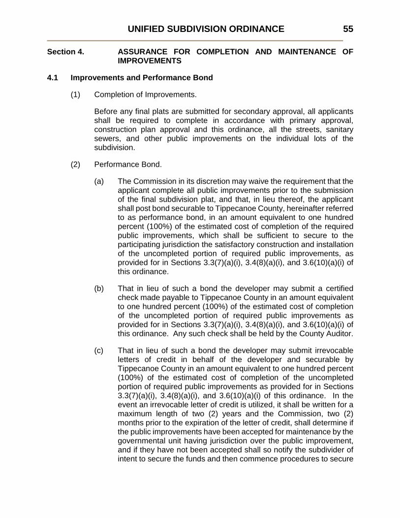
UNIFIED SUBDIVISION ORDINANCE 55
Section 4. ASSURANCE FOR COMPLETION AND MAINTENANCE OF IMPROVEMENTS
4.1 Improvements and Performance Bond
(1) Completion of Improvements.
Before any final plats are submitted for secondary approval, all applicants shall be required to complete in accordance with primary approval, construction plan approval and this ordinance, all the streets, sanitary sewers, and other public improvements on the individual lots of the subdivision.
(2) Performance Bond.
(a) The Commission in its discretion may waive the requirement that the applicant complete all public improvements prior to the submission of the final subdivision plat, and that, in lieu thereof, the applicant shall post bond securable to Tippecanoe County, hereinafter referred to as performance bond, in an amount equivalent to one hundred percent (100%) of the estimated cost of completion of the required public improvements, which shall be sufficient to secure to the participating jurisdiction the satisfactory construction and installation of the uncompleted portion of required public improvements, as provided for in Sections 3.3(7)(a)(i), 3.4(8)(a)(i), and 3.6(10)(a)(i) of this ordinance.
(b) That in lieu of such a bond the developer may submit a certified check made payable to Tippecanoe County in an amount equivalent to one hundred percent (100%) of the estimated cost of completion of the uncompleted portion of required public improvements as provided for in Sections 3.3(7)(a)(i), 3.4(8)(a)(i), and 3.6(10)(a)(i) of this ordinance. Any such check shall be held by the County Auditor.
(c) That in lieu of such a bond the developer may submit irrevocable letters of credit in behalf of the developer and securable by Tippecanoe County in an amount equivalent to one hundred percent (100%) of the estimated cost of completion of the uncompleted portion of required public improvements as provided for in Sections 3.3(7)(a)(i), 3.4(8)(a)(i), and 3.6(10)(a)(i) of this ordinance. In the event an irrevocable letter of credit is utilized, it shall be written for a maximum length of two (2) years and the Commission, two (2) months prior to the expiration of the letter of credit, shall determine if the public improvements have been accepted for maintenance by the governmental unit having jurisdiction over the public improvement, and if they have not been accepted shall so notify the subdivider of intent to secure the funds and then commence procedures to secure

UNIFIED SUBDIVISION ORDINANCE
56
the funds pledged by such letter of credit, or at the discretion of the Commission to grant an extension for such period fixed by the Commission, not to exceed one (1) year, and the subdivider filing with the Commission a new letter of credit for the period so fixed.
(d) That in lieu of such a bond the subdivider may submit a certificate of deposit made out to either Tippecanoe County and/or the developer, to be held by the County Auditor and in an amount equivalent to one hundred percent (100%) of the cost of completion of the uncompleted portion of required public improvements as provided for in Sections 3.3(7)(a)(i), 3.4(8)(a)(i), and 3.6(10)(a)(i) of this ordinance. If the subdivider is named singly or jointly on such certificate, then the developer must before submitting it to the Commission endorse it so that the County may secure the funds.
(e) Such performance bond shall comply with all statutory requirements and shall be satisfactory to the Commission Attorney as to form, sufficiency, and manner of execution as set forth in this ordinance. See Appendix A for forms. The period within which required public improvements must be completed may be specified by the Commission in the primary approval and shall be incorporated into the bond. Bonds shall not in any event exceed two (2) years from date of secondary approval. Such bond shall be approved by the participating jurisdiction as to amount. The Commission may upon proof of difficulty, grant an extension of the completion date set forth in such bond for a maximum period of one (1) additional year, provided that the bond submitted for this extension period meets all other requirements herein. The Commission may at any time during the period of such bond accept a substitution of principal or sureties on the bond.
(3) Temporary Public Improvement.
The applicant shall build and pay for all costs of temporary public improvements required by the Commission as requested by the participating jurisdiction and shall maintain same for the period specified by the Commission. Prior to construction of any temporary public facility or improvement, the developer shall file with the Commission a separate suitable bond for temporary facilities, which bond shall insure that the temporary facilities will be properly constructed, maintained, and removed.
(4) Cost of Public Improvements.
All required public improvements shall be made by the subdivider, at his expense without reimbursement by the participating jurisdiction or any public improvement district therein, unless sharing of expenses is agreed upon by the participating jurisdiction.

UNIFIED SUBDIVISION ORDINANCE 57
(5) Governmental Units.
Governmental units to which these bond provisions apply may file in lieu of said bond a certified resolution or ordinance from officers or agencies authorized to act in their behalf, agreeing to comply with the provisions of this Section.
(6) Failure to Complete Public Improvements.
For subdivisions for which no performance bond has been posted, if the public improvements are not completed within ten (10) years of the date of primary approval, that approval shall be deemed to have expired, unless the expiration date has been extended. In those cases where a performance bond has been posted and required public improvements have not been installed within the terms of such performance bond, the participating jurisdiction may thereupon request the County to declare the bond to be in default and cause all public improvements to be installed according to primary approval and construction plan approval regardless of the extent of the building development at the time the bond is declared to be in default.
(7) Acceptance of Dedication Offers.
The secondary approval by the Commission of a final subdivision plat shall not be deemed to constitute or imply the acceptance by the participating jurisdiction of any street, easement, or park shown on said plat. The Commission may require said plat to be endorsed with appropriate notes to this effect. The acceptance is that of only the real property itself.
4.2 Inspection of Public Improvements
(1) General Procedure.
If the participating jurisdiction finds upon inspection per Sections 3.3(7)(a)(ii), 3.4(8)(a)(ii), and 3.6(10)(a)(ii) that any of the improvements have not been constructed in accordance with the approved construction plans, the applicant shall be responsible for completing the public improvements according to such plans. Where the cost of the public improvements is covered by a performance bond, the applicant and the bonding company shall be severally and jointly liable for completing the public improvements according to specifications.

UNIFIED SUBDIVISION ORDINANCE
58
(2) Release or Reduction of Performance Bond.
(a) Certificate of Satisfactory Completion.
The participating jurisdiction shall not accept required public improvements, nor the Commission release nor reduce a performance bond, until the participating jurisdiction has submitted a certificate stating that all required public improvements or a pro rata part in the case of a reduction have been satisfactorily completed. The applicant's engineer or surveyor shall provide the participating jurisdiction with detailed "as built" construction plans of the public improvements, indicating location, dimensions, materials, and other information required by the Commission or participating jurisdiction. Upon such certification, the participating jurisdiction shall thereafter accept the public improvements for maintenance in accordance with the established procedures.
(b) Reduction of Performance Bond.
A performance bond shall be reduced upon actual acceptance of public improvements and then only by the amount originally estimated for the completion of said public improvements.
4.3 Maintenance of Public Improvements
(1) The subdivider shall be required to maintain all public improvements on the individual subdivided lots and provide for snow removal on streets and sidewalks, if required, until acceptance of said public improvements by the participating jurisdiction.
(2) The subdivider shall be required to file a maintenance bond with the Commission, prior to acceptance, in an amount not to exceed ten percent (10%) of the cost of all public improvements, and in a form satisfactory to the Commission Attorney, in order to assure the satisfactory condition of the required public improvements, for a period of three (3) years after the date of their acceptance by the participating jurisdiction.
4.4 Waiver of Required Public Improvements
The Commission may defer or waive at the time of primary approval, subject to appropriate conditions, the provision of any or all such public improvements as in its judgment, are not requisite in the interests of the public health, safety, and general welfare, or which are inappropriate because of inadequacy or lack of connecting facilities.

UNIFIED SUBDIVISION ORDINANCE 59
4.5 Issuance of Building Permits
No building permit shall be issued for the last ten percent (10%) of lots in a final recorded subdivision plat or section thereof, or if ten percent (10%) be less than two (2), for the last two (2) lots of a subdivision or section thereof, until all public improvements required by the Commission for the plat with the exception of sidewalks have been fully completed and accepted for maintenance by the participating jurisdiction.

UNIFIED SUBDIVISION ORDINANCE
60
Section 5. REQUIREMENTS FOR IMPROVEMENTS, RESERVATIONS AND DESIGN
5.1 General Improvements
(1) Applicable Standards.
Whenever a participating jurisdiction, its utility system or any privately owned utility system have performance standards adopted pursuant to statute in existence or have them subsequently adopted, they shall apply in lieu of similar standards that may be contained within this ordinance. The standards adopted by the Tippecanoe County Commissioners as utilized by the Tippecanoe County Highway Engineer for urban street cross sections shall be the standards utilized within the corporate boundaries of Battle Ground, Dayton, and Clarks Hill until such time as they adopt separate standards. In differentiating between urban and rural cross sections within subdivisions, an urban cross section shall be utilized within the urbanized area as defined by the Bureau of the Census and a rural cross section may be utilized outside of this area except where the Tippecanoe County Board of Commissioners, upon advice of the County Highway Engineer, deems an urban cross section is necessary due to proximity to the urbanized area or due to the nature of the site itself.
(2) Conformance to Applicable Rules and Regulations.
In addition to the standards established herein, all subdivision plats shall comply with the following laws, rules and regulations:
(a) All applicable statutory provisions;
(b) The Unified Zoning Ordinance for Tippecanoe County, building and housing codes, and all other applicable laws of the participating jurisdictions, all as adopted by ordinance of such participating jurisdiction;
(c) The special requirements of these regulations and any rules of the Health Department and/or appropriate State agencies.
(3) Covenants.
If the owner places restrictions on any of the land contained in the subdivision greater than those required by the Unified Zoning Ordinance, such restrictions or reference thereto may be required to be indicated on the subdivision plat, or the Commission may require that restrictive covenants be recorded with the County Recorder in a statutory form to be approved by the Commission.

UNIFIED SUBDIVISION ORDINANCE 61
(4) Plats Straddling Municipal Boundaries.
Whenever access to the subdivision is required across land in another government jurisdiction, the Commission shall request assurance from the Local Government Attorney of that other government jurisdiction that access is legally established, and from that other participating jurisdiction that the access road is adequately improved, or that performance bond has been duly executed and is sufficient in amount to assure the construction of the access road. Lot lines shall be laid out so as not to cross municipal boundary lines.
(5) Boundary Improvements.
(a) The subdivider shall have placed, under the supervision of a Registered Land Surveyor, concrete monuments, four (4) inches square or in diameter and forty (40) inches long with an iron pipe cast in the center, at each corner or angle of the ultimate outside boundary. They shall be set following grading of each phase of the subdivision.
(b) The subdivider shall have placed, under the supervision of a Registered Land Surveyor, pipes or steel rods, three-fourths (3/4) inch in diameter by thirty (30) inches in length at the corners of each lot. These shall be set prior to the issuance of any Improvement Location Permit.
(6) Character of the Land.
Land which the Commission finds to be unsuitable for subdivision because of flooding, improper drainage, steep slopes, rock formations, adverse earth formations or topography, utility easements, or other features which will reasonably be harmful to the safety, health, and general welfare of the present or future inhabitants of the subdivision and/or its surrounding areas, shall not be subdivided unless adequate methods are formulated by the developer and approved by the Commission to solve the problems created by the unsuitable land conditions.
(7) Subdivision Name.
The proposed name of the subdivision shall not duplicate, or too closely approximate phonetically, the name of any other subdivision in the area covered by this ordinance. The Commission shall have final authority to approve the name of the subdivision, which shall be determined at the time of primary approval. In the event the developer intends to develop the subdivision in phases, the name of the subdivision shall incorporate by number and as necessary the respective phase, section and part in that order.

UNIFIED SUBDIVISION ORDINANCE
62
(8) Cost Sharing.
In certain instances it is to be the benefit of the general welfare that certain improvements within a subdivision be increased in size. The additional cost for such is of no special benefit to the future residents of such subdivision but is of benefit to the general public. In such events, special contractual arrangements for cost sharing may be entered into between the developer and the participating jurisdiction, public utility or governmental agency involved.
5.2 Lot Improvements
(1) Lot Dimensions.
Lot dimensions shall comply with the minimum standards of the Unified Zoning Ordinance or greater standards provided for by any ordinance of a participating jurisdiction, which relates lot size to a particular condition or circumstance. Where lots are more than double the minimum required area for the zoning district, the Commission may require that such lots be arranged so as to allow further subdivision and the opening of future streets where they would be necessary to serve potential lots, all in compliance with the Unified Zoning Ordinance and this ordinance. In general, side lot lines shall be at right angles to street lines (radial to curving street lines) unless a variation from this rule will give a better street or lot plan.
(2) Double Frontage Lots and Access to Lots.
(a) Double frontage and reversed frontage lots shall be avoided in residential subdivisions except where necessary to provide separation of residential development from traffic arterials or to overcome specific disadvantages of topography and orientation.
(b) Access from Primary and Secondary Arterials.
Lots in residential subdivision shall not, in general, derive access exclusively from a primary or secondary arterial. Where driveway access from a primary or secondary arterial may be necessary for several adjoining lots in both residential and nonresidential subdivisions, the Commission may require that such lots be served by a combined access or frontage road in order to limit a possible traffic hazard on such street. Where possible, driveways shall be designed and arranged so as to avoid requiring vehicles to back into traffic on primary or secondary arterials.

UNIFIED SUBDIVISION ORDINANCE 63
(3) Soil Preservation, Grading, Seeding.
(a) Soil Preservation and Lot Grading.
No certificate of occupancy shall be issued until rough lot grading as it applies to drainage for that lot, has been accomplished in accordance with the approved construction plans. Topsoil shall not be removed from a residential subdivision lot after the pad grade has been established, but shall be redistributed on the lot and between the curbs and sidewalks in conformance with the site grading plan. It shall be the responsibility of the lot owner to maintain the lot grade, as it applies to drainage, as provided for in the approved construction plans.
(b) Lot Drainage and Seeding.
The grading plans shall provide positive drainage away from all lot pads and individual lot drainage shall be coordinated with the general storm water drainage from each lot to adjacent lots both upstream and downstream as shown in the site grading plan in conformance with the overall storm water management plan for the area. Where appropriate and when required by the Commission, the seeding and mulching, or sodding, of drainageways, shall be included as part of the erosion control program.
(4) Debris and Waste.
No cut trees, debris, junk, rubbish, or other similar waste materials shall be buried by the developer on any lot or street in the subdivision, unless on-site disposal is provided for as shown in the approved construction plans.
(5) Water Bodies and Watercourses.
If a tract being subdivided contains a water body other than a temporary detention facility or portion thereof, lot lines shall either be so drawn as to distribute the entire ownership of the water body among the fees of adjacent lots, or the Commission may approve an alternative plan whereby the ownership of and responsibility for safe maintenance of the water body is so placed that it will not become a local government responsibility. No part of the minimum area of a lot required under the Unified Zoning Ordinance may be satisfied by land which is under water other than a temporary detention facility or portion thereof.
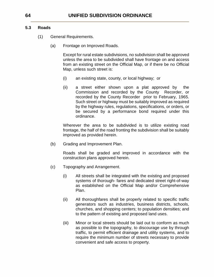
UNIFIED SUBDIVISION ORDINANCE
64
5.3 Roads
(1) General Requirements.
(a) Frontage on Improved Roads.
Except for rural estate subdivisions, no subdivision shall be approved unless the area to be subdivided shall have frontage on and access from an existing street on the Official Map, or if there be no Official Map, unless such street is:
(i) an existing state, county, or local highway; or
(ii) a street either shown upon a plat approved by the Commission and recorded by the County Recorder, or recorded by the County Recorder prior to February, 1965. Such street or highway must be suitably improved as required by the highway rules, regulations, specifications, or orders, or be secured by a performance bond required under this ordinance.
Wherever the area to be subdivided is to utilize existing road frontage, the half of the road fronting the subdivision shall be suitably improved as provided herein.
(b) Grading and Improvement Plan.
Roads shall be graded and improved in accordance with the construction plans approved herein.
(c) Topography and Arrangement.
(i) All streets shall be integrated with the existing and proposed systems of thorough- fares and dedicated street right-of-way as established on the Official Map and/or Comprehensive Plan.
(ii) All thoroughfares shall be properly related to specific traffic generators such as industries, business districts, schools, churches, and shopping centers; to population densities; and to the pattern of existing and proposed land uses.
(iii) Minor or local streets should be laid out to conform as much as possible to the topography, to discourage use by through traffic, to permit efficient drainage and utility systems, and to require the minimum number of streets necessary to provide convenient and safe access to property.

UNIFIED SUBDIVISION ORDINANCE 65
(iv) The rigid rectangular gridiron street pattern need not necessarily be adhered to, and the use of curvilinear streets, cul-de-sacs, or U-shaped streets shall be encouraged where such use will result in a more desirable layout.
(v) Proposed streets shall be extended to the boundary lines of the tract to be subdivided, unless prevented by topography or other physical conditions, or unless in the opinion of the Commission such extension is not necessary or desirable for the coordination of the layout or the most advantageous future development of adjacent tracts.
(vi) In nonresidential subdivisions, the streets and other accessways shall be planned in connection with the grouping of buildings, location of rail facilities and the provision of alleys, truck loading and maneuvering areas, and walks and parking areas so as to minimize conflict of movement between the various types of traffic, including pedestrian.
(d) Blocks.
(i) Blocks in residential subdivision shall have sufficient width to provide for two (2) tiers of lots. Exceptions to this prescribed block width may be permitted.
(ii) In long blocks, the Commission may require the reservation of an easement through the block to accommodate utilities, or drainage facilities. Pedestrianways or crosswalks may be required by the Commission at some point in blocks more than eight hundred (800) feet long where deemed essential to provide circulation or access to schools, playgrounds, shopping centers, transportation, or other community facilities.
(e) Access to Primary Arterials.
Where a subdivision borders on or contains an existing or proposed primary arterial the Commission may require that access to such streets be limited by one or more of the following means:
(i) The subdivision of residential lots so that they back onto the primary arterial and front onto a parallel local street; no access shall be permitted to the primary arterials from any lots, and screening may be required in a planting strip inside the rear property line of such lots;
(ii) A series of cul-de-sacs, U-shaped streets, or short loops entered from and designed generally at right angles to such a

UNIFIED SUBDIVISION ORDINANCE
66
parallel street, with the rear lines of their terminal lots backing onto the primary arterial;
(iii) A marginal access or service road, i.e. a perimeter street, separated from the primary arterial by a planting or grass strip and having access thereto at suitable points; however, marginal access or service roads shall generally be discouraged in residential subdivisions.
(f) Road Names.
The sketch plan as submitted shall indicate names upon any proposed streets. The Commission shall, at the time of primary approval specify the names of all roads in order to avoid duplication. The local postmaster shall be consulted by the Commission prior to rendering its approval. Names shall be sufficiently different in sound and in spelling from other road names in the several participating jurisdictions so as not to cause confusion. A road, which is, or is planned as, a continuation of an existing road shall bear the same name.
(g) Reserve Strips.
The creation of reserve strips shall not be permitted adjacent to a proposed street in such a manner as to deny access from adjacent property to such street unless prevented by topography or other physical conditions or unless in the opinion of the Commission, the access from adjacent property to such street is not necessary or desirable for the coordination of the layout for the most advantageous future development of such adjacent tracts.
(h) Construction of Roads and Dead-End Roads.
(i) Construction of Roads.
The arrangement of streets shall provide for the continuation of principal streets between adjacent properties when such continuation is necessary for convenient movement of traffic, effective fire protection, for efficient provision of utilities, and where such continuation is in accordance with the Thoroughfare Plan. If the adjacent property is undeveloped and the street must be a dead- end street temporarily, the right-of-way shall be extended to the property lines, unless prevented by topography or other physical conditions, or unless in the opinion of the Commission, such extension is not necessary or desirable for coordination of the layout or the most advantageous future development of adjacent tracts. A temporary T- or L-shaped turnabout shall be provided on all

UNIFIED SUBDIVISION ORDINANCE 67
temporary dead-end streets, with the notation on the subdivision plat that land outside the normal street right-of-way shall revert to the abutters whenever the street is continued. The Commission may limit the length of temporary dead-end streets in accordance with the design standards of these regulations.
(ii) Dead-End Roads.
Where a road does not extend to the boundary of the subdivision and its continuation is not required by the Commission for access to adjoining property, its right-of-way terminus shall normally not be nearer to such boundary than fifty (50) feet. However, the Commission may require the reservation of an appropriate easement to accommodate drainage facilities, pedestrian traffic, or utilities. A cul-de-sac turnaround shall be provided at the end of a permanent dead-end street in accordance with participating jurisdiction construction standards and specification. For greater convenience to traffic and more effective police and fire protection, permanent dead-end streets shall, in general, be limited in length in accordance with the design standards of this ordinance.
(2) Design Standards.
(a) General.
In order to provide for roads of suitable location, width, and improvement to accommodate prospective traffic and afford satisfactory access to police, firefighting, snow removal, sanitation, and road maintenance equipment, and to coordinate roads so as to compose a convenient system and avoid undue hardships to adjoining properties, the design standards for public roads indicated in Table 1 are hereby required. Road classification may be indicated by the Thoroughfare Plan; otherwise, it shall be determined by the Commission.
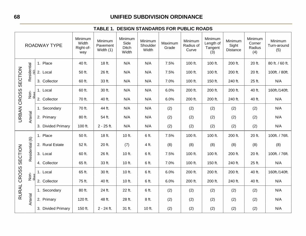
UNIFIED SUBDIVISION ORDINANCE
68
TABLE 1. DESIGN STANDARDS FOR PUBLIC ROADS
ROADWAY TYPE Minimum
Width Right-of-
way
Minimum Pavement Width (1)
Minimum Side Ditch Width
Minimum Shoulder
Width
Maximum Grade
Minimum Radius of
Curve
Minimum Length of Tangent
(3)
Minimum Sight
Distance
Minimum Corner Radius
(4)
Minimum Turn-around
(5)
UR
BAN
CR
OSS
SEC
TIO
N
Res
iden
tial
(6)
1. Place 40 ft. 18 ft. N/A N/A 7.5% 100 ft. 100 ft. 200 ft. 20 ft. 80 ft. / 60 ft.
2. Local 50 ft. 26 ft. N/A N/A 7.5% 100 ft. 100 ft. 200 ft. 20 ft. 100ft. / 80ft.
3. Collector 60 ft. 33 ft. N/A N/A 7.0% 100 ft. 150 ft. 240 ft. 25 ft. N/A
Non
-R
es 1. Local 60 ft. 30 ft. N/A N/A 6.0% 200 ft. 200 ft. 200 ft. 40 ft. 160ft./140ft.
2. Collector 70 ft. 40 ft. N/A N/A 6.0% 200 ft. 200 ft. 240 ft. 40 ft. N/A
Arte
rial 1. Secondary 70 ft. 44 ft. N/A N/A (2) (2) (2) (2) (2) N/A
2. Primary 80 ft. 54 ft. N/A N/A (2) (2) (2) (2) (2) N/A
3. Divided Primary 100 ft. 2 - 25 ft. N/A N/A (2) (2) (2) (2) (2) N/A
RU
RAL
CR
OSS
SEC
TIO
N
Res
iden
tial (
6) 1. Place 50 ft. 18 ft. 10 ft. 6 ft. 7.5% 100 ft. 100 ft. 200 ft. 20 ft. 100ft. / 76ft.
2. Rural Estate 52 ft. 20 ft. (7) 4 ft. (8) (8) (8) (8) (8) (8)
3. Local 60 ft. 26 ft. 10 ft. 6 ft. 7.5% 100 ft. 100 ft. 200 ft. 20 ft. 100ft. / 76ft.
4. Collector 65 ft. 33 ft. 10 ft. 6 ft. 7.0% 100 ft. 150 ft. 240 ft. 25 ft. N/A
Non
-R
es 1. Local 65 ft. 30 ft. 10 ft. 6 ft. 6.0% 200 ft. 200 ft. 200 ft. 40 ft. 160ft./140ft.
2. Collector 75 ft. 40 ft. 10 ft. 6 ft. 6.0% 200 ft. 200 ft. 240 ft. 40 ft. N/A
Arte
rial 1. Secondary 80 ft. 24 ft. 22 ft. 6 ft. (2) (2) (2) (2) (2) N/A
2. Primary 120 ft. 48 ft. 28 ft. 8 ft. (2) (2) (2) (2) (2) N/A
3. Divided Primary 150 ft. 2 - 24 ft. 31 ft. 10 ft. (2) (2) (2) (2) (2) N/A

UNIFIED SUBDIVISION ORDINANCE 69
TABLE 1. DESIGN STANDARDS FOR PUBLIC ROADS (CONT'D)
STANDARDS APPLIED TO ALL ROADWAYS
MINIMUM GRADE: ........................................................................0.5% MINIMUM BLOCK LENGTH: .........................................................400-ft.
(1000-ft. between collectors along arterials) MAXIMUM BLOCK LENGTH .........................................................2600-ft. MAXIMUM CUL-DE-SAC LENGTH: ..............................................800-ft. MAXIMUM LENGTH OF TEMPORARY DEAD-END ROAD: ........1000-ft. MINIMUM LENGTH OF VERTICAL CURVES: ..............................100-ft.,
but not less than 20-ft. for each percent of algebraic difference in grade.
FOOTNOTES:
(1) Curb and gutter is in addition on Urban Cross Sections (combined 2 ft. minimum on each side). (2) As required by the Local Government Engineer and/or Indiana State Highway Commission. (3) Between reverse curves. (4) Measured at curb on Urban Cross Sections, at pavement edge on Rural Cross Sections. Transitional curve into the
turnaround within cul-de-sacs: Residential -------------------------------- 50 ft. Non-residential ------------------------- 100-ft.
(5) Diameter, measured at edge of right-of-way/edge of pavement, or back-to-back of curb on urban cross sections. (6) Includes subdivisions for uses permitted in residential districts as a matter of right or through Special Exception. (7) Rural Estate roads with side ditch shall have a maximum 3:1 slope. (8) Subject to County Highway Department standards. N/A Not applicable

UNIFIED SUBDIVISION ORDINANCE
70
(b) Road Surfacing and Improvements.
Subdivider shall construct all required curb and gutters and shall surface or cause to be surfaced roadways to the widths pursuant to approved construction plans. All road pavement, shoulders, drainage improvements and structures, curbs, turnarounds and sidewalks shall conform to all construction standards and specifications adopted by ordinance of the participating jurisdictions or as approved by the applicable local unit of government through its Board of Works, Town Board or Board of County Commissioners, or as provided for in this ordinance, and shall be incorporated into the construction plans required to be submitted by the developer prior to secondary approval.
(c) Excess Right-of-Way.
Right-of-way widths in excess of the standards designated in this ordinance shall be required whenever, because of topography, additional width is necessary to provide adequate earth slopes. Such slopes shall not be in excess of a ratio of two to one (2:1).
(d) Railroads and Limited Access Highways.
Railroad rights-of-way and limited access highways where so located as to affect the subdivision of adjoining lands shall be treated as follows:
(i) In residential districts a buffer strip at least twenty-five (25) feet in depth in addition to the normal depth of the lot required in the district shall be provided adjacent to the railroad right-of-way or limited access highway. This strip shall be part of the platted lots and shall be designated on the plat: "This strip is reserved for screening. The placement of structures hereon is prohibited."
(ii) In districts zoned for business, commercial, or industrial uses the nearest street extending parallel or approximately parallel to the railroad should, wherever practicable, be at a sufficient distance therefrom to ensure suitable depth for commercial or industrial sites.
(iii) Streets parallel to the railroad when intersecting a street which crosses the railroad at grade shall, to the extent practicable, be at a distance of at least one hundred fifty (150) feet from the railroad right-of-way. Such distance shall be determined with due consideration of grades by means of appropriate approach gradients.

UNIFIED SUBDIVISION ORDINANCE 71
(e) Intersections.
(i) Streets shall be laid out so as to intersect as nearly as possible at right angles. A proposed intersection of two (2) new streets at an angle of less than seventy-five degrees (75o) shall not be acceptable. An oblique street should be curved approaching an intersection and should be approximately at right angles for at least one hundred (100) feet therefrom. Not more than two (2) streets shall intersect at any one point unless specifically approved by the Commission.
(ii) Proposed new intersections along one side of an existing street shall, wherever practicable, coincide with any existing intersections on the opposite side of such street. Street jogs with centerline offsets of less than one hundred fifty (150) feet shall not be permitted, except where the intersected street has separated dual roadways without median breaks at either intersection. Where streets intersect arterials and collectors, their alignment shall be continuous. Intersections of arterials with collectors shall be at least eight hundred (800) feet apart.
(iii) Minimum corner radius at the intersection of two (2) local streets shall be at least twenty (20) feet; and minimum corner radius at an intersection involving a collector street shall be at least twenty-five (25) feet. Alley intersections and abrupt changes in alignment within a block shall have the corners cut off in accordance with standard engineering practices to permit safe vehicular movement.
(iv) Intersections shall be designed with a flat grade wherever practicable. At the approach to an intersection, a leveling area shall be provided having not greater than three percent (3%) rate at a distance of sixty (60) feet, measured from the nearest right-of-way line of the intersecting street.
(v) Where any street intersection will involve earth banks or existing vegetation inside any lot corner that would create a traffic hazard by limiting visibility, the developer shall cut such ground and/or vegetation (including trees) in connection with the grading of the public right-of-way to the extent deemed necessary to provide an adequate sight distance.
(vi) The cross-slopes on all streets, including intersections, shall be three percent (3%) or less.
(f) Bridges.

UNIFIED SUBDIVISION ORDINANCE
72
The sharing of expense of construction of bridges shall be fixed by special agreement between the participating jurisdiction and the applicant per Section 5.1(8).
(3) Road Dedications and Reservations.
(a) New Perimeter Streets.
Street systems in new subdivisions shall be laid out so as to eliminate or avoid new perimeter half-streets. Where an existing half-street is adjacent to a new subdivision, the other half of the street shall be improved and dedicated by the subdivider. The Commission may authorize a new perimeter street where the subdivider improves and dedicates the entire required street right-of-way width within his own subdivision boundaries.
(b) Widening and Realignment of Existing and Proposed Arterials and Roads.
Where a subdivision borders an existing narrow road or when the Comprehensive Plan, Thoroughfare Plan, or zoning setback regulations indicate plans for realignment or widening an adjacent road that would require use of some land in the subdivision, the subdivider shall be required to dedicate such areas for widening or realignment of such roads. Where any lots within a major subdivision derive frontage from any such road, it shall be improved to one-half (1/2) of the full width of a collector facility as required by this ordinance. If the site is transected by an existing arterial which the Comprehensive Plan, Thoroughfare Plan, or zoning setback regulations indicate plans for realignment or widening, the subdivider shall be required to dedicate right-of-way for such arterial. Where any lots within a major subdivision derive frontage from any such arterial, it shall be improved to the full width of a collector facility as required by this ordinance. Where an arterial proposed in the Comprehensive Plan or Thoroughfare Plan borders or transects a proposed subdivision, the necessary right-of-way shall be reserved as provided for in Section 5.9 of this ordinance.
5.4 Drainage and Storm Sewers
(1) General Requirements.
As a part of the approved construction plans, the subdivider shall submit plans for the approval of the Commission for an adequate storm water drainage system, which may include sewers, channels, and basins. The storm water drainage system shall be separate and independent of any sanitary sewer system. Storm sewers, where required, shall be designed according to accepted engineering practice, and a copy of design

UNIFIED SUBDIVISION ORDINANCE 73
computations shall be submitted along with construction plans. Inlets shall be provided so that surface water is not carried across any intersection, nor for a distance in the gutter greater than that indicated by the design computations submitted with the construction plans. When calculations indicate that curb capacities are exceeded at a point, no further allowance shall be made for flow beyond that point. Surface water drainage patterns shall be shown for each and every lot and block.
(2) Nature of Storm Water Facilities.
(a) Location.
The subdivider may be required by the Commission to carry away by pipe or open ditch any spring or surface water that may exist either previously to, or as a result of the subdivision. Such drainage facilities shall be located in the road right-of-way where feasible, or in unobstructed easements of appropriate width, and shall be constructed in accordance with the approved construction plans.
(b) Accessibility to Public Storm Sewers.
Where a public storm sewer is accessible, the subdivider shall install storm sewer facilities, or if no outlets are within a reasonable distance, adequate provision shall be made for the disposal of storm waters as shown on the approved construction plans. Inspection of facilities shall be conducted by the participating jurisdiction.
(c) Effect on Downstream Drainage Areas.
The participating jurisdiction shall study the effect of each subdivision on existing downstream drainage facilities outside the area of the subdivision. Local government drainage studies together with such other studies as shall be appropriate, shall serve as a guide to needed improvements. Where it is anticipated that the additional runoff incident to the development of the subdivision will overload an existing downstream drainage facility, the Commission may withhold primary approval of the subdivision until provision has been made for the improvement of said potential condition. No subdivision shall be granted primary approval unless positive drainage shall be provided to an adequate drainage watercourse or facility, either on- or off-site.

UNIFIED SUBDIVISION ORDINANCE
74
(3) Flood Plains and Areas of Poor Drainage.
(a) Areas of Flooding Soils.
Areas which are not in the Flood Plain but contain soils which are subject to flooding may be approved for subdivision by the Commission, provided that the subdivider fills the affected areas of said subdivision to an elevation sufficient to place building sites and streets two (2) feet above ponding levels.
(b) Areas of High Seasonal Water Tables.
In areas characterized by soils having a high seasonal water table as determined by the Tippecanoe County Soil and Water Conservation District, lots shall be limited to slab type construction unless the Commission determines that appropriate engineering techniques will be applied to alleviate the subsurface problem.
(c) Floodway Areas.
If a subdivision of land is proposed within the Flood Plain, Floodways shall be preserved and not diminished in capacity by filling or obstruction, except as approved by the Natural Resources Commission in writing. No residential building site may be located within the Floodway.
(d) Floodway Fringe Areas.
Where a subdivision is proposed within an area of the Flood Plain designated as a Floodway Fringe, the Commission may approve such subdivision provided that: all streets are elevated sufficiently to be above the Regulatory Flood; all lots for residential usage have a Flood Protection Grade two (2) feet above the Regulatory Flood elevation; where provided, water and sanitary sewer facilities are constructed to eliminate contamination of or by, flood water; and, approval to fill the area from the Natural Resources Commission has been obtained in writing. Lands below the Regulatory Flood elevation shall not be used for computing the area requirement for any lot.
(e) Flood Plain Areas.
Where a subdivision is proposed within an area of the Flood Plain for which Floodway and Floodway Fringe designations have not been made, the Commission shall not approve such subdivision unless: all streets are elevated sufficiently to be above the Regulatory Flood; all lots for residential usage have a Flood Protection Grade of two (2) feet above the Regulatory Flood elevation; where provided, public

UNIFIED SUBDIVISION ORDINANCE 75
water and sanitary sewer facilities are constructed to eliminate contamination of, or by, flood water; and, filling to achieve the above will not raise the level of the Regulatory Flood more than one-tenth (1/10) of one (1) foot for that reach of the stream. All filling in the Flood Plain must be approved in writing by the Natural Resources Commission. Lands below the Regulatory Flood elevation shall not be used for computing the area requirement for any lot.
(f) Recording of Plats in the Flood Plain and Floodway Fringe.
All final plats having within their boundaries areas whose elevation is below that of the Regulatory Flood shall show and label the Regulatory Flood Boundary and elevation, as of the date the final plat is drawn, on the final plat for recording.
5.5 Water Facilities
(1) General Requirements.
(a) Where a public water main is readily accessible the subdivider shall install adequate water facilities (including fire hydrants) as shown in the approved construction plans.
(b) To facilitate the above, the location of all fire hydrants and all water supply improvements shall be shown on the preliminary plat.
(2) Individual Wells and Central Water Systems.
If a public water system is not available, individual wells may be used or a central water system provided in such a manner that an adequate supply of potable water will be available to every lot in the subdivision. Water samples shall be submitted to the Health Department for its approval, and individual wells and central water systems shall be approved by the appropriate health authorities. Orders of approval shall be submitted to the Commission.
(3) Fire Hydrants.
Fire hydrants shall be required for all subdivisions except those having lots served by individual wells. Fire hydrants shall be located no more than one thousand (1,000) feet apart and within five hundred (500) feet of any structure and shall be approved by the applicable fire protection unit. The actual placement of the hydrants shall be approved by the supplier of the water in cooperation with the affected Fire Department.

UNIFIED SUBDIVISION ORDINANCE
76
5.6 Sewerage Facilities
(1) General Requirements.
The subdivider shall install sanitary sewerage facilities in a manner prescribed by the construction standards and specifications of the participating jurisdiction. All plans shall be designed in accordance with the rules, regulations, and standards of the participating jurisdiction, Health Department, and appropriate State and Federal regulating agencies. Plans shall be approved by the above agencies where required by those agencies.
(2) Sanitary Sewerage System Requirements.
Where provided, sanitary sewerage facilities shall connect with public sanitary sewerage systems, and shall be installed to serve each lot and to grades and sizes required by approving officials and agencies. Sanitary sewerage facilities (including the installation of laterals in the right-of-way) shall be subject to the specifications, rules, regulations, and guidelines of the Health Officer, participating jurisdiction, and appropriate State agency.
(3) Individual Disposal System Requirements.
If the public sewer facilities are not available and individual disposal systems are proposed, minimum lot areas shall conform to the requirements of the Unified Zoning Ordinance and any ordinance of any participating jurisdiction establishing lot areas for individual sewerage disposal systems.
5.7 Sidewalks
(1) Required Improvements.
(a) Sidewalks shall be included within the dedicated non-pavement right-of-way of all roads with urban cross sections being improved by the subdivider as shown in Table 2.
TABLE 2. REQUIRED SIDEWALKS WITH URBAN CROSS SECTION ROADWAY TYPE STANDARD WIDTH
ALL RESIDENTIAL Place, Local Road, Collector,
Arterial 4 ft.
NON-RESIDENTIAL: Local Road, Collector 4 ft.
Arterial 6 ft.
(b) Concrete curbs are required for all roads where sidewalks are required by this ordinance and all intersections shall be ramped to enhance accessibility.

UNIFIED SUBDIVISION ORDINANCE 77
(c) Sidewalks shall be improved as required in Section 5.3(2)(b) of this ordinance. A median strip of grassed or landscaped areas at least two (2) feet wide shall separate all sidewalks from adjacent curbs.
(2) Pedestrian Accesses.
The Commission may require, in order to facilitate pedestrian access from the roads to schools, parks, playgrounds, or other nearby roads, perpetual unobstructed easements or dedications. Easements or dedications shall be indicated on preliminary and final plats.
5.8 Utilities
(1) Location.
All utility facilities, including but not limited to gas, electric power, telephone, and CATV cable, shall be located underground throughout the subdivision, except where not permitted by the utility. All utility facilities existing and proposed throughout the subdivision shall be shown on the preliminary plat. Underground service connections to the property line of each platted lot shall be installed at the subdivider's expense.
(2) Easements.
Easements centered on lot lines other than front lot lines shall be provided for utilities (private and municipal) and drainage; such easements shall be at least ten (10) feet wide. Where such easements are provided on front lot lines, or on side lot lines immediately adjacent to rights-of-way, they shall be ten (10) feet wide measured from the lot line. Proper coordination shall be established between the subdivider and the applicable utility companies for the establishment of utility easements in adjoining properties. Easements shall be indicated on preliminary and final plats.
5.9 Parks, Playgrounds, Recreation Areas and Other Community Facilities
(1) Reservation Review Requirements.
In the review of subdivisions, the Commission shall give consideration to the needs and requirements for the following open space uses and community facilities, including but not limited to:
(a) Parks based upon the standards recommended in the Land Use and Recreation Plans;
(b) School sites, other public and semi-public buildings and facilities and locations for water supply systems, sewage treatment facilities and drainage facilities, and proposed thoroughfares, in accordance with local and regional Land Use, Recreation and Thoroughfare Plans.

UNIFIED SUBDIVISION ORDINANCE
78
(2) Where open space uses or community facilities shown in the Land Use, Recreation and Thoroughfare Plans are located in whole or in part within the subdivision, the Commission may require the reservation of such area as may be deemed reasonable for such purposes.
(3) Referral to Public Body.
The sketch plan shall be referred to the public body concerned with the reservation for its consideration and report as per Sections 3.2(2) and 3.6(4) of this ordinance. The public body or agency shall have forty-five (45) days for reply indicating its official action in writing. The public body or agency's recommendation, if affirmative, shall include a copy of the sketch plan showing the boundaries and area of the land to be acquired and an estimate of the time within five (5) years required to complete the acquisition.
(4) Notice to Property Owner.
Upon receipt of a report the Commission shall notify the property owner and in the event of an affirmative report shall designate on the preliminary and final plats that area proposed to be acquired by the public body.
(5) Duration of Land Reservation.
Failure on the part of the public body or agency to acquire or initiate condemnation within the prescribed five (5) years shall result in the removal of the "reserved" designation from the property involved and the freeing of the property for development in accordance with these regulations.
(6) Maintenance of Reserved Land.
The maintenance of land reserved under the provisions of this ordinance shall at the time of primary approval become the responsibility of the public body for whom the reservation has been made unless mutual agreement to waive this requirement has been reached between the subdivider and the public body or agency. This requirement shall remain in effect as long as the reservation shall be in effect.

UNIFIED SUBDIVISION ORDINANCE 79
5.10 Preservation of Natural Features and Amenities
(1) General.
Existing features which would add value to residential development or to the participating jurisdiction as a whole, such as trees, watercourses and falls, beaches, historic spots, and similar irreplaceable assets, shall be preserved wherever possible, in the design of the subdivision.
5.11 Nonresidential Subdivisions
(1) General.
It is recognized that the subdivider, in creating a nonresidential subdivision, faces problems of lot design not normally encountered in residential subdivisions. For this reason, the initial emphasis of the Commission shall be upon street layout and block arrangement. The procedural requirements for sketch plan and for primary approval are as provided in Section 3 except that the subdivider need show only the proposed street and block layout. Subsequently as prospective buyers or users express interest in lots sized to their required specifications, the subdivider may then submit for secondary approval a final subdivision plat or plats which may show lot lines other than those shown at time of primary approval in the case of a major subdivision and sketch plan in the case of a minor subdivision. The procedural requirements of the Commission following the receipt of a final subdivision plat shall then apply, except that where public improvements were built following a previously approved set of construction plans, public improvements then need not be reconstructed because of the adoption of new criteria by a participating jurisdiction. This shall also apply to storm drainage facilities within said subdivision unless runoff characteristics are to be changed, or in the event that unauthorized existing improvements have altered conditions.
(2) Standards.
(a) Nonresidential subdivisions must be appropriately zoned for business or industry prior to the proposal for a subdivision under this section.
(b) If a nonresidential subdivision has received secondary approval, any replatting of lots may take place following the minor subdivision provisions of this ordinance. There shall be no limit on the number of minor subdivisions within the original plat.
(c) All nonresidential subdivisions shall be served by approved sewer and water facilities, by individual wells, on-site sewage disposal facilities, or some combination thereof as approved by the appropriate authorities.

UNIFIED SUBDIVISION ORDINANCE
80
5.12 Multi-Family Subdivisions
(1) General.
Unless otherwise excluded under Section A of the definition of Subdivision, or under the provisions for Parcelization indicated in Section 3.5 of this ordinance, the development of more than one multi-family structure on a single ownership lot constitutes a subdivision of land as defined herein. Yet the creation of a separate lot for each primary use building, that is, each multi-family structure, poses unique and complex problems for the subdivider of land to be so used. Many of the standards set forth in the Unified Zoning Ordinance to be applied to individual residential lots cannot be met without destroying the unifying concept of a well-designed complex of multi-family structures. Most notable among these standards are lot size, frontage and setback requirements, all of which assume a progression of uniform lots along a roadway, more typical of single family and some duplex developments. Despite these difficulties associated with the subdivision of land for multi-family development, the purposes of this ordinance, as listed in Section 1.3, must be met. Thus, with regard to proposed multi-family subdivisions, the emphasis of the Commission shall be on the number of primary use buildings, the number of proposed dwelling units and required parking spaces, and the provision of required public improvements. To this end, the necessity of placing interior lot lines on sketch plans and preliminary and final plats shall be at the subdivider's option, so long as all primary use buildings and all accessory buildings remain in the ownership or leasehold of a single entity. That option shall be revoked at such time as the ownership or leasehold of fewer than all such buildings is to be transferred to another entity. Such transfer shall necessitate a resubdivision of the affected property, complete with appropriate lot lines.
(2) Procedural Requirements and Submission Specifications.
(a) Multi-family subdivisions must be zoned R3, R3W or R4W prior to the proposal for a subdivision under this section. However, if a multi-family subdivision is comprised solely of buildings containing only two dwelling units, the multi-family subdivision may be zoned R2, R3, R3W or R4W.
(b) The subdivider of land to be used for the development of multi-family structures shall adhere to the procedural requirements and submission specifications for sketch plans and preliminary and final plats as provided in Sections 3 and 6 of this ordinance, except as follows:
(i) the number of primary use buildings, and the number of proposed dwelling units and required parking spaces shall be indicated on sketch plans and preliminary and final plats;

UNIFIED SUBDIVISION ORDINANCE 81
(ii) the subdivider may opt to omit interior lot lines under the circumstances indicated in Section 5.12(1); and
(iii) no multi-family subdivision shall be approved unless the area to be subdivided shall have frontage on and access from an existing street on the Official Map, or if there be no Official Map, unless such street is:
(A) an existing state, county, or local highway or a street either shown upon a plat approved by the Commission and recorded by the County Recorder, or recorded by the County Recorder prior to February, 1965. Such street or highway must be suitably improved and accepted for public maintenance, or be secured by a performance bond required under this ordinance. Wherever the area to be subdivided is to utilize existing road frontage, the half of the road fronting the subdivision shall be suitably improved as provided for in Section 5.12(3)(a)(i) or Section 5.12(3)(a)(ii) as follows; or
(B) a street platted as a part of the multi-family subdivision.
(c) Should the subdivider exercise the option of omitting interior lot lines, the standards of the Unified Zoning Ordinance shall be applied to the entire tract. That is, the entire tract will be treated as one lot, subject to all restrictions and requirements of the Unified Zoning Ordinance pertaining to multi-family dwellings on a single lot. In effect, this will permit the placement of more than one primary use building on a single lot. Should there be a necessity to resubdivide, as would occur in the event of a transfer of ownership or leasehold of fewer than all principal use and accessory buildings, the standards of the Unified Zoning Ordinance for multi-family dwellings shall be applied to each and every separate lot so created through the resubdivision process; variances may be sought from the appropriate Board of Zoning Appeals.
(3) Requirements for Improvements. (a) The subdivider of land to be so used for the development of multi-
family structures shall be subject to the requirements of Section 5 of this ordinance, except as follows: (i) Widening and Realignment of Existing and Proposed
Arterials. Where a multi-family subdivision borders an existing narrow arterial or when the Comprehensive Plan, Thoroughfare Plan, or zoning setback regulations indicate plans for realignment

UNIFIED SUBDIVISION ORDINANCE
82
or widening an adjacent arterial that would require use of some land in the subdivision, the subdivider shall be required to dedicate such areas for widening or realignment of such arterials. Where any portion of a multi-family subdivision abuts any such arterial, that arterial shall be improved only to one-half (1/2) of the full width of a collector facility as required by this ordinance. If the site is transected by an existing arterial which the Comprehensive Plan, Thoroughfare Plan, or zoning setback regulations indicate plans for realignment or widening, the subdivider shall be required to dedicate right-of-way for such arterial. Where any portion of a multi-family subdivision abuts any such arterial, that arterial shall be improved to the full width of a collector facility as required by this ordinance. Where an arterial proposed in the Comprehensive Plan or Thoroughfare Plan borders or transects a proposed subdivision, the necessary right-of-way shall be reserved as provided for in Section 5.9 of this ordinance.
(ii) Widening and Realignment of Existing and Proposed Collectors and Local Roads. Where a multi-family subdivision borders an existing narrow collector or local road or when the Comprehensive Plan, Thoroughfare Plan, or zoning setback regulations indicate plans for realignment or widening an adjacent collector or local road that would require use of some land in the subdivision, the subdivider shall be required to dedicate such areas for widening or realignment of such collectors or local roads. Where any portion of a multi-family subdivision abuts any such collector or local road, that collector or local road shall be improved to one-half (1/2) of the full width of that designated facility as required by this ordinance. If the site is transected by an existing collector or local road which the Comprehensive Plan, Thoroughfare Plan, or zoning setback regulations indicate plans for realignment or widening, the subdivider shall be required to dedicate right-of-way for such collector or local road. Where any portion of a multi-family subdivision abuts any such collector or local road, that collector or local road shall be improved to the full width of that facility respectively as required by this ordinance.
(iii) In the event of resubdivision, where public improvements were built following a previously approved set of construction plans, public improvements then need not be reconstructed because of the adoption of new criteria by a participating jurisdiction.

UNIFIED SUBDIVISION ORDINANCE 83
5.13 Rural Estate Subdivisions
(1) General
The rural estate subdivision is unique in that it is the only classification of subdivision permitted in the RE (Rural Estate) zone and shall meet specific standards different from other subdivisions. For that reason the application procedures and approval processes in Section 3 have been separated from the major and minor subdivision sections. However, in Sections 4 and 5 many requirements apply to all subdivisions, including rural estate. The differences are noted throughout these sections for the three subdivision classifications. To better unify the rural estate subdivision and zoning processes, the following standards are the same as those found in the Unified Zoning Ordinance for Rural Estate Zones.
(2) Standards.
To ensure limited and appropriate levels of residential development in some rural areas in unincorporated Tippecanoe County, without jeopardizing productive farmland and the way of life associated with farming, the following parameters shall be incorporated into any submission seeking approval of a rural estate subdivision:
(a) Proposed RE-zoned sites, or FP-zoned portions of rural estate subdivisions shall not be located within an IURC approved service area (CTA) of a sanitary sewer provider or within the service area of a municipally owned sewer system unless it is farther than ½ mile, measured radially, from the nearest sanitary sewer line or lift station having unused capacity for twelve (12) lots. Proposed RE-zoned sites, or FP-zoned portions of rural estate subdivisions may be located closer than ½ mile, measured radially, from the nearest sanitary sewer line or lift station having unused capacity if outside the IURC approved service area (CTA) of a sanitary sewer provider or outside the service area of a municipally owned sewer system.
(b) Subdivider shall demonstrate that more than 50% of the acreage in the rural estate subdivision request is either:
(i) wooded and untilled,
(ii) non-tillable, or
(iii) not mechanically harvested for at least 3 of the 5 years between 1997 and 2001,
or a combination of any 2 or 3 of the 3 above conditions equaling more than 50%, part of which may be zoned FP. Subdivider shall supply evidence of this percentage in the form of current and past

UNIFIED SUBDIVISION ORDINANCE
84
aerial photography available from the Soil and Water Conservation District.
(c) 12 single-family residential lots shall be the maximum proposed for any rural estate subdivision.
(d) Lots created through RE zoning and simultaneous rural estate subdivision, shall be a minimum of 1 acre of either RE-zoned land, or 1 acre of RE-and FP-zoned land of which at least 30,000 sq.ft. is zoned RE, exclusive of any outlot containing drainage easements and/or rural estate roads, and exclusive of any public street right-of-way, within a maximum zone density of no more than 1 dwelling unit per 2 acres within the rural estate subdivision.
(e) Each lot shall be accessed only from a rural estate road within the proposed RE-zoned site. Subdivider shall demonstrate that any rural estate road would be sited to minimize damage to existing trees and topography.
(f) A rural estate road shall be built to the specific standards found in Section 5.3 above and below in 5.13(2)(g) and 5.13(2)(h).
(g) If it is to be held privately by a homeowners’ association, the rural estate road shall:
(i) have a minimum 20’ pavement width, within a minimum 52’-wide outlot;
(ii) have either two 4’ or wider grassed shoulders or curb and gutter alongside the pavement;
(iii) if shoulders, have side ditches with a maximum 3:1 slope;
(iv) when required by the County Drainage Board, have additional easements platted beyond the edge of the outlot; and
(v) should it be a cul-de-sac, end in a turnaround. If looped, this turnaround shall have a minimum 20’ pavement width, surrounded by a 4’ or wider grassed shoulder and side ditches or curb and gutter; if no curb and gutter, have side ditches with a maximum 3:1 slope, all situated in an outlot having a minimum 80’ diameter. Should the rural estate road end in a hammerhead, each side shall conform to 5.13(2)(g)(i) through 5.13(2)(g)(iv) above.
All cross section design standards shall be certified by subdivider's Registered Land Surveyor or Professional Engineer as complying with private rural estate road standards. A private rural estate road

UNIFIED SUBDIVISION ORDINANCE 85
may, on a case-by-case basis, be dedicated and may be accepted for public maintenance at any time if it has been built or subsequently rebuilt to County Highway Department standards current at the time of the request.
(h) If it is to be a public street dedicated and accepted for public maintenance, the rural estate road shall:
(i) conform to all subdivision road standards as per Section 5.3 above; or
(ii) conform to the following public rural estate road standards:
(A) a rural cross-section in a dedicated 52’ minimum right-of-way, with 20’ of pavement , 4’ grassed shoulders, and a drainage easement configured with 3:1 maximum side slopes with a 2’ minimum ditch depth; and
(B) an appropriate rural cross-section cul-de-sac, subject to County Highway Department standards.
(i) Water supply shall be by individual well or a central water supply.
(j) Sanitary effluent shall be handled either by individual or clustered sewage disposal system, approved by the County Health Department through the rural estate subdivision process.
(k) The County Drainage Board shall enforce all aspects of drainage, including side ditches if situated within a privately held outlot. However, the County Highway Department shall enforce side ditches in dedicated right-of-way.
(l) A homeowners’ association shall be created and appropriate documents recorded at the time of final plat recording. The association shall be responsible for maintaining any outlot, private rural estate road, common area, and improvement for common usage, and for implementing any approved stormwater management, landscape and erosion control plans. Deeds transferring outlots and common areas to the homeowners’ association shall be recorded at the time of final plat recording.

UNIFIED SUBDIVISION ORDINANCE
86
Section 6. SPECIFICATIONS FOR DOCUMENTS TO BE SUBMITTED
6.1 Sketch Plan
Sketch plans submitted to the Commission, prepared in pen or pencil, shall be drawn to an approximate scale of not more than one hundred (100) feet to an inch and shall show the following information:
(1) Name.
(a) Name of subdivision if property is within an existing subdivision;
(b) Proposed name if not within a previously platted subdivision; the proposed name shall not duplicate the name of any having previously received final plat approval or secondary approval;
(c) Name of property if no subdivision name has been chosen (this is commonly the name by which the property is locally known).
(2) Ownership.
(a) Name and address, including telephone number, of legal owner or agent of property, and citation of last instrument conveying title to each parcel of property involved in the proposed subdivision, giving grantor, grantee, date and land records reference;
(b) Citation of any existing legal right-of-way or easements affecting the property;
(c) Existing covenants on the property, if any;
(d) Name and address, including telephone number, of the professional person(s) responsible for subdivision design, for the design of public improvements, and for surveys.
(3) Description.
Location of property by government lot, Section, Township, Range and County, graphic scale, north arrow, and date.
(4) Features.
(a) Location of property lines, existing easements, burial grounds, railroad rights-of-way, and water-courses; location, width, names of all existing or platted streets or other public ways within or immediately adjacent to the tract; names and addresses of adjoining or adjacent property owners;

UNIFIED SUBDIVISION ORDINANCE 87
(b) Information on the availability of sewer and water if such facilities are available;
(c) Approximate topography;
(d) The approximate location and widths of proposed streets;
(e) The approximate location, dimensions, and areas of all proposed and existing lots;
(f) The approximate location, dimensions, and area of all land proposed to be set aside for park and playground use or other public use, or for the common use of property owners in the proposed subdivision;
(g) Whenever the sketch plan covers only a part of a subdivider's contiguous holdings, the subdivider shall submit, at the scale of no more than two hundred (200) feet to the inch, a sketch in pen or pencil of the total area, together with the subdivision's proposed street system, and an indication of the probable future street system of the remaining portion of the tract.
6.2 Preliminary Plat
(1) General.
The preliminary plat shall be prepared by a Registered Land Surveyor at a convenient scale not more than one hundred (100) feet to the inch, may be prepared in pen, and the sheets shall be numbered in sequence if more than one (1) sheet is used and shall be of such size as is acceptable for filing in the Office of the County Recorder, but shall not be larger than twenty-four by thirty-six (24 x 36) inches.
(2) Features.
The preliminary plat shall show the following:
(a) The location of property with respect to surrounding property and streets, and the names of adjoining developments; the names of adjoining streets;
(b) The location and dimensions of all boundary lines of the property to be expressed in feet and decimals of a foot;
(c) The location of existing streets, easements, water bodies, streams, and other pertinent features such as swamps, floodplains, railroads, buildings, parks, cemeteries, drainage ditches, and bridges;

UNIFIED SUBDIVISION ORDINANCE
88
(d) The location and width of all existing and proposed streets and easements, alleys, and other public ways, and easements and proposed street rights-of-way and building set-back lines;
(e) The locations, dimensions, and areas of all proposed and existing lots;
(f) The location and dimensions of all property proposed to be set aside for park or playground use, or other public or private reservation, with designation of the purpose thereof, and conditions, if any, of the reservation;
(g) The name and address of the owner or owners of land to be subdivided, the name and address of the subdivider if other than the owner, and the name of the land surveyor with the surveyor's seal;
(h) The date of the map, approximate true north point, scale and title of the subdivision;
(i) Sufficient data to determine readily the location, bearing, and length of all lines, and to reproduce such lines upon the ground; the location of all proposed monuments;
(j) Name of the subdivision and names of the streets to be approved by the Commission;
(k) Indication of the use of any lot (single family, two family, multi-family, townhouse) and all other uses other than residential proposed by the subdivider;
(l) Blocks shall be consecutively numbered or lettered in alphabetical order; the blocks in numbered additions to subdivisions bearing the same name shall be numbered or lettered consecutively throughout the several additions;
(m) All lots shall be consecutively numbered throughout the entire subdivision but not necessarily consecutively numbered within a particular phase, section or part of the subdivision;
(n) The following notation shall also be shown:
(i) Explanation of drainage easements, if any;
(ii) Explanation of site easements, if any;
(iii) Explanation of reservations, if any;
(iv) Endorsement of owner, as follows:

UNIFIED SUBDIVISION ORDINANCE 89
______________________________________________ Owner Date
(o) Form for endorsements by Commission President is as provided for in State Statute.
6.3 Construction Plans
(1) General.
Construction plans shall be prepared for all required improvements to be installed by the subdivider. Plans shall be drawn at a scale of no more than fifty (50) feet to the inch, and map sheets shall be of the same size as the preliminary plat. The following shall be shown:
(a) Profiles showing existing and proposed elevations along center lines of all roads; where a proposed road intersects an existing road or roads, the elevation along the center line of the existing road or roads within one hundred (100) feet of the intersection shall be shown, plus approximate radii of all curves, lengths of tangents, and central angles on all streets;
(b) The Commission may require, where steep slopes exist that cross-sections of all proposed streets at one hundred (100) foot stations shall be shown at five (5) points as follows: on line at right angles to the center line of the street, each property line, and points twenty-five (25) feet inside each property line;
(c) Plans and profiles showing the locations and typical cross-section of street pavements including curbs and gutters, sidewalks, drainage easements, servitudes, rights-of-way, manholes, and catch basins; the location of street signs, the location, size and invert elevations of existing or proposed sanitary sewers, storm water drains, and fire hydrants, showing connection to any existing or proposed utility systems; and exact location and size of all water, or other underground utilities or structures;
(d) Location, size, elevation, and other appropriate description of any existing facilities or utilities, including, but not limited to, existing streets, sewers, drains, water mains, easements, water bodies, streams, floodplains, and other pertinent features within the proposed subdivision;
(e) Topography at the same scale as the preliminary plat with a contour interval of two (2) feet, referred to sea-level datum; all data provided shall be latest applicable U.S. Coast and Geodetic Survey data and should be so noted on the plat;

UNIFIED SUBDIVISION ORDINANCE
90
(f) All specifications and references required by the local government's construction standards and specifications, including a site grading plan for the entire subdivision;
(g) Notation of approval as follows:
________________________________________________ Owner Date ________________________________________________ Executive Director Date
(h) Title, name, address, and signature of Registered Engineer and Land Surveyor, and date, including revision dates.
6.4 Final Subdivision Plat
(1) General.
The final subdivision plat shall be presented at an appropriate scale on sheets not larger than twenty-four by thirty-six (24 x 36) inches, and show any changes or additions required by the conditions of primary approval.
All revision dates must be shown as well as the following:
(a) Name of subdivision; if the final subdivision plat is only a portion of the preliminary subdivision plat, each section or addition shall be separately designated;
(b) Legal description of the subdivision which shall include Section, Township, Range and government township;
(c) Name, address, seal and certification of the Registered Land Surveyor preparing or certifying the subdivision, as shown in Appendix A;
(d) Scale, graphic bar scale, date and north point;
(e) Exact location, width and name of all streets within the subdivision and the exact location and width of all alleys, crosswalks and other easements;
(f) Township, Range or Section Line accurately tied to the subdivision by bearing and distances in feet and hundredths thereof;
(g) Boundary of subdivision, based on accurate traverse survey with angular and lineal dimensions in feet and hundredths thereof; the

UNIFIED SUBDIVISION ORDINANCE 91
traverse survey shall be closed to a minimum accuracy of one to ten thousand (1:10,000); a boundary closure sheet shall be provided;
(h) All radii, central angles, points of curvature and tangency, length of tangents, lengths of arcs, widths of rights-of-way and similar data shall be shown for all streets; all street lines shall be tied to other streets and alleys with accurate dimensions in feet and hundredths thereof and angles or bearings;
(i) All easements dimensioned and identified as to their specific uses;
(j) All lot numbers and lines with accurate dimensions in feet and hundredths thereof and bearings expressed in degrees, minutes and seconds; lots in sections or additions to a subdivision with the same name shall not bear the same lot number as any other lot throughout the several sections or additions;
(k) All recorded subdivisions bounding the final subdivision plat shall be shown in dotted lines with name, section, or addition and Recorder's Book and Page Number;
(l) Any areas other than public right-of-way, to be dedicated or reserved for public use or semi-public use or areas to be reserved for the common use of all property owners, shall be shown on the drawing and labeled as to its use and shall have a separate legal description on the drawing with accurate dimensions in feet and hundredths thereof and bearings expressed in degrees, minutes and seconds;
(m) Dimensioned building setback lines;
(n) Statement of dedication, as shown in Appendix A;
(o) Owner's Certification, as shown in Appendix A;
(p) Notarization and seal, as shown in Appendix A;
(q) Certificate of Approval, as shown in Appendix A;
(r) The Regulatory Flood boundary and elevation, shown and labeled, for any plat having land in a Flood Plain.

UNIFIED SUBDIVISION ORDINANCE
92
Appendix A. REQUIRED FORMS AND CERTIFICATES
A.1 All applications, requests for plat approval, notices, affidavits, certificates, endorsements and instruments assuring the completion and maintenance of improvements required by the provisions of this ordinance shall be submitted to the Commission's Staff or prepared by the Commission's Staff on the following forms:
(1) Application for Minor Sketch Plan Review, Primary Approval and Certificate;
(2) Application for Major Sketch Plan Review and Certificate;
(3) Request for Primary Approval of a Major Subdivision Plat;
(4) Notice of Public Hearing on Subdivision Plat;
(5) Notice of Public Hearing Release Form;
(6) Sign Posting Affidavit;
(7) Request for Secondary Approval of Subdivision Plat;
(8) Notice to Interested Parties;
(9) Affidavit of Notice to Interested Parties for Primary Subdivision Approval;
(10) Certificate of Approval;
(11) Parcelization Certificate;
(12) Land Surveyor's Certificate;
(13) Dedication Certificate;
(14) Subdivision Performance Bond;
(15) Performance Bond Secured by Deposit;
(16) Irrevocable Letter of Credit; and
(17) Maintenance Bond.
A.2 The Commission shall determine the need for, and the form of any additional or amended applications, requests for plat approval, notices, affidavits, certificates, endorsements and instruments as may be required in the enforcement of the regulations of this ordinance.

93 A.1(1) App. No. S- ___________ Date Rec’d. ___________ Rec’d. by ___________ APPLICATION FOR MINOR SKETCH PLAN REVIEW, PRIMARY APPROVAL AND CERTIFICATE
Name(s) of Subdivider(s)
Address (es)
City State Zip City State Zip Phone(s) ( ) ( )
Subdivider’s Representative (if any) and Registered Land Surveyor (if any)
Name(s)
Address (es)
City State Zip City State Zip Phone(s) ( ) ( ) I (we) do hereby apply for sketch plan review, primary approval and certificate of approval of the following described subdivision in accordance with the provisions of the Comprehensive Plan. I (we) am (are) the owner (owners) of the real estate included in said subdivision. Name of Subdivision ______________________________________ generally described as follows: Civil Township ________________ Section ____ Quarter Section ____ Township ____ Range ____
(LEGAL DESCRIPTION OF SUBDIVISION ATTACHED HERETO) Area in acres __________; Number of Lots __________
Will there be public improvements other than sidewalks? __________YES; __________NO
The undersigned, having been duly sworn on oath states the above information is true and correct as he is informed and believes. Signature(s) of Subdivider(s) ____________________________ ___________________________
____________________________ ___________________________ State of Indiana)
County of Tippecanoe) Subscribed and sworn to before me this _______ day of____________________________, 20 ____
_________________________________________________ Notary Public
Residing in _______________________County; My Commission Expires______________________
FOR STAFF USE: Date of Sketch Plan Review __________________________________________
Date of Commission/Exec. Committee Public Hearing ______________________
Fee of $_____________ received from subdivider. Date ____________________
SS:

94 A.1(2) App. No. S- ___________ Date Rec’d. ___________ Rec’d. by ___________
APPLICATION FOR MAJOR SKETCH PLAN REVIEW AND CERTIFICATE
Name(s) of Subdivider(s)
Address (es)
City State Zip City State Zip Phone(s) ( ) ( )
Subdivider’s Representative (if any) and Registered Land Surveyor (if any)
Name(s)
Address (es)
City State Zip City State Zip Phone(s) ( ) ( ) I (we) do hereby apply for sketch plan review and certificate of approval of the following described subdivision in accordance with the provisions of the Comprehensive Plan. I (we) am (are) the owner (owners) of the real estate included in said subdivision. Name of Subdivision ______________________________________ generally described as follows: Civil Township ________________ Section ____ Quarter Section ____ Township ____ Range ____
(LEGAL DESCRIPTION OF SUBDIVISION ATTACHED HERETO) Area in acres __________; Number of Lots __________
Will there be public improvements other than sidewalks? __________YES; __________NO
The undersigned, having been duly sworn on oath states the above information is true and correct as he is informed and believes. Signature(s) of Subdivider(s) ____________________________ ___________________________
____________________________ ___________________________ State of Indiana ) County of Tippecanoe) Subscribed and sworn to before me this _______ day of____________________________, 20 ____
_________________________________________________ Notary Public
Residing in _______________________County; My Commission Expires______________________
FOR STAFF USE: Date of Sketch Plan Review __________________________________________
Fee of $_____________ received from subdivider. Date ____________________
SS:

95 A.1(3) File No. S- ___________ Date Rec’d. ___________ Rec’d. by ___________ S.P. No. S- ___________
REQUEST FOR PRIMARY APPROVAL OF A MAJOR SUBDIVISION PLAT
Name(s) of Subdivider(s)
Address (es)
City State Zip City State Zip Phone(s) ( ) ( )
Subdivider’s Representative (if any) and Registered Land Surveyor (if any)
Name(s)
Address (es)
City State Zip City State Zip Phone(s) ( ) ( ) I (we) do hereby request primary approval of the following described subdivision in accordance with the provisions of the Comprehensive Plan. I (we) am (are) the owner (owners) of the real estate included in said subdivision. Name of Subdivision ______________________________________ generally described as follows: Civil Township ________________ Section ____ Quarter Section ____ Township ____ Range ____ Area in acres __________; Number of Lots __________ Miles of new streets to be dedicated to the public (in hundredths):
Full width ________________________ Half width ________________________
The undersigned, having been duly sworn on oath states the above information is true and correct as he is informed and believes. Signature(s) of Subdivider(s) ____________________________ ___________________________
____________________________ ___________________________ State of Indiana ) County of Tippecanoe) Subscribed and sworn to before me this _______ day of____________________________, 20 ____
_________________________________________________ Notary Public
Residing in _______________________County; My Commission Expires______________________
FOR STAFF USE: Date of Public Hearing before Commission _______________________________
Fee for Additional Lots of $_____________ received from subdivider. Date _______________
SS:

96
A.1(4)
NOTICE OF PUBLIC HEARING ON SUBDIVISION PLAT
NOTICE IS HEREBY GIVEN, THAT THE TIPPECANOE COUNTY AREA PLAN
COMMISSION, ON THE ________DAY OF ____________, 20 ____, at _______ P.M.
in the COUNTY OFFICE BUILDING, 20 NORTH 3RD STREET, LAFAYETTE,
INDIANA, WILL HOLD A PUBLIC HEARING ON A REQUEST BY
___________________________________________ FOR PRIMARY APPROVAL OF
(Subdivider)
_________________________________________________________ SUBDIVISION.
(Name of Subdivision)
SAID SUBDIVISION INVOLVES THE FOLLOWING DESCRIBED REAL ESTATE IN
_______________________________________________ TOWNSHIP, LOCATED AT
(Name of Civil Township)
______________________________________________________________, TO WIT:
(Common Address or Road Location)
DESCRIPTION
Written suggestions or objections to the provisions of said request may be filed with the Secretary of the Area Plan Commission at or before such meeting and will be heard by the Tippecanoe County Area Plan Commission at the time and place specified. Said hearing may be continued from time to time as may be necessary.
Interested persons desiring to present their views on the said request, either in writing or verbally, will be given the opportunity to be heard at the above mentioned time and place. This hearing date is subject to placement on the agenda.
AREA PLAN COMMISSION OF TIPPECANOE COUNTY, INDIANA
BY: __________________________________________________ Executive Director
SEAL:

97
A.1(5)
NOTICE OF PUBLIC HEARING
RELEASE FORM
TO: Journal and Courier/Lafayette Leader
Name: ____________________________________________
Address: ____________________________________________ Street
____________________________________________ City State Zip
Date: ____________________________________________
This is to authorize you to publish the attached legal notice delivered to you by the Tippecanoe County Area Plan Commission, the cost of which is the obligation of the above and will be paid by me.
Signature: ____________________________________________

98
A.1(6)
SIGN POSTING AFFIDAVIT
STATE OF INDIANA ) COUNTY OF TIPPECANOE )
______________________________
(Name of Subdivision)
______________________________, AFTER BEING FIRST DULY SWORN STATES:
(Name of Sign Poster)
1. that the Ordinance requiring the posting of a sign on property being considered for primary approval, as adopted by the participating jurisdictions of the Tippecanoe County Area Plan Commission, has been fully complied with in connection with the above referenced request; and
2. that said sign(s) was duly erected on the _________ day of _____________ 20_______, in full compliance with the requirements of said Ordinance and remains on said property to this date.
Dated this _________ day of _____________ 20 _______
______________________________________________ (Signature of Sign Poster)
Subscribed and sworn to before me this _________ day of _____________ 20 _______
______________________________________________ Notary Public
My Commission expires ___________________________________
Residing in _______________________________________ County
RE: Request for Primary Approval before the Tippecanoe County Area Plan Commission
SS:

99 A.1(7) File No. S- ___________ Date Rec’d. ___________ Rec’d. by ___________ REQUEST FOR SECONDARY APPROVAL OF SUBDIVISION PLAT
FOR STAFF USE: Plat requires: _____ determination of conformance S.P. No. S- _____ Date Approved _____ _____ new primary approval Prelim. No. S- _____ Date Approved _____
_____ performance bond received. Date _______________ _____ restrictive covenants received. Date _______________
Name(s) of Subdivider(s)
Address (es)
City State Zip City State Zip Phone(s) ( ) ( )
I (we) do hereby request determination of conformance with the primary approval for the following described subdivision in accordance with the provisions of the Comprehensive Plan. I (we) am (are) the owner (owners) of the real estate included in said subdivision. Name of Subdivision ______________________________________ generally described as follows: Civil Township ________________ Section ____ Quarter Section ____ Township ____ Range ____ Area in acres __________; Number of Lots __________ Miles of new streets to be dedicated to the public (to hundredths):
Full width ________________________ Half width ________________________ Subdivider requests: _____Staff determination of conformance
_____Commission determination of conformance
The undersigned, having been duly sworn on oath states the above information is true and correct as he is informed and believes. Signature(s) of Subdivider(s) ____________________________ ___________________________
____________________________ ___________________________ State of Indiana ) County of Tippecanoe) Subscribed and sworn to before me this _______ day of____________________________, 20 ____
_________________________________________________ Notary Public
Residing in _______________________County; My Commission Expires______________________
FOR STAFF USE: As appropriate: _________ Staff determines conformance. Date _________________
_________ Commission determines conformance. Date _________________
SS:

100
A.1(8)
NOTICE TO INTERESTED PARTIES
TIPPECANOE COUNTY
AREA PLAN COMMISSION
Notice is hereby given that the Tippecanoe County Area Plan Commission, on the
_________ day of ________________________, 20 _____ at ________ p.m. in the
COUNTY OFFICE BUILDING at 20 N. 3rd. Street, Lafayette, Indiana, will hold a public
hearing on ________________________________________________ SUBDIVISION (Name of Subdivision)
The proposed subdivision involves _________________ Lots on _________________
acres located on________________________________________________________ (Street or Road)
between _____________________________ and _____________________________ (Street or Road) (Street or Road)
in ______________________ TOWNSHIP, SECTION ______T ______N, R ______ W.
____________________________________ (Petitioner)

101
A.1(9) TIPPECANOE COUNTY
AREA PLAN COMMISSION AFFIDAVIT OF NOTICE TO INTERESTED PARTIES
FOR PRIMARY SUBDIVISION APPROVAL STATE OF INDIANA ) COUNTY OF TIPPECANOE ) _________________________________
(NAME OF SUBDIVISION)
I, _________________________________, DO HEREBY CERTIFY THAT NOTICE TO (NAME OF PERSON MAILING LETTERS)
INTERESTED PARTIES OF THE DATE, TIME, AND PLACE OF THE PUBLIC
HEARING ON THE ABOVE REFERENCED SUBDIVISION S- __________ BEING
THE APPLICATION OF ______________________________________ WAS
CERTIFIED AND MAILED TO THE LAST KNOWN ADDRESS OF EACH OF THE
FOLLOWING PERSONS OWNING PROPERTY ADJOINING OR ADJACENT TO THE
PROPERTY CONTAINED IN THIS PETITION:
OWNERS ADDRESS AND THAT SAID NOTICES WERE SENT BY CERTIFIED MAIL ON OR BEFORE THE
_________ DAY OF _______________, 20____, BEING AT LEAST TEN (10) DAYS
PRIOR TO THE DATE OF THE PUBLIC HEARING.
_______________________________________ (Petitioner or Agent)
Subscribed and sworn to before me, a Notary Public in and for said County and State,
this _______ day of _____________________, 20 ______
My Commission expires: ____________________________
_______________________________________ (Notary Public)
residing in ____________________________County
SS:

102
A. 1(10)
CERTIFICATE OF APPROVAL (ALL SUBDIVISIONS) After having given public notice of the time, place and nature of hearing on the
application for primary approval of this subdivision by publication in the Lafayette
Leader and the Lafayette Journal and Courier more than ten (10) days before the date
set for hearing thereon, under authority provided by Chapter 138, Acts 1957, enacted by
the General Assembly of the State of Indiana, and all acts supplemental and
amendatory thereof, this plat was given primary approval by a majority of the members
of the Tippecanoe County Area Plan Commission, or its Executive Committee, at a
meeting held on _______ day of ________________ 20 ______ .
TIPPECANOE COUNTY AREA PLAN COMMISSION
BY _______________________________________ President
ATTEST: _______________________________________
Secretary

103
A.1(11)
PARCELIZATION CERTIFICATE
We, the undersigned ___________________________________, owners of the real estate shown and described herein, do hereby divide said real estate in accordance with the herein parcelization drawing or document. All streets, county roads, state and federal highway rights-of-way shown or described and not heretofore dedicated are hereby dedicated to the public. All easements shown or described within the boundaries of the parcel(s) are hereby created for the purpose(s) described on the parcelization drawing or document. Private driveways constructed within these easements shall not be accepted for maintenance by any participating jurisdiction.
(If there is an off-site ingress-egress easement, the following paragraph may be inserted here:)
An off-site easement for ingress and egress for a parcel (or parcels) shown or described on the herein parcelization drawing or document has been recorded as Document #___________________ on (date)____________________ in the Office of the Recorder of Tippecanoe County.
Witness our hands and seals this ______day of ________________, 20___. ______________________________ ______________________________ Signature above, name printed below Signature above, name printed below ______________________________
______________________________
State of Indiana County of Tippecanoe Before me, the undersigned Notary Public, in and for the County and State, personally appeared __________________________________ and each separately and severally acknowledged the execution of the foregoing instrument as his or her voluntary act and deed, for the purpose therein expressed. Witness my hand and notarial seal this ______day of ___________________, 20____.
_________________________________________ Notary Public
Residing in _________________County My Commission expires______________________.

104
A.1(12)
LAND SURVEYOR’S CERTIFICATE Each final plat submitted for secondary approval shall carry a certificate signed by a
registered professional land surveyor in substantially the following form:
I, ______________________ hereby certify that I am a registered
professional land surveyor of the State of Indiana; that this plat correctly
represents a survey completed by me on ________________________,
20 _____ that all the monuments shown thereon actually exist, and their
location, size, type, and material are accurately shown; and that the
computed error of closure of the boundary survey is not more than one (1)
foot in ten thousand (10,000) feet; and that this plat complies with the
provisions of the Subdivision Ordinance.
(SEAL) _________________________________________ Signature

105
A.1(13) DEDICATION CERTIFICATE
Each final plat submitted to the Commission for secondary approval shall carry a deed
of dedication, either on said final plat or incorporated therein by reference, in
substantially the following form:
We, the undersigned _______________________________, owners of the real estate shown and described herein, do hereby lay off, plat and subdivide said real estate in accordance with the herein plat.
This subdivision shall be known and designated as ____________________, an addition to the (name of city, town, township), Tippecanoe County, State of Indiana. All streets and alleys and public open spaces shown and not heretofore dedicated are hereby dedicated to the public.
Front and side yard building setback lines are hereby established as shown on this plat, between which lines and the property lines of the street there shall be erected or maintained no building or structure.
EASEMENTS - Easements for installation and maintenance of utilities and drainage facilities are reserved as shown on the recorded plat. Within these easements, no structure, planting or other material shall be placed or permitted to remain which may damage or interfere with the installation and maintenance of utilities or which may change the direction of flow of drainage channels in the easements or which may obstruct or retard the flow of water through drainage channels in the easements. The easement area of each lot and all improvements in it shall be maintained continuously by the owner of the lot, except for those improvements for which a public authority or utility company is responsible.
(Additional dedications and protective covenants, or private restrictions would be inserted here upon the subdivider’s initiative or the recommendation of the Commission; important provisions are those specifying the use to be made of the property and, in the case of residential use, the minimum habitable floor area.)
The foregoing covenants (or restrictions) are to run with the land and shall be binding on all parties and all persons claiming under them until January 1, 20___, (twenty-five-year period is suggested), at which time said covenants (or restrictions) shall be automatically extended for successive periods of ten (10) years unless by vote of a majority of the then owners of the building sites covered by these covenants, (or restrictions), it is agreed to change such covenants (or restrictions) in whole or in part.

106
A.1(13) continued
Invalidation of any one of the foregoing covenants (or restrictions) by judgment or court order shall in no wise affect any of the other covenants (or restrictions), which shall remain in full force and effect.
The right to enforce these provisions by injunction, together with the right to cause the removal by due process of law of any structure or part thereof erected or maintained in violation hereof, is hereby dedicated to the public, and reserved to the several owners of the several lots in this subdivision and to their heirs and assigns.
WITNESS OUR HANDS AND SEALS THIS _____ DAY ______________OF 20 _____
______________________________________
______________________________________
______________________________________
State of Indiana County of Tippecanoe
Before me, the undersigned Notary Public, in and for the County and State, personally
appeared _____________________________________________________________ ,
______________________________________ and each separately and severally
acknowledged the execution of the foregoing instrument as his or her voluntary act and
deed, for the purpose therein expressed.
WITNESS MY HAND AND NOTARIAL SEAL THIS _____day of __________ 20 _____
______________________________________ Notary Public
Residing in ________________________ County
My Commission expires _____________________________

107 A.1(14)
TO BE ISSUED ON BONDING COMPANY STATIONERY
SUBDIVISION PERFORMANCE BOND
KNOW ALL MEN BY THESE PRESENTS, That we, (NAME AND ADDRESS OF
PRINCIPAL) , as Principal, and (NAME AND ADDRESS OF SURETY) ,
as Surety, are held and firmly bound unto Tippecanoe County, Indiana, in the sum of
(AMOUNT SPELLED OUT) , (NUMERICAL AMOUNT),
for payment of which we firmly bind ourselves, our heirs, executors, administrators, and
assigns.
THE CONDITION OF THIS BOND is such that if the said Principal shall complete
the construction of (COMPLETE DESCRIPTION OF IMPROVEMENTS AND
DESCRIPTION OF PROPERTY LOCATION) , according to the approved
plans and specifications on file with the Tippecanoe County Area Plan Commission, on
or before (NOT MORE THAN 2 YEARS FROM DATE BOND IS ISSUED) , then
this obligation is null and void, otherwise to remain in full force and effect.
IN WITNESS WHEREOF, we have hereunto set our hands and seal this
(DATE - DAY, MONTH, YEAR).
(NAME OF PRINCIPAL)
ATTEST: ________________ BY: (SIGNATURE OF PRINCIPAL) (TYPED NAME OF INDIVIDUAL SIGNING) (NAME OF SURETY)
BY: (SIGNATURE OF REPRESENTATIVE) (TYPED NAME OF INDIVIDUAL SIGNING) APPROVED BY: TIPPECANOE COUNTY AREA PLAN COMMISSION _______________________________
Director

108
A.1(15) PERFORMANCE BOND - SECURED BY DEPOSIT
KNOW ALL MEN BY THESE PRESENTS:
That I (we), ___________________, of _____________________ in the County
of Tippecanoe, Indiana, hereby am (are) held and stand firmly bound, and bind and
obligate myself (ourselves), and my (our) successors, assigns, executors,
administrators, heirs, and devisees to Tippecanoe County in the sum of
________________________ dollars ($______________) and have secured my (our)
compliance with this obligation by the deposit with the County Auditor of said sum in
money, savings bank books duly assigned, or negotiable securities, in an amount
satisfactory to the Area Plan Commission.
The CONDITION of this obligation is such that is the undersigned or his (their)
successors, assigns, executors, administrators, heirs, or devisees shall have within the
time specified in the order of the Area Plan Commission fully and satisfactorily
performed in the manner specified, all of the conditions, covenants, terms, agreements,
and provisions contained in the application signed by _________________ and dated
___________, 20 ___, and in the approval of a definitive plan of a certain subdivision
entitled _______________________________________________ and drawn up by
____________________________ and dated ____________, 20 ____ which was
granted on ___________________, 20 ___, or is hereafter granted, by the Area Plan
Commission, then this obligation shall be null and void; OTHERWISE it shall remain in
full force and effect, and the aforesaid security for the payment of said sum shall be and
become the sole property of Tippecanoe County as liquidated damages.
IN WITNESS WHEREOF, the obligor has hereunto set his (its, our) hand(s) and seal(s)
this _________day of _______________,20 ____ .

109
A.1(16) TIPPECANOE COUNTY, INDIANA
IRREVOCABLE LETTER OF CREDIT
(Name of Bank)
Tippecanoe County Date: _______________________________ Indiana
Dear Sirs:
We hereby open our irrevocable credit in your favor available by your drafts at
sight on us for a sum not exceeding $______________________________ for the
account of __________________________(PURCHASER), to be accepted by your
signed statement that drawing is due to default or failure to perform by PURCHASER,
the following improvements on or before
____________________________________________________________________ (Insert date twenty-four (24) months from date of this letter)
1.
2.
3.
in _____________________________, a subdivision of Tippecanoe County, Indiana.
Acting through the Board of County Commissioners, you will notify us when either:
1. The improvements have been timely completed and the credit may be released, or
2. The purchaser has failed to perform or is in default thereunder.
All drafts drawn hereunder must be marked: "Drawn under _____________________ (Name of Bank)
_________________________, Credit No. ______________, dated ______________
The amount of any draft drawn under this credit must, concurrently with
negotiation, be endorsed on the reverse side hereof, and the presentment of any such
draft shall be a warranty by the negotiating bank that such endorsement has been
made and that documents have been forwarded as herein required.
110
A.1(16) continued
Except so far as otherwise expressly stated herein, this credit is subject to the
uniform customs and practices for commercial documentary credits fixed by the 13th
Congress of the International Chamber of Commerce.
We hereby agree with the drawers, endorsers, and bona fide holders of drafts
under and in compliance with the terms of this credit that the same shall be duly
honored on due presentation and delivery of documents as specified if negotiated on
or before _____________________________________.
Very truly yours,
(Name of Bank)
By:
(Authorized Signature)

111
A.1(17) TO BE ISSUED ON BONDING COMPANY STATIONERY
MAINTENANCE BOND
KNOW ALL MEN BY THESE PRESENTS, That we (Developer's Name)
(Address) , as Principal, and ___________________
(Surety’s Name and Address) as Surety, are held and firmly bound unto Tippecanoe County, Indiana, in the full and
just sum of (Written amount, and in parentheses, the numerical amount), for the
payment of which, well and truly to be made, we bind ourselves, jointly and severally,
and joint and several heirs, executors, administrators, and assigns, firmly by these
presents, this ______ day of __________________ , 20 _____ .
THE CONDITIONS OF THE ABOVE OBLIGATION are such that, if the above
described Principal shall well and truly maintain (Describe items to maintain)
and they shall be free from defects of workmanship and materials, general wear and
tear excepted, for a period of three (3) years, then this obligation shall be null and void,
otherwise to remain in full force and effect.
SIGNED AND SEALED this _____ day of ___________________ , 20 _____ .
(Name of Principal)
Witness: ________________________ BY: (Signature of Principal)
(Name of Surety)
Witness: ________________________ BY: (Signature of Surety)
(Type name of Attorney-in-fact)

112
APPENDIX B. ILLUSTRATIVE EXAMPLES

113
B.1 Lot and Frontage Examples

114
B.2 Yard Areas and Street Improvements

115
B.3 Example of a Sketch Plan

116
B.4 Example of a Preliminary Plat

117
B.5 Example of a Final Plat

118
B.6 Flood Plain Delineation

119
B.7 Subdivision of Flood Plain

120
B.8 Typical Urban Cross Section for Major Roadways

121
B.9 Typical Rural Cross Section for Major Roadways

122
B.10 Typical Rural Estate Road Cross Sections

November 2006
The Area Plan Commission of Tippecanoe County County Office Building 20 N. 3rd Street Lafayette, IN 47901 (317) 423-9242
NOTICE TO INTERESTED PARTIES
Notice is hereby given that the Area Plan Commission of Tippecanoe County, on the
_________ day of ________________________, 20 _____ at 6:00 p.m. in the
COUNTY OFFICE BUILDING at 20 N. 3rd. Street, Lafayette, Indiana, will hold a public
hearing on ________________________________________________ SUBDIVISION (Name of Subdivision)
The proposed subdivision involves _________________ Lots on _________________
acres located on _______________________________________________________ (Street or Road)
between _____________________________ and _____________________________ (Street or Road) (Street or Road)
in _____________________ TOWNSHIP, SECTION ______T ______N, R ______ W.
____________________________________ (Petitioner)
IMPORTANT INFORMATION FROM THE AREA PLAN COMMISSION
The land in this subdivision request is already appropriately zoned for the intended use (houses or apartments or businesses). The owner has the right to subdivide the property provided the overall design, lot sizes, street and drainage improvements, and all other standards and conditions of the Unified Subdivision Ordinance (USO) are met. Based on Indiana Law and court rulings, the only issue that the plan commission may address is whether this proposed subdivision meets the requirements of the subdivision ordinance.
Public input is allowed at the hearing; however the plan commission can not deny the request based on concerns, for example, that the property should not be developed, it should be developed for some other use, streets should not connect with those in the next subdivision, or there is already too much traffic on the roads. Additionally, the plan commission may not impose conditions concerning style, size, or cost of homes, commercial buildings, or other structures to be built in the subdivision. If the proposed subdivision meets all the requirements of the Unified Subdivision Ordinance, the plan commission must approve the subdivision.
If you believe that the proposed subdivision is in violation of any standard of the subdivision ordinance, or there are standards not addressed in the request, please notify the Area Plan Commission staff as soon as possible or provide your information at the hearing. Storm drainage issues will be reviewed by the County Drainage Board or the applicable city engineer depending on the location of the subdivision. You may review both the proposed subdivision and the subdivision ordinance at the office of the Area Plan Commission; the subdivision ordinance is also available at this website address:
www.tippecanoe.in.gov/apc Please check this website (or call) to see if a case has been continued.

S-_____________
November 2006, Revised January 2010
The Area Plan Commission of Tippecanoe County County Office Building 20 N. 3rd Street Lafayette, IN 47901 (765) 423-9242
NOTICE TO INTERESTED PARTIES Minor Subdivision Heard by Executive Committee
Notice is hereby given that the Executive Committee of the Area Plan Commission of Tippecanoe
County, on the _________ day of ________________________, 20 _____ at 4:30 p.m. in the COUNTY
OFFICE BUILDING at 20 N. 3rd Street, Lafayette, Indiana, will hold a public hearing
on______________________________________________________________________ SUBDIVISION. (Name of Subdivision)
The proposed subdivision involves _________________ Lots on _________________ acres located on
____________________________________________________________________________________ (Street or Road) between ___________________________________ and ______________________________________
(Street or Road) (Street or Road)
in _____________________ TOWNSHIP, SECTION ______T ______N, R ______ W.
____________________________________ (Petitioner)
IMPORTANT INFORMATION FROM THE AREA PLAN COMMISSION The land in this subdivision request is already appropriately zoned for the intended use (houses or apartments or businesses). The owner has the right to subdivide the property provided the overall design, lot sizes, street and drainage improvements, and all other standards and conditions of the Unified Subdivision Ordinance (USO) are met. Based on Indiana Law and court rulings, the only issue that the plan commission may address is whether this proposed subdivision meets the requirements of the subdivision ordinance.
Public input is allowed at the hearing; however the plan commission can not deny the request based on concerns, for example, that the property should not be developed, it should be developed for some other use, streets should not connect with those in the next subdivision, or there is already too much traffic on the roads. Additionally, the plan commission may not impose conditions concerning style, size, or cost of homes, commercial buildings, or other structures to be built in the subdivision. If the proposed subdivision meets all the requirements of the Unified Subdivision Ordinance, the plan commission must approve the subdivision. If you believe that the proposed subdivision is in violation of any standard of the subdivision ordinance, or there are standards not addressed in the request, please notify the Area Plan Commission staff as soon as possible or provide your information at the hearing. Storm drainage issues will be reviewed by the County Drainage Board or the applicable city engineer depending on the location of the subdivision. You may review both the proposed subdivision and the subdivision ordinance at the office of the Area Plan Commission; the subdivision ordinance is also available at this website address: www.tippecanoe.in.gov/apc.
The hearing on this subdivision may be continued from time to time as necessary. Please check the APC website above or call at (765) 423-9242 to find out if a case has been continued.