unione europea repubblica italiana regione veneto ... · unione europea repubblica italiana regione...
TRANSCRIPT
ITALO ZANDONELLACALLEGHER
Unione Europea Repubblica Italiana Regione Veneto Provincia di Belluno
Cofinanziato nell’ambito dell’Iniziativa Comunitaria Interreg IIIA Italia/Austria 2000 - 2006 Fondo FESR (Cod.Progetto VEN222014)
ITALO ZANDONELLA CALLEGHER
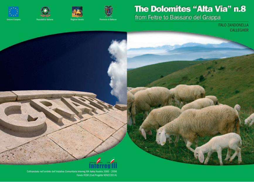
The Dolomites “Alta Via” n.8or “Degli Eroi”
created by Italo zandonella Callegher in the 1972
High Mountain and War Routesfrom Feltre to Bassano del Grappa
THE DOLOMITES “ALTA VIA” N.8 OR “DEGLI EROI” 3
General notes
The idea of marking out an Alta Via on the Massiccio del Grappa, so morphologically different from the famous Dolomites, came to Italo Zandonella Callegher when he published the article “Scopriamo (let’s discover) La Valle di Schievenìn”, in “Lo Scarpone” on the 1st of September 1972.
The aim of the article was to bring to the public’s attention these undiscovered mountains, and to reveal the hidden beauties of a mountain range which is not Dolomite, it is true, but is equally and extraordinarily complex and interesting.
Years earlier the same author had already “discovered”, together with a few others, the excellent opportunities for climbing that the bottom of valley walls had to offer even to the finest of mountaineers, especially in the Valle di Schievenìn, where a well-known rock clim-bing training ground is still in function, and is almost too popular.
These mountains, hardly touched upon and practically ignored by those who travelled along the Piave or Brenta or Cismón valleys, could, he believed, offer much more than old sentimental memories of the Great War. This Pre-alpine world had - and still has - eve-rything: rock walls, forests, paths of peace time and war time, alpine huts, log cabins, rare flora and splendid fauna; almost like a “real” mountain. So why not bring it to the attention of all those hikers of all kinds who are always looking for new suggestions?
And thus was created the Alta Via degli Eroi (of heroes), to which the Tourism Sector of the Provincial Administration of Belluno gave the name of Alta Via delle Pre-Dolomiti number 8.
It is this Tourism Sector that we have to thank for the present publication, which aims to promote the local mountains and tries to provide hikers with the most up-to-date information possible.
The text which follows is taken partly from the volumes “Alta Via degli Eroi, da Feltre a Bassano del Grappa”, “Sentieri Ferrate Arrampicate sul Massiccio del Grappa - Alta Via degli Eroi” and “Alta Via n.8 delle
2005© Provincial Administration of BellunoTOURISM, AGRITOURISM AND PRODUCTIVE ACTIVITIES SECTOR
Services, communication and promotionVia Psaro, 21 - 32100 Belluno
www.infodolomiti.it
edition completely revised and updated byItalo Zandonella Callegher
Photos Manrico Dell’AgnolaGraphics Evidenzia
Printed by Linea Grafica
cover:near Cima Grappa toward west
inside cover:first snow
back cover:“Gloria a voi soldati del Grappa”
4 FROM FELTRE TO BASSANO DEL GRAPPA THE DOLOMITES “ALTA VIA” N.8 OR “DEGLI EROI” 5
Dolomiti”, all by Italo Zandonella Callegher, published respectively in 1975 and 1986 by Tamari Editori and in 1992 by the Provincial Administration of Belluno. Thanks are due to the editors for their kind permission.
No significant changes have been made to the original route from the previous editions. Some places of shelter (the alpine huts, for instance), which in the past were in poor condition, or even falling down, have been improved, but it is still wise to have a tent or a slee-ping bag with you. These “travelling companions” will allow you to stop off wherever you please and enjoy complete independence.
The itinerary is described in the Feltre - Bassano direction and links the Piave valley with the Brenta valley through the Massiccio del Grappa and the provinces of Belluno, Treviso and Vicenza. It runs from north-east to south-west and is 30 kilometres long as the crow flies and about 51km on paths or silvopastoral roads; to this distance must be added some five kilometres on the tarmac road from Feltre Railway Station to Porcén and some 7km from the bottom of the Valle di Santa Felicita to the centre of Bassano del Grappa; so the total on foot is about 63 kilometres.
The route, excluding the climb of the first day and the long descent of the last day, remains at an altitude which varies from a minimum of the 1440m of the Forcella (saddle) Bassa to a maximum of the 1775m of the Monte Grappa.
The most panoramic route, if you choose the high itinerary, runs on the line of crest of the Monte Tomàtico, Monte Santo, Monte Sassumà, Monte Peùrna, Monte Paiòn, Colle Crodarotta, Monte d’Avién, Sasso delle Capre, Monte Fontanasecca, Monti Salaròli (or Solaròli), Col dell’Orso, Monte Casonét, Monte Grappa.
The whole route is marked, but sometimes the signs can be diffi-cult or impossible to see as a result of bad weather, making the itine-rary somewhat difficult in foggy weather (which is frequent).
In mountaineering terms, the difficulties are quite elementary. Only the Sentiero (path) CAI Montebelluna (from Malga Paòda to Malga Val Duméla), quite literally dug out ex novo with pick-axes and spa-des by the author and his CAI volunteer friends 30 years ago, could be difficult for the less experienced when crossing the various very
steep pale rock formations and on the Cengia di Prada, covered with long thin grass which is particularly tricky and slippery, and on the stretch equipped with fixed ropes at the Forcella d’Avién.
The time required has been estimated quite generously, taking into account the need to carry a rucksack with a tent and a sleeping bag.
This Alta Via, like its more famous sister trails, is a long trip which can be divided up into daily stages, in this case four, but it is up to the hiker to decide whether to shorten it, keep to it or lengthen it, depen-ding on personal taste, ability, training and interest in the route.
The only real refuge on the route is the Rifugio Bassano at the Cima Grappa, 1745m, also known as Casa Armata del Grappa. At the end of the other stages you will find only old, restructured malghe (mountain huts), which may well be very romantic, but certainly do not offer the comforts you would expect from a refuge in the Dolomites. This is why it is advisable to take a tent, a sleeping bag and a lightweight roll-up mattress, and of course, food and water.
It goes without saying that this Alta Via is suitable particularly for those who are nostalgic about the “old days”, the old way of expe-riencing the mountain, i.e. when the altimeter and the compass were used to find one’s way around in the fog, and when no-one was ever without water and food supplies and something to keep warm.
The basic route follows paths that are not particularly difficult for an experienced hill-walker; in addition, passages or stretches that are a little rough are always equipped. Some stages are very steep on the way up, others on the way down.
Here and there where the mountain has remained as it was in pioneer times and where only the chamois live undisturbed, there are more difficulties. These are more or less of a psychological nature due to isolation, extreme gradients, harsh surroundings, lack of water, complete silence and the fog that often forms quickly and envelops the surroundings! In any case, this Alta Via, like its sister trails more or less close by, passes through places which are truly extraordinary and unique, in the wild environment south of the Dolomiti Bellunesi.
6 FROM FELTRE TO BASSANO DEL GRAPPA THE DOLOMITES “ALTA VIA” N.8 OR “DEGLI EROI” 7
To suit the tastes of more expert hikers, some alternatives to the classic route are suggested. Some of these variants are more technical and gratifying hikes, others are just to take you from one place to another, to “escape” or move off the main itinerary.
To reach the Alta Via from the bottom of the valley, below are suggested some interesting connections, but many others can be “invented”, with an intelligent use of the topographical map.
We feel obliged to point out that some authors have modified the original sequence of the route, adapting it to their own personal taste, and here and there modifying the original route; we have pre-ferred to remain faithful to “the old days”, even if this means that some stages (for example the last) might seem more logical following a direct (but less interesting) route. The Alta Via could be shortened by joining up one or more routes, but this would turn it into a com-petition and this is not in line with the intention of this guide, which recommends a calm, relaxing and enjoyable pace.
Also in this case, in comparison with Italo Zandonella Callegher’s guides, we have also made some changes to the original route, par-ticularly in the cases where some stop-off points have disappeared and others have been created. Some minor updates have been made to the original route, because during the last few years, there have been some morphological changes, as well as changes as a result of interventions carried out by the organisations responsible for main-taining and equipping the various stages of the route, and some silvopastoral roads have been added to the old network of paths. Having said this, nothing has been taken away from the originality of the work and the idea; if anything there has been a willingness to improve on and to further define it.
Recommended period
Normally the itinerary is practicable until the end of October, but only when there is no snow. October, however, should be the ideal month for stable weather conditions, visibility, clarity and the absen-ce of “crowds”, but nowadays much has changed and autumn is not always sunny. Just remember that in this period the malghe (alpine
huts) are closed, although if you have a tent with you this shouldn’t be a huge problem.
Embarking upon the Sentiero (path) CAI Montebelluna when there is snow is absolute madness, because there is a grave danger of snow-slides, as the path runs high up on the very steep slopes of the Val di Prada and the Val Sassumà.
Finally, bear in mind that the only real refuge-hotel, the one on the top of the Monte Grappa, is open from May until the 4th of November. Therefore, to tackle this Alta Via, we repeat, it is essential to have a tent and a sleeping bag, or resign yourself to making do with the spartan shepherds’ shelters along the route.
Many hikers are attracted to this Alta Via because, if tackled with the appropriate spirit, it offers the peculiar pleasures of the old-fashioned way of exploring the mountains.
Useful advice for hikers Precautions - Equipment
The network of paths used by the Alta Via number 8 allows hikers to access various zones at the heart of the Dolomite groups where they can experience extraordinary walks at altitude. As the paths can be very tiring at times and conducted above 1700 metres, expe-rience, good equipment, sure footing, absence of vertigo and good physical condition are indispensable to ensure safety. Often dangers are undervalued in the mountains: a rapid change in weather, an unexpected storm, a premature snowfall, an icy patch of ground, fast-moving rivers….can all turn a pleasant, light-hearted trip into a ordeal, even on well-marked stretches of path. Good self-control can be indispensable. A fundamental condition for trekking along the “Alta Via” paths is good weather! Therefore you should find out weather conditions first from the available sources (Arraba Weather Station, TV, Radio etc.) Finally, hikers should be equipped with a good mountain kit (nowadays thousands of products of various sty-les, colours and technical specialities are available on the market), with several vital changes, warm, waterproof clothing; good quality
8 FROM FELTRE TO BASSANO DEL GRAPPA THE DOLOMITES “ALTA VIA” N.8 OR “DEGLI EROI” 9
climbing boots and socks, as well as all those other little bits and pieces that a good hiker’s experience advises.
It is a good idea to carry some medicine and first aid equipment with you, especially painkillers, Vitamin C, supplements, plasters, gauze, bandages….and never forget to bring water.
If, despite the above precautions, an accident should happen (a slip, a twist, a fracture, an injury from falling rocks, a lightning strike, vertigo, etc), try not to panic and follow the indications in the following chapter where possible.
Alpine rescue service(by Fabio Bristot, Director of the CNSAS, Veneto Region)
In this section, the C.N.S.A.S. (National Corporation of Alpine and Speleological Rescue) would like to explain what the institutional aims of the organisation are: i.e. what Alpine Rescue is and what it does.
We also offer some information and advice, as well as providing some other tips.
Although not yet perfect, this piece of work is a first step towards promoting a new culture of the mountains, based on safety and pre-vention and also on a few procedures to adopt in case of necessity.
What is the C.N.S.A.S.?
The National Corporation of Alpine and Speleological Rescue is a special section of the Italian Alpine Club whose members, all Volunteers Technicians, have the specific task of rescuing people who are injured or in danger both in an efficient and quick way. This can include the recovery of bodies when necessary and sear-ching for people who are lost in difficult to get areas, (not always at
altitude), which requires the work of personnel specialised in both mountaineering techniques and mountain rescue.
The Italian law n. 74/2001 officially recognises the work of the C.N.S.A.S. as having a function of public activity and service.
As a result of this official legislative definition, Alpine Rescue has strong links with the Italian National Health Service and with Pieve di Cadore’s S.U.E.M. 118 EMERGENCY SERVICE a close working synergy has been created in the last fifteen years, which has beco-me more and more consolidated up to the point where it has been institutionalised with a specific convention and operative protocol within the various intervention sections.
The C.n.s.a.s.Technical Staff guarantee 24 Hr, year-round (parti-cularly in the summer months) service, with on-going training and compulsory drills on the rock face (with or without helicopter ), on snow, avalanches and ice falls, search and rescue, evacuation from cable cars, first aid techniques and general logistic problems (radio and communication, operation planning etc.)
Both Law 74/01 and in particular also Law 298/02 entrust the C.n.s.a.s. staff with the task of primary rescue in the mountains, in caves and in hostile or difficult to reach environments. The C.n.s.a.s. is also responsible for rescue coordination when there are other State or Civil Protection organisations involved, except in the case of large emergencies or calamities.
Where does the C.N.S.A.S. operate?
The C.N.S.A.S. normally operates in so-called hostile environ-ments and in all inaccessible areas of the district. This does not only mean - as is generally believed - areas such as cliff faces or vie ferrate (equipped paths), but also and above all snowfields and glaciers, ice falls, avalanches, cable cars, ski slopes, caves, ravines, gorges and gullies, rivers and all other types of environment, not necessarily at high altitude (hills, woods, etc.), that due to difficulty of access or movement , or in special weather conditions, require the work of qualified personnel with expertise in all areas of mountaineering and speleological techniques and rescue.
10 FROM FELTRE TO BASSANO DEL GRAPPA THE DOLOMITES “ALTA VIA” N.8 OR “DEGLI EROI” 11
PreventionAside from the above factors, which require a strong presence in
the area in order to guarantee primary rescue, the C.N.S.A.S.also has a precise obligation to guarantee accident prevention.For this reason the brief notes below, (although they seem obvious,
our experience year in year out shows they are often ignored), aim to supply some points to consider.
Basic rules for improved safety in the mountains and other hostile environments.
Never underestimate the dangers and risks associated with any type of activity connected to the mountains and to hostile environments in general (mountaineering, speleology, skiing, mountain biking, hunting, mushroom picking, hang-gliding and parachuting etc.): the rapid changes in weather, the difficulty of the route, walking time, etc.
Good mental-physical condition and adequate preparation and training for the task to be undertaken are essential
Avoid attempting routes that are beyond your technical ability and physical and mental preparation.
Never walk alone, whenever possible be accompanied and/or advised by qualified organisations (Alpine Guides, C.A.I. and C.N.S.A.S. Stations).
Obtain adequate information about the route’s features and difficulty as well as the area in general. Study in advance all necessary information regarding destination or route, using the appropriate guides and maps.
Always leave precise information about where you are going and which route you intend to take, using visitors books in huts and bivouacs when appropriate.
Find out the weather conditions in advance, especially the local forecast.
Bring adequate footwear and clothing: avoid wearing training shoes and shoes with smooth soles; bring warm
clothing, anorak and a change of underwear. Bring a head torch, food which is light and easily absorbed
by the body and extra fluids (preferably water with perhaps added saline integrators).
Bring a small first aid kit.
Basic rules on how to behave in the event of an acci-dent
Stay calm and do not act impulsively. Evaluate the general situation (environment) and the
specific situation (the accident). Try to identify actual and possible dangers.
Immediately adopt measures to avoid and prevent further risks.
Call S.U.E.M. 118. for help immediately. If this is not possible use the following intermittent visual signalling method: 6 times a minute - once every 10 seconds - pause for 1 minute, then repeat the operation until you are sure you have been seen; or use any other system to mark your presence.
How to alert S.U.E.M. 118/C.N.S.A.S.
To request an intervention by C.N.S.A.S., you must always dial 118 and follow the advice below.
General instructions to follow when you call 118
Supply precise information about the injured person/s (name, surname, residence) and the telephone number from which you are calling.
Give details on the location of the accident or visual references that can help easily identify the spot.
Give a brief summary of the accident stating the time it happened.
Specify the number of injured and their condition.
12 FROM FELTRE TO BASSANO DEL GRAPPA THE DOLOMITES “ALTA VIA” N.8 OR “DEGLI EROI” 13
Describe the weather conditions, especially visibility. Highlight any obstacles in the area with particular reference
to power lines and cables, chair lifts and ski lifts and any other overhanging cables that could get in the way.
Give any other information that could aid the operation (people present, particular difficulties etc.)
Interventions for injured persons or persons in a situation of danger
As for previous point 1. Supply the exact location of the accident or where the injured
can be found (mountain group, slope, path, via ferrate, valley, gully, ledge, crest, gorge, etc).
Mention the presence of any other people who were present at the accident and, in particular, if they are able to collaborate (Alpine Guides, C.N.S.A.S. staff, etc.).
Interventions for injured persons or persons in a situation of danger
As for previous point 1 Specify date and time of departure. Describe the method of transport used (i.e. Car: number
plate, model, colour etc.). Indicate destination and chosen route and/or probable or
possible fixed objectives (hill walking, climbing etc.). Give the number of companions and their hill-walking or
mountaineering abilities and experience. Describe clothing (paying attention to colour and material)
and supplies carried. Inform of any problems: psychological- physical - family
- social -etc. Supply information already given to other organisations
(including C.N.S.A.S.). Supply any other useful information regarding the
subject(s), location and general environmental conditions.
Interventions in cases of avalanche
Information on the identity of the person(s) involved. Give the exact or presumed number of people swept away
or buried. Specify the brand and model of A.R.V.A. apparatus and/or
other search technology. Identify the presence of any witnesses able to give an exact
account of what happened:- If a visual-auditory- A.R.V.A., search has been carried out;- Provide a brief description of the avalanche (size and
characteristics) and the exact point where the people were swept away and/or disappeared (right, left, high, low etc.);
- subjects already extracted and their position;- other information and details that might help the
intervention.
International mountain rescue signals
International mountain rescue signals are still the same today as they were in the past, and often the only means possible in the immensity of the mountains is sending a visual or acoustic signal 6 times per minute, at regular intervals, and then every 10 seconds. Pause for a minute and repeat the same signal until you receive a response. This is done three times in a minute at a distance of 20 seconds in a visual or audible way. By acoustic we mean shouting or whistling or any other perceptible noises; by visual signals we mean waving handkerchiefs, items of clothing or mirror signals; at night you can use a torch or, if possible, a fire (obviously with caution, especially if you are in a wooded area). Over the last few years the ever more frequent use of helicopters by Alpine Rescue has rende-red new signalling methods necessary. Colourful sleeping bags or anoraks spread out on the ground or marks in the snow can help you be located from above. The SOS rescue sign can be made with letters that are about 2m high using contrasting stones placed on the ground, or footprints in the snow.
14 FROM FELTRE TO BASSANO DEL GRAPPA THE DOLOMITES “ALTA VIA” N.8 OR “DEGLI EROI” 15
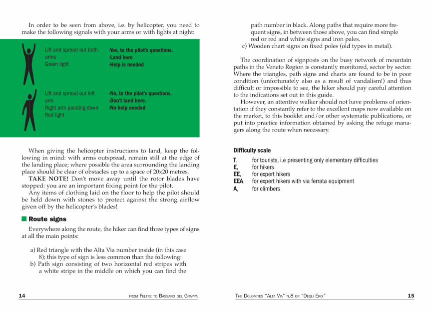
In order to be seen from above, i.e. by helicopter, you need to make the following signals with your arms or with lights at night:
When giving the helicopter instructions to land, keep the fol-lowing in mind: with arms outspread, remain still at the edge of the landing place; where possible the area surrounding the landing place should be clear of obstacles up to a space of 20x20 metres.
TAKE NOTE! Don’t move away until the rotor blades have stopped: you are an important fixing point for the pilot.
Any items of clothing laid on the floor to help the pilot should be held down with stones to protect against the strong airflow given off by the helicopter’s blades!
Route signsEverywhere along the route, the hiker can find three types of signs
at all the main points:
a) Red triangle with the Alta Via number inside (in this case 8); this type of sign is less common than the following:
b) Path sign consisting of two horizontal red stripes with a white stripe in the middle on which you can find the
path number in black. Along paths that require more fre-quent signs, in between those above, you can find simple red or red and white signs and iron pales.
c) Wooden chart signs on fixed poles (old types in metal).
The coordination of signposts on the busy network of mountain paths in the Veneto Region is constantly monitored, sector by sector. Where the triangles, path signs and charts are found to be in poor condition (unfortunately also as a result of vandalism!) and thus difficult or impossible to see, the hiker should pay careful attention to the indications set out in this guide.
However, an attentive walker should not have problems of orien-tation if they constantly refer to the excellent maps now available on the market, to this booklet and/or other systematic publications, or put into practice information obtained by asking the refuge mana-gers along the route when necessary.
Difficulty scale
T, for tourists, i.e presenting only elementary difficultiesE, for hikersEE, for expert hikersEEA, for expert hikers with via ferrata equipmentA, for climbers
Lift and spread out both armsGreen light
-Yes, to the pilot’s questions.-Land here-Help is needed
-No, to the pilot’s questions.-Don’t land here.-No help needed
Lift and spread out left armRight arm pointing downRed light
16 FROM FELTRE TO BASSANO DEL GRAPPA THE DOLOMITES “ALTA VIA” N.8 OR “DEGLI EROI” 17
Technical detailsThe routeDeparture Point: Feltre Railway Station, 256mArrival Point: Bassano, 130mWalking days: 4Route Length: about 63 kilometresRefuges on the main route: 1Malghe on the main route: 5Refreshments on the way: 6Longest stretch: the 2nd, 8 hours, from Malga Pàoda to Malga Val Dumèla Shortest stretch: the 3rd, 5 hours, from Val Duméla to the Rifugio Bassano Total time required (excluding variants): about 25 hoursDifficulty: T, E and EE , brief stretch of EEA Total gradient in ascent: about 3100 metres Total gradient in descent: about 3200 metresMaximum gradient in ascent: 1340m, first day, Feltre - Monte TomàticoMaximum gradient in descent: 1615m, fourth day, Cima Grappa - BassanoMaximum altitude: Rifugio Bassano at Cima Grappa 1745mMinimum altitude: Bassano, 130m Group involved: Massiccio del Grappa Refuge open: from the end of May to the beginning of NovemberSigns: Good
Recommended MapsCarte I.G.M. 1:25.000 Feltre sheet 22, II, SE; Seren del Grappa sheet 37, I, NE; Cavaso del Tomba sheet 37, I, SE; Monte Grappa sheet 37, I, SO; Bassano sheet 37, II, NO Canale del Brenta,CAI di Bassano (only the last stage)Map 1:30.000 -Il Massiccio del Grappa i sentieri, Comunità Montana Brenta, Grappa, Feltrino (good, with the whole route) -Colli Asolani-Grappa-Tomba, Zanetti (only the last stage)Map 1:50.000 -Le Vette, Monte Grappa, Pilotto, Feltre (the whole route) -Altopiano di Asiago, Kompass
Description of the walksDay One
From Feltre to the Malga Pàoda via Monte TomàticoGradient: in ascent 1340m; in descent 420mLength: about 15kmTime required: 6 hours on foot from FeltrePath: n.841Difficulty: T, E
You can get to Feltre with the Padova-Calalzo rail line, or the SS 348 or 50 roads.
Porcén, 390 m, departure point of the Alta Via degli Eroi n.8, is less than five kilometres of tarmac road away from Feltre. You can walk along the road in little more than an hour, or, better still, take a taxi or public transport (information at the station).
The beautiful city of Feltre, historical and industrious, is situated north of Monte Tomàtico, and is an important road link and railway station.
Within the ancient city walls you can find splendid medieval and renaissan-ce monuments of great artistic and architectural interest, some of which have frescoes by Lorenzo Luzzo (15th century), known as “Il Morto da Feltre” (Dead Man from Feltre).
The old town is superb: Largo Panfilo Castaldi leads to the 16th century Porta Imperiale (Imperial Gate) - with the headquarters of the Feltre Section of the Italian Alpine Club above it - after which is the delightful Via Mezzaterra, over-looked by numerous 16th century houses; Piazza Maggiore, partially surrounded by porticoes and important buildings; Chiesa di San Rocco (St. Rocco’s Church), with a wonderful lombardesque fountain dating from 1520; the Torre dell’Oro-logio (Clock Tower), and the Castello di Feltre (Feltre Castle). At the centre of the square there is a column with the Leone di San Marco (Lion of St. Mark), and the monuments to Vittorino da Feltre and Panfilo Castaldi; on the left side, Palazzo Guarnieri (Guarnieri Palace), by Segusini.
18 FROM FELTRE TO BASSANO DEL GRAPPA THE DOLOMITES “ALTA VIA” N.8 OR “DEGLI EROI” 19
Incorporated into the square is the Piazzetta delle Biade (Forage Square), with the monumental Palazzo del Municipio (Town Hall Building), in Palladian style.
Moving onwards, you come to Via Lorenzo Luzzo, flanked by renaissance buildings, in which, just before the medieval Porta Oria (Oria Gate), you will find the Museo Civico (Municipal Museum), which houses archaeological collections, weapons, sculptures, historical relics and paintings by the “Morto da Feltre”, Gentile Bellini and other artists of the Veneto school.
A steep street goes down to the Borgo, after which, on the right, is the Chiesa di Ognissanti (All Saints’ Church), an ancient construction in the vestry of which you can admire Luzzo’s masterpiece, the Trasfigurazione e SS. Antonio e Lucia (Christ is in white on a white background).
Also extremely interesting: Cattedrale di San Pietro (St. Peter’s Cathedral), with its 15th century bell tower, in the capitular archive of which there is a Byzantine Cross, in boxwood, dating from 542; Chiesa di Santa Maria degli Angeli, Chiesa di San Giacomo Maggiore, the Galleria di Arte Moderna (Modern Art Gallery), and the splendid, unique Museo Rizzarda, which contains superb masterpieces in wrought iron.
Tennis. Rifle Range. Riding School in Vincheto di Cellarda. Ice palace. Skating rink in Anzù. Hospital. Clinic. Banks. 1 - 4 star hotels. Tourist informa-tion office in Piazza Trento e Trieste, 9.
To get to Porcén on foot from Feltre railway station, follow the tarmac road for about 800m eastwards. After the bridge over the Torrente Colméda, take the road to the left which after about 200m leads to a fork. Continue on the left until a crossroads. Straight on south, slightly upwards. Another fork. Continue right in the direc-tion of the Villa San Giuseppe. Just before Tomo, immediately after a shrine near the church, turn right (west) and follow the tarmac road until the centre of Porcén, 390m, a charming little village at the foot of the northern side of Monte Tomàtico and north-western border of the Massiccio del Grappa.
Just after the church and the little square of Porcén, on the left (south), go along the Via Monte Tomàtico for about 150m until you come to a manor house, 430m; signpost for the Alta Via and the Monte Tomàtico.
About 1 hour from Feltre.
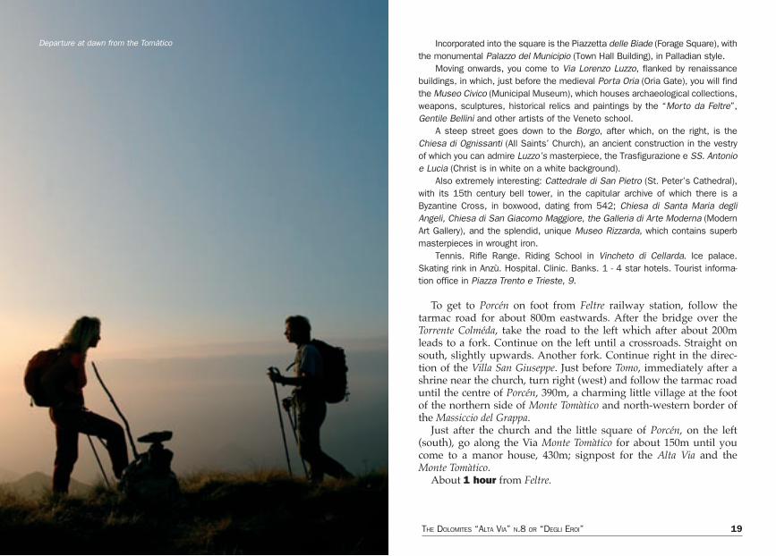
Departure at dawn from the Tomàtico
20 FROM FELTRE TO BASSANO DEL GRAPPA THE DOLOMITES “ALTA VIA” N.8 OR “DEGLI EROI” 21
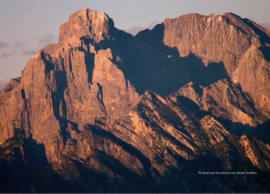
The Burèl and the schiara from Monte Tomàtico
22 FROM FELTRE TO BASSANO DEL GRAPPA THE DOLOMITES “ALTA VIA” N.8 OR “DEGLI EROI” 23
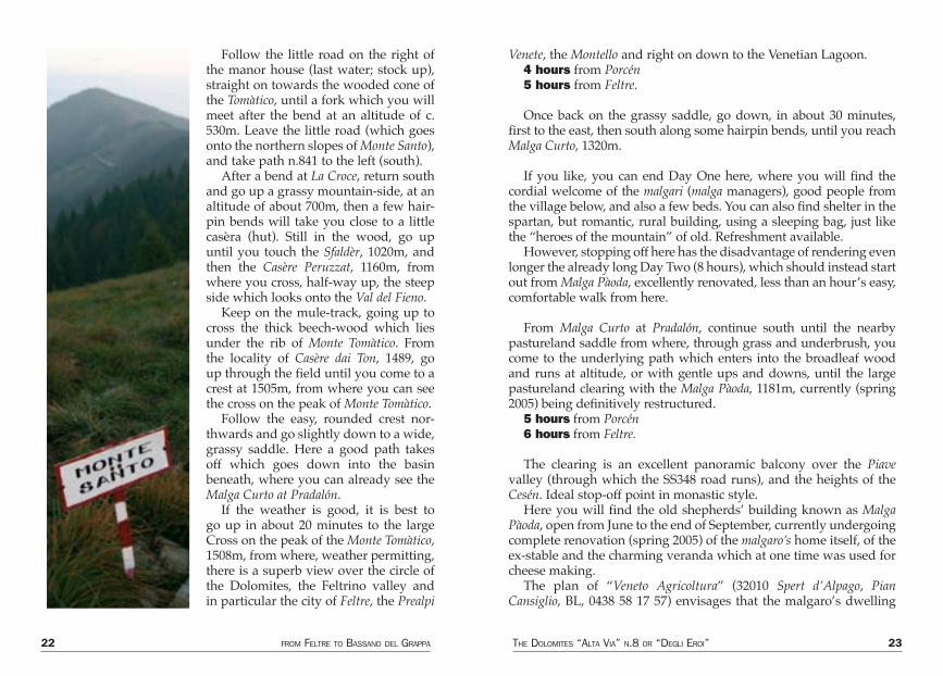
Follow the little road on the right of the manor house (last water; stock up), straight on towards the wooded cone of the Tomàtico, until a fork which you will meet after the bend at an altitude of c. 530m. Leave the little road (which goes onto the northern slopes of Monte Santo), and take path n.841 to the left (south).
After a bend at La Croce, return south and go up a grassy mountain-side, at an altitude of about 700m, then a few hair-pin bends will take you close to a little casèra (hut). Still in the wood, go up until you touch the Sfaldèr, 1020m, and then the Casère Peruzzat, 1160m, from where you cross, half-way up, the steep side which looks onto the Val del Fieno.
Keep on the mule-track, going up to cross the thick beech-wood which lies under the rib of Monte Tomàtico. From the locality of Casère dai Ton, 1489, go up through the field until you come to a crest at 1505m, from where you can see the cross on the peak of Monte Tomàtico.
Follow the easy, rounded crest nor-thwards and go slightly down to a wide, grassy saddle. Here a good path takes off which goes down into the basin beneath, where you can already see the Malga Curto at Pradalón.
If the weather is good, it is best to go up in about 20 minutes to the large Cross on the peak of the Monte Tomàtico, 1508m, from where, weather permitting, there is a superb view over the circle of the Dolomites, the Feltrino valley and in particular the city of Feltre, the Prealpi
Venete, the Montello and right on down to the Venetian Lagoon.4 hours from Porcén5 hours from Feltre.
Once back on the grassy saddle, go down, in about 30 minutes, first to the east, then south along some hairpin bends, until you reach Malga Curto, 1320m.
If you like, you can end Day One here, where you will find the cordial welcome of the malgari (malga managers), good people from the village below, and also a few beds. You can also find shelter in the spartan, but romantic, rural building, using a sleeping bag, just like the “heroes of the mountain” of old. Refreshment available.
However, stopping off here has the disadvantage of rendering even longer the already long Day Two (8 hours), which should instead start out from Malga Pàoda, excellently renovated, less than an hour’s easy, comfortable walk from here.
From Malga Curto at Pradalón, continue south until the nearby pastureland saddle from where, through grass and underbrush, you come to the underlying path which enters into the broadleaf wood and runs at altitude, or with gentle ups and downs, until the large pastureland clearing with the Malga Pàoda, 1181m, currently (spring 2005) being definitively restructured.
5 hours from Porcén6 hours from Feltre.
The clearing is an excellent panoramic balcony over the Piave valley (through which the SS348 road runs), and the heights of the Cesén. Ideal stop-off point in monastic style.
Here you will find the old shepherds’ building known as Malga Pàoda, open from June to the end of September, currently undergoing complete renovation (spring 2005) of the malgaro’s home itself, of the ex-stable and the charming veranda which at one time was used for cheese making.
The plan of “Veneto Agricoltura” (32010 Spert d’Alpago, Pian Cansiglio, BL, 0438 58 17 57) envisages that the malgaro’s dwelling
24 FROM FELTRE TO BASSANO DEL GRAPPA THE DOLOMITES “ALTA VIA” N.8 OR “DEGLI EROI” 25
should have, on one side, a kitchen with fireplace, a bathroom with shower, a small room with a washbasin and a little attic bedroom for the malgaro, and, on the other side, a little room, always open, which could put up 4-5 hikers. All of this is still to be defined, also in the light of new future management which contemplates offering an agriturismo service.
The veranda, should, however, serve as a panoramic gallery and a stop-off and refreshment point (contemplated for the near future, as mentioned above) for hikers. Underneath there is space for the installation of a lighting system and a cellar store-room.
In the building immediately north of the veranda, the renovation of which should be completed by the end of 2005, the idea is to
have a milking parlour and a cheese factory, because it is envisaged that some thirty milk cows- and perhaps also some sheep - will be brought up to the summer pasture, and that some typical dairy pro-ducts such as the cheese Bastardo del Grappa and formài morlàc will be made.
There is a third stage which should be completed with the recon-struction of the pendàna, i.e. the stable for the animals, currently in ruins, not far from the malga itself, on the path towards the Tomàtico.
All the above should ensure simple, basic hospitality (food and shelter), also to hikers on the Alta Via 8 who until now could only find the ruins of the old shepherds’ hut.
Unfortunately, “should” is very much the operative word, since
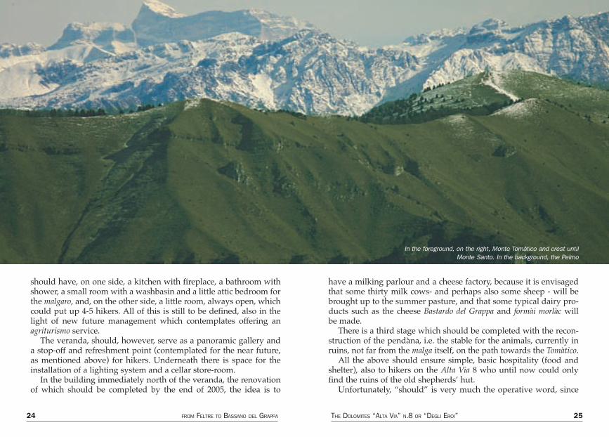
In the foreground, on the right, Monte Tomàtico and crest until Monte Santo. In the background, the Pelmo

26 FROM FELTRE TO BASSANO DEL GRAPPA THE DOLOMITES “ALTA VIA” N.8 OR “DEGLI EROI” 27
we all know how difficult it is to find “brave” entrepreneurs ready to launch into an adventure which is undoubtedly very romantic, but not very profitable. To this difficulty must be added the lack of water and the consequent problems of logistics and hygiene.
So the moral of the tale is, as pointed out in previous guides: be independent; don’t set out without a sleeping bag (or, even better, a tent) and without food and water supplies.
You will find plenty of space to pitch your tent on the edge of the pastureland, with views over the valley.
If you should manage to find a hot meal and a bed, so much the better, but don’t count on it.
Connection 1 From Ciladón to Malga PàodaRather than variants in the true sense of the word, what you will
find below are links between the bottom of the valley and the Alta Via degli Eroi n.8.
In this case they are also shortcuts which will allow you to avoid the first stage.
From Quero, a little tarmac road takes you to Ciladón, 5km away, 650m; 1,15 hour on foot.
From here, follow the new silvopastoral road which takes you onto the dirt-track road which comes up from Prada.
On the saddle where the roads meet, a parking area is planned so that cars do not reach the nearby malga.
Cutting across the pastureland mountainside in the direction of the Tomàtico, you soon reach the Malga Pàoda.
1,45 hours from Ciladón
Connection 2 From Prada to Malga PàodaFrom Schievenìn, go up the tarmac road until the last houses of the
delightful Val di Prada; restaurant (booking required), c.700m.
From here starts the new dirt-track road which first cuts through the valley and then, with a few easy zigzags leads to the saddle where you meet the road which comes from Ciladón. Cut across the pastureland side and after a large bend, you will reach the Malga Pàoda.
1,30 hours from Prada.
Day Two From the Malga Pàoda to the Malga Val Duméla along the Sentiero CAI MontebellunaGradient: in ascent 780m; in descent 790m (including ups and downs)Length: about 15kmTime required: 8 hours Path: n.847Difficulty: EE, brief stretch of EEA
This is the most interesting stage of the whole route, the longest and the only one which might present some slight technical diffi-culties. The passage across the Forcella Alta is compulsory, but you
Towards Valdumela
28 FROM FELTRE TO BASSANO DEL GRAPPA THE DOLOMITES “ALTA VIA” N.8 OR “DEGLI EROI” 29
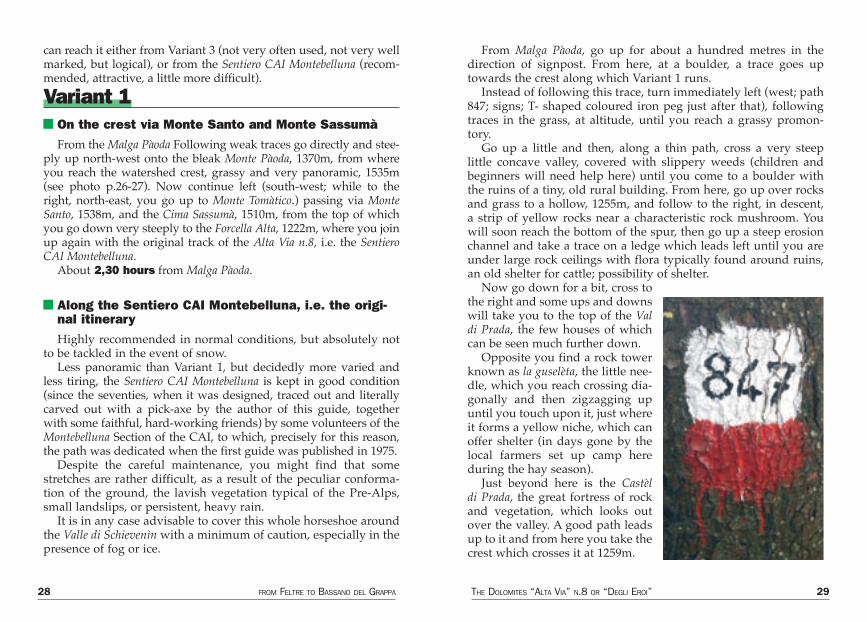
can reach it either from Variant 3 (not very often used, not very well marked, but logical), or from the Sentiero CAI Montebelluna (recom-mended, attractive, a little more difficult).
Variant 1 On the crest via Monte Santo and Monte SassumàFrom the Malga Pàoda Following weak traces go directly and stee-
ply up north-west onto the bleak Monte Pàoda, 1370m, from where you reach the watershed crest, grassy and very panoramic, 1535m (see photo p.26-27). Now continue left (south-west; while to the right, north-east, you go up to Monte Tomàtico.) passing via Monte Santo, 1538m, and the Cima Sassumà, 1510m, from the top of which you go down very steeply to the Forcella Alta, 1222m, where you join up again with the original track of the Alta Via n.8, i.e. the Sentiero CAI Montebelluna.
About 2,30 hours from Malga Pàoda.
Along the Sentiero CAI Montebelluna, i.e. the origi-nal itineraryHighly recommended in normal conditions, but absolutely not
to be tackled in the event of snow.Less panoramic than Variant 1, but decidedly more varied and
less tiring, the Sentiero CAI Montebelluna is kept in good condition (since the seventies, when it was designed, traced out and literally carved out with a pick-axe by the author of this guide, together with some faithful, hard-working friends) by some volunteers of the Montebelluna Section of the CAI, to which, precisely for this reason, the path was dedicated when the first guide was published in 1975.
Despite the careful maintenance, you might find that some stretches are rather difficult, as a result of the peculiar conforma-tion of the ground, the lavish vegetation typical of the Pre-Alps, small landslips, or persistent, heavy rain.
It is in any case advisable to cover this whole horseshoe around the Valle di Schievenìn with a minimum of caution, especially in the presence of fog or ice.
From Malga Pàoda, go up for about a hundred metres in the direction of signpost. From here, at a boulder, a trace goes up towards the crest along which Variant 1 runs.
Instead of following this trace, turn immediately left (west; path 847; signs; T- shaped coloured iron peg just after that), following traces in the grass, at altitude, until you reach a grassy promon-tory.
Go up a little and then, along a thin path, cross a very steep little concave valley, covered with slippery weeds (children and beginners will need help here) until you come to a boulder with the ruins of a tiny, old rural building. From here, go up over rocks and grass to a hollow, 1255m, and follow to the right, in descent, a strip of yellow rocks near a characteristic rock mushroom. You will soon reach the bottom of the spur, then go up a steep erosion channel and take a trace on a ledge which leads left until you are under large rock ceilings with flora typically found around ruins, an old shelter for cattle; possibility of shelter.
Now go down for a bit, cross to the right and some ups and downs will take you to the top of the Val di Prada, the few houses of which can be seen much further down.
Opposite you find a rock tower known as la guselèta, the little nee-dle, which you reach crossing dia-gonally and then zigzagging up until you touch upon it, just where it forms a yellow niche, which can offer shelter (in days gone by the local farmers set up camp here during the hay season).
Just beyond here is the Castèl di Prada, the great fortress of rock and vegetation, which looks out over the valley. A good path leads up to it and from here you take the crest which crosses it at 1259m.
30 FROM FELTRE TO BASSANO DEL GRAPPA THE DOLOMITES “ALTA VIA” N.8 OR “DEGLI EROI” 31
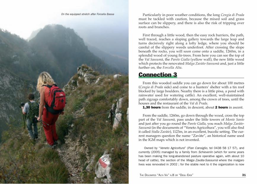
Particularly in poor weather conditions, the long Cengia di Prada must be tackled with caution, because the mixed soil and grass surface can be slippery, and there is also the risk of tripping over roots and branches.
First through a little wood, then the easy rock barriers, the path, well traced, reaches a sloping gallery towards the large leap and turns decisively right along a lofty ledge, where you should be careful of the slippery weeds underfoot. After crossing the slope beneath the rocks, you will soon come onto a saddle, 1260m, in a splendid wood of young fir-trees. From here you can see the top of the Val Sassumà, the Parete Gialla (yellow wall), the new little wood which protects the renovated Malga Zavàte-Sassumà and, just a little further on, the Forcella Alta.
Connection 3From this wooded saddle you can go down for about 100 metres
(Cengia di Prada side) and come to a hunters’ shelter with a tin roof blocked by large boulders. Nearby there is a little pòsa, a pond with rainwater used for watering cattle). An excellent, well-maintained path zigzags comfortably down, among the crown of trees, until the houses and the restaurant of the Val di Prada.
1,30 hours from the saddle, in descent, about 2 hours in ascent.
From the saddle, 1260m, go down through the wood, cross the top part of the Val Sassumà, pass under the little towers of Monte Santo and just after you go round the Parete Gialla, you reach Malga Zavàte-Sassumà (in the documents of “Veneto Agricoltura”, you will also find it called Stalla Zavàte), 1123m, in an excellent, bucolic setting. The cur-rent managers question the name “Zavàte”, an historical name used in the IGM maps which is not invented.
Owned by “Veneto Agricoltura” (Pian Cansiglio, tel 0438 58 17 57), and currently (2005) managed by a family from Schievenìn (which for some years has been making the long-abandoned pasture operative again, with about 10 head of cattle), the section of the Malga Zavàte-Sassumà where the malgaro lives was renovated in 2002 ; for the stable next to it the organization is now
On the equipped stretch after Forcella Bassa
Mai
n ro
ad
Sec
onda
ry r
oad
Ref
uge
Biv
ouac
Alta
Via
rou
te
Var
iant
rou
te
Pea
k, m
ount
ain,
ran
ge
Wat
er, b
asin
Vill
age,
tow
n
Pas
s or
sad
dle
Mou
ntai
n hu
t
Rif. B
assano
Malg
a F
onta
nasecca
Malg
a V
al D
um
èla
Malg
a S
assum
à-Z
avàte
Malg
a C
urt
o
Malg
a P
àoda
34 FROM FELTRE TO BASSANO DEL GRAPPA THE DOLOMITES “ALTA VIA” N.8 OR “DEGLI EROI” 35
contemplating a plan to bring sheep and cows up to the summer pasture.Open from the beginning of June until the end of September, the malga
has a room used as a kitchen-dining room, and a bedroom under the beams. It does not currently offer accommodation or food, but in case of necessity the hiker will find a friendly welcome here.
A silvopastoral road comes up from the bottom of the Valle di Schievenìn, through the Val Sassumà. Until 30 years ago there was hardly any vegetation in this valley; today it is overgrown.
Connection 4A little tarmac road crosses Schievenìn and goes towards the
Palestra di Roccia (rock climbing training ground), then reaches the mouth of a ravine when then opens out, higher up, into the Val Sassumà ; signposts ; path n.842.
Go up the ravine at the side of the little torrent, which is dry in summer, until you reach the new road and the Casa da Nani, where the valley opens out and the dynamic, slim Campanilón (Campanile
Manuela) appears, high up.From here the old mule-track almost disappears among the
bushes or has been wiped out by the road. It is best to follow the road, because the path which used to pass alongside the characteri-stic and rather gloomy Casa degli Spiriti which backs onto the large yellow rock above is not easy to find and to follow, and besides, the new owners (a Cultural Association from Noale, in the province of Venice, which has renovated the two buildings) have practically closed off the original passage.
A brief, final stretch of the new road will take you to the Malga Zavàte-Sassumà.
About 1,45 hours from the bottom of the valley.
You can also reach the Malga Zavàte-Sassumà from the new silvo-pastoral road.
The little tarmac road, after the ravine where path n.842 starts, continues at the bottom of the valley, goes past an abandoned house, passes the Grotta di Santa Barbara (which is a little higher up, on your left as you go up), and ends just beyond an esplanade-parking area, at about 550m, from where vehicular traffic is forbidden to continue. Picnic area.
Keeping to the dirt-track road, go up the Val d’Inferno a little, then turn right and you will come to a saddle with an abandoned house, from where, going slightly down, you enter the Val Sassumà, towards the Casa da Nani.
Now the road goes up the wide valley in easy, regular bends, pas-ses by the last houses - one has been renovated, the others apparently abandoned - and by the side on the left of a large rock wall goes up to the Malga Zavàte-Sassumà.
1,45 hours from Santa Barbara - parking area.
From the Malga Zavàte Sassumà (signs; board), go east, passing above the large pòsa (hollow filled with water) immersed in the forest, cross the pasture on a good path, then go up a little steeply until you come to a rib. Then there is a traverse which leads to a tiny spring right on the path, then, in a short time, you reach the marked Forcella Alta. 1222m; signpost.
2,30 hours from the Malga Pàoda.
The Tegozzo in Val di Schievenin
36 FROM FELTRE TO BASSANO DEL GRAPPA THE DOLOMITES “ALTA VIA” N.8 OR “DEGLI EROI” 37
From the Forcella Alta to the Forcella Bassa is only about 30 minu-tes’ walk, but the peculiar conformation of the terrain to the (clayey, with trees, humid, a little gloomy), requires good concentration and careful attention to the signs.
After going over the Forcella Alta, go immediately south-west, going slightly downwards diagonally in the thick of the wood along somewhat slippery and treacherous ground.
Just under the crest, to the north, you can easily see the dirt-track road which comes up from Seren del Grappa and ends just beyond here, to the north.
Taking care not to lose track of the signs, especially in foggy wea-ther, keep crossing constantly under the wooded crest beyond which sweep down the rocks which overlook the valley of Schievenìn. At a certain point you will come to a retaining wall, built during the war, near a lofty little saddle, which is impassable ; signs of fires or bivouacs. From here, go up a bit along a rib, cross a little wood with some orien-tation difficulties (pay attention to the signs)and begin the long, steep descent on sharp zigzags which eventually lead to the Forcella Bassa, 1044m, the lowest point of the traverse. Signposts ; signs.
Immediately north-west of the saddle, about ten metres below, passes the dirt-track road which comes from Seren del Grappa, the western branch of which ends just beyond Pra Peùrna.
Connection 5Obviously, as well as by the dirt-track road from Seren del Grappa,
you can also reach the Forcella Bassa coming up through the Val d’In-ferno, i.e. starting out from the bottom of the Valle di Schievenìn, where the tarmac road ends (parking area) and the dirt-track road begins for Malga Zavàte-Sassumà ; c.550m; path n.848.
Follow the dirt-track road a bit, and then go left (signs, cairn), in the narrow wooded valley, going up hairpin bends. After an easy stretch you come to a spring, pass the torrent and start to go steeply and tiringly up along good traces of a path in the coppice wood, inside a sort of channel of vegetation, until you come to a spur of rocks and grass.
From here, continue right, high up on the wild valley, on the path which you can just see on the very steep rock formation which cros-ses for a long stretch (not for those who suffer from dizziness), then goes up again a little and finally leads to the Forcella Bassa, 1044m, where it meets the main route.
About 2 hours from the parking area.
From the saddle, follow path n.847 which goes up a steep field and reaches an altitude of 1116m, where a trace continues south-west through the wood and goes onto a grassy-wooded shelf.
Cross the wood halfway up the mountainside until you come to a small, characteristic saddle between two boulders, under the strip of yellow rocks of the Monte Peùrna. Go up the rib following faint tra-ces and entering into a fairly delicate terrain. The path, in fact, now runs along narrow ledges above the crags, keeping on the edge of the crest, sometimes on very steep grassy and rocky slopes. Be very careful in the event of rain, snow or ice. Do not in any circumstances leave the trace marked.
You will now see a strange natural window which opens out onto a spur ; go up to it and pass over it. Keeping at altitude under
Fojaròl del Conte in Val Dumèla.In the background, Monte Sassumà and Monte Santo
38 FROM FELTRE TO BASSANO DEL GRAPPA THE DOLOMITES “ALTA VIA” N.8 OR “DEGLI EROI” 39
the main crest, you touch on another saddle, high on the Valle dello Stizzón, to the north-west and the Val Perisèlla to the south-east.
The thin path turns abruptly south and goes round a tower, and then just after that goes back onto the crest which leads to the top of a rock spur. Go down the crest decisively, on the Schievenìn side, conque-ring some rock leaps , which are made easier by fixed metal ropes.
After the very steep slope you reach a saddle and from here begins a lofty ledge, 70cm wide, exposed, slightly in ascent, equip-ped, which cuts across a rock face on the side of the Stizzón.
Beyond the ledge, go into the wood (c.1100m), go up it, go over the saddle to the east and you come to the top of a rock spike.
Go down the opposite crest towards another saddle; from here, go up steeply and tiringly on the head of a tower, c.1120m. Follow the little crest again, then go into the wood and you will soon reach the mule-track which leads immediately to the Forcella d’Avién, c.1100m, where there is a little emergency shelter made of cement.
Connection 6This stretch of the Alta Via n.8 can be reached either from the Valle
di Schievenìn going up along the Val della Storta, or from Seren del Grappa starting out from Ponte d’Avién.
From the Palestra di Roccia di Schievenìn, at Cave di Pietra, c.436m (signpost for Colle Crodarotta), path n.839 begins, which goes up the beautiful, wild valley for a while and leads to the Forcella d’Avién, 1100m, where it enters onto the Alta Via.
2 hours from Schievenìn.
From Seren del Grappa follow the little tarmac road which goes up the Valle dello Stizzón towards the village of Chiesa Nuova San Luigi. At Ponte d’Avién, 437m, path n.843 begins. Follow the path eastwards until Pian de Giacón, then go south-east, passing by the Casère Checco di Conte, 891m. From here, going round the Colle Crodarotta to the west, you reach the Forcella d’Avién, 1100m, where you meet the Alta Via coming from the north.
2 hours from Ponte d’Avién.
From the Forcella d’Avién, follow to the south the convenient path in the wood until you come to a saddle where the path becomes a wide wartime mule-track and, running under the head of Val della Storta, passes a gallery and other war ruins. From here, remaining at altitude, the mule-track will soon take you to the Fojaròl del Conte (these days it is sometimes called Fojaròl di Giovanni, but historically, on the old maps, it figures as Fojaròl del Conte).
Fojaròl is a typical rural construction of the Grappa area, extremely rare today, with the roof covered with beech branches and leaves. (fòja = leaf in the local dialect).
Just after the fojaròl, you enter into what used to be a large expanse of pasture, at the northern edges of which is the Malga Val Duméla, 1169m.
8 hours from the Malga Pàoda.
Inside a Fojaròl in the Grappa Area
40 FROM FELTRE TO BASSANO DEL GRAPPA THE DOLOMITES “ALTA VIA” N.8 OR “DEGLI EROI” 41
The Malga Val Duméla, the second stop-off point, lies in a very romantic posi-tion, but it certainly offers nothing like the comforts of a typical alpine refuge.
After years of complete neglect, some farmers from Covolo di Pederobba (Treviso) have brought about a dozen beef cattle up to pasture. The malga is open from June to the end of September.
It consists of a large stable for animals and a hut for the malgaro, with a kitchen, bathroom and closet on the ground floor and two bedrooms on the first floor. For the moment its function is not to offer food and accommodation, but, as always in this area, no-one will ever be turned away in case of need.
Plenty of room to pitch a tent in the clearing around the malga. Cistern water (rainwater, drinkable only after boiling).
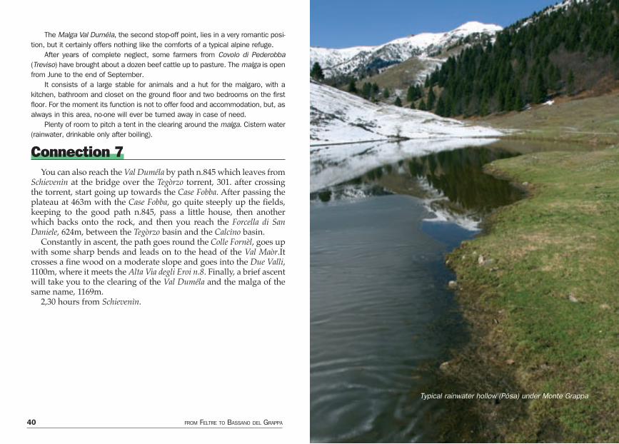
Connection 7You can also reach the Val Duméla by path n.845 which leaves from
Schievenìn at the bridge over the Tegòrzo torrent, 301. after crossing the torrent, start going up towards the Case Fobba. After passing the plateau at 463m with the Case Fobba, go quite steeply up the fields, keeping to the good path n.845, pass a little house, then another which backs onto the rock, and then you reach the Forcella di San Daniele, 624m, between the Tegòrzo basin and the Calcìno basin.
Constantly in ascent, the path goes round the Colle Fornèl, goes up with some sharp bends and leads on to the head of the Val Maòr.It crosses a fine wood on a moderate slope and goes into the Due Valli, 1100m, where it meets the Alta Via degli Eroi n.8. Finally, a brief ascent will take you to the clearing of the Val Duméla and the malga of the same name, 1169m.
2,30 hours from Schievenìn.
Typical rainwater hollow (Pósa) under Monte Grappa
42 FROM FELTRE TO BASSANO DEL GRAPPA THE DOLOMITES “ALTA VIA” N.8 OR “DEGLI EROI” 43
Day Three From the Malga Val Duméla to the Rifugio Bassano via Col dell’OrsoGradient: in ascent 830m; in descent 2600m Length: about 13kmTime required: 5 hours Path: n.845, dirt-track road, 843, 156Difficulty: EE
From the Malga Val Duméla the new silvopastoral road goes down towards the south and crosses the pasture flanked on the eastern side by the steep wooded and rocky formations of the Valle di Schievenìn and on the western side by the blooming forest of young conifers. In about twenty minutes, the road, which after a bit leaves the old mule-track, reaches the entrance to the Val Cinespa and goes up it.
You can follow the tedious road to get to Cinespa, but you can also - and we advise that you do - remain on path n.845 which goes down a little until it touches upon the locality known as Le Due Valli, at c.1075m.
After leaving the 845 which goes down to Schievenìn across the Forcella di San Daniele, turn sharply right (south-west), pass by the abandoned memorial stone ( which recalls the sacrifice made by the partisans of the Brigata Matteoti, who fell in September 1944 , here remembered by Commander Livio Morello “Neri” and the survi-vors), and go up the wooded Val Cinespa until you come back onto the new road near the Malga Cinespa, 1218m, the ruins of which “cry out for revenge”. A part of the building has been restored by local hunters, the rest is still waiting for a miracle to happen.
1 hour from Val Duméla.
From here the branch of the dirt-track road which goes south-west reaches the Malghe Valderóa, Domadór, Casón del Sol, Casón delle Mure in the Val delle Mure, the heart of the Grappa area. The other goes up to the Malga Fontana Secca.
If you stay on the right branch of the road (which from Le Due Valli to Fontana Secca - or Fontanasecca - is not numbered), you go up to the west through the ancient pastureland, today covered in vegetation, come out from the wood and, after a few easy bends (or after fol-lowing the shortcut through the sparse pastureland where there was a tiny spring under a rock) you will come to the Malga Fontana Secca, 1461m, south-west of the historic Monte Fontana Secca.
2 hours from Val Duméla.
Variant 2 Via the Malga Col de SpadaròtFrom the Malga Val Duméla, take path n.843 which goes up to the
south-west, goes into the beech and fir wood and reaches the rib at 1372m from where, heading south, reaches the remains of the Malga Col de Spadaròt, 1402m, in a splendid, panoramic position halfway up the Monte Fontana Secca and site of an ancient, gloomy legend.
Continuing for a bit southwards and then westwards, along a good path almost at altitude, you pass by the pósa, a water-filled hollow for cattle to drink from, and you soon reach the small rib with the Malga Fontana Secca, 1461m.
About 2 hours from Val Duméla
The Malga Fontana Secca is situated in a beautiful place, solitary and wild, surrounded by mountains which, although of modest structure, were historically important in WW1.
Partially restored, privately owned, it does not offer food or shelter except in emergencies, as is the case all over the Massiccio del Grappa.
Currently taken care of by some volunteers, the malga was for years the workplace and home of a heroic malgaro, last in a long line of strong mountain people : Abramo di Schievenìn, known as “Zavàte”.
From Fontana Secca, go south along path n.843, go past the large pósa, and then go moderately up to the Forcella dei Salaròli (or Solaròli), known also as Sella del Valderóa, c.1470m
44 FROM FELTRE TO BASSANO DEL GRAPPA THE DOLOMITES “ALTA VIA” N.8 OR “DEGLI EROI” 45
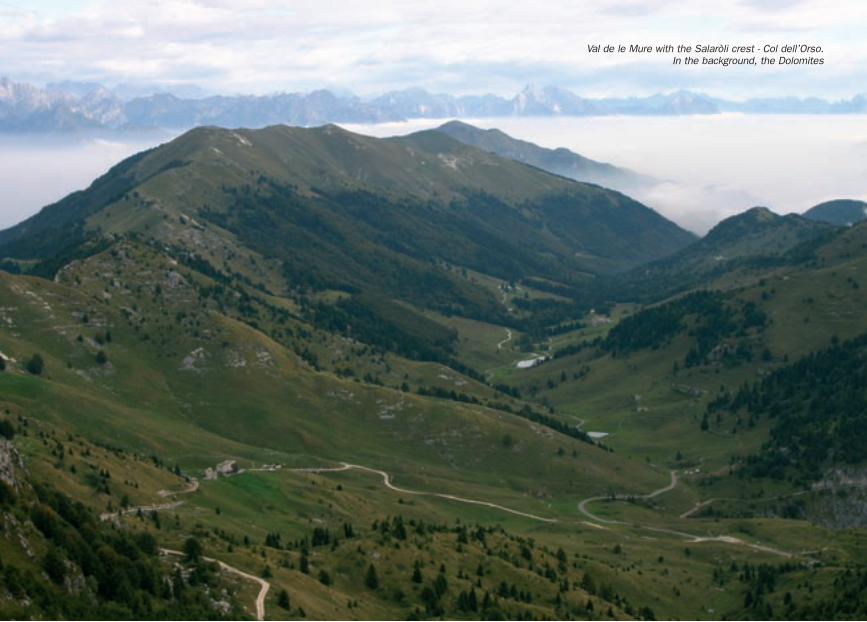
Val de le Mure with the Salaròli crest - Col dell’Orso.In the background, the Dolomites
46 FROM FELTRE TO BASSANO DEL GRAPPA THE DOLOMITES “ALTA VIA” N.8 OR “DEGLI EROI” 47
From the saddle, take path 156 which the goes up to the right (west) along the steep ridge scattered with stones until you reach an altitude of 1670m, leaving on the right, beyond a little saddle, Monte Salaròlo, 1625m, the lowest point of the Salaròli.
On the ravaged peak, 1670m, exceptionally well fortified by the Austrians during the war, there is a little iron cross with a memorial stone at the base in memory of the Val Toce, Val d’Aosta and Levanna battalions.
Continuing along the panoramic crest you reach an altitude of 1676m, known as Monte Salaròli, on which, from June to October 1918 fierce battles raged, in memory of which there is an iron cross without engravings.
Still on the crest, with immense views from all sides, you reach 1666m, 1675m and 1659m, on uncomfortable but easy ground, passing by trenches, the remains of shelters, bomb holes and crushed stone.
When you come onto Col dell’Orso, 1679m, you can look out over the valleys below and you cannot but remember the Italian solders who gave their lives here in November 1917 and June 1918.
Along more or less comfortable traces you reach Monte Casonét, 1614m, from where you continue south west along the trenches at 1560m and 1540m, moving slightly away from the crest towards east until you reach the Croce (cross) di Valpore at about 1530. Now you go up slightly to 1580 until the notch of the Croce dei Lebi, 1571m.
Along the crest you come to a woodland area, then enter the large bend of the military road, with the Casón dei Lebi in sight. Following the road comfortably, slightly in ascent, you go onto the head of the Val Vecchia, where you can find the historic military weapon pits which form part of the side arms of the Galleria Vittorio Emanuele III,
You soon reach the Rifugio Bassano (or Casa “Armata del Grappa”), 1745m, just 30 metres under the peak of the Monte Grappa.
5 hours from the Malga Duméla.
The Rifugio Bassano, the only refuge on the Alta Via n.8, is situated on the western spur of Monte Grappa and is owned by the Italian State and privately managed. A robust, squat, brick construction, it has two floors and is usually open from the end of May until the 4th of November. Basic hotel services, sleeps about ten. Tel : 0423 53101.
Variant 3 Via Val delle MureAn attractive, varied and bucolic variant, with superb flora ; par-
ticularly useful if you prefer not to tackle the crest, or especially in the event of bad weather.
All the malghe in Val delle Mure can offer food and provisions, and even shelter.
From the Malga Val Duméla to the Malga Fontana Secca and the Forcella dei Salaròli, as for Day Three in about 2,30 hours.
Go over the Forcella dei Salaròli and easily down south-west until you come to the Malga Salaròl, 1485m, after passing by two war caves, partly in ruins. Over patches of grass and then coppice wood, you come to the Casón del sol, 1275m, in a pleasant position and ope-rative ; possibility of refreshment.
You can reach here also from the Val Cinespa, after passing by the Malga Valderóa and the Malga Domadór.
A good road will take you to the Casón delle Mure, 1308, also ope-rative and welcoming.
Above you can see the Rifugio Bassano. It can be reached easily by following the military road which runs through the fields and rea-ches the basin with the Crocifisso (Crucifix) del Pian de la Bala, 1381m, from where you can continue to the right (west) the road which goes up to the Malga Val Vecchia, 1542m, and then path n.151 which passes through an area rich in flora and fauna (you may even meet the odd chamois ) and leads to the Rifugio Bassano.
Or, from Pian de la Bala, continue along the military road to the south until the fork at 1401m where path n.151 takes off on the right (west) and goes directly up to the Malga Val Vecchia and then conti-nues on to the Rifugio Bassano.
About 2,30 hours from the Forcella dei Salaròli, in both cases.5 hours from the Malga Val Duméla.
48 FROM FELTRE TO BASSANO DEL GRAPPA THE DOLOMITES “ALTA VIA” N.8 OR “DEGLI EROI” 49
ConnectionsMany connections with the main itinerary, which here goes over the
crest of the Salaròli, are possible, and more or less easy. For a descrip-tion of these links, you can refer to the specialized guides mentioned in the Bibliography, but the main links are indicated below:
1- From Seren del Grappa to the Cima Grappa through the Val delle Bocchette
2- From Fietta through the Val delle Munèghe on path n.125 then path n.109 until the Grappa area ; or from Fietta via San Liberale on path 151 until Pian de la Bala.
3- From Pian de la Bala to Cima Grappa along the Strada Militare di Arrocamento (Military Communication Line)
4- From San Liberale to Boccaór and Pian de la Bala along the Percorso Attrezzato (Equipped Route) “Sass Brusai” and path n.152
5- From San Liberale to the Rifugio Bassano along the Percorso Attrezzato “Nico Gusella
6- From Cismón del Grappa through the Val Goccia with path n.13
There are many other options, both coming up from the southern sector or the northern sector of the Monte Sacro alla Patria.
What to see on the top of theMonte Grappa
The Memorial ChapelOn the large rib of the Monte Grappa, which runs from north to
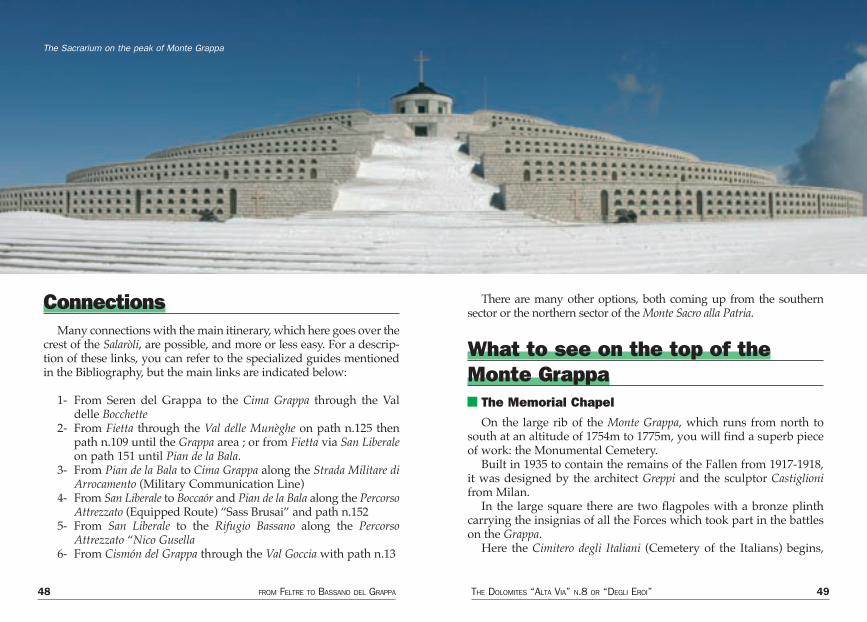
south at an altitude of 1754m to 1775m, you will find a superb piece of work: the Monumental Cemetery.
Built in 1935 to contain the remains of the Fallen from 1917-1918, it was designed by the architect Greppi and the sculptor Castiglioni from Milan.
In the large square there are two flagpoles with a bronze plinth carrying the insignias of all the Forces which took part in the battles on the Grappa.
Here the Cimitero degli Italiani (Cemetery of the Italians) begins,
The Sacrarium on the peak of Monte Grappa
50 FROM FELTRE TO BASSANO DEL GRAPPA THE DOLOMITES “ALTA VIA” N.8 OR “DEGLI EROI” 51
with five semicircular rows for the burial niches, each of which bears a bronze plaque with the name, rank and decorations of the soldier. In each one of the larger niches are the remains of 100 unk-nown soldiers. There are 2283 soldiers identified by name, 10,332 unknown soldiers, which gives an idea of the slaughter perpetrated on the Monte Grappa, and of why “Tu sei la mia Patria” (You are my homeland) is still sung today, without rhetoric. “Tu sei la mia Patria” is also written in large letters on the Portale (gate) di Roma, at the end of the Via Eroica.
The Alta Via degli Eroi n.8 is dedicated to all the Fallen, be they Italian, Austro-Hungarian or from other nations - no distinction is made.
The tomb of Gen. Giardino, commander of the Armata del Grappa from April 1918 and buried here according to his last wishes, is on the fifth row, together with that of his wife Margherita. The phrase “Gloria a Voi Soldati del Grappa” (Glory to You, Soldiers of the Grappa)
is written in large letters above the tomb of the General.At the top is the Sacello della Madonnina del Grappa (The Votive
Chapel of Our Lady of the Grappa), damaged by Austrian grenades on the 14th of May 1918 and decorated with a war medal. Inside the chapel is the altar donated by Pope Benedict XV, the Via Crucis del Castiglioni and the bronze bust of Saint Pious X, placed there on the 4th of August 1951 on the 50th anniversary of the ascent of the then Patriarch of Venice to the peak of the mountain.
Leading out of the cemetery is the Via Eroica, a broad, long espla-nade of 300 metres flanked by 14 boundary stones carved with the names of places which became famous during the war. At the end of the Via Eroica is the Portale di Roma. From the Portale di Roma you can enter the museum, a large exhibition room 350 m sq with three aisles, not always open as a result of leaks and other problems. Above is the large panoramic terrace with a large topographical bronze plaque.
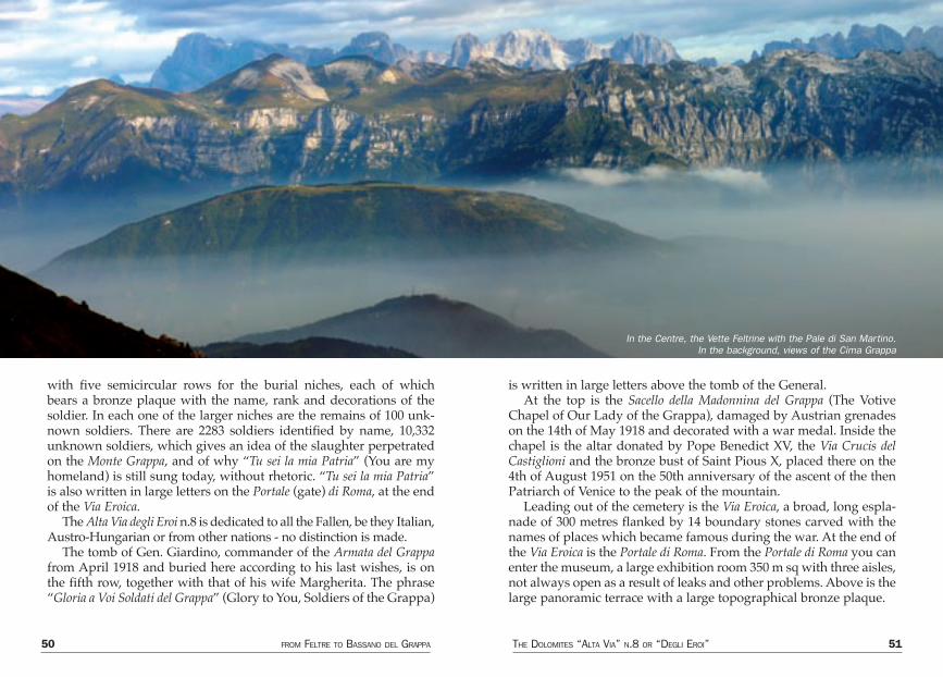
In the Centre, the Vette Feltrine with the Pale di San Martino.In the background, views of the Cima Grappa
52 FROM FELTRE TO BASSANO DEL GRAPPA THE DOLOMITES “ALTA VIA” N.8 OR “DEGLI EROI” 53
Behind the museum, facing north, is the Cimitero Austro-Ungarico (Austro-Hungarian Cemetery), with two circles and burial niches closed with bronze slabs. There are only 295 soldiers identified by name, and over 10,000 are unknown soldiers.
A total of 2578 identified soldiers and 20,332 unknown soldiers have found their final resting place up here.
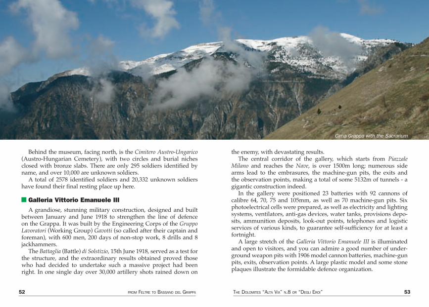
Galleria Vittorio Emanuele IIIA grandiose, stunning military construction, designed and built
between January and June 1918 to strengthen the line of defence on the Grappa. It was built by the Engineering Corps of the Gruppo Lavoratori (Working Group) Gavotti (so called after their captain and foreman), with 600 men, 200 days of non-stop work, 8 drills and 8 jackhammers.
The Battaglia (Battle) di Solstizio, 15th June 1918, served as a test for the structure, and the extraordinary results obtained proved those who had decided to undertake such a massive project had been right. In one single day over 30,000 artillery shots rained down on
the enemy, with devastating results.The central corridor of the gallery, which starts from Piazzale
Milano and reaches the Nave, is over 1500m long; numerous side arms lead to the embrasures, the machine-gun pits, the exits and the observation points, making a total of some 5132m of tunnels - a gigantic construction indeed.
In the gallery were positioned 23 batteries with 92 cannons of calibre 64, 70, 75 and 105mm, as well as 70 machine-gun pits. Six photoelectrical cells were prepared, as well as electricity and lighting systems, ventilators, anti-gas devices, water tanks, provisions depo-sits, ammunition deposits, look-out points, telephones and logistic services of various kinds, to guarantee self-sufficiency for at least a fortnight.
A large stretch of the Galleria Vittorio Emanuele III is illuminated and open to visitors, and you can admire a good number of under-ground weapon pits with 1906 model cannon batteries, machine-gun pits, exits, observation points. A large plastic model and some stone plaques illustrate the formidable defence organization.
Cima Grappa with the Sacrarium
54 FROM FELTRE TO BASSANO DEL GRAPPA THE DOLOMITES “ALTA VIA” N.8 OR “DEGLI EROI” 55
Day Four From the Rifugio Bassano to Bassano del Grappa through the Val dei Lebi and the Val di Santa FelicitaGradient: in descent 1615m Length: about 20kmTime required: about 6 hours Path: n.80Difficulty: E, T
You can go take a lift or a taxi down to Bassano, or “invent” a route of your own, map in hand, but to bring your Alta Via trip to an end on foot, in a genuine and “triumphal” manner, the best solution is the following:
From the Rifugio Bassano, 1745m, follow the Strada Cadorna south, passing high above the Casón d’Ardósa and leaving to the right (west) the Caserma (Barracks) Milano and the war cemetery.
The original route of the Alta Via degli Eroi n.8 continues along road n.141 for about 2.7km until the fork at 1446m where it conti-nues, after the Monte Pèrtica, through the Feltrina valley.
From the fork it goes down along the Strada Cadorna for about another kilometre, and then, just after the Casón di Méda, takes the little road which, at 1483m, goes off to the south-east. This road goes along the head of the Val delle Foglie, slightly in descent through ample pastu-reland. After a bend it goes more steeply and tortuously down to the south-west (military ruins and war gallery) to an altitude of 1385m, where, with a wide, marked bend, it turns abruptly north-east, then east, entering halfway up the mountainside into the Val di Poise at the Malga Selva, 1342m, in beautiful, wild, green, restful surroundings.
You can get here directly from the Cemetery by taking, from Piazzale Milano, the path n.80 to the south, which ignores the 141 road, just crossing it at 1647m, then goes towards the Monte Meda, beyond which it goes down to the Casèra Pellizzari and then to the Malga Selva.
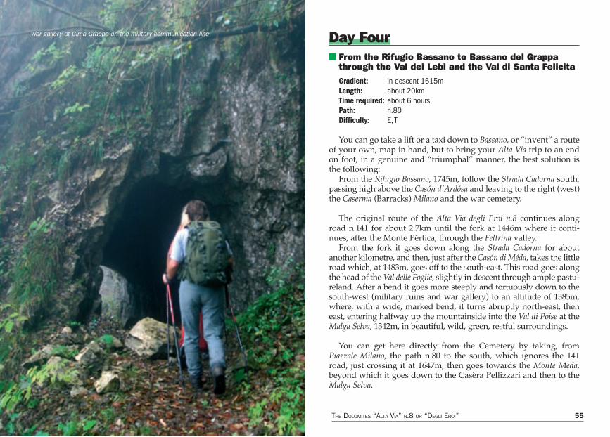
War gallery at Cima Grappa on the military communication line
56 FROM FELTRE TO BASSANO DEL GRAPPA THE DOLOMITES “ALTA VIA” N.8 OR “DEGLI EROI” 57
Along the little road or path n.80 , go down between the Boscón to the east and the Bosco Piai to the west, entering the Valle dei Lebi on the Strada Militare di Arrocamento.
At an altitude of 1066m, take the little road which takes off sou-thwards, and go down to 958m, where, on the right (west), path n.80 starts out and goes down southwards towards the Valle di Santa Felicita, meeting at 698m path n.70 coming from Casa Pianàro.
From 1066m you can continue on the original route to the west (Strada Militare di Arrocamento) until you come to Casa Pianàro, 980m, and from here take path n.70 to the south which also goes down into the Valle di Santa Felicita, meeting path n.80 at 698m.
The path, which is quite comfortable, goes down a few bends on the orographical right of the valley, at some points cut into the rock, above the dry bed of the torrent.
From the top of a gallery you can finally see the bottom of the Valle di Santa Felicita with its fine Palestra di Roccia.
Now go down steeply until you come to a rock face covered with grass at the foot of which is the start of a steep, impervious ero-sion channel known as lo Scalón, surrounded by high rock barriers (spring). Go along the little path, initially at the bottom of the chan-nel, until you reach the Palestra. 420m, from the “funnel” of which you come out along a little road on the left of the gravel. After about one and a half kilometres you come to the Trattoria alla Mena (hotel), where climbers have found shelter and refreshment for as long as anyone can remember.
Until here, about 4 hours from the Rifugio Bassano
From the trattoria to the centre of Bassano del Grappa, where the Alta Via degli Eroi n.8 ends, there are about 7km of excellent tarmac road, which, as it is quite busy, is quite boring to walk along.
Within its mediaeval walls, Bassano del Grappa, 130m, one of the most beautiful, historic and industrious cities in the Veneto region, has a superbly-conserved historical centre with old porticoes, renaissance buildings, houses with frescoes; it is an art lover’s paradise.
Among the marvels of Bassano are the Castello (castle), the Madonna della Salute, Palazzo Pretorio (magistrate’s palace), the Torre (tower) di San Ivano, the Chiostro del Museo (cloister of the museum) in the ancient Convento di San Francesco, where you can find the lapidary collection and the frescoes of Battista da Vicenza, 15th century, and the Pinacoteca (art gallery) with the paintings of Jacopo, Francesco, and Leandro da Bassano, 16th centu-ry, of Giambono, Guariento, Vivarini, etc., as well as numerous works from the 17th and 18th century by Maffei, Riccio, Tièpolo,Piazzetta, Longhi, Magnasco and sculptures by Canova and various drawings.
Also interesting is the Raccolta (collection) Remondiana of popular engra-vings from the Calcografia (copper-plate press) Bassanese Remondini of the 17th-19th century, as well as Roman material, coins, medals, ceramics….
Rather characteristic too are the Case Compostella, Brocchi, Vittorelli, Guadagnini, Cerato, Ca’ Vecchia and the Palazzo Municipale (town hall), all examples of local architecture of the sixteenth and seventeenth centuries. The Casa di Lazzaro Bonamico dates back to the 15th century. Ca’ Priuli and Ca’ Angaran have Palladian lines. The 18th century is represented by Villa Rezzonico and Villa Gradenigo; the early 17th century by Palazzo Bonaguro; Palazzo Sturm is from the 18th century; the Duomo (cathedral) dates back to the 15th century, but it has been modified several times. The Tempio Votivo (votive temple) houses the remains of 6000 soldiers killed in WW1.
However, the real symbol of Bassano is the Ponte (bridge) degli Alpini, with almost 800 years of history; its official “date of birth” is 1209. It has collap-sed, been destroyed and rebuilt many times during its history. The river Brenta has never been very kind to the bridge; in 1450 and 1490, for example, it was swept away by the Brenta. Then, in 1511 it was set fire to by Palisse; in 1520 it collapsed, and again in 1526, 1567 and finally in 1726, as a result of old age; in 1748 it came down once more; in 1813 Beauharnais blew it up.
In 1915 the Austrian grenades did not even touch it and this is the origin of the legend according to which “that bridge won the war”, and the reason it was named Ponte degli Alpini. The Alpini troops, in 1948, after the bridge had been rebuilt again, felt obliged to “christen” it with a fine bottle of the famous local grappa. Good facilities for tourists and quality accommodation with numerous excellent hotels, restaurants, guesthouses, trattorie and typi-cal establishments. Travel agencies, tourist agencies, various services. CAI Section; Touring Club; railway station with the romantic little train to and from Trent, called “su e giù per la Valsugana”
58 FROM FELTRE TO BASSANO DEL GRAPPA THE DOLOMITES “ALTA VIA” N.8 OR “DEGLI EROI” 59
Bibliography (in order of publication)
SAGLIO SILVIO, Guida da Rifugio a Rifugio-Prealpi Venete, CAI-TCI, 1961
CELOTTO ANTONIO, Monte Grappa, Minchio, Bassano, 1966CAI BASSANO, Nel 75° di Fondazione, Nuova Stampa , 1967 LLA CALLEGHER ITALO, Scopriamo la Val di Schievenin, Lo Scarpone, 1
settembre 1972ZANDONELLA CALLEGHER ITALO, Valle di Schievenin, Le Alpi Venete, N
1972ZANDONELLA CALLEGHER ITALO, Alta Via degli Eroi, Tamari, 1975ZANDONELLA CALLEGHER ITALO, 50 Escursioni in Val di Piave, Tamari,
1976GAROBBIO AURELIO, Alpi e Prealpi, mito e realtà, Grappa e Feltrino,
Alfa, 1977ZANDONELLA CALLEGHER ITALO, Racconti della Val di Piave,
Priuli&Verlucca, 1978ZANDONELLA CALLEGHER ITALO, Il Massiccio del Grappa, trionfo della
solitudine, Ghedina, 1981SCANDELLARI ARMANDO, Canale del Brenta, Tamari, 1981CAI BASSANO, Il Grappa, patrimonio ambientale, 1985HÜSSLER EUGEN, Guida alle ferrate dall’Adamello al Brenta, Denzel-
Frasnelli, 1985ZANDONELLA CALLEGHER ITALO, Massiccio del Grappa e Alta Via degli
Eroi, Tamari, 1986AA. VV., Monte Grappa da scoprire, C.M. del Grappa, 1989CARARO-GRANDESSO-SAURO, Incontri con il Grappa 1, Moro 1989BUSNARDO GIUSEPPE, Escursioni nel Massiccio del Grappa, Cierre, 1991SCANDELLARI ARMANDO, Monte Grappa, guida escursionistica,
Nuovedizionidolomiti, 1991ZANDONELLA CALLEGHER ITALO, Alta Via n. 8 delle pre-Dolomiti, Amm.
Prov. Belluno, 1992BUSNARDO-LASEN, Incontri con il Grappa 2, Moro, 1994ZANDONELLA CALLEGHER ITALO, Dolomiti, Amm. Prov. Belluno, 1995FOTOGRUPPO, Escursioni tra il Grappa e il Cesén, DBS, 1997
MASUTTI L., Incontri con il Grappa 3, Moro 1998VAROTTO M., Il paesaggio dell’abbandono nel Massiccio del Grappa
nord or., CAI Terre Alte, 1999
MapsI.G.M. maps 1:25.000SHEET 22, II, SE- Feltre;SHEET 37, I, NE - Seren del Grappa; SHEET 37, I, SE - Cavaso del Tomba; SHEET 37, I, SO - Monte Grappa SHEET 37, II, NO - Bassano
Map 1:25.000CAI DI BASSANO - Canale del Brenta (only the last stage)
Map 1:30.000COMUNITÀ MONTANA BRENTA - Il Massiccio del Grappa i sentieri, Grappa, Feltrino (good, with the whole route)ZANETTI - Colli Asolani - Grappa - M. Tomba (only the last stage)
Map 1:50.000PILOTTO - Le Vette, Monte Grappa, Feltre (the whole route)KOMPASS - Altopiano di Asiago
60 FROM FELTRE TO BASSANO DEL GRAPPA THE DOLOMITES “ALTA VIA” N.8 OR “DEGLI EROI” 61
Index IndexGeneral notes .................................................................................pag. 3 Recommended period ...................................................................pag. 6Useful advice for hikers Precautions - Equipment ...............................................................pag. 7Alpine rescue service What is the C.N.S.A.S.? ................................................................pag. 8 Where does the C.N.S.A.S. operate? .............................................pag. 9Prevention Basic rules for improved safety in the mountains and other hostile environments. ....................................................pag. 10 Basic rules on how to behave in the event of an accident ..............pag. 11 How to alert S.U.E.M. 118/C.N.S.A.S. ..........................................pag. 11 International mountain rescue signals ...........................................pag. 13 Route signs ..................................................................................pag. 14Technical details .............................................................................pag. 16
Description of the walksDay One From Feltre to the Malga Pàoda via Monte Tomàtico ......................pag. 17Connection 1 From Ciladón to Malga Pàoda .......................................................pag. 26Connection 2 From Prada to Malga Pàoda ..........................................................pag. 26Day Two From the Malga Pàoda to the Malga Val Duméla along the Sentiero CAI Montebelluna .............................................pag. 27Variant 1 On the crest via Monte Santo and Monte Sassumà .......................pag. 28 Along the Sentiero CAI Montebelluna, i.e. the original itinerary .......pag. 28Connection 3 ...................................................................................pag. 31Connection 4 ...................................................................................pag. 34Connection 5 ...................................................................................pag. 36Connection 6 ...................................................................................pag. 38Connection 7 ...................................................................................pag. 40
Day Three From the Malga Val Duméla to\the Rifugio Bassano via Col dell’Orso ...............................................pag. 42Variant 2 Via the Malga Col de Spadaròt .....................................................pag. 43Variant 3 Via Val delle Mure ........................................................................pag. 47Connections .....................................................................................pag 48What to see on the top of the Monte Grappa The Memorial Chapel ....................................................................pag. 49 Galleria Vittorio Emanuele III .........................................................pag. 52Day Four From the Rifugio Bassano to Bassano del Grappa through the Val dei Lebi and the Val di Santa Felicita ....................pag. 55Bibliography ....................................................................................pag. 58Maps ................................................................................................pag. 59
62 FROM FELTRE TO BASSANO DEL GRAPPA THE DOLOMITES “ALTA VIA” N.8 OR “DEGLI EROI” 63
Refuge stamps Refuge stamps
64 FROM FELTRE TO BASSANO DEL GRAPPA
Information
Provincial Administration - Belluno Tourism Sector - Communication and Promotion ServiceVia Psaro, 21 - 32100 BellunoTel. +39 0437 94 00 84 - fax +39 0437 [email protected] - www.infodolomiti.it
Provincial Tourist Office - FeltrePiazza Trento e Trieste, 9 - 32032 FeltreTel. +39 0439 25 40 - fax +39 0439 [email protected] - www.infodolomiti.it Tourist Office - Bassano Largo Corona d’Italia, 35 - 36061 Bassano del GrappaTel. +39 0424 52 43 51 - fax +39 0424 515301 [email protected],www.vicenzae.org - www.provincia.vicenza.it
For any other information you might require regarding the Alta Via n.8, see the Tourism sector of the Province of Belluno.
For serious problems or information, you can also contact the Italian Alpine Club Sections of Feltre, Bassano del Grappa and Montebelluna,keeping in mind that the CAI members are volunteers and are not often present during office hours in the relevant Administration sections.
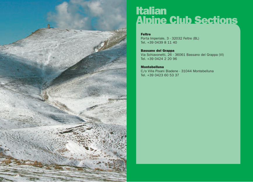
ItalianAlpine Club Sections
FeltrePorta Imperiale, 3 - 32032 Feltre (BL)Tel. +39 0439 8 11 40
Bassano del GrappaVia Schiavonetti, 26 - 36061 Bassano del Grappa (VI)Tel. +39 0424 2 20 96
MontebellunaC/o Villa Pisani Biadene - 31044 MontebellunaTel. +39 0423 60 53 37