unit nine: georeferenced data in this unit… ► data supported by arcgis ► geodesy datum ...
TRANSCRIPT

Unit Nine: Georeferenced Unit Nine: Georeferenced DataData
In this unit…In this unit…
Data Supported by ArcGISData Supported by ArcGIS
GeodesyGeodesyDatumDatum
Coordinate SystemsCoordinate SystemsProjectionsProjections
ArcGIS and ProjectionsArcGIS and Projections
ArcCatalogArcCatalog

2Unit Nine – Georeferenced DataUnit Nine – Georeferenced Data
ReviewReview
► GIS’ depict realityGIS’ depict realityonly approximately!only approximately!
► Required:Required:
1.1. RealityReality
2.2. A modelA model
3.3. A referencing systemA referencing system
4.4. Methods for referencing data Methods for referencing data within the referencing systemwithin the referencing system

3Unit Nine – Georeferenced DataUnit Nine – Georeferenced Data
Data Supported by ArcGISData Supported by ArcGIS
► Several types of data are Several types of data are supported by ArcGISsupported by ArcGIS ShapefileShapefile
ArcInfo CoverageArcInfo Coverage
GeodatabaseGeodatabase
CADCAD
GRID & TINGRID & TIN
► ArcGIS uses icons to differentiate.ArcGIS uses icons to differentiate.

4Unit Nine – Georeferenced DataUnit Nine – Georeferenced Data
Data Supported by ArcGISData Supported by ArcGIS
► Some data is of a complex Some data is of a complex structure:structure: Coverages ‘expand’Coverages ‘expand’
Layers Layers are are
‘inside’‘inside’

5Unit Nine – Georeferenced DataUnit Nine – Georeferenced Data
Data Supported by ArcGISData Supported by ArcGIS
► Geodatabases can:Geodatabases can:
1.1. Store all other types of dataStore all other types of data
2.2. Have “Rules”Have “Rules”
3.3. Support Support Data modelsData models
4.4. Be stored in MS AccessBe stored in MS Access
5.5. Create hierarchical structure of Create hierarchical structure of relationships relationships (data sets and data classes)(data sets and data classes)
ggeodatabaseeodatabase
coveragecoverage
shapefileshapefile
……or a or a reallyreally complex structure complex structure

6Unit Nine – Georeferenced DataUnit Nine – Georeferenced Data
Spatial ReferenceSpatial Reference
1.1. DATUMDATUM
2.2. PROJECTIONPROJECTION
3.3. COORDINATE SYSTEMCOORDINATE SYSTEM
4.4. MAP UNITSMAP UNITS

7Unit Nine – Georeferenced DataUnit Nine – Georeferenced Data
Ellipsoid SizeEllipsoid SizeEllipsoid ShapeEllipsoid ShapeLocation of ellipsoidLocation of ellipsoid (relative to Earth)
DatumDatumis is
defineddefinedby...by...
Datum
A “Model” Starting Place

8Unit Nine – Georeferenced DataUnit Nine – Georeferenced Data
Datum
History
LumpyLumpyPotatoPotato
Sphere
Ellipse
Our idea of the earth’s shape evolved…
Our idea of the earth’s shape evolved…

9Unit Nine – Georeferenced DataUnit Nine – Georeferenced Data
Datum
Common Datum(s?)
NAD - 83 (North American Datum - 1983)based on GRS-80 ellipsoid
NAD - 27 based on Clarke 1866 ellipsoid
WGS -84 (World Geodetic System - 1984)based on ellipsoid very similar to GRS-80
GPS
USGS

10Unit Nine – Georeferenced DataUnit Nine – Georeferenced Data
Projection
The Basic Idea

11Unit Nine – Georeferenced DataUnit Nine – Georeferenced Data
.

12Unit Nine – Georeferenced DataUnit Nine – Georeferenced Data
Projection
13Unit Nine – Georeferenced DataUnit Nine – Georeferenced Data
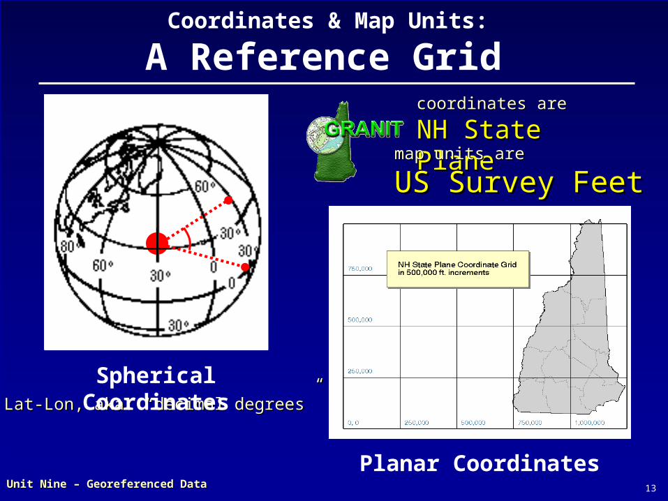
Coordinates & Map Units:
A Reference Grid
Planar Coordinates
coordinates arecoordinates are
NH State PlaneNH State Planemap units aremap units are
US Survey FeetUS Survey Feet
Lat-Lon, aka: “decimal degrees”Lat-Lon, aka: “decimal degrees”
Spherical Coordinates
14Unit Nine – Georeferenced DataUnit Nine – Georeferenced Data
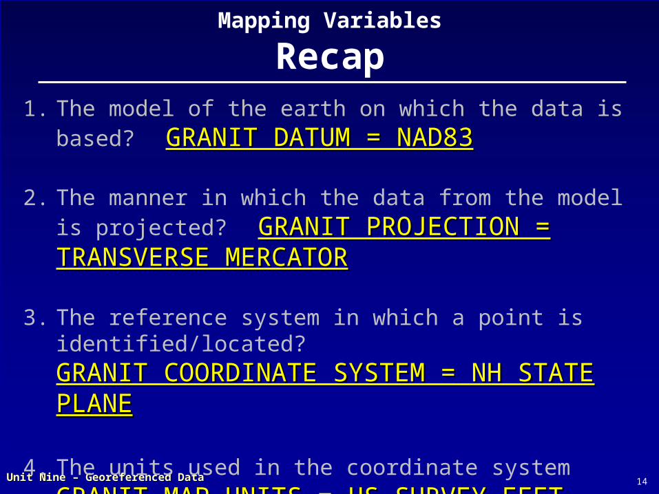
Mapping Variables
Recap1. The model of the earth on which the data is based?
GRANIT DATUM = NAD83GRANIT DATUM = NAD83
2. The manner in which the data from the model is projected? GRANIT PROJECTION = GRANIT PROJECTION = TRANSVERSE MERCATORTRANSVERSE MERCATOR
3. The reference system in which a point is identified/located? GRANIT COORDINATE SYSTEM = NH STATE GRANIT COORDINATE SYSTEM = NH STATE PLANEPLANE
4. The units used in the coordinate system GRANIT MAP UNITS = US SURVEY FEETGRANIT MAP UNITS = US SURVEY FEET

15Unit Nine – Georeferenced DataUnit Nine – Georeferenced Data
Projections in ArcGISProjections in ArcGIS
ArcCatalogArcToolbox
fyi: Launch fyi: Launch componentscomponents
Projection ToolsProjection Tools
Tabs – important!Tabs – important!

16Unit Nine – Georeferenced DataUnit Nine – Georeferenced Data
Use multiple Data Frames Use multiple Data Frames for multiple projectionsfor multiple projections
► Projection for new layers:Projection for new layers: Defaults to that of Data Defaults to that of Data
FrameFrame
Data Frame defaults to Data Frame defaults to projection of 1projection of 1stst Layer Layer addedadded
On-the-fly DOESN’T change On-the-fly DOESN’T change Layer’s original projectionLayer’s original projection
► To change original To change original projection, use ArcToolboxprojection, use ArcToolbox
On-the-Fly ProjectionOn-the-Fly Projection
Projections in ArcGISProjections in ArcGIS

17Unit Nine – Georeferenced DataUnit Nine – Georeferenced Data
Projections in ArcGISProjections in ArcGIS► Projected Data? Projected Data?
ArcGIS still has to know about it ArcGIS still has to know about it
Requires “Defining the Spatial Reference”Requires “Defining the Spatial Reference”
► Projection information is stored Projection information is stored differently for different types of datadifferently for different types of data
ShapefileShapefile .prj file.prj file
ArcInfo CoverageArcInfo Coverage .prj file.prj file
GeodatabaseGeodatabase RDBMS/RDBMS/internalinternal
CADCAD world fileworld file

18Unit Nine – Georeferenced DataUnit Nine – Georeferenced Data
Documents the data – Documents the data – e.g. all the “variables”e.g. all the “variables”
Not always includedNot always included
Viewable in ArcCatalogViewable in ArcCatalog
““importable”importable”
► Metadata Tab for Datum-Metadata Tab for Datum-Projection-Coordinate Projection-Coordinate System InfoSystem Info
If it’s projected data, If it’s projected data, does ArcGIS know it?does ArcGIS know it?
Metadata: “Data about data”Metadata: “Data about data”
Projection Info: from Projection Info: from MetadataMetadata
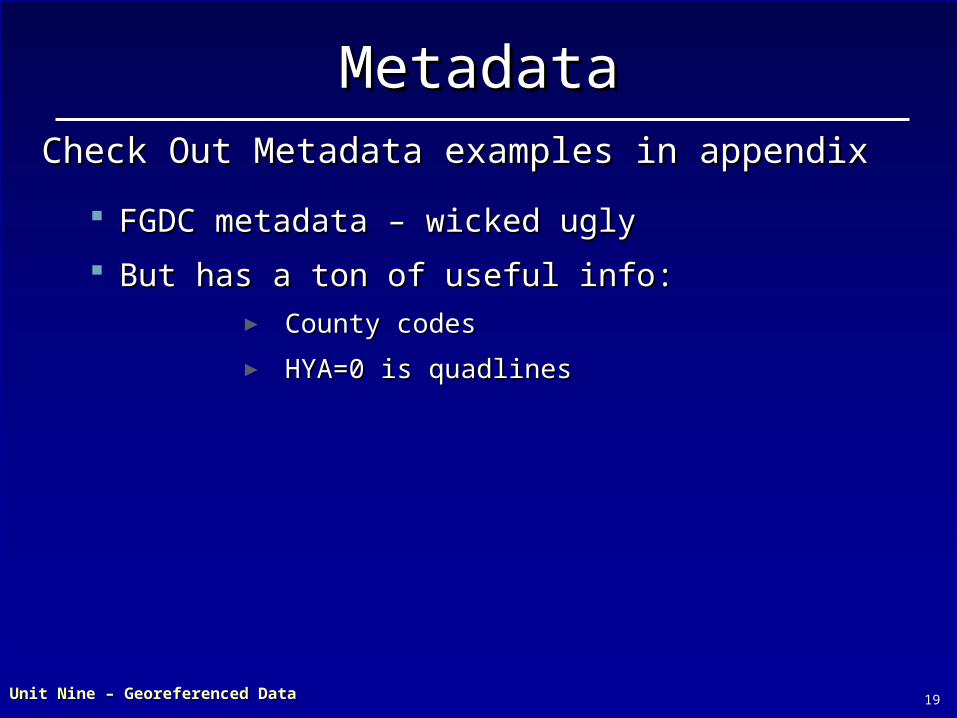
19Unit Nine – Georeferenced DataUnit Nine – Georeferenced Data
FGDC metadata – wicked uglyFGDC metadata – wicked ugly
But has a ton of useful info:But has a ton of useful info:► County codesCounty codes
► HYA=0 is quadlinesHYA=0 is quadlines
Check Out Metadata examples in appendixCheck Out Metadata examples in appendix
MetadataMetadata

20Unit Nine – Georeferenced DataUnit Nine – Georeferenced Data
View projection View projection info for different info for different files in different files in different waysways
coveragecoverage Can’t define Can’t define
spatial reference spatial reference for coverages for coverages from here – need from here – need ArcToolboxArcToolbox
Projection Info: from Projection Info: from PropertiesProperties
XX??

21Unit Nine – Georeferenced DataUnit Nine – Georeferenced Data
View projection info for different files in different ways
shapefileshapefile May defineMay define spatial spatial
reference from herereference from here1.1. Select “shape” fieldSelect “shape” field
2.2. Click elipsis buttonClick elipsis button
Defining Spatial Reference: Defining Spatial Reference: ArcCatalogArcCatalog
11
22

22Unit Nine – Georeferenced DataUnit Nine – Georeferenced Data
►View projection info for different files in different ways
shapefileshapefile Two methods for Two methods for
defining:defining:1.1. Selecting predefinedSelecting predefined
2.2. Importing from other Importing from other LayerLayer
Defining Spatial Reference: Defining Spatial Reference: ArcCatalogArcCatalog

23Unit Nine – Georeferenced DataUnit Nine – Georeferenced Data
Defining Spatial Reference: Defining Spatial Reference: ArcToolboxArcToolbox
►Several flavors of Projection
Tools 1.1. Creating or Creating or
changingchanging
2.2. DefiningDefining► Tells ArcGIS about Tells ArcGIS about the projectionthe projection
► Doesn’t change data: Doesn’t change data: creates a new file!creates a new file!
► Use if data is un-projected, Use if data is un-projected, or needs to be re-projectedor needs to be re-projected
► ACTUALLY CHANGES THE DATA!ACTUALLY CHANGES THE DATA! XX
Some tools are a little confusing…Some tools are a little confusing…

24Unit Nine – Georeferenced DataUnit Nine – Georeferenced Data
One more thing…One more thing…
►You can simplify your world! “Connecting” to
a folder gives you a shortcut
“Connecting” to a web resource or server lets you share data with others

25Unit Nine – Georeferenced DataUnit Nine – Georeferenced Data
Your turn…Your turn…
Chapter 9: Step 1 through ENDChapter 9: Step 1 through END