united nations convention on the law of the sea …india, dated 31 august 2009, the netherlands,...
TRANSCRIPT

ANNEX VI: SUMMARY OF RECOMMENDATIONS OF THE COMMISSION
United Nations Convention on the Law of the Sea ____________________________________________________________
SUMMARY OF RECOMMENDATIONS OF THE COMMISSION ON THE LIMITS OF THE CONTINENTAL SHELF IN REGARD TO THE SUBMISSION MADE BY ARGENTINA ON 21 APRIL 200913
Recommendations prepared by the Subcommission established for the consideration
of the Submission made by Argentina
Approved by the Subcommission on 21 August 2015
Approved by the Commission, with amendments, on 11 March 2016
13 The aim of this Summary is to provide information which is not of confidential or proprietary nature in order to
facilitate the function of the Secretary-General in accordance with Rule 11.3 of Annex III to the Rules of Procedure of the Commission (CLCS/40/Rev.1). This Summary is based on excerpts of the Recommendations and may refer to material not necessarily included either in the full Recommendations or this Summary.
Commission on the Limits of the Continental Shelf

Page ii
GLOSSARY OF TERMS
200 M line Line at a distance of 200 nautical miles from the baselines from which the breadth of the territorial sea is measured
2,500 m isobath A line connecting the depth of 2,500 metres
Article 76 Article 76 of the Convention
Baselines Baselines from which the breadth of the territorial sea is measured
BOS Base of the continental slope
Commission Commission on the Limits of the Continental Shelf
Convention United Nations Convention on the Law of the Sea of 10 December 1982
Depth constraint Constraint line determined at a distance of 100 M from the 2,500 m isobath
Distance constraint Constraint line determined at a distance of 350 M from the baselines from which the breadth of the territorial sea is measured
Distance formula line Line delineated by reference to fixed points determined at a distance of not more than 60 nautical miles from the foot of the continental slope
Distance formula point Fixed point determined at a distance of not more than 60 nautical miles from the foot of the continental slope
DOALOS Division for Ocean Affairs and the Law of the Sea, Office of Legal Affairs, United Nations
FOS Foot of the continental slope
Guidelines Scientific and Technical Guidelines of the Commission (CLCS/11 and CLCS/11/Add.1)
M Nautical mile
Rules of Procedure Rules of Procedure of the Commission (CLCS/40/Rev.1)
Secretary-General Secretary-General of the United Nations
Sediment thickness formula line
Line delineated by reference to the outermost fixed points at each of which the thickness of sedimentary rocks is at least 1 per cent of the shortest distance from such point to the foot of the continental slope
Sediment thickness formula point
Fixed point at which the thickness of sedimentary rocks is at least 1 per cent of the shortest distance from that point to the foot of the continental slope

Page 1 of 66
I. INTRODUCTION
1 On 21 April 2009, Argentina submitted to the Commission on the Limits of the
Continental Shelf, through the Secretary-General1 of the United Nations, information on the limits of the continental shelf beyond 200 M from the baselines from which the breadth of the territorial sea is measured, in accordance with paragraph 8 of article 76 of the Convention (“Submission”) (Figure 1).
2 The Convention entered into force for Argentina on 31 December 1995.
3 On 1 May 2009, the Secretary-General issued Continental Shelf Notification CLCS.25.2009.LOS to make public the Executive Summary of the Submission in accordance with rule 50 of the Rules of Procedure. Pursuant to rule 51 of the Rules of Procedure, the consideration of the Submission was included in the agenda of the twenty-fourth session of the Commission.
4 Pursuant to section 2 of annex III to the Rules of Procedure, the presentation of the Submission was made to the plenary of the twenty-fourth session of the Commission on 26 August 2009, by Jorge Argüello, Permanent Representative of Argentina to the United Nations, Head of Delegation; Rafael M. Grossi, General Director of Political Coordination, Ministry of Foreign Affairs; Frida M. Armas Pfirter, General Coordinator of the Comisión Nacional del Límite Exterior de la Plataforma Continental (COPLA), and Marcelo Paterlini, Geophysicist. The Delegation of Argentina (“Delegation”) also included a number of scientific, legal and technical advisers. In addition to elaborating on substantive points of the Submission, Mr. Grossi indicated that the Submission was a full submission, covering the natural prolongation of Argentina appurtenant to the continent, the islands and the Argentine Antarctic Sector. He noted that, as stated in its note of 21 April 2009, Argentina took into account the circumstances of the region south of 60°S and that the Commission could not, in accordance with its Rules of Procedure, take any action, for the time being, with regard to the part of the Submission that related to the continental shelf appurtenant to the Argentine Antarctic Sector. In reference to paragraph 2 (a) of annex I to the Rules of Procedure, he informed the Commission that there was an area that fell under the purview of rule 46 of the Rules of Procedure. In this regard, Argentina asserted “its legitimate and imprescriptible sovereignty over Islas Malvinas, Georgias del Sur and Sandwich del Sur and the corresponding island and maritime areas as they are part of the national territory” and that it expressed reservation over the note verbale from the United Kingdom of Great Britain and Northern Ireland (“United Kingdom”) dated 6 August 2009, about which Argentina would later make a timely statement.2 Mr. Grossi also stated that Mr. Osvaldo Pedro Astiz, a member of the Commission,3 had assisted Argentina by providing scientific and technical advice with respect to the Submission.
5 The Commission then continued its meeting in private. Addressing the modalities for the consideration of the Submission, the Commission took note of the note verbale from the United Kingdom, dated 6 August 2009, and the views expressed in the presentation by Argentina of its Submission in connection with this note verbale. Taking into consideration this note verbale and the presentation made by
1 Division for Ocean Affairs and the Law of the Sea (“DOALOS”), Office of Legal Affairs, United Nations. 2 Note by the secretariat: a dispute exists between the Governments of Argentina and the United Kingdom of Great
Britain and Northern Ireland concerning sovereignty over the Falkland Islands (Malvinas). 3 Mr. Astiz was a member of the Commission from 1997 to 2002, from 2002 to 2007 and from 2007 to 2012.

Page 2 of 66
the Delegation, the Commission decided that, in accordance with its Rules of Procedure, it was not in a position to consider and qualify those parts of the Submission that were subject to dispute. The Commission decided that it would instruct the Subcommission, once established in accordance with rule 51, paragraph 4 ter, of the Rules of Procedure, at a future session, to act accordingly.
6 The Commission then took note of the following notes verbales on the issue of the area appurtenant to Antarctica: (a) the note verbale from Argentina dated 21 April 2009; (b) the note verbale from the United Kingdom dated 6 August 2009; (c) the note verbale from the United States of America dated 19 August 2009; and (d) the note verbale from the Russian Federation dated 24 August 2009. The Commission also took note of the views expressed in the presentation made by Argentina of its Submission in connection with these notes verbales. Taking into consideration these notes verbales and the presentation made by the Delegation, the Commission decided that, in accordance with the Rules of Procedure, it was not in a position to consider and qualify the part of the Submission that related to the continental shelf appurtenant to Antarctica. The Commission decided that it would likewise instruct the Subcommission, once established, to act accordingly.
7 At the twenty-fifth session, the Commission took note of the notes verbales from India, dated 31 August 2009, the Netherlands, dated 30 September 2009, and Japan, dated 19 November 2009, related to the Submission.
8 The Subcommission for the consideration of the Submission made by Argentina was established on 2 August 2012, during the plenary of the thirtieth session of the Commission. The following members of the Commission were appointed as members of the Subcommission: Messrs. Awosika, Carrera, Heinesen, Madon, Marques, Oduro and Park. The Subcommission elected Mr. Carrera as its Chairperson and Messrs. Oduro and Park as its Vice-Chairpersons.
9 On 7 August 2012, the Delegation submitted a restructured version of part II and III of the Submission. Argentina indicated that the additional materials in the restructured version served to update the materials in the original Submission, dated 21 April 2009, and did not supersede or replace those materials. Argentina further clarified that none of the outer limit points had been modified, but verification data had been added and part of the Submission had been restructured for the purposes of clarity and readability.
10 On 8 August 2012, the Delegation made a second presentation of the Submission to the Commission, in view of the time elapsed since its first presentation and for the benefit of the members of the Commission newly elected by the twenty-second Meeting of States Parties to the Convention.4 The presentation was made by Mateo Estrémé, Chargé d’affaires ad interim of the Permanent Mission of Argentina to the United Nations and Head of Delegation; Frida M. Armas-Pfirter, General Coordinator of the Comisión Nacional del Límite Exterior de la Plataforma Continental; and the following consultants from COPLA: Juan Bautista Allegrino, Yanina Berbeglia, Lucila Dalmau, Edgardo Monteros and Carlos María Urien. The Delegation also included other scientific, legal and technical advisers, including Karl Hinz, a former member of the Commission on the Limits of the Continental Shelf. In addition to elaborating on substantive points of the Submission, Mr. Estrémé informed the Commission that one of its current members, Marcelo Paterlini, had been involved in the preparation of the Submission.5 Mr. Estrémé
4 See Report of the twenty-second Meeting of States Parties (SPLOS 251). 5 Mr. Paterlini was elected to the Commission on the Limits of the Continental Shelf on 6 June 2012 (see SPLOS/251).

Page 3 of 66
noted that, even though the presentation to the thirtieth session contained new elements that were complementary to those included in the original Submission made by Argentina on 21 April 2009, none of the outer limit points had been modified. He also reiterated the position of Argentina, as stated during the presentation to the Commission at its twenty-fourth session, regarding its claims over “Islas Malvinas, Georgias del Sur and Sandwich del Sur and the corresponding island and maritime areas”, as well as its reservations to the note verbale from the United Kingdom dated 6 August 2009. Mr. Estrémé noted that, as stated in its note of 21 April 2009, Argentina had taken into account the circumstances of the region south of 60°S. He, therefore, requested the Commission, in accordance with its Rules of Procedure, not to take any action for the time being with regard to the part of the Submission that related to the continental shelf appurtenant to Antarctica.
11 The Commission then continued its meeting in private. It recalled that at its twenty-fourth session, it had taken note of notes verbales from: Argentina, dated 21 April 2009; the United Kingdom, dated 6 August 2009; the United States of America, dated 19 August 2009; and the Russian Federation, dated 24 August 2009. The Commission also took note of the communications received after the first presentation by Argentina, namely, the notes verbales from: India, dated 31 August 2009; the Netherlands, dated 30 September 2009; Japan, dated 19 November 2009; and Argentina, dated 8 August 2012. Taking into consideration these notes verbales and the two presentations made by the Delegation, the Commission reiterated its instructions, in accordance with the Rules of Procedure, that the Subcommission not consider and qualify those parts of the Submission that were subject to dispute or that related to the continental shelf appurtenant to Antarctica.
12 After its establishment at the thirtieth session, the Subcommission met from 13 to 24 August 2012 to commence its consideration of the Submission. It held four meetings with the Delegation and posed a first set of questions, which were subsequently answered by the Delegation.
13 After the thirtieth session, the Commission received a note verbale from the United Kingdom, dated 24 August 2012, which reaffirmed the views conveyed in its note verbale dated 6 August 2009, with regard to the United Kingdom’s “sovereignty over the Falkland Island and over South Georgia and the South Sandwich Island and their respective surrounding maritime areas” and “Argentina’s claim to territory in Antarctica”.
14 The Subcommission continued its examination of the Submission during the thirty-first, thirty-second, thirty-third, thirty-fourth, thirty-fifth, thirty-sixth, thirty-seventh and thirty-eighth sessions. During these sessions, the Subcommission held a total of 34 meetings with the Delegation in which it made 16 requests for additional data and information in writing and made 12 presentations.
15 During the thirty-eighth session, pursuant to paragraph 10(3) of annex III to the Rules of Procedure, the Subcommission provided the Delegation with a comprehensive presentation of its unanimous views and general conclusions arising from the examination of the Submission. The Delegation also provided its response pursuant to paragraph 10(4) of annex III to the Rules of Procedure.

Page 4 of 66
16 The Subcommission approved its Recommendations by majority on 21 August 2015, and submitted them to the Commission on 25 August 2015 for consideration and approval.
17 The Subcommission presented its recommendations to the Commission on 27 August 2015. On the same day, the Delegation made a presentation to the Commission in accordance with paragraph 15.1 bis of annex III to the Rules of Procedure.
18 The Commission prepared these Recommendations, which were approved on 11 March 2016, taking into consideration article 6 of Annex II to the Convention and the internal procedures and the methodology outlined in the following documents of the Commission: the Rules of Procedure and the Guidelines.
19 The Recommendations of the Commission are based on the scientific and technical data and other material provided by Argentina in relation to the implementation of article 76. The Recommendations of the Commission only deal with issues related to article 76 and Annex II to the Convention and shall not prejudice matters relating to delimitation of boundaries between States with opposite or adjacent coasts, or prejudice the position of States which are parties to a land or maritime dispute, or application of other parts of the Convention or any other treaties.
20 The Commission makes these Recommendations to Argentina in fulfilment of its mandate as contained in paragraph 8 of article 76 and articles 3 and 5 of Annex II to the Convention.
21 The Commission makes Recommendations to coastal States on matters related to the establishment of the outer limits of their continental shelf in accordance with paragraph 8 of article 76 of the Convention. The limits of the shelf established by a coastal State on the basis of these Recommendations shall be final and binding.
22 Throughout the examination of the Submission, the Subcommission requested and received support from the Division for Ocean Affairs and the Law of the Sea, Office of Legal Affairs.
II. CONTENTS OF THE SUBMISSION
A. Original Submission
23 The original Submission received on 21 April 2009 contained three parts: an Executive Summary; a Main Body which is the analytical and descriptive part; and Scientific and Technical Data.
B. Communications and additional material
24 In the course of the examination of the Submission by the Subcommission, the Delegation submitted additional material.
III. EXAMINATION OF THE SUBMISSION BY THE SUBCOMMISSION
A. Examination of the format and completeness of the Submission
25 Pursuant to paragraph 3 of Annex III to the Rules of Procedure, the Subcommission examined and verified the format and completeness of the Submission.

Page 5 of 66
B. Preliminary analysis of the Submission
26 Pursuant to paragraph 5, section III of annex III to the Rules of Procedure, the Subcommission undertook a preliminary analysis of the Submission, in accordance with article 76 of the Convention and the Guidelines and determined that:
(i) the test of appurtenance was satisfied by the coastal State in the Río de la Plata Craton passive volcanic continental margin region and the Tierra del Fuego margin region by the application of the two formulae lines, demonstrating that the outer edge of the continental margin extends beyond 200 M;
(ii) the outer limits of the continental shelf were determined by a combination of the distance formula line and the sediment thickness formula line and did not exceed either the depth constraint or the distance constraint;
(iii) appropriate combinations of foot of the continental slope points and constraint lines had been used;
(iv) the construction of the outer limits did contain straight lines not longer than 60 M;
(v) the advice of a specialist, in accordance with rule 57, or the cooperation of relevant international organizations, in accordance with rule 56, would not be sought; and
(vi) additional time would be required to review all the data and prepare its recommendations for the Commission.
C. Main scientific and technical examination of the Submission
27 Pursuant to paragraph 9, section IV of annex III to the Rules of Procedure, the Subcommission conducted an examination of the Submission based on the Guidelines and evaluated the following, as applicable:
(i) the data and methodology employed by the coastal State to determine the location of the foot of the continental slope;
(ii) the methodology used to determine the formula line at a distance of 60 M from the foot of the continental slope;
(iii) the data and methodology used to determine the formula line delineated by reference to the outermost fixed points at each of which the thickness of sedimentary rocks is at least 1 per cent of the shortest distance from such point to the foot of the continental slope, or not less than 1 kilometre in the cases in which the Statement of Understanding applies;
(iv) the data and methodology employed in the determination of the 2,500-metre isobath;
(v) the methodology used to determine the constraint line at a distance of 100 M from the 2,500-metre isobath;
(vi) the data and methodology used to determine the constraint line at a distance of 350 M from the baselines from which the breadth of the territorial sea is measured;
(vii) the construction of the formulae line as the outer envelope of the two formulae;
(viii) the construction of the constraint line as the outer envelope of the two constraints;
(ix) the construction of the inner envelope of the formulae and constraint lines; (x) the delineation of the outer limit of the continental shelf by means of straight
lines not longer than 60 M with a view to ensuring that only the portion of the seabed that satisfies all the provisions of article 76 of the Convention and the Statement of Understanding is enclosed;

Page 6 of 66
(xi) the estimates of the uncertainties in the methods applied, with a view to identifying the main source(s) of such uncertainties and their effect on the Submission; and
(xii) whether the data submitted are sufficient in terms of quantity and quality to justify the proposed limits.
IV. RECOMMENDATIONS OF THE COMMISSION WITH RESPECT TO THE RÍO DE LA PLATA CRATON PASSIVE VOLCANIC CONTINENTAL MARGIN AND THE TIERRA DEL FUEGO MARGIN REGIONS
28 With reference to the classification made in the Guidelines (paragraph 6.2.6) Argentina identified three different continental margin types of its continent and island sectors in its Submission (Figure 2):
(i) passive volcanic continental margin (type “E”), which corresponded to the sector from the boundary with Uruguay to approximately 48° S;
(ii) sheared continental margin (type “F”), which extended all along the Malvinas Escarpment; and
(iii) combined continental margin (accretionary convergent + sheared margin, type “A+F”): located from the South of the Grande de la Tierra del Fuego Island and De los Estados Island in the west, up to the Georgias del Sur Islands in the east.
29 The present Recommendations cover two specific regions of the Argentine margin (see Figure 3):
(i) the northern region of the Argentine Atlantic margin sector, referred to in the Submission as the Río de la Plata Craton passive volcanic continental margin region; and
(ii) the westernmost sector of the combined continental margin to the south, covering the Tierra del Fuego margin region.
A. RÍO DE LA PLATA CRATON PASSIVE VOLCANIC CONTINENTAL MARGIN REGION
1. Geographical and geological description of the region
1.1 Introduction
30 The tectonic configuration of the Argentine continental margin and the South Atlantic Ocean resulted from the interaction of many tectonic blocks that resulted in the development of sea-floor spreading systems between South America, Africa and Antarctica. (Figure 4).
1.2 Río de la Plata Craton passive volcanic continental margin region
31 According to Argentina, the Río de la Plata Craton passive volcanic continental margin region extends from the boundary with Uruguay at about 35° S, to about 45° S, or to the Colorado Transfer Fracture Zone. The continental margin in this region varies in width from about 550 km by the Río de la Plata in the north, increasing toward the south to about 1,000 km off the San Jorge Gulf (Main Body, chapter IV, paragraphs 5 and 79).
32 The opening phase of the South Atlantic Ocean, with the oceanic crust formation, began in the Lower Cretaceous starting in the south (approximately 49° S) and gradually shifting north. The estimated age for the opening between Argentina-

Page 7 of 66
Uruguay and South Africa-Namibia ranges between 126 and 137 Ma. (Main Body, chapter IV, paragraph 557).
33 The rifting and opening of the South Atlantic Ocean occurred with the fragmentation of sections shorter than 400 km, limited by transfer fracture zones due to previous strike-slip faults (Figure 5). Extensional fractures generated semi-grabens with a significant tectonic subsidence where rift basins gathered and developed, in addition to a basement high in the outer portion of the margin (Main Body, chapter IV, paragraph 558).
34 In the Río de la Plata Craton passive volcanic continental margin region, Argentina summarized some structural characteristics in this region as follows (Main Body, chapter IV, paragraph 573) (see also Figure 5 and Figure 6):
(i) The continental crust basement is structured by extensional (listric) faults, which run both perpendicular and parallel to the margin.
(ii) The perpendicular to slightly oblique fracture associations define aborted rift systems or aulacogens.
(iii) The continental basement is affected by large transfer fracture zones that are both perpendicular and oblique to the margin.
(iv) There is a major volcanic wedge that can be seen on seismic data as convex seaward dipping reflectors (SDRs). They represent a phase of an extrusive and intrusive magmatism during the continental break-up and tectonic subsidence in the early phase of rifting.
(v) Intrusions of magmatic material in the lower part of the crust by underplating, resulted in a high-velocity lower crustal body with a seismic velocity of 7.2 to 7.6 km/s.
(vi) Recent tectonic features are directly conditioned by the major structures defined above, which result from the previous geodynamic evolution, including the continental break-up and oceanic opening, the magmatic activity and thermal flow.
35 The margin has undergone significant developments of its main morphological features, such as the shelf, the continental slope and rise. There are numerous submarine canyon systems crossing both the continental slope and the rise (Main Body, chapter IV, paragraph 10).
36 The different segments of the margin in this region, as described below, have different regional morphosedimentary characteristics and coincide, in part, with the tectonic segments defined by the transfer fracture zones (Main Body, chapter IV, paragraph 57).
37 Along-slope processes associated with Antarctic water masses at different depths led to the development of an extensive and complex Contourite Depositional System in the southernmost segments of this region (Segment I and the southern part of Segment II; Figure 7), which defines a terraced continental slope and the absence of continental rise. In contrast, across-slope processes prevail in the central (Segment III and the northern part of Segment II) and northern (Segment IV) areas of the margin, between approximately 35° and 44° S, conditioning a progradational thick margin characterized by a well-defined continental rise where turbiditic deposits are developed (Main Body, chapter IV, paragraph 56) (Figure 8).

Page 8 of 66
2. The determination of the foot of the continental slope (paragraph 4(b) of article 76)
38 The FOS should be established in accordance with paragraph 4(b) of article 76 of the Convention.
2.1 Considerations
39 With respect to the Río de la Plata Craton passive volcanic continental margin region, Argentina initially submitted twelve FOS points (FOS-01 to FOS-12). Eight of those points (FOS-01 to FOS-08), located in the northern part of that margin, were determined by evidence to the contrary. The remaining four FOS points in the southern part of that same margin (FOS-09 to FOS-12) were determined by maximum change in the gradient at the base of the continental slope (Figure 9).
2.1.1 Foot of the continental slope points by means of evidence to the contrary
40 The Subcommission examined the evidence to the contrary in determining the foot of the continental slope in the Río de la Plata Craton passive volcanic continental margin region.
41 In its Submission, Argentina considered the Río de la Plata Craton continental margin as a passive volcanic continental margin which was classified as ‘type E’ in the Guidelines. This type of margin is characterized by the presence of a wedge of seaward-dipping reflectors.
42 Argentina also stated that “The morphology of the Argentine [Río de la Plata] margin is very complex as can be seen on [this map]. It includes a constant curvature slope (which makes it extremely difficult to define the point of maximum change in gradient), but it also includes constant curvature slopes overprinted by erosional features, which create a series of local points of maximum change in gradient. So the maximum maximorum is not always indicative of the Foot of the Slope at its base. Therefore Argentina invoked evidence to the contrary for eight FOS points...” (Presentation to the Subcommission on 14 August 2012). Argentina provided geological and geophysical data and information in its justification for applying evidence to the contrary.
43 The crustal structure and geological characteristics of the passive volcanic continental margin were illustrated by Argentina based on seismic data and a 2D gravity model (Main Body, chapter 5, figure F.V.137) (Figure 10). The model shows the presence of a volcanic wedge with SDRs, a high-velocity magmatic body beneath the SDR wedge, and the change in crustal thickness from ‘normal’ continental thicknesses (>25 km) to oceanic (about 5 km). Such features are characteristic of a type E passive volcanic continental margin described in the Guidelines (Figure 11) for the purposes of determining the location of the foot of the continental slope. Argentina referred to paragraph 6.3.11 of the Guidelines stating that, in this type of margin, the landward limit of the continent-ocean transitional zone might be considered by the Commission as an equivalent of the foot of the continental slope (Figure 11).
44 The presence of the SDR wedge on the margin is a key factor in the application of evidence to the contrary, for a ‘type E’ passive volcanic continental margin, hence Argentina provided a map to show the approximate extent of the SDR region based on the interpretation of multichannel seismic data (Figure 12). On this map, the foot of the continental slope points as determined based on morphology are located towards the landward edge of the seaward-dipping reflector sequence. Since the foot of the continental slope normally occurs towards the seaward limit of the SDR wedge, in the view of Argentina this indicated that the points of maximum change

Page 9 of 66
in the gradient may not represent the foot of the continental slope. This has led Argentina to invoke evidence to the contrary to the general rule.
45 The Subcommission considered all the geological and geophysical data and information and agreed that the Río de la Plata Craton passive volcanic continental margin was a ‘type E’ passive volcanic continental margin with a characteristic seaward-dipping reflector sequence. It also agreed with Argentina that the morphological complexity of the margin, due to the interaction of along-slope (contour currents) and downslope (gravity currents), have resulted in either local points of maximum change in the gradient or constant curvature of slopes. These features have rendered the location of FOS points by means of the maximum change in the gradient to be unreliable in some cases. Thus, the application of evidence to the contrary was well justified. For each of the FOS points determined by evidence to the contrary, Argentina also provided, in accordance with the Guidelines, the foot of the continental slope determined by means of the maximum change in the gradient.
46 Where evidence to the contrary to the general rule was invoked, the Subcommission examined the methodology applied by Argentina, i.e. which specific criteria were used in the determination of the base and foot of the continental slope, in compliance with the Guidelines. It was the view of the Subcommission that, for the purpose of implementing evidence to the contrary to the general rule of article 76 paragraph 4(b), a set of criteria had to be applied in a consistent manner along the margin.
47 The Subcommission noted that the foot of the continental slope points determined by Argentina by means of evidence to the contrary (see Figure 13 for the location of all the FOS points) were based on the following:
Article 76 paragraph (4)(b), and chapter 6 of the Guidelines, in particular paragraphs 6.3.11 and 6.4.1.
This part of the continental margin of Argentina is classified as a passive volcanic continental margin (type E) in accordance with paragraphs 6.2.6(b)(ii), 6.3.11, 6.3.12, 6.3.13, and Figure 6.1E of the Guidelines.
The identification of the location of the last unequivocally identifiable seaward dipping reflector in the SDR sequence in the acoustic basement for FOS-01B, FOS-02, FOS-02B, FOS-03, FOS-04, FOS-04B, FOS-05, FOS-06, FOS-07 and FOS-08.
The end of the SDRs wedge for FOS-01.
48 The Subcommission considered the submitted FOS points by examining in detail the data and information contained in the Submission, which included, for example, reflection seismic data, in both interpreted and un-interpreted forms, showing the location of the SDR wedge. In addition to these data, Argentina also provided information on special seismic processing and interpretation methodologies, namely the Common Reflection Surface (CRS) processing, Técnica Volume de Amplitudes (TecVA), and the Horizon Cube Method.
49 On 5 November 2013, the Subcommission conveyed further views to Argentina regarding the criteria to be applied for establishment of a foot of the continental slope based on evidence to the contrary:

Page 10 of 66
the base and foot of the continental slope should not be located seaward of the region where the SDR sequence terminates;
the base and foot of the continental slope should not be located seaward of the region where the thickness of the crust reduces to typical oceanic crustal values further seaward; and
the specific seaward dipping reflector chosen as the ‘last unequivocally identifiable seaward dipping reflector’ at the end of the SDR sequence should be of sufficient coherency and impedance.
50 As recommended in the Guidelines, the Subcommission also examined other geological and geophysical data provided in the Submission (Main Body, chapter III), as additional evidence for the position of the continent-ocean transition (COT) zone, which include, for example, gravity and magnetic anomalies (see also Figure 5).
51 With respect to foot of the continental slope points FOS-03, -05, -06, and -07 (Figure 13), the Subcommission examined all the evidence based on the Guidelines and the methodology employed by Argentina and agreed with the location of these foot of the continental slope points, as submitted. The minority view was that the general rule was applicable for FOS-07 and also for FOS-01, -02 and -08.
52 With respect to foot of the continental slope point FOS-04 on seismic line ARG-08, the Subcommission found that the seaward dipping reflector identified by Argentina lacked the coherency and strength to be the ‘last identifiable reflector’. An alternative location for FOS-04 on the same seismic line was proposed by the Subcommission. In response, Argentina provided an alternative point, FOS-04B, located on line ARG-34, which intersected line ARG-08. The Subcommission did not accept the location of FOS-04B, but suggested an alternative location at shotpoint 3104. After further consideration, Argentina agreed on the alternative location suggested by the Subcommission for FOS-04 at shotpoint 675 on line ARG-08.
53 With respect to foot of the continental slope point FOS-08, the Subcommission did not agree with the proposed location on line ARG-15 because it was positioned outside the region of well-developed SDRs. An alternative FOS point provided by Argentina was also, in the view of the Subcommission, not sufficiently coherent or clear to be the “last unequivocally identifiable reflector’ of the SDR sequence. At a meeting held on 30 October 2013, Argentina requested the Subcommission not to consider FOS‐08 as a critical FOS point for the establishment of its outer continental margin and proposed that FOS-08 be replaced with FOS-09 on line ARG-19, which was determined by maximum change in the gradient. According to Argentina, FOS-09 would then also be used to determine the sediment thickness point ST-08.
54 With respect to foot of the continental slope point FOS-01, the Subcommission noted that the criteria used to locate FOS-01 on seismic line ARG-02 were not consistent with the criteria applied for FOS-02 to -08, and were not provided for in the Guidelines. Whereas all other FOS points were determined based on the “last unequivocally identifiable SDR”, FOS-01 was determined at a basement escarpment feature that Argentina interpreted as representing the seaward limit of the SDR wedge. In support of its arguments, Argentina provided an additional location FOS-01B located on seismic line A. In its consideration of FOS-01B, the Subcommission examined seismic lines ARG-01, ARG-201 and ARG-33 adjacent

Page 11 of 66
to seismic lines A and ARG-02. The Subcommission also referred to an interpretation of seismic line ARG-01, published by Soto et al. (2010), as well as the tectonic model by Franke et al. (2010), presented by Argentina on 1 November 2013, which clearly differentiated the SDR sequences from an adjacent zone of flat-lying lava flows further seaward. The tectonic model also made reference to the upper crustal reflection (UCR) underlying the zone of flat-lying lava flows. The Subcommission was of the view that the proposed locations of FOS-01 and FOS-01B based on evidence to the contrary were beyond the region where the SDR sequences terminated and the flat-lying lava flows region begin. After further consideration of additional data, including the results of CRS, TecVA and Horizon Cube processing, the Subcommission did not agree with the locations of FOS-01 and FOS-01B.
55 With respect to foot of the continental slope point FOS-02, the Subcommission did not agree with the proposed location on seismic line ARG-04. Argentina submitted additional material on 4 November 2013, in which it introduced, as an additional, FOS-02B on seismic line ARG-05, also determined by means of evidence to the contrary. The Subcommission examined FOS-02B according to the criteria used in all the other lines. It also examined adjacent seismic lines provided in the Submission, particularly line ARG-04. As in the examination of FOS-02, the same geological and geophysical considerations related to the tectonic models were applied, i.e. the FOS point based on evidence to the contrary should not be located beyond the region where the SDR sequences terminated and the flat-lying lava flows region began. The Subcommission, therefore, did not agree with the proposed locations of FOS-02 and FOS-02B and suggested an alternative point where a much clearer SDR intersected with the top of basement reflector. Subsequently, Argentina re-submitted FOS-02B as an additional foot of the continental slope point determined by means of the maximum change in the gradient along the seismic line ARG-05. The Subcommission accepted FOS-02B determined by means of the general rule.
56 In conclusion, the Subcommission agreed by majority with the determination of the foot of the continental slope points FOS-03, FOS-04, FOS-05, FOS-06, and FOS-07 based on the application of evidence to the contrary to the general rule in the Río de la Plata Craton passive volcanic continental margin region of Argentina, in accordance with paragraph 4(b) of article 76 and with the paragraphs 6.2.6(b)(ii), 6.3.11, 6.3.12, 6.3.13, and Figure 6.1E of the Guidelines.
2.1.2 Foot of the continental slope points by maximum change in the gradient
57 The foot of the continental slope points determined by means of maximum change in the gradient at its base in the Río de la Plata Craton passive volcanic continental margin region include (Figure 9):
FOS-09 – Seismic / Bathymetric Line ARG-19;
FOS-10 – Seismic / Bathymetric Line ARG-20;
FOS-11 – Seismic / Bathymetric Line ARG-22; and
FOS-12 – Seismic / Bathymetric Line ARG-23.
58 As described in paragraph 56, above, Argentina subsequently submitted FOS-02B, an additional foot of the continental slope point determined by means of the maximum change in the gradient along the seismic line ARG-05, and reintroduced FOS-13 on seismic line ARG-25.

Page 12 of 66
59 Argentina identified the base of the continental slope on a morphological basis and determined the foot of the continental slope points FOS-02B, FOS-09, FOS-10, FOS-11, FOS-12 and FOS-13 as follows:
The application of maximum change in the gradient at its base, in accordance with paragraph 4(b) of article 76, and chapter 5 of the Guidelines;
The methodology described by the Commission in paragraphs 5.1.3, 5.3.1, 5.4.4, 5.4.5, 5.4.6, and 5.4.7 of the Guidelines; and
The BOS region was first identified according to morphological criteria, with the aid of the first derivative and then the FOS point determined by means of the maximum change in the gradient using the second derivative. The identification of the base and the determination of the foot of the continental slope were based on the analyses of gradients assisted by morphosedimentary analyses. These results were then compared and confirmed by the application of the Douglas-Peucker filter.
60 The Subcommission considered the determination of the base and the foot of the continental slope point FOS-02B, FOS-09, FOS-10, FOS-11, and FOS-12. The determination of these FOS points was achieved by means of gradient analyses, morphosedimentary analysis, maximum change in the gradient at its base, and the application of the Douglas Peucker filter as a means of verification.
61 The Subcommission also considered the determination of the base and the foot of the continental slope point FOS-13 along seismic line ARG-25. The determination of this FOS point was achieved by means of the maximum change in the gradient at its base and a morphosedimentary analysis.
62 In response to a request for clarification posed by the Subcommission, the Delegation submitted an additional foot of the continental slope point FOS-13B on 18 August 2015. The Subcommission considered the determination of the base and the foot of the continental slope point FOS-13B along seismic line ARG-25. The consideration of the information available for both FOS-13 and FOS-13B led the Subcommission to agree with the determination of the base and the foot of the continental slope point FOS-13 along seismic line ARG-25.
63 In summary, the Subcommission agreed with the methodology and the determination of the base and the foot of the continental slope points FOS-02B, FOS-09, FOS-10, FOS-11, FOS-12, and FOS-13 based on the application of maximum change in the gradient assisted by morphosedimentary analyses.
64 Table 1 shows the complete list of FOS points considered and accepted by the Subcommission.
2.2 Recommendations
65 Based on its consideration of the technical and scientific documentation contained in the Submission of Argentina and the additional scientific and technical data and information provided in documents referred to in paragraph 25 above, the Commission concludes that, in the Río de la Plata Craton passive volcanic continental margin region, the FOS points listed in Table 1, fulfil the requirements of article 76 and the Guidelines. The Commission recommends that these FOS points should form the basis for the establishment of the outer edge of the continental margin in the Río de la Plata Craton passive volcanic continental margin region.

Page 13 of 66
3. The establishment of the outer edge of the continental margin (paragraph 4(a) of article 76)
66 There is a single continuous segment of the outer edge of the continental margin in the Río de la Plata Craton passive volcanic continental margin region.
67 The outer edge of the continental margin of Argentina in the Río de la Plata Craton passive volcanic continental margin region, for the purposes of the Convention, was submitted by Argentina in the Submission on 21 April 2009 and amended on 19 August 2015, in accordance with paragraphs 4 and 7 of article 76 of the Convention.
3.1 The application of the 60 M distance formula (paragraph 4(a)(ii) of article 76)
68 The outer edge of the continental margin is partly based on an arc determined at a distance of not more than 60 M from a FOS point of the Río de la Plata Craton passive volcanic continental margin region, in accordance with the provision contained in paragraph 4(a)(ii) of article 76 of the Convention.
69 Argentina described the methodology to determine the distance formula line in the Main Body of the Submission, and submitted the distance formula line from FOS-13 as additional data and information on 18 August 2015.
70 The Subcommission agreed with the methodology for the determination of the distance formula line described in the Main Body, and its determination from the foot of the continental slope point FOS-13, as submitted by Argentina.
3.2 The application of the 1 per cent sediment thickness formula (paragraph 4(a)(i) of article 76)
71 In the Río de la Plata Craton passive volcanic continental margin region, Argentina submitted 13 fixed points based on the sediment thickness formula of paragraph 4(a)(i) of article 76 of the Convention utilizing FOS points FOS-01 through -12 (Figure 14). Argentina established these sediment thickness formula points ST-01, -02, -03, -04, -05, -06, -07, -08, -09, -10, -11, -12 and -13 based on the seismic lines ARG-02, -04, -06, -07, -09, -11, -12, -15, -19, -20, -22, -23 and -25, respectively.
72 As described above in paragraphs 56 and 62, Argentina submitted for consideration additional FOS points, FOS-02B and FOS-13, and corresponding sediment thickness points, ST-02B and ST-13, respectively.
73 In its consideration of the 1 per cent sediment thickness formula line, the Subcommission examined the data and information with respect to sediment continuity, namely the seismic evidence of the continuity between the sediments at each of the outermost sediment thickness fixed points and the sediments at the foot of the continental slope. The Subcommission examined all the seismic profiles on which the sediment thickness fixed points (ST-02B to ST-13) were located, and noted that they showed a continuous prism of sediment along and across the margin and satisfied the criterion of sediment continuity, as outlined in paragraph 8.5.3(b) of the Guidelines, which is consistent with the past practice of the Commission.6
74 In addition, Argentina in its Submission provided a map of sediment thickness of the Atlantic margin based on the interpretation of seismic data (Figure 14). The Subcommission was satisfied that all the sediment thickness formula points were connected by a continuous sedimentary layer to the FOS across the entire margin.
6 See CLCS/78 para 51-53.

Page 14 of 66
75 The Subcommission also examined the methodology employed by Argentina in estimating the sediment thickness at the submitted sediment thickness fixed points. Argentina used pre-stack depth-migrated seismic sections, generated using industry-standard algorithms, for the determination of sediment thickness. The basement was clearly identified on the seismic profiles and was considered to represent the base of the sedimentary rocks (Figure 15). The basement ‘picks’ on all the seismic profiles were verified as correct by the Subcommission.
76 In the Main Body, Argentina calculated sediment thickness based on the difference between the depth to basement determined from seismic reflection data and the seabed depth from echo sounding measurements. The Subcommission was of the view that this method was not in accordance with the relevant paragraphs of the Guidelines relating to the geophysical techniques applicable for sediment thickness estimation (section 8.2). In a presentation on 28 August 2014, the Subcommission requested that Argentina recalculate the sediment thickness based on seismic reflection data only, whereby the seabed depth and the depth to basement were determined from the same seismic reflection line.
77 On 17 February 2015, Argentina submitted data and information related to sediment thickness calculated using seismic reflection data only. It also updated the positions of the relevant sediment thickness formula points. The Subcommission examined and verified those points and accepted them with minor modifications. This was conveyed in a letter to Argentina dated 20 March 2015. The Subcommission was satisfied that the sediment thickness estimation was sufficient to fulfil the requirement of not less than 1 per cent as provided for in the Convention. Table 2 shows the list of sediment thickness fixed points considered and accepted by the Commission.
3.3 Configuration of the Outer Edge of the Continental Margin
78 Argentina included the outer edge of the continental margin in the Main Body of the Submission. The outer edge of the continental margin was determined by reference to sediment thickness points ST-01 to ST-13 in the Main Body of the Submission (Figure 16).
79 Argentina submitted, on 19 August 2015, a re-determined outer edge of the continental margin by means of the outer envelope of the sediment thickness formula line determined from fixed points ST-02B to ST-13, as measured from FOS-02B to FOS-12 (see Table 2), and the distance formula line determined from FOS-13 (Figure 17).
80 The Subcommission agreed with the determination of the outer edge of the Río de la Plata Craton passive volcanic continental margin region submitted by Argentina on 19 August 2015.
3.4 Recommendations
81 In the Río de la Plata Craton passive volcanic continental margin region, the outer edge of the continental margin beyond 200 M is based on points determined by both the distance and sediment thickness formulae, as described in sections 3.1 and 3.2, in accordance with paragraph 7 of article 76 of the Convention (Figure 17). The Commission recommends that the combined formulae line contained in the additional materials submitted on 19 August 2015 be used as the basis for delineating the outer edge of the continental margin in this region. The Commission recommends that this line be used as an element for delineating the outer limits of the continental shelf in this region.

Page 15 of 66
4. The application of the constraint criteria (paragraphs 5 and 6 of article 76)
82 The outer limits of the continental shelf should be based on the established outer edge of the continental margin, taking into consideration the constraints contained in paragraphs 5 and 6 of article 76 of the Convention. The fixed points comprising the line of the outer limits of the continental shelf on the seabed, drawn in accordance with paragraph 4(a)(i) and (ii), either shall not exceed 350 nautical miles from the baselines from which the breadth of the territorial sea is measured, or shall not exceed 100 nautical miles from the 2,500 metre isobath, which is a line connecting the depth of 2,500 metres.
83 For the outer limits of the continental shelf in the Río de la Plata Craton passive volcanic continental margin region, Argentina invoked a combination of the depth and distance constraints.
4.1 The construction of the distance constraint line
84 The distance constraint line submitted by Argentina in the Submission was constructed by arcs determined at a distance of 350 M from the baselines from which the breadth of the territorial sea of Argentina is measured (Figure 18).
85 The Subcommission agreed with the procedure and its accuracy by which the constraint line at a distance of 350 M from the baselines from which the breadth of the territorial sea had been determined, taking into consideration the additional data and information provided by Argentina on 18 August 2015.
4.2 The construction of the depth constraint line
86 The depth constraint line submitted by Argentina in the Main Body was based on the 2,500 m isobath (Figure 19).
87 The Subcommission agreed with the procedure and accuracy by which the 2,500 m isobath and the depth constraint at a distance of 100 M from it had been determined by taking into consideration the additional multibeam echosounding data and information provided by Argentina on 6 February 2014 (Figure 20).
4.3 The construction of the combined constraints line
88 In the Río de la Plata Craton passive volcanic continental margin region, Argentina applied a constraints line based on the combination of lines constructed by the application of both the distance and depth constraints contained in paragraph 5 of article 76 of the Convention (see sections 4.1 and 4.2 above). The Commission agrees with the methodology applied by Argentina to determine this combined constraints line in the Río de la Plata Craton passive volcanic continental margin region (Figure 21).
89 The Subcommission agreed with the determination of the combined constraints line as submitted by Argentina on 18 August 2015.
5. The outer limits of the continental shelf (paragraph 7 of article 76)
90 The outer limits of the continental shelf in the Río de la Plata passive volcanic continental margin result from the application of the combined constraints line, determined according to paragraph 89, to the outer edge of the continental margin, determined according to paragraph 82. The outer limits of the continental shelf consist of fixed points connected by straight lines not exceeding 60 M in length. The Subcommission agreed with the determination of the outer limit defined by fixed points submitted on 19 August 2015, which are listed in Table 3, Annex I. The

Page 16 of 66
outer limit of the continental shelf, in the region that was considered, consists of fixed points RA-02B to RA-481 connected by straight lines in accordance with article 76 of the Convention. (Figure 22)
6. Recommendations for the Río de la Plata Craton passive volcanic continental margin region (paragraph 8 of article 76)
91 The Commission recommends that the delineation of the outer limits of the continental shelf in the Río de la Plata Craton passive volcanic continental margin region be conducted in accordance with paragraph 7 of article 76 of the Convention by straight lines not exceeding 60 M in length, connecting fixed points, defined by coordinates of latitude and longitude. Further, the Commission agrees with the methodology applied in delineating the outer limits of the continental shelf in the Río de la Plata Craton passive volcanic continental margin region, including the determination of the fixed points listed in Table 3, Annex I, and the construction of the straight lines connecting those points. The Commission recommends that Argentina proceeds to establish the outer limits of the continental shelf from fixed point RA-02B to fixed point RA-481.
B. TIERRA DEL FUEGO MARGIN REGION
1. Geographical and geological description of the region
1.1 Tierra del Fuego margin region
92 The Tierra del Fuego margin region is the westernmost part of what is referred to in the Submission as the “combined continental margin” located to the south of Grande de la Tierra del Fuego Island.
93 Argentina explained that the combined continental margin was developed by a combination of convergence and shearing since the Oligocene and begins at the Tierra del Fuego Spur located in the southern tip of the shelf of the Grande de la Tierra del Fuego Island region in the northwestern corner of the Scotia Sea. From the Tierra del Fuego Spur, the margin continues to the north and east towards the De los Estados Island (Figure 23).
94 According to Argentina (paragraph 43, Main Body, Chapter IV-Parte-Norte), the NW-SE trending Tierra del Fuego Spur, has the elements of a continental crust. It has a length of 135 km, a width of between 50 and 25 km, and slopes of 65° towards the west and 45° towards the east. The Spur divides the margin of south of Grande de la Tierra del Fuego Island into two sectors: the southwestern sector, of a “convergent” or “subduction” type; and the southeastern sector, of a “combined” type.
2. The determination of the foot of the continental slope (paragraph 4(b) of article 76)
95 The FOS should be established in accordance with paragraph 4(b) of article 76 of the Convention.
2.1 Considerations
96 FOS-49 is the only FOS point which generates distance formula points beyond the 200 M lines of Argentina in the Tierra del Fuego margin region. FOS-49 is located on the Tierra del Fuego Spur. Argentina showed that the Tierra del Fuego Spur lies within the base of the continental slope which is at a depth of approximately 4,500 m where the continental slope of the Tierra del Fuego margin region directly

Page 17 of 66
merges with the deep ocean floor of the Scotia Sea (Main Body, chapter V, figure F.V.144). The Subcommission was therefore satisfied that the Tierra del Fuego Spur is a natural prolongation of the Argentine continental margin.
97 The Subcommission agreed with the identification of the base of the continental slope region around the Tierra del Fuego Spur and with the determination of foot of the continental slope point FOS-49 along bathymetric line ARG-87 by means of maximum change in the gradient.
2.2 Recommendations
98 Based on its consideration of the technical and scientific documentation contained in the Submission of Argentina and the additional information provided in documents referred to in paragraph 25 above, the Commission concludes that, in the Tierra del Fuego margin region, the foot of the continental slope point FOS-49 fulfils the requirements of article 76 and Chapter 5 of the Guidelines. The Commission recommends that this FOS point should form the basis for the establishment of the outer edge of the continental margin in the Tierra del Fuego margin region.
3. The establishment of the outer edge of the continental margin (paragraph 4(a) of article 76)
99 There is a single segment to the outer edge of the continental margin in the Tierra del Fuego margin region. (Figure 24).
100 The outer edge of the continental margin of Argentina in the Tierra del Fuego margin region should, for the purposes of the Convention, be established in accordance with paragraphs 4 and 7 of article 76 of the Convention.
3.1 The application of the 60 M distance formula (paragraph 4(a)(ii) of article 76)
101 In the Tierra del Fuego margin region, the outer edge of the continental margin is based on fixed points on an arc constructed at a distance of not more than 60 M from a FOS point on the continental margin of Tierra del Fuego margin region, in accordance with the provision contained in paragraph 4(a)(ii) of article 76 of the Convention.
102 The outer edge of the continental margin established in the Tierra del Fuego margin region is based on fixed points derived from the 60 M distance formula line utilising FOS-49 located on the continental margin of Tierra del Fuego.
103 The Commission agrees with the procedure and accuracy by which these points were established by Argentina in the Tierra del Fuego margin region.
3.2 Configuration of the Outer Edge of the Continental Margin
104 In the Tierra del Fuego margin region, the outer edge of the continental margin is equivalent to the distance formula line. Argentina did not apply the sediment thickness formula.
3.3 Recommendations
105 In the Tierra del Fuego margin region, the outer edge of the continental margin beyond 200 M is based on points determined on the 60 M formula arcs, in accordance with paragraph 7 of article 76 of the Convention (Figure 24). The Commission recommends that the points on this arc can be used as the basis for delineating the outer limits of the continental shelf in this region.

Page 18 of 66
4. The application of the constraint criteria (paragraphs 5 & 6 of article 76)
106 The outer limits of the continental shelf should be based on the established outer edge of the continental margin, taking into consideration the constraints contained in paragraphs 5 and 6 of article 76 of the Convention. The fixed points comprising the line of the outer limits of the continental shelf on the seabed, drawn in accordance with paragraph 4(a)(i) and (ii), either shall not exceed 350 nautical miles from the baselines from which the breadth of the territorial sea is measured, or shall not exceed 100 nautical miles from the 2,500 metre isobath, which is a line connecting the depth of 2,500 metres.
107 For the outer limits of the continental shelf in the Tierra del Fuego margin region, Argentina has invoked the distance constraint.
4.1 The construction of the distance constraint line
108 The distance constraint line submitted by Argentina is constructed by arcs at 350 M distance from the baselines from which the breadth of the territorial sea of Argentina is measured (Figure 25). The Commission agrees with the procedure and accuracy applied by Argentina in the construction of this constraint line.
4.2 The construction of the combined constraints line
109 In the Tierra del Fuego margin region, Argentina has applied a combined constraint line based solely on the distance constraint.
5. The outer limits of the continental shelf (paragraph 7 of article 76)
110 The outer limits of the continental shelf in the Tierra del Fuego margin region result from the application of the combined constraints line determined according to paragraph 110 to the outer edge of the continental margin, determined according to paragraph 105. The outer limits of the continental shelf consist of fixed points connected by straight lines not exceeding 60 M in length. The Subcommission agreed with the determination of the outer limit defined by fixed points submitted on 19 August 2015, which are listed in Table 4, Annex I. The outer limit of the continental shelf consists of fixed points RA-3458 to RA-3840 connected by straight lines in accordance with article 76 of the Convention (Figure 26).
6. Recommendations for Tierra del Fuego (paragraph 8 of article 76)
111 The Commission recommends that the delineation of the outer limits of the continental shelf in the Tierra del Fuego margin region be conducted in accordance with paragraph 7 of article 76 of the Convention by straight lines not exceeding 60 M in length, connecting fixed points, defined by coordinates of latitude and longitude. Further, the Commission agrees with the methodology applied in delineating the outer limits of the continental shelf in the Tierra del Fuego margin region, including the determination of the fixed points listed in Table 4, Annex I, and the construction of the straight lines connecting those points. The Commission recommends that Argentina proceeds to establish the outer limits of the continental shelf from fixed points RA-3458 to RA-3840, accordingly.

Page 19 of 66
FIGURES
Figure 1: “Map of the zones between the baseline and the 200 M and this and the outer limit” (Executive Summary, figure 8). These Recommendations are with regard to the Río de la Plata passive volcanic continental margin and Tierra del Fuego margin regions as shown in Figure 3.

Page 20 of 66
Figure 2: Types of continental margins identified by Argentina in its continental and island sector. Margin type “E”, red line, corresponds to the passive volcanic continental margin; margin type “F”, orange line, to the sheared continental margin; and margin type “A+F”, yellow line, to the combined continental margin, sheared + accretionary convergent margin (Prepared by the Subcommission, from Main Body, chapter IV, figure F.IV.1).
Figure 3: The northern region of the Argentine Atlantic margin sector, referred to in the Submission as the Río de la Plata Craton passive volcanic continental margin region, left, (highlighted in red) and the westernmost sector of the combined continental margin to the south, covering the Tierra del Fuego margin region, right, (highlighted in red) (From presentation of Argentina PRESENTACION ORAL 08-08-12 ULTIMO 8 PM; slides 4 and 5, red highlights added by the Subcommission, subset extracted by the Subcommission).

Page 21 of 66
Figure 4: “Main features of the sea-floor spreading system of South America, Antarctica and Africa, illustrated with an image of the free-air gravity anomaly field made up of two sets of satellite-derived gravity data. [...] SAM: South American plate; NZC: Nazca plate; ANT: Antarctica plate; SCT: Scotia plate; MEB: M. Ewing bank; SDW: Sandwich micro-plate; SAAR: South American-Antarctic ridge; BTJ: Bouvet triple junction; MAR: Mid-Atlantic ridge; and AFR: African plate” (Main Body, chapter II, figure F.II.6).
Figure 5: The northern region of the Argentine Atlantic margin sector, referred to in the Submission as the Río de la Plata Craton passive volcanic continental margin region. COB: Continent-Ocean Boundary; SDRs: Seaward Dipping Reflectors. Yellow lines represent oceanic magnetic anomalies (From presentation of Argentina PRESENTACION ORAL 08-08-12 ULTIMO 8 PM, slide 22, subset extracted by the Subcommission).
Page 22 of 66
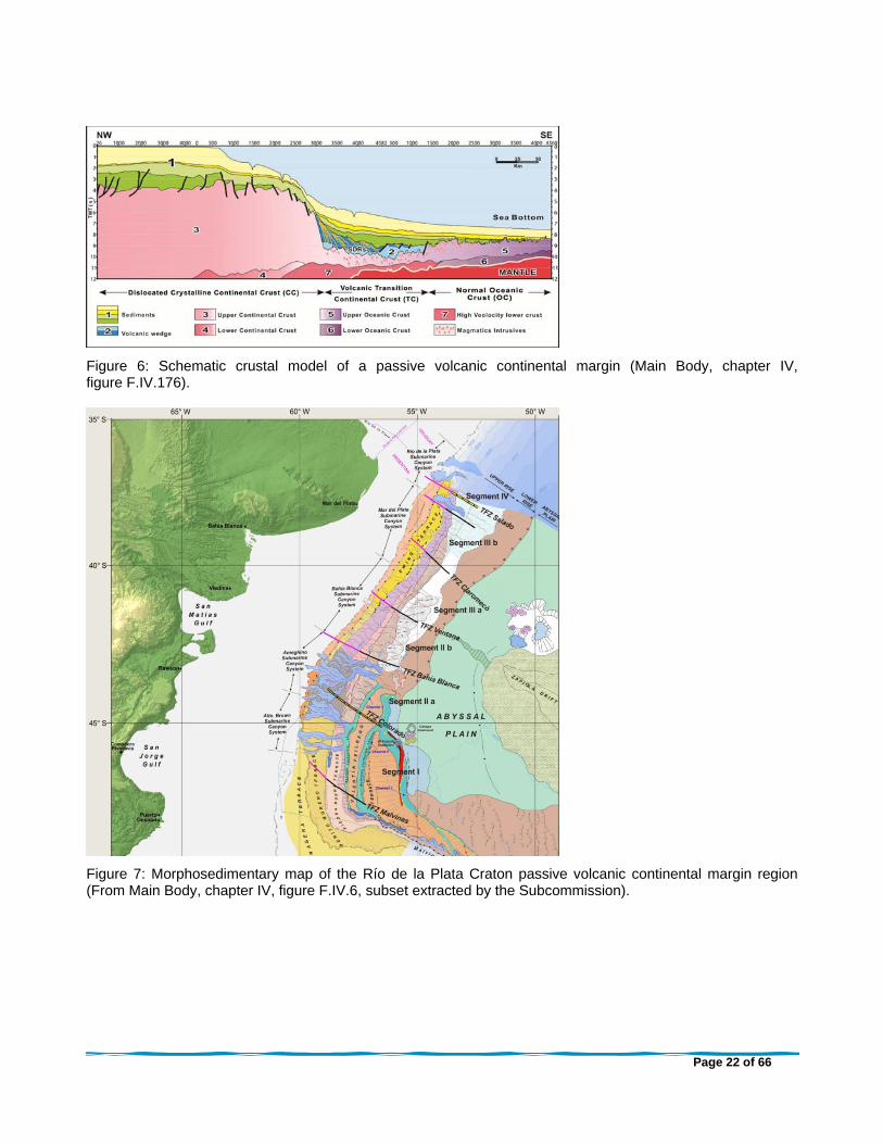
Figure 6: Schematic crustal model of a passive volcanic continental margin (Main Body, chapter IV, figure F.IV.176).
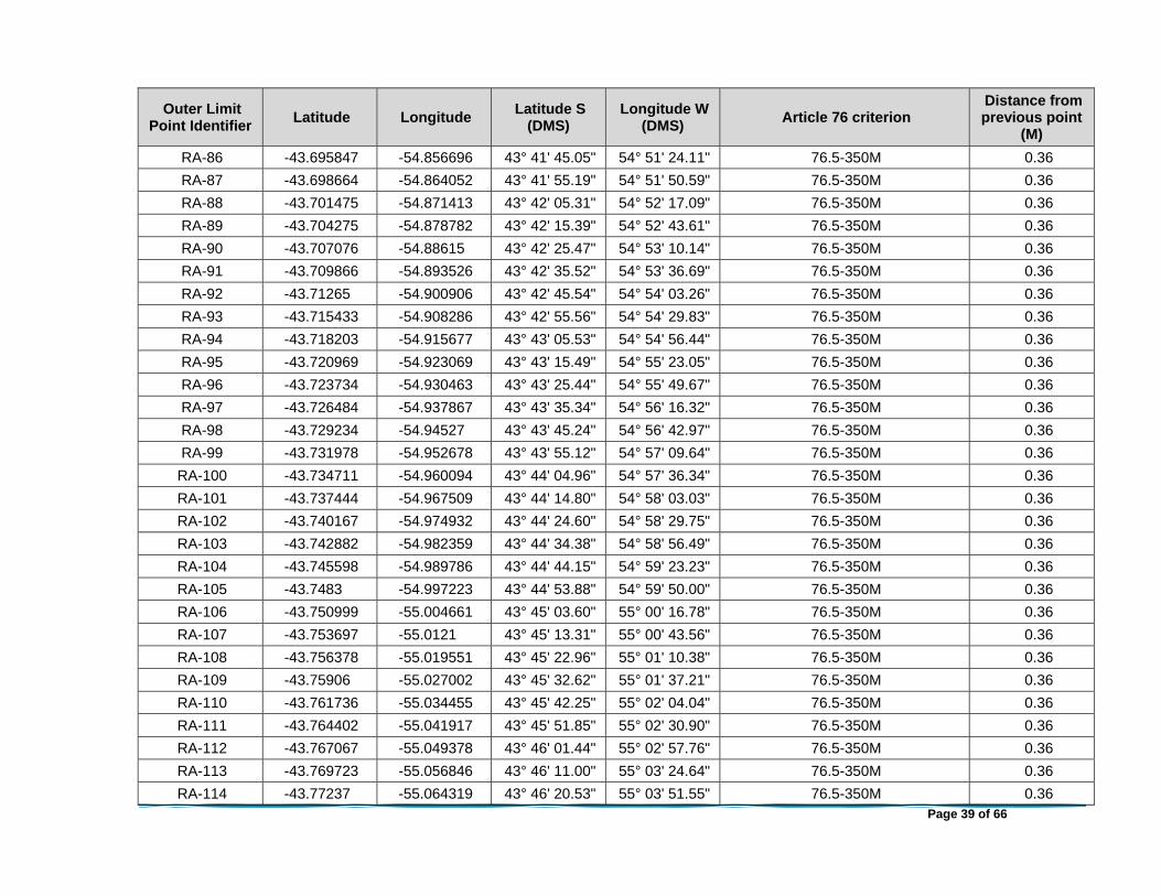
Figure 7: Morphosedimentary map of the Río de la Plata Craton passive volcanic continental margin region (From Main Body, chapter IV, figure F.IV.6, subset extracted by the Subcommission).

Page 23 of 66
Figure 8: Summary of the main morphosedimentary processes of each segment of the Río de la Plata Craton passive volcanic continental margin region (Main Body, chapter IV, figure F.IV.8).

Page 24 of 66
Figure 9: Map of the Río de la Plata Craton passive volcanic continental margin region, submitted by Argentina on 7 August 2012, FOS points determined by means of evidence to the contrary, green, FOS points determined by maximum change in the gradient, yellow (Presentation by Delegation 20 February 2013).

Page 25 of 66
Figure 10: Crustal structure of the passive volcanic margin based on seismic data and 2D gravity model (Main Body, chapter 5, figure F.V.137).
Figure 11: Schematic section of type E: Passive volcanic continental margin. COT: Continent-ocean transition (from Main Body, chapter II, figure F.II.4 adapted by Argentina from Figure 6.1.E. in the Guidelines).

Page 26 of 66
Figure 12: Gradient map showing the region of the base of the slope as determined based on morphology (yellow lines) and points of maximum change in the gradient (yellow points) compared to the location of the seaward-dipping reflector sequence (cyan shaded area) (Presentation by Delegation 20 February 2013).

Page 27 of 66
Figure 13: FOS points submitted and determined by means of evidence to the contrary, including the seismic lines, as of 7 November 2013 (Presentation by Delegation 7 November 2013).

Page 28 of 66
Figure 14: Sediment thickness map in the Río de la Plata Craton passive volcanic continental margin region and the FOS and sediment thickness formula points submitted by Argentina (Main Body, chapter VI, figure F.VI.1).
Figure 15: Example of a seismic profile, Seismic Line ARG-06, submitted for the determination of sediment thickness showing the continuity of the sedimentary layer between the top of basement and the seabed (From Main Body, chapter VI, figure F.VI.7A, subset extracted by the Subcommission).

Page 29 of 66
Figure 16: Outer edge of the continental margin in the Río de la Plata Craton passive volcanic continental margin region (Main Body, chapter VI, figure F.VI.46, subset extracted by the Subcommission).
Figure 17: Outer edge of the continental margin in the Río de la Plata Craton passive volcanic continental margin region (MAPA 2 (FOS+ST) submitted on 19 August 2015).

Page 30 of 66
Figure 18: Distance constraint line as contained in the Submission (From Main Body, chapter VI, figure F.VI.47, subset extracted by the Subcommission)

Page 31 of 66
Figure 19: The 2,500 m isobath contained in the Submission (Main Body, chapter III, figure F.III.D.87)
Figure 20: Verification of the 2,500 m isobath (Prepared by the Subcommission)

Page 32 of 66
Figure 21: Combined constraints line contained in the Submission (Main Body, chapter VI, figure F.VI.51, subset extracted by the Subcommission)
Figure 22: Outer limits of the continental shelf of the Río de la Plata Craton passive volcanic continental margin region contained in the Submission (MAPA 3 (RA+OL) submitted on 19 August 2015).

Page 33 of 66
Figure 23: The westernmost sector of the combined continental margin in the Tierra del Fuego margin region (From Main Body, chapter IV, figure F.IV.175, subset extracted by the Subcommission).
Figure 24: Outer edge of the continental margin in the Tierra del Fuego margin region as contained in the Submission (From Main Body, chapter VI, figure F.VI.23, subset extracted by the Subcommission).

Page 34 of 66
Figure 25: Distance constraint line in the Tierra del Fuego margin region as contained in the Submission (From Main Body, chapter VI, figure F.VI.49, subset extracted by the Subcommission).
Figure 26: Outer limits of the continental shelf in the Tierra del Fuego margin region as contained in the Submission (From Main Body, chapter VI, figure F.VI.54, subset extracted by the Subcommission).

Page 35 of 66
TABLES
FOS Consideration
FOS-02B – Line ARG-05 Supported – Maximum change in the gradient
FOS-03 – Line ARG-06 Supported - Evidence to the contrary
FOS-04 – Line ARG-08 Supported - Evidence to the contrary
FOS-05 – Line ARG-09 Supported - Evidence to the contrary
FOS-06 – Line ARG-11 Supported - Evidence to the contrary
FOS-07 – Line ARG-12 Supported - Evidence to the contrary
FOS-09 – Line ARG-19 Supported – Maximum change in the gradient
FOS-10 – Line ARG-20 Supported – Maximum change in the gradient
FOS-11 – Line ARG-22 Supported – Maximum change in the gradient
FOS-12 – Line ARG-23 Supported – Maximum change in the gradient
FOS-13 – Line ARG-25 Supported – Maximum change in the gradient
Table 1: FOS points, accepted by the Subcommission, used in the determination of the distance, and sediment thickness formulae lines in the Río de la Plata Craton passive volcanic continental margin region.
Sediment Thickness Point ID
Seismic Line
Shotpoint Sediment Thickness
(m) FOS Point
Seismic Line
Distance to FOS (km)
Sediment Thickness/ Distance to
FOS (%) ST-02B ARG-05B 1729 2,129 FOS-02B ARG-05 211.84 1.005
ST-03 ARG-06B 2586 1,990 FOS-03 ARG-06 198.29 1.004
ST-04 ARG-07 1789 1,942 FOS-04 ARG-08 192.32 1.010
ST-05 ARG-09B 4108 1,747 FOS-05 ARG-09 173.28 1.008
ST-06 ARG-11B 1545 1,808 FOS-06 ARG-11 180.73 1.000
ST-07 ARG-12B 2491 1,676 FOS-07 ARG-12 166.61 1.006
ST-08 ARG-15B 3048 1,638 FOS-09 ARG-19 163.67 1.001
ST-09 ARG-19B 773 1,458 FOS-09 ARG-19 144.64 1.008
ST-10 ARG-20B 101 1,990 FOS-10 ARG-20 134.44 1.480
ST-11 ARG-22B 101 1,772 FOS-11 ARG-22 67.55 2.623
ST-12 ARG-23B 2012 1,449 FOS-12 ARG-23 79.85 1.815
ST-13 ARG-25 6901 1,144 FOS-12 ARG-23 114.23 1.001
Table 2: Sediment thickness points, accepted by the Subcommission

Page 36 of 66
ANNEX I: COORDINATES FOR THE OUTER LIMITS OF THE CONTINENTAL SHELF FIXED POINTS BEYOND 200 M
Outer Limit Point Identifier
Latitude Longitude Latitude S
(DMS) Longitude W
(DMS) Article 76 criterion
Distance from previous point
(M)
RA-02B -40.274408 -51.394858 40° 16' 27.87" 51° 23' 41.49" 76.4(a)(i)-1% Sediment thickness N/A
RA-03 -40.627261 -51.881797 40° 37' 38.14" 51° 52' 54.47" 76.4(a)(i)-1% Sediment thickness 30.74
RA-04 -41.164028 -52.089506 41° 09' 50.50" 52° 05' 22.22" 76.4(a)(i)-1% Sediment thickness 33.55
RA-05 -41.525758 -52.564878 41° 31' 32.73" 52° 33' 53.56" 76.4(a)(i)-1% Sediment thickness 30.53
RA-06 -41.971594 -52.893094 41° 58' 17.74" 52° 53' 35.14" 76.4(a)(i)-1% Sediment thickness 30.53
RA-07 -42.359933 -53.334933 42° 21' 35.76" 53° 20' 05.76" 76.4(a)(i)-1% Sediment thickness 30.51
RA-08 -42.983289 -54.065003 42° 58' 59.84" 54° 03' 54.01" 76.4(a)(i)-1% Sediment thickness 49.42
RA-09 -43.472831 -54.294562 43° 28' 22.19" 54° 17' 40.42" 76.5-350M 31.04
RA-10 -43.47574 -54.301859 43° 28' 32.66" 54° 18' 06.69" 76.5-350M 0.36
RA-11 -43.478648 -54.309156 43° 28' 43.13" 54° 18' 32.96" 76.5-350M 0.36
RA-12 -43.48154 -54.316465 43° 28' 53.55" 54° 18' 59.27" 76.5-350M 0.36
RA-13 -43.484432 -54.323774 43° 29' 03.96" 54° 19' 25.59" 76.5-350M 0.36
RA-14 -43.48732 -54.331086 43° 29' 14.35" 54° 19' 51.91" 76.5-350M 0.36
RA-15 -43.490195 -54.338407 43° 29' 24.70" 54° 20' 18.27" 76.5-350M 0.36
RA-16 -43.493071 -54.345728 43° 29' 35.05" 54° 20' 44.62" 76.5-350M 0.36
RA-17 -43.495938 -54.353056 43° 29' 45.38" 54° 21' 11.00" 76.5-350M 0.36
RA-18 -43.498796 -54.360389 43° 29' 55.67" 54° 21' 37.40" 76.5-350M 0.36
RA-19 -43.501654 -54.367723 43° 30' 05.95" 54° 22' 03.80" 76.5-350M 0.36
RA-20 -43.5045 -54.375065 43° 30' 16.20" 54° 22' 30.23" 76.5-350M 0.36
RA-21 -43.507341 -54.382411 43° 30' 26.43" 54° 22' 56.68" 76.5-350M 0.36
RA-22 -43.510182 -54.389757 43° 30' 36.65" 54° 23' 23.12" 76.5-350M 0.36
RA-23 -43.513007 -54.397114 43° 30' 46.83" 54° 23' 49.61" 76.5-350M 0.36
RA-24 -43.515832 -54.404471 43° 30' 57.00" 54° 24' 16.10" 76.5-350M 0.36
RA-25 -43.518653 -54.411831 43° 31' 07.15" 54° 24' 42.59" 76.5-350M 0.36
RA-26 -43.52146 -54.419201 43° 31' 17.26" 54° 25' 09.12" 76.5-350M 0.36
RA-27 -43.524267 -54.426571 43° 31' 27.36" 54° 25' 35.65" 76.5-350M 0.36

Page 37 of 66
Outer Limit Point Identifier
Latitude Longitude Latitude S
(DMS) Longitude W
(DMS) Article 76 criterion
Distance from previous point
(M)
RA-28 -43.527067 -54.433946 43° 31' 37.44" 54° 26' 02.21" 76.5-350M 0.36
RA-29 -43.529858 -54.441327 43° 31' 47.49" 54° 26' 28.78" 76.5-350M 0.36
RA-30 -43.532649 -54.448708 43° 31' 57.54" 54° 26' 55.35" 76.5-350M 0.36
RA-31 -43.535427 -54.456098 43° 32' 07.54" 54° 27' 21.95" 76.5-350M 0.36
RA-32 -43.5382 -54.463492 43° 32' 17.52" 54° 27' 48.57" 76.5-350M 0.36
RA-33 -43.540973 -54.470885 43° 32' 27.50" 54° 28' 15.19" 76.5-350M 0.36
RA-34 -43.54373 -54.47829 43° 32' 37.43" 54° 28' 41.84" 76.5-350M 0.36
RA-35 -43.546487 -54.485695 43° 32' 47.35" 54° 29' 08.50" 76.5-350M 0.36
RA-36 -43.54924 -54.493102 43° 32' 57.26" 54° 29' 35.17" 76.5-350M 0.36
RA-37 -43.55198 -54.500519 43° 33' 07.13" 54° 30' 01.87" 76.5-350M 0.36
RA-38 -43.55472 -54.507935 43° 33' 16.99" 54° 30' 28.57" 76.5-350M 0.36
RA-39 -43.557452 -54.515357 43° 33' 26.83" 54° 30' 55.29" 76.5-350M 0.36
RA-40 -43.560175 -54.522785 43° 33' 36.63" 54° 31' 22.03" 76.5-350M 0.36
RA-41 -43.562898 -54.530213 43° 33' 46.43" 54° 31' 48.77" 76.5-350M 0.36
RA-42 -43.565945 -54.537397 43° 33' 57.40" 54° 32' 14.63" 76.5-350M 0.36
RA-43 -43.569028 -54.544554 43° 34' 08.50" 54° 32' 40.39" 76.5-350M 0.36
RA-44 -43.572104 -54.551716 43° 34' 19.58" 54° 33' 06.18" 76.5-350M 0.36
RA-45 -43.575172 -54.558885 43° 34' 30.62" 54° 33' 31.98" 76.5-350M 0.36
RA-46 -43.578239 -54.566054 43° 34' 41.66" 54° 33' 57.79" 76.5-350M 0.36
RA-47 -43.581295 -54.573232 43° 34' 52.66" 54° 34' 23.63" 76.5-350M 0.36
RA-48 -43.584346 -54.580414 43° 35' 03.64" 54° 34' 49.49" 76.5-350M 0.36
RA-49 -43.587396 -54.587596 43° 35' 14.63" 54° 35' 15.35" 76.5-350M 0.36
RA-50 -43.590431 -54.594791 43° 35' 25.55" 54° 35' 41.25" 76.5-350M 0.36
RA-51 -43.593466 -54.601985 43° 35' 36.48" 54° 36' 07.15" 76.5-350M 0.36
RA-52 -43.596497 -54.609183 43° 35' 47.39" 54° 36' 33.06" 76.5-350M 0.36
RA-53 -43.599515 -54.616391 43° 35' 58.25" 54° 36' 59.01" 76.5-350M 0.36
RA-54 -43.602533 -54.623598 43° 36' 09.12" 54° 37' 24.95" 76.5-350M 0.36
RA-55 -43.605543 -54.630812 43° 36' 19.96" 54° 37' 50.92" 76.5-350M 0.36
RA-56 -43.608545 -54.638032 43° 36' 30.76" 54° 38' 16.92" 76.5-350M 0.36

Page 38 of 66
Outer Limit Point Identifier
Latitude Longitude Latitude S
(DMS) Longitude W
(DMS) Article 76 criterion
Distance from previous point
(M)
RA-57 -43.611546 -54.645253 43° 36' 41.57" 54° 38' 42.91" 76.5-350M 0.36
RA-58 -43.614536 -54.652482 43° 36' 52.33" 54° 39' 08.93" 76.5-350M 0.36
RA-59 -43.617521 -54.659715 43° 37' 03.08" 54° 39' 34.97" 76.5-350M 0.36
RA-60 -43.620506 -54.666948 43° 37' 13.82" 54° 40' 01.01" 76.5-350M 0.36
RA-61 -43.623475 -54.674193 43° 37' 24.51" 54° 40' 27.09" 76.5-350M 0.36
RA-62 -43.626442 -54.681439 43° 37' 35.19" 54° 40' 53.18" 76.5-350M 0.36
RA-63 -43.629407 -54.688687 43° 37' 45.87" 54° 41' 19.27" 76.5-350M 0.36
RA-64 -43.632359 -54.695946 43° 37' 56.49" 54° 41' 45.40" 76.5-350M 0.36
RA-65 -43.63531 -54.703204 43° 38' 07.12" 54° 42' 11.53" 76.5-350M 0.36
RA-66 -43.638255 -54.710467 43° 38' 17.72" 54° 42' 37.68" 76.5-350M 0.36
RA-67 -43.641189 -54.717738 43° 38' 28.28" 54° 43' 03.86" 76.5-350M 0.36
RA-68 -43.644124 -54.725009 43° 38' 38.85" 54° 43' 30.03" 76.5-350M 0.36
RA-69 -43.647047 -54.732289 43° 38' 49.37" 54° 43' 56.24" 76.5-350M 0.36
RA-70 -43.649965 -54.739572 43° 38' 59.88" 54° 44' 22.46" 76.5-350M 0.36
RA-71 -43.652883 -54.746856 43° 39' 10.38" 54° 44' 48.68" 76.5-350M 0.36
RA-72 -43.655786 -54.75415 43° 39' 20.83" 54° 45' 14.94" 76.5-350M 0.36
RA-73 -43.658687 -54.761446 43° 39' 31.28" 54° 45' 41.20" 76.5-350M 0.36
RA-74 -43.661586 -54.768743 43° 39' 41.71" 54° 46' 07.48" 76.5-350M 0.36
RA-75 -43.664471 -54.776051 43° 39' 52.09" 54° 46' 33.79" 76.5-350M 0.36
RA-76 -43.667355 -54.783359 43° 40' 02.48" 54° 47' 00.09" 76.5-350M 0.36
RA-77 -43.670233 -54.790672 43° 40' 12.84" 54° 47' 26.42" 76.5-350M 0.36
RA-78 -43.6731 -54.797993 43° 40' 23.16" 54° 47' 52.77" 76.5-350M 0.36
RA-79 -43.675968 -54.805313 43° 40' 33.48" 54° 48' 19.13" 76.5-350M 0.36
RA-80 -43.678825 -54.812641 43° 40' 43.77" 54° 48' 45.51" 76.5-350M 0.36
RA-81 -43.681676 -54.819973 43° 40' 54.04" 54° 49' 11.90" 76.5-350M 0.36
RA-82 -43.684528 -54.827305 43° 41' 04.30" 54° 49' 38.30" 76.5-350M 0.36
RA-83 -43.687364 -54.834648 43° 41' 14.51" 54° 50' 04.74" 76.5-350M 0.36
RA-84 -43.690198 -54.841993 43° 41' 24.71" 54° 50' 31.18" 76.5-350M 0.36
RA-85 -43.693029 -54.849339 43° 41' 34.91" 54° 50' 57.62" 76.5-350M 0.36
Page 39 of 66
Outer Limit Point Identifier
Latitude Longitude Latitude S
(DMS) Longitude W
(DMS) Article 76 criterion
Distance from previous point
(M)
RA-86 -43.695847 -54.856696 43° 41' 45.05" 54° 51' 24.11" 76.5-350M 0.36
RA-87 -43.698664 -54.864052 43° 41' 55.19" 54° 51' 50.59" 76.5-350M 0.36
RA-88 -43.701475 -54.871413 43° 42' 05.31" 54° 52' 17.09" 76.5-350M 0.36
RA-89 -43.704275 -54.878782 43° 42' 15.39" 54° 52' 43.61" 76.5-350M 0.36
RA-90 -43.707076 -54.88615 43° 42' 25.47" 54° 53' 10.14" 76.5-350M 0.36
RA-91 -43.709866 -54.893526 43° 42' 35.52" 54° 53' 36.69" 76.5-350M 0.36
RA-92 -43.71265 -54.900906 43° 42' 45.54" 54° 54' 03.26" 76.5-350M 0.36
RA-93 -43.715433 -54.908286 43° 42' 55.56" 54° 54' 29.83" 76.5-350M 0.36
RA-94 -43.718203 -54.915677 43° 43' 05.53" 54° 54' 56.44" 76.5-350M 0.36
RA-95 -43.720969 -54.923069 43° 43' 15.49" 54° 55' 23.05" 76.5-350M 0.36
RA-96 -43.723734 -54.930463 43° 43' 25.44" 54° 55' 49.67" 76.5-350M 0.36
RA-97 -43.726484 -54.937867 43° 43' 35.34" 54° 56' 16.32" 76.5-350M 0.36
RA-98 -43.729234 -54.94527 43° 43' 45.24" 54° 56' 42.97" 76.5-350M 0.36
RA-99 -43.731978 -54.952678 43° 43' 55.12" 54° 57' 09.64" 76.5-350M 0.36
RA-100 -43.734711 -54.960094 43° 44' 04.96" 54° 57' 36.34" 76.5-350M 0.36
RA-101 -43.737444 -54.967509 43° 44' 14.80" 54° 58' 03.03" 76.5-350M 0.36
RA-102 -43.740167 -54.974932 43° 44' 24.60" 54° 58' 29.75" 76.5-350M 0.36
RA-103 -43.742882 -54.982359 43° 44' 34.38" 54° 58' 56.49" 76.5-350M 0.36
RA-104 -43.745598 -54.989786 43° 44' 44.15" 54° 59' 23.23" 76.5-350M 0.36
RA-105 -43.7483 -54.997223 43° 44' 53.88" 54° 59' 50.00" 76.5-350M 0.36
RA-106 -43.750999 -55.004661 43° 45' 03.60" 55° 00' 16.78" 76.5-350M 0.36
RA-107 -43.753697 -55.0121 43° 45' 13.31" 55° 00' 43.56" 76.5-350M 0.36
RA-108 -43.756378 -55.019551 43° 45' 22.96" 55° 01' 10.38" 76.5-350M 0.36
RA-109 -43.75906 -55.027002 43° 45' 32.62" 55° 01' 37.21" 76.5-350M 0.36
RA-110 -43.761736 -55.034455 43° 45' 42.25" 55° 02' 04.04" 76.5-350M 0.36
RA-111 -43.764402 -55.041917 43° 45' 51.85" 55° 02' 30.90" 76.5-350M 0.36
RA-112 -43.767067 -55.049378 43° 46' 01.44" 55° 02' 57.76" 76.5-350M 0.36
RA-113 -43.769723 -55.056846 43° 46' 11.00" 55° 03' 24.64" 76.5-350M 0.36
RA-114 -43.77237 -55.064319 43° 46' 20.53" 55° 03' 51.55" 76.5-350M 0.36

Page 40 of 66
Outer Limit Point Identifier
Latitude Longitude Latitude S
(DMS) Longitude W
(DMS) Article 76 criterion
Distance from previous point
(M)
RA-115 -43.775018 -55.071792 43° 46' 30.06" 55° 04' 18.45" 76.5-350M 0.36
RA-116 -43.777652 -55.079273 43° 46' 39.55" 55° 04' 45.39" 76.5-350M 0.36
RA-117 -43.780283 -55.086758 43° 46' 49.02" 55° 05' 12.33" 76.5-350M 0.36
RA-118 -43.782913 -55.094242 43° 46' 58.49" 55° 05' 39.27" 76.5-350M 0.36
RA-119 -43.785527 -55.101737 43° 47' 07.90" 55° 06' 06.26" 76.5-350M 0.36
RA-120 -43.78814 -55.109233 43° 47' 17.31" 55° 06' 33.24" 76.5-350M 0.36
RA-121 -43.79075 -55.116731 43° 47' 26.70" 55° 07' 00.23" 76.5-350M 0.36
RA-122 -43.793346 -55.124238 43° 47' 36.05" 55° 07' 27.26" 76.5-350M 0.36
RA-123 -43.795942 -55.131744 43° 47' 45.39" 55° 07' 54.28" 76.5-350M 0.36
RA-124 -43.79853 -55.139256 43° 47' 54.71" 55° 08' 21.32" 76.5-350M 0.36
RA-125 -43.80111 -55.146774 43° 48' 04.00" 55° 08' 48.39" 76.5-350M 0.36
RA-126 -43.803689 -55.154291 43° 48' 13.28" 55° 09' 15.45" 76.5-350M 0.36
RA-127 -43.806256 -55.161817 43° 48' 22.52" 55° 09' 42.54" 76.5-350M 0.36
RA-128 -43.808818 -55.169345 43° 48' 31.74" 55° 10' 09.64" 76.5-350M 0.36
RA-129 -43.811379 -55.176874 43° 48' 40.97" 55° 10' 36.75" 76.5-350M 0.36
RA-130 -43.813925 -55.184413 43° 48' 50.13" 55° 11' 03.89" 76.5-350M 0.36
RA-131 -43.81647 -55.191953 43° 48' 59.29" 55° 11' 31.03" 76.5-350M 0.36
RA-132 -43.819011 -55.199495 43° 49' 08.44" 55° 11' 58.18" 76.5-350M 0.36
RA-133 -43.821539 -55.207045 43° 49' 17.54" 55° 12' 25.36" 76.5-350M 0.36
RA-134 -43.824067 -55.214595 43° 49' 26.64" 55° 12' 52.54" 76.5-350M 0.36
RA-135 -43.826589 -55.222149 43° 49' 35.72" 55° 13' 19.74" 76.5-350M 0.36
RA-136 -43.829108 -55.229705 43° 49' 44.79" 55° 13' 46.94" 76.5-350M 0.36
RA-137 -43.831717 -55.237202 43° 49' 54.18" 55° 14' 13.93" 76.5-350M 0.36
RA-138 -43.834327 -55.244698 43° 50' 03.58" 55° 14' 40.91" 76.5-350M 0.36
RA-139 -43.836924 -55.252203 43° 50' 12.93" 55° 15' 07.93" 76.5-350M 0.36
RA-140 -43.839519 -55.259709 43° 50' 22.27" 55° 15' 34.95" 76.5-350M 0.36
RA-141 -43.842112 -55.267216 43° 50' 31.60" 55° 16' 01.98" 76.5-350M 0.36
RA-142 -43.84469 -55.274734 43° 50' 40.88" 55° 16' 29.04" 76.5-350M 0.36
RA-143 -43.847267 -55.282251 43° 50' 50.16" 55° 16' 56.11" 76.5-350M 0.36

Page 41 of 66
Outer Limit Point Identifier
Latitude Longitude Latitude S
(DMS) Longitude W
(DMS) Article 76 criterion
Distance from previous point
(M)
RA-144 -43.849839 -55.289773 43° 50' 59.42" 55° 17' 23.18" 76.5-350M 0.36
RA-145 -43.8524 -55.297301 43° 51' 08.64" 55° 17' 50.28" 76.5-350M 0.36
RA-146 -43.85496 -55.304829 43° 51' 17.86" 55° 18' 17.39" 76.5-350M 0.36
RA-147 -43.857511 -55.312364 43° 51' 27.04" 55° 18' 44.51" 76.5-350M 0.36
RA-148 -43.860054 -55.319903 43° 51' 36.20" 55° 19' 11.65" 76.5-350M 0.36
RA-149 -43.862597 -55.327442 43° 51' 45.35" 55° 19' 38.79" 76.5-350M 0.36
RA-150 -43.865127 -55.33499 43° 51' 54.46" 55° 20' 05.97" 76.5-350M 0.36
RA-151 -43.867654 -55.34254 43° 52' 03.55" 55° 20' 33.15" 76.5-350M 0.36
RA-152 -43.870179 -55.350091 43° 52' 12.65" 55° 21' 00.33" 76.5-350M 0.36
RA-153 -43.872688 -55.357652 43° 52' 21.68" 55° 21' 27.55" 76.5-350M 0.36
RA-154 -43.875197 -55.365212 43° 52' 30.71" 55° 21' 54.77" 76.5-350M 0.36
RA-155 -43.877701 -55.372776 43° 52' 39.72" 55° 22' 22.00" 76.5-350M 0.36
RA-156 -43.880193 -55.380348 43° 52' 48.69" 55° 22' 49.25" 76.5-350M 0.36
RA-157 -43.882684 -55.38792 43° 52' 57.66" 55° 23' 16.51" 76.5-350M 0.36
RA-158 -43.885167 -55.395496 43° 53' 06.60" 55° 23' 43.79" 76.5-350M 0.36
RA-159 -43.887642 -55.403079 43° 53' 15.51" 55° 24' 11.08" 76.5-350M 0.36
RA-160 -43.890116 -55.410661 43° 53' 24.42" 55° 24' 38.38" 76.5-350M 0.36
RA-161 -43.892578 -55.418251 43° 53' 33.28" 55° 25' 05.70" 76.5-350M 0.36
RA-162 -43.895035 -55.425844 43° 53' 42.13" 55° 25' 33.04" 76.5-350M 0.36
RA-163 -43.897492 -55.433436 43° 53' 50.97" 55° 26' 00.37" 76.5-350M 0.36
RA-164 -43.899933 -55.441039 43° 53' 59.76" 55° 26' 27.74" 76.5-350M 0.36
RA-165 -43.902373 -55.448642 43° 54' 08.54" 55° 26' 55.11" 76.5-350M 0.36
RA-166 -43.904809 -55.456248 43° 54' 17.31" 55° 27' 22.49" 76.5-350M 0.36
RA-167 -43.907232 -55.463862 43° 54' 26.03" 55° 27' 49.90" 76.5-350M 0.36
RA-168 -43.909654 -55.471475 43° 54' 34.76" 55° 28' 17.31" 76.5-350M 0.36
RA-169 -43.912069 -55.479093 43° 54' 43.45" 55° 28' 44.74" 76.5-350M 0.36
RA-170 -43.914474 -55.486717 43° 54' 52.11" 55° 29' 12.18" 76.5-350M 0.36
RA-171 -43.91688 -55.494341 43° 55' 00.77" 55° 29' 39.63" 76.5-350M 0.36
RA-172 -43.919273 -55.501972 43° 55' 09.38" 55° 30' 07.10" 76.5-350M 0.36

Page 42 of 66
Outer Limit Point Identifier
Latitude Longitude Latitude S
(DMS) Longitude W
(DMS) Article 76 criterion
Distance from previous point
(M)
RA-173 -43.921661 -55.509607 43° 55' 17.98" 55° 30' 34.58" 76.5-350M 0.36
RA-174 -43.924048 -55.517241 43° 55' 26.57" 55° 31' 02.07" 76.5-350M 0.36
RA-175 -43.926421 -55.524885 43° 55' 35.11" 55° 31' 29.59" 76.5-350M 0.36
RA-176 -43.928792 -55.532529 43° 55' 43.65" 55° 31' 57.10" 76.5-350M 0.36
RA-177 -43.93116 -55.540174 43° 55' 52.18" 55° 32' 24.63" 76.5-350M 0.36
RA-178 -43.931375 -55.540869 43° 55' 52.95" 55° 32' 27.13" 76.5-2,500 isobath+100M 0.03
RA-179 -43.941787 -55.542126 43° 56' 30.43" 55° 32' 31.65" 76.5-2,500 isobath+100M 0.63
RA-180 -43.947162 -55.542846 43° 56' 49.78" 55° 32' 34.25" 76.5-2,500 isobath+100M 0.32
RA-181 -43.952536 -55.543566 43° 57' 09.13" 55° 32' 36.84" 76.5-2,500 isobath+100M 0.32
RA-182 -43.958376 -55.544356 43° 57' 30.15" 55° 32' 39.68" 76.5-2,500 isobath+100M 0.35
RA-183 -43.963745 -55.545151 43° 57' 49.48" 55° 32' 42.54" 76.5-2,500 isobath+100M 0.32
RA-184 -43.969114 -55.545946 43° 58' 08.81" 55° 32' 45.41" 76.5-2,500 isobath+100M 0.32
RA-185 -43.974945 -55.546817 43° 58' 29.80" 55° 32' 48.54" 76.5-2,500 isobath+100M 0.35
RA-186 -43.985672 -55.548556 43° 59' 08.42" 55° 32' 54.80" 76.5-2,500 isobath+100M 0.65
RA-187 -43.991497 -55.549507 43° 59' 29.39" 55° 32' 58.23" 76.5-2,500 isobath+100M 0.35
RA-188 -43.996854 -55.550451 43° 59' 48.67" 55° 33' 01.62" 76.5-2,500 isobath+100M 0.32
RA-189 -44.002211 -55.551396 44° 00' 07.96" 55° 33' 05.03" 76.5-2,500 isobath+100M 0.32
RA-190 -44.008029 -55.552428 44° 00' 28.90" 55° 33' 08.74" 76.5-2,500 isobath+100M 0.35
RA-191 -44.013378 -55.553448 44° 00' 48.16" 55° 33' 12.41" 76.5-2,500 isobath+100M 0.32
RA-192 -44.018728 -55.554467 44° 01' 07.42" 55° 33' 16.08" 76.5-2,500 isobath+100M 0.32
RA-193 -44.024538 -55.555581 44° 01' 28.34" 55° 33' 20.09" 76.5-2,500 isobath+100M 0.35
RA-194 -44.029879 -55.556675 44° 01' 47.56" 55° 33' 24.03" 76.5-2,500 isobath+100M 0.32
RA-195 -44.035221 -55.557768 44° 02' 06.80" 55° 33' 27.96" 76.5-2,500 isobath+100M 0.32
RA-196 -44.041024 -55.558963 44° 02' 27.69" 55° 33' 32.27" 76.5-2,500 isobath+100M 0.35
RA-197 -44.046358 -55.560131 44° 02' 46.89" 55° 33' 36.47" 76.5-2,500 isobath+100M 0.32
RA-198 -44.051691 -55.561299 44° 03' 06.09" 55° 33' 40.68" 76.5-2,500 isobath+100M 0.32
RA-199 -44.057485 -55.562574 44° 03' 26.95" 55° 33' 45.27" 76.5-2,500 isobath+100M 0.35
RA-200 -44.06281 -55.563817 44° 03' 46.12" 55° 33' 49.74" 76.5-2,500 isobath+100M 0.32
RA-201 -44.068135 -55.565059 44° 04' 05.29" 55° 33' 54.21" 76.5-2,500 isobath+100M 0.32

Page 43 of 66
Outer Limit Point Identifier
Latitude Longitude Latitude S
(DMS) Longitude W
(DMS) Article 76 criterion
Distance from previous point
(M)
RA-202 -44.073918 -55.566416 44° 04' 26.10" 55° 33' 59.10" 76.5-2,500 isobath+100M 0.35
RA-203 -44.079234 -55.567734 44° 04' 45.24" 55° 34' 03.84" 76.5-2,500 isobath+100M 0.32
RA-204 -44.08455 -55.569052 44° 05' 04.38" 55° 34' 08.59" 76.5-2,500 isobath+100M 0.32
RA-205 -44.090323 -55.57049 44° 05' 25.16" 55° 34' 13.76" 76.5-2,500 isobath+100M 0.35
RA-206 -44.095629 -55.571881 44° 05' 44.26" 55° 34' 18.77" 76.5-2,500 isobath+100M 0.32
RA-207 -44.100935 -55.573274 44° 06' 03.37" 55° 34' 23.79" 76.5-2,500 isobath+100M 0.32
RA-208 -44.106697 -55.574792 44° 06' 24.11" 55° 34' 29.25" 76.5-2,500 isobath+100M 0.35
RA-209 -44.111992 -55.576257 44° 06' 43.17" 55° 34' 34.53" 76.5-2,500 isobath+100M 0.32
RA-210 -44.117288 -55.577723 44° 07' 02.24" 55° 34' 39.80" 76.5-2,500 isobath+100M 0.32
RA-211 -44.123039 -55.579322 44° 07' 22.94" 55° 34' 45.56" 76.5-2,500 isobath+100M 0.35
RA-212 -44.128324 -55.580862 44° 07' 41.97" 55° 34' 51.10" 76.5-2,500 isobath+100M 0.32
RA-213 -44.139348 -55.584082 44° 08' 21.65" 55° 35' 02.70" 76.5-2,500 isobath+100M 0.68
RA-214 -44.144621 -55.585697 44° 08' 40.64" 55° 35' 08.51" 76.5-2,500 isobath+100M 0.32
RA-215 -44.149894 -55.587312 44° 08' 59.62" 55° 35' 14.32" 76.5-2,500 isobath+100M 0.32
RA-216 -44.155621 -55.589072 44° 09' 20.24" 55° 35' 20.66" 76.5-2,500 isobath+100M 0.35
RA-217 -44.160882 -55.59076 44° 09' 39.18" 55° 35' 26.74" 76.5-2,500 isobath+100M 0.32
RA-218 -44.166143 -55.592448 44° 09' 58.11" 55° 35' 32.81" 76.5-2,500 isobath+100M 0.32
RA-219 -44.171856 -55.594288 44° 10' 18.68" 55° 35' 39.44" 76.5-2,500 isobath+100M 0.35
RA-220 -44.177104 -55.596051 44° 10' 37.57" 55° 35' 45.78" 76.5-2,500 isobath+100M 0.32
RA-221 -44.182353 -55.597813 44° 10' 56.47" 55° 35' 52.13" 76.5-2,500 isobath+100M 0.32
RA-222 -44.188054 -55.599735 44° 11' 16.99" 55° 35' 59.05" 76.5-2,500 isobath+100M 0.35
RA-223 -44.193289 -55.601571 44° 11' 35.84" 55° 36' 05.66" 76.5-2,500 isobath+100M 0.32
RA-224 -44.198525 -55.603408 44° 11' 54.69" 55° 36' 12.27" 76.5-2,500 isobath+100M 0.32
RA-225 -44.204212 -55.605409 44° 12' 15.16" 55° 36' 19.47" 76.5-2,500 isobath+100M 0.35
RA-226 -44.209434 -55.607319 44° 12' 33.96" 55° 36' 26.35" 76.5-2,500 isobath+100M 0.32
RA-227 -44.214656 -55.609229 44° 12' 52.76" 55° 36' 33.22" 76.5-2,500 isobath+100M 0.32
RA-228 -44.220326 -55.61131 44° 13' 13.17" 55° 36' 40.72" 76.5-2,500 isobath+100M 0.35
RA-229 -44.225534 -55.613293 44° 13' 31.92" 55° 36' 47.85" 76.5-2,500 isobath+100M 0.32
RA-230 -44.230742 -55.615276 44° 13' 50.67" 55° 36' 54.99" 76.5-2,500 isobath+100M 0.32

Page 44 of 66
Outer Limit Point Identifier
Latitude Longitude Latitude S
(DMS) Longitude W
(DMS) Article 76 criterion
Distance from previous point
(M)
RA-231 -44.235988 -55.617274 44° 14' 09.56" 55° 37' 02.19" 76.5-2,500 isobath+100M 0.33
RA-232 -44.241186 -55.619307 44° 14' 28.27" 55° 37' 09.51" 76.5-2,500 isobath+100M 0.32
RA-233 -44.250509 -55.621362 44° 15' 01.83" 55° 37' 16.90" 76.5-2,500 isobath+100M 0.57
RA-234 -44.256301 -55.622644 44° 15' 22.68" 55° 37' 21.52" 76.5-2,500 isobath+100M 0.35
RA-235 -44.261626 -55.623889 44° 15' 41.85" 55° 37' 26.00" 76.5-2,500 isobath+100M 0.32
RA-236 -44.266951 -55.625134 44° 16' 01.02" 55° 37' 30.48" 76.5-2,500 isobath+100M 0.32
RA-237 -44.272734 -55.626493 44° 16' 21.84" 55° 37' 35.37" 76.5-2,500 isobath+100M 0.35
RA-238 -44.278049 -55.627814 44° 16' 40.98" 55° 37' 40.13" 76.5-2,500 isobath+100M 0.32
RA-239 -44.283365 -55.629135 44° 17' 00.11" 55° 37' 44.89" 76.5-2,500 isobath+100M 0.32
RA-240 -44.289139 -55.630576 44° 17' 20.90" 55° 37' 50.07" 76.5-2,500 isobath+100M 0.35
RA-241 -44.294445 -55.631971 44° 17' 40.00" 55° 37' 55.10" 76.5-2,500 isobath+100M 0.32
RA-242 -44.299751 -55.633366 44° 17' 59.10" 55° 38' 00.12" 76.5-2,500 isobath+100M 0.32
RA-243 -44.305513 -55.634887 44° 18' 19.85" 55° 38' 05.59" 76.5-2,500 isobath+100M 0.35
RA-244 -44.310808 -55.636357 44° 18' 38.91" 55° 38' 10.89" 76.5-2,500 isobath+100M 0.32
RA-245 -44.316104 -55.637827 44° 18' 57.97" 55° 38' 16.18" 76.5-2,500 isobath+100M 0.32
RA-246 -44.32714 -55.640974 44° 19' 37.70" 55° 38' 27.51" 76.5-2,500 isobath+100M 0.68
RA-247 -44.332425 -55.642519 44° 19' 56.73" 55° 38' 33.07" 76.5-2,500 isobath+100M 0.32
RA-248 -44.338164 -55.644202 44° 20' 17.39" 55° 38' 39.13" 76.5-2,500 isobath+100M 0.35
RA-249 -44.343437 -55.64582 44° 20' 36.37" 55° 38' 44.95" 76.5-2,500 isobath+100M 0.32
RA-250 -44.34871 -55.647439 44° 20' 55.36" 55° 38' 50.78" 76.5-2,500 isobath+100M 0.32
RA-251 -44.354438 -55.649204 44° 21' 15.98" 55° 38' 57.13" 76.5-2,500 isobath+100M 0.35
RA-252 -44.3597 -55.650897 44° 21' 34.92" 55° 39' 03.23" 76.5-2,500 isobath+100M 0.32
RA-253 -44.364961 -55.65259 44° 21' 53.86" 55° 39' 09.32" 76.5-2,500 isobath+100M 0.32
RA-254 -44.370674 -55.654436 44° 22' 14.43" 55° 39' 15.97" 76.5-2,500 isobath+100M 0.35
RA-255 -44.375923 -55.656202 44° 22' 33.32" 55° 39' 22.33" 76.5-2,500 isobath+100M 0.32
RA-256 -44.381172 -55.657969 44° 22' 52.22" 55° 39' 28.69" 76.5-2,500 isobath+100M 0.32
RA-257 -44.387104 -55.659975 44° 23' 13.57" 55° 39' 35.91" 76.5-2,500 isobath+100M 0.37
RA-258 -44.392342 -55.661805 44° 23' 32.43" 55° 39' 42.50" 76.5-2,500 isobath+100M 0.32
RA-259 -44.39758 -55.663634 44° 23' 51.29" 55° 39' 49.08" 76.5-2,500 isobath+100M 0.32

Page 45 of 66
Outer Limit Point Identifier
Latitude Longitude Latitude S
(DMS) Longitude W
(DMS) Article 76 criterion
Distance from previous point
(M)
RA-260 -44.408131 -55.665385 44° 24' 29.27" 55° 39' 55.39" 76.5-2,500 isobath+100M 0.64
RA-261 -44.413487 -55.666333 44° 24' 48.55" 55° 39' 58.80" 76.5-2,500 isobath+100M 0.32
RA-262 -44.418844 -55.667282 44° 25' 07.84" 55° 40' 02.22" 76.5-2,500 isobath+100M 0.32
RA-263 -44.424661 -55.668318 44° 25' 28.78" 55° 40' 05.94" 76.5-2,500 isobath+100M 0.35
RA-264 -44.43001 -55.669342 44° 25' 48.04" 55° 40' 09.63" 76.5-2,500 isobath+100M 0.32
RA-265 -44.43536 -55.670366 44° 26' 07.30" 55° 40' 13.32" 76.5-2,500 isobath+100M 0.32
RA-266 -44.44117 -55.671484 44° 26' 28.21" 55° 40' 17.34" 76.5-2,500 isobath+100M 0.35
RA-267 -44.446512 -55.672582 44° 26' 47.44" 55° 40' 21.30" 76.5-2,500 isobath+100M 0.32
RA-268 -44.451853 -55.67368 44° 27' 06.67" 55° 40' 25.25" 76.5-2,500 isobath+100M 0.32
RA-269 -44.457656 -55.67488 44° 27' 27.56" 55° 40' 29.57" 76.5-2,500 isobath+100M 0.35
RA-270 -44.46299 -55.676053 44° 27' 46.76" 55° 40' 33.79" 76.5-2,500 isobath+100M 0.32
RA-271 -44.468324 -55.677227 44° 28' 05.97" 55° 40' 38.02" 76.5-2,500 isobath+100M 0.32
RA-272 -44.474094 -55.678503 44° 28' 26.74" 55° 40' 42.61" 76.5-2,500 isobath+100M 0.35
RA-273 -44.479419 -55.679752 44° 28' 45.91" 55° 40' 47.11" 76.5-2,500 isobath+100M 0.32
RA-274 -44.484743 -55.681001 44° 29' 05.07" 55° 40' 51.60" 76.5-2,500 isobath+100M 0.32
RA-275 -44.490068 -55.68225 44° 29' 24.24" 55° 40' 56.10" 76.5-2,500 isobath+100M 0.32
RA-276 -44.498437 -55.682586 44° 29' 54.37" 55° 40' 57.31" 76.5-2,500 isobath+100M 0.5
RA-277 -44.503833 -55.682856 44° 30' 13.80" 55° 40' 58.28" 76.5-2,500 isobath+100M 0.32
RA-278 -44.509229 -55.683126 44° 30' 33.22" 55° 40' 59.25" 76.5-2,500 isobath+100M 0.32
RA-279 -44.515091 -55.683425 44° 30' 54.33" 55° 41' 00.33" 76.5-2,500 isobath+100M 0.35
RA-280 -44.525878 -55.684117 44° 31' 33.16" 55° 41' 02.82" 76.5-2,500 isobath+100M 0.65
RA-281 -44.531738 -55.684499 44° 31' 54.26" 55° 41' 04.20" 76.5-2,500 isobath+100M 0.35
RA-282 -44.537129 -55.68492 44° 32' 13.66" 55° 41' 05.71" 76.5-2,500 isobath+100M 0.32
RA-283 -44.54252 -55.685341 44° 32' 33.07" 55° 41' 07.23" 76.5-2,500 isobath+100M 0.32
RA-284 -44.548375 -55.685805 44° 32' 54.15" 55° 41' 08.90" 76.5-2,500 isobath+100M 0.35
RA-285 -44.553763 -55.686302 44° 33' 13.55" 55° 41' 10.69" 76.5-2,500 isobath+100M 0.32
RA-286 -44.55915 -55.686798 44° 33' 32.94" 55° 41' 12.47" 76.5-2,500 isobath+100M 0.32
RA-287 -44.565003 -55.687344 44° 33' 54.01" 55° 41' 14.44" 76.5-2,500 isobath+100M 0.35
RA-288 -44.570387 -55.687916 44° 34' 13.39" 55° 41' 16.50" 76.5-2,500 isobath+100M 0.32

Page 46 of 66
Outer Limit Point Identifier
Latitude Longitude Latitude S
(DMS) Longitude W
(DMS) Article 76 criterion
Distance from previous point
(M)
RA-289 -44.57577 -55.688489 44° 34' 32.77" 55° 41' 18.56" 76.5-2,500 isobath+100M 0.32
RA-290 -44.581618 -55.689118 44° 34' 53.82" 55° 41' 20.82" 76.5-2,500 isobath+100M 0.35
RA-291 -44.586997 -55.689765 44° 35' 13.19" 55° 41' 23.15" 76.5-2,500 isobath+100M 0.32
RA-292 -44.592377 -55.690413 44° 35' 32.56" 55° 41' 25.49" 76.5-2,500 isobath+100M 0.32
RA-293 -44.59822 -55.691123 44° 35' 53.59" 55° 41' 28.04" 76.5-2,500 isobath+100M 0.35
RA-294 -44.603594 -55.691846 44° 36' 12.94" 55° 41' 30.65" 76.5-2,500 isobath+100M 0.32
RA-295 -44.608969 -55.692569 44° 36' 32.29" 55° 41' 33.25" 76.5-2,500 isobath+100M 0.32
RA-296 -44.614806 -55.693362 44° 36' 53.30" 55° 41' 36.10" 76.5-2,500 isobath+100M 0.35
RA-297 -44.620175 -55.694161 44° 37' 12.63" 55° 41' 38.98" 76.5-2,500 isobath+100M 0.32
RA-298 -44.625544 -55.69496 44° 37' 31.96" 55° 41' 41.86" 76.5-2,500 isobath+100M 0.32
RA-299 -44.631376 -55.695834 44° 37' 52.95" 55° 41' 45.00" 76.5-2,500 isobath+100M 0.35
RA-300 -44.63674 -55.696709 44° 38' 12.26" 55° 41' 48.15" 76.5-2,500 isobath+100M 0.32
RA-301 -44.642103 -55.697585 44° 38' 31.57" 55° 41' 51.31" 76.5-2,500 isobath+100M 0.32
RA-302 -44.647927 -55.698542 44° 38' 52.54" 55° 41' 54.75" 76.5-2,500 isobath+100M 0.35
RA-303 -44.653284 -55.699492 44° 39' 11.82" 55° 41' 58.17" 76.5-2,500 isobath+100M 0.32
RA-304 -44.65864 -55.700441 44° 39' 31.10" 55° 42' 01.59" 76.5-2,500 isobath+100M 0.32
RA-305 -44.664458 -55.70148 44° 39' 52.05" 55° 42' 05.33" 76.5-2,500 isobath+100M 0.35
RA-306 -44.669807 -55.702505 44° 40' 11.31" 55° 42' 09.02" 76.5-2,500 isobath+100M 0.32
RA-307 -44.675157 -55.703531 44° 40' 30.57" 55° 42' 12.71" 76.5-2,500 isobath+100M 0.32
RA-308 -44.680968 -55.704653 44° 40' 51.48" 55° 42' 16.75" 76.5-2,500 isobath+100M 0.35
RA-309 -44.686309 -55.705754 44° 41' 10.71" 55° 42' 20.71" 76.5-2,500 isobath+100M 0.32
RA-310 -44.691651 -55.706856 44° 41' 29.94" 55° 42' 24.68" 76.5-2,500 isobath+100M 0.32
RA-311 -44.697452 -55.708059 44° 41' 50.83" 55° 42' 29.01" 76.5-2,500 isobath+100M 0.35
RA-312 -44.702785 -55.709236 44° 42' 10.03" 55° 42' 33.25" 76.5-2,500 isobath+100M 0.32
RA-313 -44.713912 -55.711697 44° 42' 50.08" 55° 42' 42.11" 76.5-2,500 isobath+100M 0.68
RA-314 -44.719237 -55.712949 44° 43' 09.25" 55° 42' 46.62" 76.5-2,500 isobath+100M 0.32
RA-315 -44.724562 -55.7142 44° 43' 28.42" 55° 42' 51.12" 76.5-2,500 isobath+100M 0.32
RA-316 -44.730074 -55.715498 44° 43' 48.27" 55° 42' 55.79" 76.5-2,500 isobath+100M 0.34
RA-317 -44.740548 -55.717965 44° 44' 25.97" 55° 43' 04.67" 76.5-2,500 isobath+100M 0.64

Page 47 of 66
Outer Limit Point Identifier
Latitude Longitude Latitude S
(DMS) Longitude W
(DMS) Article 76 criterion
Distance from previous point
(M)
RA-318 -44.746331 -55.719333 44° 44' 46.79" 55° 43' 09.60" 76.5-2,500 isobath+100M 0.35
RA-319 -44.751647 -55.720661 44° 45' 05.93" 55° 43' 14.38" 76.5-2,500 isobath+100M 0.32
RA-320 -44.756963 -55.721989 44° 45' 25.07" 55° 43' 19.16" 76.5-2,500 isobath+100M 0.32
RA-321 -44.762736 -55.723438 44° 45' 45.85" 55° 43' 24.38" 76.5-2,500 isobath+100M 0.35
RA-322 -44.768042 -55.72484 44° 46' 04.95" 55° 43' 29.42" 76.5-2,500 isobath+100M 0.32
RA-323 -44.773348 -55.726243 44° 46' 24.05" 55° 43' 34.47" 76.5-2,500 isobath+100M 0.32
RA-324 -44.77911 -55.727774 44° 46' 44.80" 55° 43' 39.99" 76.5-2,500 isobath+100M 0.35
RA-325 -44.784406 -55.729252 44° 47' 03.86" 55° 43' 45.31" 76.5-2,500 isobath+100M 0.32
RA-326 -44.789701 -55.73073 44° 47' 22.92" 55° 43' 50.63" 76.5-2,500 isobath+100M 0.32
RA-327 -44.799955 -55.733663 44° 47' 59.84" 55° 44' 01.19" 76.5-2,500 isobath+100M 0.63
RA-328 -44.80524 -55.735215 44° 48' 18.86" 55° 44' 06.77" 76.5-2,500 isobath+100M 0.32
RA-329 -44.810525 -55.736767 44° 48' 37.89" 55° 44' 12.36" 76.5-2,500 isobath+100M 0.32
RA-330 -44.818755 -55.739223 44° 49' 07.52" 55° 44' 21.20" 76.5-2,500 isobath+100M 0.5
RA-331 -44.824029 -55.740851 44° 49' 26.50" 55° 44' 27.06" 76.5-2,500 isobath+100M 0.32
RA-332 -44.829302 -55.742479 44° 49' 45.49" 55° 44' 32.92" 76.5-2,500 isobath+100M 0.32
RA-333 -44.835029 -55.744255 44° 50' 06.10" 55° 44' 39.32" 76.5-2,500 isobath+100M 0.35
RA-334 -44.840291 -55.745958 44° 50' 25.05" 55° 44' 45.45" 76.5-2,500 isobath+100M 0.32
RA-335 -44.845552 -55.747662 44° 50' 43.99" 55° 44' 51.58" 76.5-2,500 isobath+100M 0.32
RA-336 -44.851265 -55.749519 44° 51' 04.55" 55° 44' 58.27" 76.5-2,500 isobath+100M 0.35
RA-337 -44.856514 -55.751297 44° 51' 23.45" 55° 45' 04.67" 76.5-2,500 isobath+100M 0.32
RA-338 -44.861763 -55.753076 44° 51' 42.35" 55° 45' 11.07" 76.5-2,500 isobath+100M 0.32
RA-339 -44.871818 -55.756553 44° 52' 18.54" 55° 45' 23.59" 76.5-2,500 isobath+100M 0.62
RA-340 -44.877054 -55.758404 44° 52' 37.39" 55° 45' 30.25" 76.5-2,500 isobath+100M 0.32
RA-341 -44.88229 -55.760255 44° 52' 56.24" 55° 45' 36.92" 76.5-2,500 isobath+100M 0.32
RA-342 -44.888251 -55.761846 44° 53' 17.70" 55° 45' 42.65" 76.5-2,500 isobath+100M 0.36
RA-343 -44.894013 -55.763391 44° 53' 38.45" 55° 45' 48.21" 76.5-2,500 isobath+100M 0.35
RA-344 -44.899308 -55.764871 44° 53' 57.51" 55° 45' 53.54" 76.5-2,500 isobath+100M 0.32
RA-345 -44.904604 -55.766352 44° 54' 16.57" 55° 45' 58.87" 76.5-2,500 isobath+100M 0.32
RA-346 -44.910354 -55.767967 44° 54' 37.27" 55° 46' 04.68" 76.5-2,500 isobath+100M 0.35

Page 48 of 66
Outer Limit Point Identifier
Latitude Longitude Latitude S
(DMS) Longitude W
(DMS) Article 76 criterion
Distance from previous point
(M)
RA-347 -44.915639 -55.769521 44° 54' 56.30" 55° 46' 10.28" 76.5-2,500 isobath+100M 0.32
RA-348 -44.926663 -55.772772 44° 55' 35.99" 55° 46' 21.98" 76.5-2,500 isobath+100M 0.68
RA-349 -44.931936 -55.774403 44° 55' 54.97" 55° 46' 27.85" 76.5-2,500 isobath+100M 0.32
RA-350 -44.93721 -55.776034 44° 56' 13.96" 55° 46' 33.72" 76.5-2,500 isobath+100M 0.32
RA-351 -44.942937 -55.777812 44° 56' 34.57" 55° 46' 40.12" 76.5-2,500 isobath+100M 0.35
RA-352 -44.948198 -55.779518 44° 56' 53.51" 55° 46' 46.26" 76.5-2,500 isobath+100M 0.32
RA-353 -44.953459 -55.781225 44° 57' 12.45" 55° 46' 52.41" 76.5-2,500 isobath+100M 0.32
RA-354 -44.959173 -55.783085 44° 57' 33.02" 55° 46' 59.11" 76.5-2,500 isobath+100M 0.35
RA-355 -44.964422 -55.784865 44° 57' 51.92" 55° 47' 05.51" 76.5-2,500 isobath+100M 0.32
RA-356 -44.969671 -55.786646 44° 58' 10.82" 55° 47' 11.93" 76.5-2,500 isobath+100M 0.32
RA-357 -44.975372 -55.788587 44° 58' 31.34" 55° 47' 18.91" 76.5-2,500 isobath+100M 0.35
RA-358 -44.980608 -55.790442 44° 58' 50.19" 55° 47' 25.59" 76.5-2,500 isobath+100M 0.32
RA-359 -44.985844 -55.792298 44° 59' 09.04" 55° 47' 32.27" 76.5-2,500 isobath+100M 0.32
RA-360 -44.9963 -55.796081 44° 59' 46.68" 55° 47' 45.89" 76.5-2,500 isobath+100M 0.65
RA-361 -45.001522 -55.798011 45° 00' 05.48" 55° 47' 52.84" 76.5-2,500 isobath+100M 0.32
RA-362 -45.006745 -55.799941 45° 00' 24.28" 55° 47' 59.79" 76.5-2,500 isobath+100M 0.32
RA-363 -45.012417 -55.800869 45° 00' 44.70" 55° 48' 03.13" 76.5-2,500 isobath+100M 0.34
RA-364 -45.01778 -55.801747 45° 01' 04.01" 55° 48' 06.29" 76.5-2,500 isobath+100M 0.32
RA-365 -45.027948 -55.803478 45° 01' 40.61" 55° 48' 12.52" 76.5-2,500 isobath+100M 0.61
RA-366 -45.033305 -55.804429 45° 01' 59.90" 55° 48' 15.94" 76.5-2,500 isobath+100M 0.32
RA-367 -45.038662 -55.805381 45° 02' 19.18" 55° 48' 19.37" 76.5-2,500 isobath+100M 0.32
RA-368 -45.047979 -55.806344 45° 02' 52.72" 55° 48' 22.84" 76.5-2,500 isobath+100M 0.56
RA-369 -45.053363 -55.806918 45° 03' 12.11" 55° 48' 24.90" 76.5-2,500 isobath+100M 0.32
RA-370 -45.059209 -55.807547 45° 03' 33.15" 55° 48' 27.17" 76.5-2,500 isobath+100M 0.35
RA-371 -45.064588 -55.808196 45° 03' 52.52" 55° 48' 29.51" 76.5-2,500 isobath+100M 0.32
RA-372 -45.069968 -55.808845 45° 04' 11.88" 55° 48' 31.84" 76.5-2,500 isobath+100M 0.32
RA-373 -45.07581 -55.809557 45° 04' 32.92" 55° 48' 34.41" 76.5-2,500 isobath+100M 0.35
RA-374 -45.081185 -55.810283 45° 04' 52.27" 55° 48' 37.02" 76.5-2,500 isobath+100M 0.32
RA-375 -45.086559 -55.811009 45° 05' 11.61" 55° 48' 39.63" 76.5-2,500 isobath+100M 0.32

Page 49 of 66
Outer Limit Point Identifier
Latitude Longitude Latitude S
(DMS) Longitude W
(DMS) Article 76 criterion
Distance from previous point
(M)
RA-376 -45.092397 -55.811805 45° 05' 32.63" 55° 48' 42.50" 76.5-2,500 isobath+100M 0.35
RA-377 -45.097766 -55.812607 45° 05' 51.96" 55° 48' 45.39" 76.5-2,500 isobath+100M 0.32
RA-378 -45.103135 -55.813409 45° 06' 11.29" 55° 48' 48.27" 76.5-2,500 isobath+100M 0.32
RA-379 -45.108966 -55.814286 45° 06' 32.28" 55° 48' 51.43" 76.5-2,500 isobath+100M 0.35
RA-380 -45.114329 -55.815164 45° 06' 51.58" 55° 48' 54.59" 76.5-2,500 isobath+100M 0.32
RA-381 -45.119692 -55.816043 45° 07' 10.89" 55° 48' 57.75" 76.5-2,500 isobath+100M 0.32
RA-382 -45.130873 -55.817958 45° 07' 51.14" 55° 49' 04.65" 76.5-2,500 isobath+100M 0.68
RA-383 -45.136229 -55.818913 45° 08' 10.42" 55° 49' 08.09" 76.5-2,500 isobath+100M 0.32
RA-384 -45.142047 -55.819957 45° 08' 31.37" 55° 49' 11.85" 76.5-2,500 isobath+100M 0.35
RA-385 -45.147397 -55.820987 45° 08' 50.63" 55° 49' 15.55" 76.5-2,500 isobath+100M 0.32
RA-386 -45.152746 -55.822017 45° 09' 09.89" 55° 49' 19.26" 76.5-2,500 isobath+100M 0.32
RA-387 -45.158556 -55.823143 45° 09' 30.80" 55° 49' 23.31" 76.5-2,500 isobath+100M 0.35
RA-388 -45.163898 -55.824251 45° 09' 50.03" 55° 49' 27.30" 76.5-2,500 isobath+100M 0.32
RA-389 -45.16924 -55.825358 45° 10' 09.26" 55° 49' 31.29" 76.5-2,500 isobath+100M 0.32
RA-390 -45.175041 -55.826568 45° 10' 30.15" 55° 49' 35.64" 76.5-2,500 isobath+100M 0.35
RA-391 -45.180374 -55.82775 45° 10' 49.35" 55° 49' 39.90" 76.5-2,500 isobath+100M 0.32
RA-392 -45.185708 -55.828933 45° 11' 08.55" 55° 49' 44.16" 76.5-2,500 isobath+100M 0.32
RA-393 -45.1915 -55.830224 45° 11' 29.40" 55° 49' 48.81" 76.5-2,500 isobath+100M 0.35
RA-394 -45.196825 -55.831482 45° 11' 48.57" 55° 49' 53.34" 76.5-2,500 isobath+100M 0.32
RA-395 -45.20215 -55.832741 45° 12' 07.74" 55° 49' 57.87" 76.5-2,500 isobath+100M 0.32
RA-396 -45.207933 -55.834115 45° 12' 28.56" 55° 50' 02.81" 76.5-2,500 isobath+100M 0.35
RA-397 -45.213249 -55.835451 45° 12' 47.70" 55° 50' 07.62" 76.5-2,500 isobath+100M 0.32
RA-398 -45.218564 -55.836786 45° 13' 06.83" 55° 50' 12.43" 76.5-2,500 isobath+100M 0.32
RA-399 -45.224339 -55.838243 45° 13' 27.62" 55° 50' 17.67" 76.5-2,500 isobath+100M 0.35
RA-400 -45.229645 -55.839654 45° 13' 46.72" 55° 50' 22.75" 76.5-2,500 isobath+100M 0.32
RA-401 -45.234951 -55.841065 45° 14' 05.82" 55° 50' 27.83" 76.5-2,500 isobath+100M 0.32
RA-402 -45.240713 -55.842604 45° 14' 26.57" 55° 50' 33.37" 76.5-2,500 isobath+100M 0.35
RA-403 -45.246008 -55.844091 45° 14' 45.63" 55° 50' 38.73" 76.5-2,500 isobath+100M 0.32
RA-404 -45.251304 -55.845577 45° 15' 04.69" 55° 50' 44.08" 76.5-2,500 isobath+100M 0.32

Page 50 of 66
Outer Limit Point Identifier
Latitude Longitude Latitude S
(DMS) Longitude W
(DMS) Article 76 criterion
Distance from previous point
(M)
RA-405 -45.257055 -55.847199 45° 15' 25.40" 55° 50' 49.92" 76.5-2,500 isobath+100M 0.35
RA-406 -45.26234 -55.848761 45° 15' 44.42" 55° 50' 55.54" 76.5-2,500 isobath+100M 0.32
RA-407 -45.267624 -55.850323 45° 16' 03.45" 55° 51' 01.16" 76.5-2,500 isobath+100M 0.32
RA-408 -45.273364 -55.852027 45° 16' 24.11" 55° 51' 07.30" 76.5-2,500 isobath+100M 0.35
RA-409 -45.278637 -55.853665 45° 16' 43.09" 55° 51' 13.19" 76.5-2,500 isobath+100M 0.32
RA-410 -45.283911 -55.855303 45° 17' 02.08" 55° 51' 19.09" 76.5-2,500 isobath+100M 0.32
RA-411 -45.289638 -55.857089 45° 17' 22.70" 55° 51' 25.52" 76.5-2,500 isobath+100M 0.35
RA-412 -45.2949 -55.858802 45° 17' 41.64" 55° 51' 31.69" 76.5-2,500 isobath+100M 0.32
RA-413 -45.300161 -55.860516 45° 18' 00.58" 55° 51' 37.86" 76.5-2,500 isobath+100M 0.32
RA-414 -45.305875 -55.862384 45° 18' 21.15" 55° 51' 44.58" 76.5-2,500 isobath+100M 0.35
RA-415 -45.311124 -55.864173 45° 18' 40.05" 55° 51' 51.02" 76.5-2,500 isobath+100M 0.32
RA-416 -45.322073 -55.867913 45° 19' 19.46" 55° 52' 04.49" 76.5-2,500 isobath+100M 0.68
RA-417 -45.327309 -55.869777 45° 19' 38.31" 55° 52' 11.20" 76.5-2,500 isobath+100M 0.32
RA-418 -45.332545 -55.871641 45° 19' 57.16" 55° 52' 17.91" 76.5-2,500 isobath+100M 0.32
RA-419 -45.338232 -55.873674 45° 20' 17.64" 55° 52' 25.23" 76.5-2,500 isobath+100M 0.35
RA-420 -45.343455 -55.875613 45° 20' 36.44" 55° 52' 32.21" 76.5-2,500 isobath+100M 0.32
RA-421 -45.348677 -55.877553 45° 20' 55.24" 55° 52' 39.19" 76.5-2,500 isobath+100M 0.32
RA-422 -45.354348 -55.879667 45° 21' 15.65" 55° 52' 46.80" 76.5-2,500 isobath+100M 0.35
RA-423 -45.359557 -55.881681 45° 21' 34.41" 55° 52' 54.05" 76.5-2,500 isobath+100M 0.32
RA-424 -45.364765 -55.883695 45° 21' 53.15" 55° 53' 01.30" 76.5-2,500 isobath+100M 0.32
RA-425 -45.370422 -55.88589 45° 22' 13.52" 55° 53' 09.20" 76.5-2,500 isobath+100M 0.35
RA-426 -45.375616 -55.88798 45° 22' 32.22" 55° 53' 16.73" 76.5-2,500 isobath+100M 0.32
RA-427 -45.38081 -55.890069 45° 22' 50.92" 55° 53' 24.25" 76.5-2,500 isobath+100M 0.32
RA-428 -45.38645 -55.892346 45° 23' 11.22" 55° 53' 32.45" 76.5-2,500 isobath+100M 0.35
RA-429 -45.391629 -55.89451 45° 23' 29.86" 55° 53' 40.24" 76.5-2,500 isobath+100M 0.32
RA-430 -45.396808 -55.896674 45° 23' 48.51" 55° 53' 48.03" 76.5-2,500 isobath+100M 0.32
RA-431 -45.402431 -55.899031 45° 24' 08.75" 55° 53' 56.51" 76.5-2,500 isobath+100M 0.35
RA-432 -45.407594 -55.90127 45° 24' 27.34" 55° 54' 04.57" 76.5-2,500 isobath+100M 0.32
RA-433 -45.412757 -55.903509 45° 24' 45.93" 55° 54' 12.63" 76.5-2,500 isobath+100M 0.32

Page 51 of 66
Outer Limit Point Identifier
Latitude Longitude Latitude S
(DMS) Longitude W
(DMS) Article 76 criterion
Distance from previous point
(M)
RA-434 -45.418365 -55.905948 45° 25' 06.11" 55° 54' 21.41" 76.5-2,500 isobath+100M 0.35
RA-435 -45.423512 -55.908261 45° 25' 24.64" 55° 54' 29.74" 76.5-2,500 isobath+100M 0.32
RA-436 -45.428659 -55.910575 45° 25' 43.17" 55° 54' 38.07" 76.5-2,500 isobath+100M 0.32
RA-437 -45.434248 -55.913094 45° 26' 03.29" 55° 54' 47.14" 76.5-2,500 isobath+100M 0.35
RA-438 -45.439379 -55.915482 45° 26' 21.76" 55° 54' 55.74" 76.5-2,500 isobath+100M 0.32
RA-439 -45.444509 -55.91787 45° 26' 40.23" 55° 55' 04.33" 76.5-2,500 isobath+100M 0.32
RA-440 -45.45008 -55.920471 45° 27' 00.29" 55° 55' 13.70" 76.5-2,500 isobath+100M 0.35
RA-441 -45.455193 -55.922932 45° 27' 18.69" 55° 55' 22.56" 76.5-2,500 isobath+100M 0.32
RA-442 -45.460306 -55.925394 45° 27' 37.10" 55° 55' 31.42" 76.5-2,500 isobath+100M 0.32
RA-443 -45.465857 -55.928075 45° 27' 57.09" 55° 55' 41.07" 76.5-2,500 isobath+100M 0.35
RA-444 -45.470953 -55.93061 45° 28' 15.43" 55° 55' 50.20" 76.5-2,500 isobath+100M 0.32
RA-445 -45.476048 -55.933145 45° 28' 33.77" 55° 55' 59.32" 76.5-2,500 isobath+100M 0.32
RA-446 -45.481581 -55.935906 45° 28' 53.69" 55° 56' 09.26" 76.5-2,500 isobath+100M 0.35
RA-447 -45.486658 -55.938515 45° 29' 11.97" 55° 56' 18.65" 76.5-2,500 isobath+100M 0.32
RA-448 -45.491735 -55.941124 45° 29' 30.25" 55° 56' 28.05" 76.5-2,500 isobath+100M 0.32
RA-449 -45.497249 -55.943966 45° 29' 50.10" 55° 56' 38.28" 76.5-2,500 isobath+100M 0.35
RA-450 -45.507365 -55.949331 45° 30' 26.51" 55° 56' 57.59" 76.5-2,500 isobath+100M 0.65
RA-451 -45.512858 -55.952252 45° 30' 46.29" 55° 57' 08.11" 76.5-2,500 isobath+100M 0.35
RA-452 -45.517896 -55.955008 45° 31' 04.43" 55° 57' 18.03" 76.5-2,500 isobath+100M 0.32
RA-453 -45.522935 -55.957764 45° 31' 22.57" 55° 57' 27.95" 76.5-2,500 isobath+100M 0.32
RA-454 -45.528406 -55.960765 45° 31' 42.26" 55° 57' 38.75" 76.5-2,500 isobath+100M 0.35
RA-455 -45.533425 -55.963594 45° 32' 00.33" 55° 57' 48.94" 76.5-2,500 isobath+100M 0.32
RA-456 -45.538444 -55.966423 45° 32' 18.40" 55° 57' 59.12" 76.5-2,500 isobath+100M 0.32
RA-457 -45.545365 -55.970353 45° 32' 43.31" 55° 58' 13.27" 76.5-2,500 isobath+100M 0.45
RA-458 -45.550366 -55.973247 45° 33' 01.32" 55° 58' 23.69" 76.5-2,500 isobath+100M 0.32
RA-459 -45.562349 -55.980251 45° 33' 44.46" 55° 58' 48.90" 76.5-2,500 isobath+100M 0.78
RA-460 -45.570542 -55.981908 45° 34' 13.95" 55° 58' 54.87" 76.5-2,500 isobath+100M 0.5
RA-461 -45.575883 -55.983019 45° 34' 33.18" 55° 58' 58.87" 76.5-2,500 isobath+100M 0.32
RA-462 -45.581684 -55.984234 45° 34' 54.06" 55° 59' 03.24" 76.5-2,500 isobath+100M 0.35

Page 52 of 66
Outer Limit Point Identifier
Latitude Longitude Latitude S
(DMS) Longitude W
(DMS) Article 76 criterion
Distance from previous point
(M)
RA-463 -45.587018 -55.985422 45° 35' 13.26" 55° 59' 07.52" 76.5-2,500 isobath+100M 0.32
RA-464 -45.592351 -55.98661 45° 35' 32.46" 55° 59' 11.80" 76.5-2,500 isobath+100M 0.32
RA-465 -45.598145 -55.987908 45° 35' 53.32" 55° 59' 16.47" 76.5-2,500 isobath+100M 0.35
RA-466 -45.60347 -55.989172 45° 36' 12.49" 55° 59' 21.02" 76.5-2,500 isobath+100M 0.32
RA-467 -45.608795 -55.990437 45° 36' 31.66" 55° 59' 25.57" 76.5-2,500 isobath+100M 0.32
RA-468 -45.614577 -55.991817 45° 36' 52.48" 55° 59' 30.54" 76.5-2,500 isobath+100M 0.35
RA-469 -45.619893 -55.993159 45° 37' 11.61" 55° 59' 35.37" 76.5-2,500 isobath+100M 0.32
RA-470 -45.625208 -55.994501 45° 37' 30.75" 55° 59' 40.20" 76.5-2,500 isobath+100M 0.32
RA-471 -45.630982 -55.995966 45° 37' 51.54" 55° 59' 45.48" 76.5-2,500 isobath+100M 0.35
RA-472 -45.636288 -55.997383 45° 38' 10.64" 55° 59' 50.58" 76.5-2,500 isobath+100M 0.32
RA-473 -45.641594 -55.9988 45° 38' 29.74" 55° 59' 55.68" 76.5-2,500 isobath+100M 0.32
RA-474 -45.647356 -56.000347 45° 38' 50.48" 56° 00' 01.25" 76.5-2,500 isobath+100M 0.35
RA-475 -45.652652 -56.001841 45° 39' 09.55" 56° 00' 06.63" 76.5-2,500 isobath+100M 0.32
RA-476 -45.657948 -56.003336 45° 39' 28.61" 56° 00' 12.01" 76.5-2,500 isobath+100M 0.32
RA-477 -45.663699 -56.004966 45° 39' 49.32" 56° 00' 17.88" 76.5-2,500 isobath+100M 0.35
RA-478 -45.668983 -56.006537 45° 40' 08.34" 56° 00' 23.53" 76.5-2,500 isobath+100M 0.32
RA-479 -45.674268 -56.008108 45° 40' 27.36" 56° 00' 29.19" 76.5-2,500 isobath+100M 0.32
RA-480 -45.682948 -56.010739 45° 40' 58.61" 56° 00' 38.66" 76.5-2,500 isobath+100M 0.53
RA-481 -45.688222 -56.012386 45° 41' 17.60" 56° 00' 44.59" 76.5-2,500 isobath+100M 0.32
Table 3: Coordinates of the outer limits of the continental shelf fixed points beyond 200 M for the Río de la Plata Craton passive volcanic continental margin region

Page 53 of 66
Outer Limit Point Identifier
Latitude Longitude Latitude S
(DMS) Longitude W
(DMS) Article 76 criterion
Distance from previous point
(M)
RA-3458 -58.246868 -64.525318 58° 14' 48.73" 64° 31' 31.14" 76.1-200M N/A
RA-3459 -58.250651 -64.529525 58° 15' 02.34" 64° 31' 46.29" 76.4(a)(ii)-FOS+60M 0.26
RA-3460 -58.254434 -64.533733 58° 15' 15.96" 64° 32' 01.44" 76.4(a)(ii)-FOS+60M 0.26
RA-3461 -58.258216 -64.53794 58° 15' 29.58" 64° 32' 16.59" 76.4(a)(ii)-FOS+60M 0.26
RA-3462 -58.261986 -64.542187 58° 15' 43.15" 64° 32' 31.87" 76.4(a)(ii)-FOS+60M 0.26
RA-3463 -58.26573 -64.546515 58° 15' 56.63" 64° 32' 47.46" 76.4(a)(ii)-FOS+60M 0.26
RA-3464 -58.269473 -64.550844 58° 16' 10.10" 64° 33' 03.04" 76.4(a)(ii)-FOS+60M 0.26
RA-3465 -58.273215 -64.555172 58° 16' 23.58" 64° 33' 18.62" 76.4(a)(ii)-FOS+60M 0.26
RA-3466 -58.276937 -64.559565 58° 16' 36.97" 64° 33' 34.43" 76.4(a)(ii)-FOS+60M 0.26
RA-3467 -58.280639 -64.564013 58° 16' 50.30" 64° 33' 50.45" 76.4(a)(ii)-FOS+60M 0.26
RA-3468 -58.284342 -64.568462 58° 17' 03.63" 64° 34' 06.46" 76.4(a)(ii)-FOS+60M 0.26
RA-3469 -58.288043 -64.57291 58° 17' 16.96" 64° 34' 22.48" 76.4(a)(ii)-FOS+60M 0.26
RA-3470 -58.291715 -64.577446 58° 17' 30.18" 64° 34' 38.80" 76.4(a)(ii)-FOS+60M 0.26
RA-3471 -58.295376 -64.582012 58° 17' 43.36" 64° 34' 55.24" 76.4(a)(ii)-FOS+60M 0.26
RA-3472 -58.299037 -64.586579 58° 17' 56.53" 64° 35' 11.68" 76.4(a)(ii)-FOS+60M 0.26
RA-3473 -58.302697 -64.591145 58° 18' 09.71" 64° 35' 28.12" 76.4(a)(ii)-FOS+60M 0.26
RA-3474 -58.306319 -64.595821 58° 18' 22.75" 64° 35' 44.96" 76.4(a)(ii)-FOS+60M 0.26
RA-3475 -58.309937 -64.600504 58° 18' 35.77" 64° 36' 01.82" 76.4(a)(ii)-FOS+60M 0.26
RA-3476 -58.313555 -64.605187 58° 18' 48.80" 64° 36' 18.68" 76.4(a)(ii)-FOS+60M 0.26
RA-3477 -58.317167 -64.609887 58° 19' 01.80" 64° 36' 35.59" 76.4(a)(ii)-FOS+60M 0.26
RA-3478 -58.320742 -64.614686 58° 19' 14.67" 64° 36' 52.87" 76.4(a)(ii)-FOS+60M 0.26
RA-3479 -58.324316 -64.619486 58° 19' 27.54" 64° 37' 10.15" 76.4(a)(ii)-FOS+60M 0.26
RA-3480 -58.327891 -64.624285 58° 19' 40.41" 64° 37' 27.43" 76.4(a)(ii)-FOS+60M 0.26
RA-3481 -58.33145 -64.629123 58° 19' 53.22" 64° 37' 44.84" 76.4(a)(ii)-FOS+60M 0.26
RA-3482 -58.33498 -64.634037 58° 20' 05.93" 64° 38' 02.53" 76.4(a)(ii)-FOS+60M 0.26
RA-3483 -58.33851 -64.63895 58° 20' 18.64" 64° 38' 20.22" 76.4(a)(ii)-FOS+60M 0.26
RA-3484 -58.34204 -64.643864 58° 20' 31.34" 64° 38' 37.91" 76.4(a)(ii)-FOS+60M 0.26
RA-3485 -58.345545 -64.648838 58° 20' 43.96" 64° 38' 55.82" 76.4(a)(ii)-FOS+60M 0.26

Page 54 of 66
Outer Limit Point Identifier
Latitude Longitude Latitude S
(DMS) Longitude W
(DMS) Article 76 criterion
Distance from previous point
(M)
RA-3486 -58.349029 -64.653865 58° 20' 56.51" 64° 39' 13.91" 76.4(a)(ii)-FOS+60M 0.26
RA-3487 -58.352514 -64.658891 58° 21' 09.05" 64° 39' 32.01" 76.4(a)(ii)-FOS+60M 0.26
RA-3488 -58.355997 -64.663918 58° 21' 21.59" 64° 39' 50.11" 76.4(a)(ii)-FOS+60M 0.26
RA-3489 -58.359448 -64.669027 58° 21' 34.01" 64° 40' 08.50" 76.4(a)(ii)-FOS+60M 0.26
RA-3490 -58.362885 -64.674165 58° 21' 46.39" 64° 40' 27.00" 76.4(a)(ii)-FOS+60M 0.26
RA-3491 -58.366323 -64.679304 58° 21' 58.76" 64° 40' 45.49" 76.4(a)(ii)-FOS+60M 0.26
RA-3492 -58.36976 -64.684442 58° 22' 11.14" 64° 41' 03.99" 76.4(a)(ii)-FOS+60M 0.26
RA-3493 -58.373154 -64.689683 58° 22' 23.35" 64° 41' 22.86" 76.4(a)(ii)-FOS+60M 0.26
RA-3494 -58.376544 -64.694932 58° 22' 35.56" 64° 41' 41.75" 76.4(a)(ii)-FOS+60M 0.26
RA-3495 -58.379934 -64.70018 58° 22' 47.76" 64° 42' 00.65" 76.4(a)(ii)-FOS+60M 0.26
RA-3496 -58.383318 -64.705443 58° 22' 59.94" 64° 42' 19.59" 76.4(a)(ii)-FOS+60M 0.26
RA-3497 -58.38666 -64.7108 58° 23' 11.98" 64° 42' 38.88" 76.4(a)(ii)-FOS+60M 0.26
RA-3498 -58.390001 -64.716158 58° 23' 24.00" 64° 42' 58.17" 76.4(a)(ii)-FOS+60M 0.26
RA-3499 -58.393343 -64.721515 58° 23' 36.03" 64° 43' 17.45" 76.4(a)(ii)-FOS+60M 0.26
RA-3500 -58.396668 -64.726907 58° 23' 48.01" 64° 43' 36.87" 76.4(a)(ii)-FOS+60M 0.26
RA-3501 -58.399961 -64.732371 58° 23' 59.86" 64° 43' 56.54" 76.4(a)(ii)-FOS+60M 0.26
RA-3502 -58.403253 -64.737835 58° 24' 11.71" 64° 44' 16.21" 76.4(a)(ii)-FOS+60M 0.26
RA-3503 -58.406545 -64.743299 58° 24' 23.56" 64° 44' 35.88" 76.4(a)(ii)-FOS+60M 0.26
RA-3504 -58.409812 -64.748818 58° 24' 35.32" 64° 44' 55.75" 76.4(a)(ii)-FOS+60M 0.26
RA-3505 -58.413054 -64.754389 58° 24' 46.99" 64° 45' 15.80" 76.4(a)(ii)-FOS+60M 0.26
RA-3506 -58.416296 -64.759959 58° 24' 58.66" 64° 45' 35.85" 76.4(a)(ii)-FOS+60M 0.26
RA-3507 -58.419537 -64.765529 58° 25' 10.33" 64° 45' 55.90" 76.4(a)(ii)-FOS+60M 0.26
RA-3508 -58.422743 -64.771173 58° 25' 21.88" 64° 46' 16.22" 76.4(a)(ii)-FOS+60M 0.26
RA-3509 -58.425934 -64.776847 58° 25' 33.36" 64° 46' 36.65" 76.4(a)(ii)-FOS+60M 0.26
RA-3510 -58.429125 -64.782521 58° 25' 44.85" 64° 46' 57.08" 76.4(a)(ii)-FOS+60M 0.26
RA-3511 -58.432315 -64.788195 58° 25' 56.33" 64° 47' 17.50" 76.4(a)(ii)-FOS+60M 0.26
RA-3512 -58.435459 -64.793962 58° 26' 07.65" 64° 47' 38.26" 76.4(a)(ii)-FOS+60M 0.26
RA-3513 -58.438598 -64.799738 58° 26' 18.95" 64° 47' 59.06" 76.4(a)(ii)-FOS+60M 0.26
RA-3514 -58.441737 -64.805515 58° 26' 30.25" 64° 48' 19.85" 76.4(a)(ii)-FOS+60M 0.26

Page 55 of 66
Outer Limit Point Identifier
Latitude Longitude Latitude S
(DMS) Longitude W
(DMS) Article 76 criterion
Distance from previous point
(M)
RA-3515 -58.444871 -64.8113 58° 26' 41.53" 64° 48' 40.68" 76.4(a)(ii)-FOS+60M 0.26
RA-3516 -58.447957 -64.817177 58° 26' 52.64" 64° 49' 01.84" 76.4(a)(ii)-FOS+60M 0.26
RA-3517 -58.451042 -64.823055 58° 27' 03.75" 64° 49' 23.00" 76.4(a)(ii)-FOS+60M 0.26
RA-3518 -58.454128 -64.828933 58° 27' 14.86" 64° 49' 44.16" 76.4(a)(ii)-FOS+60M 0.26
RA-3519 -58.457199 -64.834837 58° 27' 25.92" 64° 50' 05.41" 76.4(a)(ii)-FOS+60M 0.26
RA-3520 -58.460231 -64.840814 58° 27' 36.83" 64° 50' 26.93" 76.4(a)(ii)-FOS+60M 0.26
RA-3521 -58.463263 -64.84679 58° 27' 47.75" 64° 50' 48.45" 76.4(a)(ii)-FOS+60M 0.26
RA-3522 -58.466294 -64.852767 58° 27' 58.66" 64° 51' 09.96" 76.4(a)(ii)-FOS+60M 0.26
RA-3523 -58.469301 -64.858789 58° 28' 09.48" 64° 51' 31.64" 76.4(a)(ii)-FOS+60M 0.26
RA-3524 -58.472278 -64.864863 58° 28' 20.20" 64° 51' 53.51" 76.4(a)(ii)-FOS+60M 0.26
RA-3525 -58.475256 -64.870938 58° 28' 30.92" 64° 52' 15.38" 76.4(a)(ii)-FOS+60M 0.26
RA-3526 -58.478232 -64.877012 58° 28' 41.64" 64° 52' 37.24" 76.4(a)(ii)-FOS+60M 0.26
RA-3527 -58.481174 -64.883148 58° 28' 52.23" 64° 52' 59.33" 76.4(a)(ii)-FOS+60M 0.26
RA-3528 -58.484096 -64.889318 58° 29' 02.74" 64° 53' 21.55" 76.4(a)(ii)-FOS+60M 0.26
RA-3529 -58.487017 -64.895489 58° 29' 13.26" 64° 53' 43.76" 76.4(a)(ii)-FOS+60M 0.26
RA-3530 -58.489938 -64.901659 58° 29' 23.78" 64° 54' 05.97" 76.4(a)(ii)-FOS+60M 0.26
RA-3531 -58.492814 -64.907907 58° 29' 34.13" 64° 54' 28.46" 76.4(a)(ii)-FOS+60M 0.26
RA-3532 -58.495679 -64.914171 58° 29' 44.45" 64° 54' 51.02" 76.4(a)(ii)-FOS+60M 0.26
RA-3533 -58.498545 -64.920435 58° 29' 54.76" 64° 55' 13.57" 76.4(a)(ii)-FOS+60M 0.26
RA-3534 -58.501409 -64.9267 58° 30' 05.07" 64° 55' 36.12" 76.4(a)(ii)-FOS+60M 0.26
RA-3535 -58.504218 -64.933056 58° 30' 15.18" 64° 55' 59.00" 76.4(a)(ii)-FOS+60M 0.26
RA-3536 -58.507026 -64.939412 58° 30' 25.29" 64° 56' 21.88" 76.4(a)(ii)-FOS+60M 0.26
RA-3537 -58.509834 -64.945769 58° 30' 35.40" 64° 56' 44.77" 76.4(a)(ii)-FOS+60M 0.26
RA-3538 -58.512631 -64.952142 58° 30' 45.47" 64° 57' 07.71" 76.4(a)(ii)-FOS+60M 0.26
RA-3539 -58.515382 -64.958589 58° 30' 55.38" 64° 57' 30.92" 76.4(a)(ii)-FOS+60M 0.26
RA-3540 -58.518133 -64.965036 58° 31' 05.28" 64° 57' 54.13" 76.4(a)(ii)-FOS+60M 0.26
RA-3541 -58.520883 -64.971482 58° 31' 15.18" 64° 58' 17.34" 76.4(a)(ii)-FOS+60M 0.26
RA-3542 -58.523611 -64.977962 58° 31' 25.00" 64° 58' 40.66" 76.4(a)(ii)-FOS+60M 0.26
RA-3543 -58.526303 -64.984498 58° 31' 34.69" 64° 59' 04.19" 76.4(a)(ii)-FOS+60M 0.26

Page 56 of 66
Outer Limit Point Identifier
Latitude Longitude Latitude S
(DMS) Longitude W
(DMS) Article 76 criterion
Distance from previous point
(M)
RA-3544 -58.528994 -64.991034 58° 31' 44.38" 64° 59' 27.72" 76.4(a)(ii)-FOS+60M 0.26
RA-3545 -58.531686 -64.997569 58° 31' 54.07" 64° 59' 51.25" 76.4(a)(ii)-FOS+60M 0.26
RA-3546 -58.534345 -65.004153 58° 32' 03.64" 65° 00' 14.95" 76.4(a)(ii)-FOS+60M 0.26
RA-3547 -58.536977 -65.010775 58° 32' 13.12" 65° 00' 38.79" 76.4(a)(ii)-FOS+60M 0.26
RA-3548 -58.53961 -65.017397 58° 32' 22.60" 65° 01' 02.63" 76.4(a)(ii)-FOS+60M 0.26
RA-3549 -58.542242 -65.024019 58° 32' 32.07" 65° 01' 26.47" 76.4(a)(ii)-FOS+60M 0.26
RA-3550 -58.544831 -65.030703 58° 32' 41.39" 65° 01' 50.53" 76.4(a)(ii)-FOS+60M 0.26
RA-3551 -58.547403 -65.03741 58° 32' 50.65" 65° 02' 14.68" 76.4(a)(ii)-FOS+60M 0.26
RA-3552 -58.549975 -65.044117 58° 32' 59.91" 65° 02' 38.82" 76.4(a)(ii)-FOS+60M 0.26
RA-3553 -58.552547 -65.050824 58° 33' 09.17" 65° 03' 02.97" 76.4(a)(ii)-FOS+60M 0.26
RA-3554 -58.555064 -65.057606 58° 33' 18.23" 65° 03' 27.38" 76.4(a)(ii)-FOS+60M 0.26
RA-3555 -58.557576 -65.064396 58° 33' 27.27" 65° 03' 51.82" 76.4(a)(ii)-FOS+60M 0.26
RA-3556 -58.560087 -65.071185 58° 33' 36.31" 65° 04' 16.27" 76.4(a)(ii)-FOS+60M 0.26
RA-3557 -58.562593 -65.077982 58° 33' 45.34" 65° 04' 40.73" 76.4(a)(ii)-FOS+60M 0.26
RA-3558 -58.565043 -65.084853 58° 33' 54.16" 65° 05' 05.47" 76.4(a)(ii)-FOS+60M 0.26
RA-3559 -58.567493 -65.091724 58° 34' 02.98" 65° 05' 30.21" 76.4(a)(ii)-FOS+60M 0.26
RA-3560 -58.569943 -65.098595 58° 34' 11.79" 65° 05' 54.94" 76.4(a)(ii)-FOS+60M 0.26
RA-3561 -58.572377 -65.105486 58° 34' 20.56" 65° 06' 19.75" 76.4(a)(ii)-FOS+60M 0.26
RA-3562 -58.574765 -65.112435 58° 34' 29.15" 65° 06' 44.77" 76.4(a)(ii)-FOS+60M 0.26
RA-3563 -58.577152 -65.119385 58° 34' 37.75" 65° 07' 09.79" 76.4(a)(ii)-FOS+60M 0.26
RA-3564 -58.57954 -65.126334 58° 34' 46.34" 65° 07' 34.80" 76.4(a)(ii)-FOS+60M 0.26
RA-3565 -58.581901 -65.133317 58° 34' 54.84" 65° 07' 59.94" 76.4(a)(ii)-FOS+60M 0.26
RA-3566 -58.584225 -65.140344 58° 35' 03.21" 65° 08' 25.24" 76.4(a)(ii)-FOS+60M 0.26
RA-3567 -58.58655 -65.147371 58° 35' 11.58" 65° 08' 50.54" 76.4(a)(ii)-FOS+60M 0.26
RA-3568 -58.588874 -65.154398 58° 35' 19.95" 65° 09' 15.83" 76.4(a)(ii)-FOS+60M 0.26
RA-3569 -58.591161 -65.16147 58° 35' 28.18" 65° 09' 41.29" 76.4(a)(ii)-FOS+60M 0.26
RA-3570 -58.593422 -65.168572 58° 35' 36.32" 65° 10' 06.86" 76.4(a)(ii)-FOS+60M 0.26
RA-3571 -58.595683 -65.175673 58° 35' 44.46" 65° 10' 32.42" 76.4(a)(ii)-FOS+60M 0.26
RA-3572 -58.597944 -65.182775 58° 35' 52.60" 65° 10' 57.99" 76.4(a)(ii)-FOS+60M 0.26
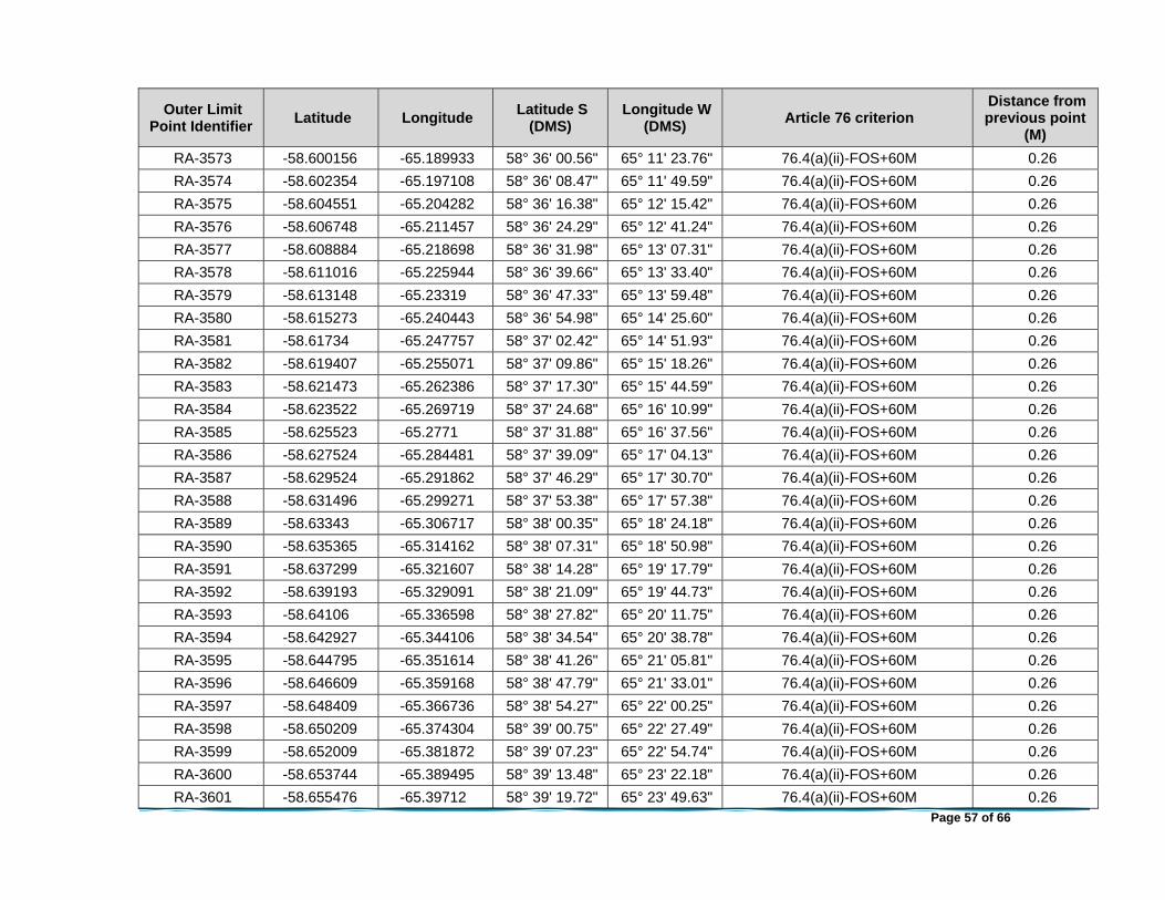
Page 57 of 66
Outer Limit Point Identifier
Latitude Longitude Latitude S
(DMS) Longitude W
(DMS) Article 76 criterion
Distance from previous point
(M)
RA-3573 -58.600156 -65.189933 58° 36' 00.56" 65° 11' 23.76" 76.4(a)(ii)-FOS+60M 0.26
RA-3574 -58.602354 -65.197108 58° 36' 08.47" 65° 11' 49.59" 76.4(a)(ii)-FOS+60M 0.26
RA-3575 -58.604551 -65.204282 58° 36' 16.38" 65° 12' 15.42" 76.4(a)(ii)-FOS+60M 0.26
RA-3576 -58.606748 -65.211457 58° 36' 24.29" 65° 12' 41.24" 76.4(a)(ii)-FOS+60M 0.26
RA-3577 -58.608884 -65.218698 58° 36' 31.98" 65° 13' 07.31" 76.4(a)(ii)-FOS+60M 0.26
RA-3578 -58.611016 -65.225944 58° 36' 39.66" 65° 13' 33.40" 76.4(a)(ii)-FOS+60M 0.26
RA-3579 -58.613148 -65.23319 58° 36' 47.33" 65° 13' 59.48" 76.4(a)(ii)-FOS+60M 0.26
RA-3580 -58.615273 -65.240443 58° 36' 54.98" 65° 14' 25.60" 76.4(a)(ii)-FOS+60M 0.26
RA-3581 -58.61734 -65.247757 58° 37' 02.42" 65° 14' 51.93" 76.4(a)(ii)-FOS+60M 0.26
RA-3582 -58.619407 -65.255071 58° 37' 09.86" 65° 15' 18.26" 76.4(a)(ii)-FOS+60M 0.26
RA-3583 -58.621473 -65.262386 58° 37' 17.30" 65° 15' 44.59" 76.4(a)(ii)-FOS+60M 0.26
RA-3584 -58.623522 -65.269719 58° 37' 24.68" 65° 16' 10.99" 76.4(a)(ii)-FOS+60M 0.26
RA-3585 -58.625523 -65.2771 58° 37' 31.88" 65° 16' 37.56" 76.4(a)(ii)-FOS+60M 0.26
RA-3586 -58.627524 -65.284481 58° 37' 39.09" 65° 17' 04.13" 76.4(a)(ii)-FOS+60M 0.26
RA-3587 -58.629524 -65.291862 58° 37' 46.29" 65° 17' 30.70" 76.4(a)(ii)-FOS+60M 0.26
RA-3588 -58.631496 -65.299271 58° 37' 53.38" 65° 17' 57.38" 76.4(a)(ii)-FOS+60M 0.26
RA-3589 -58.63343 -65.306717 58° 38' 00.35" 65° 18' 24.18" 76.4(a)(ii)-FOS+60M 0.26
RA-3590 -58.635365 -65.314162 58° 38' 07.31" 65° 18' 50.98" 76.4(a)(ii)-FOS+60M 0.26
RA-3591 -58.637299 -65.321607 58° 38' 14.28" 65° 19' 17.79" 76.4(a)(ii)-FOS+60M 0.26
RA-3592 -58.639193 -65.329091 58° 38' 21.09" 65° 19' 44.73" 76.4(a)(ii)-FOS+60M 0.26
RA-3593 -58.64106 -65.336598 58° 38' 27.82" 65° 20' 11.75" 76.4(a)(ii)-FOS+60M 0.26
RA-3594 -58.642927 -65.344106 58° 38' 34.54" 65° 20' 38.78" 76.4(a)(ii)-FOS+60M 0.26
RA-3595 -58.644795 -65.351614 58° 38' 41.26" 65° 21' 05.81" 76.4(a)(ii)-FOS+60M 0.26
RA-3596 -58.646609 -65.359168 58° 38' 47.79" 65° 21' 33.01" 76.4(a)(ii)-FOS+60M 0.26
RA-3597 -58.648409 -65.366736 58° 38' 54.27" 65° 22' 00.25" 76.4(a)(ii)-FOS+60M 0.26
RA-3598 -58.650209 -65.374304 58° 39' 00.75" 65° 22' 27.49" 76.4(a)(ii)-FOS+60M 0.26
RA-3599 -58.652009 -65.381872 58° 39' 07.23" 65° 22' 54.74" 76.4(a)(ii)-FOS+60M 0.26
RA-3600 -58.653744 -65.389495 58° 39' 13.48" 65° 23' 22.18" 76.4(a)(ii)-FOS+60M 0.26
RA-3601 -58.655476 -65.39712 58° 39' 19.72" 65° 23' 49.63" 76.4(a)(ii)-FOS+60M 0.26

Page 58 of 66
Outer Limit Point Identifier
Latitude Longitude Latitude S
(DMS) Longitude W
(DMS) Article 76 criterion
Distance from previous point
(M)
RA-3602 -58.657208 -65.404746 58° 39' 25.95" 65° 24' 17.09" 76.4(a)(ii)-FOS+60M 0.26
RA-3603 -58.658932 -65.412378 58° 39' 32.16" 65° 24' 44.56" 76.4(a)(ii)-FOS+60M 0.26
RA-3604 -58.660596 -65.42006 58° 39' 38.14" 65° 25' 12.21" 76.4(a)(ii)-FOS+60M 0.26
RA-3605 -58.662259 -65.427741 58° 39' 44.13" 65° 25' 39.87" 76.4(a)(ii)-FOS+60M 0.26
RA-3606 -58.663922 -65.435422 58° 39' 50.12" 65° 26' 07.52" 76.4(a)(ii)-FOS+60M 0.26
RA-3607 -58.665567 -65.443118 58° 39' 56.04" 65° 26' 35.23" 76.4(a)(ii)-FOS+60M 0.26
RA-3608 -58.667161 -65.450853 58° 40' 01.78" 65° 27' 03.07" 76.4(a)(ii)-FOS+60M 0.26
RA-3609 -58.668756 -65.458588 58° 40' 07.52" 65° 27' 30.92" 76.4(a)(ii)-FOS+60M 0.26
RA-3610 -58.67035 -65.466323 58° 40' 13.26" 65° 27' 58.76" 76.4(a)(ii)-FOS+60M 0.26
RA-3611 -58.671914 -65.47408 58° 40' 18.89" 65° 28' 26.69" 76.4(a)(ii)-FOS+60M 0.26
RA-3612 -58.673439 -65.481867 58° 40' 24.38" 65° 28' 54.72" 76.4(a)(ii)-FOS+60M 0.26
RA-3613 -58.674964 -65.489653 58° 40' 29.87" 65° 29' 22.75" 76.4(a)(ii)-FOS+60M 0.26
RA-3614 -58.676488 -65.497439 58° 40' 35.36" 65° 29' 50.78" 76.4(a)(ii)-FOS+60M 0.26
RA-3615 -58.677971 -65.505255 58° 40' 40.70" 65° 30' 18.92" 76.4(a)(ii)-FOS+60M 0.26
RA-3616 -58.679426 -65.51309 58° 40' 45.94" 65° 30' 47.12" 76.4(a)(ii)-FOS+60M 0.26
RA-3617 -58.680881 -65.520925 58° 40' 51.17" 65° 31' 15.33" 76.4(a)(ii)-FOS+60M 0.26
RA-3618 -58.682337 -65.52876 58° 40' 56.41" 65° 31' 43.54" 76.4(a)(ii)-FOS+60M 0.26
RA-3619 -58.683738 -65.536631 58° 41' 01.46" 65° 32' 11.87" 76.4(a)(ii)-FOS+60M 0.26
RA-3620 -58.685123 -65.544512 58° 41' 06.44" 65° 32' 40.24" 76.4(a)(ii)-FOS+60M 0.26
RA-3621 -58.686508 -65.552394 58° 41' 11.43" 65° 33' 08.62" 76.4(a)(ii)-FOS+60M 0.26
RA-3622 -58.687893 -65.560276 58° 41' 16.41" 65° 33' 36.99" 76.4(a)(ii)-FOS+60M 0.26
RA-3623 -58.689212 -65.568199 58° 41' 21.16" 65° 34' 05.52" 76.4(a)(ii)-FOS+60M 0.26
RA-3624 -58.690526 -65.576125 58° 41' 25.89" 65° 34' 34.05" 76.4(a)(ii)-FOS+60M 0.26
RA-3625 -58.69184 -65.584051 58° 41' 30.62" 65° 35' 02.58" 76.4(a)(ii)-FOS+60M 0.26
RA-3626 -58.693148 -65.591981 58° 41' 35.33" 65° 35' 31.13" 76.4(a)(ii)-FOS+60M 0.26
RA-3627 -58.694391 -65.599949 58° 41' 39.81" 65° 35' 59.82" 76.4(a)(ii)-FOS+60M 0.26
RA-3628 -58.695634 -65.607917 58° 41' 44.28" 65° 36' 28.50" 76.4(a)(ii)-FOS+60M 0.26
RA-3629 -58.696878 -65.615885 58° 41' 48.76" 65° 36' 57.19" 76.4(a)(ii)-FOS+60M 0.26
RA-3630 -58.698103 -65.623863 58° 41' 53.17" 65° 37' 25.91" 76.4(a)(ii)-FOS+60M 0.26

Page 59 of 66
Outer Limit Point Identifier
Latitude Longitude Latitude S
(DMS) Longitude W
(DMS) Article 76 criterion
Distance from previous point
(M)
RA-3631 -58.699275 -65.631871 58° 41' 57.39" 65° 37' 54.74" 76.4(a)(ii)-FOS+60M 0.26
RA-3632 -58.700447 -65.639879 58° 42' 01.61" 65° 38' 23.57" 76.4(a)(ii)-FOS+60M 0.26
RA-3633 -58.701619 -65.647887 58° 42' 05.83" 65° 38' 52.39" 76.4(a)(ii)-FOS+60M 0.26
RA-3634 -58.702761 -65.65591 58° 42' 09.94" 65° 39' 21.28" 76.4(a)(ii)-FOS+60M 0.26
RA-3635 -58.703861 -65.663956 58° 42' 13.90" 65° 39' 50.24" 76.4(a)(ii)-FOS+60M 0.26
RA-3636 -58.704961 -65.672001 58° 42' 17.86" 65° 40' 19.20" 76.4(a)(ii)-FOS+60M 0.26
RA-3637 -58.706061 -65.680046 58° 42' 21.82" 65° 40' 48.17" 76.4(a)(ii)-FOS+60M 0.26
RA-3638 -58.707121 -65.688111 58° 42' 25.64" 65° 41' 17.20" 76.4(a)(ii)-FOS+60M 0.26
RA-3639 -58.708149 -65.696192 58° 42' 29.34" 65° 41' 46.29" 76.4(a)(ii)-FOS+60M 0.26
RA-3640 -58.709177 -65.704272 58° 42' 33.04" 65° 42' 15.38" 76.4(a)(ii)-FOS+60M 0.26
RA-3641 -58.710206 -65.712352 58° 42' 36.74" 65° 42' 44.47" 76.4(a)(ii)-FOS+60M 0.26
RA-3642 -58.711181 -65.720456 58° 42' 40.25" 65° 43' 13.64" 76.4(a)(ii)-FOS+60M 0.26
RA-3643 -58.712137 -65.728569 58° 42' 43.69" 65° 43' 42.85" 76.4(a)(ii)-FOS+60M 0.26
RA-3644 -58.713093 -65.736682 58° 42' 47.13" 65° 44' 12.06" 76.4(a)(ii)-FOS+60M 0.26
RA-3645 -58.714048 -65.744795 58° 42' 50.57" 65° 44' 41.26" 76.4(a)(ii)-FOS+60M 0.26
RA-3646 -58.71494 -65.752935 58° 42' 53.78" 65° 45' 10.57" 76.4(a)(ii)-FOS+60M 0.26
RA-3647 -58.715823 -65.761078 58° 42' 56.96" 65° 45' 39.88" 76.4(a)(ii)-FOS+60M 0.26
RA-3648 -58.716707 -65.769222 58° 43' 00.15" 65° 46' 09.20" 76.4(a)(ii)-FOS+60M 0.26
RA-3649 -58.717587 -65.777366 58° 43' 03.31" 65° 46' 38.52" 76.4(a)(ii)-FOS+60M 0.26
RA-3650 -58.718398 -65.785537 58° 43' 06.23" 65° 47' 07.93" 76.4(a)(ii)-FOS+60M 0.26
RA-3651 -58.719208 -65.793708 58° 43' 09.15" 65° 47' 37.35" 76.4(a)(ii)-FOS+60M 0.26
RA-3652 -58.720019 -65.801879 58° 43' 12.07" 65° 48' 06.77" 76.4(a)(ii)-FOS+60M 0.26
RA-3653 -58.720815 -65.810056 58° 43' 14.93" 65° 48' 36.20" 76.4(a)(ii)-FOS+60M 0.26
RA-3654 -58.721552 -65.818252 58° 43' 17.59" 65° 49' 05.71" 76.4(a)(ii)-FOS+60M 0.26
RA-3655 -58.72229 -65.826449 58° 43' 20.24" 65° 49' 35.22" 76.4(a)(ii)-FOS+60M 0.26
RA-3656 -58.723027 -65.834646 58° 43' 22.90" 65° 50' 04.72" 76.4(a)(ii)-FOS+60M 0.26
RA-3657 -58.723738 -65.842851 58° 43' 25.46" 65° 50' 34.26" 76.4(a)(ii)-FOS+60M 0.26
RA-3658 -58.724403 -65.85107 58° 43' 27.85" 65° 51' 03.85" 76.4(a)(ii)-FOS+60M 0.26
RA-3659 -58.725067 -65.85929 58° 43' 30.24" 65° 51' 33.44" 76.4(a)(ii)-FOS+60M 0.26
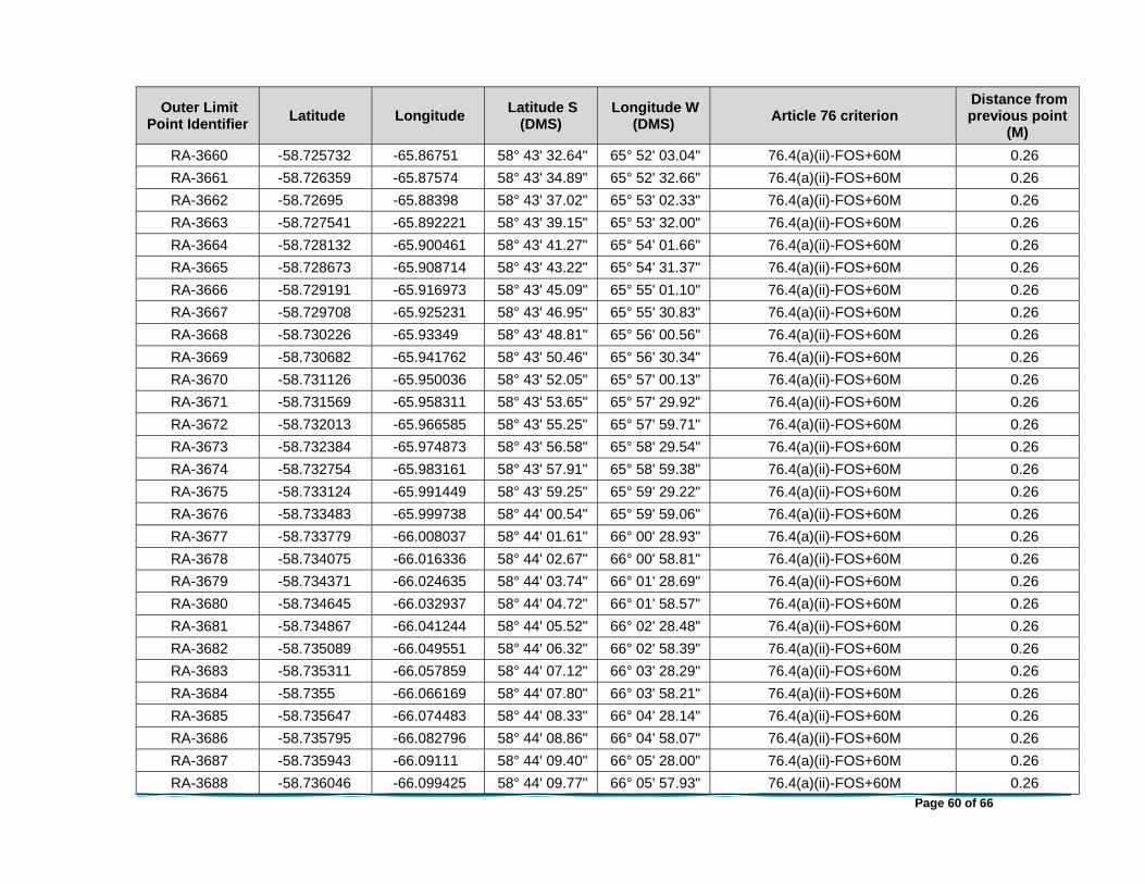
Page 60 of 66
Outer Limit Point Identifier
Latitude Longitude Latitude S
(DMS) Longitude W
(DMS) Article 76 criterion
Distance from previous point
(M)
RA-3660 -58.725732 -65.86751 58° 43' 32.64" 65° 52' 03.04" 76.4(a)(ii)-FOS+60M 0.26
RA-3661 -58.726359 -65.87574 58° 43' 34.89" 65° 52' 32.66" 76.4(a)(ii)-FOS+60M 0.26
RA-3662 -58.72695 -65.88398 58° 43' 37.02" 65° 53' 02.33" 76.4(a)(ii)-FOS+60M 0.26
RA-3663 -58.727541 -65.892221 58° 43' 39.15" 65° 53' 32.00" 76.4(a)(ii)-FOS+60M 0.26
RA-3664 -58.728132 -65.900461 58° 43' 41.27" 65° 54' 01.66" 76.4(a)(ii)-FOS+60M 0.26
RA-3665 -58.728673 -65.908714 58° 43' 43.22" 65° 54' 31.37" 76.4(a)(ii)-FOS+60M 0.26
RA-3666 -58.729191 -65.916973 58° 43' 45.09" 65° 55' 01.10" 76.4(a)(ii)-FOS+60M 0.26
RA-3667 -58.729708 -65.925231 58° 43' 46.95" 65° 55' 30.83" 76.4(a)(ii)-FOS+60M 0.26
RA-3668 -58.730226 -65.93349 58° 43' 48.81" 65° 56' 00.56" 76.4(a)(ii)-FOS+60M 0.26
RA-3669 -58.730682 -65.941762 58° 43' 50.46" 65° 56' 30.34" 76.4(a)(ii)-FOS+60M 0.26
RA-3670 -58.731126 -65.950036 58° 43' 52.05" 65° 57' 00.13" 76.4(a)(ii)-FOS+60M 0.26
RA-3671 -58.731569 -65.958311 58° 43' 53.65" 65° 57' 29.92" 76.4(a)(ii)-FOS+60M 0.26
RA-3672 -58.732013 -65.966585 58° 43' 55.25" 65° 57' 59.71" 76.4(a)(ii)-FOS+60M 0.26
RA-3673 -58.732384 -65.974873 58° 43' 56.58" 65° 58' 29.54" 76.4(a)(ii)-FOS+60M 0.26
RA-3674 -58.732754 -65.983161 58° 43' 57.91" 65° 58' 59.38" 76.4(a)(ii)-FOS+60M 0.26
RA-3675 -58.733124 -65.991449 58° 43' 59.25" 65° 59' 29.22" 76.4(a)(ii)-FOS+60M 0.26
RA-3676 -58.733483 -65.999738 58° 44' 00.54" 65° 59' 59.06" 76.4(a)(ii)-FOS+60M 0.26
RA-3677 -58.733779 -66.008037 58° 44' 01.61" 66° 00' 28.93" 76.4(a)(ii)-FOS+60M 0.26
RA-3678 -58.734075 -66.016336 58° 44' 02.67" 66° 00' 58.81" 76.4(a)(ii)-FOS+60M 0.26
RA-3679 -58.734371 -66.024635 58° 44' 03.74" 66° 01' 28.69" 76.4(a)(ii)-FOS+60M 0.26
RA-3680 -58.734645 -66.032937 58° 44' 04.72" 66° 01' 58.57" 76.4(a)(ii)-FOS+60M 0.26
RA-3681 -58.734867 -66.041244 58° 44' 05.52" 66° 02' 28.48" 76.4(a)(ii)-FOS+60M 0.26
RA-3682 -58.735089 -66.049551 58° 44' 06.32" 66° 02' 58.39" 76.4(a)(ii)-FOS+60M 0.26
RA-3683 -58.735311 -66.057859 58° 44' 07.12" 66° 03' 28.29" 76.4(a)(ii)-FOS+60M 0.26
RA-3684 -58.7355 -66.066169 58° 44' 07.80" 66° 03' 58.21" 76.4(a)(ii)-FOS+60M 0.26
RA-3685 -58.735647 -66.074483 58° 44' 08.33" 66° 04' 28.14" 76.4(a)(ii)-FOS+60M 0.26
RA-3686 -58.735795 -66.082796 58° 44' 08.86" 66° 04' 58.07" 76.4(a)(ii)-FOS+60M 0.26
RA-3687 -58.735943 -66.09111 58° 44' 09.40" 66° 05' 28.00" 76.4(a)(ii)-FOS+60M 0.26
RA-3688 -58.736046 -66.099425 58° 44' 09.77" 66° 05' 57.93" 76.4(a)(ii)-FOS+60M 0.26

Page 61 of 66
Outer Limit Point Identifier
Latitude Longitude Latitude S
(DMS) Longitude W
(DMS) Article 76 criterion
Distance from previous point
(M)
RA-3689 -58.73612 -66.107743 58° 44' 10.03" 66° 06' 27.87" 76.4(a)(ii)-FOS+60M 0.26
RA-3690 -58.736194 -66.11606 58° 44' 10.30" 66° 06' 57.82" 76.4(a)(ii)-FOS+60M 0.26
RA-3691 -58.736267 -66.124377 58° 44' 10.56" 66° 07' 27.76" 76.4(a)(ii)-FOS+60M 0.26
RA-3692 -58.736284 -66.132695 58° 44' 10.62" 66° 07' 57.70" 76.4(a)(ii)-FOS+60M 0.26
RA-3693 -58.736284 -66.141013 58° 44' 10.62" 66° 08' 27.65" 76.4(a)(ii)-FOS+60M 0.26
RA-3694 -58.736283 -66.149332 58° 44' 10.62" 66° 08' 57.60" 76.4(a)(ii)-FOS+60M 0.26
RA-3695 -58.736282 -66.15765 58° 44' 10.62" 66° 09' 27.54" 76.4(a)(ii)-FOS+60M 0.26
RA-3696 -58.736214 -66.165968 58° 44' 10.37" 66° 09' 57.48" 76.4(a)(ii)-FOS+60M 0.26
RA-3697 -58.736139 -66.174285 58° 44' 10.10" 66° 10' 27.43" 76.4(a)(ii)-FOS+60M 0.26
RA-3698 -58.736065 -66.182602 58° 44' 09.83" 66° 10' 57.37" 76.4(a)(ii)-FOS+60M 0.26
RA-3699 -58.735985 -66.190919 58° 44' 09.54" 66° 11' 27.31" 76.4(a)(ii)-FOS+60M 0.26
RA-3700 -58.735836 -66.199232 58° 44' 09.01" 66° 11' 57.24" 76.4(a)(ii)-FOS+60M 0.26
RA-3701 -58.735687 -66.207546 58° 44' 08.48" 66° 12' 27.17" 76.4(a)(ii)-FOS+60M 0.26
RA-3702 -58.735539 -66.215859 58° 44' 07.94" 66° 12' 57.09" 76.4(a)(ii)-FOS+60M 0.26
RA-3703 -58.735373 -66.224171 58° 44' 07.34" 66° 13' 27.02" 76.4(a)(ii)-FOS+60M 0.26
RA-3704 -58.73515 -66.232479 58° 44' 06.54" 66° 13' 56.92" 76.4(a)(ii)-FOS+60M 0.26
RA-3705 -58.734928 -66.240786 58° 44' 05.74" 66° 14' 26.83" 76.4(a)(ii)-FOS+60M 0.26
RA-3706 -58.734705 -66.249093 58° 44' 04.94" 66° 14' 56.74" 76.4(a)(ii)-FOS+60M 0.26
RA-3707 -58.734453 -66.257397 58° 44' 04.03" 66° 15' 26.63" 76.4(a)(ii)-FOS+60M 0.26
RA-3708 -58.734157 -66.265696 58° 44' 02.97" 66° 15' 56.51" 76.4(a)(ii)-FOS+60M 0.26
RA-3709 -58.73386 -66.273995 58° 44' 01.90" 66° 16' 26.38" 76.4(a)(ii)-FOS+60M 0.26
RA-3710 -58.733564 -66.282294 58° 44' 00.83" 66° 16' 56.26" 76.4(a)(ii)-FOS+60M 0.26
RA-3711 -58.733227 -66.290587 58° 43' 59.62" 66° 17' 26.11" 76.4(a)(ii)-FOS+60M 0.26
RA-3712 -58.732856 -66.298875 58° 43' 58.28" 66° 17' 55.95" 76.4(a)(ii)-FOS+60M 0.26
RA-3713 -58.732486 -66.307162 58° 43' 56.95" 66° 18' 25.78" 76.4(a)(ii)-FOS+60M 0.26
RA-3714 -58.732115 -66.31545 58° 43' 55.61" 66° 18' 55.62" 76.4(a)(ii)-FOS+60M 0.26
RA-3715 -58.731692 -66.323728 58° 43' 54.09" 66° 19' 25.42" 76.4(a)(ii)-FOS+60M 0.26
RA-3716 -58.731248 -66.332003 58° 43' 52.49" 66° 19' 55.21" 76.4(a)(ii)-FOS+60M 0.26
RA-3717 -58.730803 -66.340277 58° 43' 50.89" 66° 20' 25.00" 76.4(a)(ii)-FOS+60M 0.26

Page 62 of 66
Outer Limit Point Identifier
Latitude Longitude Latitude S
(DMS) Longitude W
(DMS) Article 76 criterion
Distance from previous point
(M)
RA-3718 -58.730359 -66.348552 58° 43' 49.29" 66° 20' 54.79" 76.4(a)(ii)-FOS+60M 0.26
RA-3719 -58.729851 -66.356812 58° 43' 47.47" 66° 21' 24.52" 76.4(a)(ii)-FOS+60M 0.26
RA-3720 -58.729334 -66.365071 58° 43' 45.60" 66° 21' 54.26" 76.4(a)(ii)-FOS+60M 0.26
RA-3721 -58.728816 -66.37333 58° 43' 43.74" 66° 22' 23.99" 76.4(a)(ii)-FOS+60M 0.26
RA-3722 -58.728297 -66.381588 58° 43' 41.87" 66° 22' 53.72" 76.4(a)(ii)-FOS+60M 0.26
RA-3723 -58.727705 -66.389828 58° 43' 39.74" 66° 23' 23.38" 76.4(a)(ii)-FOS+60M 0.26
RA-3724 -58.727113 -66.398068 58° 43' 37.61" 66° 23' 53.05" 76.4(a)(ii)-FOS+60M 0.26
RA-3725 -58.726522 -66.406308 58° 43' 35.48" 66° 24' 22.71" 76.4(a)(ii)-FOS+60M 0.26
RA-3726 -58.725917 -66.414545 58° 43' 33.30" 66° 24' 52.36" 76.4(a)(ii)-FOS+60M 0.26
RA-3727 -58.725252 -66.422765 58° 43' 30.91" 66° 25' 21.95" 76.4(a)(ii)-FOS+60M 0.26
RA-3728 -58.724587 -66.430984 58° 43' 28.51" 66° 25' 51.54" 76.4(a)(ii)-FOS+60M 0.26
RA-3729 -58.723922 -66.439204 58° 43' 26.12" 66° 26' 21.13" 76.4(a)(ii)-FOS+60M 0.26
RA-3730 -58.723233 -66.447416 58° 43' 23.64" 66° 26' 50.70" 76.4(a)(ii)-FOS+60M 0.26
RA-3731 -58.722494 -66.455612 58° 43' 20.98" 66° 27' 20.20" 76.4(a)(ii)-FOS+60M 0.26
RA-3732 -58.721756 -66.463808 58° 43' 18.32" 66° 27' 49.71" 76.4(a)(ii)-FOS+60M 0.26
RA-3733 -58.721017 -66.472005 58° 43' 15.66" 66° 28' 19.22" 76.4(a)(ii)-FOS+60M 0.26
RA-3734 -58.720244 -66.480189 58° 43' 12.88" 66° 28' 48.68" 76.4(a)(ii)-FOS+60M 0.26
RA-3735 -58.719432 -66.48836 58° 43' 09.96" 66° 29' 18.09" 76.4(a)(ii)-FOS+60M 0.26
RA-3736 -58.718621 -66.49653 58° 43' 07.04" 66° 29' 47.51" 76.4(a)(ii)-FOS+60M 0.26
RA-3737 -58.71781 -66.504701 58° 43' 04.12" 66° 30' 16.93" 76.4(a)(ii)-FOS+60M 0.26
RA-3738 -58.716952 -66.512854 58° 43' 01.03" 66° 30' 46.28" 76.4(a)(ii)-FOS+60M 0.26
RA-3739 -58.716068 -66.520997 58° 42' 57.84" 66° 31' 15.59" 76.4(a)(ii)-FOS+60M 0.26
RA-3740 -58.715184 -66.52914 58° 42' 54.66" 66° 31' 44.91" 76.4(a)(ii)-FOS+60M 0.26
RA-3741 -58.7143 -66.537283 58° 42' 51.48" 66° 32' 14.22" 76.4(a)(ii)-FOS+60M 0.26
RA-3742 -58.713357 -66.545402 58° 42' 48.09" 66° 32' 43.45" 76.4(a)(ii)-FOS+60M 0.26
RA-3743 -58.712401 -66.553515 58° 42' 44.64" 66° 33' 12.65" 76.4(a)(ii)-FOS+60M 0.26
RA-3744 -58.711445 -66.561627 58° 42' 41.20" 66° 33' 41.86" 76.4(a)(ii)-FOS+60M 0.26
RA-3745 -58.710489 -66.56974 58° 42' 37.76" 66° 34' 11.07" 76.4(a)(ii)-FOS+60M 0.26
RA-3746 -58.709462 -66.577821 58° 42' 34.06" 66° 34' 40.16" 76.4(a)(ii)-FOS+60M 0.26

Page 63 of 66
Outer Limit Point Identifier
Latitude Longitude Latitude S
(DMS) Longitude W
(DMS) Article 76 criterion
Distance from previous point
(M)
RA-3747 -58.708433 -66.585901 58° 42' 30.36" 66° 35' 09.25" 76.4(a)(ii)-FOS+60M 0.26
RA-3748 -58.707404 -66.593981 58° 42' 26.66" 66° 35' 38.33" 76.4(a)(ii)-FOS+60M 0.26
RA-3749 -58.706367 -66.602057 58° 42' 22.92" 66° 36' 07.41" 76.4(a)(ii)-FOS+60M 0.26
RA-3750 -58.705266 -66.610102 58° 42' 18.96" 66° 36' 36.37" 76.4(a)(ii)-FOS+60M 0.26
RA-3751 -58.704165 -66.618147 58° 42' 15.00" 66° 37' 05.33" 76.4(a)(ii)-FOS+60M 0.26
RA-3752 -58.703065 -66.626192 58° 42' 11.03" 66° 37' 34.29" 76.4(a)(ii)-FOS+60M 0.26
RA-3753 -58.701944 -66.634226 58° 42' 07.00" 66° 38' 03.22" 76.4(a)(ii)-FOS+60M 0.26
RA-3754 -58.700771 -66.642234 58° 42' 02.78" 66° 38' 32.04" 76.4(a)(ii)-FOS+60M 0.26
RA-3755 -58.699599 -66.650242 58° 41' 58.56" 66° 39' 00.87" 76.4(a)(ii)-FOS+60M 0.26
RA-3756 -58.698426 -66.658249 58° 41' 54.34" 66° 39' 29.70" 76.4(a)(ii)-FOS+60M 0.26
RA-3757 -58.697222 -66.666239 58° 41' 50.00" 66° 39' 58.46" 76.4(a)(ii)-FOS+60M 0.26
RA-3758 -58.695978 -66.674207 58° 41' 45.52" 66° 40' 27.14" 76.4(a)(ii)-FOS+60M 0.26
RA-3759 -58.694734 -66.682174 58° 41' 41.04" 66° 40' 55.83" 76.4(a)(ii)-FOS+60M 0.26
RA-3760 -58.69349 -66.690142 58° 41' 36.57" 66° 41' 24.51" 76.4(a)(ii)-FOS+60M 0.26
RA-3761 -58.692204 -66.698085 58° 41' 31.93" 66° 41' 53.10" 76.4(a)(ii)-FOS+60M 0.26
RA-3762 -58.690889 -66.70601 58° 41' 27.20" 66° 42' 21.64" 76.4(a)(ii)-FOS+60M 0.26
RA-3763 -58.689574 -66.713936 58° 41' 22.47" 66° 42' 50.17" 76.4(a)(ii)-FOS+60M 0.26
RA-3764 -58.68826 -66.721862 58° 41' 17.73" 66° 43' 18.70" 76.4(a)(ii)-FOS+60M 0.26
RA-3765 -58.686891 -66.729754 58° 41' 12.81" 66° 43' 47.11" 76.4(a)(ii)-FOS+60M 0.26
RA-3766 -58.685505 -66.737635 58° 41' 07.82" 66° 44' 15.49" 76.4(a)(ii)-FOS+60M 0.26
RA-3767 -58.68412 -66.745516 58° 41' 02.83" 66° 44' 43.86" 76.4(a)(ii)-FOS+60M 0.26
RA-3768 -58.682734 -66.753398 58° 40' 57.84" 66° 45' 12.23" 76.4(a)(ii)-FOS+60M 0.26
RA-3769 -58.681284 -66.761236 58° 40' 52.62" 66° 45' 40.45" 76.4(a)(ii)-FOS+60M 0.26
RA-3770 -58.679829 -66.769071 58° 40' 47.38" 66° 46' 08.66" 76.4(a)(ii)-FOS+60M 0.26
RA-3771 -58.678373 -66.776906 58° 40' 42.14" 66° 46' 36.86" 76.4(a)(ii)-FOS+60M 0.26
RA-3772 -58.676912 -66.784736 58° 40' 36.88" 66° 47' 05.05" 76.4(a)(ii)-FOS+60M 0.26
RA-3773 -58.675386 -66.792522 58° 40' 31.39" 66° 47' 33.08" 76.4(a)(ii)-FOS+60M 0.26
RA-3774 -58.67386 -66.800308 58° 40' 25.90" 66° 48' 01.11" 76.4(a)(ii)-FOS+60M 0.26
RA-3775 -58.672335 -66.808093 58° 40' 20.41" 66° 48' 29.14" 76.4(a)(ii)-FOS+60M 0.26

Page 64 of 66
Outer Limit Point Identifier
Latitude Longitude Latitude S
(DMS) Longitude W
(DMS) Article 76 criterion
Distance from previous point
(M)
RA-3776 -58.670792 -66.815866 58° 40' 14.85" 66° 48' 57.12" 76.4(a)(ii)-FOS+60M 0.26
RA-3777 -58.669197 -66.823601 58° 40' 09.11" 66° 49' 24.96" 76.4(a)(ii)-FOS+60M 0.26
RA-3778 -58.667602 -66.831335 58° 40' 03.37" 66° 49' 52.81" 76.4(a)(ii)-FOS+60M 0.26
RA-3779 -58.666007 -66.83907 58° 39' 57.63" 66° 50' 20.65" 76.4(a)(ii)-FOS+60M 0.26
RA-3780 -58.664384 -66.846782 58° 39' 51.78" 66° 50' 48.42" 76.4(a)(ii)-FOS+60M 0.26
RA-3781 -58.66272 -66.854463 58° 39' 45.79" 66° 51' 16.07" 76.4(a)(ii)-FOS+60M 0.26
RA-3782 -58.661056 -66.862144 58° 39' 39.80" 66° 51' 43.72" 76.4(a)(ii)-FOS+60M 0.26
RA-3783 -58.659392 -66.869825 58° 39' 33.81" 66° 52' 11.37" 76.4(a)(ii)-FOS+60M 0.26
RA-3784 -58.657688 -66.877473 58° 39' 27.68" 66° 52' 38.91" 76.4(a)(ii)-FOS+60M 0.26
RA-3785 -58.655956 -66.885099 58° 39' 21.44" 66° 53' 06.36" 76.4(a)(ii)-FOS+60M 0.26
RA-3786 -58.654223 -66.892724 58° 39' 15.20" 66° 53' 33.81" 76.4(a)(ii)-FOS+60M 0.26
RA-3787 -58.652491 -66.900349 58° 39' 08.97" 66° 54' 01.26" 76.4(a)(ii)-FOS+60M 0.26
RA-3788 -58.650708 -66.907932 58° 39' 02.55" 66° 54' 28.55" 76.4(a)(ii)-FOS+60M 0.26
RA-3789 -58.648907 -66.915499 58° 38' 56.07" 66° 54' 55.80" 76.4(a)(ii)-FOS+60M 0.26
RA-3790 -58.647107 -66.923066 58° 38' 49.59" 66° 55' 23.04" 76.4(a)(ii)-FOS+60M 0.26
RA-3791 -58.645306 -66.930633 58° 38' 43.10" 66° 55' 50.28" 76.4(a)(ii)-FOS+60M 0.26
RA-3792 -58.643444 -66.938146 58° 38' 36.40" 66° 56' 17.33" 76.4(a)(ii)-FOS+60M 0.26
RA-3793 -58.641576 -66.945653 58° 38' 29.68" 66° 56' 44.35" 76.4(a)(ii)-FOS+60M 0.26
RA-3794 -58.639708 -66.95316 58° 38' 22.95" 66° 57' 11.38" 76.4(a)(ii)-FOS+60M 0.26
RA-3795 -58.637835 -66.960662 58° 38' 16.21" 66° 57' 38.38" 76.4(a)(ii)-FOS+60M 0.26
RA-3796 -58.6359 -66.968107 58° 38' 09.24" 66° 58' 05.19" 76.4(a)(ii)-FOS+60M 0.26
RA-3797 -58.633965 -66.975552 58° 38' 02.28" 66° 58' 31.99" 76.4(a)(ii)-FOS+60M 0.26
RA-3798 -58.63203 -66.982997 58° 37' 55.31" 66° 58' 58.79" 76.4(a)(ii)-FOS+60M 0.26
RA-3799 -58.630079 -66.990426 58° 37' 48.29" 66° 59' 25.54" 76.4(a)(ii)-FOS+60M 0.26
RA-3800 -58.628078 -66.997807 58° 37' 41.08" 66° 59' 52.10" 76.4(a)(ii)-FOS+60M 0.26
RA-3801 -58.626076 -67.005187 58° 37' 33.88" 67° 00' 18.67" 76.4(a)(ii)-FOS+60M 0.26
RA-3802 -58.624075 -67.012567 58° 37' 26.67" 67° 00' 45.24" 76.4(a)(ii)-FOS+60M 0.26
RA-3803 -58.622046 -67.01992 58° 37' 19.37" 67° 01' 11.71" 76.4(a)(ii)-FOS+60M 0.26
RA-3804 -58.619979 -67.027234 58° 37' 11.92" 67° 01' 38.04" 76.4(a)(ii)-FOS+60M 0.26

Page 65 of 66
Outer Limit Point Identifier
Latitude Longitude Latitude S
(DMS) Longitude W
(DMS) Article 76 criterion
Distance from previous point
(M)
RA-3805 -58.617911 -67.034547 58° 37' 04.48" 67° 02' 04.37" 76.4(a)(ii)-FOS+60M 0.26
RA-3806 -58.615843 -67.041861 58° 36' 57.04" 67° 02' 30.70" 76.4(a)(ii)-FOS+60M 0.26
RA-3807 -58.613738 -67.049135 58° 36' 49.46" 67° 02' 56.89" 76.4(a)(ii)-FOS+60M 0.26
RA-3808 -58.611606 -67.05638 58° 36' 41.78" 67° 03' 22.97" 76.4(a)(ii)-FOS+60M 0.26
RA-3809 -58.609473 -67.063625 58° 36' 34.10" 67° 03' 49.05" 76.4(a)(ii)-FOS+60M 0.26
RA-3810 -58.60734 -67.07087 58° 36' 26.42" 67° 04' 15.13" 76.4(a)(ii)-FOS+60M 0.26
RA-3811 -58.605159 -67.078062 58° 36' 18.57" 67° 04' 41.02" 76.4(a)(ii)-FOS+60M 0.26
RA-3812 -58.602961 -67.085236 58° 36' 10.66" 67° 05' 06.85" 76.4(a)(ii)-FOS+60M 0.26
RA-3813 -58.600763 -67.092409 58° 36' 02.75" 67° 05' 32.67" 76.4(a)(ii)-FOS+60M 0.26
RA-3814 -58.598565 -67.099583 58° 35' 54.84" 67° 05' 58.50" 76.4(a)(ii)-FOS+60M 0.26
RA-3815 -58.596309 -67.106691 58° 35' 46.71" 67° 06' 24.09" 76.4(a)(ii)-FOS+60M 0.26
RA-3816 -58.594048 -67.113792 58° 35' 38.57" 67° 06' 49.65" 76.4(a)(ii)-FOS+60M 0.26
RA-3817 -58.591786 -67.120893 58° 35' 30.43" 67° 07' 15.22" 76.4(a)(ii)-FOS+60M 0.26
RA-3818 -58.589519 -67.127988 58° 35' 22.27" 67° 07' 40.76" 76.4(a)(ii)-FOS+60M 0.26
RA-3819 -58.587194 -67.135014 58° 35' 13.90" 67° 08' 06.05" 76.4(a)(ii)-FOS+60M 0.26
RA-3820 -58.584868 -67.14204 58° 35' 05.53" 67° 08' 31.34" 76.4(a)(ii)-FOS+60M 0.26
RA-3821 -58.582543 -67.149066 58° 34' 57.15" 67° 08' 56.64" 76.4(a)(ii)-FOS+60M 0.26
RA-3822 -58.580201 -67.156072 58° 34' 48.72" 67° 09' 21.86" 76.4(a)(ii)-FOS+60M 0.26
RA-3823 -58.577813 -67.163021 58° 34' 40.13" 67° 09' 46.88" 76.4(a)(ii)-FOS+60M 0.26
RA-3824 -58.575425 -67.16997 58° 34' 31.53" 67° 10' 11.89" 76.4(a)(ii)-FOS+60M 0.26
RA-3825 -58.573036 -67.176919 58° 34' 22.93" 67° 10' 36.91" 76.4(a)(ii)-FOS+60M 0.26
RA-3826 -58.570621 -67.183834 58° 34' 14.24" 67° 11' 01.80" 76.4(a)(ii)-FOS+60M 0.26
RA-3827 -58.568171 -67.190704 58° 34' 05.42" 67° 11' 26.54" 76.4(a)(ii)-FOS+60M 0.26
RA-3828 -58.565721 -67.197575 58° 33' 56.60" 67° 11' 51.27" 76.4(a)(ii)-FOS+60M 0.26
RA-3829 -58.56327 -67.204445 58° 33' 47.77" 67° 12' 16.00" 76.4(a)(ii)-FOS+60M 0.26
RA-3830 -58.560783 -67.211266 58° 33' 38.82" 67° 12' 40.56" 76.4(a)(ii)-FOS+60M 0.26
RA-3831 -58.558271 -67.218055 58° 33' 29.78" 67° 13' 05.00" 76.4(a)(ii)-FOS+60M 0.26
RA-3832 -58.555759 -67.224844 58° 33' 20.73" 67° 13' 29.44" 76.4(a)(ii)-FOS+60M 0.26
RA-3833 -58.553247 -67.231633 58° 33' 11.69" 67° 13' 53.88" 76.4(a)(ii)-FOS+60M 0.26

Page 66 of 66
Outer Limit Point Identifier
Latitude Longitude Latitude S
(DMS) Longitude W
(DMS) Article 76 criterion
Distance from previous point
(M)
RA-3834 -58.550687 -67.238357 58° 33' 02.47" 67° 14' 18.09" 76.4(a)(ii)-FOS+60M 0.26
RA-3835 -58.548114 -67.245063 58° 32' 53.21" 67° 14' 42.23" 76.4(a)(ii)-FOS+60M 0.26
RA-3836 -58.545542 -67.251769 58° 32' 43.95" 67° 15' 06.37" 76.4(a)(ii)-FOS+60M 0.26
RA-3837 -58.542969 -67.258476 58° 32' 34.69" 67° 15' 30.51" 76.4(a)(ii)-FOS+60M 0.26
RA-3838 -58.540338 -67.2651 58° 32' 25.22" 67° 15' 54.36" 76.4(a)(ii)-FOS+60M 0.26
RA-3839 -58.539746 -67.266667 58° 32' 23.09" 67° 16' 00.00" INTERNATIONAL LIMIT 0.06
RA-3840 -58.351667 -67.266667 58° 21' 06.00" 67° 16' 00.00" INTERNATIONAL LIMIT 11.31
Table 4: Coordinates of the outer limits of the continental shelf fixed points beyond 200 M for the Tierra del Fuego margin region