unmanned lidar for legacy management - energy.gov · juniper’s evolution past •uas training...
TRANSCRIPT

2018 Long-Term Stewardship Conference
August 20–23, 2018
Grand Junction, Colorado
Unmanned LiDAR for Legacy Management
Brian Soliday VP, Sales and Marketing
Juniper Unmanned, Inc.
Track 2: Advancing science and technology to reduce costs while maintaining or improving protection of human health and the environment

• Juniper Unmanned Commercial UAS background
• LiDAR technology development • UAS LiDAR capabilities and
limitations • LiDAR products • Tuba City Disposal Site project • Change Detection • UAS LiDAR benefits to Legacy
Management • UAS Magnetometry
Agenda

Juniper’s Evolution
Past • UAS training organization for Trimble and
Topcon • Flight safety and FAA compliance • Optimal data collection
Present • Data acquisition
• A leading UAS LiDAR provider • Data processing • Insights • Solutions
Future Capabilities • Data analytics and management
• Predictive and prescriptive analytics

Juniper’s Stable of Platforms/Sensors

Lidar Technology

Juniper Unmanned Lidar Capabilities
Standard Lidar Package Premium Lidar Package
Coverage per flight per crew
50 acres 250 acres
Daily acquisition rate per crew
500 acres 2,000 acres
Point density > 150 pts/m2 > 75 pts/m2
Accuracy < 0.25’ RMSE Z < 0.1’ RMSE Z
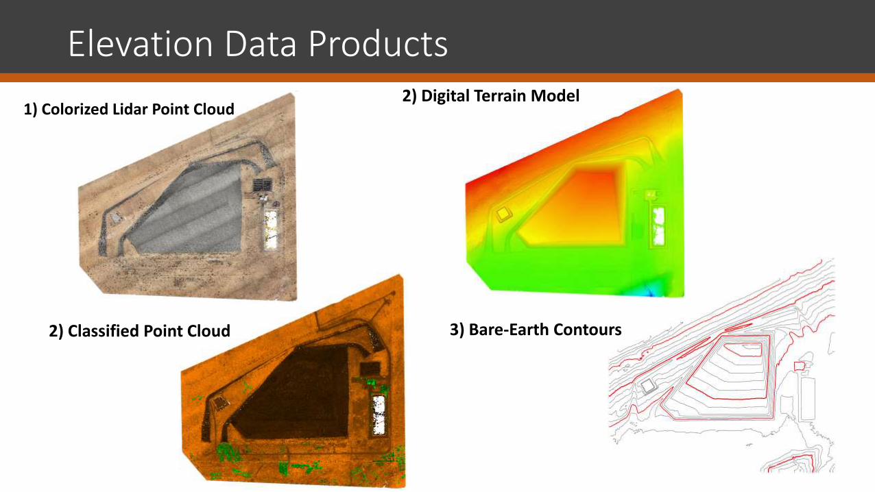
Elevation Data Products
1) Colorized Lidar Point Cloud 2) Digital Terrain Model
3) Bare-Earth Contours
2) Classified Point Cloud

• Wind < 25 mph • Elevation < 12,000 ft
• Ground snow
• Very Dense vegetation
• Restricted airspace • Rain/snow
UAS Platform and LiDAR Limitations
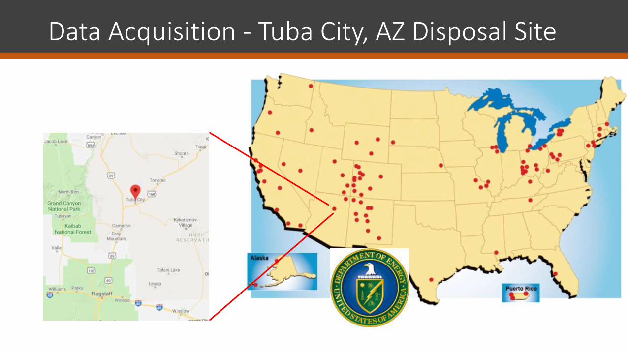
Data Acquisition - Tuba City, AZ Disposal Site

Methods for Tuba City, AZ Disposal Site
• Acquisition – Dual sensor collection
• Riegl miniVUX-1 LiDAR sensor • Dual Sony a6000 RGB sensors
• Processing • LiDAR
• Raw LiDAR calibration
• Colorize point cloud • Classified point cloud
• Digital Surface Model (DSM)
• Digital Terrain Model (DTM) • Contour creation
• RGB image processing
• Ortho Mosaic • Survey data post processing
• RTX/OPUS post processing and calibration
• Analysis
• Data accuracy assessment
• Future Change Detection

Data Acquisition Tuba City, AZ Disposal Site
• Collection in April 2018
• 505 acres site in Arizona
• 12 ground control points
• Platform: Altus ORC2 UAS
• Sensor: Riegl miniVUX-1 LiDAR sensor - dual collect w/ two Sony a6000 cameras

Accuracy Assessment Tuba City, AZ Disposal Site
• Riegl miniVUX-1
• RMSEz = 0.073 US survey feet
• Point density = approx. 75/m2

Change Detection
• Compare multiple surfaces and detect where change has happened and by how much
• Factors affecting change detection: • Point cloud density • Terrain • Vegetation • Point Classification • LiDAR Sensor Accuracy • Post-Processing

Benefits to Legacy Management
• Safety - Risk factors to personnel is reduced significantly
• Efficiency – 2000+ Acres per day of data collection
• Accuracy – better than 1/10th of a foot
• Density – Up to 250 points per meter squared

Other Potential Uses
Identification of buried objects and/or materials
Buried Well Heads
Buried Gas/Oil Lines

Other Potential Uses
• Identification of Hot Spots from abandoned/leaked materials

Other Potential Uses
• Identification of invasive vegetation species upon the property
• Stressed vegetation as an indicator of subsurface materials

Other Potential Uses
• Identification of unique natural, man-made or cultural features – Even those covered by vegetation

New Technology: UAS Magnetometry
“My impressions/view is the MagArrow was effective in finding large ferrous anomalies like historic gas/oil wells and could provide greater cost savings for customers when compared to traditional aerial magnetic surveys.”
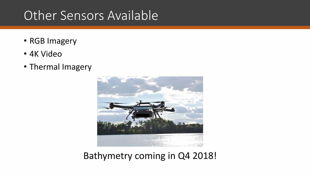
Other Sensors Available
• RGB Imagery
• 4K Video
• Thermal Imagery
Bathymetry coming in Q4 2018!

Thanks… Questions?