use of gis for discovering and investigating contamination ... · use of gis for discovering and...
TRANSCRIPT

Use of GIS for Discovering and Use of GIS for Discovering and Investigating Contamination from Investigating Contamination from Dry Cleaners in Visalia CaliforniaDry Cleaners in Visalia California
Presented by:Presented by:Rick L. Fears, P.G. Rick L. Fears, P.G.
and Mike Vivas, P.E.and Mike Vivas, P.E.
Department of Toxic Substances ControlDepartment of Toxic Substances ControlNorthern California Central Cleanup Operations Northern California Central Cleanup Operations
BranchBranch

General Discovery Approach
Through a Cooperative Agreement Obtain DHS California Water Quality Monitoring Database (Approximately 38,000 Source Locations)
Work With DTSC’s OEIM to Develop Intranet Based Sequel Server Query Application For DHS Water Quality Database
Identify Locations of Public Drinking Water Wells Impacted by PCE Statewide
Select Visalia Study Area


Statewide Dry Cleaner Discovery Project Findings
1537 Wells in 41of 58 California Counties Have Been Impacted by PCE Above MDL of 0.5 ppb
480 Wells in 29 of 58 California Counties Have Been Impacted by PCE Above MCL of 5.0 ppb
311 PCE Impacted Wells are Currently Inactive and May Not Be Properly Abandoned
7279 Dry Cleaning Operations (HWTS)

Conceptual Site Model
Soil vapor impacted with PCE
PCE pooled in sewer sag
Groundwater flow
PCE-laden wastewater from drycleaner discharged to sanitary sewer
PCE-impacted groundwater
Groundwater
Spills of PCE and PCE-impacted water to surface water and storm sewer drains
06-21-05
Generalized Conceptual Site Model
14840Proj No Drawn By
H. Duke
Visalia Discovery Project, Visalia, CA
Not to ScaleDate Fig. No.
1

Visalia DiscoveryVisalia Discovery

Visalia Discovery Investigation Process
Locations-Current and Former Dry Cleaners
Well Construction and Operations Info- PCE Impacted Wells
Regional and Local Hydrogeologic Conditions
Obtain Supporting GIS Shape Files• Roads• Streams• USGS Topographic Maps• Air Photos• City Boundaries• Local Sewer • Local Storm Water System Information

Determine Locations of Current and Former Dry Cleaners
Query DTSC HWTS Database With Support From OEIM
Research Polk City Directories at State Library For Names and Addresses of Dry Cleaners
Web Based Search
Obtain Geo-coded Latitudes and Longitudes Based on Street Addresses

Processing Dry Cleaner DataVerify Latitudes and Longitudes Via Hand Held GPS Unit in the Field (front door of address)
Enter Latitudes and Longitudes on EXCEL Spread Sheets
Use GIS to Create Point Shape Files for Dry Cleaners
Map the Locations of Dry Cleaners in Study Area

Gather Local Sewer and Storm Water System Information
The City of Visalia GIS Dept. provided shape files for the sewer and storm water systems
DTSC mapped the sewer and storm water systems via GIS
The City Public Works officials and staff from the RWQCB Fresno office provided some information on sewer system conditions in Visalia

Gather Well Construction and Operational Information
DTSC contacted water purveyors for all known PCE impacted public wells in Visalia using information from the DHS Water Quality Database
Purveyors provided well construction diagrams, well pump capacities driller logs, sample point histories, and sample results for impacted wells

Evaluate Hydrogeologic Conditions
DTSC Reviewed Available Driller Logs From Purveyors
Production zones are typically 10-15 ft units of coarse or medium sand and sandy gravels
Well completion depths from 150 to 480 ft bgs With Variable Construction
Regional Groundwater Flow is Generally South South-west at Approximately 0.002 ft/ft
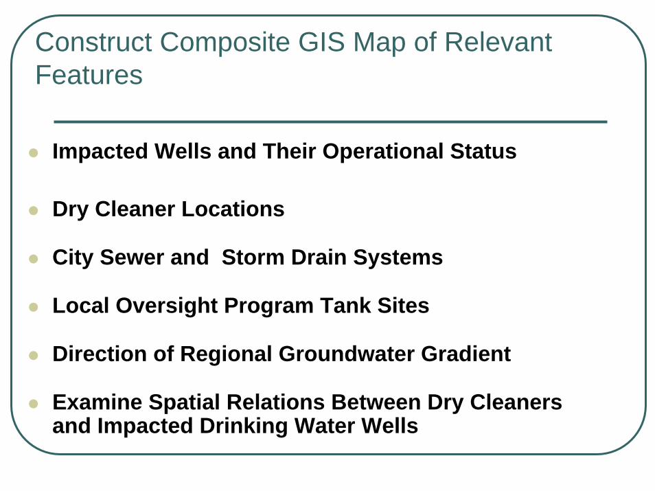
Construct Composite GIS Map of Relevant Features
Impacted Wells and Their Operational Status
Dry Cleaner Locations
City Sewer and Storm Drain Systems
Local Oversight Program Tank Sites
Direction of Regional Groundwater Gradient
Examine Spatial Relations Between Dry Cleaners and Impacted Drinking Water Wells

Conceptual Plume ModelConceptual Plume Model

City of Chico

Conceptual Depiction of Extent GW Contamination

Visalia Wells and Dry Cleaners With 5-PPB PCE Contours

Typical Visalia Sewer Lines(Thicker Line Weight Indicates Larger Diameter Sewer
Line)

Findings For Visalia Study Area21 Public Drinking Water Wells Show PCE Detections Ranging From 1.0 – 23.3 ppb
6 of These Wells Show PCE Detections Above MCL of 5.0 ppb
6 of the PCE Impacted Wells are Inactive and May Not Be Properly Abandoned
33 Locations of Current or Former Dry Cleaning Operations are Potential PCE Release Sources (40 Different Operations)
4 Dry Cleaners, Located in the South City Area Are Being Investigated by the RWQCB

Typical Abandoned Well

Example Dry Cleaner LocationsExample Dry Cleaner Locations

Former CleanersCurrently a Bank

Former CleanersCurrently Offices

Former CleanersCurrently Offices
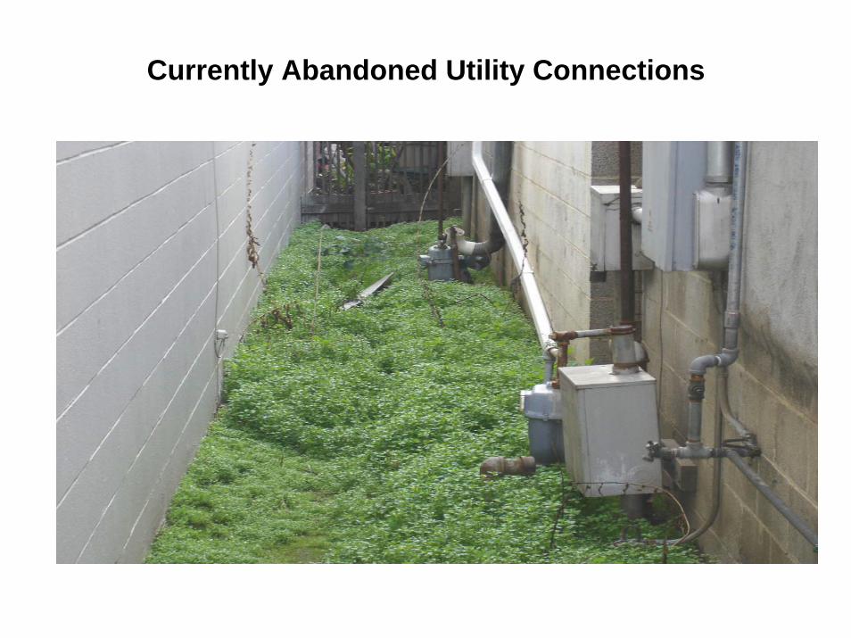
Currently Abandoned Utility Connections

Former Utility Connection (possibly gas)

Former CleanersCurrently Parking Lot

Former CleanersCurrently Offices

Former CleanersCurrently Storage Building

Abandoned Utility Panel

DTSC ActionCompleted Imminent and Substantial Endangerment Determination
Orphan Site Status

Orphan Site Investigation Scope of Work
DWR, RWQCB and Local Oversight Program LUST/SLIC File Search
DTSC Envirostor Site Information Search
Gore Sorber soil gas screening Survey Suma canister Soil Gas Sampling at key Locations
Profiling Selected Existing Wells of Interest
Focused Soil and Groundwater Investigation
Preparing a Phase 1 Remedial Investigation Report

Potential Future GIS Applications in Visalia
Use of Electronically Reported Data
Sewer Pathway Investigation
Soil Gas Maps
Conduct Hydrologic Modeling
Indoor Air Evaluation