usgs report to ceos wgcvceos.org/.../wgcv-41/presentations/ceos-wgcv-41-agr-09-usgs.pdf ·...
TRANSCRIPT
U.S. Department of the Interior
U.S. Geological Survey
CEOS WGCV-41, Japan
USGS Report to CEOS WGCV
Sep 6, 2016
Greg Stensaas, USGS, EROS, [email protected]
Ron Morfitt, USGS EROS, [email protected]
Tom Stone, USGS Flagstaff, [email protected]

2 CEOS WGCV-41, Japan
Attitude Control System
X-band System S-band System Performance nominal
Enhanced Thematic Mapper +
(1999)
Batteries Performance nominal
Solid State Recorder
Reaction Control System •1/07/04 Fuel line #4 thermostat #1a failure
•2/24/05 Fuel line #4 thermostat failure; Primary
heater circuit disabled
•4/25/13 Fuel line #2 thermostat failure; Redundant
heater circuit disabled
Solar Array •5/14/2002 Circuit #14 Failure
•5/16/2005 Circuit # 6 Failure
•8/13/2008 Circuit #14 partial recovery
•14 circuits remain operating
•no impact to ops
•11/15/1999 SSR PWA #23 Loss
•02/11/2001 SSR PWA #12 Loss
•12/07/2005 SSR PWA #02 Loss
•08/02/2006 SSR PWA #13 Loss
•03/28/2008 SSR PWA #22 Loss
•09/03/2008 SSR PWA #23 Recovered
•10/12/2013 SSR PWA #11 Loss
•Each PWA is 4% loss of launch capacity
•Boards are likely recoverable Performance nominal
•05/05/2004 Gyro 3 Shut Off
•1-gyro control system in development
≈ 17 years of on-orbit operations
•5/31/2003 SLC Failure
•4/01/2007 Bumper mode
Remote Tlm Cmd (RTC) Box •09/27/2014 RTC A Failover
Power Subsystem
Power Control Unit • 10/18/2014 BVR failover
Landsat 7 Spacecraft Status

3 CEOS WGCV-41, Japan
Landsat 8 Spacecraft Status
3
Operational Land Imager
Thermal Infrared Sensor • 10/1/2014 - Side-A SSM Encoder
Propulsion Subsystem
Thermal Control System
Electrical Power System Attitude Control System
RF Communications
Command & Data Handling System
X-band System
S-band System
Batteries
Solid State Recorder
Solar array
≈ 3 years of on-orbit operations (2013)

4 CEOS WGCV-41, Japan
Sustainable Land Imaging; Landsat-9
Landsat-9 is very similar to Landsat-8
President’s FY 17 Budget Submittal to Congress (February 2016) included Landsat 9, with a launch as early as FY 2021.
Project directed to strive for a late CY 2020 launch date

5 CEOS WGCV-41, Japan
Landsat 9 Mission Overview
Mission Objectives
• Provide continuity in the multi-decadal Landsat land surface observations to study, predict, and understand the consequences of land surface dynamics
• Land cover/use change
• Ecosystem dynamics
• Landscape scale carbon stocks
• Resource management/societal needs
• Core Component of Sustainable Land Imaging Program
Increase in pivot irrigation in Saudi Arabia from 1987 to
2012 as recorded by Landsat. The increase in irrigated
land correlates with declining groundwater levels
measured from GRACE (courtesy M. Rodell, GSFC)
Instruments
• Operational Land Imager 2 (Ball Aerospace) • Reflective-band push-broom imager (15-30m res)
• 9 spectral bands at 15 - 30m resolution
• Retrieves data on surface properties, land cover, and vegetation condition
• Thermal Infrared Sensor 2 (NASA GSFC) • Thermal infrared (TIR) push-broom imager
• 2 TIR bands at 100m resolution
• Retrieves surface temperature, supporting agricultural and climate
applications, including monitoring evapotranspiration
Spacecraft & Observatory I&T
• Competitively Procured: TBD
Launch Services
• Competitively Procured: TBD
Mission Parameters
• Single Satellite, Mission Category 1, Risk Class B
• 5-year design life after on-orbit checkout
• At least 10 years of consumables
• Sun-synchronous orbit, 705 km at equator, 98°inclination
• 16-day global land revisit
• Partnership: NASA & United States Geological Survey (USGS)
• NASA: Flight segment & checkout
• USGS: Ground system and operations
• Launch: FY2021 (Targeting December 15, 2020), Category 3 Vehicle
Mission Team • NASA Goddard Space Flight Center (GSFC)
• USGS Earth Resources Observation & Science (EROS) Center
• NASA Kennedy Space Center (KSC)
5 Reference: LST Meeting, 26 Jul 2016, Jenstorm, Nelson

6 CEOS WGCV-41, Japan
Mission Architecture Identical to Landsat 8
6

7 CEOS WGCV-41, Japan
Landsat 9 Ground System
Mission Operations Center (MOC) Flight Operations Team (FOT) performs mission
planning and scheduling, command and control, health and status monitoring, orbit and attitude maintenance, mission data management
NASA provides MOC and BMOC facility at GSFC as well as NASA institutional services (SN, NEN, NISN, FDF) through on-orbit acceptance
Ground Network Element (GNE) Landsat Ground Network (LGN) stations provide X-
and S-band communications with the Observatory
LGN stations in Sioux Falls, SD; Fairbanks, AK; and Svalbard, Norway
Data Collection and Routing Subsystem (DCRS) gathers mission data from LGN stations into complete intervals to transfer to the DPAS
Data Processing and Archive System (DPAS) Provides data ingest, storage and archive, image
assessment, product generation, and data access and distribution
DPAS facility at USGS EROS Center
EROS, Sioux Falls, SD
GSFC, Greenbelt, MD
Fairbanks,
AK
Svalbard,
Norway
Sioux
Falls, SD
7

8 CEOS WGCV-41, Japan
Sustainable Land Imaging; L-10
L-10 launch: 2027
Landsat-10 looking at multiple approaches
and technologies
L-10 User Requirement Collection and
Technology Evaluation (Dec 2016)
Continue building set of user requirements
across the broader range of land imaging
applications
Hyperspectral applications
Additional thermal applications
Higher resolution applications (~5-20 m range)
Higher revisit applications
Developing approach to analyze requirements
Compare user requirements to potential L 10
configurations; which requirements are met?
NASA L10 engineering models
Notional systems with expanded resolution
or spectral bands
http://remotesensing.usgs.gov/rca-eo/

9 CEOS WGCV-41, Japan
Landsat Use from Earth Observation Assessment 2016 (preliminary)
• OSTP-led snapshot of Earth observation (EO) data use across
Federal Civil Agencies organized by 13 societal benefit areas; ~1750
key products surveyed
• Preliminary results based on current snapshot Federal civil Landsat
users
• 174 key products from multiple Federal agencies
• Most people use more than one type of Landsat data, and are
generally satisfied with Landsat data, but did identify some limitations
• Temporal revisit was the most often cited limitation
• Users also identified needs for higher spatial resolution,
additional processing, and mosaic products
3
13
179
48
Poor
Fair
Good
Fully satisfied
Temporal revisit 36%
Spatial resolution
20%
Data processing and access
20%
Cloud cover 18%
Spectral coverage
6%
Landsat Optical
162
Landsat Archive
30
Landsat Thermal
27
Landsat Pan 17
User
Satisfaction
Landsat Data
Use
Cited
Landsat
Data
Limitations

10 CEOS WGCV-41, Japan
http://landsat.usgs.gov/landsat-science-team-meeting-july-26-28-2016.php

11 CEOS WGCV-41, Japan

12 CEOS WGCV-41, Japan
Active Landsat International Ground Stations
10 Active L7 Stations 17 Active L8 Stations
L7 pLGN

13 CEOS WGCV-41, Japan
Landsat-7 Geometric Performance
Geodetic accuracy improved since 2012
Bumper mode parameters continue to be updated ~2 weeks
Mirror velocity surpassed Landsat-5 TM velocity

14 CEOS WGCV-41, Japan
Landsat-7 Radiometric Performance
Lifetime TOA reflectance based on PICS stable with seasonal variations
Coherent noise component continues to increase
Continuing quarterly ETM+ absolute gain updates
Progating L8 OLI reflectance based calibration to L1-7

15 CEOS WGCV-41, Japan
Reflectance based archive Calibration
Goal is to transfer L8 OLI reflectance based calibration to other Landsat sensors
New gain parameters have been derived (by SDSU) for L7 ETM+, L5 TM, L4 TM, L5 MSS and L4 MSS
Some inconsistencies in L3 MSS calibration need to address to perform reflectance calibration of rest of the MSS sensors
Bands1 Band2 Band3 Band4 Band5 Band7
OLI-ETM+ 529.02 468.93 497.36 339.86 356.88 376.37
ETM-5TM 783.37 378.51 442.05 366.11 555.81 399.16
5TM -4TM 931.43 416.31 467.5 366.53 565.05 406.71
5TM-5MSS 697.18 535.25 413.17 274.58 NA NA
5MSS-4MSS 609.32 492.15 397.9 257.1 NA NA
Gains When forced Through 0,g(n,L,λ)

16 CEOS WGCV-41, Japan
Validation of L7 Reflectance Based Calibration
L7 reflectance agrees better with L8 reflectance
Except band 1 and may be band 2
L7 reflectance of bands 1, 2 and 4 will be darker (maximum in band 1 ~ 3.2%)
L7 reflectance of bands 3, 5 and 7 will be brighter (maximum in band 5 ~ 1.9%)

17 CEOS WGCV-41, Japan
Landsat GCP Improvement Goals
L8 geolocation accuracy has identified areas where the GLS-derived global GCP library is deficient
Regions of poor accuracy are being re-triangulated using Landsat 8 data, with new OLI GCPs added where needed
Triangulation updates are proceeding in four phases
The first three phases are complete
Phase 4 was added to make the GLS control consistent with the Sentinel-2 global reference image base (GRI)
The original control library image chips are all Landsat 7 ETM+ (8-bit) circa 2000
Once the triangulation updates are complete, new 16-bit OLI image chips will be extracted for all scenes

18 CEOS WGCV-41, Japan
Landsat-8 Radiometric Performance
SNR continues to exceed requirements
Continuing quarterly relative gain updates
OLI radiometric stability, worst case CA band (band 1), about 1% over 2 years; most bands stable
within ~0.3%
Update planned for next reprocessing
Correct for a decay in CA band calibration trend
Account for small short-term increase in trends of VNIR bands
Reflectance calibration agrees generally to 3-5% with vicarious techniques
Working on transfer of reflectance absolute calibration back to ETM+, TMs and MSS sensors

19 CEOS WGCV-41, Japan
L8 OLI Lunar Calibration
Lunar trending follows other cal methods
Absolute offsets are relatively large — cause is being studied
lunar

20 CEOS WGCV-41, Japan
TIRS Scene Select Mirror Anomaly
SSM encoder current began increasing Summer/Fall 2014
Reached yellow limit December 19, 2014
Encoder powered down
Product generation system couldn’t handle no encoder
TIRS imagery zeroed through early March
Software updated April 23, 2015
TIRS electronics switched to side-B March 4, 2015
The TIRS SSM has been operating in mode 0 (mostly) since 29 October 2015.
After the switch to mode 0, the encoder is powered off and provides no further SSM position measurements
For subsequent data processing, SSM position is estimated using a model of SSM motion fitted to:
Encoder measurements taken immediately following switch
TIRS-to-OLI calibration scene measurements
SSM motion is less repeatable than hoped, more telemetry needed
Typical OLI-TIRS alignment
OLI-TIRS alignment without
encoder

21 CEOS WGCV-41, Japan
L8 IAS/LPGS Status & Schedule
L8 IAS R3.6.2 & L8 LPGS R2.6.2 Phase 3 GCP updates DEM improvements over Greenland and a couple
islands TIRS SSM model fit algorithm
Fits TIRS SSM calibration results and populates estimated positions into the database
Work orders retrieve estimated TIRS SSM encoder positions from the database
Support for reprocessing scenes in LPGS after the final estimated TIRS SSM encoder positions are available
Installed into Operations April 25, 2016
L8 Ingest R4.0 Adjusted TIRS framing near the poles Installed into Operations April 23, 2016

22 CEOS WGCV-41, Japan
TIRS Stray Light Correction
Original GOES Correction TIRS Correction
Model of stray light determined by optical model
Effectively a point spread function for each detector
Verified by comparing PSF to special lunar scans
Update on TIRS Stray Light
Convolving PSF with TIRS imagery, scene before and after, or TIRS nearest pixels; Subtract stray light estimate from TIRS image
TIRS stray light correction algorithm is currently implemented in ST and Cal/Val is validating the algorithm
The plan is to implement the algorithm in IAS; summer 2016

23 CEOS WGCV-41, Japan
L8 IAS/LPGS Status & Schedule
L8 LPGS 2.7 / IAS 3.7 (Collection Processing) New Landsat Product ID Add Albers product for LCMAP Modified CPF and RLUT filenames Support for multiple concurrent software installs (i.e. collections 0
and 1) TIRS Stray Light correction (final approval pending) Remove TIRS band 11 from product (final approval pending) CFmask
Turn on as part of release and eliminate weighting of multiple cloud cover algorithms
Implement the non-thermal with Cirrus option Minor algorithm fixes
Angle Coefficients, & Angle Band Tool (turn on as part of release) Add Truncation Mode to metadata and MTL Remove SCA notches (Cirrus & TIRS bands)

24 CEOS WGCV-41, Japan
Schedule
L8 LPGS 2.7 / IAS 3.7 (Collection Processing - cont)
Quality Band Bits Add saturation Change order of the bits Remove water and vegetation bits
Sustaining Add an option to disable the L1R size limit check in create_l1r to
support slide slither processing Bug fix for select_control_gcps Allow a split CPF date range to be merged Add BPF and RLUT filenames to the radiometric work order common
table Manage the geometric work order common table valid flag in a
processing flow aware way Support for automating the initial TIRS SSM model fit Use highest GCP ID in the database to pick starting ID in
generate_chips Other potential pending CRs

25 CEOS WGCV-41, Japan
Schedule
L8 LPGS 2.7 / IAS 3.7 (Collection Processing - cont) Removing the following from IAS:
Caltest subsystem (not used since everyone uses PWG instead) TIRS Gain Determination algorithm SCA Overlap Characterization algorithm in create_l1r (replaced with
algorithm that uses the resampler output)
Install into operations September 30, 2016

26 CEOS WGCV-41, Japan
The plot shows that three years after launch average OLI PICS trends finally agree with on-board calibrators within a half percent.
PICS Based Stability

27 CEOS WGCV-41, Japan
PICS Normalization: Improved Temporal Trending Using PICS,
SDSU: Vuppula, Ervin, Tabassum, Kaewmanee, LST Meeting, July 26-28,2016

28 CEOS WGCV-41, Japan

29 CEOS WGCV-41, Japan
JACIE 2016: http://calval.cr.usgs.gov/jacie/
The Joint Agency Commercial Imagery Evaluation (JACIE) Workshop co-located with the American Society for Photogrammetry and Remote Sensing (ASPRS) Imaging and Geospatial Technology Forum (IGTF) in Fort Worth, Texas, USA, April 12-14, 2016.
New Sensor plans and calibration PlanetLabs, TripleSat Constellation (21AT), MUSES/DESIS, …, Harris, SigmaSpace, Sensors calibration – RapidEye, KompSat-3A, CBERS-4, Woldview-3 radiometry (DG
group), Landsat-8 and Sentinel, UltraCam Condor, UltraMap, ADS-100, VIRS day/night, TerraBella, …,
Processes Excellent processes w/RadCalNet
and Spatial Resolution
Sensor Harmonization
Can we get documented
standardized approach for JACIE
sensor types? CEOS?
Various sensors all being calibrated geospatially
Aerial lidar & cameras; UAS – many sensors Satellites: Hi-res, medium res,
moderate res, ….

30 CEOS WGCV-41, Japan
USGS Imagery Assessments and Activities
Planet Labs Image over NYC
07 Sep 2014
Assessments
ResourceSat-2 AWiFS-2, VNREDSat-1, KOMPSAT-3, WorldDEM™, PROBA-V, Planet Labs, SkyBox-1 & 2, …, Future assessments: Planet Labs, CBERS-4, KompSat-3A, DMC- follow-on
Higher-Level Product Quality Monitoring
Joint Agency Commercial Imagery Evaluation (JACIE) Workshop with ASPRS; 40+ papers
http://calval.cr.usgs.gov/satellite-sensor-characterization/rst-presentations-publications/
USGS presenting on Sentinel-2, RapidEye, Vricon DEM, Single-photon Lidar
Engaged in multi agency assessment of PlanetLabs with NGA and DOD
ESA Sentinel-2a
Archive Level 1c products available via USGS Earth Explorer; http://earthexplorer.usgs.gov/
Sentinel-2 Geometric/Geodetic Assessment
Verifying against L8 standards, S-2 internal geometry is excellent
Begin to work with ESA to harmonize/improve GCP framework worldwide
On going geometric and radiometric assessments
ISRO ResourceSat-2
Agreement to archive ResourceSat-2 products over the U.S.
Land Change Monitoring, Assessments and Projections (LCMAP)
Architecture being built and tested, and Analysis Ready Data definition being worked
Working toward Landsat-9 launch (Dec 2020) with NASA GSFC and Landsat 10 planning
beginning

U.S. Department of the Interior
U.S. Geological Survey
CEOS WGCV-41, Japan
32 CEOS WGCV-41, Japan
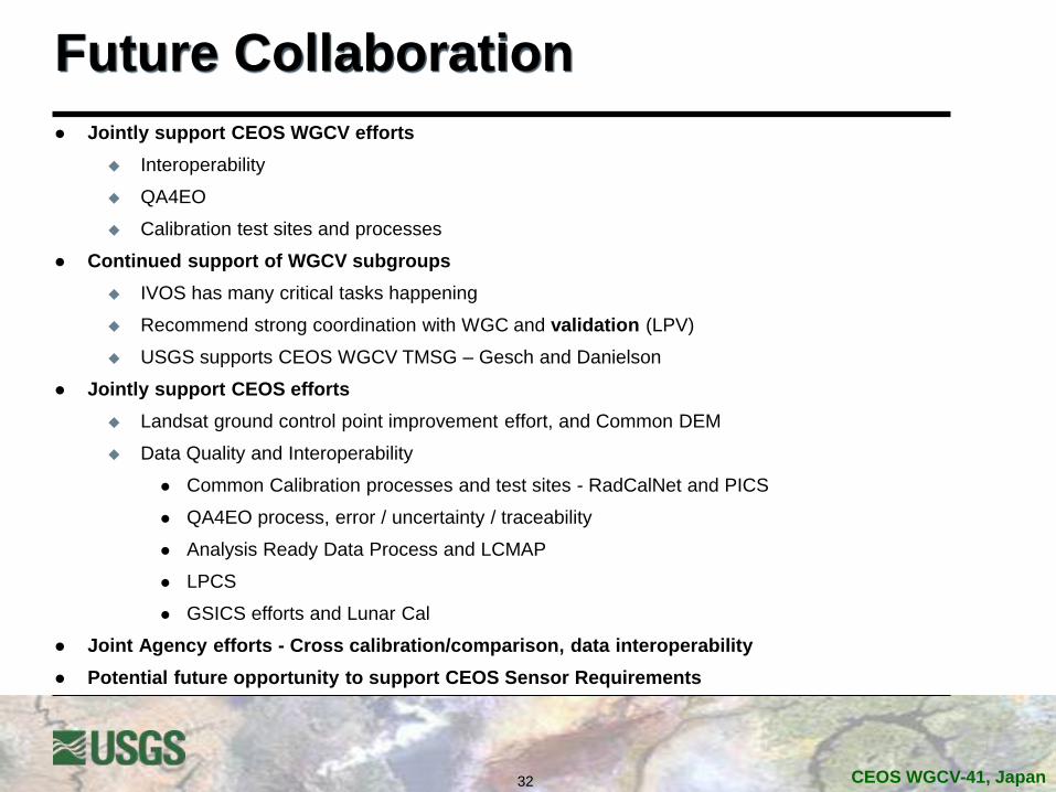
Future Collaboration
Jointly support CEOS WGCV efforts
Interoperability
QA4EO
Calibration test sites and processes
Continued support of WGCV subgroups
IVOS has many critical tasks happening
Recommend strong coordination with WGC and validation (LPV)
USGS supports CEOS WGCV TMSG – Gesch and Danielson
Jointly support CEOS efforts
Landsat ground control point improvement effort, and Common DEM
Data Quality and Interoperability
Common Calibration processes and test sites - RadCalNet and PICS
QA4EO process, error / uncertainty / traceability
Analysis Ready Data Process and LCMAP
LPCS
GSICS efforts and Lunar Cal
Joint Agency efforts - Cross calibration/comparison, data interoperability
Potential future opportunity to support CEOS Sensor Requirements

33 CEOS WGCV-41, Japan
Questions
More of Interoperability later

34 CEOS WGCV-41, Japan
Revised Geometric Reference
Proposed global re-triangulation of the GLS (outside Australia) to improve
consistency with Sentinel-2 MSI framework.
Sentinel-2 will use a set of global reference images (GRI) to ensure multi-temporal
registration.
Australian GLS has already been registered to the AGRI reference provided by
Geoscience Australia
This reference is being established through a series of continental-scale triangulation
blocks of MSI data.
Schedule will depend upon availability of Sentinel-2 reference images (GRI).
Blocks will be worked as GRI become available but would likely not be released until all
are complete.
Europe is first with other regions to follow.
Timing will depend upon availability of suitably cloud-free MSI imagery.
Updates should mostly be subpixel but will still require complete archive
reprocessing / new collection when complete.
Timing should work well for coordinated DEM upgrade.
34

35 CEOS WGCV-41, Japan
Expected Landsat/Sentinel-2 Registration
The Landsat GLS framework is not being used to constrain the Sentinel-2 geometric framework.
Registration accuracy will thus depend upon the absolute accuracies of the two systems.
Taking the RSS of the respective accuracies of the GLS (25 m RMSEr) and GRI (10 m 2-sigma), predicts registration on the order of 37 m 2-sigma.
Landsat / Sentinel misregistration of up to several MSI pixels can be expected.
Better registration is highly desirable and will likely be demanded by the science community.
Provides motivation to improve the GLS while making it consistent with the Sentinel-2 GRI framework.

36 CEOS WGCV-41, Japan
Sentinel-2A Analyses Performed
Sentinel-2A MSI L1C data geometric performance was assessed relative to Landsat 8 requirements, not S2A MSI requirements
The MSI L1C data were preprocessed for compatibility with Landsat 8 geometric characterization tools
Absolute geolocation accuracy – S2A MSI data could be used in conjunction with Landsat 8 OLI data to improve the accuracy of the GLS ground control point framework. Once the MSI global reference image infrastructure is complete, we will need to investigate methods for harmonizing the MSI and GLS geometric references.
Internal geometric accuracy – S2A MSI data exhibit minimal internal distortion. Residual MSI/OLI offsets should be low frequency biases inherited from the GLS framework.
Band-to-band registration – S2A MSI L1C band registration appears to be similar to or slightly better than L8 OLI performance, including MSI bands 5, 6, and 7 which have no corresponding OLI band.
S2A MSI data will be geometrically consistent and interoperable with L8 OLI data once residual issues with the Landsat GLS control framework (and possibly with the GLS digital elevation model at high latitudes) are resolved.
Credit: Jim Storey, USGS EROS/SGT

37 CEOS WGCV-41, Japan
GCP Improvement Phase 4 Landsat/Sentinel Harmonization
Propose global readjustment of the GLS using L8 data with sparse ties to Sentinel-2 GRI.
Global scale version of what was done for the Australian AGRI during the phase 2 GCP improvement.
Block areas of up to ~1000 scenes are practical.
Blocks can be designed and run unconstrained (based upon L8 geometry) prior to GRI completion.
Allows time consuming block layout and scene selection processes to get started prior to GRI availability.
MSI control will be added when available to support a second, constrained triangulation solution.
Some MSI control will be withheld to test the triangulation.
Validate using OLI-MSI image registration measurements.

38 CEOS WGCV-41, Japan
RCA-EO Components
38
Value
Tree
Capabilities Requirements
Analysis
RCA-EO Components User Requirements
− Database of system-independent user needs
Observing Systems Capabilities − Database of current and future Earth
observing systems
Value Tree Information (VTI) − Organizational program Earth observing
input and capabilities mapped to the organization’s goals and objectives
Earth Observation Requirements Evaluation System (EORES) and Analysis
RCA-EO is driving toward a user needs driven business
management process to address mission priorities, and
incorporate evolving Earth observing technology
EORES
Using EOA VTI to elicit User Requirements − Across all Civil Federal Agencies

39 CEOS WGCV-41, Japan
National Earth Observation Assessment
National Earth Observation Assessment (EOA 2012)
http://www.whitehouse.gov/sites/default/files/microsites/ostp/NSTC/national_plan_for_civil_eart
h_observations_-_july_2014.pdf
Conducted to inform the National Plan for Civil Earth Observations
Identified a portfolio of observing systems relied upon by the Federal agencies
Provided a cross-cutting and integrated look at observing capabilities (satellite and non-
satellite systems)
Quantified the impact of those observing systems in delivering societal benefit
Second National Earth Observation Assessment (EOA 2016) underway
Refined process to capture details related to impacts and allow analysis of value information
Tri-annual National Federal Government assessment
Both use an organizing framework for the assessment of 13 Societal Benefit
Areas (SBAs) plus Reference Measurements
Reference Measurements include geodesy, bathymetry, topography, geolocation, etc.
Agriculture & Forestry, Biodiversity, Climate, Disasters, Ecosystems (Terrestrial &
Freshwater), Energy & Mineral Resources, Human Health, Ocean & Coastal Resources &
Ecosystems, Space Weather, Transportation, Water Resources, Weather
SBA Teams each produced an assessment for their SBA

40 CEOS WGCV-41, Japan
Landsat – EOA 2012 Results
Assessment of 362 US Earth Obs. Systems (EOS) (space, air, land, and sea platforms) contributions to 13 Societal Benefit Areas (SBAs)
Landsat was 3rd out of total, and Landsat 2nd “most critical SBA impact” of 132 satellite systems (GPS=1)
10 of 13 (77%) SBAs use Landsat data
Landsat has a Significant Impact on 6 SBAs;
Ranked #1 for contributions in Biodiversity, Ecosystems, and Energy
Ranked #2 for contributions in Agriculture/Forestry, Climate, Human Health, and Water
31 of 52 (60%) Sub-SBA Areas utilize Landsat
Landsat had a Significant Impact on 15 Sub-SBAs and a Moderate Impact on 6 Sub-SBAs
Societal Benefit Areas (inner ring)
Sub-Societal Benefit Areas (outer ring)
LANDSAT
40

41 CEOS WGCV-41, Japan
NOAA/USGS Land Product
Characterization System
Kevin Gallo: NOAA/NESDIS/STAR
John Dwyer: USGS/EROS
Greg Stensaas: USGS/EROS
Ryan Longhenry: USGS/EROS
A web-based system that is designed to use
moderate- to high-resolution satellite data
for the characterization and validation of
CEOS-endorsed time series products,
including GOES-R ABI, Landsat-8/Sentinel-
2, and the Land Science products from
MODIS and VIIRS.
The LPCS includes:
• data inventory
• access and
• analysis functions
that will permit selection of data to be easily
identified, retrieved, co-registered, and
compared statistically through a single
interface.

42 CEOS WGCV-41, Japan
Land Change Monitoring, Assessments and Projections (LCMAP)
• series of prototype releases
throughout 2016
• followed by a series of operational
releases in 2017 and beyond.
• prototype seeks to validate the
science and technology well in
advance of the 2017 initial operating
capability.
• The EROS LCMAP mission and the science
objectives it supports require an architecture that
exploits analysis ready data and its derivatives in
a highly distributed, highly scalable execution
environment.. • Provide users and science models with direct focused access to a vast
amount of ARD.
Assess and project land cover, use, and condition.
Continuously monitor and classify changes.
Support decision making relevant to environmental management and
policy.
Enable discovery, access and distribution of information derived by
science models through many channels, to many user communities.
Source Data Curation (SDC)
Landsat1982 - present
Non-Landsat remote sensors
Future . . .Future . . . Future . . .
Access and Exploration (A&E)
Exploration, Discovery & Visualization
Reporting and Notification
Mapping
API ClientTool Extensions
(ArcGIS, QGIS, etc..)Future . . .
Science Execution Environment (SEE)
Assessment Projection Monitoring
HTTP APIDevelopment and
ValidationData Augmentation(Labels, Links, etc...)
Information Warehouse and Data Store (IW+DS)
Analysis Ready Data(ARD)
ReusableAssessment
Output
Land-cover change and condition
productsMetadata HTTP API
Federal Partners, Science CommunityScience Staff and Collaborators

43 CEOS WGCV-41, Japan
LCMAP Landsat-based ARD
Figure 3 provides a conceptual data flow for LCMAP Landsat-based ARD. This flow highlights the necessary building blocks
and is not intended to provide a map of all components needed to generate the products.
Figure 3 Summary of ARD product flow for LCMAP

44 CEOS WGCV-41, Japan
Geoscience Australia implementation of pixel quality
Figure 2 Geoscience Australia implementation of pixel contiguity, radiometric saturation, land/sea, and topographic
shadowing are examples of additional QA attributes that could be added to Level-1 or Level-2 products.

45 CEOS WGCV-41, Japan
ARD Processing Levels in LCMAP
In the context of LCMAP, there are three distinct processing levels associated with the generation of ARD
Level-1 processing refers to the generation of the radiometrically calibrated and orthorectified Level-1T data products.
Level-2 processing refers to the generation of the ARD with Top of Atmosphere Reflectance, Surface Reflectance, Brightness Temperature, and possibly Surface Temperature being the geophysical units for these products.
Level-3 processing refers to temporal composites and science products (burned area, dynamic surface water extent, fraction of snow covered area, spectral indices) derived from the lower levels of ARD.
standard definitions for the various processing levels associated with the NASA EOS Program

46 CEOS WGCV-41, Japan
LCMAP Products Tiers
The USGS defined three basic categories of products
NRT (Near-real time) – products that are processed using ancillary data such as predicted ephemeris or bumper mode parameters that may be improved by reprocessing
Tier 1 – products that meet the criteria for the collection definition (i.e. enable time-series stacking, <11.9m RMSEr)
Tier 2 – products that do not meet the criteria for the collection definition and have been processed using the best known ancillary data
A single collection (i.e. “collection 1”) for all sensors (excluding MSS) as opposed to a separate collection per sensor