using gis to build smarter communities in washington state · using gis to build smarter...
TRANSCRIPT

Using GIS to build Smarter
Communities in
Washington State
Tyler Vick, FLO Analytics
Andy Meyer, AICP, Association of
Washington Cities

Why was the GIS Consortium Created?
o GIS recognized as an
important tool
o Cities are struggling with it
o Researched how AWC
could support
o Based on existing AWC
pooled-service models

A Little About FLO
o Experts in the design,
implementation and use of GIS
& data analytic solutions
o Located in Portland and
Seattle
o Partnered with AWC to create
the GIS Consortium in July, 2016

What Does the Consortium Offer?
o Better rates through buying power
o Buy what you need, use how you’d like
o Flexible tiers
o Results based on your needs
o Long-term support
o City and non-city membership

Milestones to Date
o Launched in July 2016
o 25+ GIS needs assessments
o Design your own program
o 14 cities and 2 non-cities
signed up so far

o Do you know where all
your assets are?
o Aging workforce
o Getting access to data
o Doing more efficient work
o Responding to public
requests
Why GIS?

o Capture institutional knowledge
o Improve sharing and collaboration
o Improve your management of assets
o Engage your community
o Increase efficiencies and reduce costs
GIS as a Solution

Building Smarter Communities
Utilities
Program
Development
Public Works
Planning and
Development
Land
RecordsPublic Safety
Emergency
Management
Internal
Collaboration
Citizen
Engagement
Needs
Assessments

GIS for Public Works and Utilities
o Asset inventory/asset management
o Maintain comprehensive water, sewer,
and stormwater records
o Capture institutional knowledge
o Data conversion
o Data access
o Improved efficiencies

City Member Details
Members scan select the service tier
that best suits their needs
FREE 1 year ArcGIS Online account available ($2,500 value)

Service
Examples

GIS Needs Assessments
Needs assessments help us understand the
necessary requirements for implementing
and optimizing GIS at your organization
Common scenarios:
o Currently not using GIS
o Use of GIS is very limited; need a strategic
plan
o Utilizing GIS, but are interested in more
advanced development or have special
projects in mind
GIS Needs Assessments
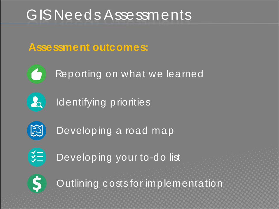
Assessment outcomes:
Reporting on what we learned
Identifying priorities
Developing a road map
Developing your to-do list
Outlining costs for implementation

Stormwater Utility AssessmentCity of Shelton
o Accomplish
Shelton’s conversion
goals
o Integrate with long-
term GIS goals
o Provide access web
map application
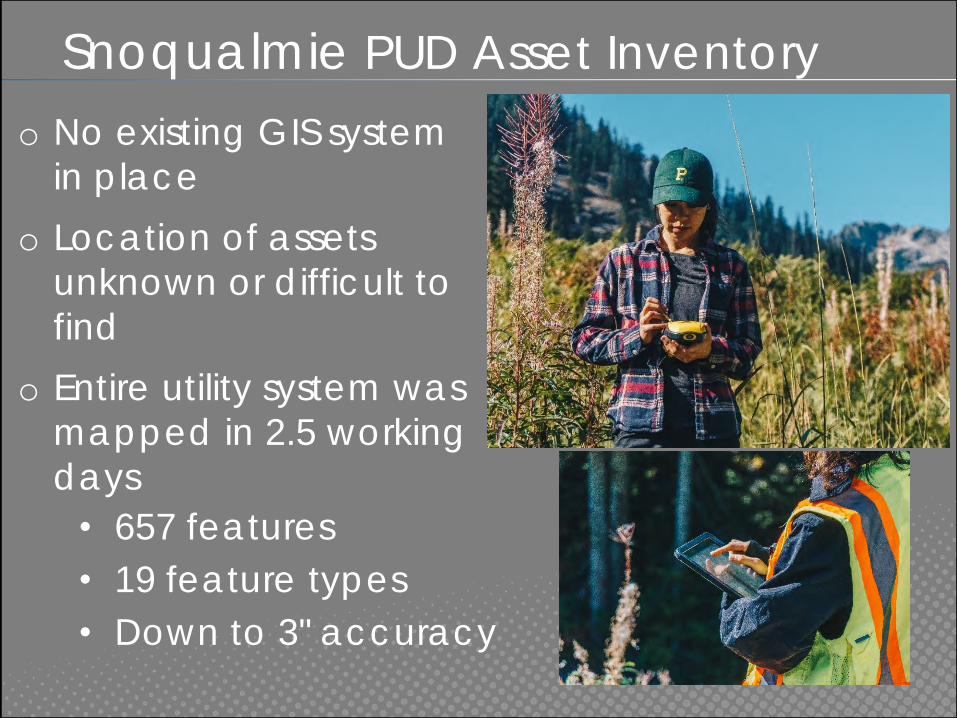
Snoqualmie PUD Asset Inventory
o No existing GIS system
in place
o Location of assets
unknown or difficult to
find
o Entire utility system was
mapped in 2.5 working
days
• 657 features
• 19 feature types
• Down to 3" accuracy

Snoqualmie PUD Asset Inventory

On-Call UAS MappingCity of Ellensburg


City Member Details
Members scan select the service tier
that best suits their needs
FREE 1 year ArcGIS Online account available ($2,500 value)

Q&A
QUESTIONS?
www.GIS.AWCNET.ORG
Tyler Vick
(503) 501-5248
Andy Meyer, AICP
(360) 753-4137