using high resolution satellite imagery to improve sweet potato crop statistics in uganda l....
TRANSCRIPT
Using high resolution satellite imagery to improve sweet potato crop statistics in Uganda
L. Claessens, P. Zorogastúa, R. Quiroz, M. Potts & S. Namanda
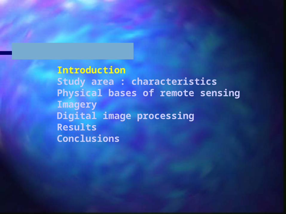
IntroductionStudy area : characteristicsPhysical bases of remote sensingImagery Digital image processingResultsConclusions
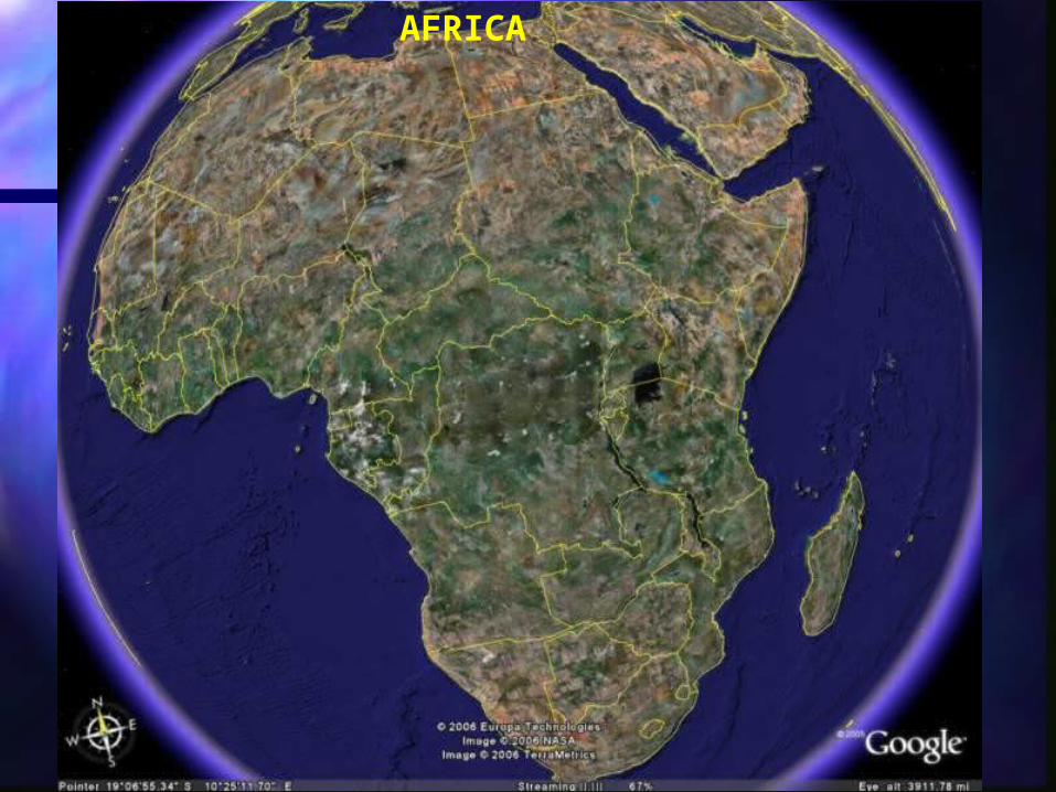
AFRICA
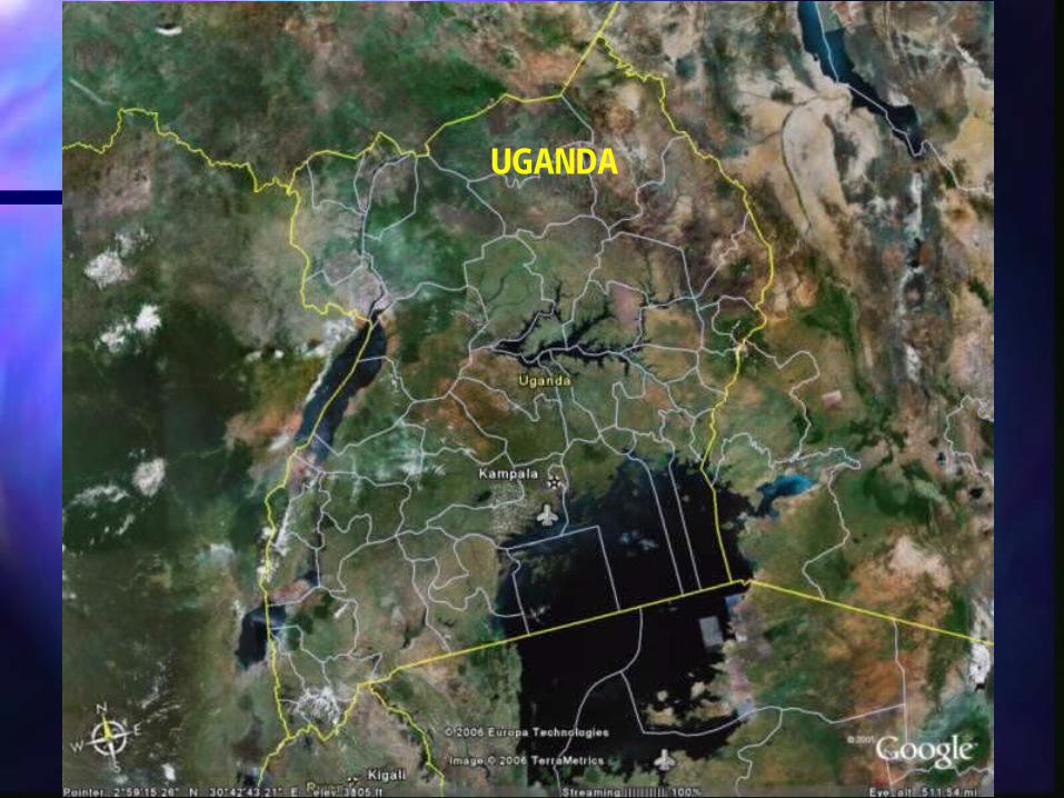
UGANDA

IntroductionStudy area : characteristicsPhysical bases of remote sensingImagery Digital image processingResultsConclusions
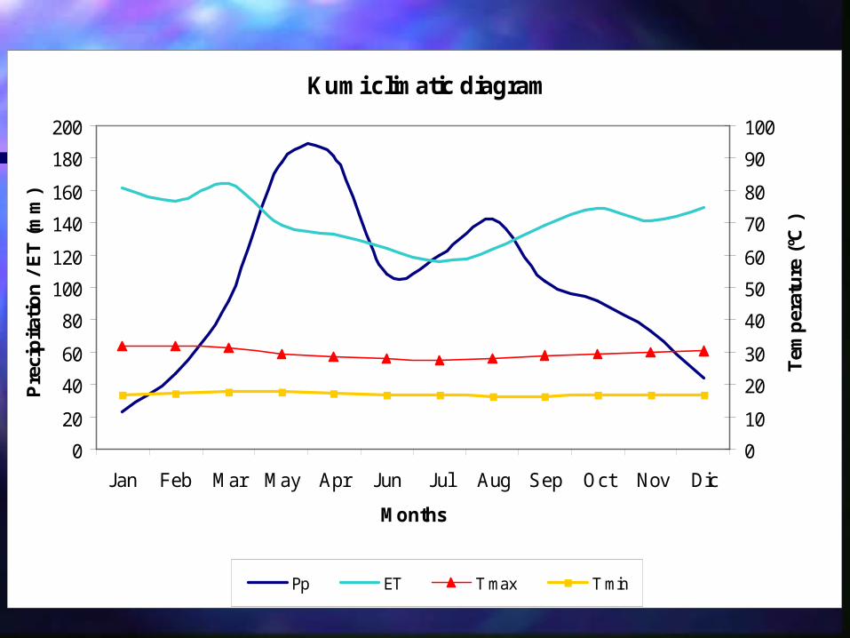
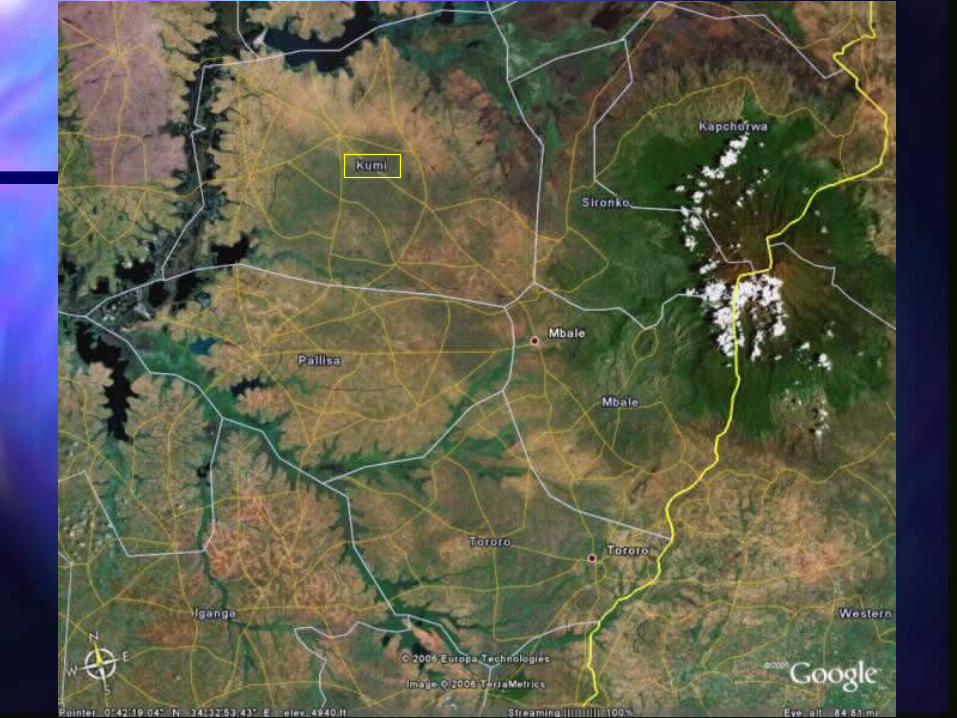
Kumi climatic diagram
0
20
40
60
80
100
120
140
160
180
200
Jan Feb Mar May Apr Jun Jul Aug Sep Oct Nov Dic
Months
Pre
cip
itat
ion
/ E
T (
mm
)
0
10
20
30
40
50
60
70
80
90
100
Tem
per
atu
re (
ºC )
Pp ET T max T min

Source: FAO

IntroductionStudy area : characteristicsPhysical bases of remote sensingImagery Digital image processingResultsConclusions
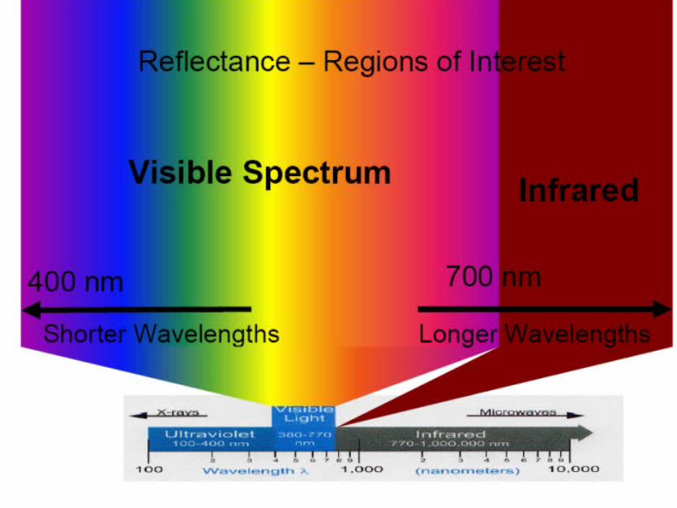
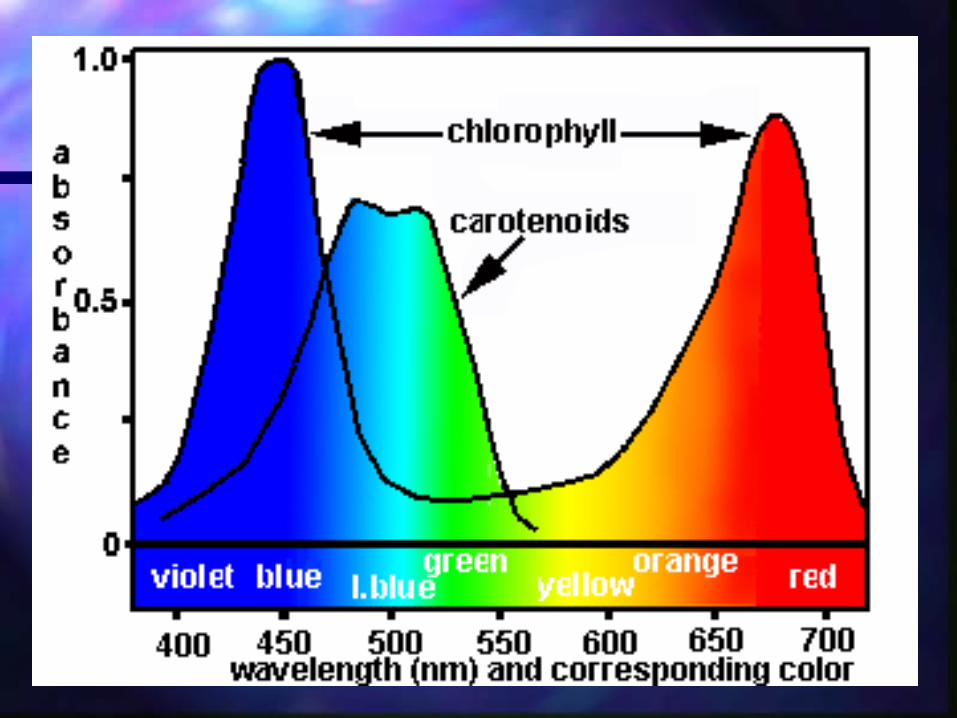
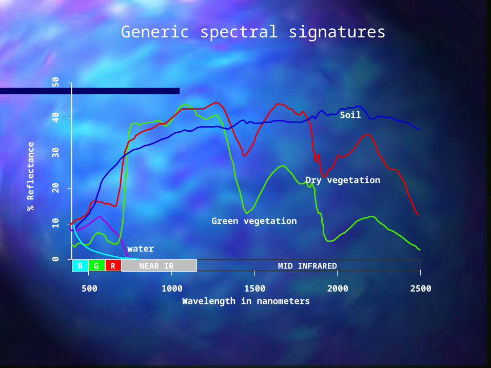
B RG NEAR IR MID INFRARED
500 1000 1500 2000 2500
010
2030
4050
Wavelength in nanometers
% R
efle
ctan
ce
water
Green vegetation
Dry vegetation
Soil
Generic spectral signatures

IntroductionStudy area : characteristicsPhysical bases of remote sensingImagery Digital image processingResultsConclusions
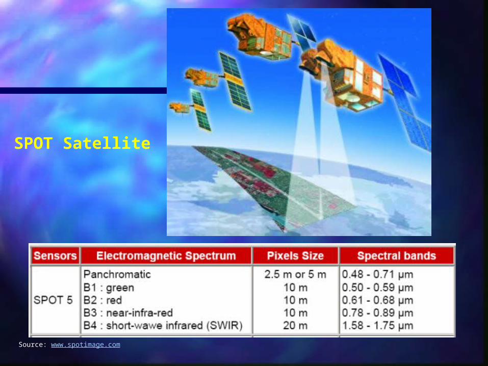
SPOT Satellite
Source: www.spotimage.com
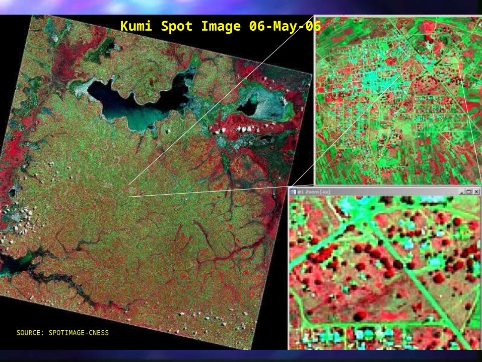
SOURCE: SPOTIMAGE-CNESS
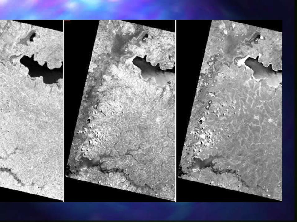
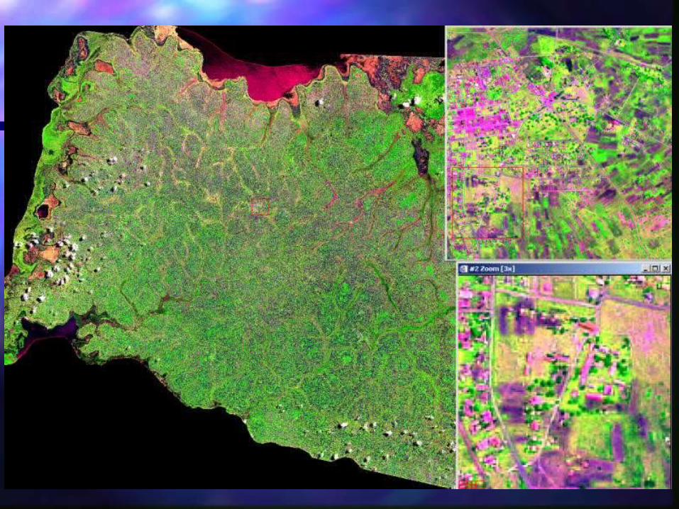
Kumi Spot Image 06-May-06
IntroductionStudy area : characteristicsPhysical bases of remote sensingImagery Digital processingResultsConclusions
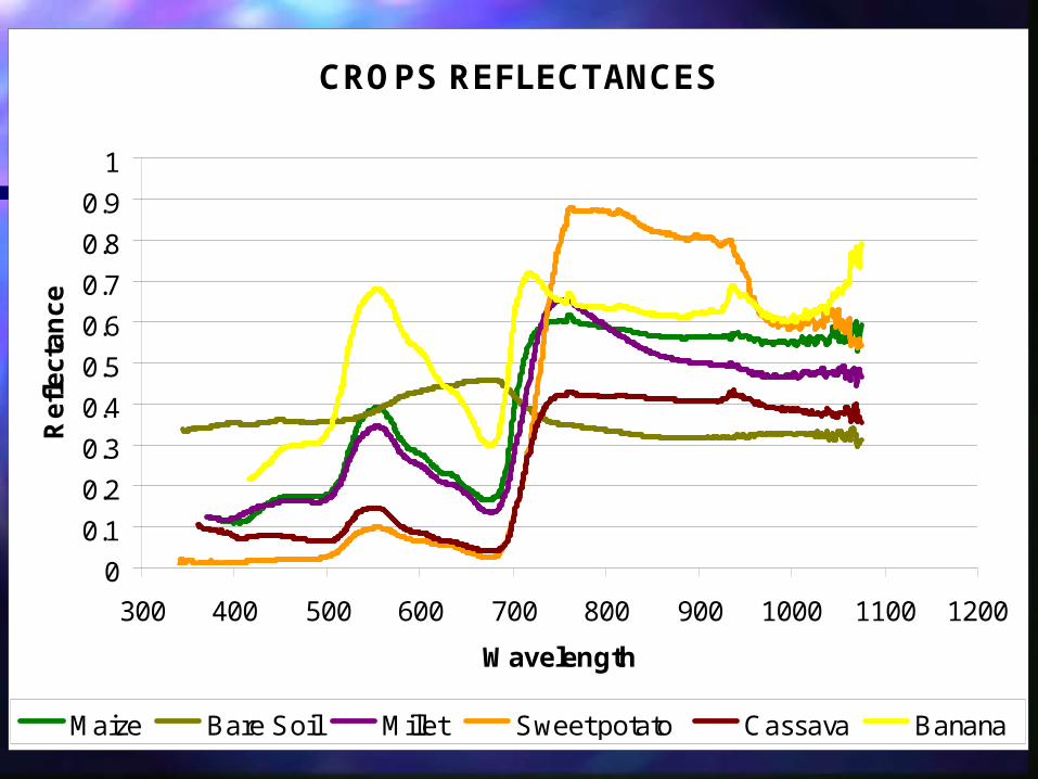
CROPS REFLECTANCES
0
0.1
0.2
0.3
0.4
0.5
0.6
0.7
0.8
0.9
1
300 400 500 600 700 800 900 1000 1100 1200
Wavelength
Re
fle
cta
nc
e
Maize Bare Soil Millet Sweet potato Cassava Banana

IntroductionStudy area : characteristicsPhysical bases of remote sensingImagery Digital image processingResultsConclusions
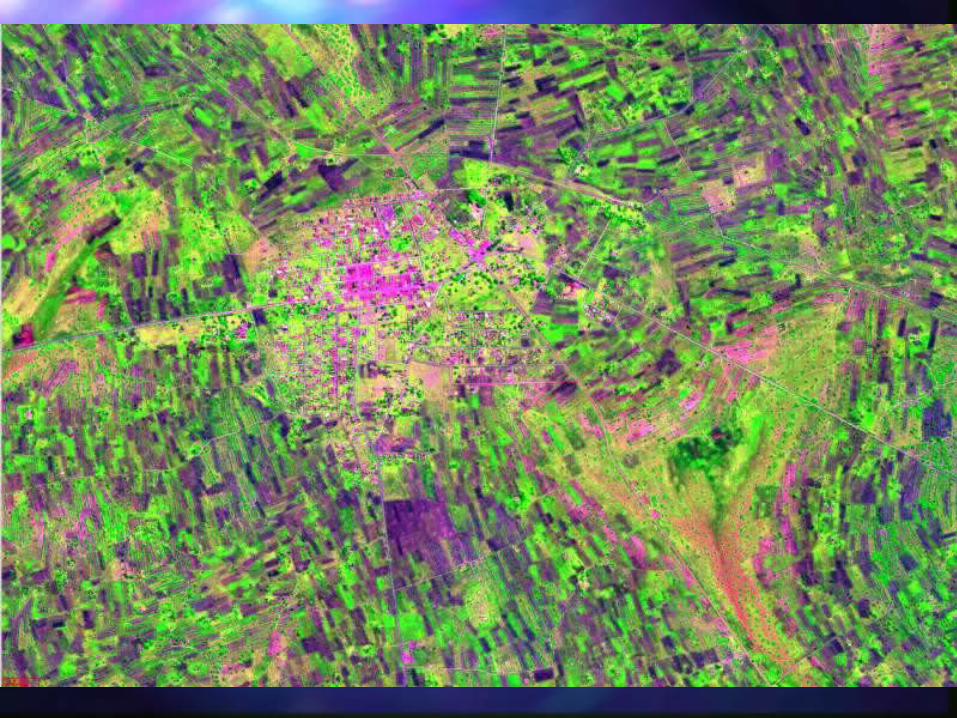
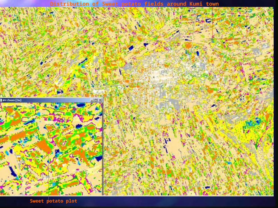
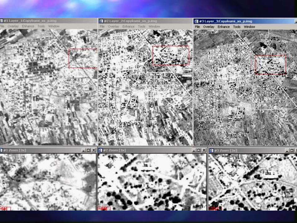
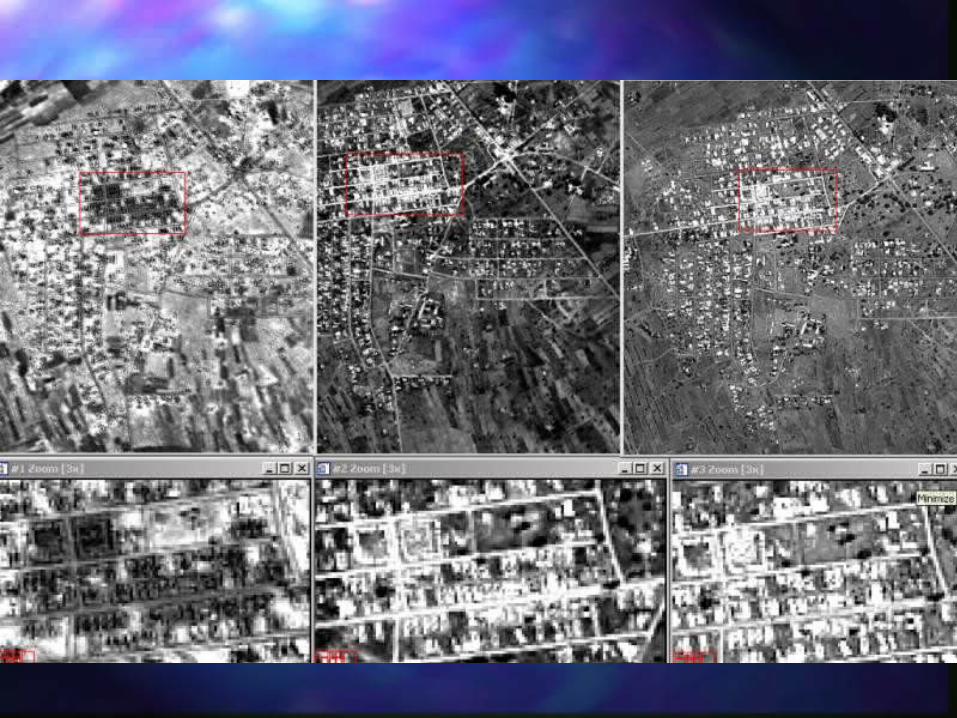
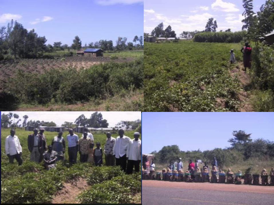
Sweet potato plot
Distribution of Sweet potato fields around Kumi town

IntroductionStudy area : characteristicsPhysical bases of remote sensingImagery Digital image processingResultsConclusions
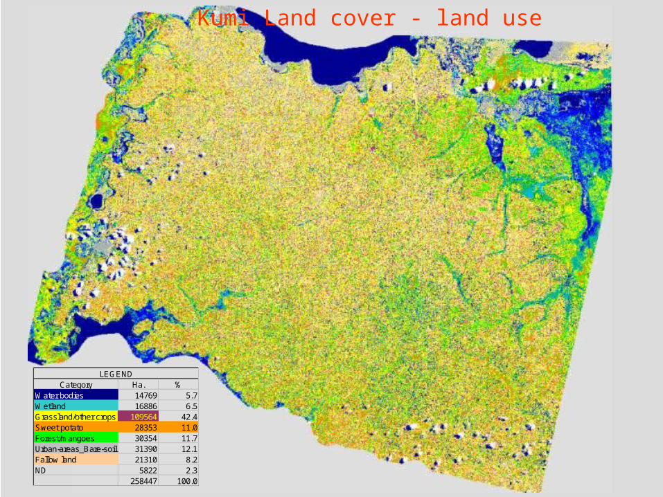
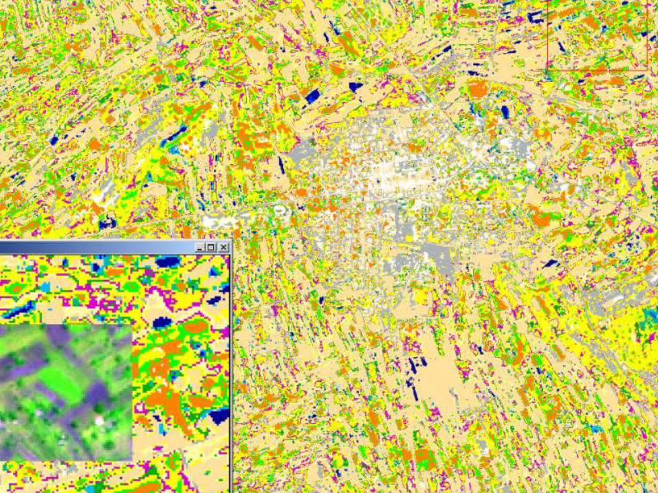
Kumi Land cover - land use
Category Ha. %Water bodies 14769 5.7Wetland 16886 6.5Grassland/other crops 109564 42.4Sweet potato 28353 11.0Forest/mangoes 30354 11.7Urban-areas_Bare-soil 31390 12.1Fallow land 21310 8.2ND 5822 2.3
258447 100.0
LEGEND
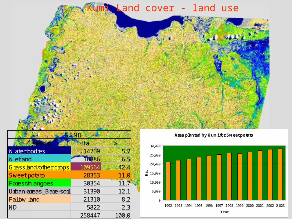
Kumi Land cover - land use
Category Ha. %Water bodies 14769 5.7Wetland 16886 6.5Grassland/other crops 109564 42.4Sweet potato 28353 11.0Forest/mangoes 30354 11.7Urban-areas_Bare-soil 31390 12.1Fallow land 21310 8.2ND 5822 2.3
258447 100.0
LEGEND Area planted by Kumi for Sweet potato
0
5,000
10,000
15,000
20,000
25,000
30,000
1992 1993 1994 1995 1996 1997 1998 1999 2000 2001 2002 2,003
Year
Ha.

THANKSTHANKS