· web viewsubdivision: bryce woodland estates unit #5a block: 6 lot: 21 unit: 5a all of lot #21...
TRANSCRIPT

PUBLIC NOTICE
Notice is hereby given that on May 26, 2016 at 10:00 o’clock am at the front door of the Kane County Courthouse, 76 N Main, Kanab, Kane County, Utah, the Kane County Auditor, Karla Johnson, will offer for sale at public auction and sell to the highest bidder for CASH OR CERTIFIED FUNDS pursuant to the provisions of Section 59-2-1351.1 Utah Code, the following described real property located in the County and now delinquent and subject to tax sale. No bid for less than the total amount of taxes, interest, penalty and administrative costs which are charged upon said real estate will be accepted. The Auditor reserves the right to move the tax sale proceedings indoors. Registration and administrative procedures will commence at 8 a.m. (MST), and the first property offered for bid at 10 a.m.
NO PERSONAL CHECKS WILL BE ACCEPTED IN PAYMENT OF BID. KANE COUNTY DOES NOT WARRANTY ANY PARCEL, AND ALL TITLE SEARCHES ARE THE RESPONSIBILITY OF THE PURCHASER.
METHOD OF SALE
The Board of County Commissioners of Kane County has determined the following method of sale best meets the objectives of protecting the financial interests of the delinquent property owners and collecting delinquent property taxes due:
The parcel will be sold to the bidder with the highest bid amount for the entire parcel of property. However, a bid may not be accepted for an amount which is insufficient to pay the taxes, penalties, interest and administrative costs. Any amount received in excess of the taxes due to all local governments and any administrative costs by the County shall be treated as surplus property and paid to the State Treasurer.
KANE COUNTY MAY TAX SALE RULES
1. The County Auditor will state the amount of taxes, penalties, interest, and administrative costs on the parcel being offered for sale, which is the amount at which bidding will begin and the lowest acceptable bid.
2. Upon receipt of a bid sufficient to pay taxes, penalties, interest and administrative costs on the parcel, higher bids shall be solicited. The bid received in the highest dollar amount, when no higher bids are tendered upon request by the Auditor, shall be the bid accepted. (If such bid is otherwise acceptable under these rules.)

3. Only cash or certified funds will be accepted in payment for property. Payment shall be made to the County Treasurer on or before 5:00 P.M. the day of the sale.
4. Each bidder shall pre-register prior to bidding and be given a number for bidding purposes. In the registration, each bidder shall properly and clearly identify correct information and address for use in issuance of deeds.
5. Upon ratification by the Board of County Commissioners, one deed, and only one deed, will be issued to the successful bidder on each parcel sold and shall be recorded by the County Recorder, upon submission (the filing fee being part of the administrative costs of the tax sale). The deed issued shall be a tax deed and not a warranty deed.
6. This tax deed will not guarantee a clear title. Kane County offers no warranties, assertions, legal opinions, or advice regarding the property. Kane County makes no representations as to the title conveyed, nor as to the purchaser’s right of possession of the property. Additionally, the County makes no warranties or representations as to whether the property is buildable or developable, nor does the County make any representations regarding whether or not if the parcel complies with applicable zoning or land use regulations. Kane County does not warrant or represent that any property purchased during tax sale is habitable or in any particular condition. The County makes no warranties or representations regarding the accuracy of the assessment of the property or the accuracy of the description of the real estate or improvements thereon.
7. The bidder first recognized by the County Auditor will be the first bid recorded, etc. As in any auction, the bid recognized is the one in effect at the time. All bids must be in increments of $50 or more. After bidding on any given parcel of land has started, parties who are bidding will not be permitted to withdraw their bids.
8. Loud whispering, yelling or talking, other than bids, shall be avoided, so that accurate records may be kept of the proceedings of the sale. The County reserves the right to remove any person(s) from the tax sale for disruptive behavior, at the request of the County Auditor.
9. The final bid number announced by the Auditor is the official sale, and the registered name and address will be the name that will go on the deed.
10. All bids shall be considered conditional, whether or not the bid is contested, until reviewed and accepted by the Board of County Commissioners, acting at a regularly scheduled meeting. The County Commissioners may reject any and all bids on the grounds that none are acceptable. Bids may not be withdrawn unilaterally by the successful bidder(s). The County Commissioners may enforce the terms of the bid by obtaining a legal judgment against the successful bidder in the amount of the bid, plus
interest and attorney’s fees.
11. The County Commission reserves the right to reject any and all bids.
12. Upon any final bid being rejected, the next previous acceptable bid may be accepted and the property sold to such bidder.
13. A fee in the amount of $300 will be assessed for "administrative costs" per parcel.
14. Any person wishing to contest any action taken in connection with the Kane County Tax Sale must present such protest to the Kane County Commission, in writing, within ten (10) days of the sale.
15. Property may be redeemed on behalf of the record owner by any person at any time prior to the tax sale, by paying all delinquent taxes, interest, penalties, and administrative costs that have accrued on the property to the Kane County Treasurer. Redemption must be paid by cash or certified funds. The period to redeem property shall end the day preceding the tax sale, prior to the closing of the books at the Treasurer’s Office at 5 p.m. (MST), as the tax sale will commence at 8 a.m. the following day.
State law requires payments on delinquencies be applied first to the interest and administrative costs accrued on the delinquencies for the last year included in the delinquent account at the time of payment, then payment is applied to the penalty charged for the last year included. After, payments are applied in the same manner to the delinquent year prior to the last year included on the tax sale, payment going towards the most recent year of interest, penalties, and delinquent taxes until paid in full.
A parcel will not be withdrawn from the tax sale unless the year of delinquent taxes triggering the inclusion of the parcel on the tax sale list, with its corresponding penalties and interest, are paid in full.
16. Any property listed may be subject to a roll-back tax under the provisions of "THE FARMLAND ASSESSMENT ACT" Utah Code Section 59-2-501 through 59-2-515.
17. Parcels subject to bankruptcy shall be withdrawn from the tax sale.
18. Properties not purchased at the tax sale shall be struck off to the County by the Auditor, becoming property of Kane County, subject to approval and acceptance of the Board of County Commissioners. If a successful bidder fails to tender payment as required, the property may, at the discretion of the Board of County Commissioners, be struck off to
the County. Properties struck off to the County may only be sold for fair market value, not the amount of the tax arrearages, the excess sale proceeds being treated according to State law and unclaimed property requirements.
19. No absentee or collusive bidding shall be permitted.
20. No person or party who has a conflict of interest shall be permitted to bid. Kane County employee(s) or official(s) may bid on a parcel, subject to these rules.
21. The County Auditor or Board of Commissioners shall withdraw a parcel from the tax sale, due to the discovery of irregular or erroneous assessment, deficient legal description, or may withdraw a parcel if withdrawal is in the best interest of the County. If the County Auditor withdraws a parcel based on it being in the best interest of the County, the Auditor must issue a written finding as to the reason for withdrawal, which then must be approved by the Board of County Commissioners, pursuant to State law.
22. The County Auditor shall disclose the properties withdrawn from the tax sale, for reasons other than redemption, at the regularly convened meeting of the Board of Commissioners, preceding the tax sale and the meeting after the tax sale.
23. The Board of County Commissioners may reject acceptance of property stricken off to the County by the County Auditor.
24. There shall be no preference given to any bidder.
25. Property taxes for the current year are not included in the tax sale, as they are not considered delinquent at the time of the tax sale.

2016 TAX SALE
KANE COUNTY COURTHOUSE26 MAY 2016
10:00 AM
Parcel10029291 T-A-29AAA OWL CORPORATIONBAGOLY BELA41 S BERkLEY AVE PASADENA, CA 91107ALL OF LOT #29 MAXWELL TOWERY SUBDIVISION AMENDED.
Parcel 20141245 T-A-30AAA OWL CORPORATIONBAGOLY BELA41 S BERKLEY AVE PASADENA, CA 91107ALL OF LOT #30 MAXWELL TOWERY SUBDIVISION AMENDED.
Parcel 30141252 T-A-31AAA OWL CORPORATIONBAGOLY BELA41 S BERKLEY AVE PASADENA, CA 91107ALL OF LOT #31 MAXWELL TOWERY SUBDIVISION AMENDED.
Parcel 40101260 T-A-34AAA OWL CORPORATIONBAGOLY BELA41 S BERKLEY AVE PASADENA, CA 91107ALL OF LOT #34 MAXWELL TOWERY SUBDIVISION AMENDED.
Parcel 50141278 T-A-35AAA OWL CORPORATIONBAGOLY BELA41 S BERKLEY AVE PASADENA, CA 91107ALL OF LOT #35 MAXWELL TOWERY SUBDIVISION AMENDED.
Parcel 60141286 T-A-36AAA OWL CORPORATIONBAGOLY BELA41 S BERKLEY AVE PASADENA, CA 91107ALL OF LOT #36 MAXWELL TOWERY SUBDIVISION AMENDED.
Parcel 70141294 T-A-37AAA OWL CORPORATIONBAGOLY BELA41 S BERKLEY AVE PASADENA, CA 91107ALL OF LOT #37 MAXWELL TOWERY SUBDIVISION AMENDED.
Parcel 80141302 T-A-38AAA OWL CORPORATIONBAGOLY BELA41 S BERKLEY AVE PASADENA, CA 91107ALL OF LOT #38 MAXWELL TOWERY SUBDIVISION AMENDED.
Parcel 90141310 T-A-39AAA OWL CORPORATIONBAGOLY BELA41 S BERKLEY AVE PASADENA, CA 91107ALL OF LOT #39 MAXWELL TOWERY SUBDIVISION AMENDED.

Parcel 100141344 T-A-42AAA OWL CORPORATIONBAGOLY BELA41 S BERKLEY AVE PASADENA, CA 91107ALL OF LOT #42 MAXWELL TOWERY SUBDIVISION AMENDED.
Parcel 110141351 T-A-43AAA OWL CORPORATIONBAGOLY BELA41 S BERKLEY AVE PASADENA, CA 91107ALL OF LOT #43 MAXWELL TOWERY SUBDIVISION AMENDED.
Parcel 120141369 T-A-44AAA OWL CORPORATIONBAGOLY BELA41 S BERKLEY AVE PASADENA, CA 91107ALL OF LOT #44 MAXWELL TOWERY SUBDIVISION AMENDED.
Parcel 13141385 T-A-46AAA OWL CORPORATIONBAGOLY BELA41 S BERKLEY AVE PASADENA, CA 91107ALL OF LOT #46 MAXWELL TOWERY SUBDIVISION AMENDED.
Parcel 140141393 T-A-47AAA OWL CORPORATIONBAGOLY BELA41 S BERKLEY AVE PASADENA, CA 9117ALL OF LOT #47 MAXWELL TOWERY SUBDIVISION AMENDED.

Parcel 150141427 T-A-50AAA OWL CORPORATIONBAGOLY BELA41 S BERKLEY AVE PASADENA, CA 91107ALL OF LOT #50 MAXWELL TOWERY SUBDIVISION AMENDED.
Parcel 160141435 T-A-51AAA OWL CORPORATIONBAGOLY BELA41 S BERKLEY AVE PASADENA, CA 91107ALL OF LOT #51 MAXWELL TOWERY SUBDIVISION AMENDED.
Parcel 17141401 T-A-48ALEXANDER HENRY & VICKIPO BOX 310 PAGE, AZ 86040-0310ALL OF LOT #48 MAXWELL TOWERY SUBDIVISION AMENDED.
Parcel 18141419 T-A-49ALEXANDER HENRY & VICKIPO BOX 310 PAGE, AZ 86040-0310ALL OF LOT #49 MAXWELL TOWERY SUBDIVISION AMENDED.
PARCEL 19 WITDRAWN
PARCEL 200046774 17-3-70BARATH ARTHUR6911 EISENHOWER AVEPORTAGE, IN 46368-1703ALL OF LOT #70 BLOCK 3 BRYCE WOODLAND ESTATES SUBDIVISION UNIT #3

PARCEL 210111545 8-8-19-1A1BARKER MICHAEL ROBERT –TR-BARKER MICHAEL ROBERTPO BOX 142SANTA CLARA, UT 84765-0142SECTION 19 TOWNSHIP 38S RANGE 8W BEG AT A PT S 89*43’W 897.2 FT FROM THE CENTER OF SEC 19 T38 S R8W SLB&M & RUN TH S 1320.0 FT; TH S 89*43’ W897.2 FT; TH N 1320.0 FT; TO THE PT OF BEG SUBJ TO R/W’S *FOR ABRAHAM & SONS*
PARCEL 220080575 52-38BARTA RAYMOND DALE7516 JOCKEY AVELAS VEGAS, NV 89130-1093ALLL OF LOT #38 MEADOW VIEW ESTATES SUBDIVISION PLAT C
PARCEL 230002074 B-24-78ABOGDANOVICH DONNA –SUC TR-2537-D #418 PACIFIC COAST HWYTORRANCE, CA 90505SECTION 24 TOWNSHIP: 43 S RANGE: 2 E THE W’LY ½ OF THE N’LY 329.0 FT OF LOT 78 SECT 24 T43S R2E SLB&M
PARCEL 24003643 E2-E-115BRODERICK DAVID L5050 LAKE POWELL BLVDCHURCHWELLS, UT 84741-8181ALL OF LOT #115 BLOCK E CHURCH WELLS SUBDIVISION PLAT B AMENDED
PARCEL 250003668 E2-E-117BRODERICK DAVID L5050 LAKE POWELL BLVDCHURCHWELLS, UT 84741-8181ALL OF LOT #117 BLOCK E CHURCH WELLS SUBDIVISION PLAT B AMENDED

PARCEL 260040314 O-4-58-ANNEXC&C HOLDINGS & SERVICES LLCCRUNK MARK319 E KIMBERLY DRHENDERSON, NV 89015-8145ORDERVILLE ANNEX 4 SECTION: 7 TOWNSHIP: 41S RANGE: 7W BEG AT A PT 660.0FT N & 486.3 FT W OF THE E/4 COR OF SEC 7 T41S R7W SLB&M & RUN TH W 162.1 FT; TH N 660.0 FT; TH E 163.1FT; TH S 660.0 FT TO THE PT OF BEG CONT 2.46 ACRES M/L
PARCEL -27 REDEEMED
PARCEL 280011463 K-1-11CHURCH KENNETH208 S 300 EKANAB UT 84741-3710KANAB BLOCK: 1 LOT: 4 TRACT: AOOO BEG AT THE NE COR OF LOT 4 BLOCK 1 PLAT A OF THE OFFICIAL SURVEY OF KANAB TOWNSITE & RUN TH W 113.5 FT; TH S 104.0 FT; TH E 113.5 FT; TH N 104.0 FT TO THE PT OF BEG
PARCEL 29 – 32 REDEEMED
PARCEL 330116215 K-45-1COLEMAN JERRY S & ROSA LIE133 S 200 W KANAB, UT 8474-3412SUBDIVISION: KANAB BLOCK: 45 LOT: 2 TRACT: A000 BEG AT A PT 272.5 FT E OF THE SW COR OF LOT 2 BLK 45 PLAT A OFFICIAL SURVEY KANAB TOWNSITE & RUN TH N 264.0 FT; TH E 190.42 FT TO THE E LINE OF SEC 28; TH S 09*35’ W ALONG SAID SEC LINE 172.0 FT; TH W 70.0 FT; TH S 92.0 FT; TH W 118.36 FT TO BEG
PARCEL 340016272 K-45-4COLEMAN JERRY S & ROSA LIE133 S 200 W

KANAB, UT 84741SUBDIVISION: KANAB BLOCK: 45 TRACT: A000 BEG 160 FT E OF THE SW COR OF BLK 45 PLAT A OFFICIAL SURVEY KANAB TOWNSITE & RUN TH N 132 FT; TH W 41 FT; TH N 132 FT; TH E 13 FT; THN 132 FT; TH E 331.95 FT M/L TO THE E LINE OF SEC 28; TH S 0*09’35” W 132 FT ALONG SAID LINE; TH W 190.42 FT; TH S 264 FT; TH W 112.5 FT TO BEG *WITH LIFE ESTATE TO CARL W SHRUM ON A PORTION OF ABOVE DESC PROPERTY FOR 2 YEARS OR UNTIL TERMINATED*
PARCEL 350071418 38-8-46COLLIER MEVLIN & CHARLENE225 TERRA VISTA RDHOWARD, PA 16841SUBDIVISION: BRYCE WOODLAND ESTATES UNIT #6C BLOCK: 8 LOT: 46 UNIT: 6CALL OF LOT #46 BLOCK 8 BRYCE WOODLAND ESTATES SUBDIVISION UNIT #6C
PARCEL 360046105 15-7-10COOK K BRINTON4753 STAVANGER LNLAS VEGAS, NV 89147-6049SUBDIVISION: BRYCE WOODLAND ESTATES UNIT #2 BLOCK: 7 LOT: 10 UNIT: 2 ALL OF LOT #10 BLOCK 7 BRYCE WOODLAND ESTATES SUBDIVISION UNIT #2
PARCEL 370046113 15-7-11COOK K BRINTON & STEPHANIE L4753 STAVENGER LNLAS VEGAS, NV 89147-6049SUBDIVISION: BRYCE WOODLAND ESTATES UNIT #2 BLOCK: 7 LOT: 11 UNIT: 2 ALL OF LOT #11 BLOCK 7 BRYCE WOODLAND ESTATES SUBDIVISIO UNIT #2
PARCEL 380056773 26-6-21CUDDY WILLIAM T & HARRIET F –CO-TR-5513 MORENDO DR

LAS VEGAS, NV 89107-1607SUBDIVISION: BRYCE WOODLAND ESTATES UNIT #5A BLOCK: 6 LOT: 21 UNIT: 5A ALL OF LOT #21 BLOCK 6 BRYCE WOODLAND ESTATES SUBDIVISION UNIT #5A*OF THE CUDDY 1991 TRUST 6/20/91*
PARCEL 390108962 8-5-11-1CCUDDY WILLIAM T & HARRIET F –CO-TR-1/5 CUDDY WILLIAM5513 MORENDO DRLAS VEGAS, NV 89107-1607SECTION: 11 TOWNSHIP: 38 S RANGE: 5W THE W/2NE/4NW/4NW/4 SEC 11 T38S R5W SLB&M, UTAH CONT 5.0 ACRES M/L RESERVING R/W *CUDDY 1991 TRUST 6/20/91 1/5 INTEREST*
PARCEL 40 REDEEMED
PARCEL 410104219 73-82DUPLEX RONAL JAMES3325 MISTY COVE CTLAS VEGAS, NV 89117-0233SUBDIVISION: NAVAJO LAKE ESTATES UNIT #4 AMENDED LOT: 82 UNIT: 4 ALL OF LOT #82 NAVAJO LAKE ESTATES SUBDIVISION UNIT #4 AMENDED
PARCEL 42 REDEEMED
PARCEL 430057938 27-7-84FLOYD ALMA J3116 WOODRIDGE DR HURST, TX 76054-2004SUBDIVISION: BRYCE WOODLAND ESTATES UNIT#5B BLOCK: 7 LOT: 84 UNIT: 5B ALL OF LOT #84 BLOCK 7 BRYCE WOODLAND ESTATES SUBDIVISION UNIT #5B
PARCEL 440107873 8A-G-24

FOLKERSEN MATTHEW DARRELL947 N MAIN STHURRICANE, UT 84737SUBDIVISION: LITTLE PONDEROSA RANCH AMENDED BLOCK: G000 LOT: 24 ALL OF LOT #24 BLOCK G LITTLE PONDEROSA RANCH AMENDED SUBDIVISION
PARCEL 450034242 G-2-30-ANNEXFOLLMER ROBERT & LOIS M1349 E SEA GULL DRGILBERT, AZ 85234-2611SUBDIVISION: GLENDALE TOWN ANNEX 2 SECTION: 10 TOWNSHIP: 40 S Range: 7W BEG S 2295 FT & E 2994 FT FROM THE NW COR OF SEC 1O T40S R7W SLB&M & RUN TH N 36*30’ E 1250 FT M/L TO THE N LINE OF SW/4NE/4; TH E 215 FT M/L TO THE NE COR OF SD 40 ACRES; TH S 233 FT; TH S 27*30’W 1217 FT; TH N 52*17’W 501.8 FT TO THE PT OF BEG
PARCEL 460116957 G-83-21FORCE STEPHEN L & MIRIAM C474 N 100 ELAVERKIN, UT 84745SUBDIVISION: LYDIA’S CANYON ESTATES UNIT A LOT: 21 UNIT: A000 ALL OF LOT #21 LYDIA’S CANYON ESTATES SUBDIVISION UNIT A *ROYCE CHAMBERLAIN – TRUSTEE – FOR JACK CHAMBERLAIN*
PARCEL 47 WITHDRAWN
PARCEL 480044571 13-47HOLMAN DOUGLAS A636 SAINT ANDREWS RDHENDERSON, NV 89015SUBDIVISION: MEADOW VIEW ESTATES UNIT A LOT:47 UNIT: A000 ALL OF LOT #47 MEADOW VIEW ESTATES SUBDIVISION UNIT A
PARCEL 490059801 3-4-29-1JEM INVESTMENTS

STRANSKY JOHN 18084 WESTMISTER DRLAKE OSWEGO, OR 97034SECTION: 29 Township: 43S RANGE: 4W BEG AT THE NW COR OF SEC 29 T43S R4W SLB&M, UTAH TH S 0*04’08” W ALG THE W LINE OF SEC 29, 3784.10 FT TO THE INTERSECTION OF THE N R/W LINE OF U.S.HWY 89; TH N 88*08’05” E ALG SD R/W LINE 2618.55 FF TO THE INTERSECTION WITH THE N-S CENTER LINE OF SECTION 29; TN N 0*20’44” E ALG SD CENTERLINE 3699.82 FT TO THE N/4 COR SEC 29; TH S 89*58’50” W ALG THE SEC LINE 2634.92 FT TO BEG
PARCEL 500067960 35-A-6KIMBALL ROLLOW D4936 E CLEVELAND AVELAS VEGAS, NV 89104SUBDIVISION: LONG VALLEY ESTATES BLOCK: A000 LOT: 6 ALL OF LOT #6 BLOCK A LONG VALLEY ESTATES SUBDIVISION
PARCEL 510000839 B-10-32 KROVER-MOSEL ENTERPRISES LTD614 PIONEER DR SANTA MARIA, CA 93454-3444SECTION: 10 TOWNSHIP: 43 RANGE: 2E ALL OF LOT #32 SECTION 10 T43S R2E SLB&M 1.32 AC AND ALL OF LOT #4 SECTION 15 T43S R2E SLB&M .18 AC TOTAL AC 1.50*BIG WATER UTAH*
PARCEL 520000847 B-10-33KROVER-MOSEL ENTERPRISES LTD614 PIONEER DR SANTA MARIA, CA 93454-3444SECTION: 10 TOWNSHIP : 43S RANGE:2E ALL OF LOT #33 SEC 10 T43S R2E SLB&M 1.39 AC & ALL OF LOT #5 SEC 15 T43S R2E SLB&M 1.21 AC TOTAL AC 2.60 *BIG WATER UTAH*
PARCEL 530138837 B-J-L-17KROVER-MOSEL ENTERPRISES LTD
614 PIONEER DR SANTA MARIA, CA 93454-3444SUBDIVISION: GLEN CANYON TOWNSITE BLOCK: L000: 17 TRACT: A000 ALL OF LOT #17 BLOCK L REVISED PLAT A OFFICIAL TOWNSITE GLEN CANYON, UTAH *BIG WATER UTAH*
PARCEL 540138845 B-J-L-18KROVER-MOSEL ENTERPRISES LTD614 PIONEER DR SANTA MARIA, CA 93454-3444SUBDIVISION: GLEN CANYON TOWNSITE BLOCK: L000 LOT: 18 TRACT: A000 ALL OF LOT #18 BLOCK L REVISED PLAT A OFFICIAL TOWNSITE GLEN CANYON, UTAH *BIGWATER, UTAH*
PARCEL 550138852 B-J-L-19KROVER-MOSEL ENTERPRISES LTD614 PIONEER DR SANTA MARIA, CA 93454-3444SUBDIVSION: GLEN CANYON TOWNSITE BLOCK: L000 LOT: 19 TRACT: A000 ALL OF LOT #19 BLOCK L; REVISED PLAT A OFFICIAL TOWNSITE GLEN CANON, UTAH *BIG WATER, UTAH*
PARCEL 560008709 B-J-L-2KROVER-MOSEL ENTERPRISES LTD614 PIONEER DR SANTA MARIA, CA 93454-3444SUBDIVISION: GLEN CANYON TOWNSITE BLOCK: L000 LOT: 2 TRACT: A000 ALL OF LOT #2 BLOCK L REVISED PLAT A OFFICIAL TOWNSITE GLEN CANYON, UTAH *BIG WATER, UTAH*
PARCEL 570008717 B-J-L-23KROVER-MOSEL ENTERPRISES LTD614 PIONEER DR SANTA MARIA, CA 93454-3444

SUBDIVISION: GLEN CANYON TOWNSITE BLOCK: L000 LOT: 23 TRACT: A000 ALL OF LOT #23 BLOCK L REVISED PLAT A OFFICIAL TOWNSITE GLEN CANYON, UTAH *BIG WATER, UTAH*
PARCEL 580138795 B-J-L-5KROVER-MOSEL ENTERPRISES LTD614 PIONEER DR SANTA MARIA, CA 93454-3444SUBDIVISION: GLEN CANYON TOWNSITE BLOCK: L000 LOT: 5 TRACT: A000 ALL OF LOT # 5 BLOCK L REVISED PLAT A OFFICIAL TOWNSITE GLEN CANYON, UTAH *BIG WATER, UTAH*
PARCEL 590138803 B-J-L-6KROVER-MOSEL ENTERPRISES LTD614 PIONEER DR SANTA MARIA, CA 93454-3444SUBDIVISION: GLEN CANYON TOWNSITE BLOCK: L000 LOT: 6 TRACT: A000 ALL OF LOT # 6 BLOCK L REVISED PLAT A OFFICIAL TOWNSITE GLEN CANYON, UTAH *BIG WATER UTAH*
PARCEL 600138811 B-J-L-7KROVER-MOSEL ENTERPRISES LTD614 PIONEER DR SANTA MARIA, CA 93454-3444SUBDIVISION: GLEN CANYON TOWNSITE BLOCK: L000 LOT: 7 TRACT: A000 ALL OF LOT #7 BLOCK L REVISED PLAT A OFFICIAL TOWNSITE GLEN CANYON , UTAH *BIG WATER UTAH*
PARCEL 610138829 B-J-L-8KROVER-MOSEL ENTERPRISES LTD614 PIONEER DR SANTA MARIA, CA 93454-3444SUBDIVISION: GLEN CANYON TOWNSITE BLOCK: L000 LOT: 8 TRACT: A000 ALL OF LOT #8 BLOCK L REVISED PLAT A OFFICIAL TOWNSITE GLEN CANYON, UTAH *BIG WATER, UTAH*

PARCEL 62 WITHDRAWN
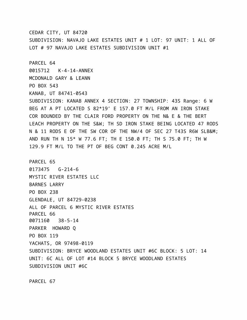
PARCEL 630024706 N-97MCCORMICK CHRIS M2739 W COOKIE JAR CIRCEDAR CITY, UT 84720SUBDIVISION: NAVAJO LAKE ESTATES UNIT # 1 LOT: 97 UNIT: 1 ALL OF LOT # 97 NAVAJO LAKE ESTATES SUBDIVISION UNIT #1
PARCEL 640015712 K-4-14-ANNEXMCDONALD GARY & LEANNPO BOX 543 KANAB, UT 84741-0543SUBDIVISION: KANAB ANNEX 4 SECTION: 27 TOWNSHIP: 43S Range: 6 W BEG AT A PT LOCATED S 82*19’ E 157.0 FT M/L FROM AN IRON STAKE COR BOUNDED BY THE CLAIR FORD PROPERTY ON THE N& E & THE BERT LEACH PROPERTY ON THE S&W; TH SD IRON STAKE BEING LOCATED 47 RODS N & 11 RODS E OF THE SW COR OF THE NW/4 OF SEC 27 T43S R6W SLB&M; AND RUN TH N 15* W 77.6 FT; TH E 150.0 FT; TH S 75.0 FT; TH W 129.9 FT M/L TO THE PT OF BEG CONT 0.245 ACRE M/L
PARCEL 650173475 G-214-6MYSTIC RIVER ESTATES LLCBARNES LARRYPO BOX 238 GLENDALE, UT 84729-0238ALL OF PARCEL 6 MYSTIC RIVER ESTATES PARCEL 660071160 38-5-14PARKER HOWARD QPO BOX 119YACHATS, OR 97498-0119SUBDIVISION: BRYCE WOODLAND ESTATES UNIT #6C BLOCK: 5 LOT: 14 UNIT: 6C ALL OF LOT #14 BLOCK 5 BRYCE WOODLAND ESTATES SUBDIVISION UNIT #6C
PARCEL 67
0071178 38-5-15PARKER HOWARD QPO BOX 119YACHATS, OR 97498-0119SUBDIVISION: BRYCE WOODLAND ESTATES UNIT #6C BLOCK: 5 LOT: 15 UNIT: 6C ALL OF LOT #15 BLOCK 5 BRYCE WOODLAND ESTATES SUBDIVISION UNIT #6C
PARCEL 680071236 38-5-5PARKER HOWARD QPO BOX 119YACHATS, OR 97498-0119SUBDIVISION: BRYCE WOODLAND ESTATES UNIT #6C BLOCK: 5 LOT: 5 UNIT: 6C ALL OF LOT #5 BLOCK 5 BRYCE WOODLAND ESTATES SUBDIVISION UNIT #6C
PARCEL 690071244 38-5-6PARKER HOWARD QPO BOX 119YACHATS, OR 97498-0119SUBDIVISION: BRYCE WOODLAND ESTATES UNIT #6C BLOCK: 5 LOT: 6 UNIT: 6C ALL OF LOT #6 BLOCK 5 BRYCE WOODLAND ESTATES SUBDIVISION UNIT #6C
PARCEL 700071251 38-5-7PARKER HOWARD QPO BOX 119YACHATS, OR 97498-0119SUBDIVISION: BRYCE WOODLAND ESTATES UNIT #6C BLOCK: 5 LOT: 7 UNIT: 6C ALL OF LOT #7 BLOCK 5 BRYCE WOODLAND ESTATES SUBDIVISION UNIT #6C
PARCEL 710056922 26-6-36SHAUL TODD7911 EVENING SHADOWS AVELAS VEGAS, NV 89131-4692
SUBDIVISION: BRYCE WOODLAND ESTATES UNIT #5A BLOCK: 6 LOT: 36 UNIT: 5A ALL OF LOT #36 BLOCK 6 BRYCE WOODLAND ESTATES SUBDIVISION UNIT #5A
PARCEL 720056930 26-6-37SHAUL TODD7911 EVENING SHADOWS AVELAS VEGAS, NV 89131-4692SUBDIVISION: BRYCE WOODLAND ESTATES UNIT #5A BLOCK: 6 LOT: 37 UNIT: 5A ALL OF LOT #37 BLOCK 6 BRYCE WOODLAND ESTATES SUBDIVISION UNIT #5A
PARCEL 730020415 K-90-5STEWART GINAPO BOX 6174LAS VEGAS, NV 89141SUBDIVISION: COUNTRY VILLAGE UNIT #1 LOT; 5 UNIT: 1 ALL OF LOT #5 COUNTRY VILLAGE SUBDIVISION UNIT #1
PARCEL 740107444 8A-F-20TOWN N COUNTRY SALES INC1207 CARMEL OAKSSAN ANTONIO, TX 78253-6631SUBDIVISION: LITTLE PONDEROSA RANCH AMENDED BLOCK: F000 LOT: 20 TRACT: A000 ALL OF LOT #20 BLOCK F LITTLE PONDEROSA RANCH SUBDIVISION AMENDED
PARCEL 750030125 X-8-494UTHE DONALD & NORAH1625 CAMBELL ST STE #1RAPID CITY, SD 57701SUBDIVISION: ROUND VALLEY SUBDIVISION BLOCK: 8 LOT: 494 LOT 494 BLK 8 ROUND VALLEY SUBDIVISION
PARCEL 760133267 123-149-3
WESTFALL ROBERT L JR & GRACIE L9332 TANGO MOON CTLAS VEGAS, NV 89149SUBDIVISION: SKYHAVEN MT RETREAT UNIT #3 LOT: 149 UNIT: 3 ALL OF LOT #149 SKYHAVEN MOUNTAIN RETREAT SUBDIVISION UNIT #3
PARCEL 770124183 9-8-15-1-6WEST JOETTE WEST RICK9885 WITTIG AVELAS VEGAS, NV 89149SECTION: 15 TOWNSHIP: 39S RANGE: 8W BEG AT A PT 990.0 FT E FROM THE W/4 COR OF SEC 15 T 39S R8W SLB&M & RUN TH N 577.02 FT; TH S 75*53’E 253.47 FT; TH S 88*00’ E 249.34 FT; TH S 506.50 FT M/L TO THE 1/16TH SEC LINE; TH W 495.0 FT M/L ALG SD LINE TO THE PT OF BEG
PARCEL 780125198 9-8-21-101WEST JOETTE 9885 WITTIG AVELAS VEGAS, NV 89149-1364SECTION: 21 Township: 39S RANGE: 8W THE NE/4SW/4NE/4 OF SEC 21 T39S R8W SLB&M CONT 10.0 ACRES M/L
PARCEL 790098767 66-39WILLIAMS BROTHER INC7260 W AZURE DR STE 140LAS VEGAS, NV 89130-4413SUBDIVISION: ZION VIEW MTN ESTATES UNIT E LOT: 39 UNIT: E000 ALL OF LOT #39 ZION VIEW MTN ESTATES SUBDIVISION UNIT E