virtual data center 26july2010
TRANSCRIPT

Virtual Data Centre Metadata ProjectPutting endusers in direct contact with data owners via metadata web services
Dr Brad Ilg July 2010
GNS Science
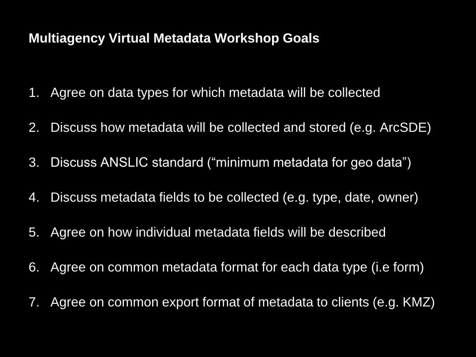
Multiagency Virtual Metadata Workshop Goals
1. Agree on data types for which metadata will be collected
2. Discuss how metadata will be collected and stored (e.g. ArcSDE)
3. Discuss ANSLIC standard (“minimum metadata for geo data”)
4. Discuss metadata fields to be collected (e.g. type, date, owner)
5. Agree on how individual metadata fields will be described
6. Agree on common metadata format for each data type (i.e form)
7. Agree on common export format of metadata to clients (e.g. KMZ)
GNS Science
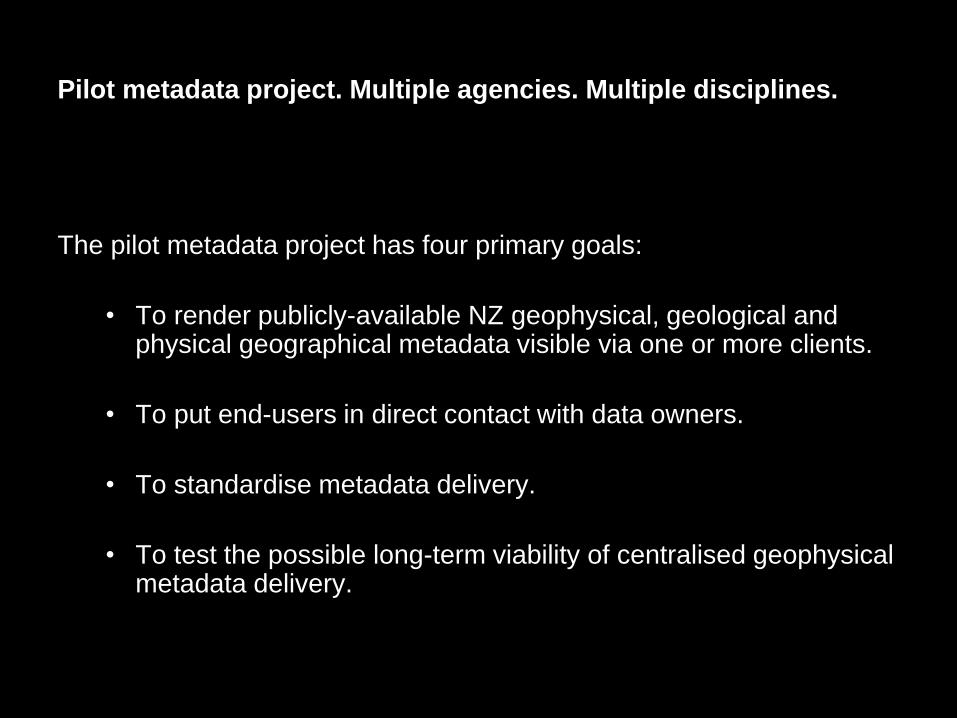
Pilot metadata project. Multiple agencies. Multiple disciplines.
The pilot metadata project has four primary goals:
• To render publicly-available NZ geophysical, geological and physical geographical metadata visible via one or more clients.
• To put end-users in direct contact with data owners.
• To standardise metadata delivery.
• To test the possible long-term viability of centralised geophysical metadata delivery.

GNS Science
Example configuration of metadata host
Public GE Globe
Atmosphere
Hydrosphere
Biosphere
Lithosphere
Cen
tral M
eta
data
Ho
st
Built
Firewall
Government
Delivery
Clients?
Firewall?
Web Services
Contributing Disciplines

GNS Science
Example metadata topical divisions (marine data only initially)
Geography
•Swath bathymetry
•topography
Geology
•Bottom samples
•Seep maps
•PETLAB
•FRED
Geophysics
•Seismic
•Gravity
•Magnetics
•Magnetotellurics
Geochemistry
•Water column samples
•Rock samples
Oceanography
•Currents
•Temperature
•Slick maps
•Waves
GNS Science
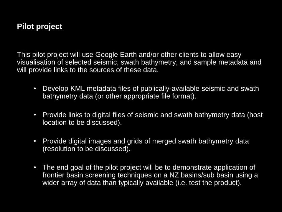
Pilot project
This pilot project will use Google Earth and/or other clients to allow easy visualisation of selected seismic, swath bathymetry, and sample metadata and will provide links to the sources of these data.
• Develop KML metadata files of publically-available seismic and swath bathymetry data (or other appropriate file format).
• Provide links to digital files of seismic and swath bathymetry data (host location to be discussed).
• Provide digital images and grids of merged swath bathymetry data (resolution to be discussed).
• The end goal of the pilot project will be to demonstrate application of frontier basin screening techniques on a NZ basins/sub basin using a wider array of data than typically available (i.e. test the product).

GNS Science
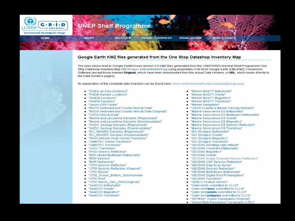
Conceptual model of web interface-UNEP Shelf Programme
www.continentalshelf.org
GNS Science

GNS Science
GNS Science
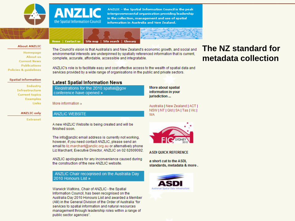
The NZ standard for
metadata collection
GNS Science
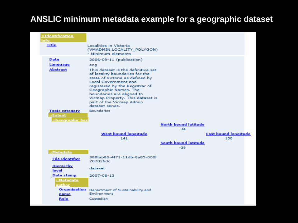
ANSLIC minimum metadata example for a geographic dataset

GNS Science
It’s all about visibility of data. Access to the data is
negotiated between data owner and industry client.
Initially
• Seismic reflection data (geophysical)
• Swath bathymetry data (geographical)
• Seafloor sample data (geological)
Eventually
• Gravity
• Magnetics
• Drill holes
• And other relevant data
GNS Science
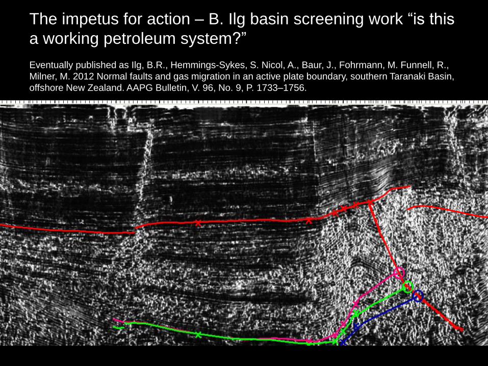
The impetus for action – B. Ilg basin screening work “is this
a working petroleum system?”
Eventually published as Ilg, B.R., Hemmings-Sykes, S. Nicol, A., Baur, J., Fohrmann, M. Funnell, R.,
Milner, M. 2012 Normal faults and gas migration in an active plate boundary, southern Taranaki Basin,
offshore New Zealand. AAPG Bulletin, V. 96, No. 9, P. 1733–1756.

GNS Science
Swath bathymetry data displayed on public GE globe

GNS Science
Legend
Dk blue-oil slicks
Lt blue-? Oil slicks
Orange-pollution
Dk green-oil mature
Red-gas mature
Lt green-sub mature
Example basin screening data
and interpretation performed in
2009/2010 and PEPs awarded
to Statoil in 2013 and 2014.
Stagpoole V. M., Reid E., Browne, G.H., Bland, K.J., Ilg, B.R.,
Griffin, A.G., Herzer, R.H., Uruski, C.I. 2009. Petroleum
prospectivity of the Reinga Basin, New Zealand. GNS Science
Consultancy Report. 2009/251. 2 logs,105 p.
Uruski, C.I., Reid, E., Stagpoole, V.M., Herzer, R.H., Griffin,
A.G., Bland, K.J., Ilg, B.R., Browne, G.H. 2010. The Reinga
Basin, North Island, New Zealand. APPEA journal 50: 287-
308.
Figure at right-Frontier Basin Screening by B.R. Ilg. Note
coincidence between red and green dots and Statoil Blocks

GNS Science
Pilot metadata project. Multiple agencies. Multiple disciplines.
The pilot metadata project has four primary goals:
• To render publicly-available NZ geophysical, geological and physical geographical metadata visible via one or more clients.
• To put end-users in direct contact with data owners.
• To standardise metadata delivery.
• To test the possible long-term viability of centralised geophysical metadata delivery.