visitor center connector trail environmental assessment
TRANSCRIPT
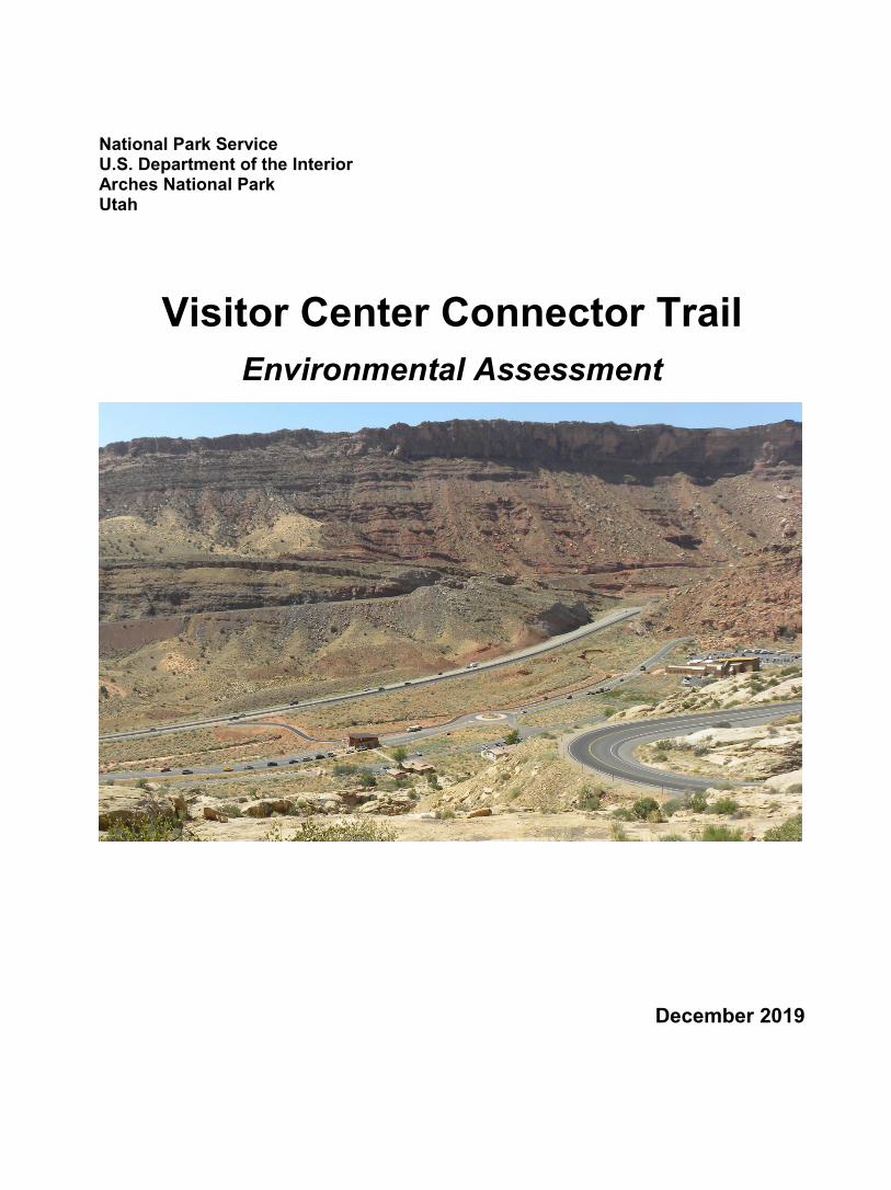
National Park Service U.S. Department of the Interior Arches National Park Utah
Visitor Center Connector Trail Environmental Assessment
December 2019

Page left intentionally blank

Contents PART 1: PURPOSE AND NEED ................................................................................................................... 1
PURPOSE AND NEED .............................................................................................................................. 1
BACKGROUND ......................................................................................................................................... 1
ISSUES AND RESOURCE TOPICS RETAINED FOR ANALYSIS ..................................................... 3
Bicyclists’ Safety and Experience in the Entrance Area ..................................................................... 3
PART 2: ALTERNATIVES .............................................................................................................................. 3
NO-ACTION ALTERNATIVE ................................................................................................................ 3
PROPOSED ACTION ALTERNATIVE (NPS PREFERRED ALTERNATIVE) .............................. 4
PART 3: AFFECTED ENVIRONMENT AND ENVIRONMENTAL CONSEQUENCES ............... 4
ANALYZING CUMULATIVE IMPACTS ............................................................................................. 4
AFFECTED ENVIRONMENT AND ENVIRONMENTAL CONSEQUENCES ........................... 5
Bicyclists’ Safety and Experience in the Entrance Area ..................................................................... 5
PART 4: CONSULTATION AND COORDINATION ............................................................................ 7
PART 5: ACRONYMS ................................................................................................................................... 8

PART 1: PURPOSE AND NEED
PURPOSE AND NEED The purpose for taking action is to allow park visitors, park employees, and town residents to safely access the Arches visitor center by bicycle from the existing bicycle and pedestrian path (Moab Canyon Pathway) outside the park. Action is needed at this time because currently, people entering Arches National Park on a bicycle must use the Arches park entrance road to access the visitor center and scenic drive. This creates safety issues for vehicles and bicycles, and marginally increased queuing times at the entrance station.
BACKGROUND The Moab Canyon Pathway is a shared use bicycle and pedestrian paved pathway that was completed in 2010. It extends from the pedestrian/bike bridge across the Colorado River just north of Moab to the beginning of Highway 313 (8.5 miles total length). Approximately 2 miles north of the pedestrian/bike bridge, the path intersects with the Arches entrance road. Use of this trail has increased over the past five years from approximately 12,000 annual users in 2015 to over 30,000 annual users in 2019 (BLM trail counter data). The new Visitor Center Connector Trail (figure 1) connects park visitors and town residents to the Arches National Park Visitor Center. The paved trail is 0.26 miles in length and starts from the existing Moab Canyon Pathway off Highway 191 and utilizes the visitor center bridge (and former park entrance road) to cross over Bloody Mary Wash. From there, it bypasses the entrance station and stays below the road on a bench between Bloody Mary Wash and the entrance road before gradually rising up to the road and crossing perpendicularly.
Figure 1. Arches Visitor Center Connector Trail
1

At this crossing, stop signs are used, as well as other traffic signs and pavement markings. The trail traverses through an area which was previously the old visitor center parking lot and ends between existing stone walls along the Arches visitor center patio (figure 2). A fee collection device will be installed at this location to collect fees missed by bypassing the entrance station.
Figure 2. Terminus of Visitor Center Connector Trail at VC patio (mock-up)
The Visitor Center Connector Trail, which was constructed in the summer of 2019, currently provides access for pedestrians. The trail was constructed in accordance with national guidelines for shared use paths. As a shared use path, the trail is well suited for bicycle use. It has an asphalt running surface (2" asphalt travel surface over 6" of imported base), a minimum path width of ten feet with a two foot shoulder, a five percent maximum running slope grade, and a safety railing/guard rail adjacent to steep slopes. All salvageable plants of significance were salvaged prior to construction and temporary fencing was installed to delineate the work zone and minimize impacts to surrounding resources. Jute netting and straw wattles were installed on steeper slopes for erosion control and these slopes will be reseeded and revegetated beginning in the fall of 2019. The trail was designed to ensure water drains off the path appropriately and not eroding adjacent areas. Lifecycle costs for the trail will be low and include striping and crack-sealing as needed to coincide with regularly scheduled maintenance for other park roads and parking areas.
The construction of the trail was evaluated under a categorical exclusion. In order for the trail to connect with the Moab Canyon Pathway, it included construction outside the Arches National Park boundary (a 150 section on Bureau of Land Management (BLM) land and a 220 foot section on the Utah Department of Transportation (UDOT) Right-of-Way (ROW) (see figure 3). A ROW permit was obtained from the Bureau of Land Management and an Encroachment Permit was obtained from the Utah Department of Transportation prior to completion of the categorical exclusion. NPS Regulation 36 CFR § 4.30 requires any park, before authorizing bicycle use on an existing trail, must evaluate the use in an environmental assessment (EA) or environmental impact statement
2

(EIS). Consistent with this regulation, the park is now evaluating bicycle access on the Visitor Center Connector Trail in this EA.
Figure 3. Visitor Center Connector Trail and NPS/BLM/UDOT Boundaries
ISSUES AND RESOURCE TOPICS RETAINED FOR ANALYSIS The following issues and resource topics associated with the proposed plan were identified during internal park scoping. Resource topics identified below are discussed and analyzed in Part 3: Affected Environment and Environmental Consequences.
Bicyclists’ Safety and Experience in the Entrance Area There are no dedicated bike paths in Arches National Park, so bicyclists are forced to ride on narrow road shoulders as they enter the park. Allowing bicycle access on the new shared use path in Arches National Park would not only provide a new experience but also would provide a safer means of access for bicyclists wishing to enter the park and visit the visitor center.
PART 2: ALTERNATIVES
NO-ACTION ALTERNATIVE Under the No-Action Alternative, the Visitor Center Connector Trail would remain designated for pedestrian use only.
3
PROPOSED ACTION ALTERNATIVE (NPS PREFERRED ALTERNATIVE) Under the Proposed Action Alternative, the Visitor Center Connector Trail would be open for bicycle use. A new sign would be installed where the Moab Canyon Pathway intersects with the Arches entrance road to direct bicyclists to the Visitor Center Connector Trail. Bicyclists would be encouraged to use the Visitor Center Connector Trail rather than the entrance road to enter the park. Pedestrian access would continue to be allowed. As described in the background section of this EA, the Visitor Center Connector Trail was built in accordance with national guidelines for shared use paths; therefore, the trail surface and underlying soil conditions are suitable for accommodating bicycle use. No bike-specific maintenance, rehabilitation or armoring would be necessary to upgrade the trail to sustainable condition. Also, as noted in the background section, several actions were taken during trail construction to maintain visitor safety along the trail and to protect natural and cultural resources and mitigate impacts. In addition, the following safety measures would be taken to prevent or minimize pedestrian-bicyclist conflicts along the trail: installation of signage about sharing the trail. Life cycle maintenance costs related to allowing bicycle use along the trail are estimated to be in the range of $500 to $1,500 annually.
PART 3: AFFECTED ENVIRONMENT AND ENVIRONMENTAL
CONSEQUENCES
This chapter describes the affected environment and analyzes the resource topics identified in Part 1 and potential environmental consequences that may occur as a result of implementing any of the alternatives.
In accordance with the Council on Environmental Quality (CEQ) regulations, direct, indirect, and cumulative impacts are described (40 CFR 1502.16) and the impacts are assessed in terms of context and intensity (40 CFR 1508.27). Where appropriate, mitigating measures for adverse impacts are also described and incorporated into the evaluation of impacts.
ANALYZING CUMULATIVE IMPACTS Cumulative impacts are defined as “the impact on the environment which results from the incremental impact of the action when added to other past, present, and reasonably foreseeable future actions, regardless of what agency or person undertakes such other actions” (40 CFR 1508.7). Cumulative impacts can result from individually minor, but collectively significant, actions taking place over a period of time.
Cumulative impacts are determined for each resource topic by combining the impacts of the alternative being analyzed and other past, present, and reasonably foreseeable future actions that also would result in beneficial or adverse impacts. Cumulative impacts are considered for both the No-Action and the Preferred Alternative. The geographic scope for the cumulative impacts is all areas within one mile of the Arches Visitor Center. The temporal scope is 10 years. Projects considered in the cumulative impact analysis are described and identified below:
● The Moab Canyon Pathway (a shared use bicycle and pedestrian paved pathway) was completed in 2010 to provide safer and expanded opportunities for pedestrians and bicyclists; it is 8.5 miles in total length. Approximately 2 miles north of the pedestrian/bike bridge just north of Moab, the path intersects with the Arches entrance road.
● The Parkwide Road Maintenance and Modification Project – This project included construction of a second entrance lane on the main park entrance road (nearly doubling entrance road capacity). This work was completed in November 2017.
4
● Construction of the Visitor Center Connector Trail (0.26 miles in length) was completed in the summer of 2019.
● A current project to redesign and replace obsolete waysides throughout Arches National Park is under consideration and includes the addition of a new wayside where the Visitor Center Connector Trail meets the Visitor Center patio. The purpose of this sign would be to provide bicyclists with safety information about biking in the park (no bike lanes, narrow road shoulders, single-file riding, etc.).
AFFECTED ENVIRONMENT AND ENVIRONMENTAL CONSEQUENCES
Bicyclists’ Safety and Experience in the Entrance Area
Currently less than one-half of one percent of Arches National Park visitors (approximately 100-150 individuals) enter the park on a bicycle. However, for those visitors, bicycle entry to the park currently involves exiting the Moab Canyon Pathway where it crosses the Arches entrance road just 75 feet from its junction with Highway 191 and riding with vehicle traffic or adjacent to vehicle traffic on the one foot wide road shoulder of the main entrance road. Bicyclists have to continue another 0.625 miles to the entrance station where they pay their entrance fees and then ride an additional 0.2 miles to the Arches visitor center. The entrance road and entrance gate are considerably congested during much of the year. Vehicle traffic regularly backs up to the bicycle path crossing on the entrance road, with vehicle queuing extending for over half a mile and wait times exceeding 45 minutes. To avoid these conditions, bicyclists sometimes cut through the entrance line, which can create conflicts between bicycles and vehicles. This precludes connectivity for bicycle use with existing trails (Moab Canyon Pathway) and forces bicycle use onto narrow road shoulders and along congested roadways.
Impacts of the No-Action Alternative. Under the No-Action Alternative, the current conditions described above would continue. Adverse impacts to bicyclists from congestion on the entrance road and limited access options would continue over time.
Cumulative ImpactsThere are no new direct and indirect impacts associated with the No-Action Alternative, therefore there are no cumulative impacts to consider.
Impacts of the Preferred Alternative. Allowing and encouraging bicycle use on the Visitor Center Connector Trail would result in substantially reduced numbers of cyclists on the Arches entrance road. This would assist in mitigating conflicts between bicycles and vehicles and could result in slightly shorter wait times for visitors accessing the park by motor vehicle. Cyclists would no longer be required to wait in the entrance line but encouraged to enter, through new signage, by way of the shared-use path. For the 100-150 bicyclists annually, the result would be substantially reduced wait times for entering the park, which can exceed 45 minutes under current conditions. For Arches employees, the new use would provide a safer and faster access to the Moab Canyon Pathway, encouraging expanded bicycle commuting.
It is anticipated there would be a slight increase in the number of bicyclists in the Arches entrance area. Those using the Moab Canyon Pathway may choose to enter the park to fill water bottles, use the restroom, or stop at the visitor center. Visitors who access the park by bicycle often find conditions challenging or intimidating beyond the visitor center. No improvements in bicycle-related infrastructure beyond the visitor center will occur under this project or any reasonably foreseeable future projects. Because of this, any change to the current number of bicyclists beyond the visitor
5

center is expected to be negligible. In conclusion, shorter wait times and a safer means of access by way of a separated path would improve visitor experience for bicyclists in the entrance area.
Cumulative ImpactsPast actions as described in the No-Action Alternative have supported improvements to infrastructure to safely accommodate more visitors and contributed to improvements in overall visitor experience in Arches National Park. However, these past actions have been insufficient to provide safe access and improved visitor experiences for those entering the park on bicycles. As previously described in this EA, the direct and indirect impacts of the Preferred Alternative on bicyclists’ safety and experience in the entrance area would be beneficial and long-term, as bicyclists would experience shorter wait times and a new and safer means of access to the Arches National Park visitor center. When the large beneficial impacts of the Preferred Alternative are combined with other past, present, and reasonably foreseeable future impacts, the total cumulative impact on bicyclists’ safety and experience in the entrance area would be beneficial and long-term and would negate the adverse impacts that are already occurring.
6
PART 4: CONSULTATION AND COORDINATION
AGENCY CONSULATION In accordance with section 106 of the National Historic Preservation Act, the NPS conducted consultation with the Utah State Historic Preservation Officer (UT SHPO) and submitted the project description and assessment of eligibility and determination of effect for review and comment. The UT SHPO has concurred with the agency’s determination of “no adverse effect” in a letter dated October 22, 2018.
Additionally, the NPS consulted with the Bureau of Land Management and Utah Department of Transportation.
NATIVE AMERICAN CONSULTATION The NPS initiated consultation with nine Native American tribes on October 15, 2018 to provide a project description and assessment of eligibility and determination of effect for review and comment. These tribes included:
Hopi Tribe Kaibab Paiute Tribe Las Vegas Paiute Tribe Navajo Nation Paiute Indian Tribe of Utah Southern Ute Indian Tribe Ute Indian Tribe Ute Mountain Ute Tribe Pueblo of Zuni
Concurrence with the agency’s determination of “no adverse effect” was received from seven of the tribes contacted. No response was received from two of the tribes contacted.
7

PART 5: ACRONYMS
Area of Potential Effect (APE) Bureau of Land Management (BLM) Civilian Conservation Corps (CCC) Code of Federal Regulations (CFR) Council on Environmental Quality (CEQ) Environmental Impact Statement (EIS) Historic American Buildings Survey (HABS) Historic American Engineering Record (HAER) National Park Service (NPS) State Historic Preservation Office (SHPO) Right-of-Way (ROW) Utah Department of Transportation (UDOT)
8