volcanology: volcanism: any activity dealing with...
TRANSCRIPT


•VOLCANOLOGY:
•The study of Volcanoes.
•Volcanolegist is one who studies volcanoes.
•VOLCANISM:
•Any activity dealing with magma moving toward or
on the surface of the earth.
•MAGMA:
•Is liquid rock that is less dense then the surrounding
rock.
•It comes to the surface because there is less pressure
being applied to then the surrounding rock.
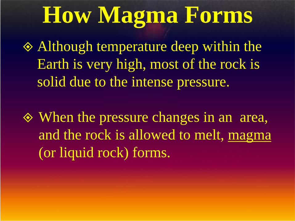
Although temperature deep within the
Earth is very high, most of the rock is
solid due to the intense pressure.
When the pressure changes in an area,
and the rock is allowed to melt, magma
(or liquid rock) forms.
How Magma Forms
How Magma Forms
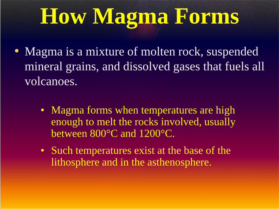
• Magma is a mixture of molten rock, suspended
mineral grains, and dissolved gases that fuels all
volcanoes.
• Magma forms when temperatures are high enough to melt the rocks involved, usually between 800°C and 1200°C.
• Such temperatures exist at the base of the lithosphere and in the asthenosphere.

Types of Magma• The 3 major types of magma are:
– Basaltic magma has the same composition as basalt and fuels the volcanoes that make up the Hawaiian Islands and Surtsey, which is south of Iceland.
– Andesitic magma has the same composition as andesiteand fuels Mount St. Helens in Washington State and Tambora in Indonesia.
– Rhyolitic magma has the same composition as granite and fueled the dormant volcanoes in Yellowstone National Park.

Types of Magma

Magma Composition
– Viscosity is the internal resistance to flow; the higher the viscosity, the thicker the magma.
Types of Magma
• The viscosity of magma and lava depends on both
temperature and composition.
– The hotter the magma or lava, the lower the viscosity.
– Magmas and lavas high in silica have higher viscosities than magmas and lavas low in silica.
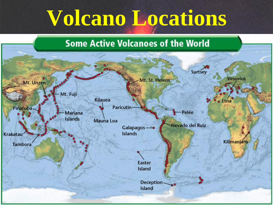
Volcano Locations
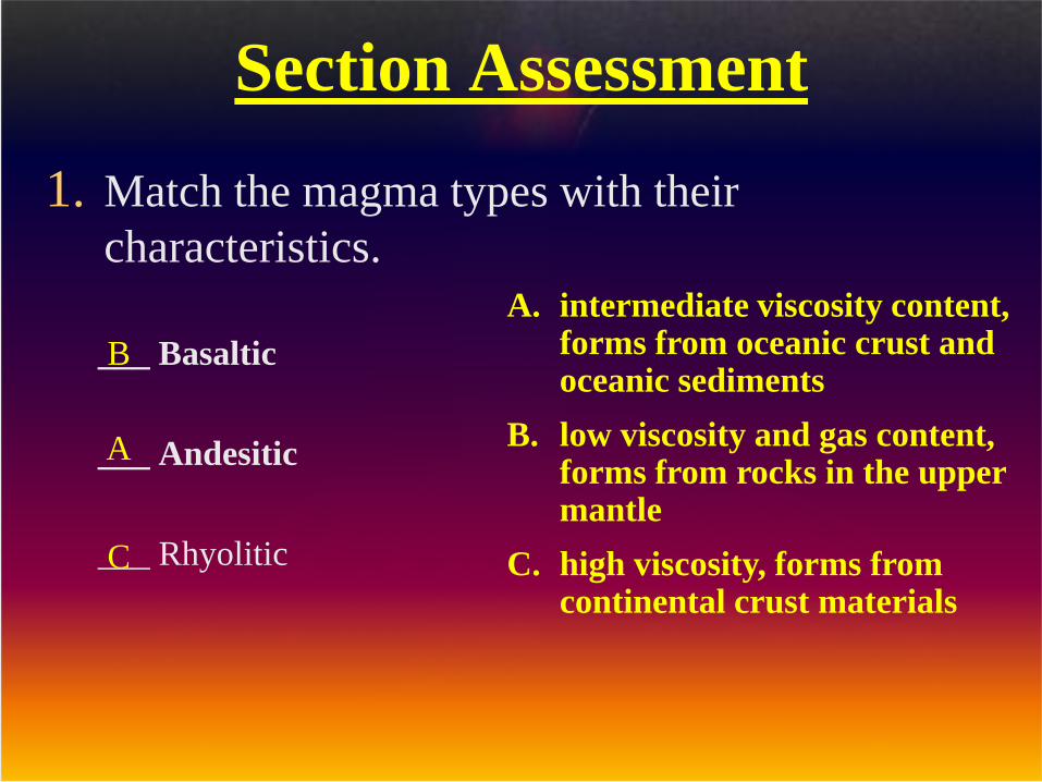
Section Assessment
1. Match the magma types with their
characteristics.
___ Basaltic
___ Andesitic
___ Rhyolitic
A. intermediate viscosity content, forms from oceanic crust and oceanic sediments
B. low viscosity and gas content, forms from rocks in the upper mantle
C. high viscosity, forms from continental crust materials
B
A
C

Anatomy of a Volcano
• Magma that reaches Earth’s surface it is called Lava.
• A Vent is where lava erupts through an opening in the crust.
• As lava flows out onto the surface, it cools and solidifies around the vent, eventually accumulating to form a mountain known as a volcano.
• A Crater is a bowl-shaped depression at the top of a volcano that is connected to the magma chamber by a vent.

Anatomy of a Volcano• Volcanic craters are usually less than 1 km in diameter.
• Calderas, However, are large depressions up to 50 km in diameter that can form when the summit or the side of a volcano collapses into the magma chamber that once fueled the volcano.

Anatomy of a Volcano
Main Vent
Crater
Secondary
Vent
Magma Chamber
Lava Flow

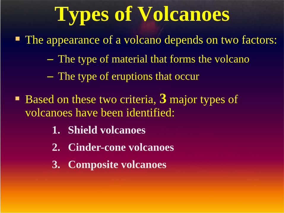
Types of Volcanoes The appearance of a volcano depends on two factors:
Based on these two criteria, 3 major types of volcanoes have been identified:
– The type of material that forms the volcano
– The type of eruptions that occur
1. Shield volcanoes
2. Cinder-cone volcanoes
3. Composite volcanoes

Types of VolcanoesShield Volcanoes
– A Shield volcano is a mountain with broad, gently sloping sides and a nearly circular base that forms when layer upon layer of basaltic lava accumulates during nonexplosive eruptions.


Types of VolcanoesCinder-Cone Volcanoes
– A Cinder-Cone volcano is a generally small, steep-sided volcano that forms when material ejected high into the air falls back to Earth and piles up around the vent.
– The magma that fuels these volcanoes contains more water and silica than shield volcanoes, which makes them more explosive in nature.
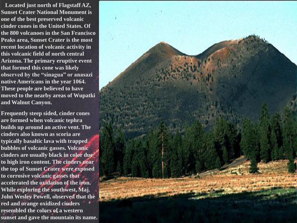
Located just north of Flagstaff AZ,
Sunset Crater National Monument is
one of the best preserved volcanic
cinder cones in the United States. Of
the 800 volcanoes in the San Francisco
Peaks area, Sunset Crater is the most
recent location of volcanic activity in
this volcanic field of north central
Arizona. The primary eruptive event
that formed this cone was likely
observed by the “sinagua” or anasazi
native Americans in the year 1064.
These people are believed to have
moved to the nearby areas of Wupatki
and Walnut Canyon.
Frequently steep sided, cinder cones
are formed when volcanic tephra
builds up around an active vent. The
cinders also known as scoria are
typically basaltic lava with trapped
bubbles of volcanic gasses. Volcanic
cinders are usually black in color due
to high iron content. The cinders near
the top of Sunset Crater were exposed
to corrosive volcanic gasses that
accelerated the oxidation of the iron.
While exploring the southwest, Maj.
John Wesley Powell, observed that the
red and orange oxidized cinders
resembled the colors of a western
sunset and gave the mountain its name.

Types of VolcanoesComposite Volcanoes
– Composite volcanoes are large volcanoes that form when layers of volcanic fragments alternate with lava.
– The magma that forms composite volcanoes commonly contains large amounts of silica, water, and gases, making these volcanoes violently explosive.

Volcán Misti stands (19,101 ft) above sea level in southern Peru. The
extinct volcano is part of the Cordillera Occidental, an arm of the
Andes Mountains.

Volcanic Material• Tephra are rock fragments thrown into the air
during a volcanic eruption.
• Tephra are classified by size, the smallest being dust (less than 0.25 mm) and ash (0.25–2 mm).
• Somewhat larger fragments are called lapilli, or “little stones” (2–64 mm in diameter).
• The largest tephra thrown from a volcano include angular volcanic blocks and rounded or streamlined volcanic bombs, both of which can be the size of a house or larger.

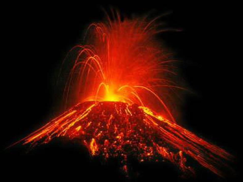
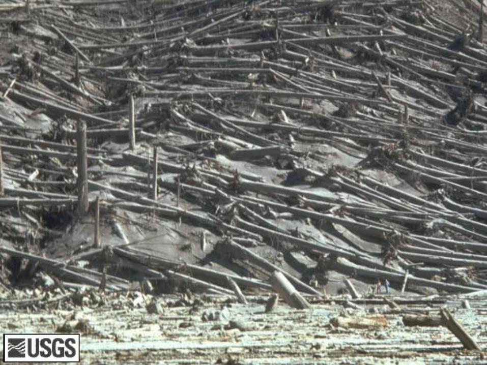
Volcanic MaterialPyroclastic Flows
– A Pyroclastic Flow is a cloud of volcanic gas, dust, and other tephra traveling at speeds of nearly 200 km/h.
– The temperature at the center of a pyroclastic flow can exceed 700°C.

Pyroclastic Flow
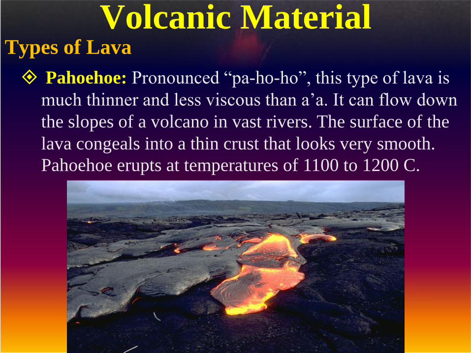
Pahoehoe: Pronounced “pa-ho-ho”, this type of lava is
much thinner and less viscous than a’a. It can flow down
the slopes of a volcano in vast rivers. The surface of the
lava congeals into a thin crust that looks very smooth.
Pahoehoe erupts at temperatures of 1100 to 1200 C.
Volcanic MaterialTypes of Lava

A’a: Pronounced “ah-ah”, this is a basaltic lava that doesn’t
flow very quickly. It looks like a slowly moving mass of hot
jello, with cooler, rough surface. Once it hardens, the sharp
spiny surface of a’a lava is extremely difficult to walk across.
These types of lava erupt at temperatures above 1000 to 1100
degrees C.
Volcanic MaterialTypes of Lava

Mt. St. Helens

Mt. Pinatubo

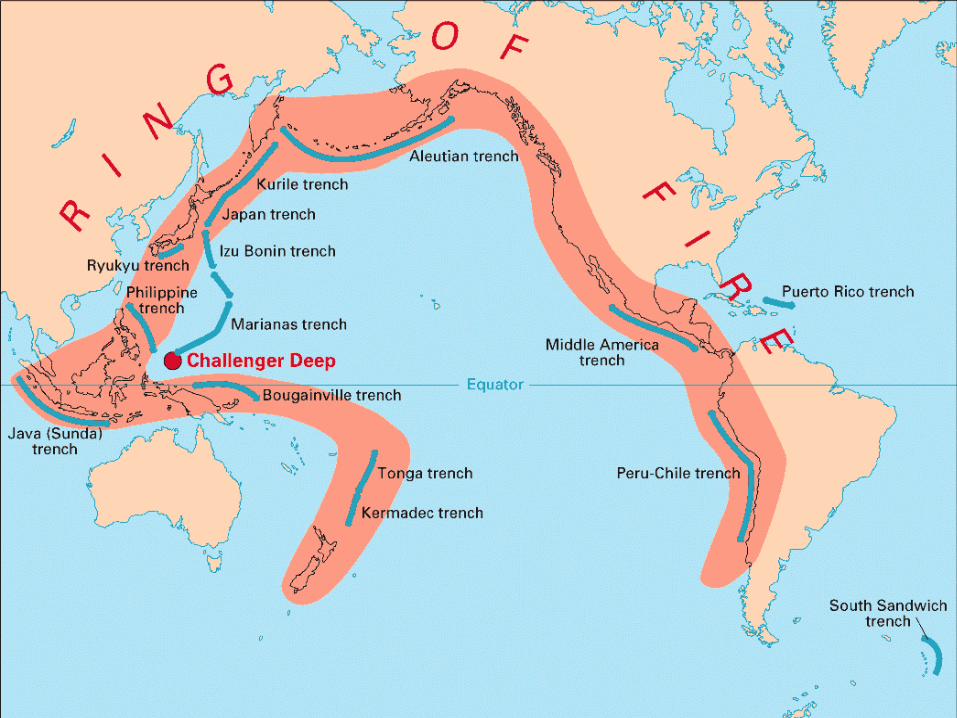
Where do volcanoes occur?• Most volcanoes form at plate boundaries.
– About 80 percent of all volcanoes are found along convergent boundaries.
– About 15 percent are found along divergent boundaries.
– Only about 5 percent of extrusive igneous activity occurs far from plate boundaries.

Where do volcanoes occur?
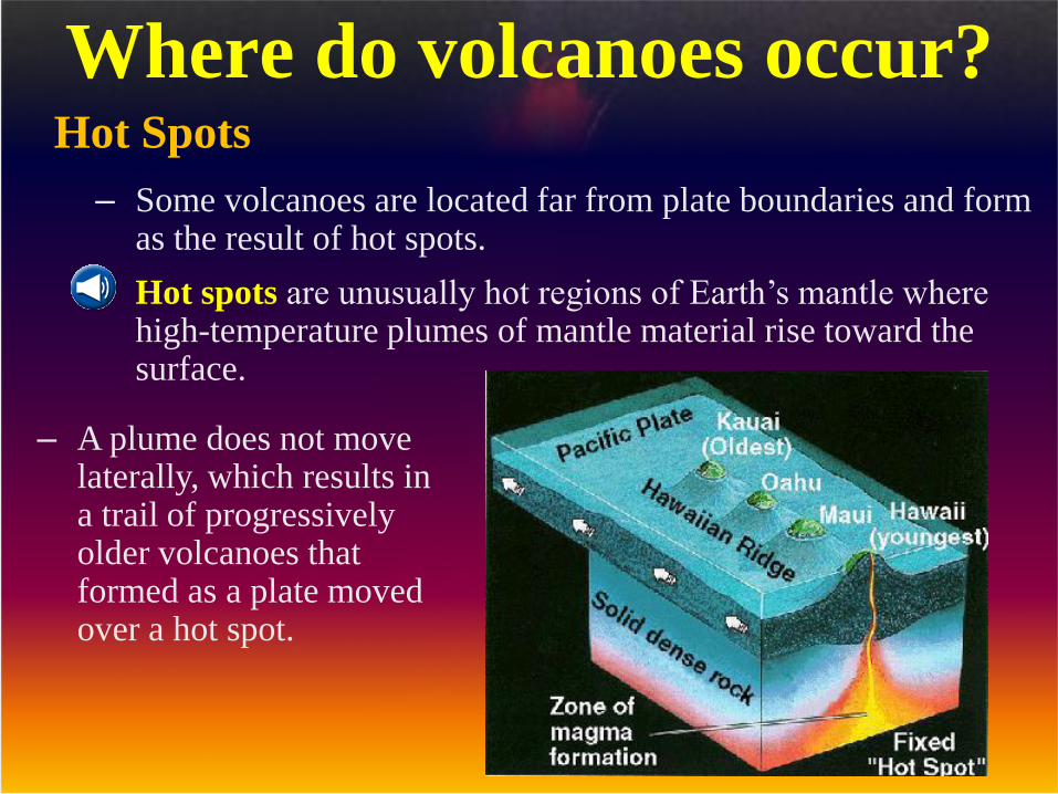
Where do volcanoes occur?Hot Spots
– Some volcanoes are located far from plate boundaries and form as the result of hot spots.
– Hot spots are unusually hot regions of Earth’s mantle where high-temperature plumes of mantle material rise toward the surface.
– A plume does not move laterally, which results in a trail of progressively older volcanoes that formed as a plate moved over a hot spot.

Most volcanoes are associated with plate boundaries. Hotspots
are the exception.
You find hotspots in the middle of plates, weather that is in the
middle of a continental plate like Yellowstone or in the middle of
a oceanic plate like Hawaii
Where do volcanoes occur?Hot Spots

Where do volcanoes occur?Hot Spots
– The Hawaiian Islands continue to rise above the ocean floor as the Pacific Plate moves slowly over a hot spot.
– The rate and direction of plate motion can be calculated from the positions of volcanoes in a chain that has formed over a hot spot.


Mount Rainier the highest peak in the Cascade Range, which runs
through southwestern Canada and the northwestern United States.
The dormant, glacier-capped volcano rises to a height of (14,410 ft)
in western Washington. The mountain’s slopes support 25 named
glaciers, the thickest of which is the Carbon Glacier, at (705 ft).


Mount Fuji Japan- Highest Mountain in Japan
12,387 ft.


MT. Etna, Italy


Kilauea Volcano

Hollywood cannot compete
with the real thing - lava pouring
to the sea, an image that conjures
scenes from Dante's "Inferno".
Kilauea, the most active volcano
on Hawaii, has been erupting
constantly since 1983, drizzling
over 2 cubic kilometers of lava
across its flanks in a continual
island building process covering
over 100 square kilometers and
adding over 200 hectares to
Kilauea's southern shore. The
current flow started on Mother's
Day, May 12, when a new vent
opened near the southwest base of
Pu`u `O`o and has been inching
steadily toward the coast. In the
third week of July, the flow finally
reached the sea, and began
pouring into the ocean at a point
known as West Highcastle and
later at Wilipe`a. This view to the
west shows photographers on the
other side of the flow watching in
awe as the 1000+ degree C
magma pours into the ocean,
forming new land as a bench of
rock.
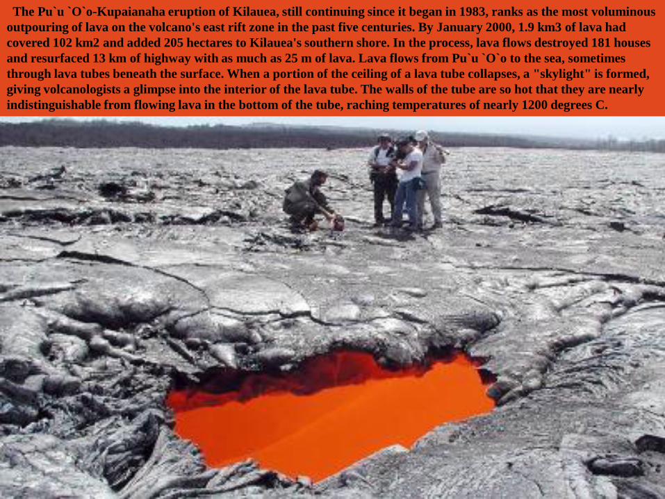
The Pu`u `O`o-Kupaianaha eruption of Kilauea, still continuing since it began in 1983, ranks as the most voluminous
outpouring of lava on the volcano's east rift zone in the past five centuries. By January 2000, 1.9 km3 of lava had
covered 102 km2 and added 205 hectares to Kilauea's southern shore. In the process, lava flows destroyed 181 houses
and resurfaced 13 km of highway with as much as 25 m of lava. Lava flows from Pu`u `O`o to the sea, sometimes
through lava tubes beneath the surface. When a portion of the ceiling of a lava tube collapses, a "skylight" is formed,
giving volcanologists a glimpse into the interior of the lava tube. The walls of the tube are so hot that they are nearly
indistinguishable from flowing lava in the bottom of the tube, raching temperatures of nearly 1200 degrees C.

The tallest mountain in Africa, Kilimanjaro, lies near the
border of Kenya. The mountain has two volcanic peaks,
spaced (7 miles) apart, with the higher of the two rising
(19,341 ft).

Mount Meru is an
active volcano
located just 70
kilometers(44
miles) west of
Mount
Kilimanjaro in
Tanzania. It
reaches 4,566
meters (14,978
feet) in height but
has lost much of
its bulk due to an
eastward volcanic
blast sometime in
its distant past,
perhaps similar to
the eruption of
Mount Saint
Helens in
Washington State
in 1980. Mount
Meru most
recently had a
minor eruption
about a century
ago.
The several small
cones and craters
seen in the vicinity
probably reflect
numerous episodes
of volcanic
activity.
Mount Meru is the
topographic
centerpiece of
Arusha National
Park, but
Ngurdoto Crater
to the east (image
top) is also
prominent. The
fertile slopes of
both volcanoes rise
above the
surrounding
savanna and
support a forest
that hosts diverse
wildlife, including
nearly 400 species
of birds, and also
monkeys and
leopards, while the
floor of Ngurdoto
Crater hosts herds
of elephants and
buffaloes.


The Deadliest Volcanic Eruption of the
century and perhaps the deadliest disaster in
the Western Hemisphere since 1900 occurred
on the Caribbean island of Martinique - the
northern most Windward Island of the Lesser
Antilles. Martinique is part of a volcanic arc of
islands, formed by the subduction of the North
American Plate beneath the Caribbean Plate.
When Pelee erupted on May 8, 1902, the coastal
town of St. Pierre, about 5 miles (8 km) to the
south of the Pelee, was virtually obliterated, as
shown on the above photo.
The approximately 29,000 inhabitants of St.
Pierre were killed by an incandescent, high-
velocity ash flow, sometimes referred to as a
nuees ardente (glowing cloud). Superheated gas
and steaming volcanic ash poured out of the
cone of Pelee and sped down its flanks. Within
minutes, a poisonous red cloud enveloped and
incinerated St. Pierre. The cloud was so dense
that very little sunlight was transmitted
through it - at noon it looked like midnight.
This is the same kind of eruption that buried
Pompeii after Vesuvius erupted in 79 A.D.
As a footnote to the eruption of Pelee 100 years
ago, it's reported that only one person survived
Pelee's fury; a prisoner in an underground cell.
World’s Deadliest Volcano Eruption
Mt. Pelee - May, 8, 1902


Popocatépetl, whose name is the Aztec
word for smoking mountain, towers 55
km to the east of Mexico City, Mexico
and is North America's 2nd highest
volcano rising 5,465 meters above sea
level. The steep-sided volcanic cone
came back to life six years ago after
nearly 70 years of dormancy and has
been erupting intermittently since then.
More than 30 million people live within
view of the volcano. On Monday,
December 18, the largest eruption of
Popocatépetl in 1,200 years occurred
and convinced people to leave
immediately. Over 56,000 evacuees of
the 40 villages within 12 km of the
volcano crowded the roads heading
away from the eruption. Besides
volcanic ash, a hazard at Popo is the
possibility of the eruptive material
melting glacial ice on the volcano and
causing a large mudflow or lahar. The
volcano has quieted since the 18th, but
scientists are keeping a close watch on
this waking giant. Popocatépetl, locally
called "Popo," is one of more than 400
active volcanoes surrounding the
Pacific Basin.

Popocatépetl, Volcano


Tambora is a stratovolcano, forming
the Sanggar peninsula of Sumbawa
Island. The diameter of the volcano at
sea-level is about 38 miles (60 km).
Prior to the 1815 eruption, the
volcano may have been as tall as
13,000 feet (4,000 m). The 1815
eruption formed a caldera about 4
miles (6 km) in diameter. The caldera
is 3,640 feet (1,110 m) deep.
The 1815 eruption of Tambora was
the largest eruption in historic time.
About 150 cubic kilometers of ash
were erupted (about 150 times more
than the 1980 eruption of Mount St.
Helens). Ash fell as far as 800 miles
(1,300 km) from the volcano. In
central Java and Kalimantan, 550
miles (900 km) from the eruption, one
centimeter of ash fell. The eruption
was 7. The eruption column reached a
height of about 28 miles (44 km). The
collapse of the eruption column
produced numerous pyroclastic flows.
As these hot pyroclastic flows reached
the ocean where they caused
additional explosions. During these
explosions, most of the fine-fraction of
the ash was removed. The eruption
formed a caldera. An estimated
92,000 people were killed by the
eruption. About 10,000 direct deaths
were caused by bomb impacts, tephra
fall, and pyroclastic flows. An
estimated 82,000 were killed
indirectly by the eruption by
starvation, disease, and hunger.
Worlds Largest Volcanic Eruption
Mt. Tambora, Sumbawa Island
The explosion equaled 3 million atomic bombs
Tambora contains the deepest caldera in the world

The World’s Highest Volcano
Mt. Ojos del Salado, Nevodos Chile
22,595 ft.

Mole Hill in Rockingham county
near Harrisonburg, Virginia is all
that remains of what may have
been the last active volcano in
Virginia. The igneous rocks that
form the core of the hill have been
age dated as 47 million years old,
considerably younger than the
other igneous rocks in the area,
and are the remnants of a conduit
of molten rock that fed a volcano
long since eroded away in the
heart of the Appalachians. Mole
Hill rock contains the mineral
olivine, typically formed at great
depth, and fragments of sandstone
torn from country rock far
beneath as the hot magma rose to
the surface. This modest bump
rising from the Shenandoah Valley
between the Allegheny Mountains
and Massanutten Mountain still
has a story to tell for those willing
to look at the rocks.
Mole Hill Volcano, Virginia

Jupiter’s Moon IoThe Voyager 1 spacecraft launched by the United States National Aeronautics and
Space Administration (NASA) photographed both hemispheres of Io, the innermost
moon of Jupiter, in 1979. The moon’s colors depict its many volcanoes and the large
lava flows and sulphur-dioxide snow resulting from Io’s tremendous volcanic activity.
During the three months between the photos of Io taken by Voyager 1 and Voyager 2,
the surface of the moon changed dramatically—some volcanos stopped erupting while
previously dormant volcanos became active.
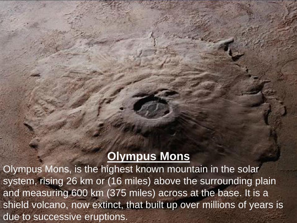
Olympus MonsOlympus Mons, is the highest known mountain in the solar
system, rising 26 km or (16 miles) above the surrounding plain
and measuring 600 km (375 miles) across at the base. It is a
shield volcano, now extinct, that built up over millions of years is
due to successive eruptions.