vulnerability, risk reduction, and adaptation to climate...
TRANSCRIPT

E N VTeam
Climate ChangeClimate
Investment Funds
!(
!( !(
!(!(
!(!(
!( !(
!( !(!(
!(
!(!(
!(!(
!(
!(
!(
!(Banda AcehBanda Aceh
MedanMedan
JambiJambi
PalembangPalembangBengkuluBengkulu
JakartaJakartaTanjungkarang-TelukbetungTanjungkarang-Telukbetung SemarangSemarang
MataramMataramDenpasarDenpasar KupangKupang
MakassarMakassar
PontianakPontianak SamarindaSamarinda
PaluPaluBalikpapanBalikpapan
ManadoManado
AmbonAmbon
SurabajaSurabaja
BandjermasinBandjermasin
BandungBandungYogyakartaYogyakarta
Key to Map Symbols
Capital
City/Town
River
Lake N
0 1,000 2,000500
Kilometers
Climate Risk and Adaptation Country Profile April 2011
CLIMATE
ADAPTATIONDISASTER
RISKREDUCTION INDONESIA
Vulnerability, Risk Reduction, and Adaptation to
Climate Change

2
Climate Risk and Adaptation Country Profile Indonesia
COUNTRY OVERVIEW
The Republic of Indonesia is the world’s largest archipelagic state, consisting of more than 17,500 islands and covering over 81,000 kilometers (km) of coastline
1. These islands are home to an extremely varied geography,
topography, and climate, ranging from sea and coastal systems to peat swamps and montane forests. Most of the two million square kilometer landmass of Indonesia is covered by forests that harbor a wealth of biodiversity. Forests, marine, and coastal ecosystems provide vital services to sustain millions of livelihoods and drive economic growth. A high population density and rapid industrialization, coupled with this dependance on the country’s resource base, make the country vulnerable to projected changes in climate
2,3.
Almost 230 million people inhabit Indonesia, the majority (~54%) of whom live on the island of Java. Approximately 140 million people (over 50% of the country’s population) live on less than US$2 per day and average per capita income is US$814. Seventeen percent of the population live in rural areas where poverty levels have begun to decline thanks to concerted government attention
4. Climate variability and change are
exacerbating many of the disaster risks that Indonesia faces today. During the past four decades, floods, droughts, storms, landslides, and forest fires have posed the greatest threats to livelihoods, economic growth, and environmental sustainability. While the public is gradually gaining awareness of the importance of accounting for the impacts of climate variability and change, more evidence-based response and adaptation measures are needed
5. The Asian Development Bank estimates that by 2100, the impacts of climate change will cost between
2.5--7% of the gross domestic product (GDP). The poorest will bear the brunt of this burden as they are typically the most vulnerable to the impacts of drought, floods, and landslides and pursue livelihoods that are highly dependent on climate-sensitive sectors (i.e fisheries and forestry)
6.
Indonesia has made considerable gains in integrating environmental issues into development plans, in particular with respect to mainstreaming climate change into the national development strategy
7. Nevertheless, significant
challenges in data and research remain in order to improve the development strategies and plans. A proactive approach to addressing the impacts of climate variability and change is to reduce the sources of current vulnerability to natural hazards. Monitoring, early warning, and response mechanisms need to be integrated as outlined in the priorities noted below.
PRIORITY ADAPTATION MEASURES
According to Indonesia’s National Action Plan Addressing Climate Change, the national adaptation agenda needs to focus on water resources, agriculture, fisheries, coastal and marine ecosystems, infrastructure and settlement, health, and forestry sectors
8. In
particular, adaptation measures that target sea-level rise, extreme weather, and threats to ecosystems and biodiversity should be prioritized. The Action Plan encourages natural resource management that builds resilience of ecosystems as a vehicle for reducing the vulnerability of millions of Indonesians
9. The
Government of Indonesia is committed to mainstreaming effective, efficient, and equitable adaptation interventions into
1 Ministry of Environment, 2007. National Action Plan Addressing Climate Change.
2 World Bank, 2009. Investing in a more sustainable Indonesia. Country Environment Analysis. Report No. 50762-ID. 3 World Bank, 2006. Sustaining Economic Growth, Rural Livelihoods, and Environmental Benefits - Strategic Options for Forest Assistance. World Bank: Jakarta. 4 World Bank, 2010. Country Data for Indonesia. Available at http://data.worldbank.org/country/indonesia. 5 GFDRR Disaster Risk Management Programs for Priority Countries. Indonesia Case Study. 6 World Bank, 2010. Program Document for Climate Change Development Policy Loan for Indonesia. 7 World Bank, 2009. Country Environmental Analysis for Indonesia. 8 Ministry of Environment, 2007. National Action Plan Addressing Climate Change.
Key Sectors
Water Resources
Agriculture
Fisheries
Coastal and Marine ecosystems
Infrastructure and settlement
Health
Forestry
Source: Indonesia’s National Action Plan Addressing Climate Change, 2007.

3
Climate Risk and Adaptation Country Profile Indonesia
development planning, and significant progress has been made in recent years on this approach. The Climate Change Adaptation Program (ICCP), developed in 2007, is based on the following principles:
Opting for no-regrets measures and addressing climate variability as the starting points.
Ensuring a participatory approach in developing the climate change adaptation agenda.
Adjusting the ongoing and planned initiatives and programs for adaptation measures to the climate risks.
Institutionalizing and effectively utilizing the knowledge base on climate variability to better manage current and future risks.
Harmonizing policies and programs in a decentralized and multi-sectoral setting.
The subsequent World Bank Country Environmental Analysis (2009) further suggests the following adaptation options:
Undertaking reactive and proactive adaptation measures in the key areas of water resources, agriculture, forestry, coastal/marine, and health, including and in addition to what is currently contemplated.
Prioritizing adaptation options by emphasizing “no regrets” actions that provide benefits even without climate change, buying safety margins for new investments, and favoring reversible and flexible options.
Implementing a phased strategy to mainstream adaptation, including complementary efforts to raise public awareness, undertake research, coordinate, strengthen local capacity, and increase the resilience of vulnerable groups.
CLIMATE BASELINE AND CLIMATE FUTURE
CLIMATE BASELINE
Indonesia’s climate is hot and humid with rainfall occurring mostly in low-lying areas. Mountainous regions are cooler. The cities of Jakarta, Ujung Padang, Medan, Padang, and Balikpapan have an average minimum temperature of 22.8°C and a high of 30.2°C. Humidity in Jakarta varies between 61% to 95% and average rainfall amounts to 218.4 millimeters (mm) per month. The “wet” season occurs between November and April, leaving May through October typically dry. According to the country’s Adaptation Action Plan, rainfall has become
increasingly unpredictable10.
RECENT CLIMATE TRENDS
Climate baseline summary for Indonesia11,12
:
Mean annual temperature has increased by about 0.3°C in Indonesia since 1990.
Overall annual rainfall has decreased by 2-3% since 1990.
Precipitation patterns have changed in particular during the wet and dry seasons; there has been a decline in average annual rainfall in the southern regions but this includes increases in wet season rainfall, while an average increase in precipitation in the northern regions is coupled with decreased dry season rainfall.
10 USAID Indonesia, 2008. Conservation of Tropical Forests and Biological Diversity In Indonesia. Report submitted in accordance with Foreign Assistance Act Sections 118/119. 11 Hulme, M and N. Sheard. 1999. Climate Change Scenarios for Indonesia. Climatic Research Unit, Norwich, UK, 6 pp. 12 Boer, R. and A. Faqih. 2004. Current and Future Rainfall Variability in Indonesia. In An Integrated Assessment of Climate Change Impacts, Adaptation and Vulnerability in Watershed Areas and Communities in Southeast Asia. Report from AIACC Project No AS21. International START Secretariat. Washington, DC.

4
Climate Risk and Adaptation Country Profile Indonesia
Figure 1: Annual Climate Baseline for Indonesia13
Recent trends can be correlated with a change in the timing of seasons and increasingly unpredictable rainfall patterns in Indonesia. This will have implications for food production and economic stability. For example, during the period of 1991-2003, in parts of Sumatra and Java, the wet season began up to 20 days later than the average compared to 1960-1990. Accordingly, it is projected that a longer dry season and a more intense rainy season will result in prolonged drought and more intense flooding. This can have disastrous consequences; as for example, in 2007, when floods in Jakarta impacted 80 districts, destroying 70,000 homes, killing dozens of people, and displacing over 400,000
14 people. Notably, these general trends and related regional variations can only be
ascertained with improved data using downscaled climate data or regional climate models15
.
13 WorldClim 1960-1990 averages. Robert J. Hijmans, Susan Cameron, and Juan Parra, at the Museum of Vertebrate Zoology, University of California, Berkeley, in collaboration with Peter Jones and Andrew Jarvis (CIAT), and with Karen Richardson (Rainforest CRC). www.worldclim.org/current. 14 WWF, 2007. Climate Change in Indonesia: Implications for Humans and Nature. 15 University of Gothenburg, 2008. Indonesia Environmental and Climate Change Policy Brief.

5
Climate Risk and Adaptation Country Profile Indonesia
CLIMATE FUTURE
The climate science community sources a suite of models to inform decision makers on future climate. Among the most widely used are GCMs (Global Climate Models), RCMs (Regional Climate Models), and downscaling techniques (both empirical and statistical), and several comprehensive reviews are available on the subject. GCMs are our primary source of information about future climate. They comprise of simplified but systematically rigorous interacting mathematical descriptions of important physical and chemical processes governing climate, including the role of the atmosphere, land, oceans, and biological processes. The following insights into a changing climate are from a suite of GCMs used by the Intergovernmental Panel on Climate Change, as well as downscaled data for 11 stations across Indonesia (Figure 2).
Projected climate change summary for Indonesia:
Warming will increase by 0.2-0.3°C per decade in Indonesia.
Increasing annual precipitation across the majority of the Indonesian islands, except in southern Indonesia where is it projected to decline by up to 15%.
Changes in the seasonality of precipitation are projected: parts of Sumatra and Borneo may become 10-30% wetter by the 2080s during December-February, and Jakarta is projected to become 515% drier during June-August. These are, however, broadly defined patterns that are not consistent across downscaled information for Indonesia.
A 30-day delay in the annual monsoon is projected, bringing a 10% increase in rainfall later in the crop year (April-June), and up to a 75% decrease in rainfall later in the dry season (July–September).
CLIMATE CHANGE IMPACTS ON NATURAL HAZARD VULNERABILITY
AT A GLANCE
The eastern and western portions of Indonesia’s most densely populated island, Java, as well as the coastal regions of Sumatra, parts of western and northern Sulawesi, and southeastern Papua islands are all highly vulnerable to multiple climate hazards, including drought, floods, landslides, and sea-level rise—but not cyclones
16. A global risk
analysis conducted by the World Bank ranks Indonesia as 12th
out of thirty-five countries facing a relatively high mortality risk from multiple hazards
17.
16 World Bank, 2010. Program Document for Climate Change Development Policy Loan for Indonesia. 17 World Bank, 2005. Natural Disaster Hotspots, A Global Risk Analysis. Washington, DC: Disaster Risk Management Series.
Figure 2: Stations across Indonesia for which downscaled information is available and summarized here.

6
Climate Risk and Adaptation Country Profile Indonesia
Figure 3: Frequency and Distribution of Floods and Droughts across Indonesia18,19
According to a recent vulnerability mapping exercise conducted for South East Asia, western and eastern parts of the island of Java are considered hotspots for the impacts of multiple hazards
20. These hazards are either
geological or hydro-meteorological in nature and include earthquakes, tsunamis, volcanic eruptions, floods, landslides, droughts, and forest fires. An estimated 40% of the country’s inhabitants are at risk. Between 2001 and 2007, four thousand disasters occurred: 37% were floods, 24% were drought, 11% were landslides, and 9% were windstorms. Restoring the damage caused by these natural disasters is putting a growing strain on public expenditures. Consequently, financing for reconstruction and recovery is diverted from important development
18 Note that for the purposes of this assessment of disasters, a global disasters database was used. However, more detailed maps on the distributional impacts of disasters in Indonesia can be found in Indonesia’s National Disaster Management Plan for 2010-2014 as well as in Yusuf and Francisco, 2009: Climate Vulnerability Mapping of South-East Asia. These maps, where possible, will be made available also on the forthcoming GFDRR Indonesian Dashboard. 19 Columbia University Center for Hazards and Risk Research (CHRR) and Columbia University Center for International Earth Science Information Network (CIESIN). 20
Yusuf and Francisco, 2009: Climate Vulnerability Mapping of South-East Asia.

7
Climate Risk and Adaptation Country Profile Indonesia
interventions21
. Climate change threatens to exacerbate hydro-meteorological risks such as recurring floods and drought; prolonged drought in turn is projected to worsen the impacts of forest fires
22. Climate change will also
decrease food security as production patterns and outputs change due to shifts in rainfall, evaporation, run-off water, and soil moisture.
Floods and droughts: The western region of Indonesia and the dry zones in some eastern provinces have a long history of coping with recurring floods and droughts. Floods have posed the greatest threat to Indonesians in major urban centers, including Jakarta, Medan, and Bandung, home to more than 13 million, two million, and four million people, respectively. For example, the damages from the 2007 flood in Jakarta amounted to more than US$900 million
23, and rain-triggered landslides are common
24. Floods
and storms destroy homes and buildings and pose a significant threat towards meeting MDG Goal 2, to achieve universal primary education.
Sea-level rise: Forty-two million Indonesians live less than 10 meters (m) above sea level. A one m rise in sea level could inundate 405,000 hectares of land and reduce Indonesia’s territory by flooding low-lying islands. A 50 centimeter (cm) rise in sea-level, combined with land subsidence in Jakarta Bay, could permanently inundate densely populated areas of Jakarta and Bekasi that house over 270,000. In addition to jeopardizing coastal and farming livelihoods, a related threat of saltwater intrusion poses additional stresses on the availability of freshwater supply in terms of both quality and quantity and damage to infrastructure along the coast.
Effects of El Niño/La Niña: Indonesia suffers the effects of El Niño, which reduceaverage rainfall and water storage capacity while exposing large regions to drought and fire. In 1997, droughts related to El Niño adversely impacted 426,000 hectares of rice, yields of coffee, cocoa, and rubber also suffered; and it caused widespread water shortages and wildfires. Land and forest fires are worse during El Niño years; these fires damage natural habitats, pollute watersheds, destroy biological diversity, and increase air pollution, with serious health effects. At the same time, La Niña cycles increase rainfall and flooding events. Flooding in La Niña years is projected to increase incidences of water-borne diseases such as cholera, while warmer El Niño years will facilitate the spread of vector-borne diseases such as dengue and malaria. Some predict that the effects of El Niño/La Niña today may be a proxy of how Indonesia will be impacted by climate change in the future.
SECTORAL CLIMATE RISK REDUCTION RECOMMENDATIONS
AGRICULTURE
Agricultural activities in Indonesia center on five subsectors: annual food crops, estate crops, livestock, forestry, and fisheries. Food crop farming contributes almost 50% to the GDP of agriculture and is particularly important on the island of Java, which is home to over 60% of the country’s population, 70% of whom live in rural areas. Rice is the primary crop, while cassava, soybeans, corn, and groundnut are important secondary crops. Estate crops, planted outside Java Island, consisting of rubber, coffee, oil, palm, coconut, tea, cocoa, pepper, cashew, and sugarcane, account for approximately 17% of agricultural GDP and are important export commodities
25. As
climate change alters precipitation, evaporation, run‐off water, and soil moisture, production of these crops and food security will be severely affected
26. Past trends indicate a low capacity to adapt to changes in climate.
For example, harvest failure reached 100,000 tons per district between 1981 and 1990; this increased to 300,000 tons per district in the period between 1991 and 2000
27. Rising temperatures will increase the
21 Indonesia’s National Disaster Management Plan 2010-2014. 22 GFDRR Disaster Risk Management Programs for Priority Countries. Indonesia Case Study. 23 DiBi database (Data and Information on Disaster in Indonesia), National Disaster Management Agency (BNPB). http://dibi.bnpb.go.id. 24 Rain-triggered landslides in Maluku and Kalimantan in 2010 were among the most damaging in recent years. 25 National Communication of Indonesia, 1996. 26 World Bank, DFID, and PEACE, 2007. Indonesia and Climate Change: Current Status and Policies. Jakarta. http://siteresources.worldbank.org/INTINDONESIA/Resources/ Environment/ClimateChange_Full_EN.pdf 27 Ministry of Environment, 2007. National Action Plan Addressing Climate Change.

8
Climate Risk and Adaptation Country Profile Indonesia
incidence and range of pests and, when combined with decreased rainfall and increased demand, higher temperatures will also present new challenges related to water storage or transfer mechanisms.
Building a resilient agriculture sector in Indonesia will require a multi-pronged approach, including:
improved data use and management (e.g. development of early El Niño warning systems and expanded use of maps of drought prone areas);
improved farming practices and supporting infrastructure (e.g. development and deployment of more efficient irrigation techniques and infrastructure such as trough, sprinkle, and trickle irrigation);
improved institutional management (e.g.. facilitate knowledge exchange on climate science for institutions and small farmer groups);
more research (e.g. reestablish areas that are drought and flood prone and conduct research on drought-resistant seed varieties);
public awareness-raising campaign on climate change impacts and adaptation; and
livelihood diversification into off-farm activities.
COASTAL ZONES
Between 140 and 220 million Indonesians reside within 100 km of the coast, and of these 115 to 160 million rely on marine resources for their livelihoods
28. Coastal and marine activities employ a large segment of the
population and contribute up to 15% of Indonesia’s GDP. Indonesia’s reefs are home to 90% of the fish stock and account for 60% of the protein intake of the average Indonesian, and recent data show significant reef degradation
29. It is estimated that over 70% of all coral reefs in Indonesia may already suffer damage and over
700 native wildlife species face extinction. Maintaining healthy coral reef systems are therefore vital to the country.
The coastal and marine resources (i.e. coral reefs, fisheries, and mangroves), business, vital infrastructure, and some of the country’s most fertile lands located along Indonesia’s 81,000 km coastline are under threat from climate variability and change. By some estimates, sea level is expected to rise by as much as 0.57 centimeters per year in Jakarta Bay, while land surface has been observed to be sinking at a rate as high as 0.8 cm per year
30. If these trends continue, humans and ecosystems found along coastal zones will be devastated with
major implications for hard-earned development gains.
Rural coastal areas will also increasingly feel the impacts of climate change: as coastal zones become inundated, Krawang and Subang districts may face up to a 95% reduction in local rice supply (or approximately 300,000 tons), while maize production in these districts is also projected to decline by 10,000 tons. Saltwater intrusion, a threat closely related to sea-level rise, will also impact the availability and quality of freshwater supply during the dry season and damage agricultural lands, such as rice fields, and damage key infrastructure as well as aquaculture
31. In the Subang District, decreased fish, shrimp, and prawns and rice stocks could
result in 43,000 farm laborers losing their jobs. Appropriate adaptation measures to build resilient coastal zones include:
conducting vulnerability assessments of key infrastructure to determine most appropriate measures to deal with future impacts of sea-level rise and storm surge;
protecting and restoring mangroves to protect coastal areas; and
building capacity among fishermen and the coastal communities to develop and use early warning systems and apply climate forecast information to daily activities; and
pursuing integrated coastal zone management practices in local communities.
28 WRI, 2001. World Resources 2000-2001: People and Ecosystems: The Fraying Web of Life. 29 World Bank, 2004. Coral Reef Rehabilitation and Management Project (Phase II) Project Appraisal Document, Technical Annex I: Country, Sector and Program Background. Washington DC. 30 WWF, 2007. Climate Change in Indonesia: Implications for Humans and Nature. 31 Ministry of Environment, 2007. National Action Plan Addressing Climate Change.

9
Climate Risk and Adaptation Country Profile Indonesia
WATER RESOURCES
Despite having over 20% of the freshwater reserves of Asia, Indonesia has great difficulty in providing potable water as well as freshwater supplies to meet the demands of society, industry, and agricultural producers. Water shortages are especially acute during the dry season, particularly in urban areas, and total economic losses attributable to limited access to safe water and sanitation were estimated in 2009 by the World Bank to be conservatively 2% annually. Java, Bali, and Nusa Tenggara suffer from low water quality, and in some downstream regions, only 10% of water supply is safe for human consumption. Poor water quality can cause outbreaks of major diseases, posing an additional stressor on already vulnerable populations. Moreover, agricultural run-off, inadequate storage capacity, and fertilizer and pesticide use for agricultural production serve to exacerbate existing problems of water scarcity and pollution.
Indonesia’s current water collection and storage facilities meet about 10% (700,000 hectares) of the country’s demand for irrigation. Similarly, clean water supplies only reach 37% of urban residents and 8% of rural residents. While shallow groundwater supplies may meet demand for household consumption, water quality and quantity fluctuate widely, especially in the dry season. Industries, on the other hand, resort to deep groundwater resources to meet their larger-scale needs; this can consequently cause land subsidence, leaving large areas vulnerable to flood and salt-water intrusion. Improved water resource infrastructure and appropriate water management policies, underpinned by a suitable budget, are needed to better control the use of groundwater in a sustainable manner
32. Adaptation measures to combat water insecurity include:
development of improved water collection and storage facilities;
investment in both drought-tolerant and salt-tolerant crops;
crop diversification; and
improved early El Niño warning systems.
In addition, some regions of Indonesia may need to reevaluate water use priorities in order to more effectively manage growing water demands and reduce currently inefficient water use practices.
FORESTRY
Indonesia is amongst the 10 most biologically diverse countries in the world38
. Yet the degradation of terrestrial, marine, and freshwater ecosystems is occurring rapidly with significant implications for vital ecosystem services, human systems, and economic growth. Over the past twenty years, changes in temperature, rainfall, and land-use have led to widespread wildfires that cause major economic losses and augment levels of domestic and trans-boundary air pollution. Moreover, continued forest fires will alter forest composition and structure, as certain species will compete for new habitat areas once their shelters are gone. Mangrove systems are also already feeling the effects of climate variability and change; reduced freshwater flows and sea-level rise as well as human activities (i.e. clearing mangroves for agricultural purposes) can only add pressure to these vital ecosystems that protect coastal zones from climate change impacts. Unsustainable exploitation of natural resources is a central cause for biodiversity loss and reduction of ecosystem services. Adaptation measures to build resilience of the forestry sector and of the diverse range of ecosystems in Indonesia include:
conservation of mangroves; and
implementation of programs and policies aimed at reducing deforestation and protecting forests.
32 State Ministry of Environment, Republic of Indonesia, 2007. National Action Plan Addressing Climate Change.

10
Climate Risk and Adaptation Country Profile Indonesia
EXISTING ADAPTATION FRAMEWORK/STRATEGY/POLICY AND INSTITUTIONAL SETUP
In 2009, the Government of Indonesia published its Second National Communication and advanced towards the development of an Indonesian Climate Change Trust Fund. Nonetheless, significant institutional, policy, technical, financial, and legal challenges exist for developing effective interventions to manage climate change. The Ministry of the Environment (MOE) has been the focal ministry for climate change, and has experienced difficulties in mainstreaming climate change adaptation policies within development planning. For example, plans to develop and expand fossil fuel use have met resistance from the MOE. At the same time, Indonesia’s Climate Change Adaptation Program (ICCAP) proposes several principles upon which to develop climate change policy, one of which relates to the harmonization of policies and programs across sectors. Additional guiding principles demonstrate support for no-regrets measures, participatory approaches for establishing an adaptation agenda, reevaluating existing initiatives, integrating adaptation measures as necessary, and expanding and entrenching the knowledge base on climate change to better manage current and future risks. While the occurrence of natural hazards may be unpredictable, the impacts can be managed through a sound adaptation policy that builds socio-ecological resilience. The Indonesian Government’s National Disaster Management Plan for 2010-2014 addresses many of these challenges, and some of the specific institutional measures to support climate change adaptation in the natural hazard arena in this document are listed below:
Strengthening environmental management capacities of local government agencies, particularly through decentralization.
Taking stock of existing adaptation activities in Indonesia. Lessons learned from these experiences would aid in building capacity for future adaptation.
Continuing support and development of policies that address urban and rural sanitation and wastewater management, especially in the context of the decentralization process, is needed. This includes inter alia development of a national strategy for access to sanitation and wastewater treatment across scales, and plans for environmental, economic, and socially sustainable water and wastewater utilities.
Addressing the institutional and financial constraints that prevent improvement in the monitoring and enforcement of policies and legislation to reduce deforestation. Moreover, decentralization poses new challenges for monitoring and enforcing policies.
Improving the mainstreaming of environmental concerns into development policy. In particular, public investment planning and regional planning of land and natural resource management could be better integrate all relevant environmental issues.
Ongoing Efforts—At a Glance
Vulnerability Reduction
Indonesia’s National Disaster Management Plan for 2010-2014.
The World Bank’s Climate Change Development Policy Loan (CC DPL) Program supports the Government's policy agenda on climate change, an issue of growing global concern.
Support to national and local strategy for disaster risk reduction and climate change adaptation, implemented by the National Council for Climate Change, the National Disaster Management Agency, Local governments, Civil Society, and the World Bank.
Pilot initiatives and investment in climate adaptation and resilience in urban and rural communities to build alliance among the DRR and CCA constituents and programs; implementing agencies are the National Council for Climate Change (DN PI), National Disaster Management Agency (BN PB), Local Governments, Civil Society, and World Bank (2009-2012).
Support to implementation of disaster and climate proof building codes and standards and micro zoning.

11
Climate Risk and Adaptation Country Profile Indonesia
Indonesia Climate Change Trust Fund (ICCTF) is a national-managed trust fund that aims to contribute effectively and efficiently to mainstreaming climate change issues in government planning and the implementation of climate change activities across Indonesia.
33
GFDRR Interventions
Mainstreaming DRR in Indonesia (2008-2010).
RESEARCH, DATA, AND INFORMATION GAPS
Indonesia’s status as a country dependent mainly on agriculture and aquaculture makes it particularly susceptible to the effects of climate change. Indonesia has made considerable gains in integrating environmental issues into development plans since 2000, in particular with respect to mainstreaming climate change into the national development strategy. Nevertheless, significant challenges in data and research remain, which need to be addressed in order to climate proof these activities. A proactive approach to addressing the impacts of climate variability and change is to reduce the sources of current vulnerability to natural hazards. Monitoring, early warning, and response mechanisms need to be integrated as outlined in the priorities noted below. These challenges are outlined below in the form of recommendations.
RESEARCH GAPS
There is need for improved capacity to disseminate and use climate information in an informed and practical way to support adaptation. Currently, 3-4 organizations are equipped to support adaptation projects. Training additional institutions on how to use climate information is vital.
Development of effective mechanisms to disseminate climate information and raise awareness on climate change issues is required.
Detailed vulnerability assessments need to be conducted in the most vulnerable regions, especially in the south where rainfall is projected to decrease. These are needed to develop appropriate interventions and strategies for adaptation.
A well-developed network of experts in Indonesia is actively involved in disaster risk reduction. Yet joint approaches between adaptation and DRR communities for building resilience against climate change related disasters must be further developed.
DATA AND INFORMATION GAPS
An assessment is required of appropriate locations and information needs to provide early warnings on floods in the western region of Indonesia and on droughts in the dry zones in some eastern provinces which have a long history of coping with recurring floods and droughts.
A system for monitoring fire risks, including implementing an early warning system, is required.
Sea levels need to be monitored across the Indonesian archipelago.
33
http://www.icctf.org/site/
INDONESIA
Climate Risk and Adaptation Country Profile
© 2011 THE WORLD BANK GROUP1818 H Street, NWWashington, DC 20433Internet: www.worldbank.orgContact: Milen Dyoulgerov, [email protected]
All rights reserved.
This volume is a product of the World Bank Group. The World Bank Group does not guarantee the accuracy of the data in-cluded in this work. The boundaries, colors, denominations, and other information shown on any map in this work do not imply any judgement on the part of the World Bank Group concerning the legal status of any territory or the endorsement or acceptance of such boundaries.
E N VTeam
Climate ChangeClimate
Investment Funds
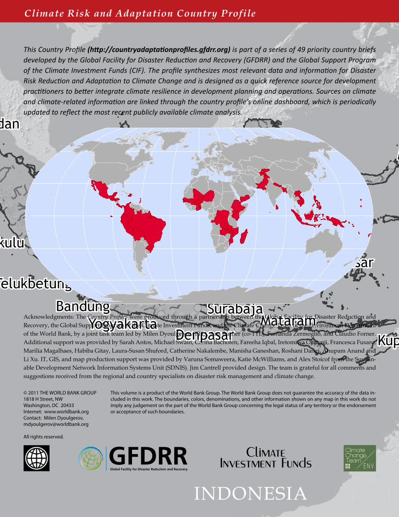
This Country Profile (http://countryadaptationprofiles.gfdrr.org) is part of a series of 49 priority country briefs developed by the Global Facility for Disaster Reduction and Recovery (GFDRR) and the Global Support Program of the Climate Investment Funds (CIF). The profile synthesizes most relevant data and information for Disaster Risk Reduction and Adaptation to Climate Change and is designed as a quick reference source for development practitioners to better integrate climate resilience in development planning and operations. Sources on climate and climate-related information are linked through the country profile’s online dashboard, which is periodically updated to reflect the most recent publicly available climate analysis.
Acknowledgments: The Country Profiles were produced through a partnership between the Global Facility for Disaster Reduction and Recovery, the Global Support Program of the Climate Investment Funds, and the Climate Change Team of the Environment Department of the World Bank, by a joint task team led by Milen Dyoulgerov (TTL), Ana Bucher (co-TTL), Fernanda Zermoglio, and Claudio Forner. Additional support was provided by Sarah Antos, Michael Swain, Carina Bachofen, Fareeha Iqbal, Iretomiwa Olatunji, Francesca Fusaro, Marilia Magalhaes, Habiba Gitay, Laura-Susan Shuford, Catherine Nakalembe, Manisha Ganeshan, Roshani Dangi, Anupam Anand and Li Xu. IT, GIS, and map production support was provided by Varuna Somaweera, Katie McWilliams, and Alex Stoicof from the Sustain-able Development Network Information Systems Unit (SDNIS). Jim Cantrell provided design. The team is grateful for all comments and suggestions received from the regional and country specialists on disaster risk management and climate change.